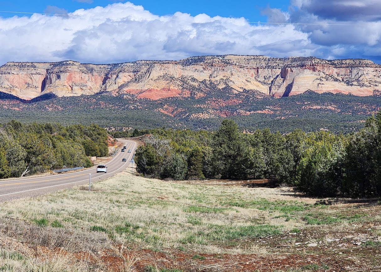
There are only two official trails along the highway on the east side of the park, the Canyon Overlook and East Rim Trails. Off-trail wandering is encouraged with the multiple pullovers and parking areas. Knowing that 95% of visitors to National Parks stay within 1/4 mile of the road, it was an easy decision to set off for a wander. I had flagged a couple of areas on my map that looked interesting so the first priority was arriving early to obtain parking. Note: you’ll need good navigation skills and plan to hike in washes and on rocks avoiding biological soil.
Checkboard Mesa and Crazy Quilt Mesa
I remember the first time I drove into the park nearly a decade ago, I was excited by this mesa and wanted to explore. This was going to be the day!
Early morning light.
Late morning light of Crazy Quilt Mesa.
Finding water in these potholes made for engaging views.
Progeny Peak Area
At the parking area, you’ll find many social trails on both sides of the road. I say, “pick your poison or your delight.”
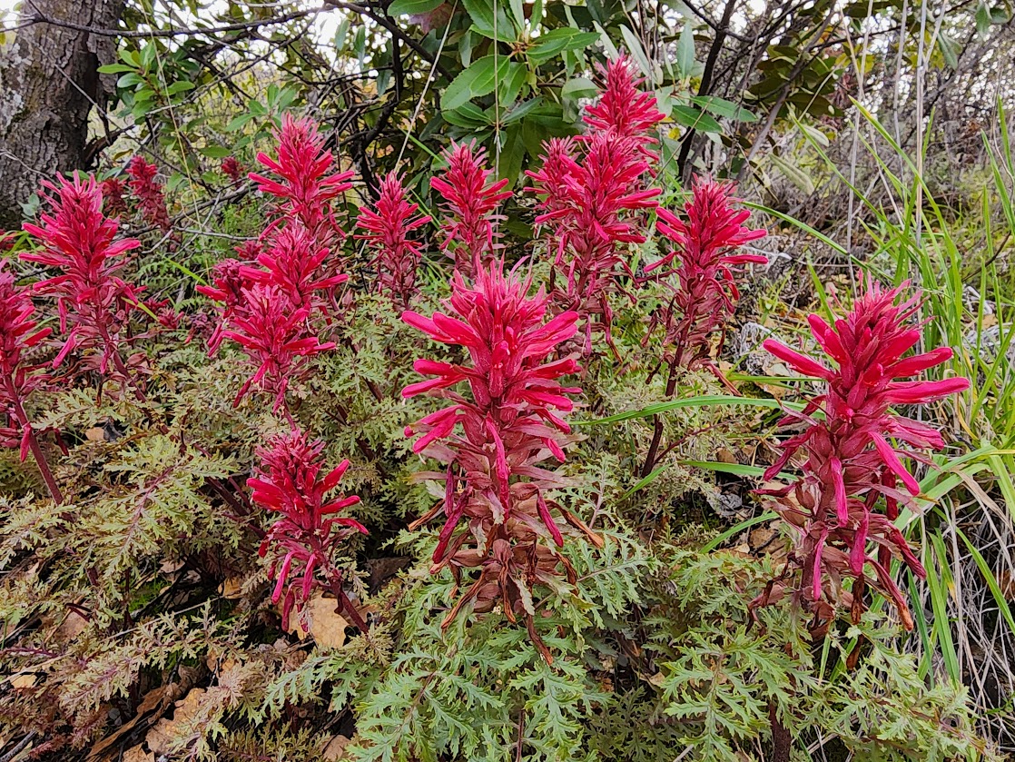
I found my first paintbrush bloom but I couldn’t get quite close enough for the best photo.
There are so many choices. Do you want to scale slickrock or walk in sandy washes? Or maybe do a bit of both, which was my choice on this day.
I was delighted to follow these pools. My timing couldn’t have been better to find them filled with water after the recent rains and snowmelt.
Some of the potholes would have made for a good swim, but they are to be saved for the critters.
Reflective goodness added to the experience.
I loved seeing the water flowing between the pools.
There’s no doubt the pools won’t last much longer.
This marked the end of this section of pools.
Isn’t geology incredible? These holes are desperately needed in this dry environment.
I was blocked in for about 30 minutes when I returned from my hike.
Early bird gets the worm or more like parking in Zion. Silly me overslept then spent time in the coffee shop before starting the drive. Google quickly told me about the traffic delays but I pushed on, testing my patience and fortitude. I had several places marked for possible exploration but the joke was on me as there was no parking anywhere. Did I mention it was Monday morning? This is exactly why I prefer to visit National Parks in the off-season.
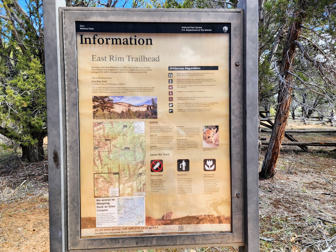
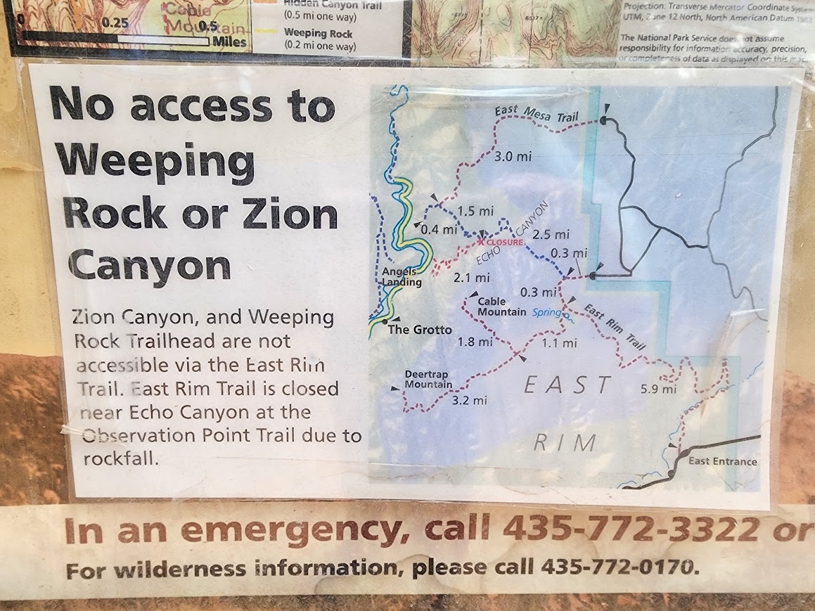
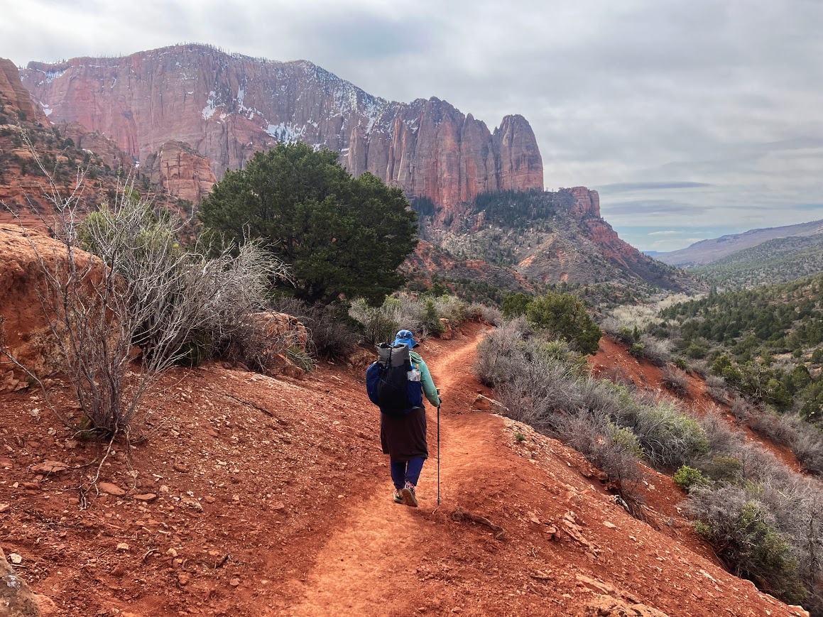
East Rim Trail
Just before exiting the Park, I was thrilled to find an open parking spot at the East Rim Trailhead. Better yet with limited parking, of maybe 10-15 vehicles, it meant a crowd-free experience.
Trail closures to the most desired destinations helped keep the crowds away. I met one family backpacking, which I could have done had I been motivated to deal with the Visitor Center logistics.
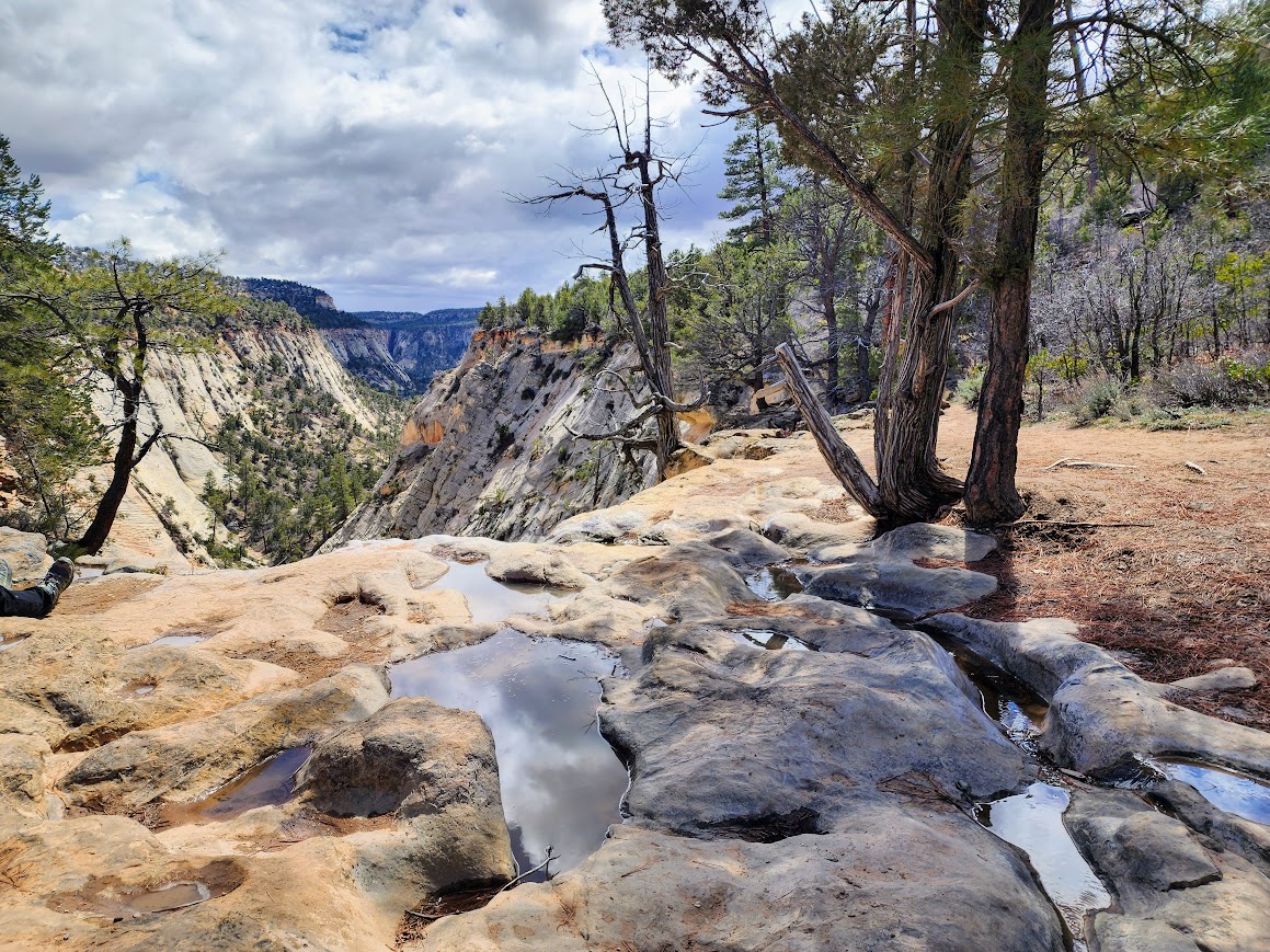
What I saw along the 3-mile section I hiked.
Jolley Gulch was my turnaround.
The view when I turned around. It was nice to look down at the sandy trail from where I’d come.
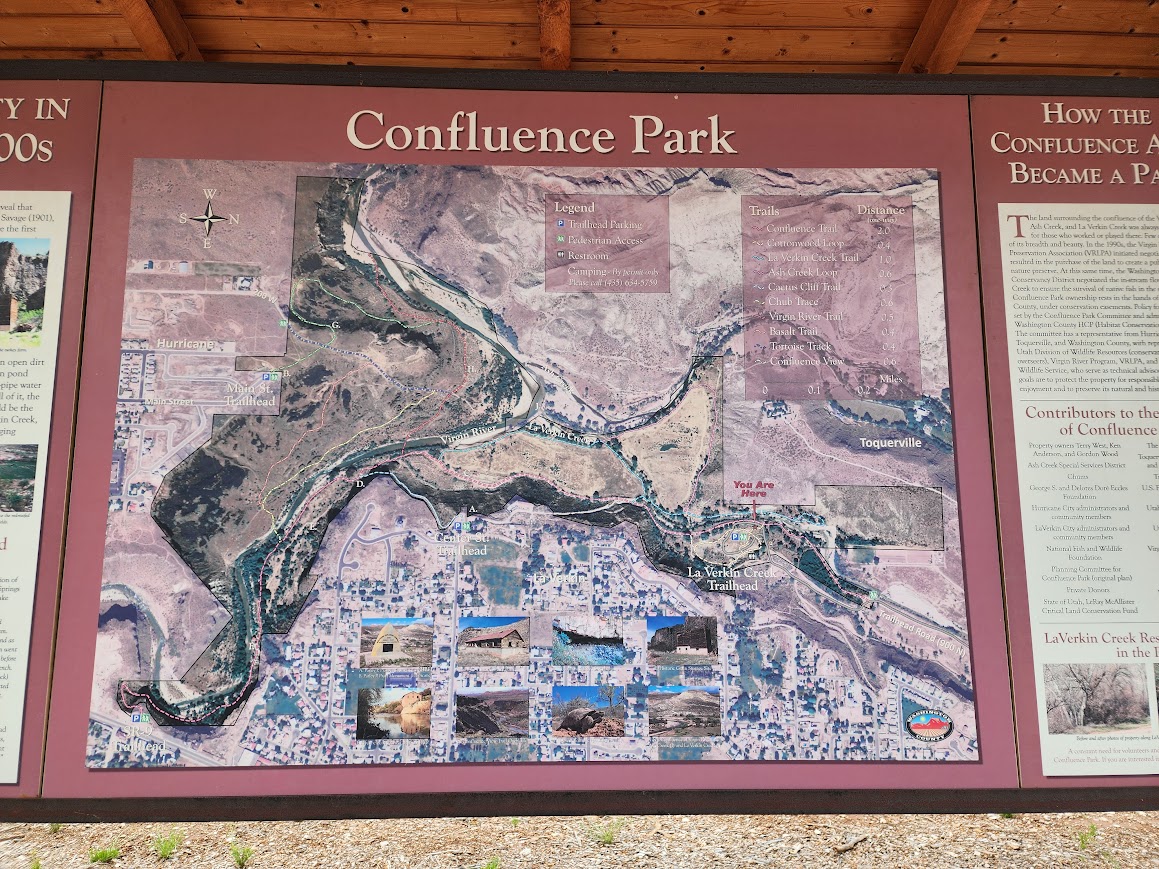
I spent a day waiting out storms; afterward needing to find trails and roads that wouldn’t be too muddy. I was camped near La Verkin and found a wonderful coffee shop where I could enjoy good eats and drinks. Although the area is in the process of growth it felt much more welcoming than those nearer Zion National Park.
This is the view down to the trail from the coffee shop. Recent snowfall is shown in the background. It’s great seeing areas being redeveloped. There are many trailheads and interconnecting trails in Confluence Park.
The trails are signed and easy to follow.
When in red rock country, when it rains the waterways run chocolate. The brown water was quite a contrast to the spring green of new leaves on the trees.
Want to swing? I saw several swings on my hike so it’s obvious this area gets a lot of swimming use in the summer.
Chocolate Falls! This would make for an interesting float.
These sword-like cacti were a contrast with the volcanic (?) rocks.
One of many historic finds along the trail. This one is an old granary.
There were interesting views all around even though surrounded by an urban jungle.
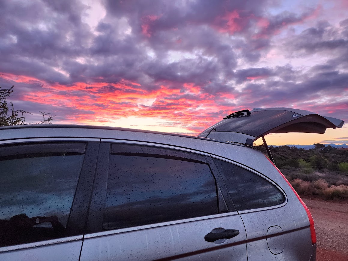
As a result of the unsettled weather, I enjoyed the best sunrise of my trip thus far.
Zion Canyon is spectacular, there’s no doubt. Zion National Park is the third most visited park behind only Great Smoky Mountains and Grand Canyon. As visitation has grown so has the infrastructure of nearby communities that support such a grand national park. To me, it feels more like Disneyland than the areas I prefer to visit.
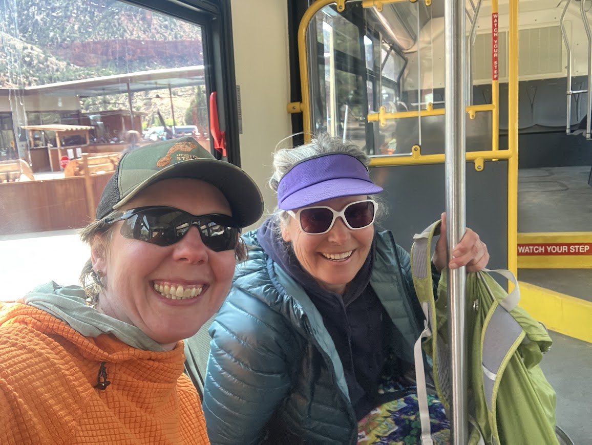
Joan and I decided to spend her spring break near St George. After spending a couple of days at Snow Canyon State Park and Red Mountain (blog link), we decided to explore options for the Kolob Canyons side of Zion National Park. Joan was surprised to find an available campsite where we could backpack. We reserved it and then learned that we couldn’t pick up the permit at the Kolob Visitor Center, so we spent a day dealing with the logistics (and crowds). Neither of us would have done it solo but together we made it fun. Lots of lucky things happened to make it a whole lot less painful.
There are a lot of reasons to say no to the Zion backpacking experience. For me, those tend to be permits and crowds. For others, it might be the rules which include no dogs, no campfires, and the required use of wag bags.
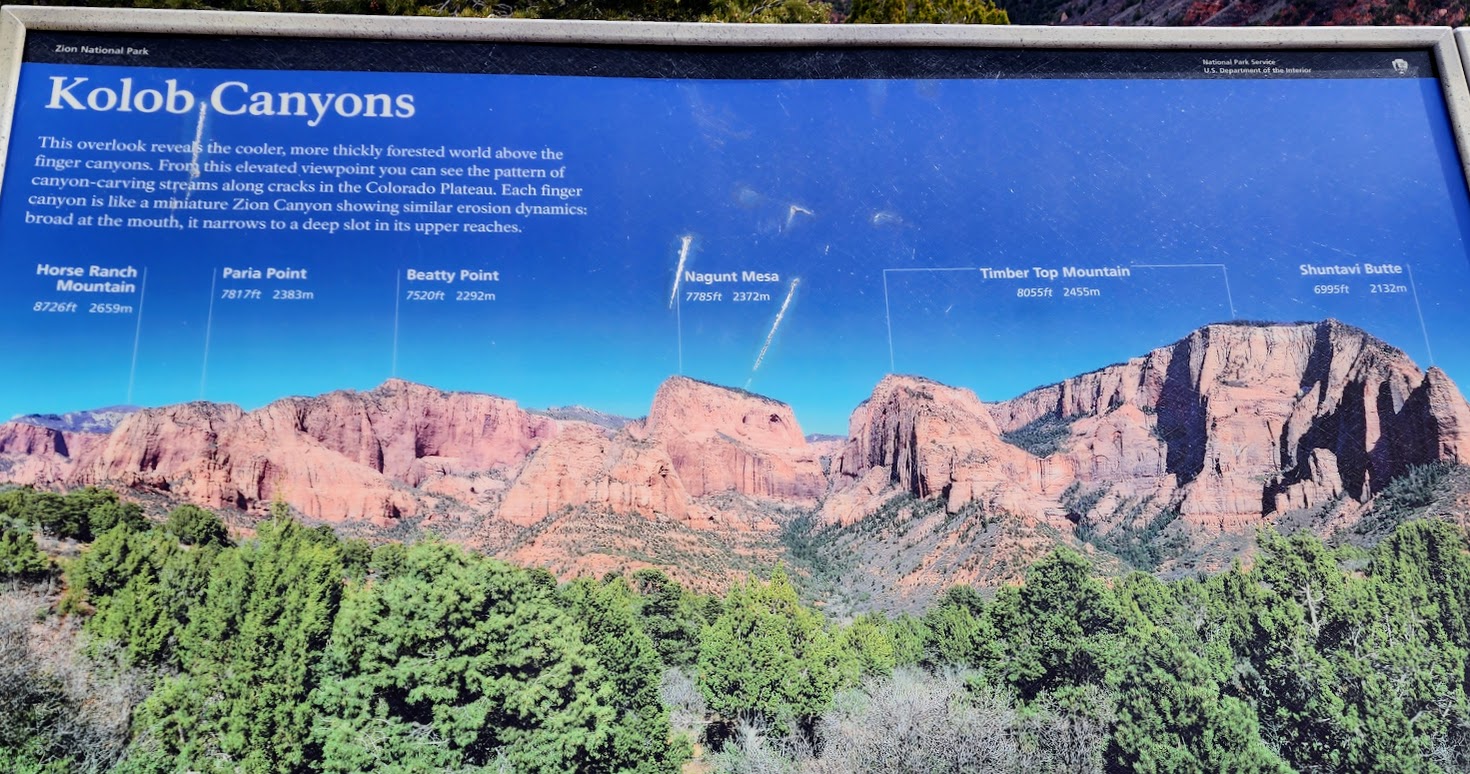
Zion Wilderness
It was surprising to learn that it wasn’t until 2009 that Congress designated 84% of Zion wilderness.
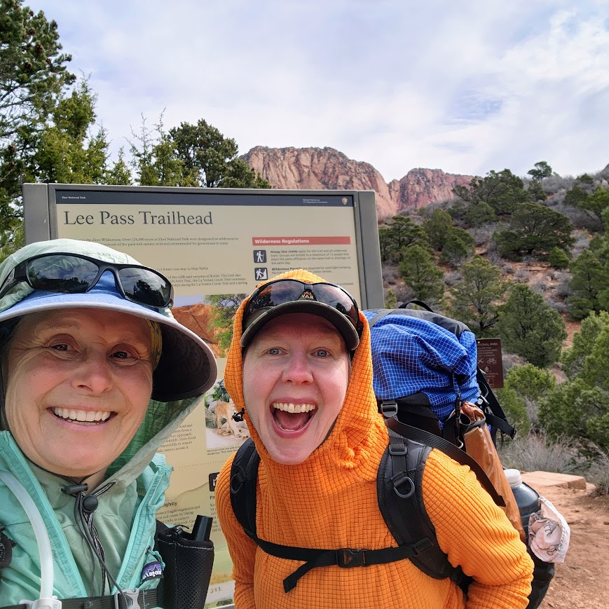
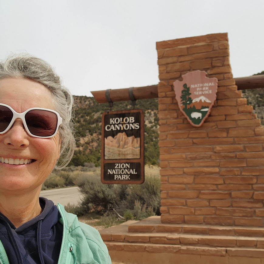
Lee Pass Trailhead
From the Lee Pass Trailhead, you reach the wilderness boundary almost immediately. Parking limits the number of trail users, as do limited overnight camping permits. We saw around 20-25 people each of our two days. With well-spaced developed campsites, it felt like a wilderness experience.
It was great to experience a part of Zion away from the busy Zion Canyon. Kolob Canyons were beautiful and the river corridor was much better than expected with plentiful trees and various vegetation.
There was remaining snow on the higher peaks.
Wait are we in Arches National Park? I was certain this was an arch until the resident expert Joan educated me otherwise, showing me this was deception.
This IS an arch, it’s Kolob Arch and is the second longest in the country at 287′, behind only Landscape Arch in Arches National Park.
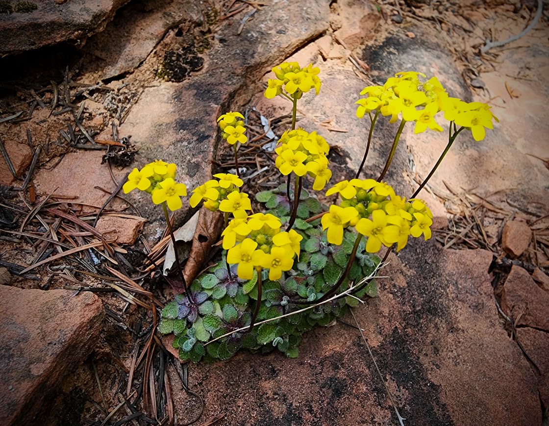
Zion Draba (Draba zionensis)
Milkvetch or Astragalus.
It rained during the night but the next morning we awoke to blue skies and alpenglow.
On the way out, there were more beautiful views.
This was a 15-mile 1,200′ elevation gain/loss out-and-back trip.
I stopped at the Kolob Canyons overlook after our hike.
The Rangers at the Kolob Canyons Visitor Center were helpful even if they couldn’t issue Backcountry permits.
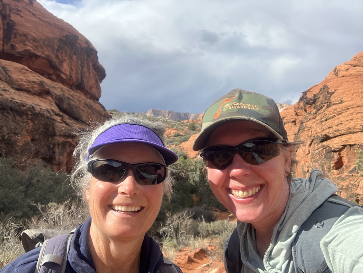
Joan and I are usually able to share some time during her spring break vacation. Last year we hiked some miles on the Arizona Trail and we’d hoped to complete another section in 2024. However, Mother Nature had other ideas gifting Arizona a March Miracle, in the form of snow. From a logistics and weather perspective, we decided to explore the St George area especially since Joan hadn’t been previously.
We lucked out and got a walk-up campsite reservation at the park which made for a convenient location for starting our hikes.
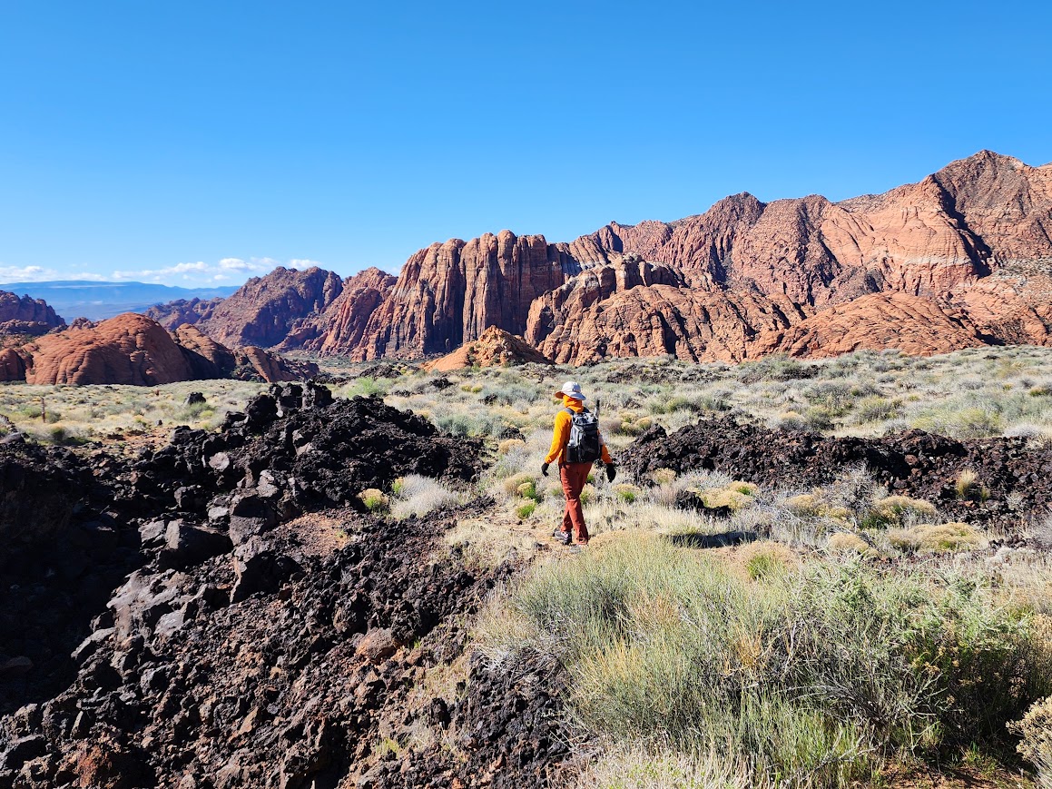
I’d been to Snow Canyon State Canyon a couple times previously, but I didn’t mind returning. It’s a beautiful place with all the colorful rocks. Since I usually hike in front of Joan she got some photos of me showing perspective. This was on the Hidden Pinyon Trail.
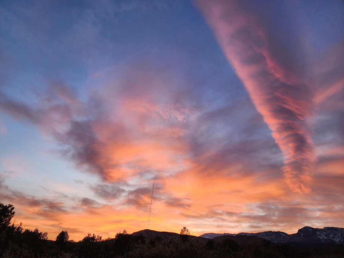
It rained intermittently during the night but we awoke to a bluebird day with alpenlight color.
With two vehicles we were able to do a one-way hike, starting at Whiterocks Trailhead and ending at the campground. We took the detour to the Whiterocks Amphitheater and unlike my previous visit, there was plentiful water.
There are so many rock colors in this park.
We visited the lava tubes.
There were a few blooms including this mustard.
Red Mountain Wilderness
We backpacked to the rim of Snow Canyon for an overnight with views.
We hiked further along the rim the next morning.
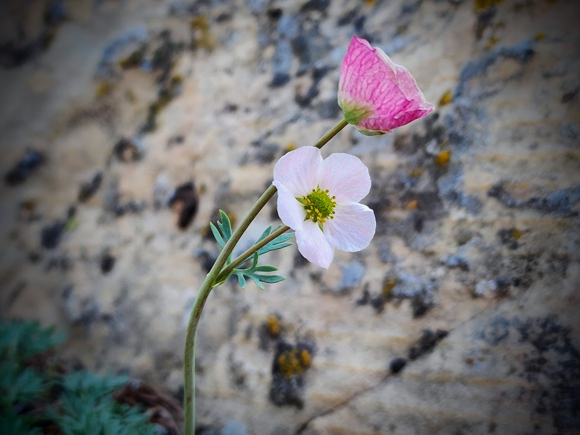
Discovering Anderson’s Buttercup was a highlight.
We also found many Western Wallflowers.
Being near urban and touristy areas means limited dispersed camping opportunities especially when it’s wet and the roads become treacherous. This was a lucky find.
This area wasn’t ideal but it was convenient to our next trailhead.
It was spring jaunting season and with a date in southwest Utah, I needed to first cross California and Nevada. I was dancing with a storm, trying to stay one step ahead.
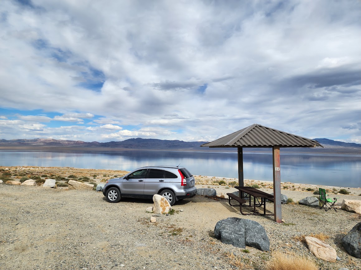
Pyramid Lake
When I reached Susanville I noticed a route on my Google map bypassing the business of the Reno/Sparks area. Since I avoid urban traffic whenever possible, I said YES to this option even though Google indicated it would take an extra 30-45 minutes. What Google failed to indicate was once I reached the Nevada border the road would become unpaved. I immediately stopped and checked my maps to see if I should turn around but made the decision to explore a bit further.
According to Wikipedia, “Pyramid Lake is the geographic sink of the basin of the Truckee River, 40 mi northeast of Reno, Nevada, United States. Pyramid Lake is the biggest remnant of ancient Lake Lahontan, the inland sea that once covered much of western Nevada. Pyramid Lake is fed by the Truckee River, which is mostly the outflow from Lake Tahoe. The Truckee River enters Pyramid Lake at its southern end. Pyramid Lake is an endorheic lake. It has no outlet, with water left only by evaporation, or sub-surface seepage. The lake has about 10% of the area of the Great Salt Lake, but it has about 25% more volume. The salinity is approximately 1/6 that of sea water. Although clear Lake Tahoe forms the headwaters that drain to Pyramid Lake, the Truckee River delivers more turbid waters to Pyramid Lake after traversing the steep Sierra terrain and collecting moderately high silt-loaded surface runoff. The lake is owned/managed by Paiute Tribe with permits required for recreation and visitation.“
Walker Lake State Recreation Area
My destination for the night was Walker Lake, a BLM-managed area with dispersed camping. I’d stayed here previously and knew it would provide safe roads after rain.
It was a relief to make it east of the big snow event.
I was gifted soft suede pastel colors in the evening light.
Although a couple days before the moon would be truly full, I hoped to watch it rise above the lake. Clouds obscured that opportunity but a bit later I enjoyed this view and was happy to capture this decent image with my Samsung S22 phone, using my car window as the tripod.
Strong winds arrived during the night and I was certain my car would be blown into the lake. With all the rockin’ and rollin’ I wasn’t getting any sleep so finally at 3am I relocated to a slightly more protected area. The next morning the storm caught up with me and I waited out about an hour of sleet.
Extraterrestrial Highway
I continued my drive east, finding myself dodging tumbleweeds racing across the highway in the wind gusts.
Although there were lots of references to aliens and Area 51 along the Extraterrestrial Highway, a large swath of Joshua trees caught my interest.
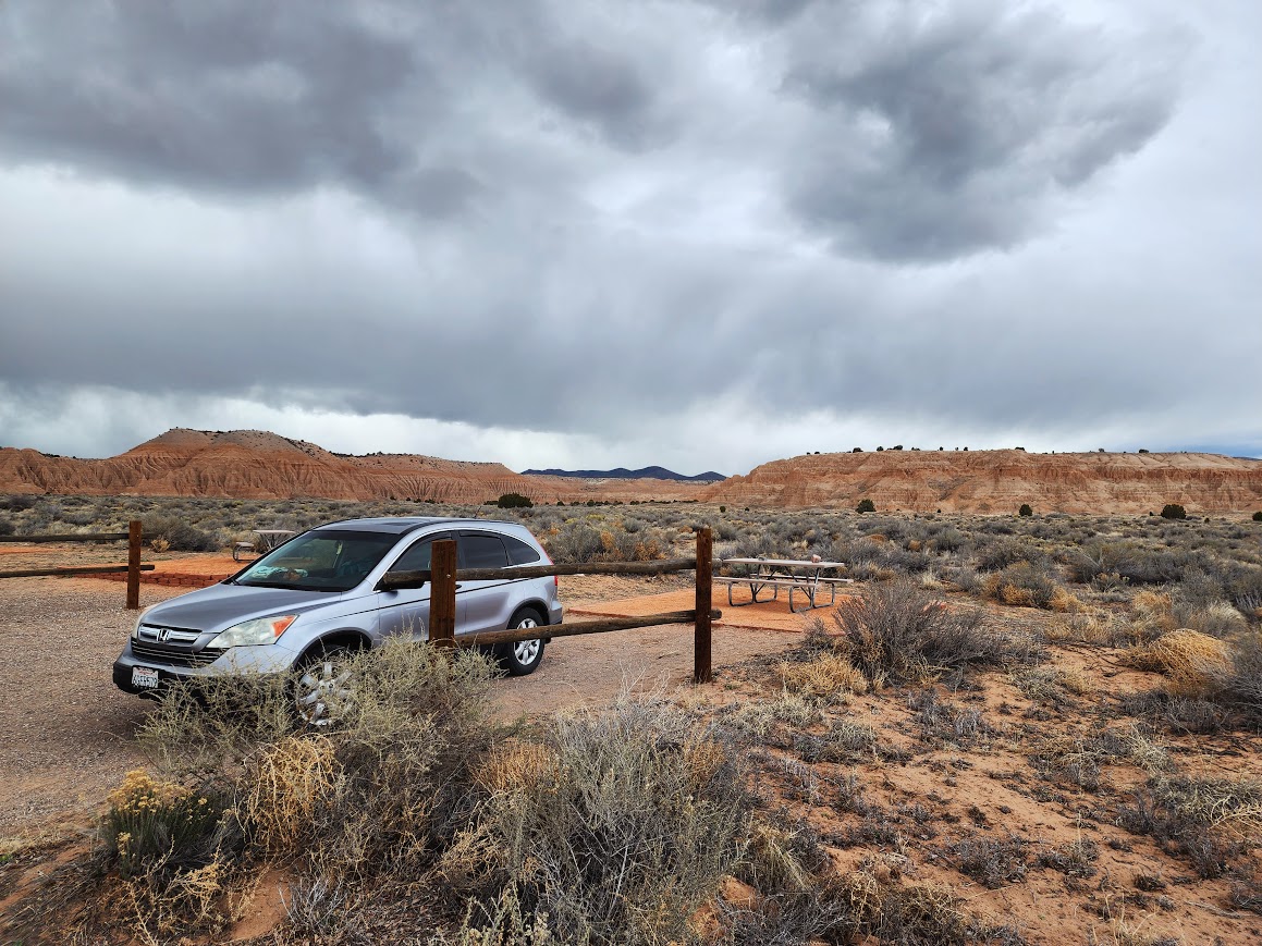
Cathedral Gorge State Park
This was a location on my future Jaunt map and perfectly aligned for an overnight stop on my way to Utah. Given the stormy conditions, it was smart to be on good roads versus typical dispersed camping roads. At this time there were three car camping spots available for first come first serve reservations.
It was a great place for storm-watching and rainbow-making.
And to observe storm-clearing light.
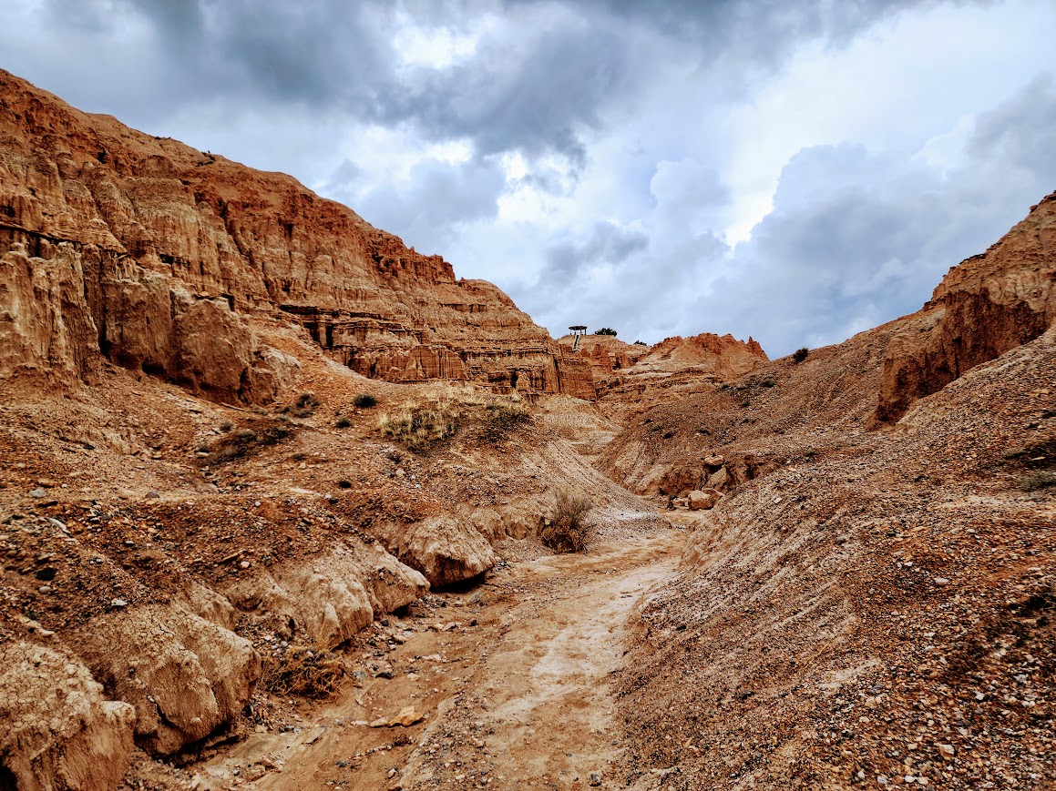
According to the park’s website, “Cathedral Gorge State Park is located in a long, narrow valley in southeastern Nevada, where erosion has carved dramatic and unique patterns in the soft bentonite clay. The park’s beauty began with explosive volcanic activity that, with each eruption, deposited layers of ash hundreds of feet thick. Great walking trails abound for exploring the cave-like formations and cathedral-like spires that are the result of geologic processes from tens of millions of years ago. A photographer’s dream, the park offers stunning views of the scenic canyon and visitors can enjoy hiking, picnicking, camping and nature study.“
This is one of those places where it’s hard to capture the colors and textures unless the light is right. I lucked out with the storm clouds. There are some well-defined trails, opening into areas inviting further exploration. During a break in the storm, I got out for a wander.
Millers Point is a viewpoint accessible by vehicle, but I chose to hike up to it as I needed to stretch my legs after driving for two days.
Details of the mud in the formations.
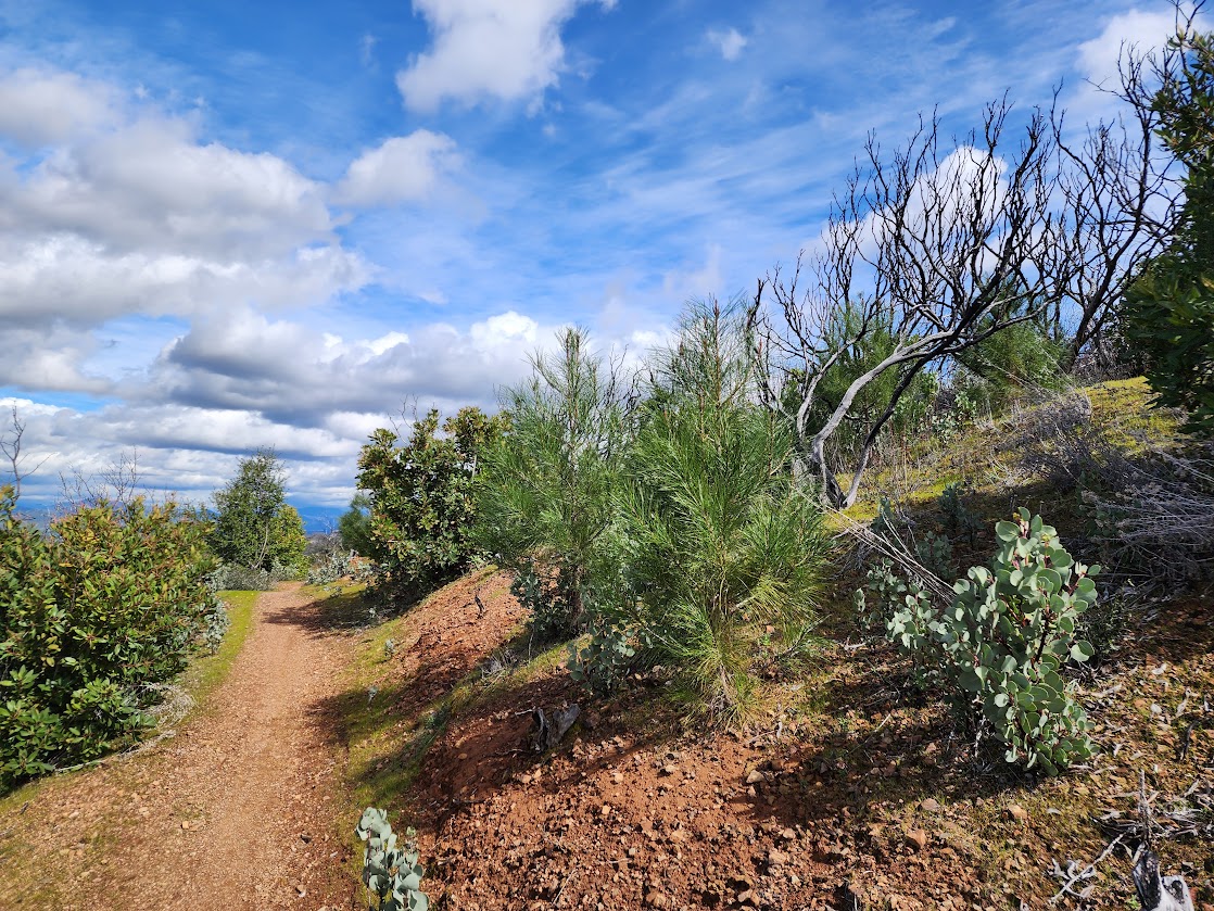
The next morning I planned to hike the Juniper Draw Loop, but when I saw this junction I couldn’t help but choose the Hawk’s Ridge Trail instead. Interestingly this trail is not on the park maps, nor was it on my Gaia digital maps until I added the Trailforks MTB layer.
With Crater Lake National Park and my time as a Volunteer Ranger in the rearview mirror, it was time to find spring. Far NorCal experienced a wet winter and with more clouds and cooler temperatures, spring was a bit more delayed than some years. I was happy to get out on the warmer days and find plentiful waterfalls and creeks in areas often dry, as well as our early bloomers.
My first hike was on February 24th at Swasey Recreation Area in the Redding foothills.
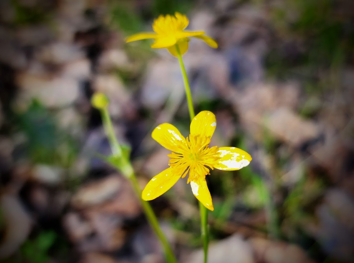
Nothing says spring quite like buttercups, in this case Western Buttercup (Ranunculus occidentalis).
Henderson’s Shooting Stars (Primula hendersonii).
Pacific Hound’s Tongue (Adelinia grande).
Blue Dips (Dipterostemon capitatus).
Tolmie’s Pussy Ears or Star Tulips (Calochortus tolmiei).
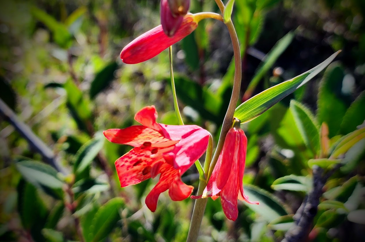
Scarlet Fritillary (Fritillaria recurva).
Warrior’s Plume (Pedicularis densiflora).
What’s this? A rare swimming hole?
On February 25th I explored a newish trail in the expanded Mary Lake/Westside Trails area on the outskirts of Redding. It was exceptionally fun as the trails have yet to be marked on my Gaia digital maps. And a big surprise for me, it’s an area without evidence of recent fires. A friend shared photos from last April and this area was filled with wildflower blooms.
Manzanita blooms, bushes and trees dominated the area. The smell was intoxicating . . . in a good way. The bees were buzzing.
The trails and parking areas aren’t signed yet but I found this one to give me something to research, but alas I didn’t find a match.
Someone must have been hungry when naming these trails.
I suspect this may have been an old mining area as it’s not far from known gold mining tailings.
The trails wind in and out of canyons where there was plenty of water and a few bridges.
Checker Lily (Fritillaria affinis).
I found two benches and this picnic table. In the summer these oak trees will provide some nice shade.
With more rain in the forecast, I visited my favorite trail in the Swasey Recreation Area. I like this one because it’s what I call Jan grade with a nice long pull to gain elevation.
Were there’s manzanita there’s poison oak, or at least so it seems.
Milkmaids (Cardamine californica).
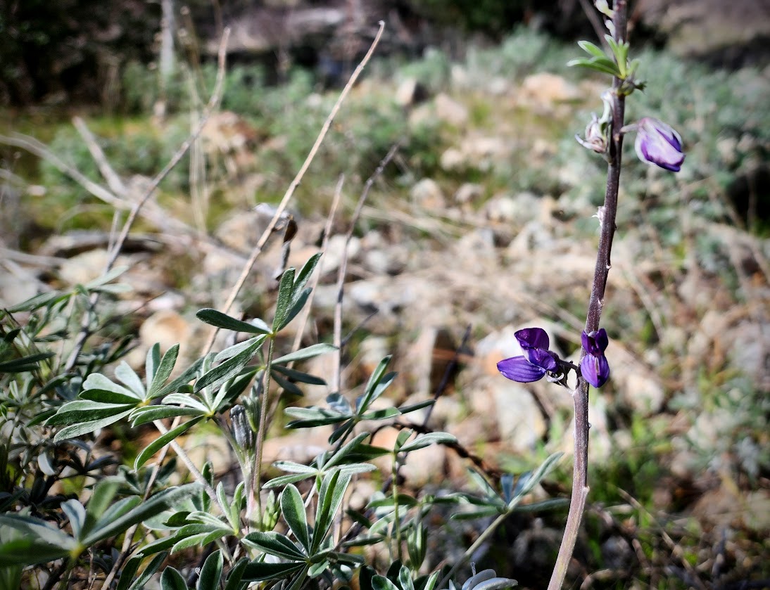
One solo lupine decided to be the earliest of early birds.
At the divide, I checked on my friend Smokey who lives in this Carr Fire survivor log.
Speaking of the Carr Fire, in early March I hiked the Mary Lake/Westside trails and visited a recently installed memorial.
It’s hard not to be thankful when you find trees taking back the landscape wiped clean 5+ years earlier.
Oak leaves.
Wintercress?
Baby nightshade.
Redbud.
Finally after eight days of hard rain, accumulating nearly 5 inches, on March 7th I got out for another hike. This time in the Clear Creek Greenway area where the green grasses were accented by the white-topped foothill peaks.
Rusty Popcornflower (Plagiobothrys nothofulvus).
Saxifrage
Neighborhood walks after more rain gave me reason to enjoy tree blossoms.
Over the few weeks I’d been home, my rain gauge collected nearly 8″. When the temperatures warming I found my first blood sucker, a sure sign of spring.
Although the weather had been perfect for hiking, I had to stay focused on getting chores done so I’d be ready for my spring jaunt. This nearby BLM trail provided a perfect distraction. These non-native wild radish blooms stood tall over Upper Salt Creek.
I was hoping to find poppies, well I found a few tiny ones.
The flowers of the day were Shooting Stars and Blue Dips.
I don’t recall seeing or identifying wintercress previously. I guess it signals the transition from winter to spring.
Yellow blooms makes it feel like mother nature welcoming spring.
The creek was alive with plentiful flow.
The McConnell Arboretum & Botanical Gardens were prepping for a lighted lantern display. I enjoyed the whimsical scenes during my walk along the garden paths.
Meanwhile it’s time for some spring jaunting. The March snow storms have added a few limitations but as always there’s plenty of other choices. My buddies want to know when and where we are going. As I told them, patience . . .
While sorting through my photos taken during the 9.5 weeks I spent this winter living at Crater Lake National Park, I found a few worthy of highlighting. Finding viewpoints for a variety of images was my personal challenge, especially for optimal sunrise, sunset and full moon photography. That was one of the benefits of spending significant time in a single location.
This photo was taken on December 26th at 11am. I like it because it includes the broken tree trunks showing the aftermath of wind events, mountain hemlock trees which are the most prevalent tree along the rim, and Mount Scott in the background, the tallest peak in the park. The clouds stuck around to offer up a colorful sunset.
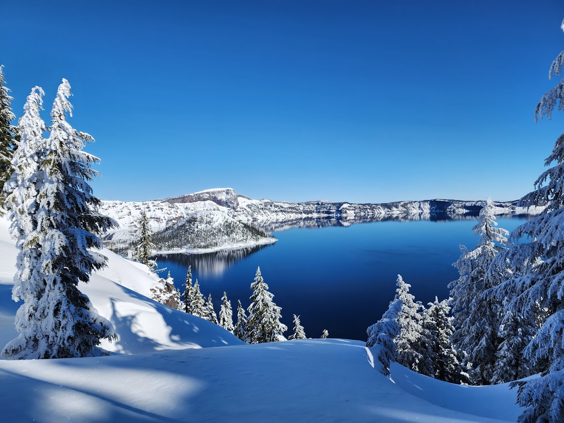
This image captured on February 3rd is worth highlighting due to it’s reflective quality, as well as the potentially deceptive icy sheen. The lake has only frozen twice is known history with the last time being in 1949. Llao Rock is significant as a visual measuring stick, with the distance to the lake being about 2,000′ similar to the lake’s depth. On clear sky days, 9,184′ Mount Thielsen is visible to the left of 7,424′ Timber Crater. As for Llao Rock, “This great mass of dacite (a sluggish lava) was produced from a vent on the upper slopes of Mazama and hardened after moving only a mile or two. The dacite filled in a former explosion crater. The rock pillar was named after Llao, a Native American god.” Fascinating reading: http://npshistory.com/nature_notes/crla/vol10-3b.htm
This moody photo of Llao Rock is a favorite.
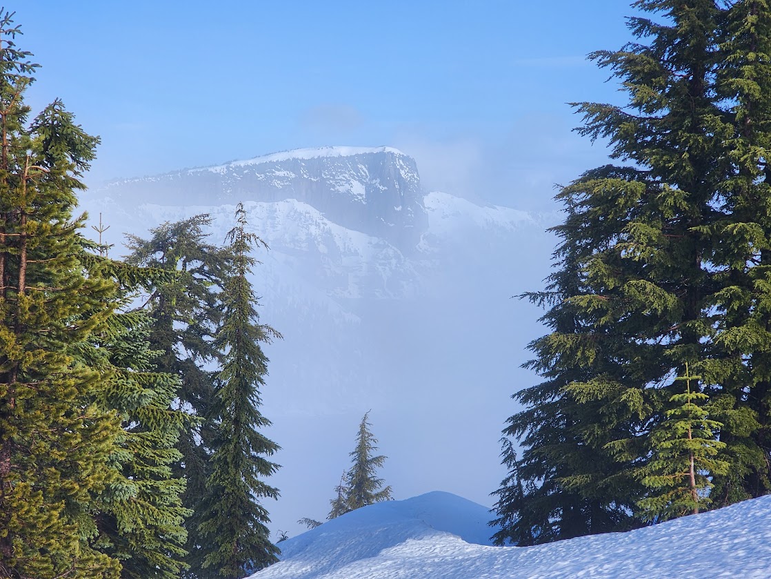
The most frequent question I got as Ranger Jan was will I be able to see the lake? This photo depicts how the lake makes it’s own weather much like mountains are known to do. You can see the sparkly snow flying around amongst the fog. It was one of those days where the lake played peekaboo every few minutes. Those with patience were rewarded; many left disappointed.
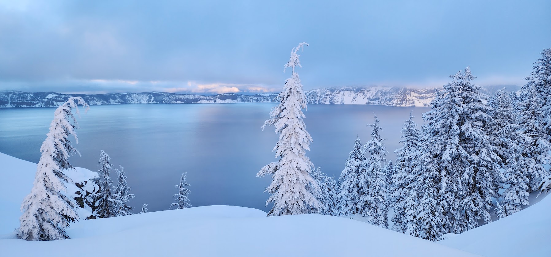
If you search for an image of Crater Lake, you’ll most likely see the iconic brilliant deep blue color. But as I learned during my 69 days, the visual color is influenced by the sky. I only saw the lake colored this breathtaking soft lavender turquoise color once. It was quite a contrast to the midnight blue I witnessed during a storm. My paychecks as a volunteer ranger were rich in eye candy and experiences.
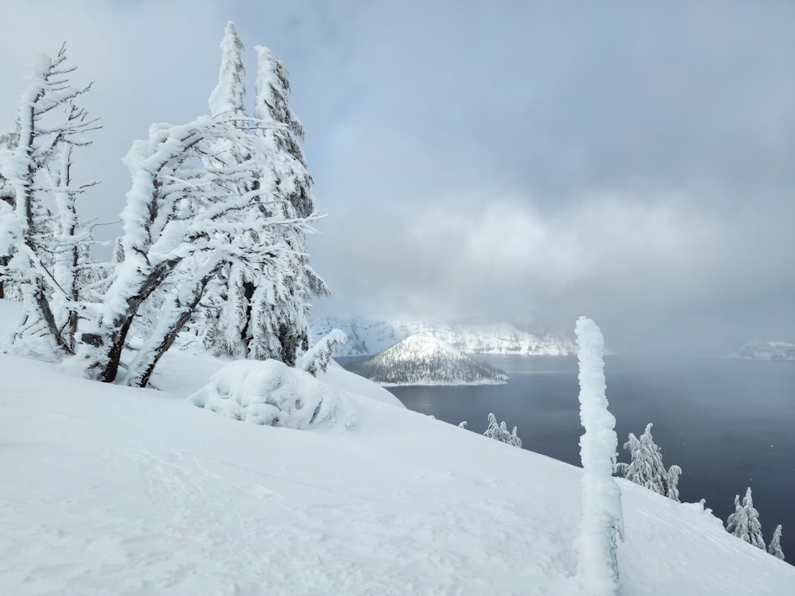
I spent a lot of time snowshoeing along the rim looking for a variety of viewpoints. This was the best spot I found for capturing Wizard Island, no doubt the star of the lake. Although later I learned there are two islands, the other is Phantom Ship. I should have captured this image with better lighting; I could always add a fake sky.
This historic lodge was built in 1915 and was on the demolishment list in the 1980s. As one can imagine its had maintenance issues over the decades and requires significant financial resources to maintain. I enjoyed watching it transform into a winter mansion, complete with icicles and snow-laden trees.
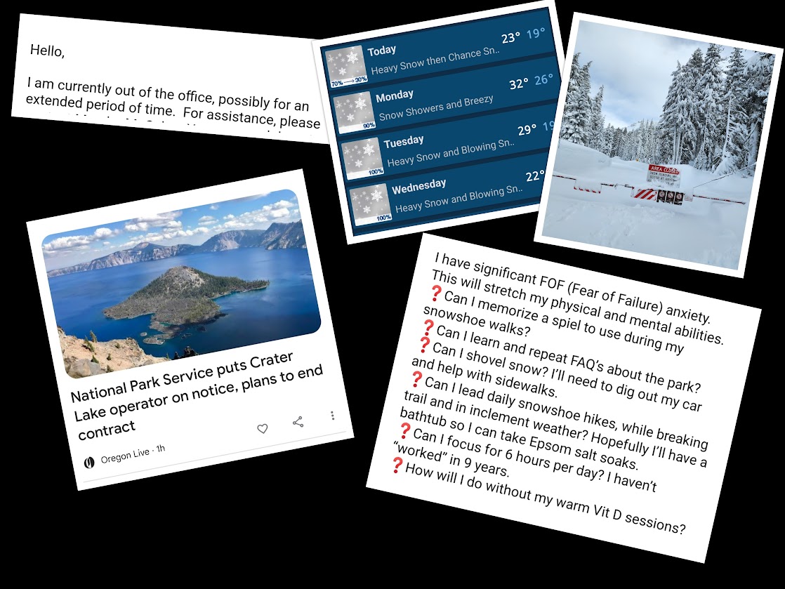
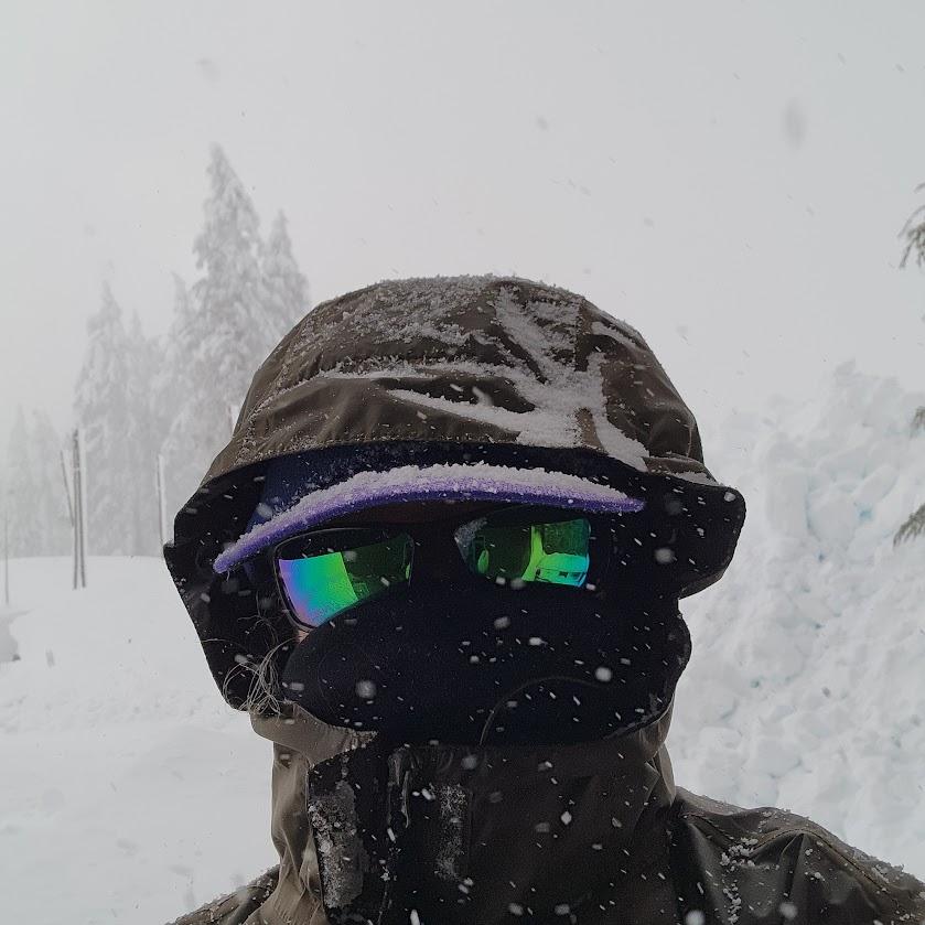
This was my first volunteer gig with the National Park Service, and also my first time spending extended time living in snow. I didn’t know what to expect, relying mostly on the position posting, conversations with the volunteer supervisor and a previous volunteer. Hopefully this post will help future volunteers, or those considering this unique winter position.
My housing exceeded expectations although when I arrived the kitchen cache wasn’t available so I went a week without utensils and it took a few days to receive the promised microwave and toaster. High-speed internet was completely false advertising, but in fairness DSL was a recent addition and the measuring stick might be a bit different than in the rest of the country. I didn’t end up with housemates, primarily due to internet issues. 75% of the time the satellite dish was covered in snow/ice thus unable to connect, and mounted too high for me to clear. With more realistic expectations I would have brought different things to keep me occupied instead of an internet project. In the summer I’m sure this is much less of an issue since more time would be spent outside.
I was warned that the thing volunteers liked least was not having covered parking. I agree and it led to a many unpleasant hours digging out my car and my entryway. My unit seemed to be the most vulnerable to wind blown snow and collapses requiring more shoveling than my neighbors. The positive was that my unit was aligned for receiving sun rays on nice days.
The things I wasn’t prepared for included:
My supervisor being on an unexpected leave of absence requiring me to figure things out myself. No welcome, training or orientation left me feeling a bit vulnerable but as a self-starter it was also empowering.
The lack of staff and volunteers, making for a little too much solitude, even for this introvert. Normally there would have been six volunteers to form a community during the winter, but sadly it was only me for my first 7 weeks. The majority of permanent staff was out on holiday or end-of-year leave, making it feel like a ghost town in December and early January.
The drama. Not only was the supervisor MIA for most of my time, but there was also publicity regarding a conflict with the concessionaire.
The lack of blue sky days and limited access to lake views. The gate to lake views was closed for 19 days in January due to snow load. Stats weren’t recorded daily but I’m guessing it snowed at least 85% of the days I was there. My plan to enjoy sunrises and sunsets was thwarted by those closures, cloudy and snowy skies, gusty winds, etc. Additionally, I hadn’t realized it was 3 miles from my housing to the lake viewing area at the rim.
On a positive note my anxieties were lessened because I wasn’t being micromanaged nor worrying about meeting expectations. It gave me the freedom I needed to create a position suitable for my current mental and physical abilities, and best of all allowed me to avoid working outside during inclement weather.
These are the things I found useful and would recommend. Since some volunteers arrive by public transportation, I’m sure they get by with a lot less. With Klamath Falls and Medford within reasonable distances, those who don’t mind driving in the snow/ice might resupply more often. I limited my drives; twice to refuel and once to replenish groceries.
Housing Essentials:
Kitchen
Large and small skillets, cookpot and strainer
Plate (glass pie dish), two sizes of glass bowls with lids, plastic sandwich tubs
Cutting board, knives, spatula, a set of utensils, scissors, and a can-opener
Coffee fixings (glass measuring cup and pour-over filter) and mug
To-go thermos/mug
Cloth and paper towels, dishwashing cloth and soap, scrubber, cloth napkins, plastic storage bags, and trash bags
My department supplied a microwave and toaster (I wish I would have brought my microwave heating splash cover).
My unit came with two refrigerator/freezers for up to four residents
Bedroom
Sheets, blankets, pillows
Hangers (important for drying stuff)
Earplugs (for possible snoring housemates or opposite sleep schedules)
Bathroom
Towels – I was glad I also had a large towel to use as a bathmat.
Toiletries – I’m sensitive to cold dry temperatures and get bloody nasal passages for the first week. I’ve found Ayr nasal gel to be a great solution. I also brought my Neti-pot with saline packets and distilled water (just in case). SUNSCREEN is a necessity.
Wellness Kit (remember you’re a long way from anywhere, what if you get sick?). I brought COVID test kits, medication and masks, as well as a few things should I catch a virus. I used my tiger balm patches when I flared up my carpal tunnel shoveling snow. As a side note, before leaving home I updated my vaccines as a preventative measure.
Notebook and writing utensils to organize work notes
Hand warmers – inside temperatures in the house and office can be chilly or hot. While out roving or if I was leading snowshoe tours you stand around so these offer a bit of warmth.
Heating Pad – I found myself using this as a heater often, and it also helped with any sore spots from snow shoveling.
Laundry detergent. The house came with a washer and dryer.
Mouse traps – I was told mice can be a problem. There wasn’t any evidence in my housing unit and my car stayed rodent free but the admin building had quite the tribe.
Clothing Essentials:
Work Pants – I found some Eddie Bauer flannel/fleece lined pants at Costco. They were comfortable, warm, and water and wind resistant. NPS reimbursed me the cost. I also brought another pair of lightweight pants to wear in the office, since the temperature was usually too warm for the lined version.
Snow Pants – I owned these and preferred on days when it was wetter or warmer (they are unlined and vented).
Lounge Pants – Basically this was all I wore when hanging out at my housing unit.
Casual Bottoms – I brought a pair of jeans for town days, and tights with a skirt (for good weather snowshoeing days).
Thermal Bottoms – I never needed additional layers, but I tend to run warm especially when active.
Layering Tops – I brought 3 lightweight merino wool long-sleeved shirts I wore as a base daily, and one short-sleeve to wear in the office under my uniform shirt (most days it was uncomfortably warm in the office). I wore a lightweight sweatshirt and a polar fleece top over the base layer at home when chilly. The inside temperature can be a compromise with housemates.
Socks – I wore merino wool Darn Toughs or Smartwool socks and brought several pairs. I layered with thin merino liner socks on especially cold days when out roving on snowshoes.
Shoes/Boots – The boots I bought were perfect (Merrell Men’s Thermo Overlook 2 Mid Waterproof Snow Boot). They were warm and comfortable, with great traction. I had separate trail runners I wore in the office (since it was uncomfortably warm). I wore crocs as slippers in the house and had another pair of town shoes.
Hats/Beanies – While on duty I was provided a beanie but I wore my own frequently in the house as well as while off-duty. I lost one, so I was happy I’d brought a couple. I was glad I’d brought a visor for the bright sun and to protect face when it was snowing (or raining). The park also had baseball caps for volunteers.
Gloves/Mittens – I brought many pairs and didn’t regret having options.
Jackets - The park had options to choose from and layer. I brought a black down jacket I frequently wore as a mid-layer when roving so I could wear just their rain jacket as the top layer. For personal time I brought down and rain jackets.
Neck/Face Buff – This merino wool piece was essential as often I was pelted in the face by snow or freezing rain, or blown about by wind gusts.
Gear Essentials:
Shoe Traction – I brought several pairs because it seems there is always ice and I didn’t want to risk slipping, falling and breaking something. I was surprised at how well the exospikes (Kahtoola EXOspikes) worked. There was only twice when I had to switch to microspikes (Kahtoola MICROspikes). Since there’s a risk these traction devices will break I was happy to have options.
Snowshoes – although not necessary for the position as the department provides while working, I prefer mine and also used during my off-duty time. The new bindings are exceptional. I’m so glad I upgraded (MSR Lightning Ascent Backcountry & Mountaineering Snowshoes with Paragon Bindings). Some volunteers bring cross-country or backcountry skis. I would consider XC if I were to return. East Rim Drive is a great place to build skills.
Umbrella – I had a hiking umbrella in my car and it came in handy when walking to work in the rain and snow.
Pack – although my department provided one, I preferred my own and also used for my off-duty snowshoe adventures.
Vehicle
Before leaving home I had my battery and antifreeze checked.
I replaced the windshield fluid with below zero option (also filled a spray bottle so I could use as deicer).
Long-handled scraper/brush combo. I was told the brush would scratch my window so I mostly used the scraper side to push snow off my car (although it scratched my back window).
Windshield Frost Cover – I didn’t know to get one and I was jealous of those who had them so on my first trip to purchase supplies I got one and it made my life a bit easier.
Chains or Oregon-approved traction tires (snowflake/3 peak insignia or studded)
Backpacking Gear – I knew I’d regret not bringing this gear should an opportunity present for an aurora borealis or full moon viewing.
Food Storage:
It’s a bit intimidating to shop for several weeks of food, although if you don’t mind driving in winter conditions you can shop more frequently. The nearest towns are 1-2 hours away. I didn’t know about refrigerator/freezer capacity given that up to 3 housemates are a possibility. My unit had two refrigerator/freezers. Although I could provide a list, food choices are highly personal. I brought perishable food that would last a long time such as apples, mandarins, spinach, slaw, avocados, sweet potatoes, tomatoes, carrots, eggs, tortillas, and some with a shorter life such as bananas and salad greens. I also bought freezer vegetables and fruit. I had made single-serving meals at home and froze for this trip. Since I don’t really enjoy prepping/planning, being able to heat meals was perfect. For non-perishables, I brought things like pasta, canned items such as beans, chicken, corn and spicy tomatoes, plus seasonings, cereals, peanut butter, nuts, coffee, tea, and snacks for eating while snowshoeing.
Words of Wisdom:
Although housing comes with internet, it was pretty dismal. Upload speeds were less than .10Mbps and my router frequently dropped signal. I was able to intermittently stream audio and video with download speeds of less than 3.0Mbps. Cell signal was mostly non-existent except hit and miss at the rim. The satellite TV signal was often offline due to storms, ice and snow build-up. Had I known I would have brought puzzles, games, crafts, etc.
Placing and receiving online orders is not something encouraged.
Bring cash to reimburse coworkers who might offer to add items to their shopping list.
Office supplies were minimal so I was glad there was an empty composition book at the house I could use for notes and had brought my own pens. I kept track of my days and hours worked, plus duties performed which helped when completing my reimbursement forms.
I was glad I brought a yoga mat and some weights. I later learned there was a community gym which I would have gladly used during the multi-day snow events.
Come prepared to be adaptable, flexible and independent.
Final Thoughts
Those who follow my blog know about my no regrets motto. I have zero regrets about taking on this challenge. I’ve wanted to volunteer for many years and hadn’t found the right time, right fit. This opportunity came the closest to what I was looking for. I thought I came with zero expectations but I soon found I did expect to have someone to train me. It all worked out because I was open to learning and figuring things out, plus I had a super supportive boss who was encouraging and appreciative. I’m glad to have had the experience and will be ready should more doors open.
If you are interested in learning more, check out https://www.volunteer.gov/s/ where you too might find a good fit opportunity.
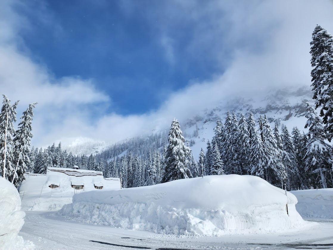
With an average of 500″ of snowfall annually, this is indeed one of the snowiest places in the lower 48.
My fortress. By mid February the walls hid most of the balcony.
When I arrived on December 14th, there was 24″ of snow on the ground at the Visitor Center which is about 600′ below Rim Village. When I left on February 20th there was 114″ (9.5 feet). During my tenure, the most received in 24 hours was 19.7″ and 5.5 feet over a one-week period.
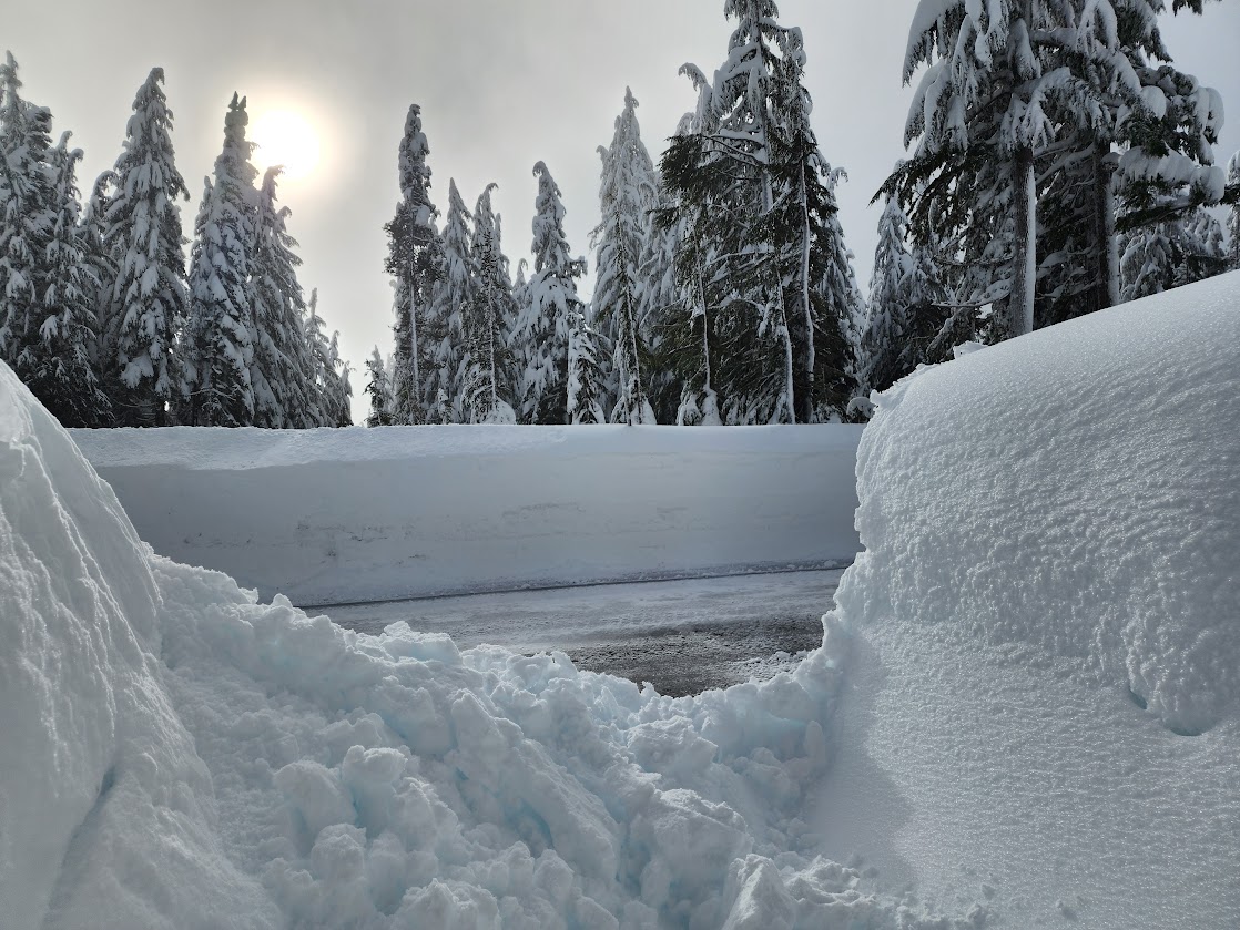
The road to Rim Village was closed for 19 days in January after being overwhelmed by storms.
I was glad I’d brought my umbrella for walking to work as most days there were snow flurries or blowing snow, freezing rain and even rain for a few days. The goggles came in handy when I was snowshoeing during blizzard conditions. I’ll be adding a post about essential gear, eats, etc.
This is our walk to work, sometimes it’s plowed most often not. I wore traction devices on my shoes nearly daily as there tended to be an icy base.
Digging out my car continued to be a mostly negative experience. This was possibly the worst day. The snow was piled on my roof way taller than me. It took me 30 minutes to reach my car as shown in the 3rd photo, and at least two hours to free my car from her snowy casket. I was pretty sure I’d need to resign my position after flaring up my carpal tunnel but thankfully I had a few days to recover.
This is Steel Visitor Center where I should be working but it’s been closed since 2022 for a structural remodel. It was slated to open in November, then December, then February . . .
This is the administration building where I worked, since the visitor center was closed. My office was on the first floor with all windows covered by snow so it felt like I was in a cave. It was dark even with the lights on. The pile of snow in the middle is indicative of snow depth, which was about 8 feet at this point.
Mother nature was stingy when it came to bringing out the orange orb.
Weather prevented me from getting out as often as I would have liked with only few days without snowfall. Snow conditions varied and weren’t always the best for snowshoeing but regardless I was out on storm-free days. During my time here I snowshoed 29 days. My new boots and snowshoes were amazing!
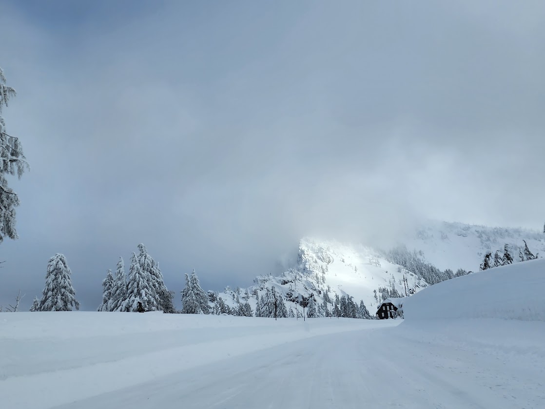
January 14th brought blue skies with 2-3 feet of powder topped with a 1″ crust. I broke trail on East Rim Drive. After 8 days of continuous snow, the sun decided to make an appearance. With the park roads still closed, thus no public access, it was one of those days were the park was mine, shared only with snow plows.
I was gifted another nice day on January 15th when I went out to explore Raven Trail, a ski/snowshoe route. The snow was so deep and heavy I was waddling about but happy to enjoy the sun.
When I finished showshoeing for the day, I found a wonderful spot of sun. Thankfully I’d cleared my car the previous day so I could watch others suffering the same fait, albeit being paid for it.
January 19th found me back on East Rim Drive breaking trail, and finding views of Union Peak.
Gray Jays have adapted to living here in the winter. They collect seeds and insects during the summer and glue them to tree trunks with their saliva for winter eats. Much like chipmunks they are also expert beggars and known as camp robbers.
I was disappointed that the road was still closed as the webcam showed visibility and I was confident there would be a good sunset.
I earned a day off on January 23rd and with the road to the rim still closed, it was a good day to wander through the trees to a clearing where I could get decent views. Snow conditions were better, still not giggly joyful but the blue skies and sunshine made everything worthwhile.
As seems to be my new norm it was a double-dip day with snowshoeing followed by digging out my car.
Finally after 19 days, the gate to the rim reopened on January 24th. I was excited to see how different it looked after over 100″ (9′) of snow was received 600′ below the rim. They don’t measure at the rim but I’m guessing 12′ on the ground. My car was so excited to go for a drive after being on a short leash, only getting to move from parking spot to parking spot after being cleared of snow. She, like me, was feeling restless as I hadn’t left the park since January 3rd. Finding the best snowshoeing conditions all year I was ecstatic. Although short-lived, the momentary joy felt like a worthy paycheck. Within an hour of arrival it was blizzard conditions and time for incognito Ranger Jan to get back down the hill.
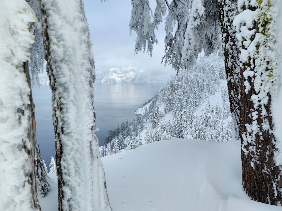
The day started as usual with snow flurries and no visibility but the forecast showed possibilities of clearing in the afternoon. I kept my eye on the webcam and as soon as it showed some visibility I switched from office mode to roving-on-snowshoes mode. When I arrived at the rim there wasn’t much visibility but soon I was granted views and so much more. The trees were loaded with snow and ice. The scene was incredible.
The fog came and went with the wind providing occasional teases of the lake and mountains. The hemlock trees were nodding a bit more than normal.
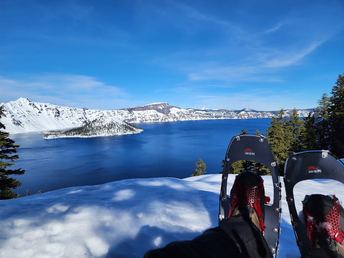
The trees were encased in ice. I could see blue ice with my polarized lenses. Wizard Island is in the distance.
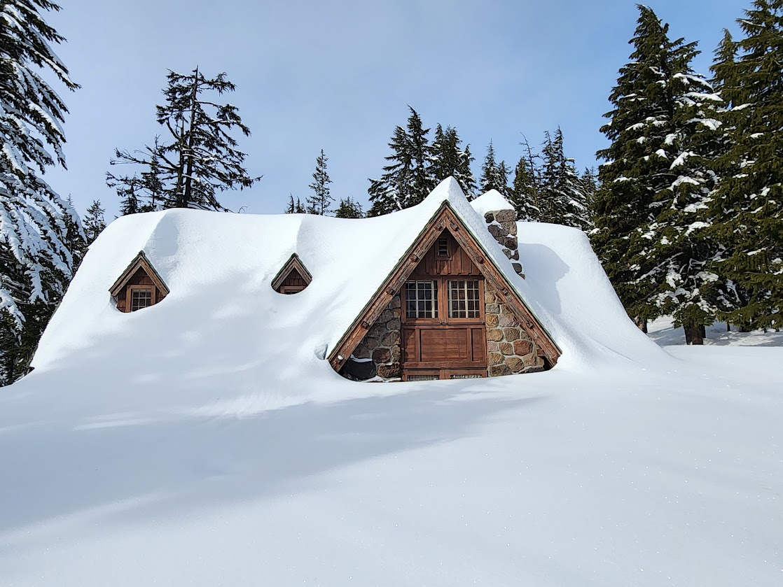
Icicle magic. The lake side of the lodge with Garfield Peak in the background.
Brrrr . . . the lodge looks cold. No wonder they keep it closed during the winter.
What a scene! Postcard worthy.
Those are the doors to the restroom. I’m sure maintenance had to work hard to find and dig out those doors.
Driving home I was blocked by this roofalanche in my housing area and had to back up and take an alternate route.
The next day was a replay. I spent the morning in the office while it snowed outside. I kept an eye on the webcam and was hopeful my forecast was correct. Sure enough the stars aligned and upon arrival the lake was fogged over but the sun lit up Garfield Peak.
Ice was thick but I got a peek at Wizard Island. Snowshoeing conditions were even better than the previous day. Plus no wind!
Views became more visible as the fog lifted.
Frozen in time.
No doubt a winter view.
Snow sculptures created by wind. The building in the background is Rim Village Cafe and Gift Shop.
If you zoom in you can see that this image is decorated with snow flurries. I’m pretty excited about how my phone captured the details.
This is a rock entombed in ice. Notice the storm clouds.
What looks like a peninsula is a mirage. This deception was captured on several photos. Look again at the previous photo. There’s no water beyond the rim. It just happened that the first layer of sky matched the water.
After two days of rain, I was happy to be back out roving on snowshoes talking to visitors. When I arrived at the rim it was foggy, but I was trusting my optimistic froggy weather app and sure enough shortly after arriving I started seeing teases of views. Remember those icy white trees? All gone after two days of rain and warm temperatures. On a positive note all that powder is finally consolidating, on a negative it’s turning into mashed potatoes. Llao Rock was the star this day.
After two days of rain, I was so happy to see the sun.
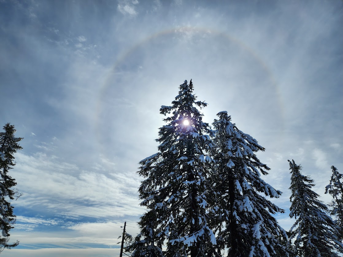
A sun dog came out to play also.
With all the rain and warm temperatures the snow walls had been tumbling with roofalanches a daily occurrence. I’m sure my biceps and core got stronger with all this manual labor.
The chunks of ice sliding from the lodge roof were like missiles.
With the break in precipitation, I finally had an opportunity to enjoy sunset and sunrise views again. My last sunrise was January 1st and sunset was December 26th.
On January 29th, I successfully made it up Raven Trail on this third attempt. The previous two were thwarted by inconducive snow conditions. It was super challenging for me, between searching for the blue diamond markers hidden in trees, to breaking trail in mashed potato conditions, to the 600′ elevation gain. It took me 2.5 hours to snowshoe this 1.3 mile route. Of course I was stopping frequently to record every marker and route finding a few times while looking for the next marker. One arrow was pointed the wrong direction, that didn’t help. On my way down I met a group of three who were super happy I’d broken trail.
It was a beautiful day to celebrate at the rim and enjoy a well earned lunch, followed by an epsom salt soak upon completion.
Unexpected sun challenged me. I was pretty tuckered after multiple snowshoe sessions over the past few days, so instead of getting out for another active adventure, I took advantage of mother nature’s natural Vit D.
The new volunteers arrived on February 1st full of smiles, laughter, enthusiasm and we bonded immediately. They are my kind of peeps and are going to be an awesome addition to the team.
The weather normalized and returned to freezing conditions with near daily snowfall. After the rain and warm temperatures the deep powder consolidated, the lumpy bumpy mashed potato snow firmed up, froze and was covered with just the right amount of dry luscious powder, making for the best snowshoeing and ski conditions since I’ve been here.
There hadn’t been many opportunities for sunset views recently so when I saw a glimpse of blue sky I took the risk and drove to the rim. I was gifted the most awesome and unique colors with the lake turning a shade of turquoise.
The next day I spent a couple of hours watching the lake disappear, reappear and dance with delight as the sugar snow sparkled like glitter.
On Day #58, I left the park for the first time in 38 days. Although I was just escaping to get fuel, it was a peek into my future since my assignment was nearing it’s end. It was a days of firsts since January 3rd. First day I’d driven over 20mph, been below 6,000′, seen snow-free roadways, escaped snow walls and been below snowline, to see colored vegetation, and eaten restaurant food.
I was gifted another opportunity to watch sunrise on February 10th. This was one of those mornings I felt paid well for my volunteerism.
With warming temperatures in the forecast, I predicted this to be the last day for a while to enjoy these snow-laden trees. It was a great day for roving and chatting with visitors, including a group of five gals who declared me their favorite ranger.
Coming home to this mess put a bit of a damper on my great day. Once the sun hit my roof and snow wall it collapsed inward. So in exchange for digging out my car I got to dig out my entryway.
Sun on my days off felt like a win.
I’d been wanting to explore a ridge so I took off on a route-finding mission. Goal #1 was checking out some historic cabins, which are now used for seasonal housing and a Science & Learning Center.
This was the Superintendent’s house back in the day. A gal commented on the Crater Lake National Park facebook page that she lived there growing up and would love a photo.
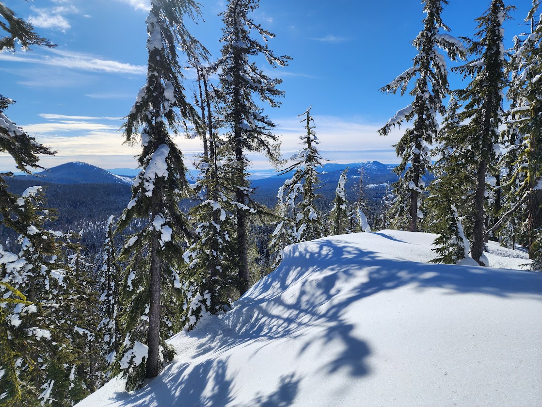
This ridge has three highpoints. On my first day I reached the one at 7,047 feet.
Views were mostly blocked by trees but I found this one of 9,499′ Mount Mcloughlin.
I earned my grub while enjoying some natural Vit D.
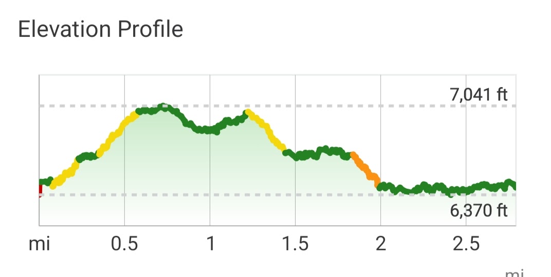
The next day I went out to see if I could reach the next three high points on Munson Ridge. I was proud of my navigation skills when I reached my first intended target.
As you can see from the topography map, this ridge isn’t flat.
But I gained views from this first high point. Applegate and Garfield Peaks plus a glimpse down into the valley from where I started.
As I continued south toward the next high point, I was treated to additional views.
Just before the next high point, further progress was blocked. Although a pine marten danced his way to the top, the risk was way too high for me.
My goal was Munson Point but with no easy way around this obstacle I decided to turnaround. The green track was Day 2, the blue Day 1.
Snowshoeing is such a good workout.
With the forecast calling for snow, snow and more snow for the next week, I figured this might be my last chance for a sunset before my time ends.
Sure enough snow closed the gate again but on February 18th it reopened and I witnessed a temperamental lake, colored what I’m calling Storm Blue. When I arrived two months earlier I walked under the limb in the lower right of the photo.
A Flat Ranger arrived from a second grader and I got to take her on an adventure.
I used her for my groundhog post for the park and it was shared by several groups including US National Weather Service out of Medford Oregon. She became an awesome mascot with this post reaching nearly 500,000 people, engaging 20,000, garnering over 11,000 reactions. I loved the comments, “we need more content from Flat Ranger.” “I would trust a ranger over a groundhog any day.” “Flat Ranger needs a coat.”
I was proud of my creativity on this post.
Other posts are being regularly shared as well. I’ve enjoyed being able to make a difference by posting about current conditions, safety tips and FAQ’s.
Chiloquin News shared regularly.
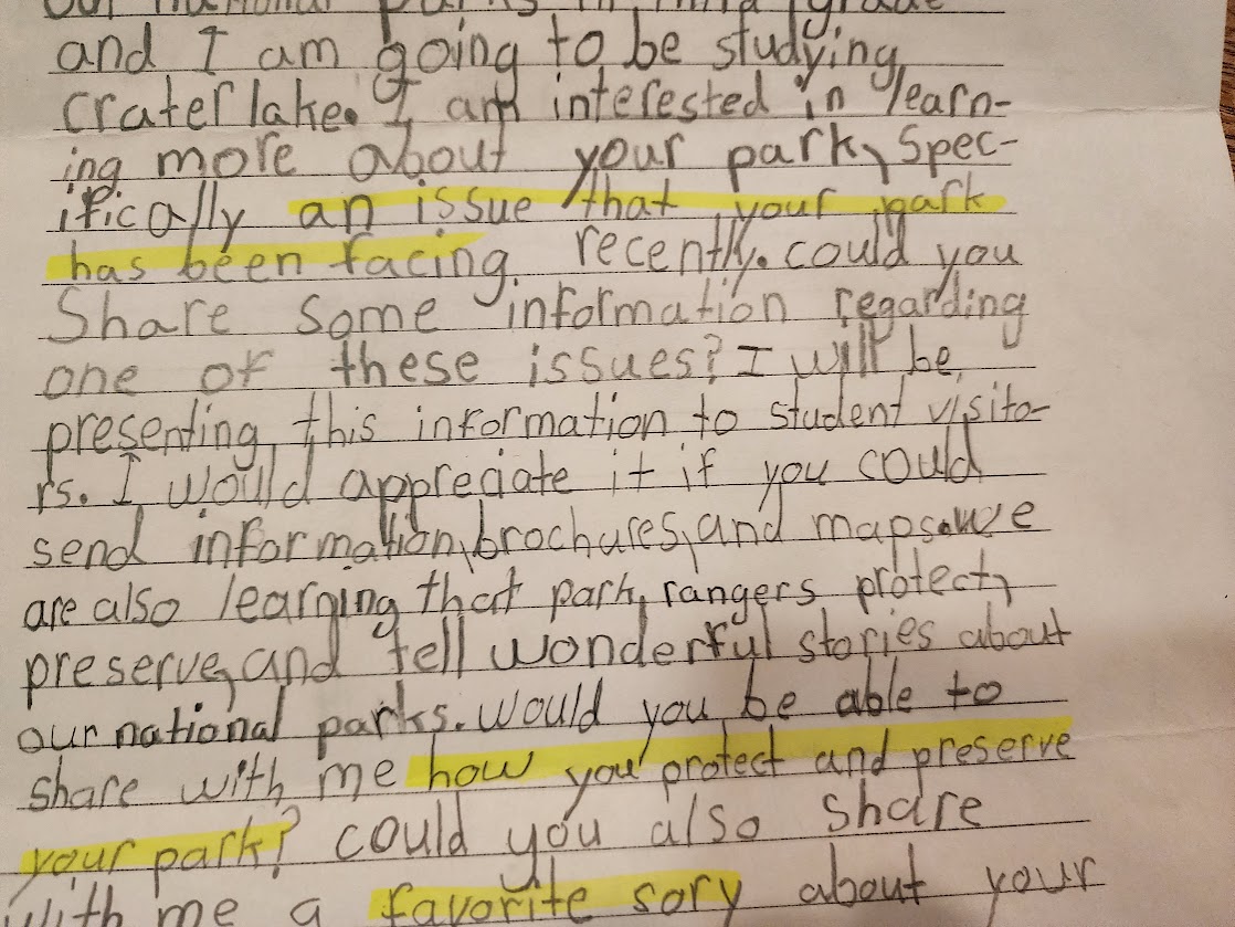
At the office, I stayed busy answering phones, snail and emails. My favorite was the school kid letters. I’m impressed by their curiosity and smart questions. They required time researching and challenged me trying to figure out appropriate concise answers. I learned how some of my responses impact school projects. One teacher wrote that the kids create brochures about their park and then write a persuasive letter to their parents encouraging them to take them to the park they researched. Another wrote that the kids become student rangers for their selected park and do a presentation to student visitors. Here are a few examples.
I also really enjoyed chatting with visitors and taking their photos while roving on snowshoes. It was especially gratifying when they realized how lucky they were to arrive when the lake was visible and road open. One couple was from Australia. They flown into Las Vegas and planned to spend their time between Yellowstone and Glacier National Parks, but weather had them changing their plans to the west coast. They had visited Redwood National Park and spent the night in Medford where they learned about Crater Lake National Park. On a whim they visited, knowing nothing about the park or area. It was a perfect day and they rented snowshoes and were joyfully exploring when I met them. More often than not visitors are disappointed. Some days are 0% chance, others like this photo indicates are 50/50 with patience needed when a gift might just be granted.
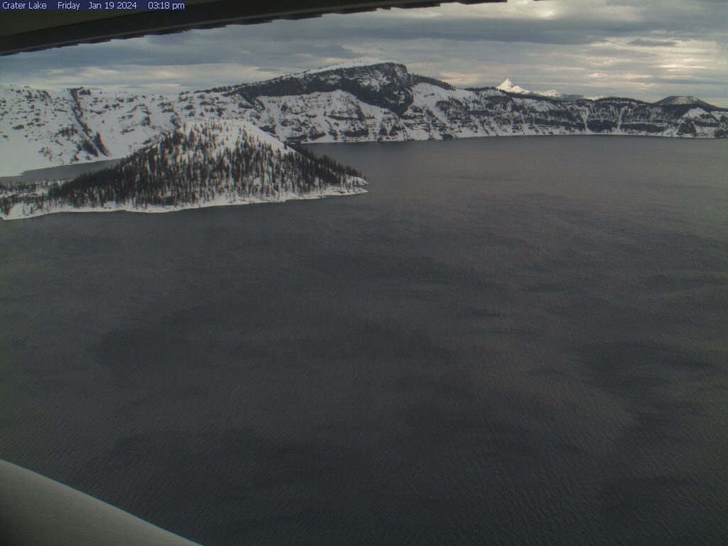
The park monitors the weather and snowfall, reporting it daily to NOAA (link).
Over 9.5 weeks, I volunteered about 260 hours. My paydays were rich with sunsets, sunrises, rainbows, virgin snow, lots of powder, amazing scenes of frozen and flocked trees. I enjoyed the days I sat in my warm cabin feeling like I was living in a snow globe. The staff was kind, welcoming and appreciative. We became a community, and I’ll miss them. However, I’m looking forward to reuniting with spring.