

It was spring jaunting season and with a date in southwest Utah, I needed to first cross California and Nevada. I was dancing with a storm, trying to stay one step ahead.
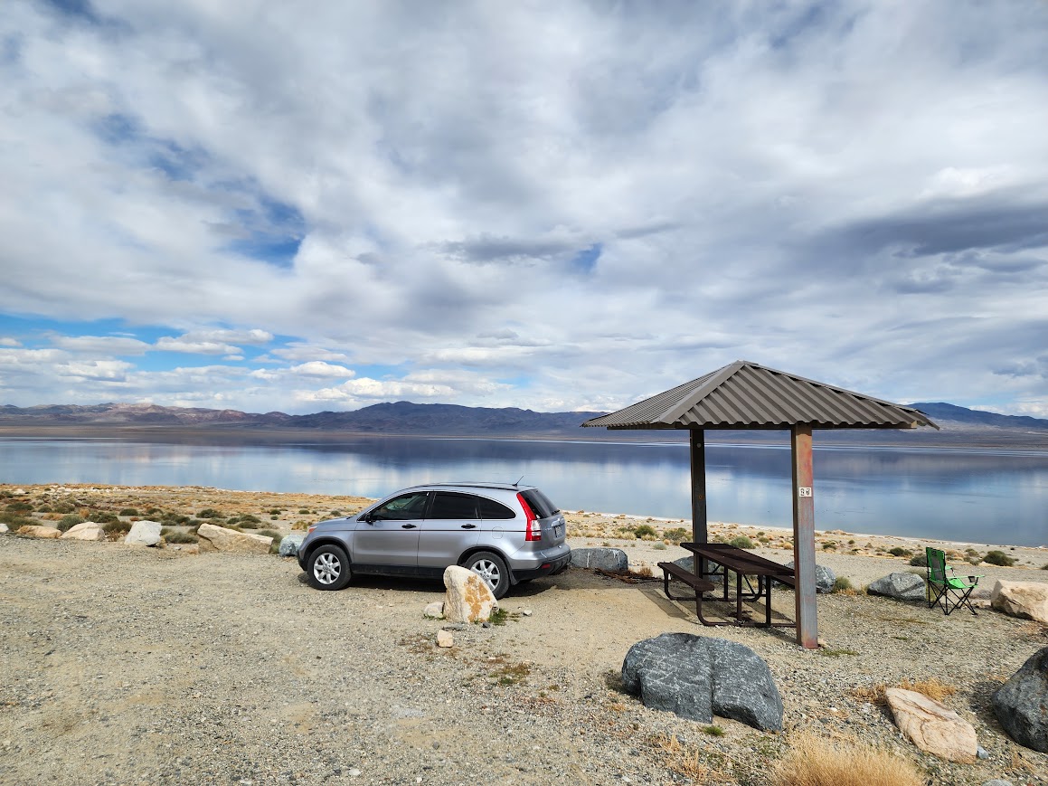
Pyramid Lake
When I reached Susanville I noticed a route on my Google map bypassing the business of the Reno/Sparks area. Since I avoid urban traffic whenever possible, I said YES to this option even though Google indicated it would take an extra 30-45 minutes. What Google failed to indicate was once I reached the Nevada border the road would become unpaved. I immediately stopped and checked my maps to see if I should turn around but made the decision to explore a bit further.

According to Wikipedia, “Pyramid Lake is the geographic sink of the basin of the Truckee River, 40 mi northeast of Reno, Nevada, United States. Pyramid Lake is the biggest remnant of ancient Lake Lahontan, the inland sea that once covered much of western Nevada. Pyramid Lake is fed by the Truckee River, which is mostly the outflow from Lake Tahoe. The Truckee River enters Pyramid Lake at its southern end. Pyramid Lake is an endorheic lake. It has no outlet, with water left only by evaporation, or sub-surface seepage. The lake has about 10% of the area of the Great Salt Lake, but it has about 25% more volume. The salinity is approximately 1/6 that of sea water. Although clear Lake Tahoe forms the headwaters that drain to Pyramid Lake, the Truckee River delivers more turbid waters to Pyramid Lake after traversing the steep Sierra terrain and collecting moderately high silt-loaded surface runoff. The lake is owned/managed by Paiute Tribe with permits required for recreation and visitation.“

Walker Lake State Recreation Area
My destination for the night was Walker Lake, a BLM-managed area with dispersed camping. I’d stayed here previously and knew it would provide safe roads after rain.
It was a relief to make it east of the big snow event.

I was gifted soft suede pastel colors in the evening light.

Although a couple days before the moon would be truly full, I hoped to watch it rise above the lake. Clouds obscured that opportunity but a bit later I enjoyed this view and was happy to capture this decent image with my Samsung S22 phone, using my car window as the tripod.

Strong winds arrived during the night and I was certain my car would be blown into the lake. With all the rockin’ and rollin’ I wasn’t getting any sleep so finally at 3am I relocated to a slightly more protected area. The next morning the storm caught up with me and I waited out about an hour of sleet.

Extraterrestrial Highway
I continued my drive east, finding myself dodging tumbleweeds racing across the highway in the wind gusts.

Although there were lots of references to aliens and Area 51 along the Extraterrestrial Highway, a large swath of Joshua trees caught my interest.


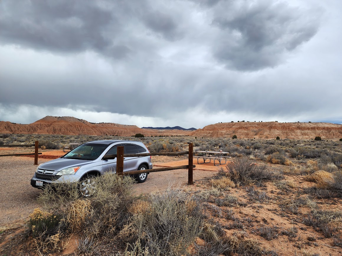
Cathedral Gorge State Park
This was a location on my future Jaunt map and perfectly aligned for an overnight stop on my way to Utah. Given the stormy conditions, it was smart to be on good roads versus typical dispersed camping roads. At this time there were three car camping spots available for first come first serve reservations.
It was a great place for storm-watching and rainbow-making.

And to observe storm-clearing light.

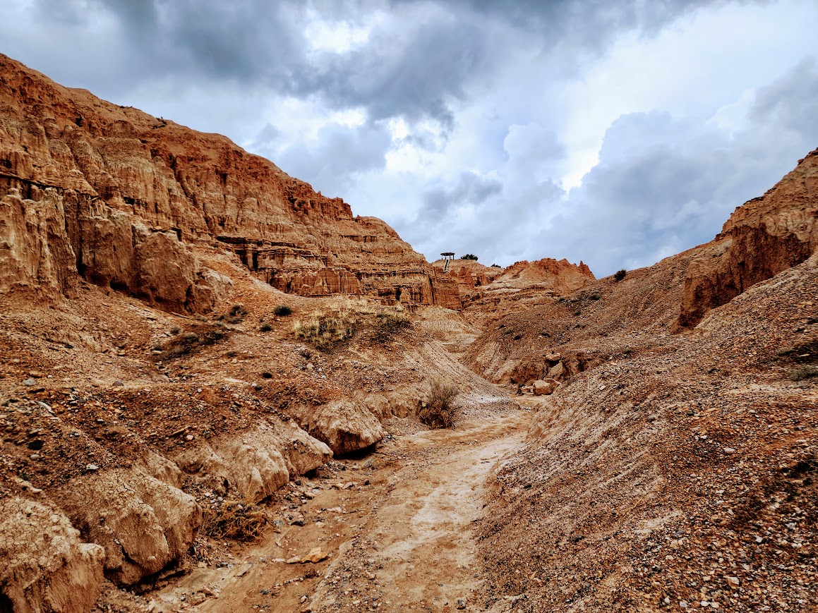
According to the park’s website, “Cathedral Gorge State Park is located in a long, narrow valley in southeastern Nevada, where erosion has carved dramatic and unique patterns in the soft bentonite clay. The park’s beauty began with explosive volcanic activity that, with each eruption, deposited layers of ash hundreds of feet thick. Great walking trails abound for exploring the cave-like formations and cathedral-like spires that are the result of geologic processes from tens of millions of years ago. A photographer’s dream, the park offers stunning views of the scenic canyon and visitors can enjoy hiking, picnicking, camping and nature study.“
This is one of those places where it’s hard to capture the colors and textures unless the light is right. I lucked out with the storm clouds. There are some well-defined trails, opening into areas inviting further exploration. During a break in the storm, I got out for a wander.


Millers Point is a viewpoint accessible by vehicle, but I chose to hike up to it as I needed to stretch my legs after driving for two days.


Details of the mud in the formations.

The next morning I planned to hike the Juniper Draw Loop, but when I saw this junction I couldn’t help but choose the Hawk’s Ridge Trail instead. Interestingly this trail is not on the park maps, nor was it on my Gaia digital maps until I added the Trailforks MTB layer.


You really need to check out one of those weird alien-themed museums on one of your jaunts. It appears there are actually those who are big believers–thought-provoking!
I considered it!