AZ – Chiricahua National Monument . . . Rockin’ the Rhyolite

I’d originally planned to take the free shuttle to Echo Canyon and hike down through the various trails. As I thought about it overnight I realized I needed the exercise, so why not hike a loop?

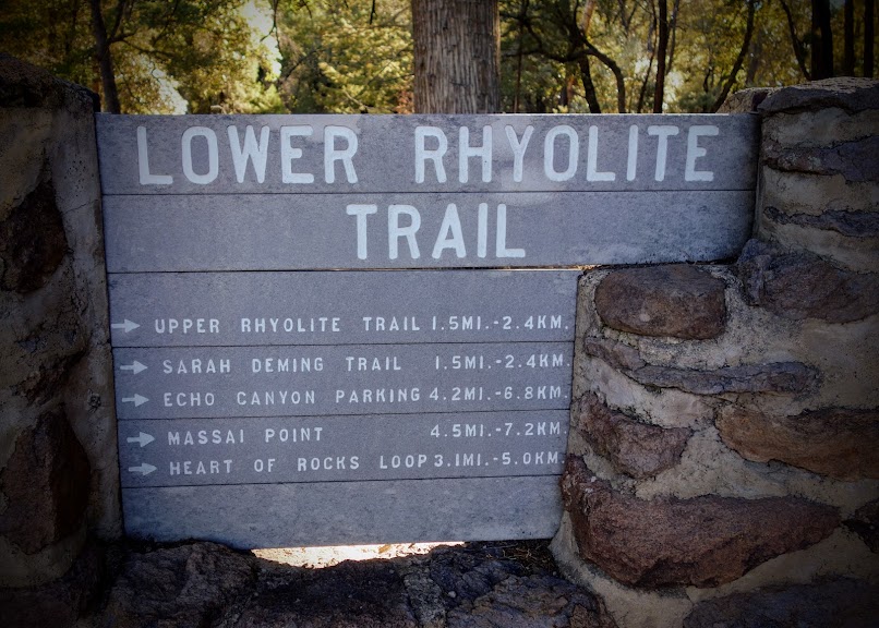
The Lower Rhyolite Trail begins at the Visitor Center. By skipping the shuttle, I skipped the crowds and the later start. In exchange I enjoyed bird chatter and creek song.

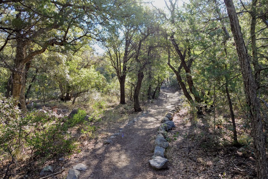
When it was time to leave the creek it was a gentle ascent.

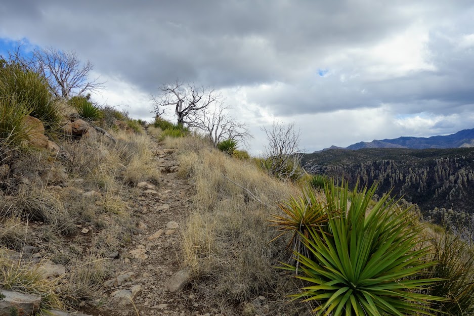
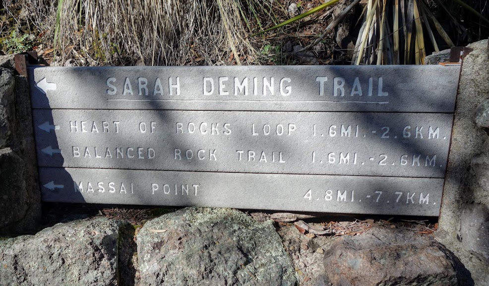
At the first junction I took the Sarah Deming Trail. As you can see, the trails are well signed making it difficult to get lost.

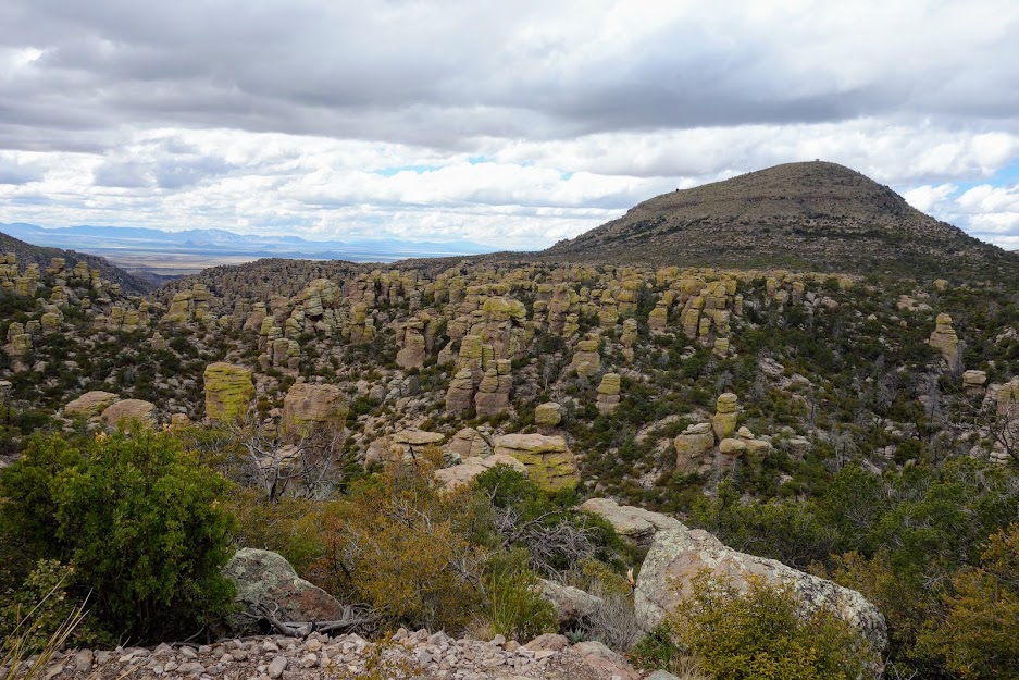
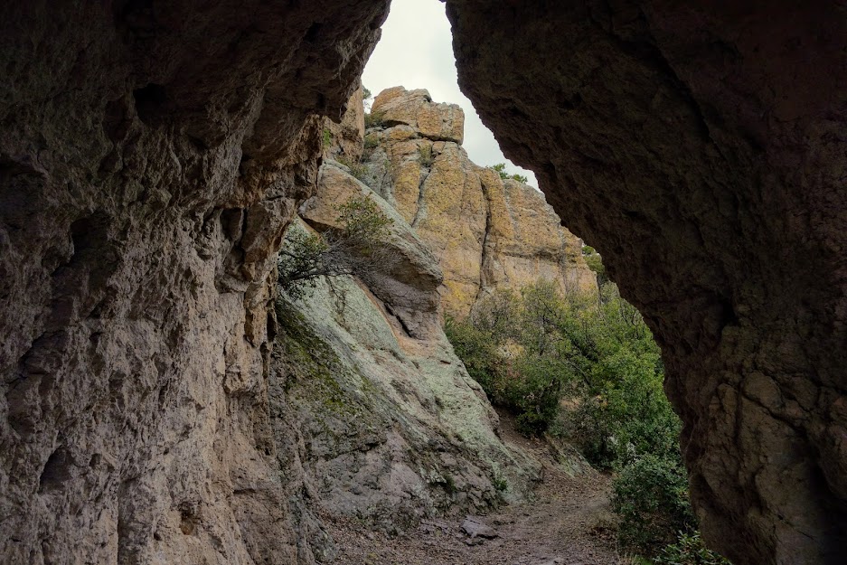
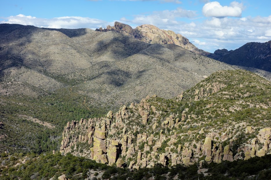
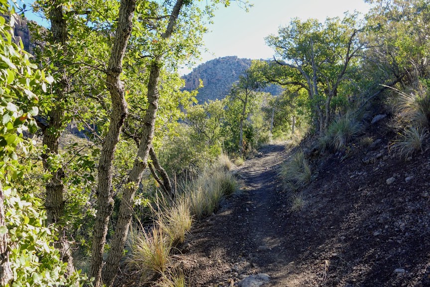
Soon enough I had my first views of the standing rocks or rhyolite.

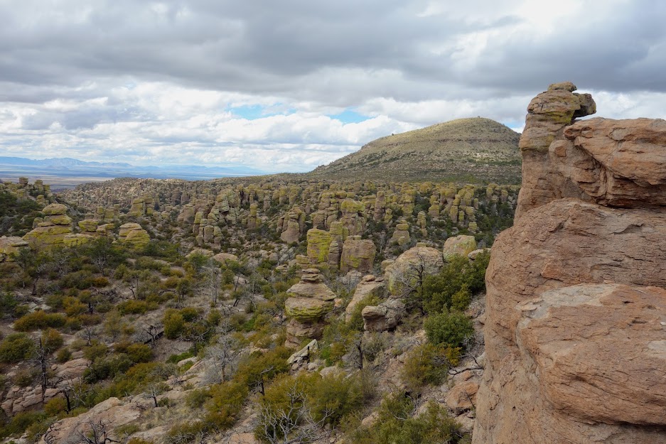
I couldn’t resist taking the Heart of Rocks Loop where if you’re lucky you might find Punch and Judy. Who are they anyway? According to Wikipedia, “Punch and Judy is a traditional puppet show featuring Mr. Punch and his wife Judy. The performance consists of a sequence of short scenes, each depicting an interaction between two characters, most typically Mr. Punch and one other character who usually falls victim to Punch’s slap stick.”

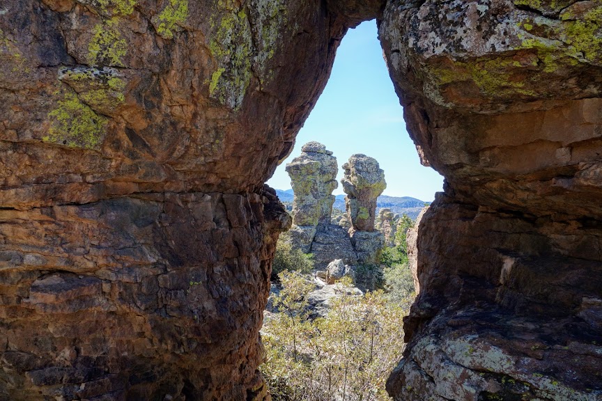
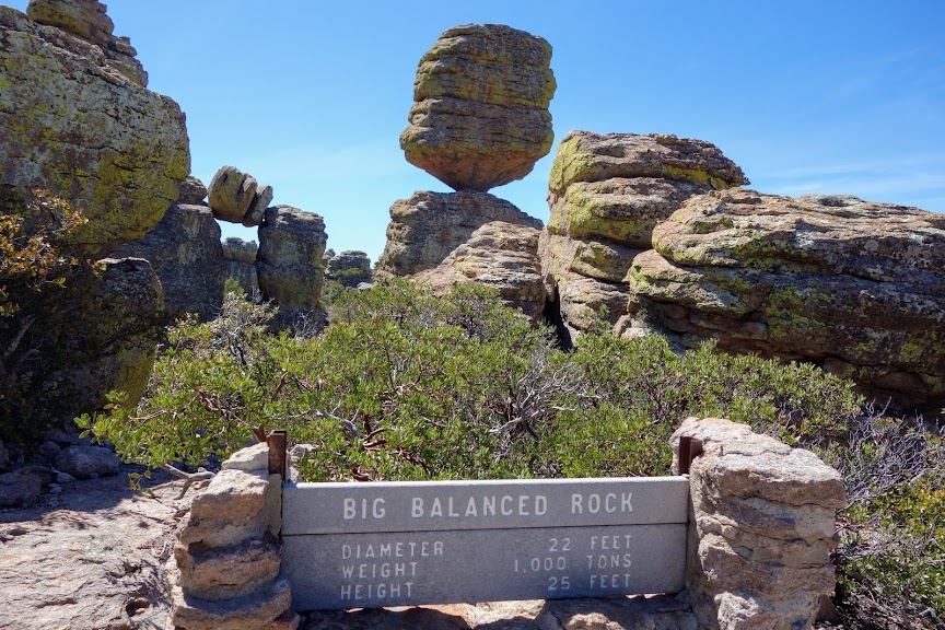
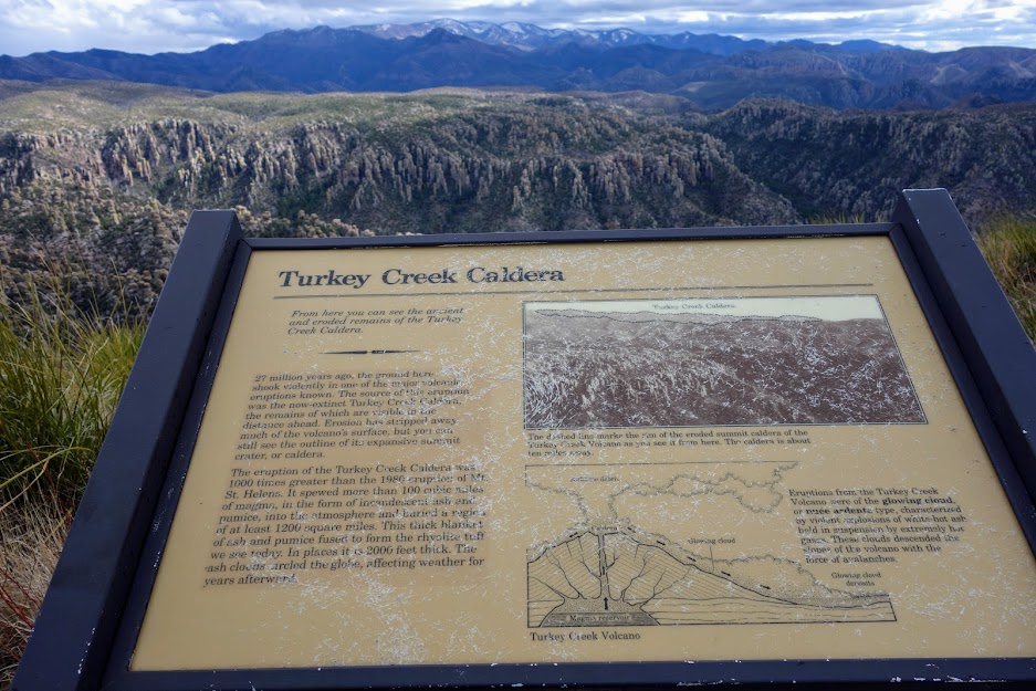
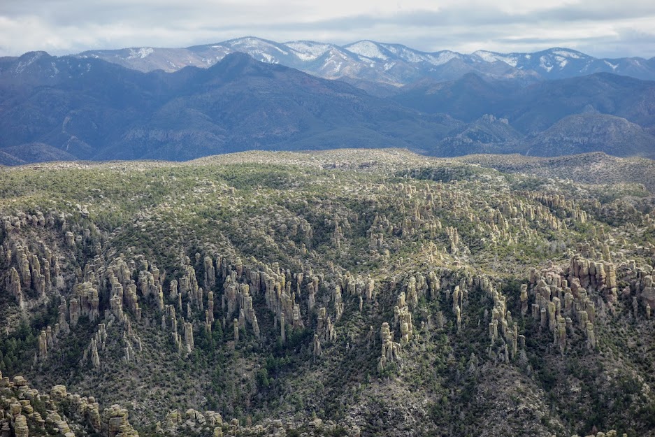
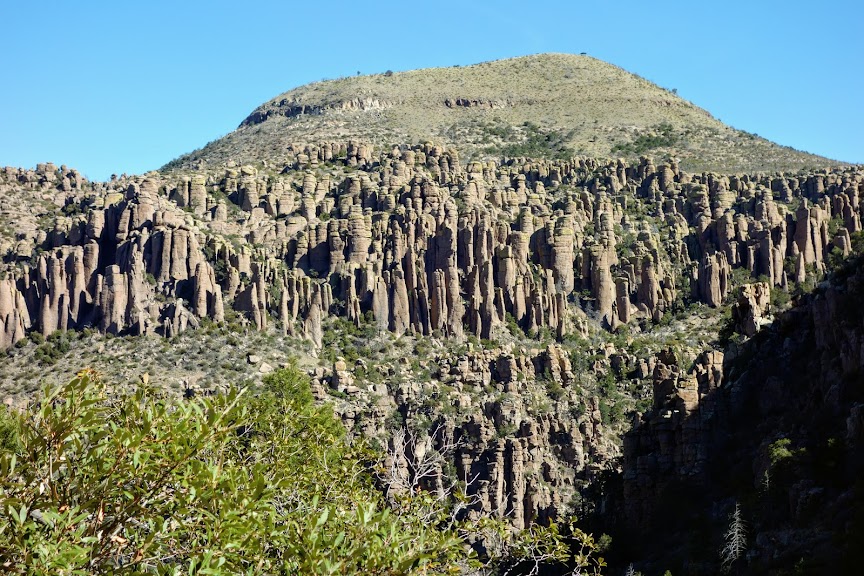
The views of rhyolite are neverending. What is rhyolite? According to Geology.com, “Rhyolite is an extrusive igneous rock with a very high silica content. It is usually pink or gray in color with grains so small that they are difficult to observe without a hand lens. Rhyolite is made up of quartz, plagioclase, and sanidine, with minor amounts of hornblende and biotite.”

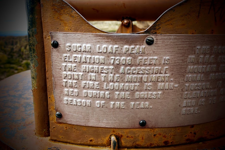
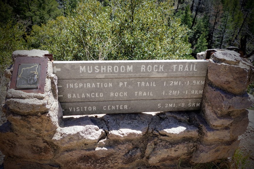
At the next junction I decided to take the Mushroom Rock Trail rather than go up to Massai Point to connect to the Echo Canyon Trail, since Joan and I previously hiked those.

I was excited to find my first flowers, Bigelow’s bristlehead.

The right light is needed to bring out the colors in the rocks, otherwise they are just kind of bland monochromatic.

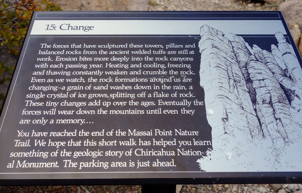
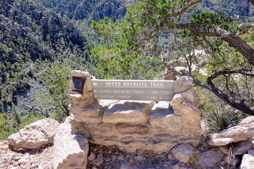
I completed the lollipop loop by taking the Upper Rhyolite Trail to reconnect to the Lower Rhyolite Trail.

Adventure Date(s):

  • March 14, 2020

Hike Details:Tips:

  • The nearest dispersed camping is on Pinery Road (FS Road 42). Although there were several others camped nearby, it was a very disruptive night with lots of Border Patrol traffic.
  • Ask for the Hiking Guide at the Visitor Center.
  • If you plan to hike more of the Chiricahua Mountains/Wilderness aka Cave Creek Canyon, I recommend getting the Green Trails Map (link) of the area.
  • Nearest resupply town is Willcox. At the time of this writing there was a Safeway. There was also a TA Travel Center for shower and laundry.

Resources:

Links:

I participate in the Amazon affiliate program and may receive a commission on qualifying purchases linked in this post. It doesn’t affect your price but it helps support this site.

AZ – Chiricahua National Monument, Sugarloaf Mountain Lookout

In December 2017, my backpacking bestie Joan and I spent time in the Chiricahau Mountains including a couple of days at the Chiricahau National Monument. Ever since I’ve had a return on my list so I could fully explore the area in less snowy conditions.

Massai Point Nature Trail

I arrived mid day so after a stop at the Visitor Center, where I  made a shuttle reservation for the next day, I drove to Massai Point to stretch my legs while learning about the geology on the nature trail.

The Chiricahua Apache called this the Land of Standing Up Rocks. These spires are the result of volcanic activity.

Sugarloaf Mountain Lookout

Joan and I hiked nearly every trail in the park but not this one. So how I could I resist? Plus at less than 2 miles round trip it was a perfect for this afternoon where I was short on time. This is the view of the lookout from Massai Point.

Not far from the trailhead you hike through this cool rock tunnel.

It was a little early for wildflowers but the manzanita was starting to bloom.

It was a moody day threatening rain. I only saw two others while hiking this trail.

First views of the lookout.

The lookout was locked up on the day I visited. I noticed a broken window and a missing pane which I reported to the Visitor Center.

I found the survey marker.

There was interpretative signage including this one about Turkey Creek Caldera. I’d like to visit that area on a future visit.

The 360-degree views were outstanding. I forgot to update my Peak Finder App so couldn’t quickly identify the mountains.

Cochise Head is very recognizable.

Adventure Date(s):

  • March 13, 2020

Hike Details:Tips:

  • The nearest dispersed camping is on Pinery Road (FS Road 42). Although there were several others camped nearby, it was a very disruptive night with lots of Border Patrol traffic.
  • Ask for the Hiking Guide at the Visitor Center.
  • If you plan to hike more of the Chiricahua Mountains/Wilderness aka Cave Creek Canyon, I recommend getting the Green Trails Map (link) of the area.
  • Nearest resupply town is Willcox. At the time of this writing there was a Safeway. There was also a TA Travel Center for shower and laundry.

Resources:

Links:

I participate in the Amazon affiliate program and may receive a commission on qualifying purchases linked in this post. It doesn’t affect your price but it helps support this site.

AZ – Chiricahua National Monument

Although Joan (aka Rambling Hemlock) and I had grand plans to spend more time hiking in the Portal area, with the snowy conditions we’d experienced the previous few days, we decided lower elevation options might be in our best interest. Chiricahua National Monument was on our must-see list, and with a bit of brainstorming we figured out a way to hike nearly all the trails over a couple days by overnighting at the campground. (Photo credit: Joan) 

Natural Bridges Trail

You have to look hard to find the bridge feature once you reach the “end of the trail” as it’s just a viewpoint across the canyon. 

The unmarked features were of much more interest. 

Along the trail we got an introduction to rhyolite, the main feature of Chiricahua National Monument.

Rhyolite is an extrusive igneous rock with a very high silica content. It is usually pink or gray in color with grains so small that they are difficult to observe without a hand lens. Rhyolite is made up of quartz, plagioclase, and sanidine, with minor amounts of hornblende and biotite. Source: geology.com

Faraway Ranch

From the Natural Bridges trailhead, we walked the road back to the campground and on to Faraway Ranch, so named because it was far away from everywhere and everything.

Joan likes to complete the Junior Ranger books. Without the scavenger hunt challenge, we might have missed this cool feature. What’s even more interesting is that these signature rocks were relocated from another project. 

Echo Canyon/Hailstone/Mushroom Rock/Inspiration Point/Balance Rock/Heart of Rocks/Sarah Deming/Lower Rhyolite Trails

This Park offers a free shuttle from the Visitor Center to a couple of trailheads allowing a one-way hiking option. What a fab resource! (Photo credit: Joan)

We started from the Echo Canyon trailhead. There is a fire lookout on the mountain in the background. Wonderland of Rocks is the park’s slogan. It’s no wonder why.

It’s also called the Land of Standing Up Rocks.

Mushroom Rock on none other than the Mushroom Rock Trail. 

This Cochise Head view on the Inspiration Point trail was my favorite. (Photo credit: Joan)

I really want to hike Cochise Head. 

Are you THE balanced rock of Balanced Rock trail? 

Maybe it’s the trail of many balanced rocks? 

Soon enough we came to a sign telling us this was THE balanced rock. 

On the Heart of Rocks loop trail, we found Pinnacle Balanced Rock. I bet there are specific ratios to determine requirements of a balanced rock versus a pinnacle balance rock.

I was surprised to find a few technical sections along the trail, including some large step-ups, primarily on the Heart of Rocks loop trail. Overall the trail was in excellent condition with lots of beautiful trail building by the CCC crews way back when. (Photo credit: Joan)

Hike Details:

  • Date(s) Hiked: December 20-21, 2017
  • Natural Bridge:
    • 4.5 miles (round trip)
    • Ascent/descent 1,200′
    • Minimum elevation 5,400′; max 6,000′
  • Echo Canyon to Visitor Center:
    • 9-10 miles (end to end)
    • Ascent 2,000′; descent 3,500′
    • Minimum elevation 5,400′; max 7,000′

Tips:

  • The Bonita Canyon Campground is available year around for camping. Beware of skunks, skunk odor, generators and barking dogs.  It’s not exactly my kind of camping, but the compromise was worth it rather than commuting back and forth from Willcox, the nearest town with lodging. Backcountry camping is not an option at the Park.
  • You can reserve a spot on the hiker shuttle at the Visitor Center. At the time of our visit it was only running once per day. 
  • Ask about the Hike for Health Pins. There are several Parks in southeast Arizona offering these cool collector items. At Chiricahua National Monument, they require you hike 5 miles  (and show recognizable photos as proof) to earn the pin. 

Links:

Resources: