WY – Wind River Mountains, Bridger-Teton National Forest, Bridger Wilderness, Boulder Lake Trailhead (08/23)

I’d been dreaming of a return to the Winds aka Wind River Mountains for several years. I was last there in 2017 and it was possibly my most memorable summer since starting this crazy lifestyle nine years ago.

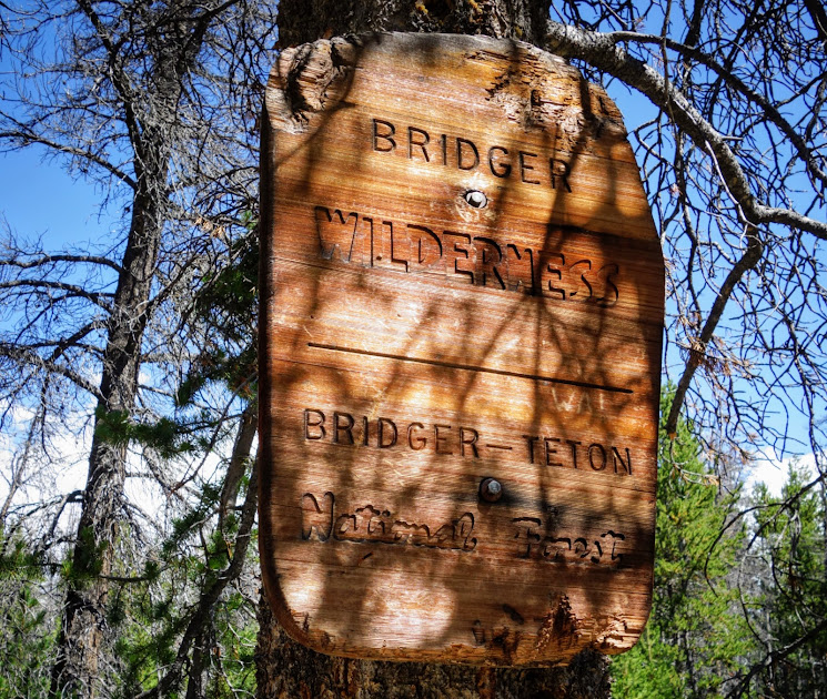
In Pinedale, I stopped at The Outdoor Store and USFS Ranger Station for recommendations, since I’d already hiked many of the highlight trails. There was consensus that this should be my next trip. First, though I had to wait out a storm system.

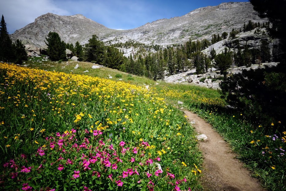
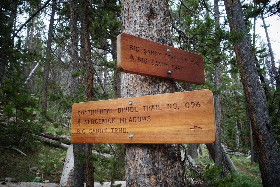
Day 1 – Boulder Canyon Trailhead to Lake Vera

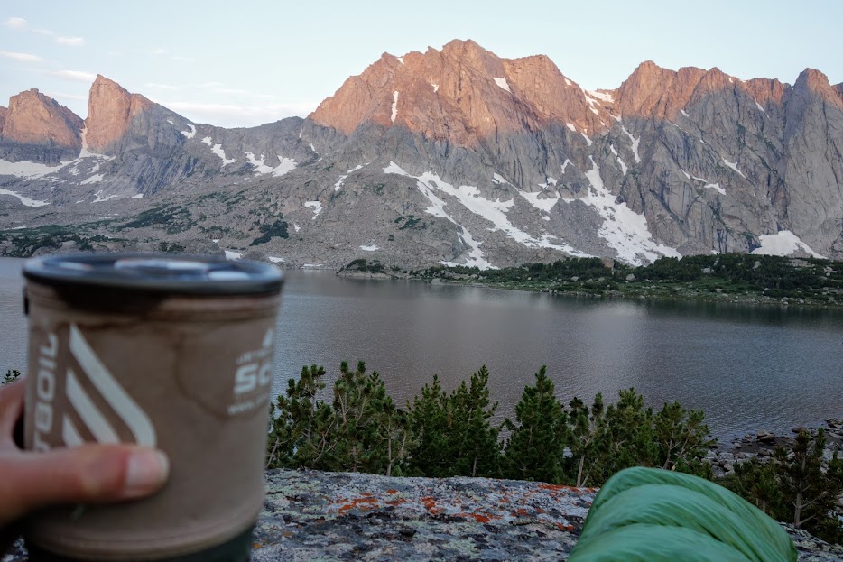
Unlike my recent time in the Beartooths where trailheads were at 9-10,000′, you have to earn your views in the Winds with this one starting at 7,800′. My morning view of Boulder Lake near the trailhead. I packed for 6.5 days and wasn’t sure how my new pack (link) would handle the nearly 29-pound weight. (Spoiler alert: my pack carried well, but my body felt a bit more fatigued each day even though I ate my way toward pack lightness.)

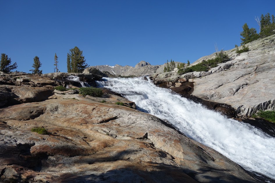
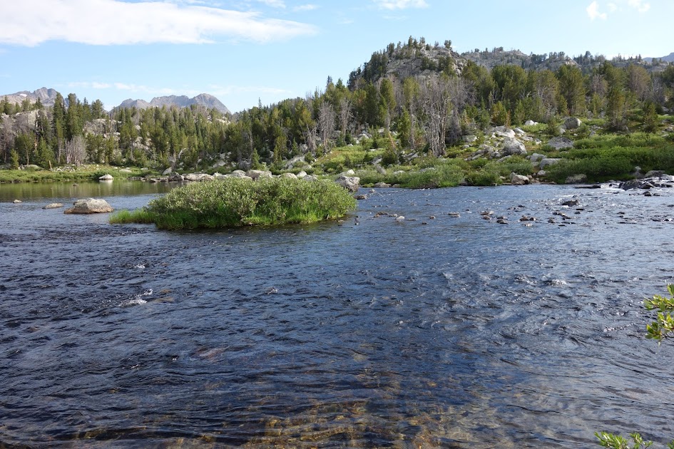
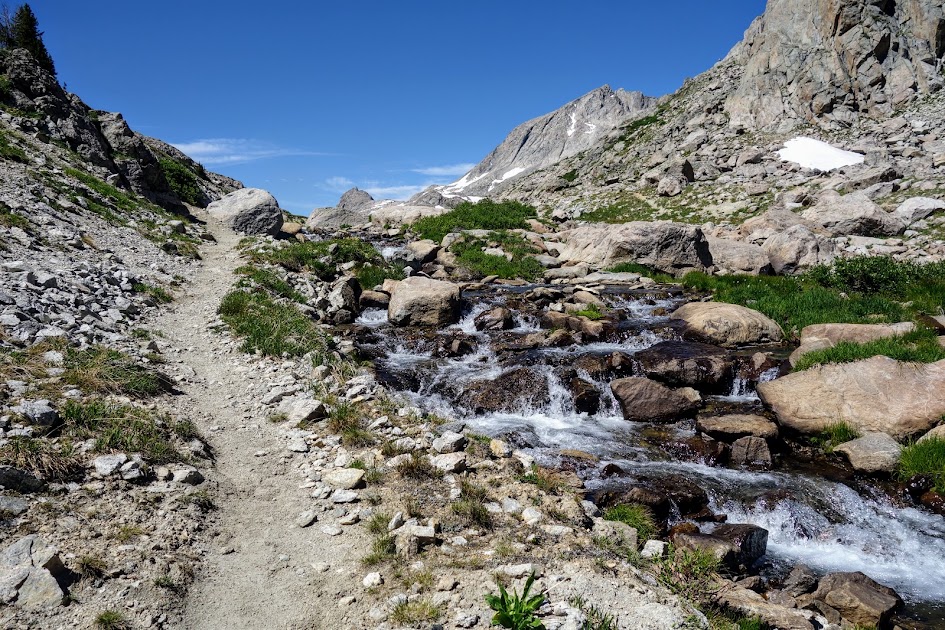
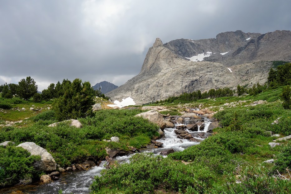
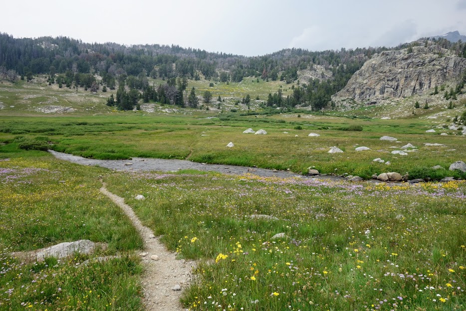
The trail crosses Boulder Creek and then parallels it for nearly six miles.

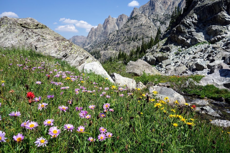
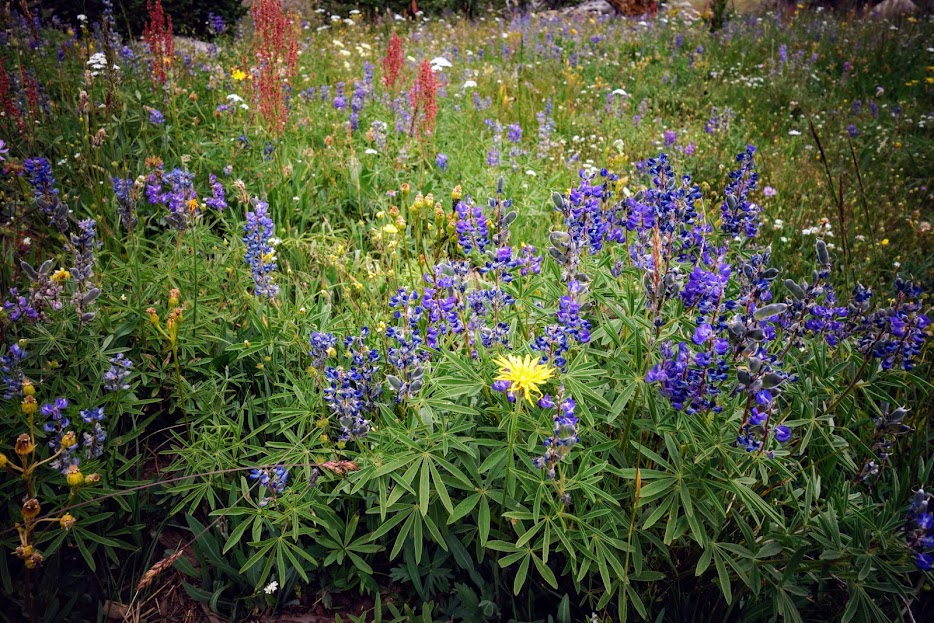
The trail was lined with ripe berries. YUM!

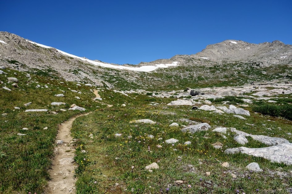
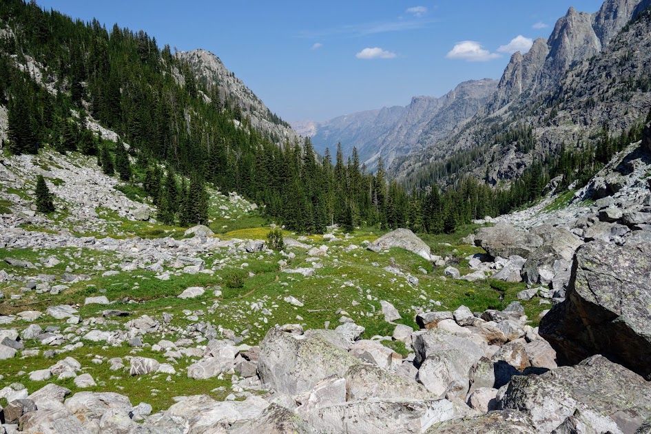
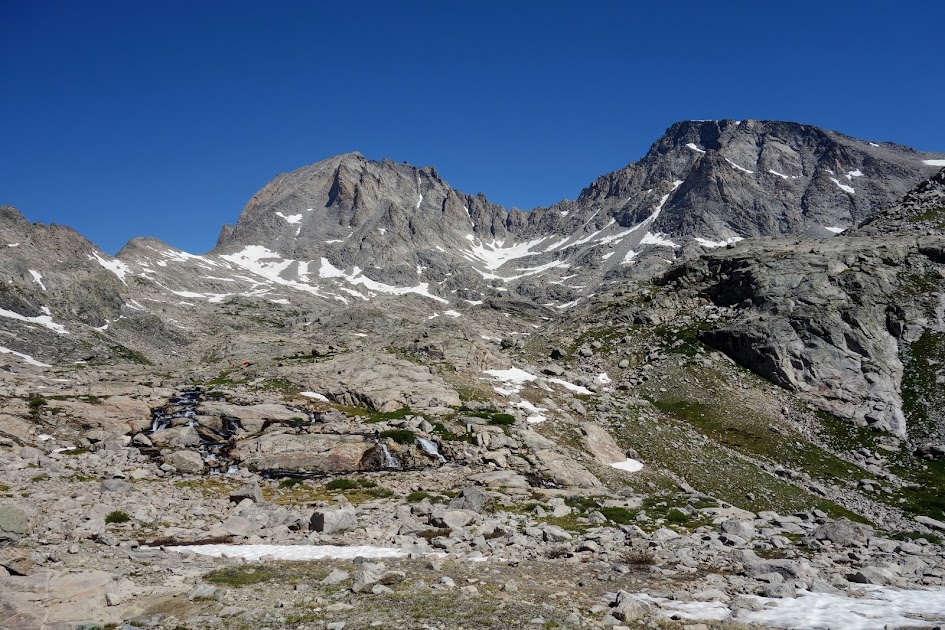
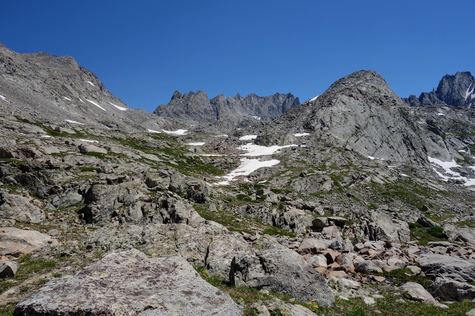
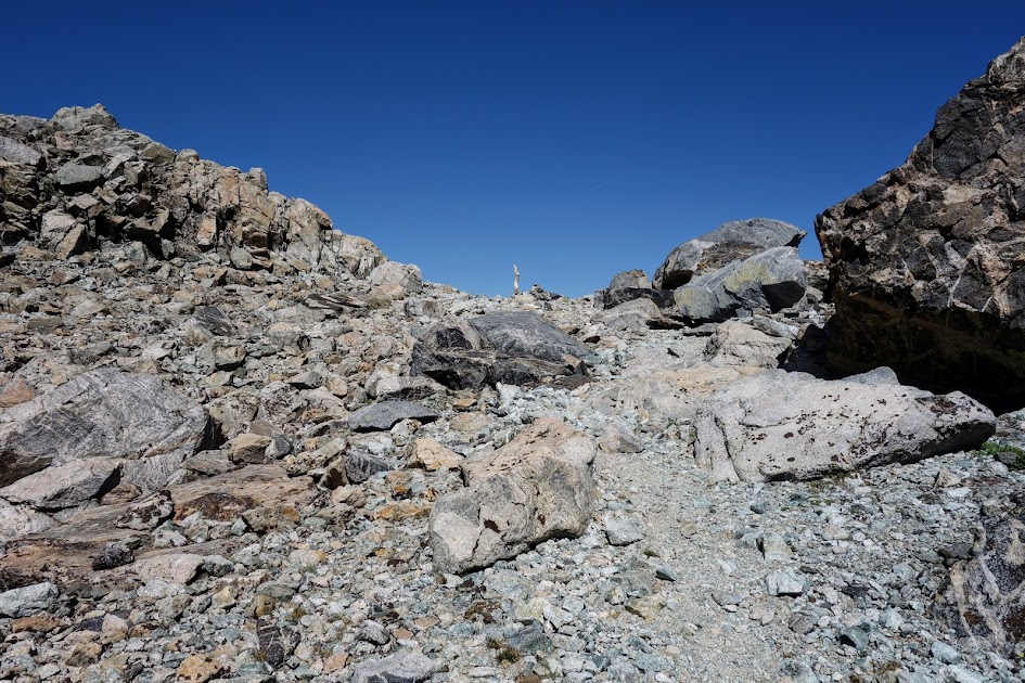
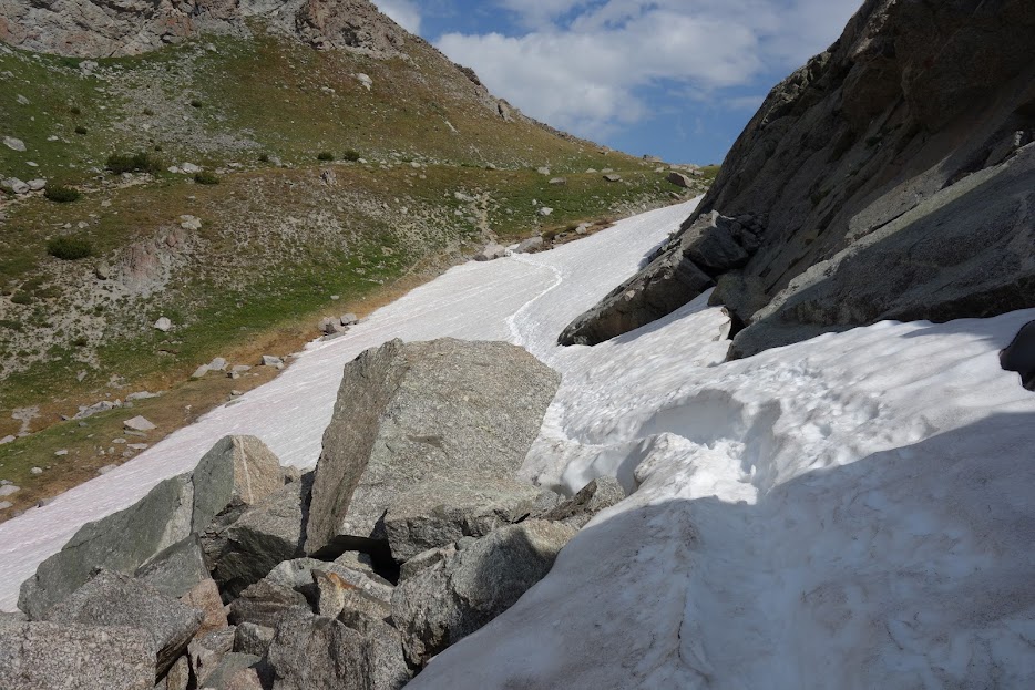
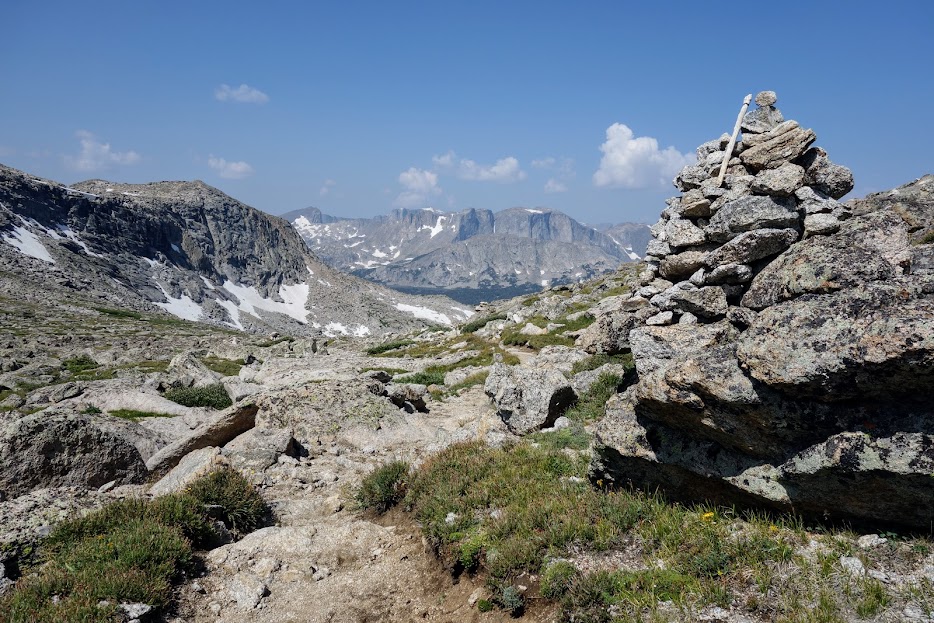
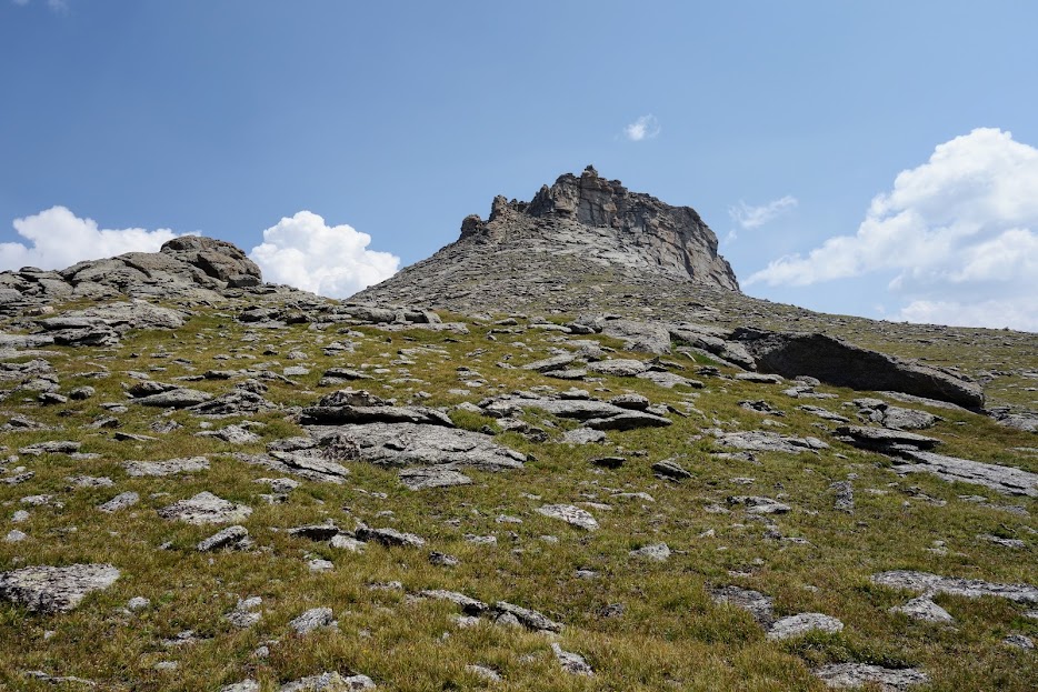
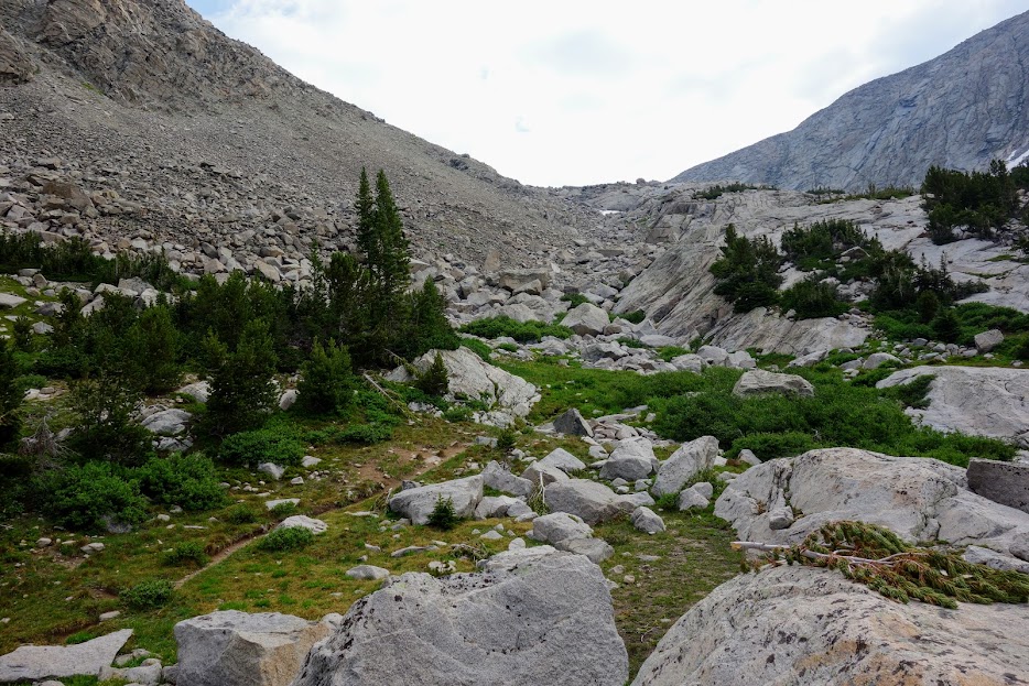
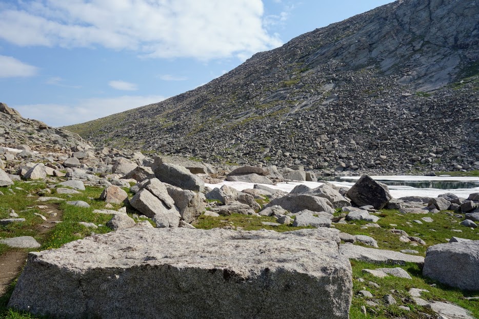
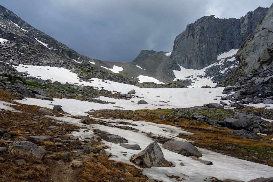
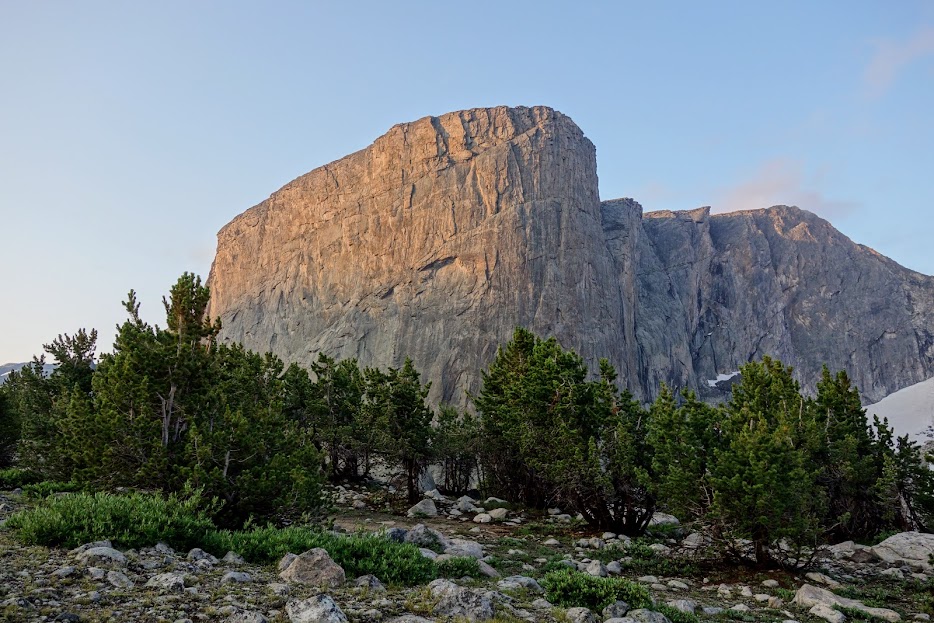
The canyon was appropriately named for the many boulders and rock formations. The trail was rocky.
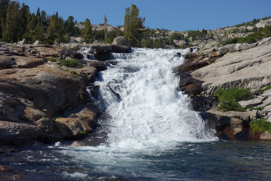
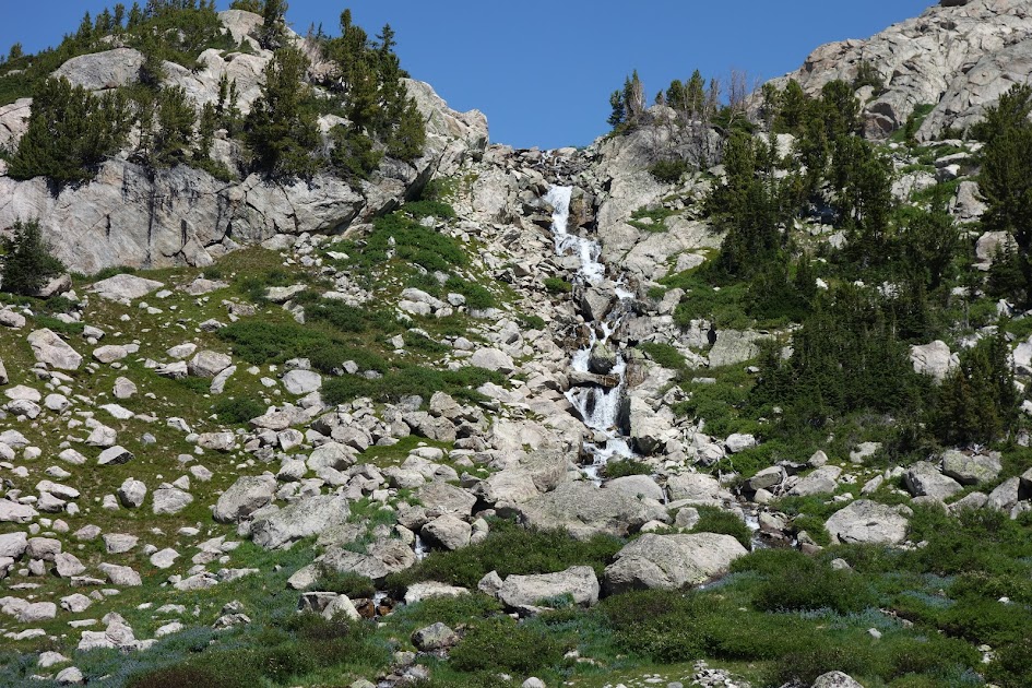
North Fork Falls.

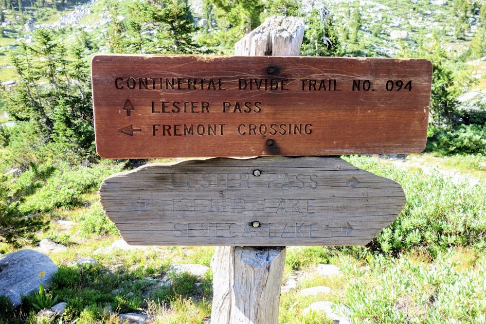
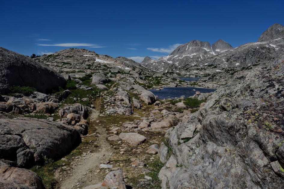
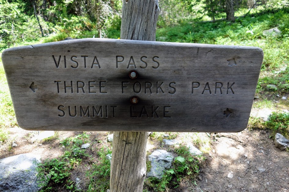
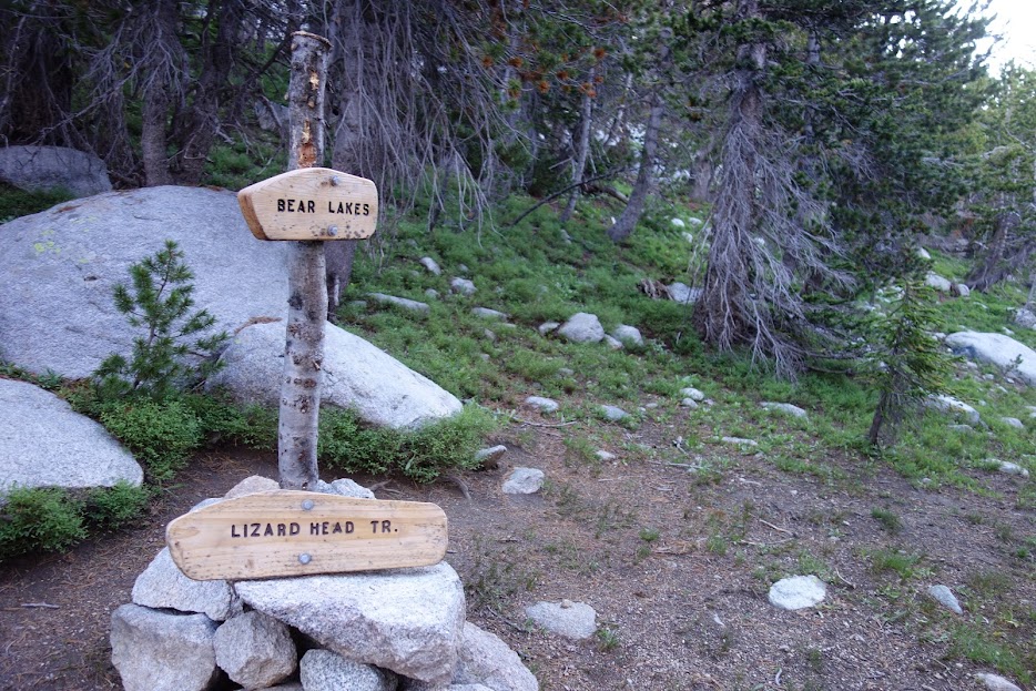
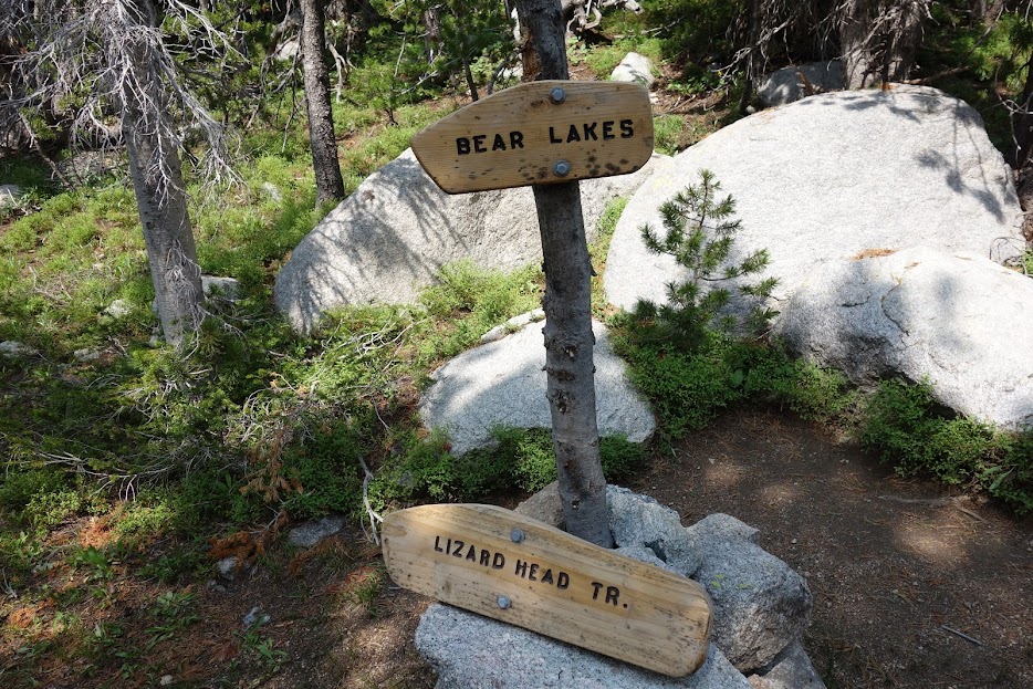
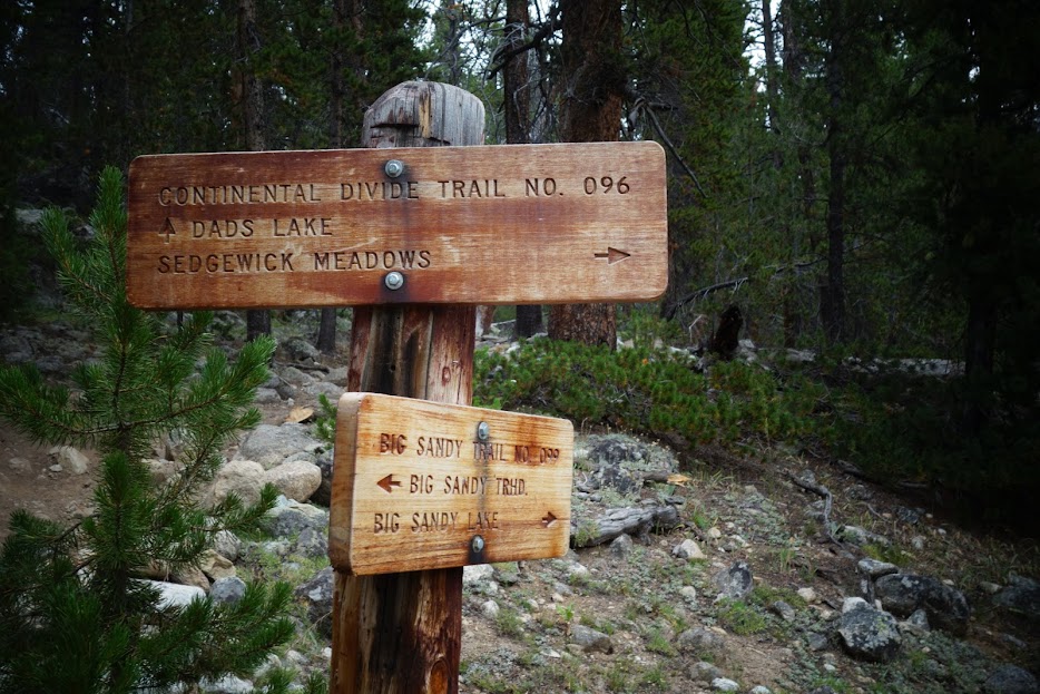
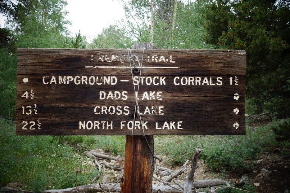
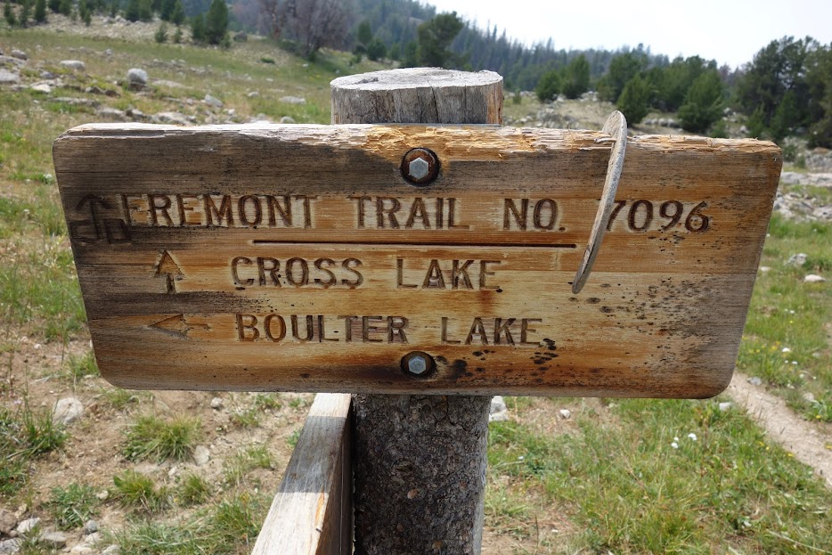
I hadn’t done much research and tossed a coin at this junction. Both led to North Fork Lake and the Fremont Trail aka CDT (Continental Divide Trail), points on my itinerary.

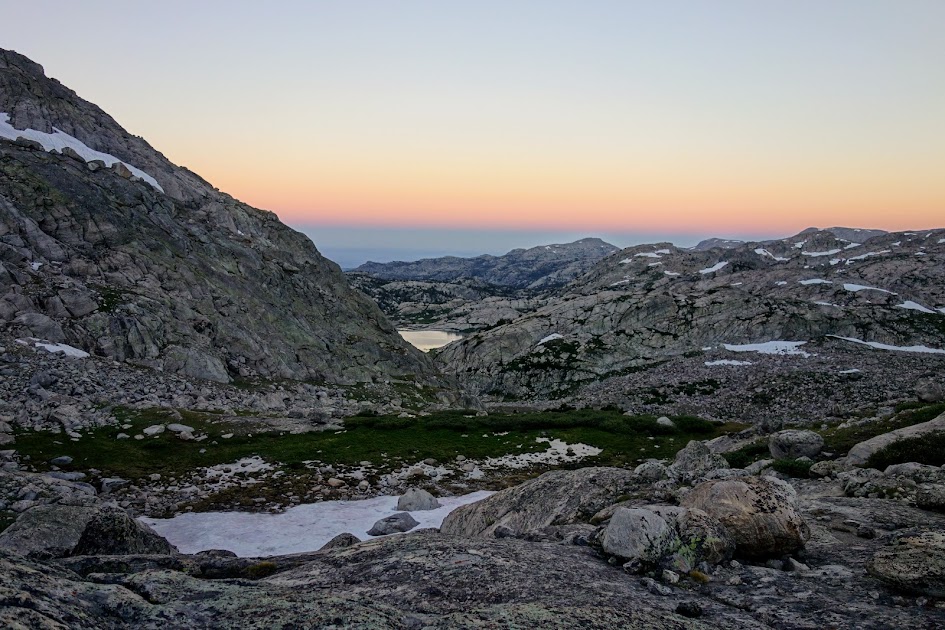
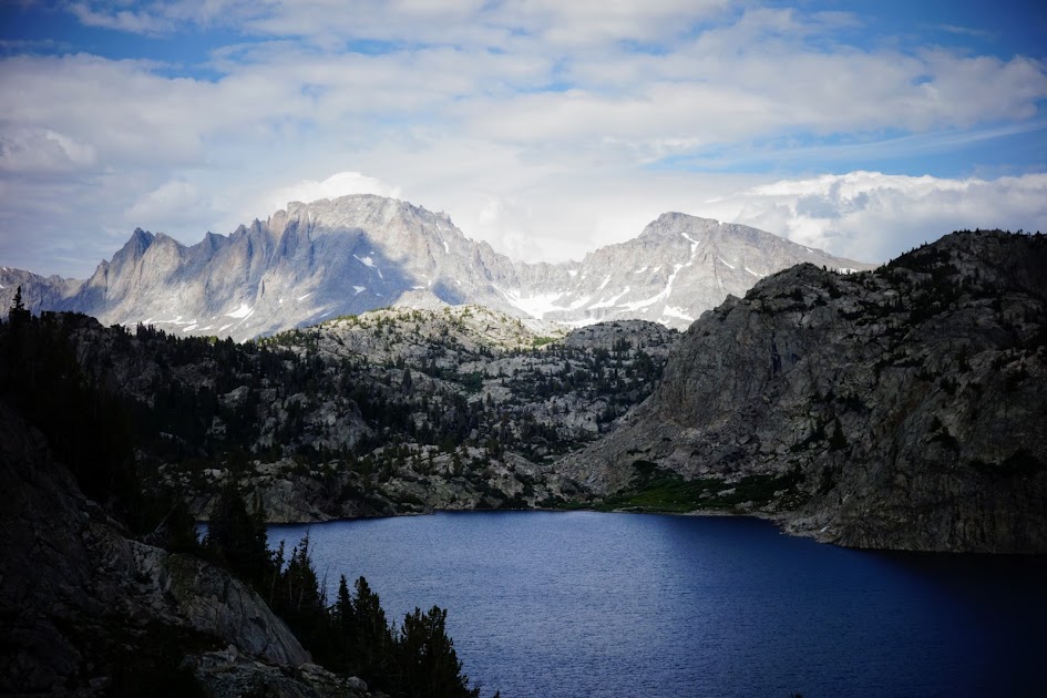
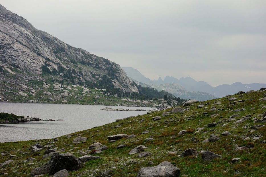
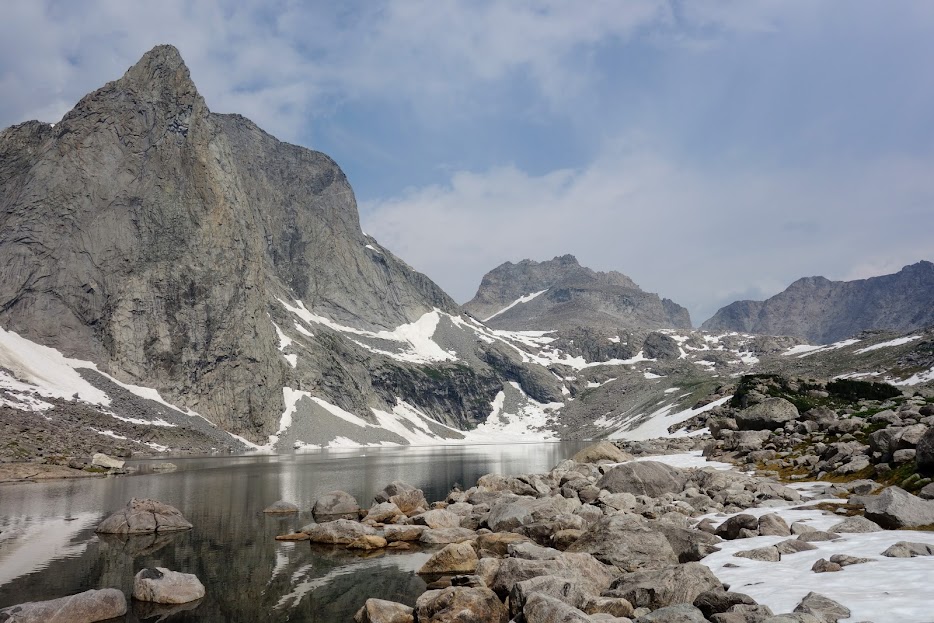
At the junction, I had this view of Lake Ethel. I met a group who hiked out and back on this trail and said they’d heard the trail to Vera was rocky thus the reason they chose Ethel. However, they said it was hard to find safe campsites as there were many standing dead trees. The 1988 Fayette Fire burned 38,000 acres in this area; this was the same year as the big fire in Yellowstone. It’s interesting (and depressing) to see the evidence and recovery 35 years later.

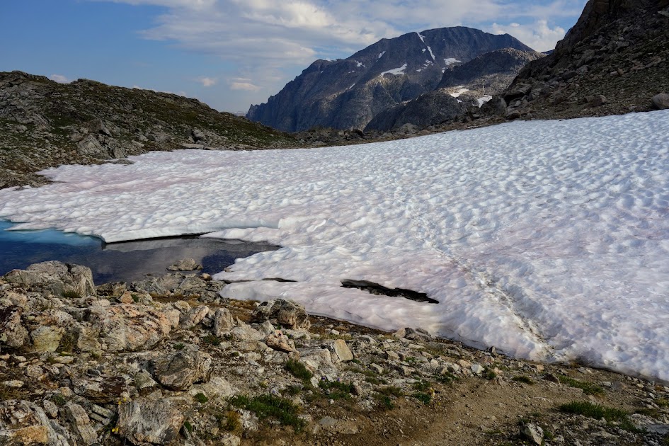
I chose the trail to Lake Vera. Dugway Lake didn’t invite a swim. Many of the lakes required a bit of off-trail exploration and I wasn’t motivated at this point in my hike. Notice the minimal recovery after 35 years.

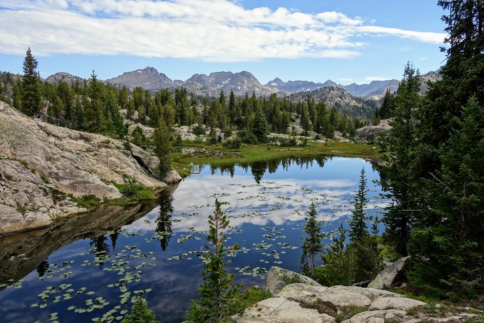
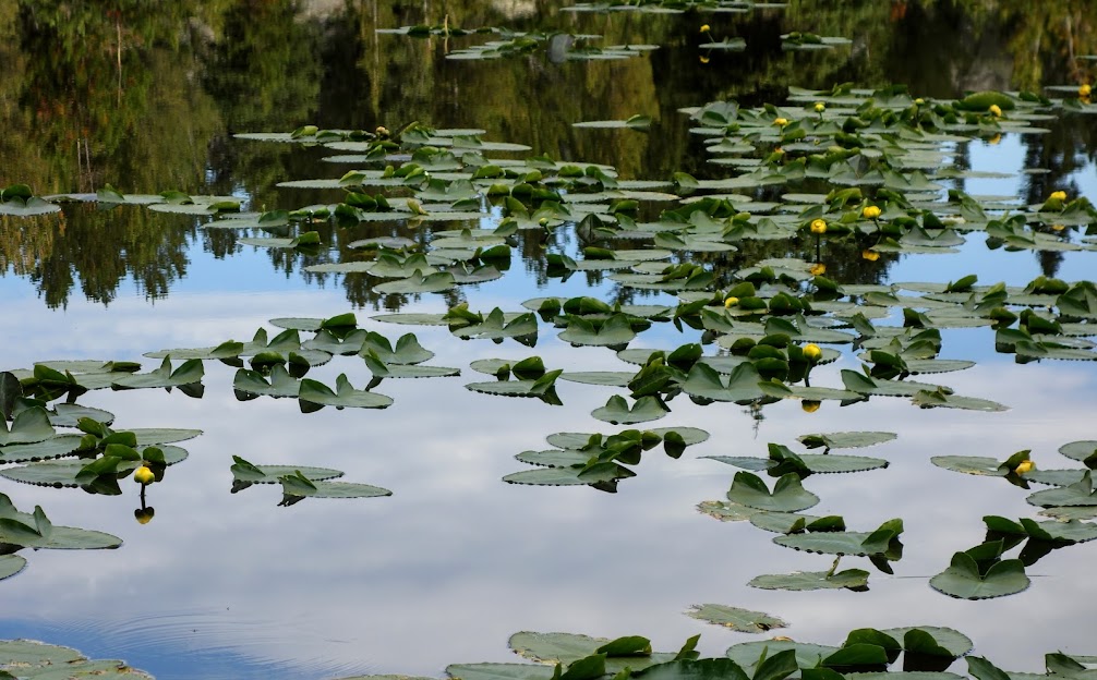
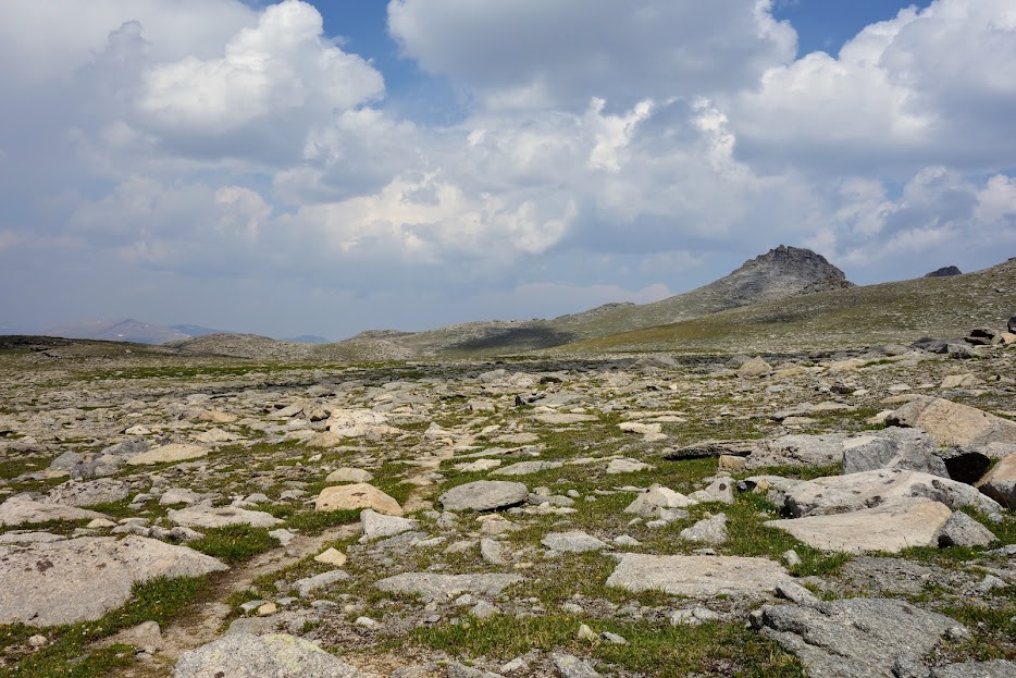
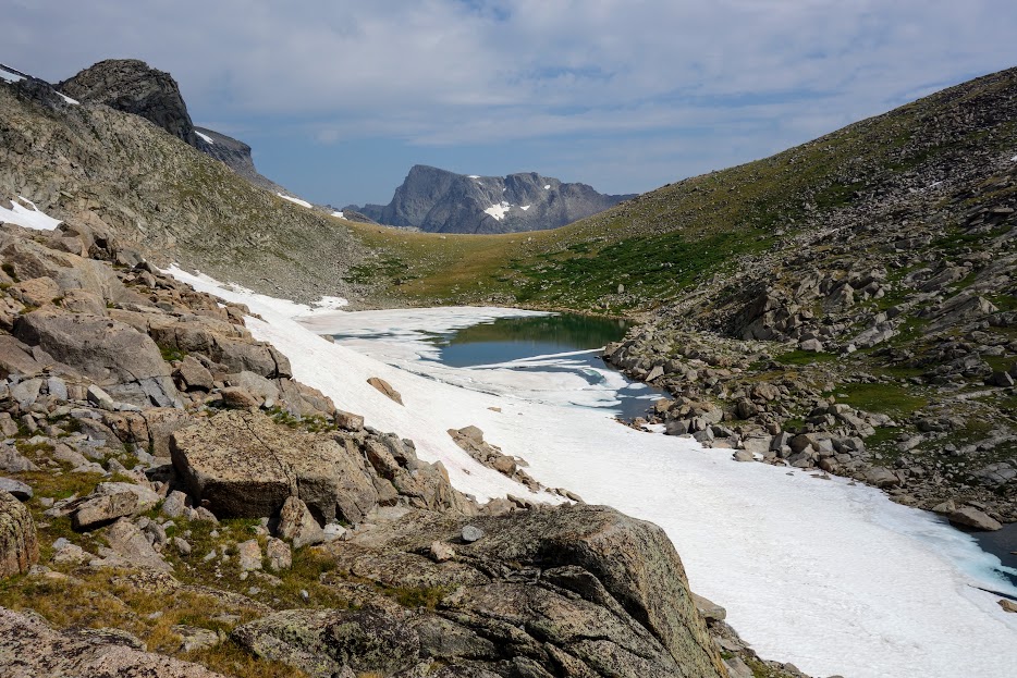
Many of the smaller shallow lakes were decorated with lilypads. I found the rocky trail similar to what I’d hiked in the canyon leading to the junction.

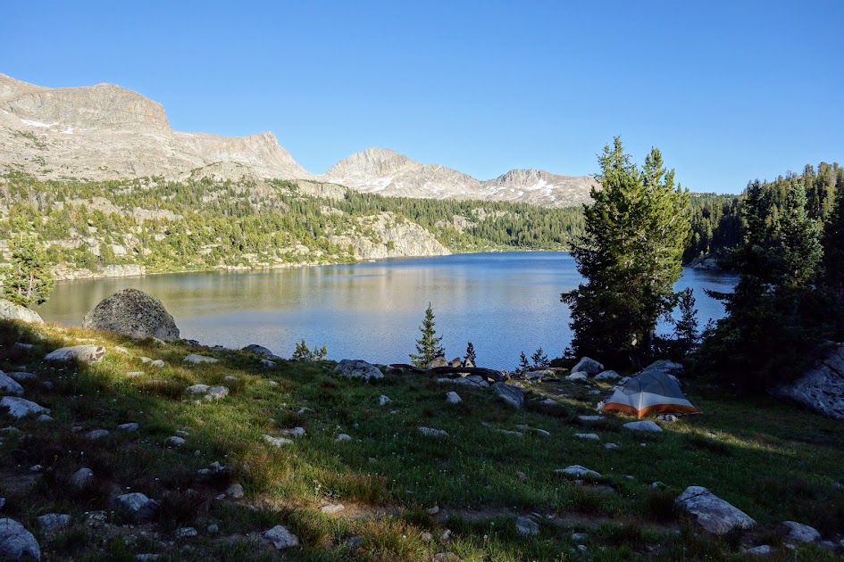
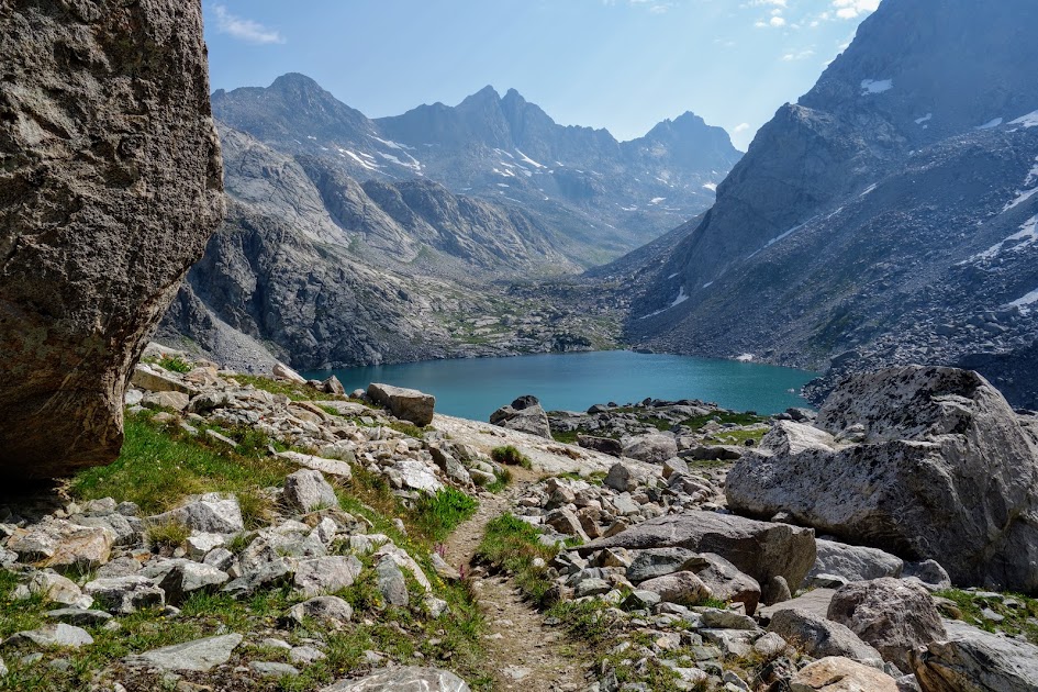
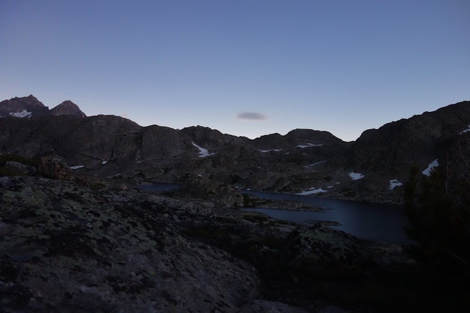
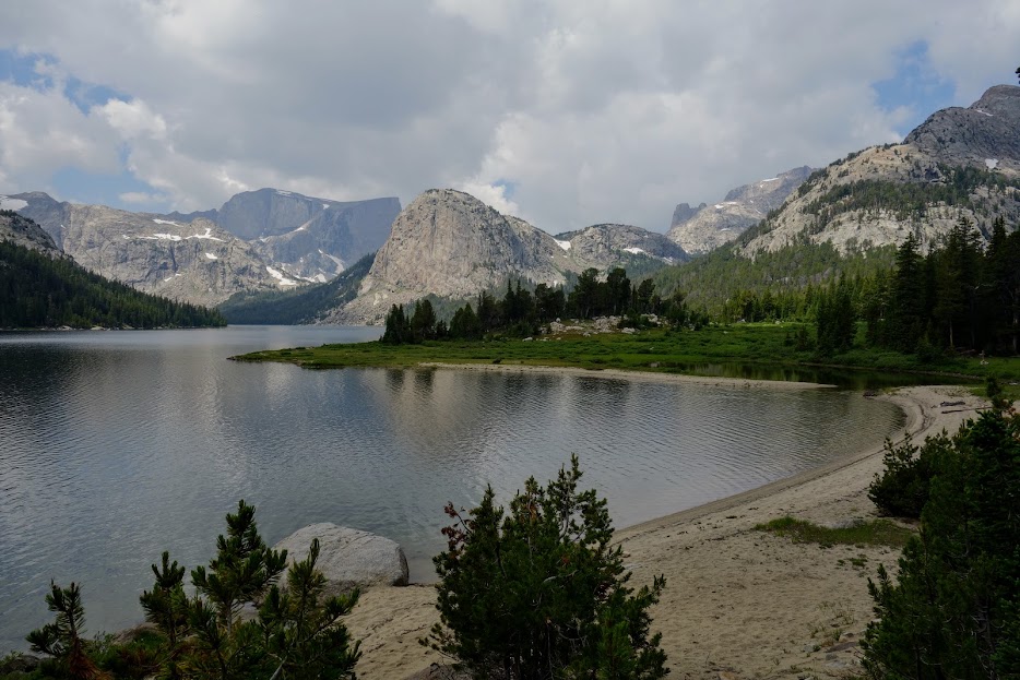
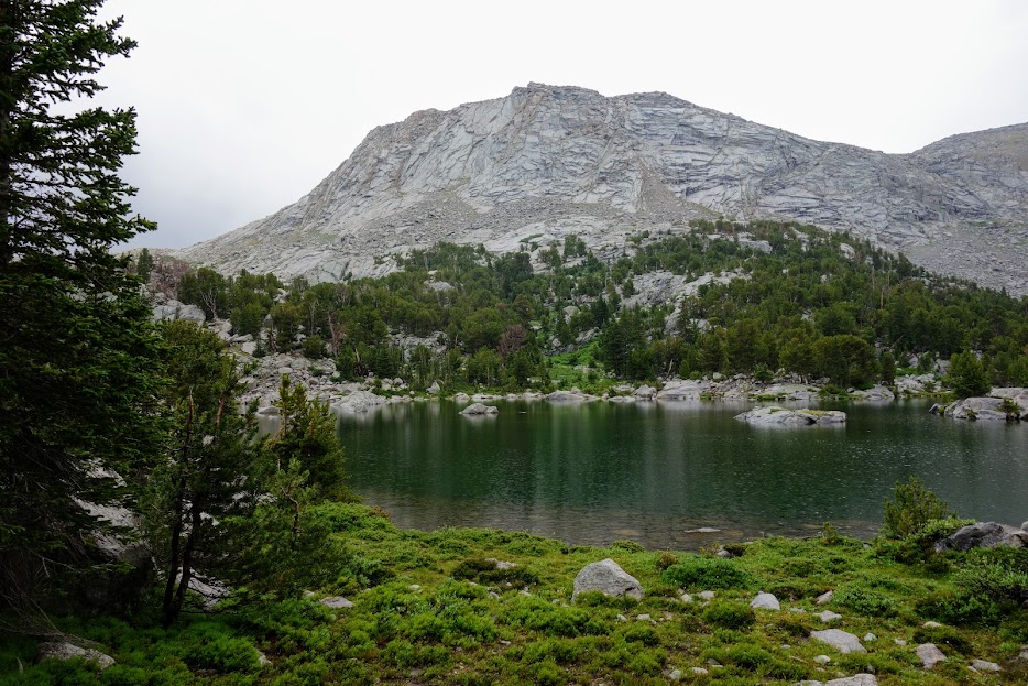
After 10.8 miles with 2,400′ of climbing, I arrived at Lake Vera, finding this nice campsite, ready to swim away the grime of the day.

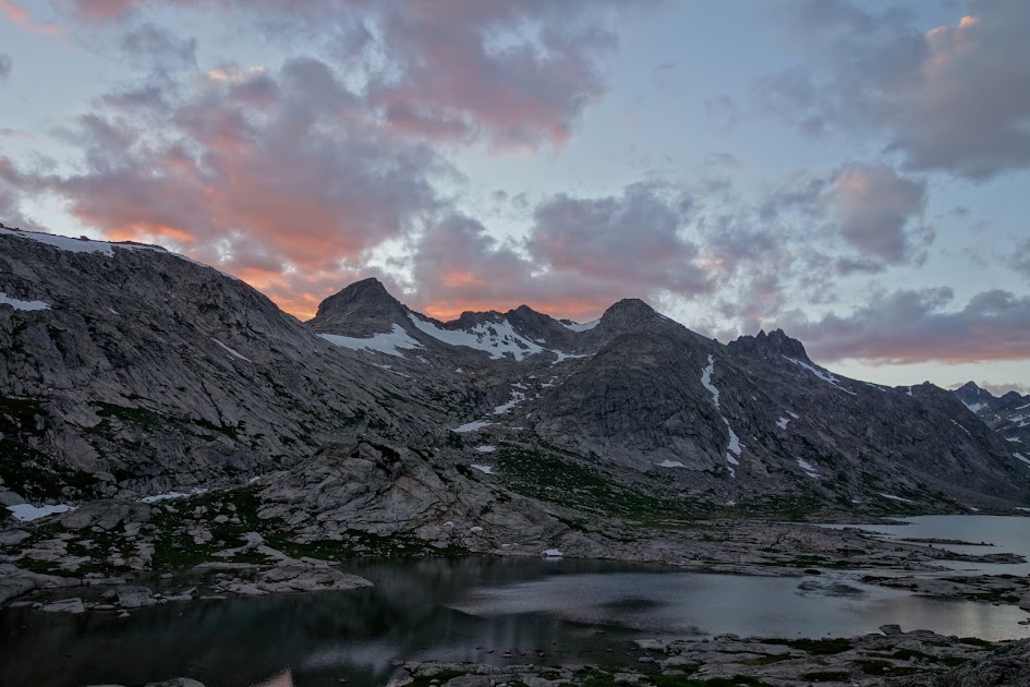
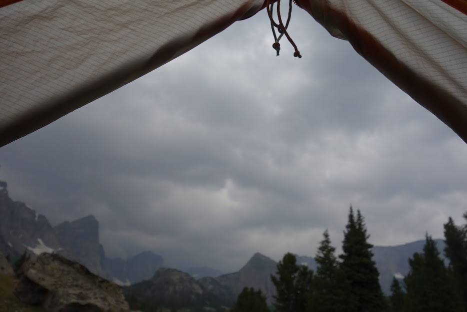
This view the next morning had me wondering about the weather. I was expecting a storm in two days and had planned for a day off if that forecast came true.

Day 2 – Lake Vera to Lake Victor

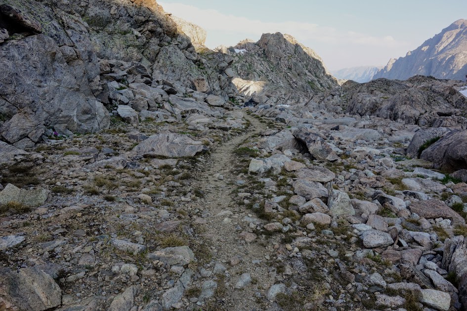
I left Lake Vera in good spirits, only to be crushed by having to play tree jungle gym nearly the entire way to North Fork Lake. This section hadn’t been included in the ranger’s trail conditions report. I was still fatigued from the previous day’s climbing so had already planned to take it easy.

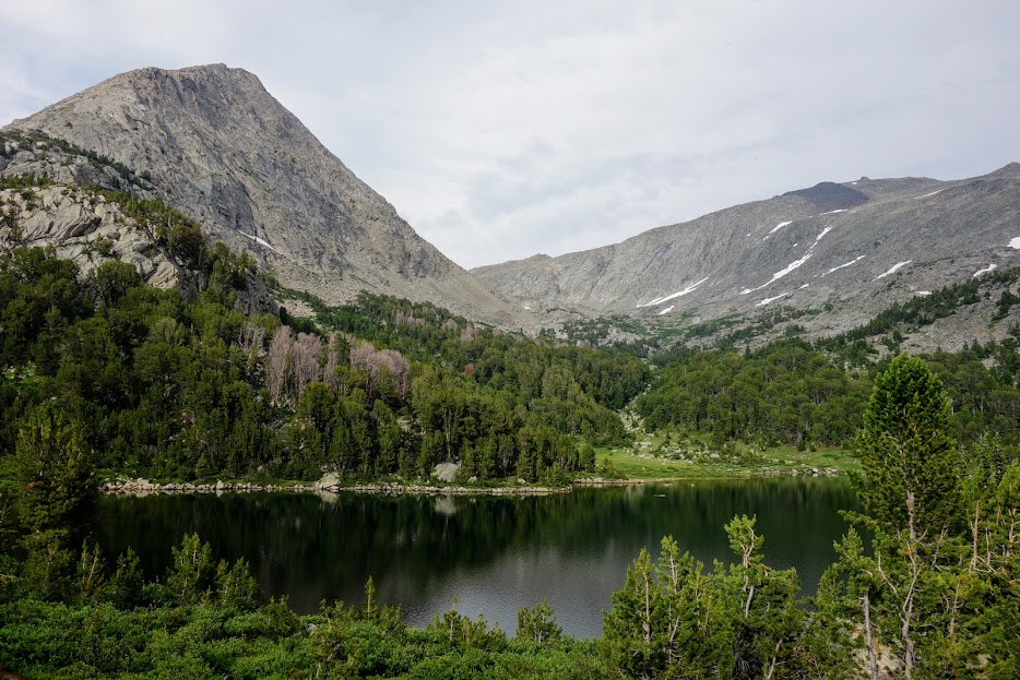
This entire trip became one where I often was reminded of the saying, “a bird in the hand is worth two in the bush.” On this day I was so thankful I’d stopped at Lake Vera, as the next lake, Winona didn’t seem to offer an inviting campsite although swimming was great.

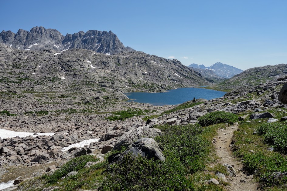
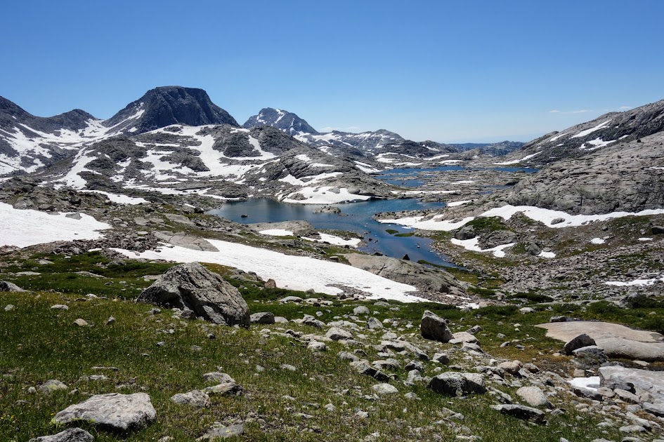
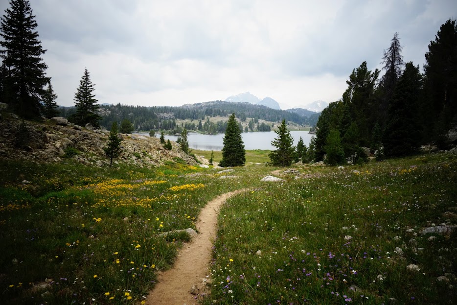
First view of North Fork Lake.

I chose to bypass North Fork Lake since access was in the opposite direction I was headed and those clouds were beginning to concern me.

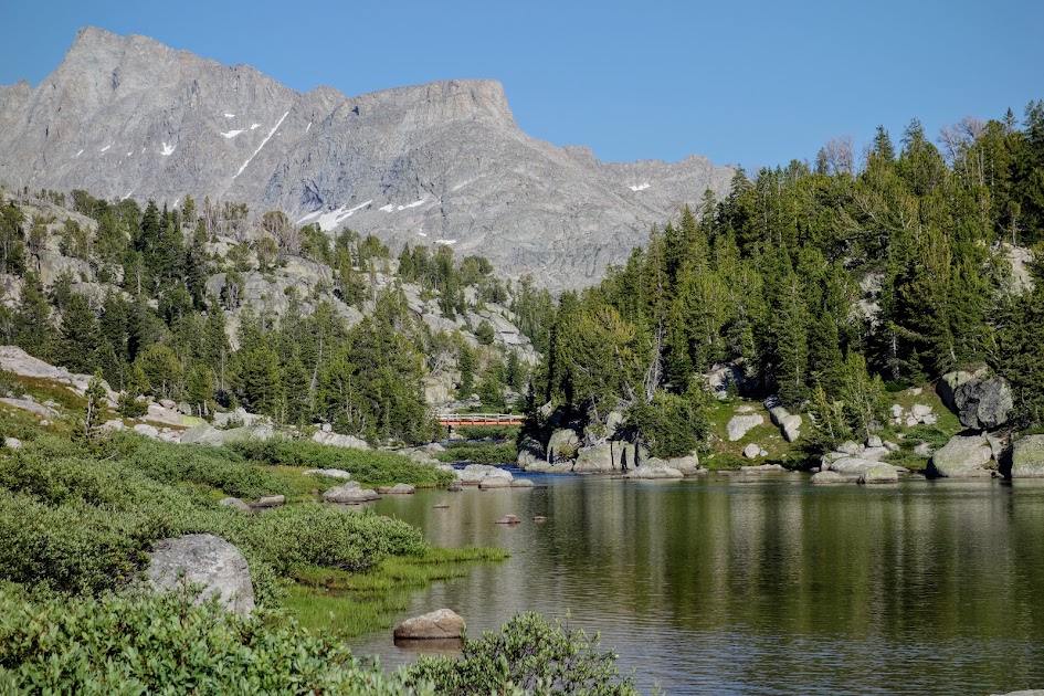
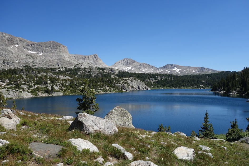
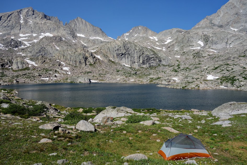
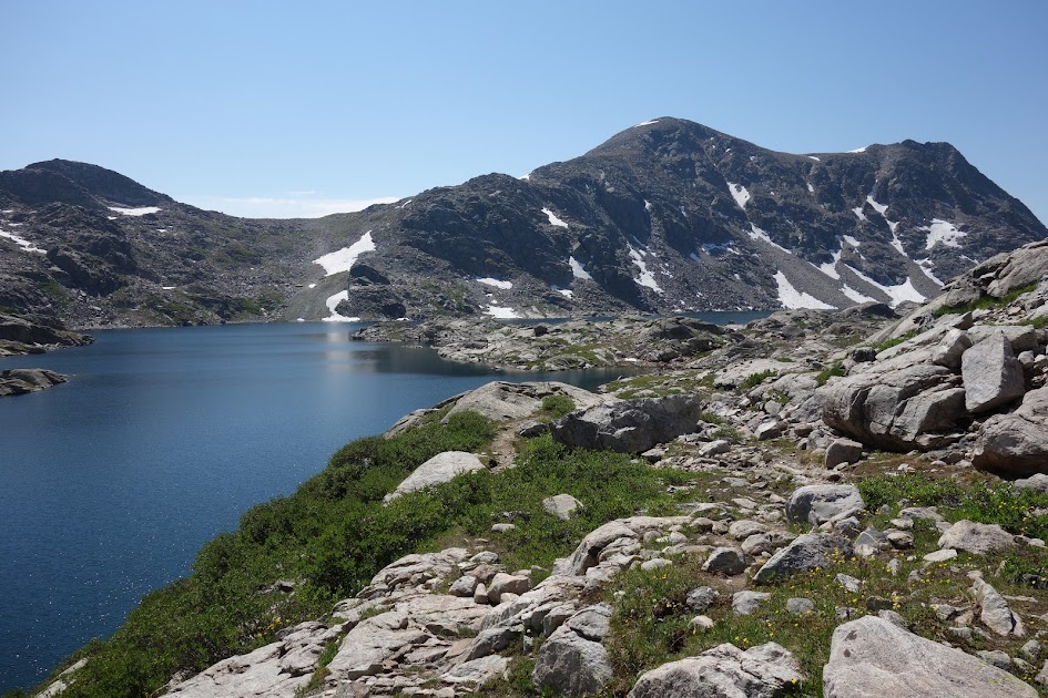
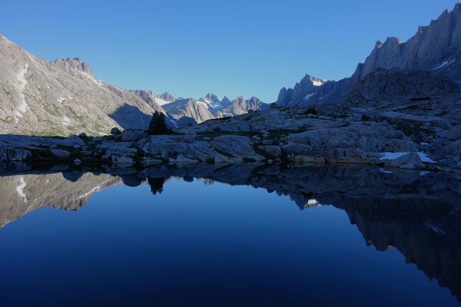
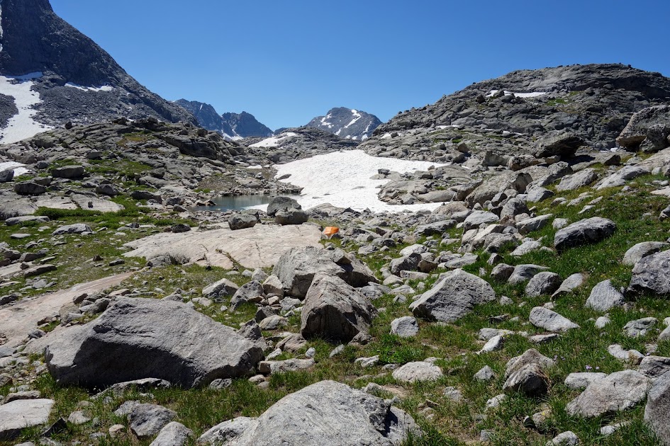
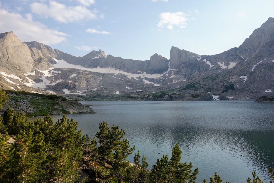
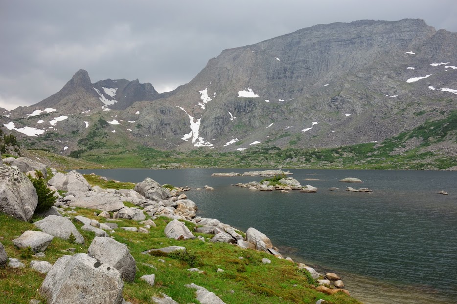
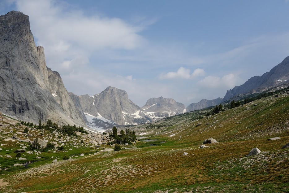
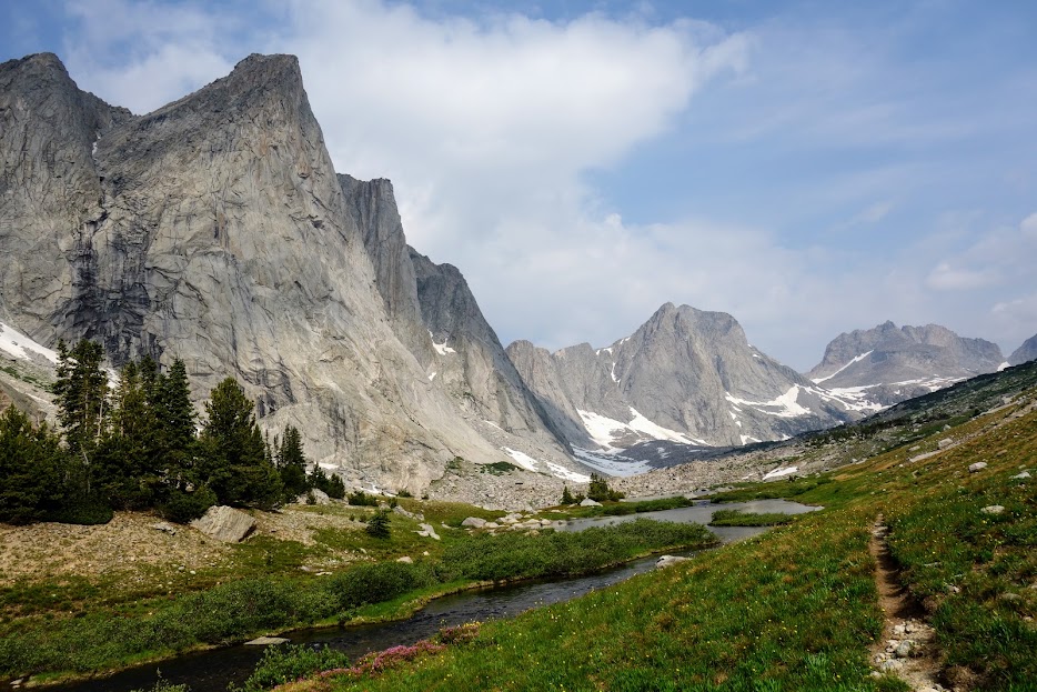
When I reached the Fremont Trail (CDT) I took the side trail to Lake Victor in hopes it would provide a storm-protected campsite, given the high winds and thunderstorms predicted for the next day.

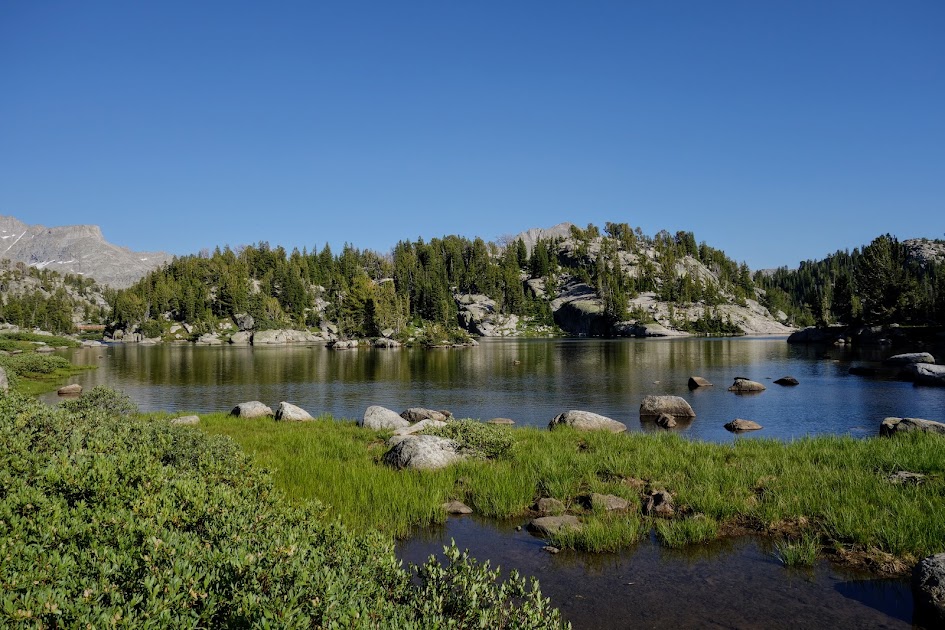
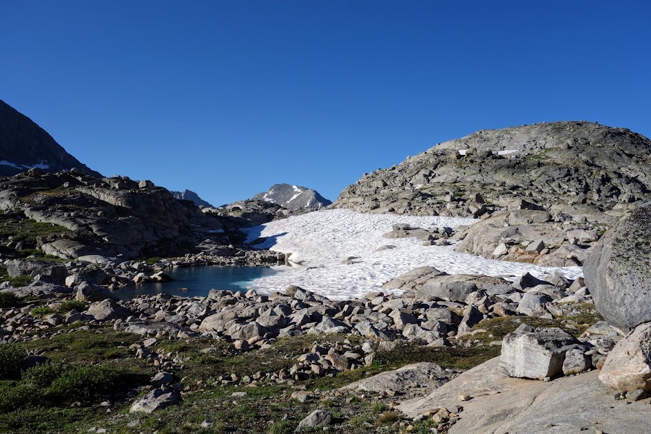
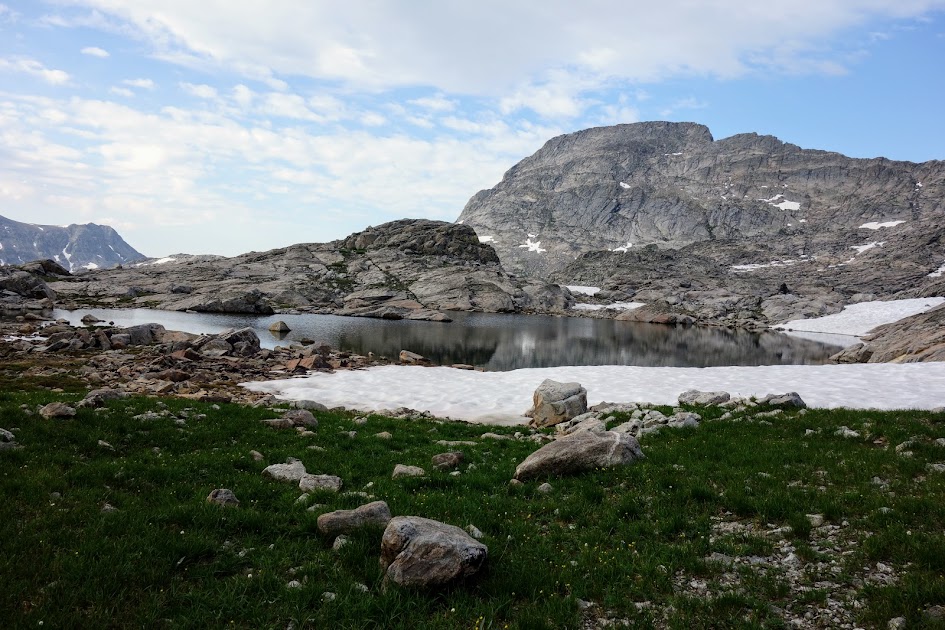
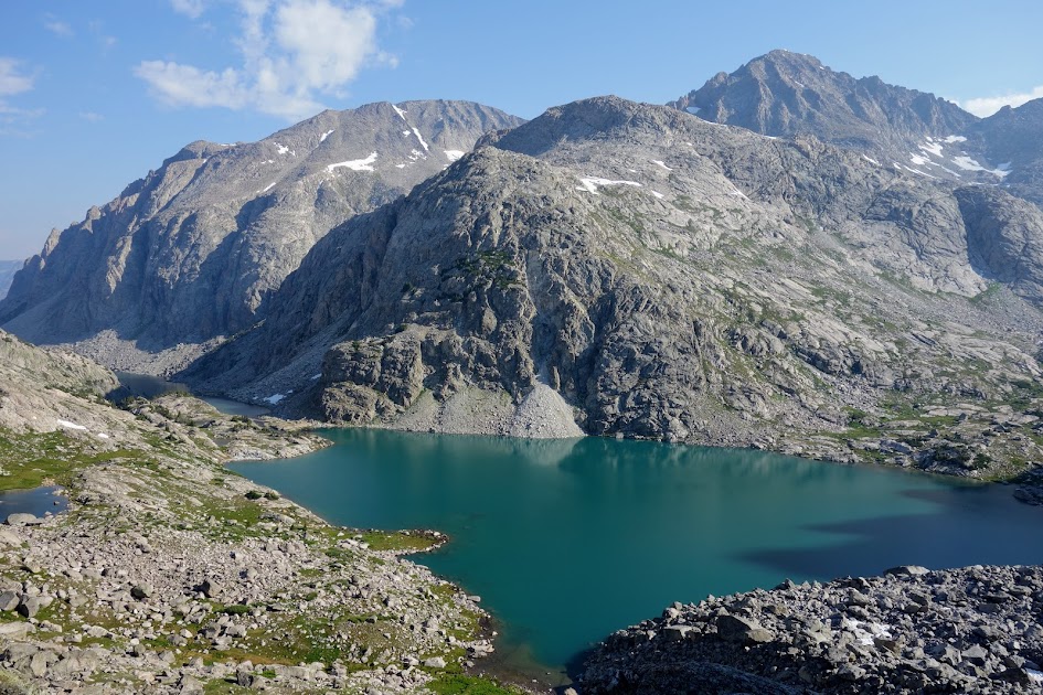
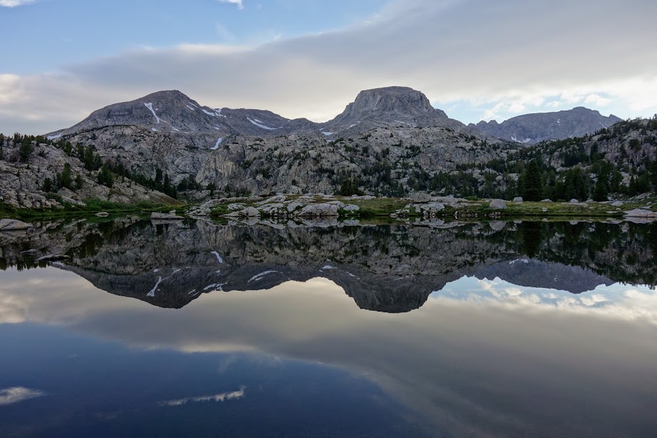
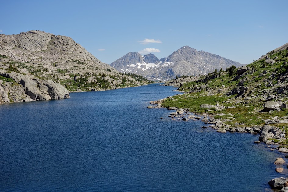
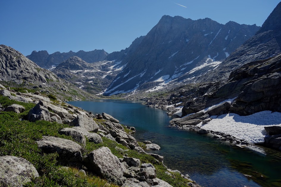
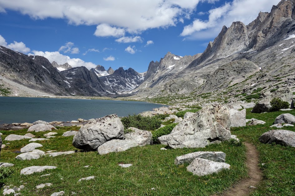
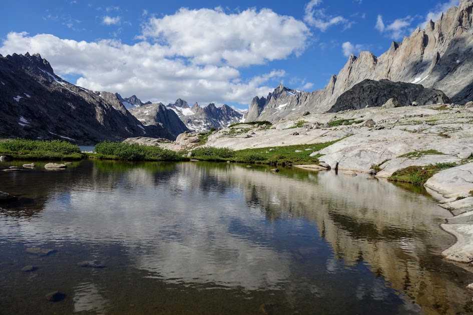
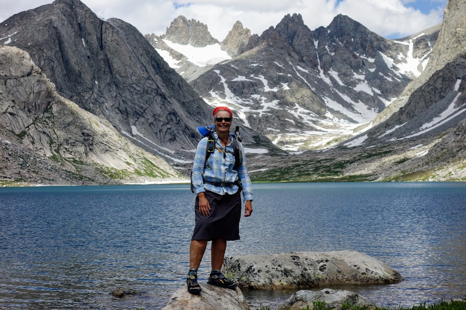
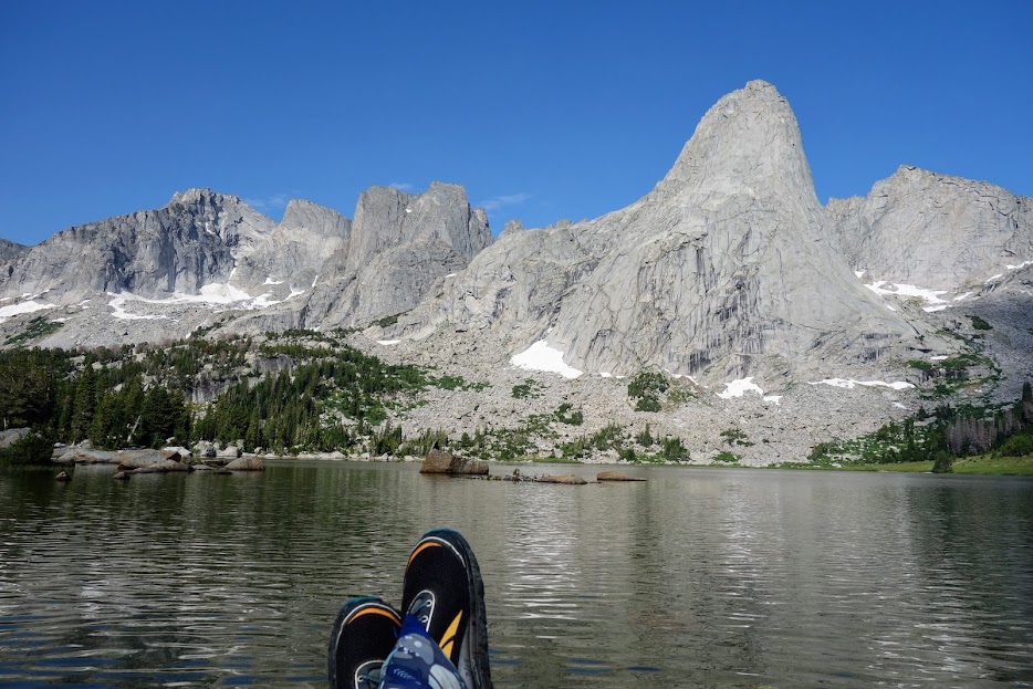
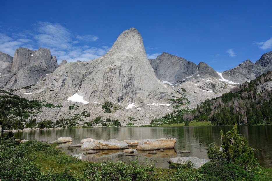
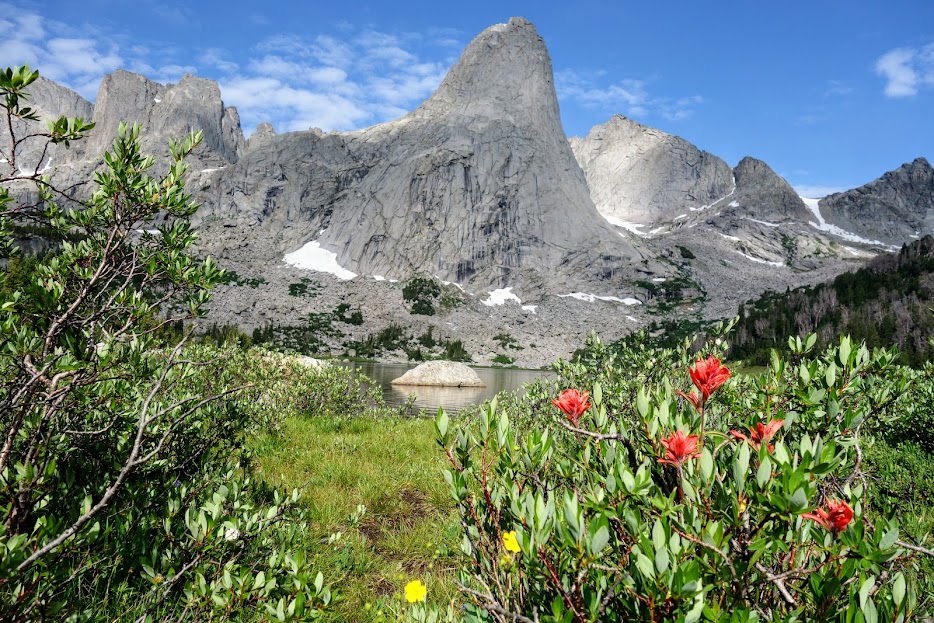
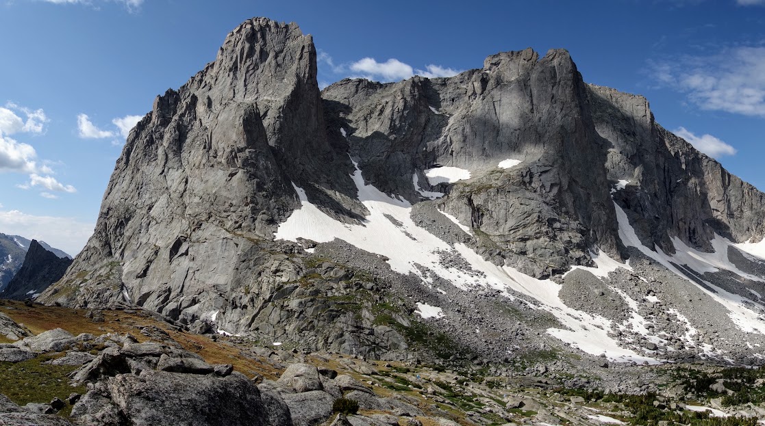
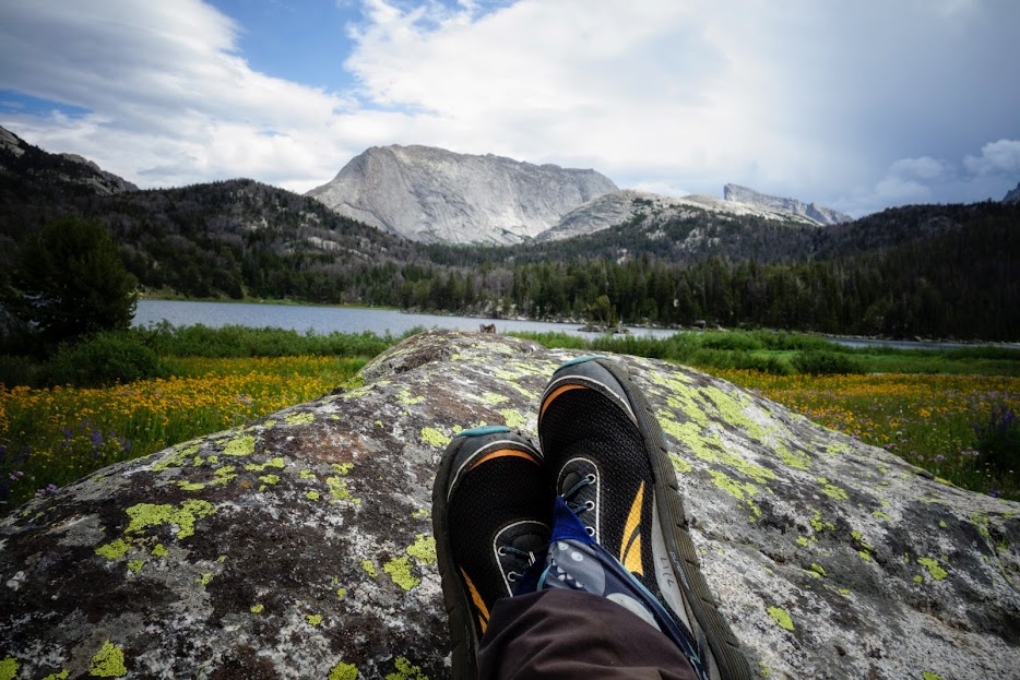
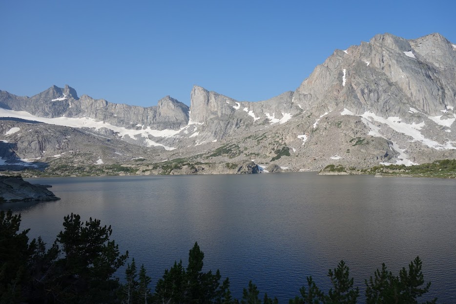
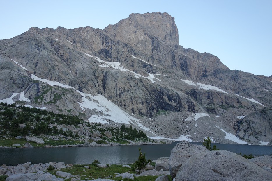
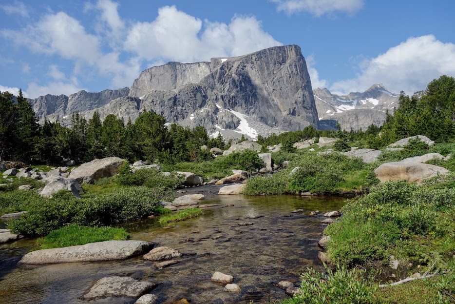
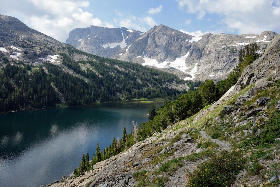
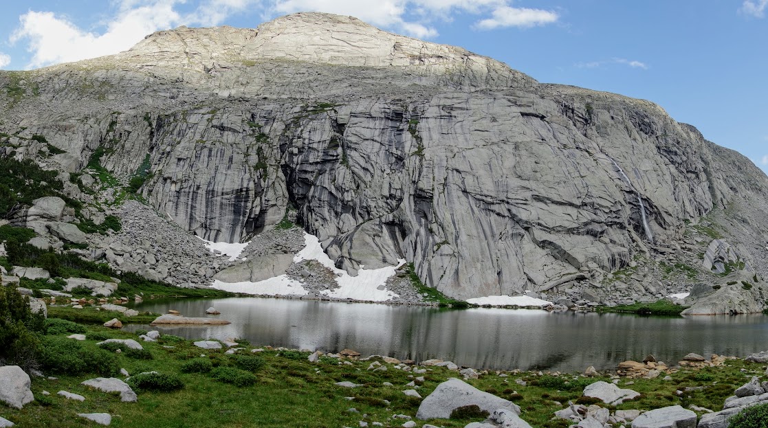
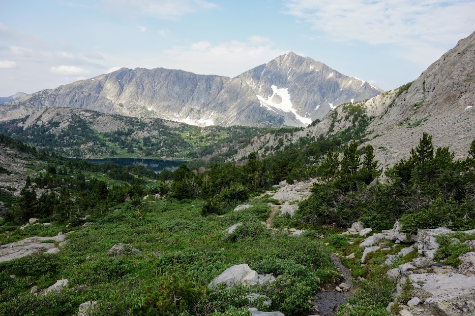
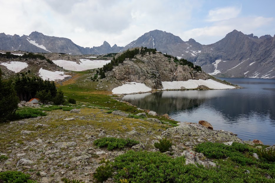
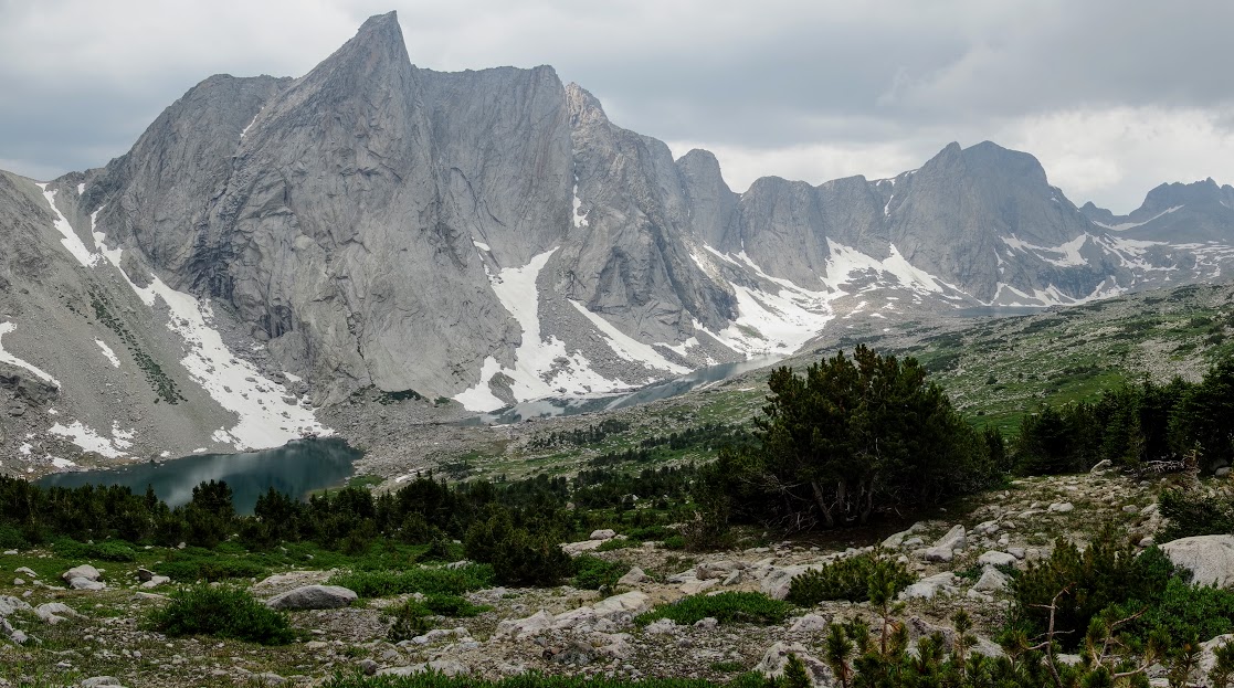
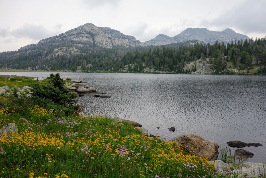
The lake was lovely made more awesome by the surrounding peaks including Victor at 12,254′.

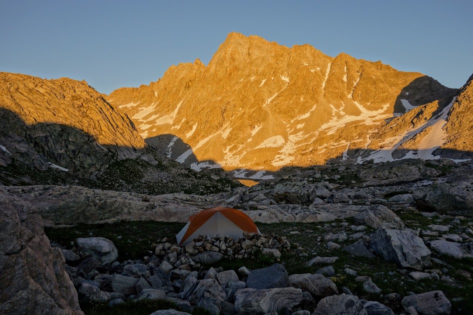
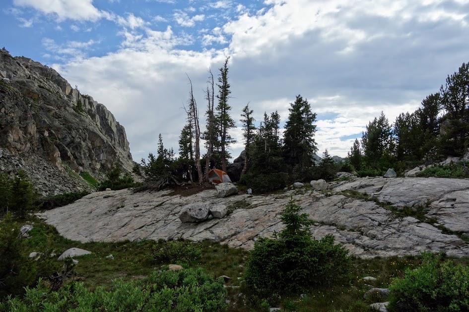
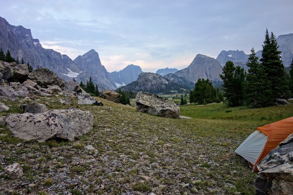
This campsite was perfect. I had views, weather protection, easy water access, and plenty of boulders where I could scramble and explore.

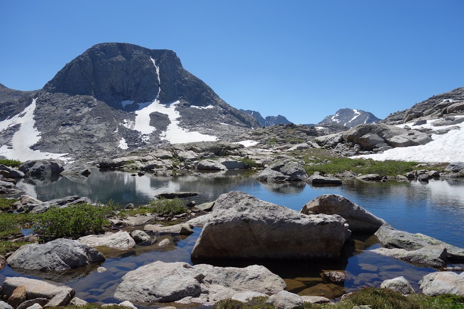
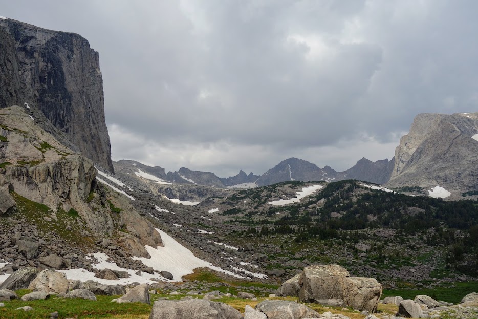
I believe this is Europe Peak in the distance on the right, along with Europe Canyon which was on my potential exploration list, but knowing the lakes were above treeline I chose Victor instead.

It was a short hiking day, but provided the R&R I needed. Except for a small group, I had the lake to myself. The swimming was divine! I checked the weather on my inReach before I went to bed to see if it had changed since I left town a couple of days earlier. Heavy rain was in the forecast from 6am through at least early afternoon.

Day 3 – Lake Victor

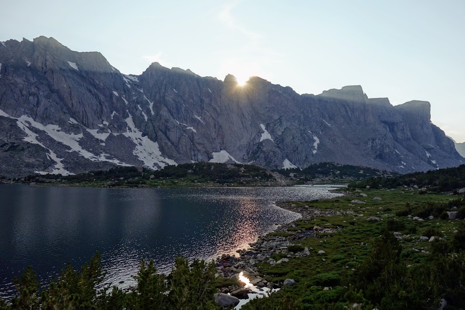
I awoke to clear skies and wondered if the forecast had changed again.

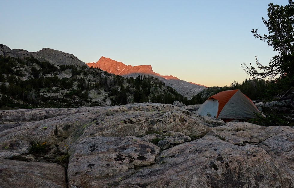
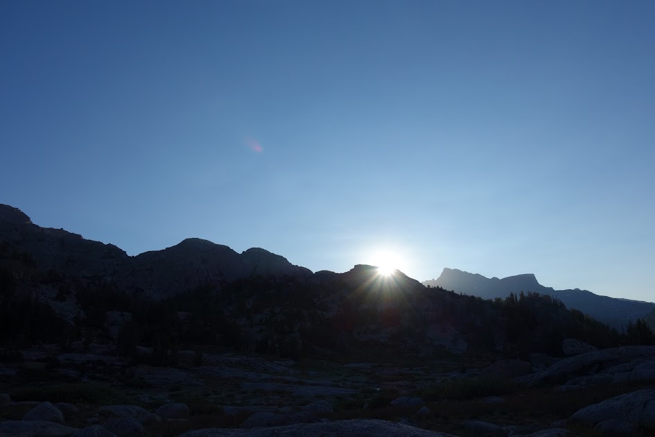
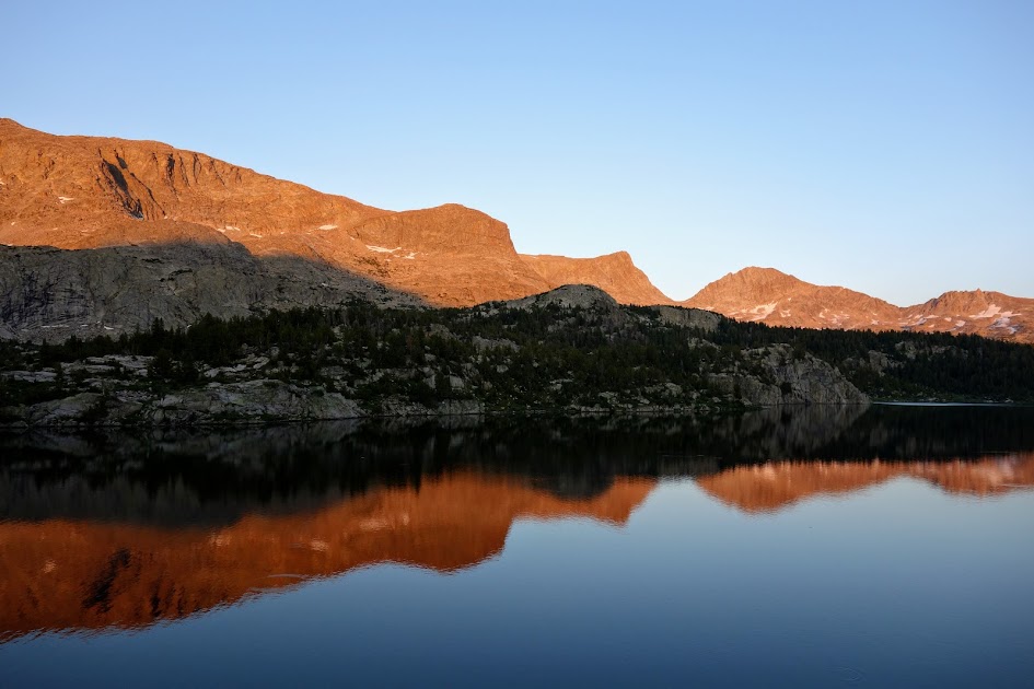
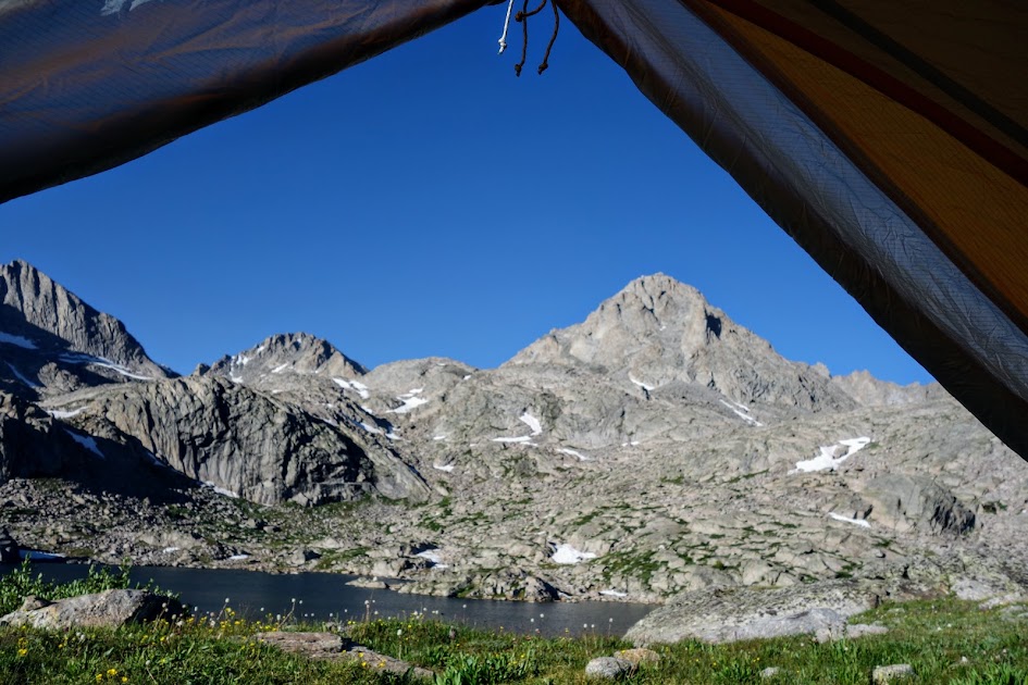
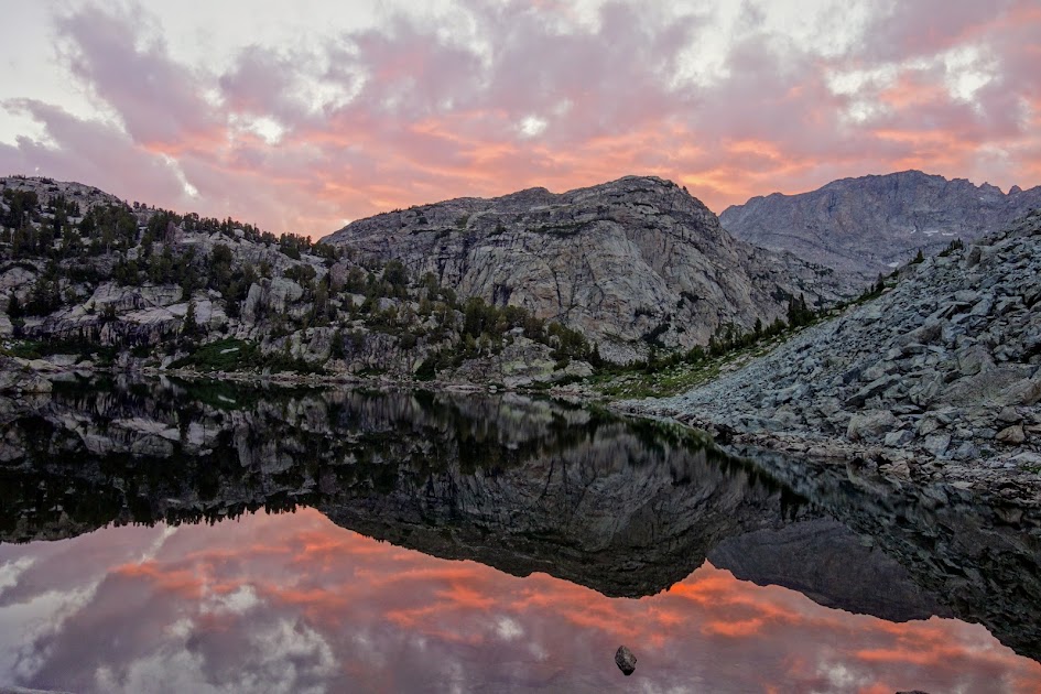
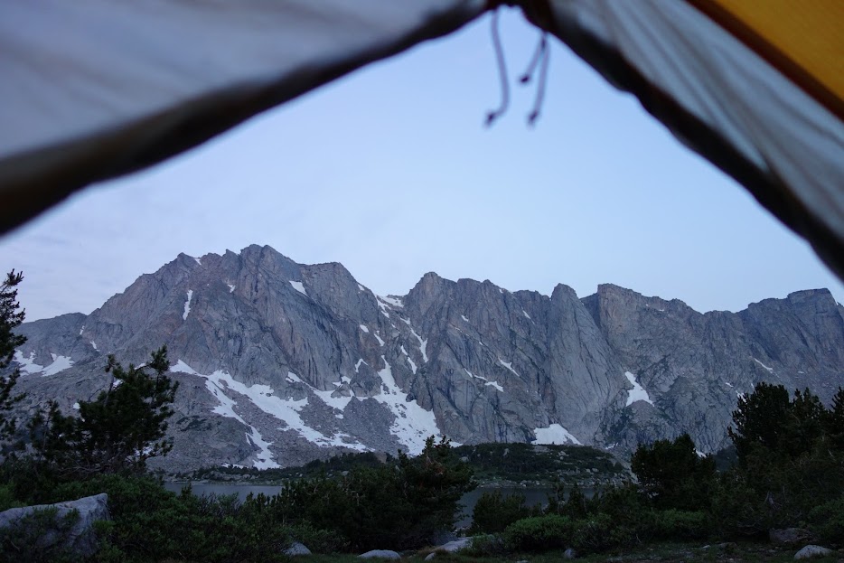
My tent was perfectly aligned for this sunrise kiss. Those clouds had me questioning the forecast. I decided to make a second pot of coffee and see what Mother Nature had in mind.

I was happy to have carried this Lixada Solar Panel Charger (Link) to extend my battery allowing me to read two books over the day and a half I hung out at this lake.

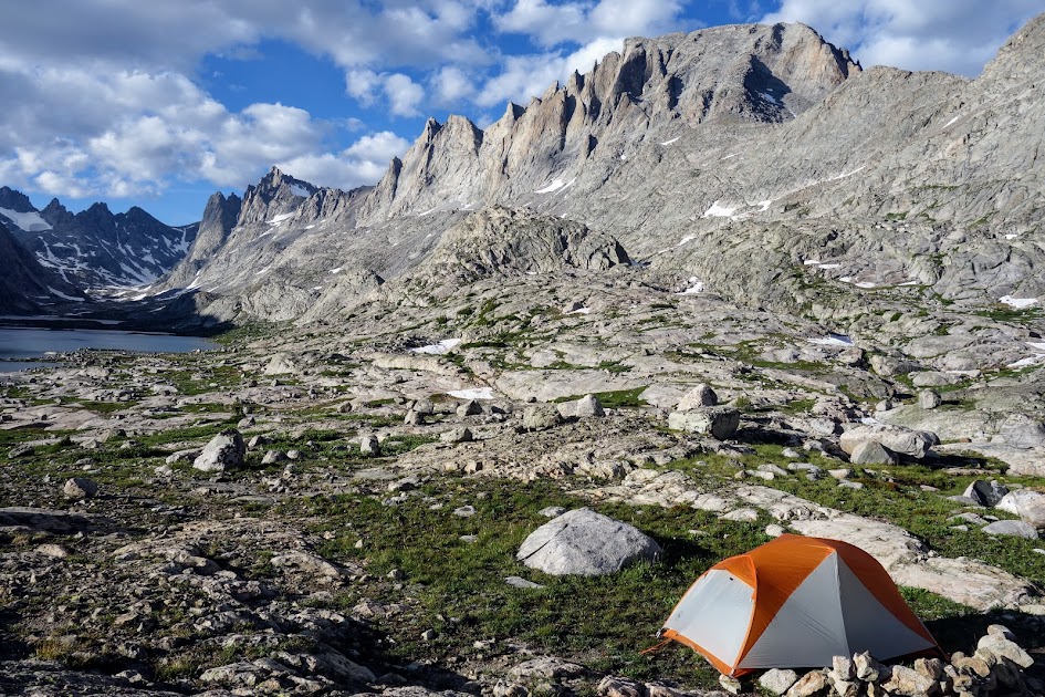
This was a good place to hunker down and wait for the storm to pass. I’d planned for a down day given the forecast. It ended up being less severe than predicted but the chilly wind and intermittent rain confirmed my decision. It was a long day and my body wasn’t happy with so much time spent sitting or lying down. HOWEVER, my Durston X-Mid Pro 1 was spacious, comfortable, and kept me dry and safe during the storm. I LOVE this tent!

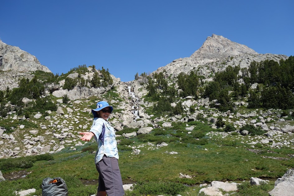
While wandering around I discovered this White Bark Pine showing amazing resilience. Look at how the trunk is embedded in the rock.

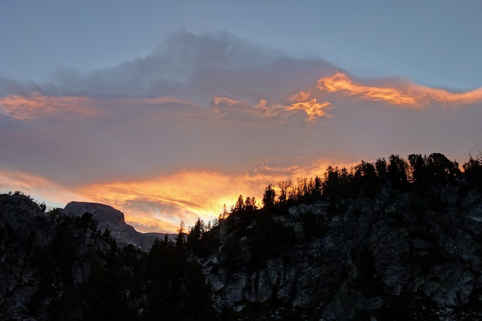
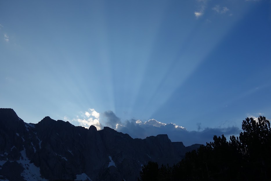
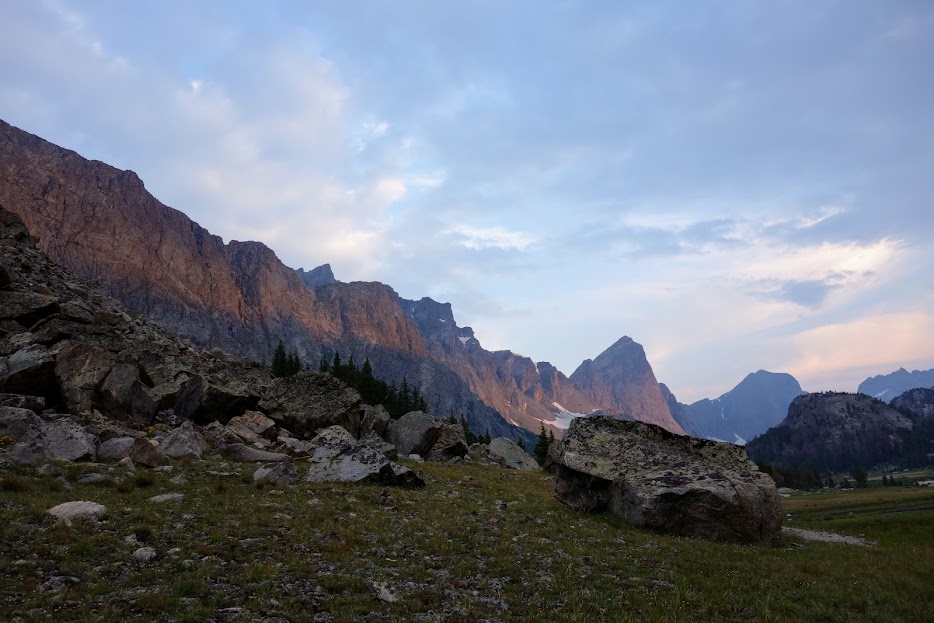
The light was wonderful during an early evening storm intermission.

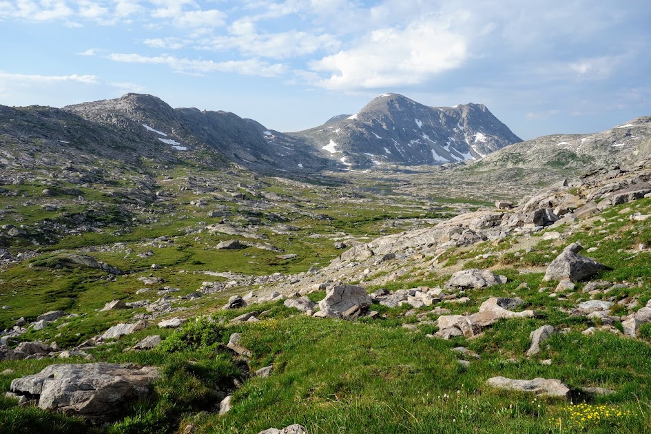
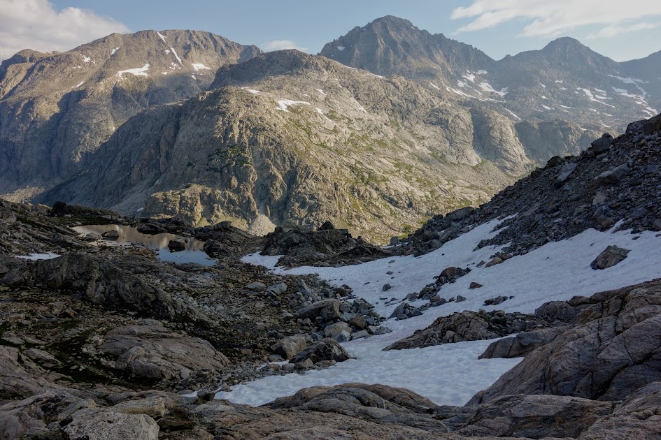
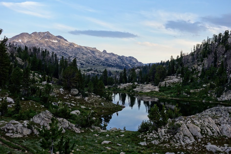
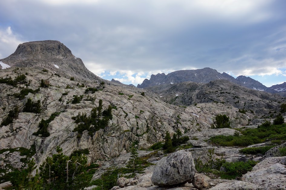
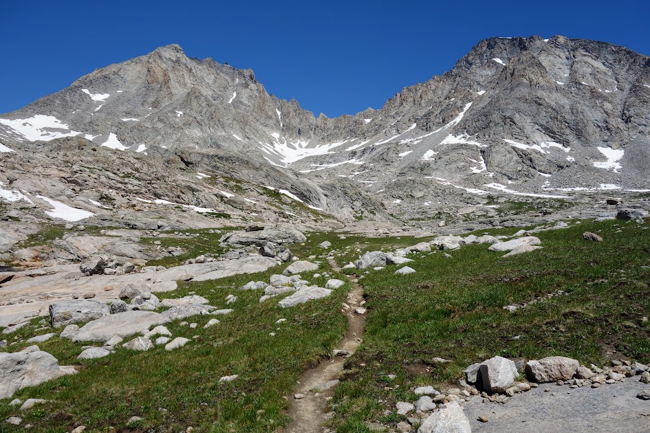
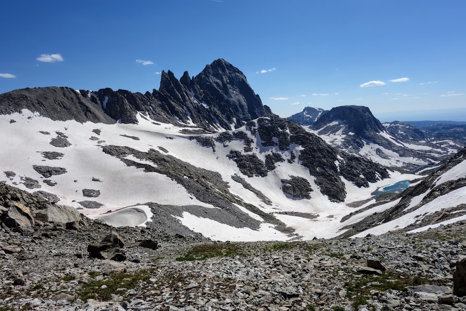
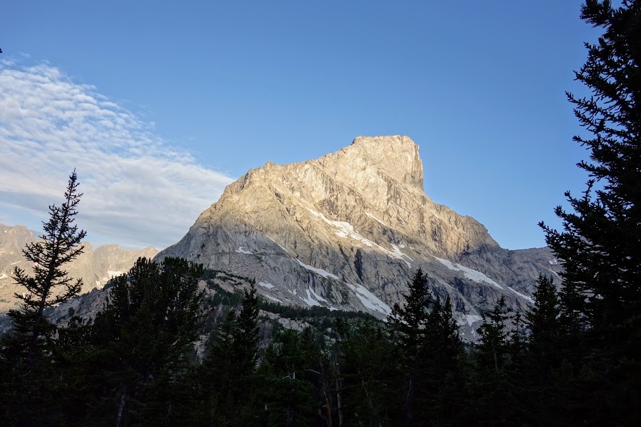
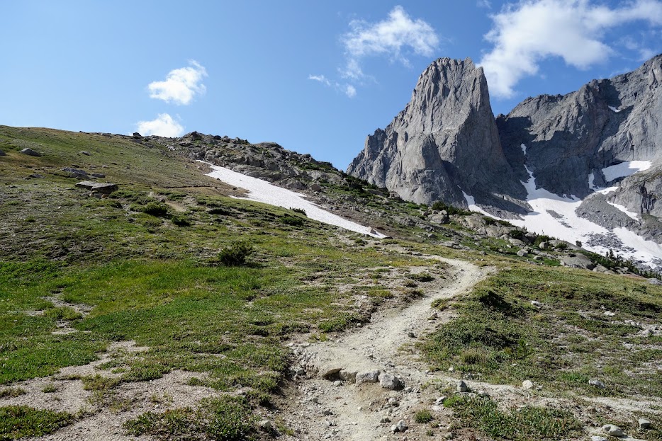
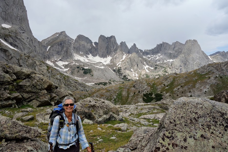
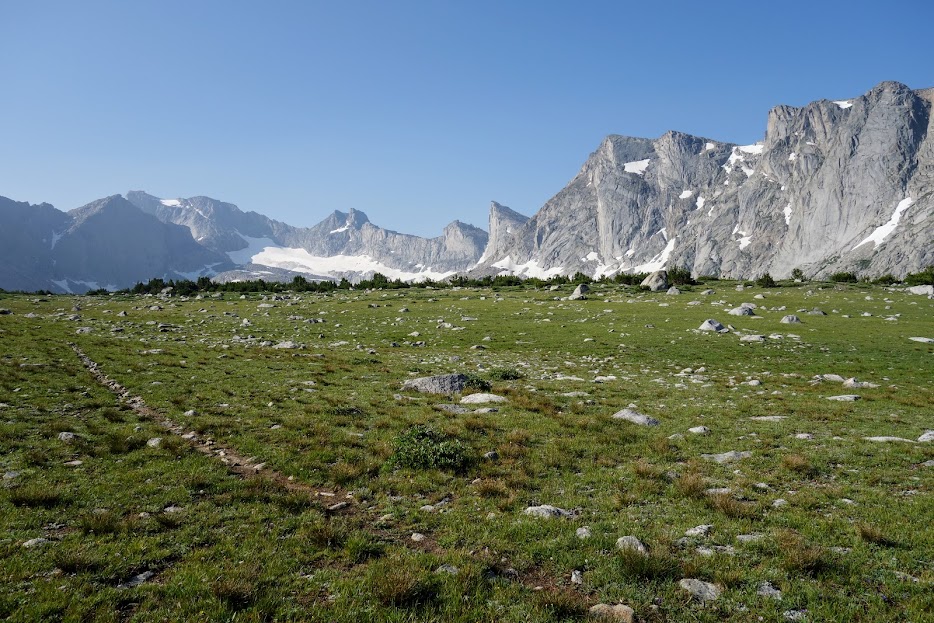
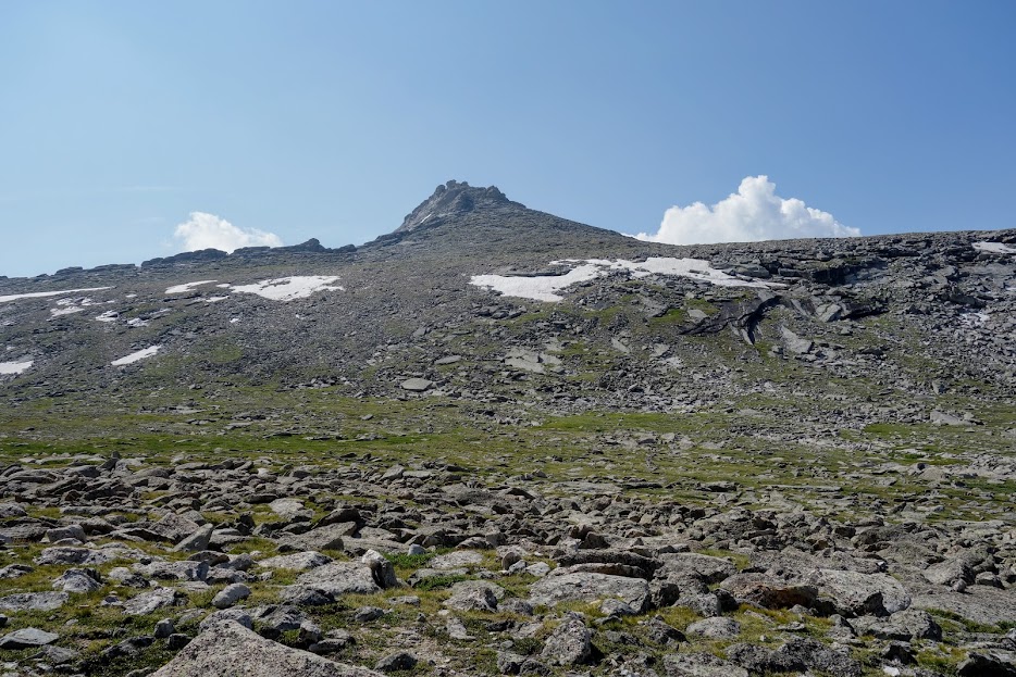
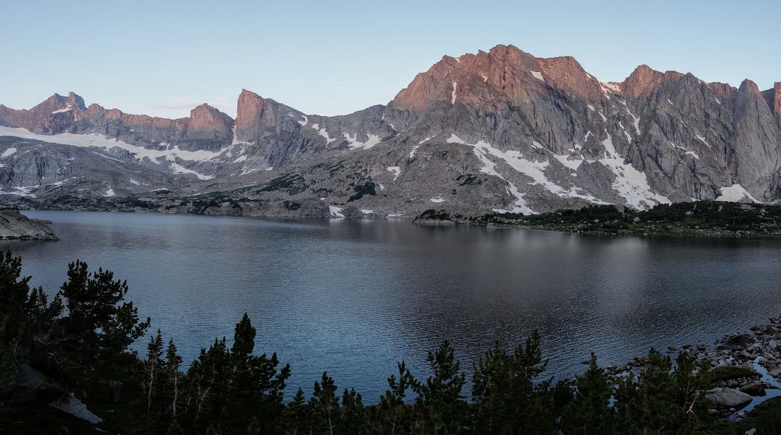
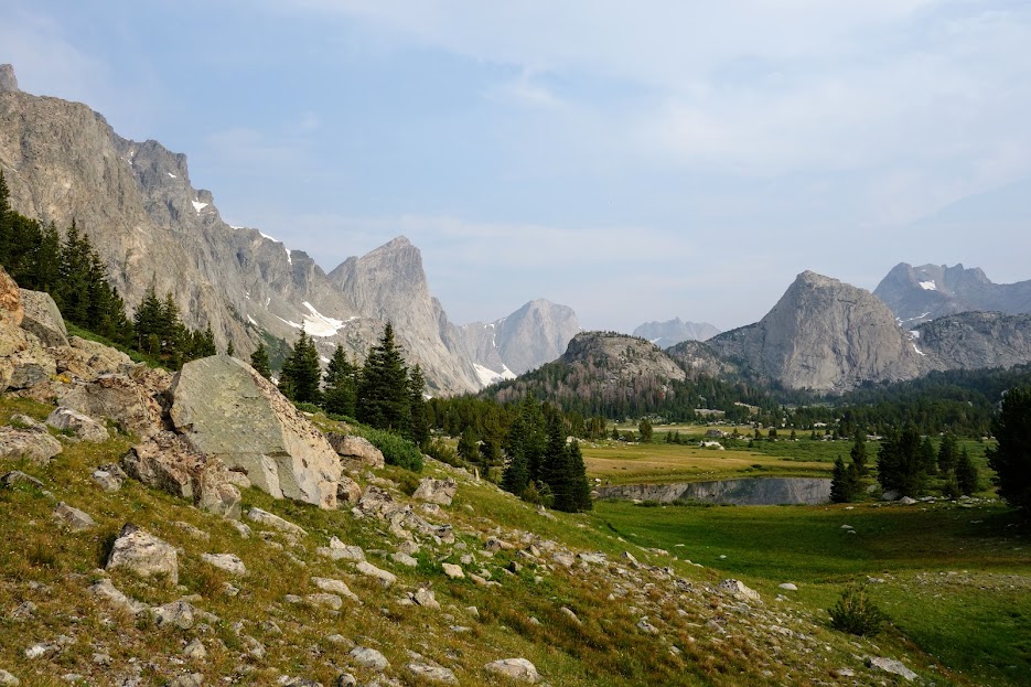
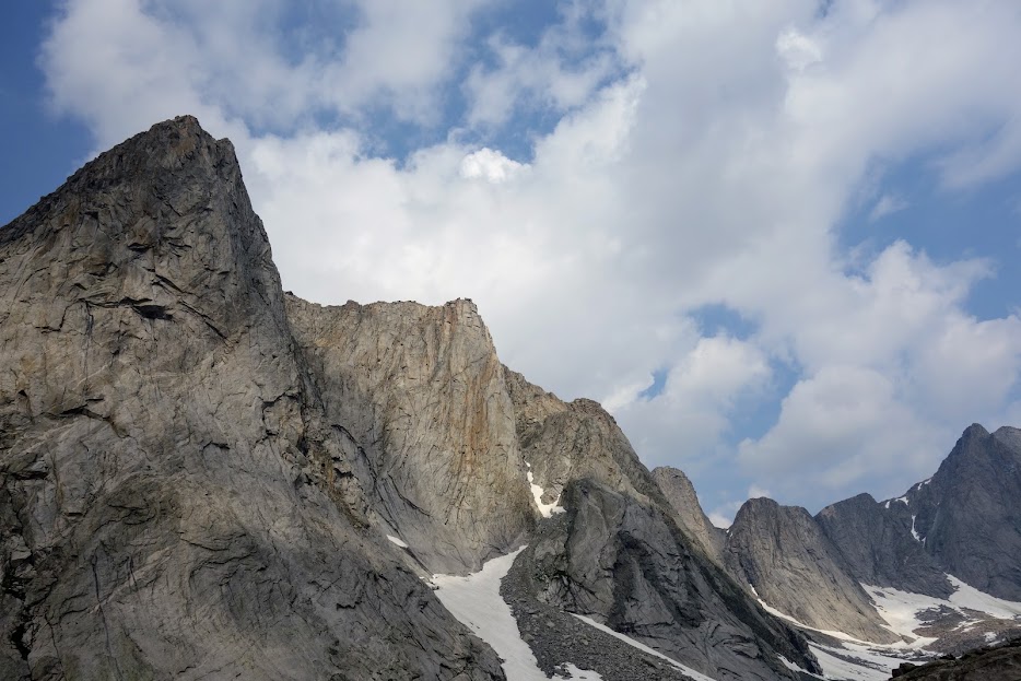
The next morning skies were clear and I was excited about the upcoming leg where I was headed to my kind of world, the one above treeline. That’s North Fork Peak on the left and Victor on the right.

Day 4 – Lake Victor to Timico Lake

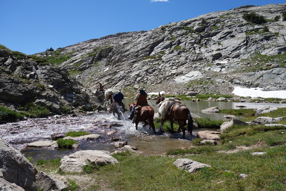
I was quickly back on the Fremont Trail, also the CDT route, where I passed several CDT hikers going the opposite direction. Victor Peak was in my rearview mirror.

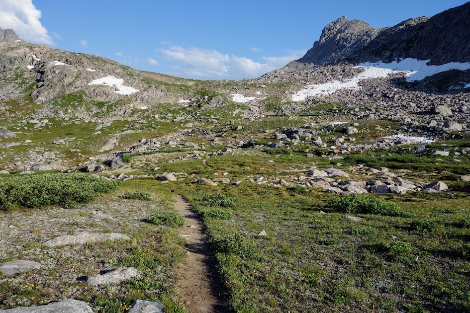
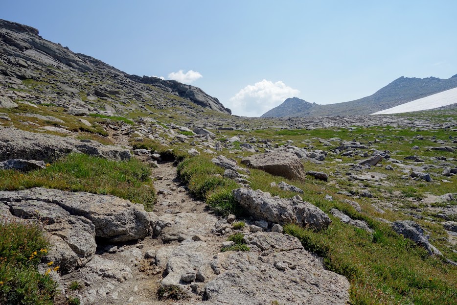
The first destination was Hat Pass at 10,848′, which woke up my climbing muscles and provided nice views.

Looking over the other side, my direction of travel. I didn’t see any marmots but said hello to a few pikas.

I wondered if there was a lake up there in the contour but my map said no.

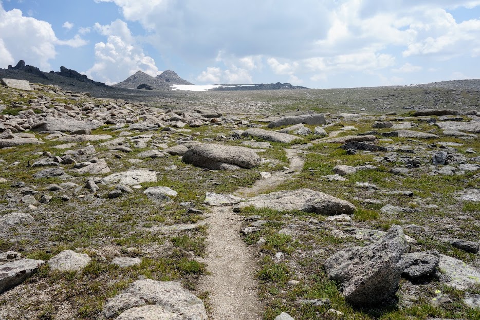
It looked like an excellent place to roam.

But I had miles to hike, things to see, and places to go, so downward I went.

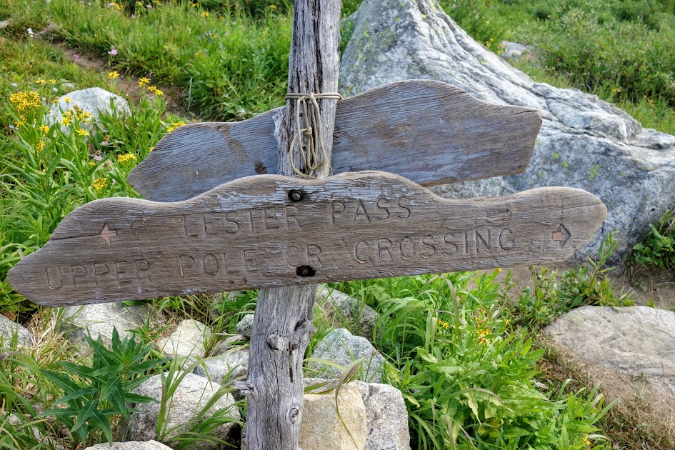
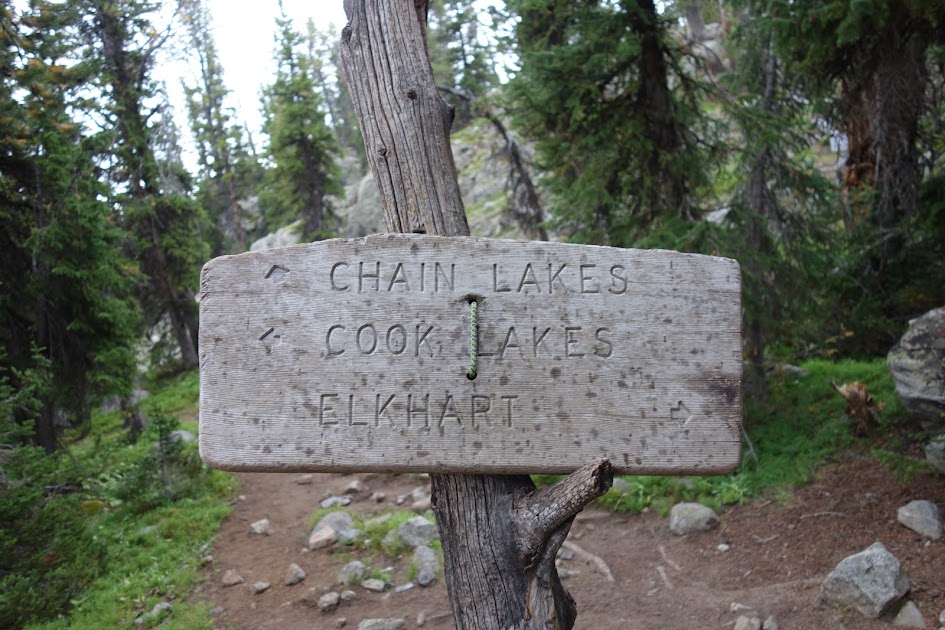
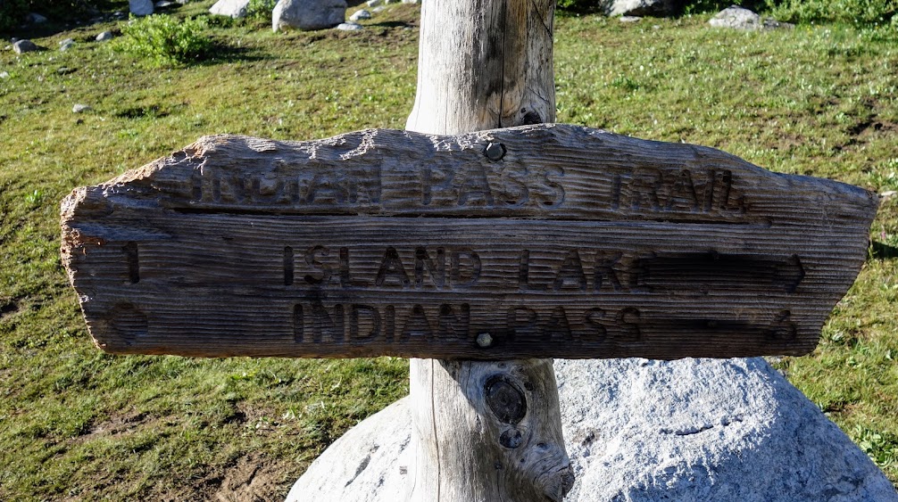
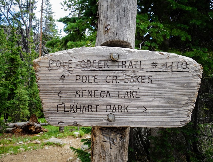
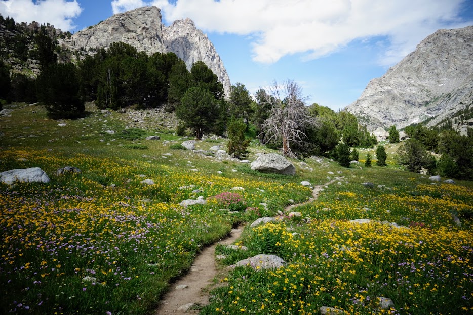
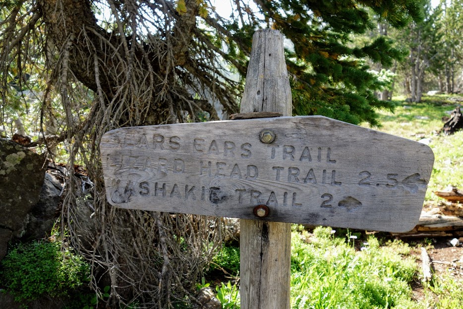
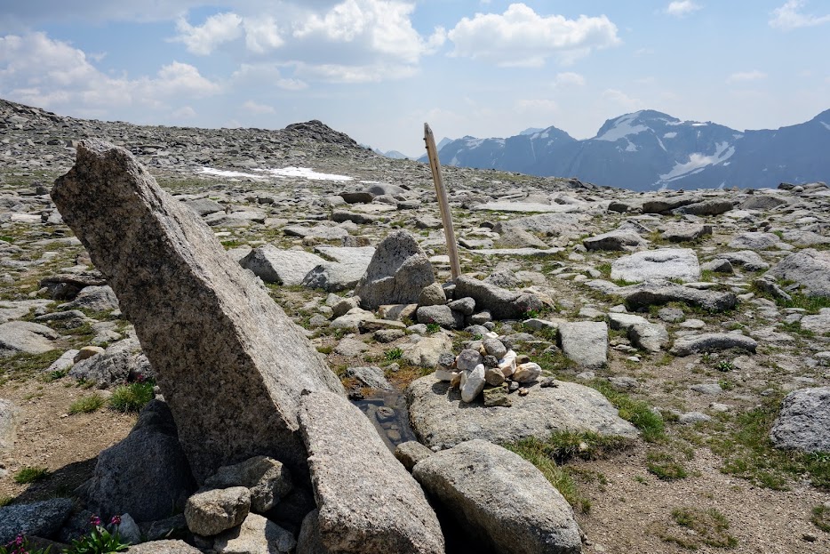
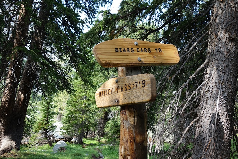
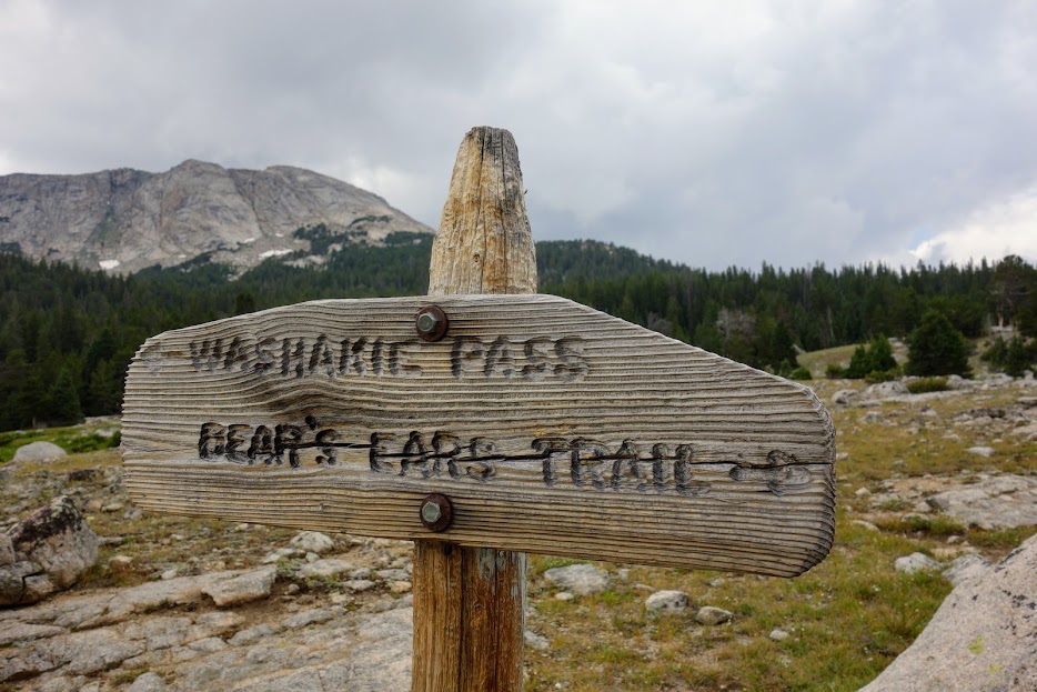
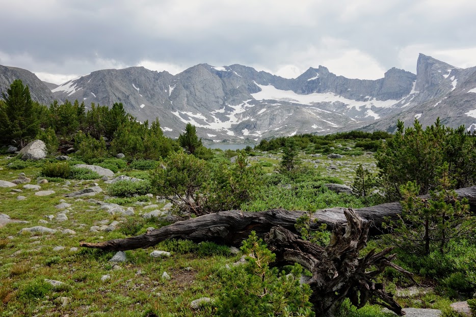
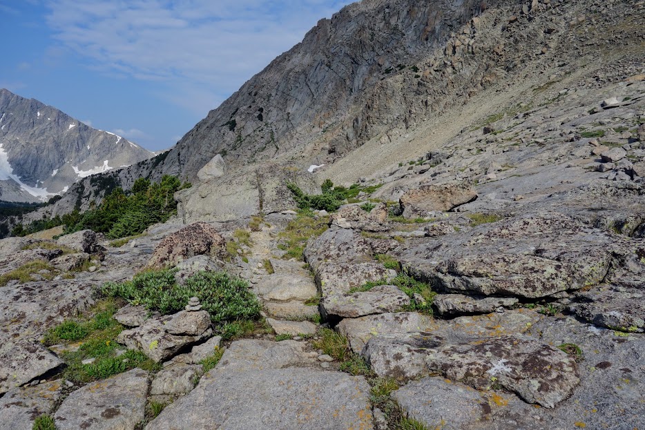
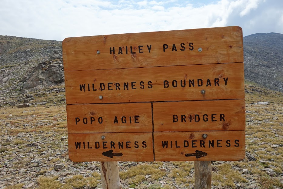
My next hopeful destination was Timico Lake. I decided if there were cairns or an obvious path I would give it a go. I started looking when I reached the Timico Creek Trail going the opposite direction. I’d marked on my map where it should be logically, and sure enough, I found the junction. I was happily surprised to see a sign and use trail.

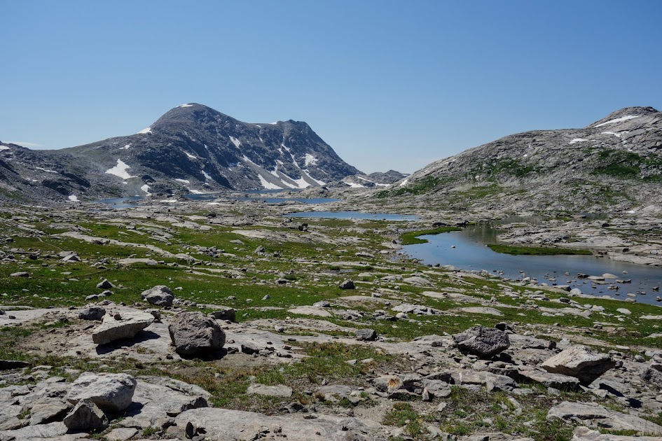
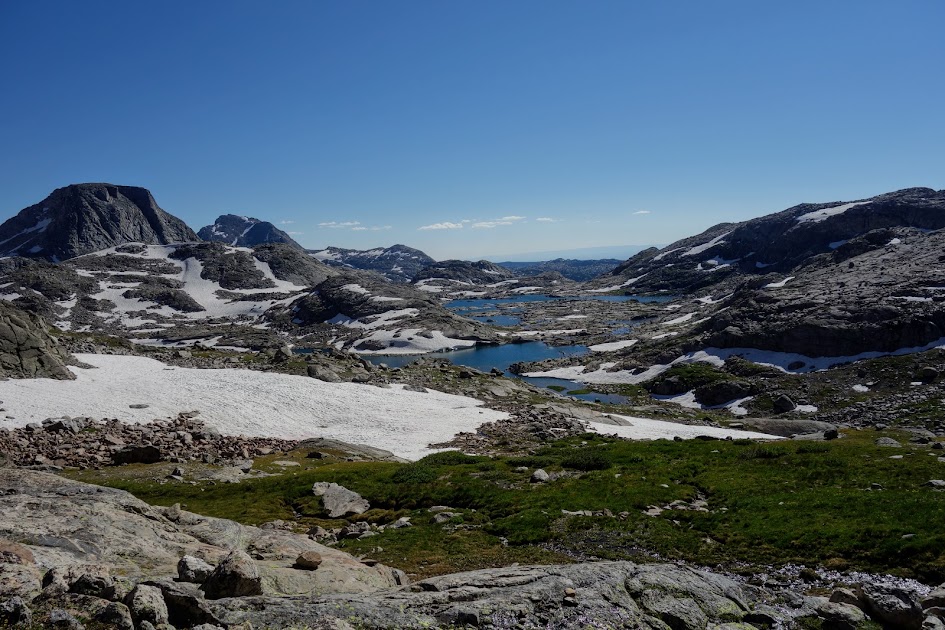
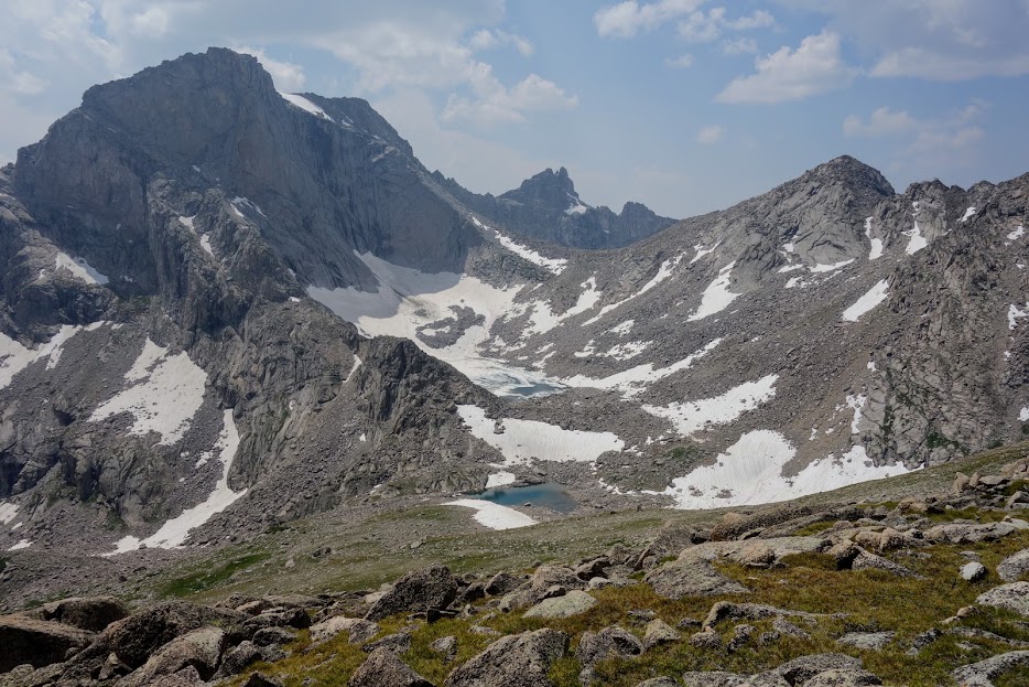
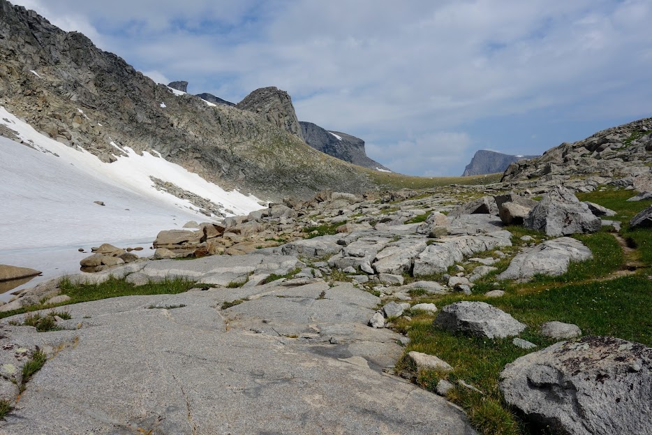
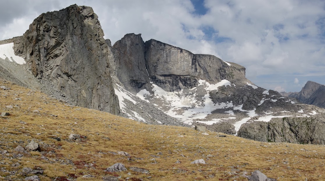
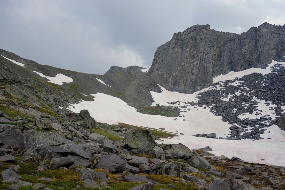
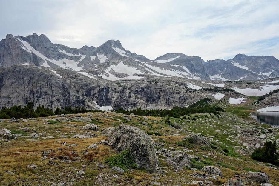
You could easily spend a day searching for the various lakes. Beneath this ridge lies the Fall Creek Lakes.

The terrain looked reasonable and I had plans to explore in the morning.

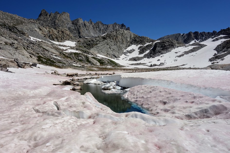
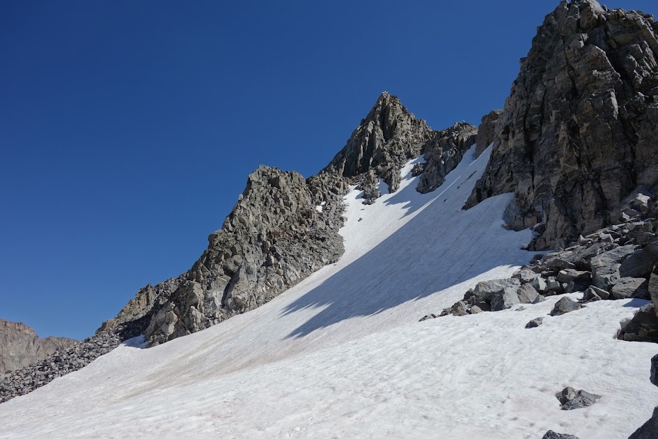
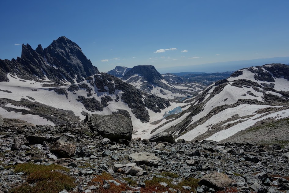
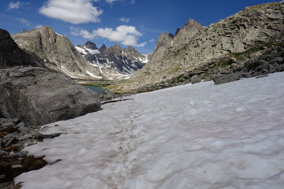
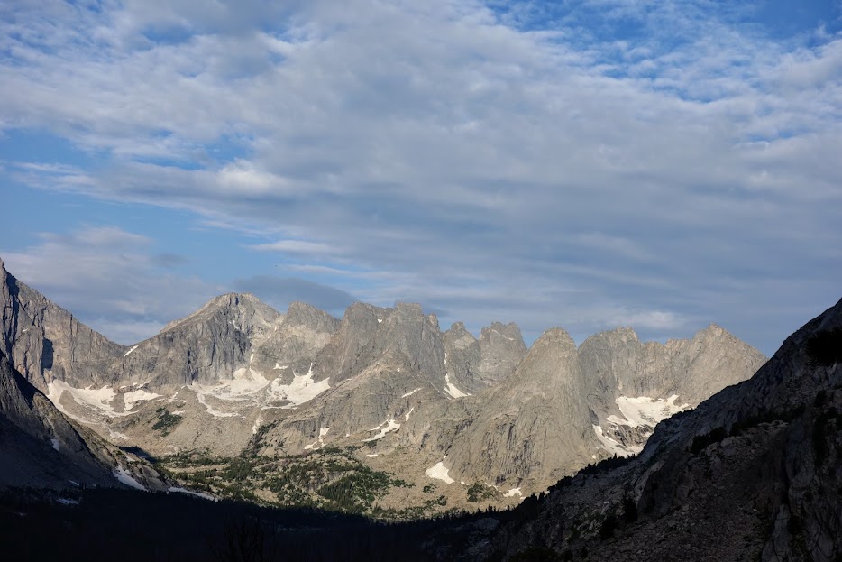
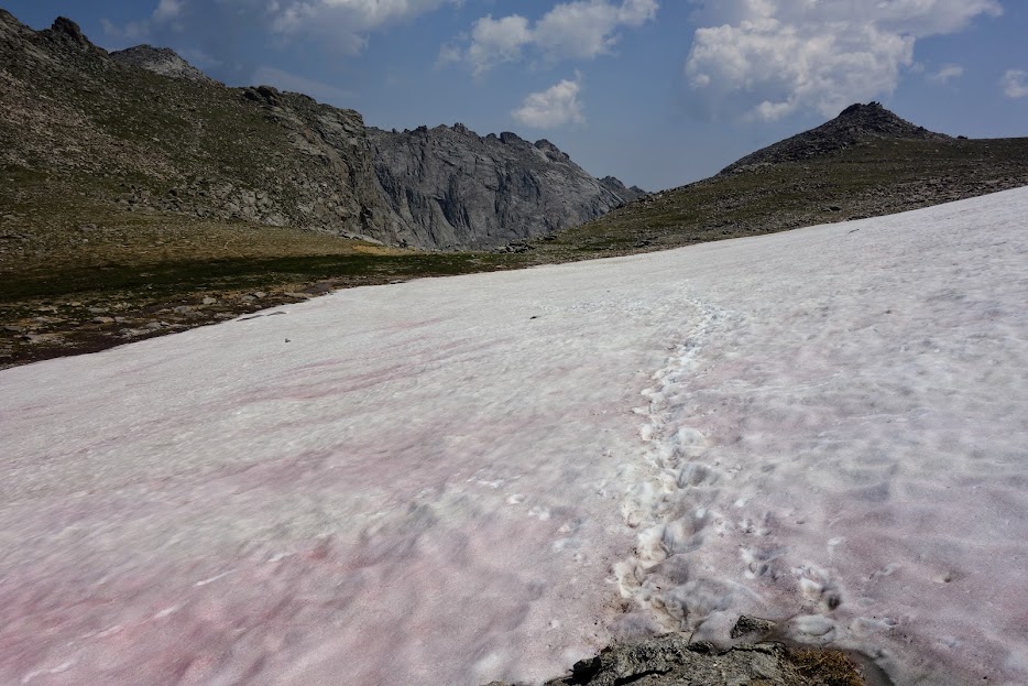
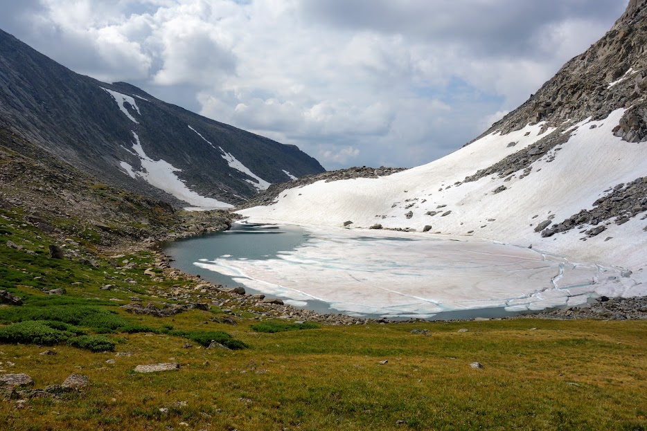
Fall Creek Pass aka Timico Pass is in the low spot in the middle. I met one guy heading in that direction where he’d drop over the other side. My plan was to attempt to reach the pass in the morning so I could at least look over the other side. On the right side are bowls for another Fall Creek Lake and Shirley Lake. I spent a few hours studying my maps and contemplating my route. Nancy Pallister’s book, Beyond Trails in The Wind River Mountains of Wyoming is a great resource for route planning (link).

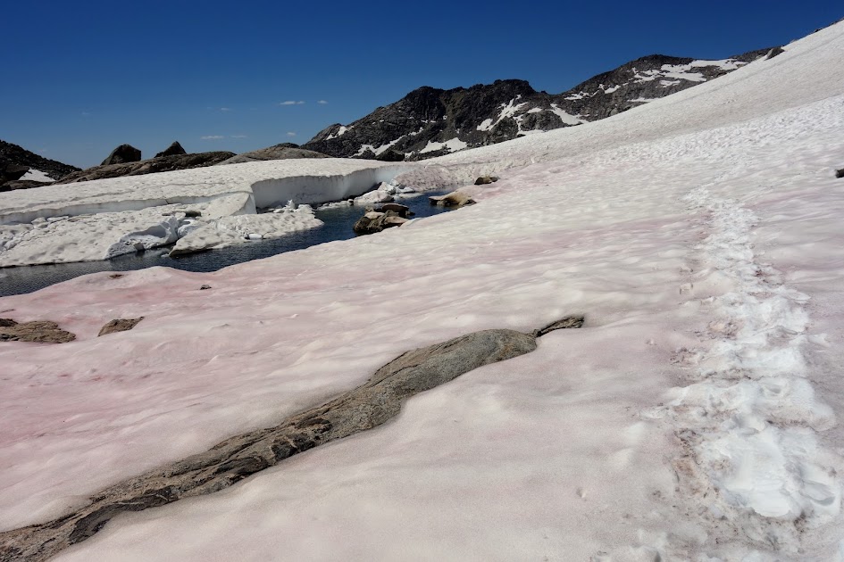
I wasn’t convinced I could complete my route as a loop given this rock ledge or steep descent to the lake or even if there was sufficient room to walk along the lake’s edge.

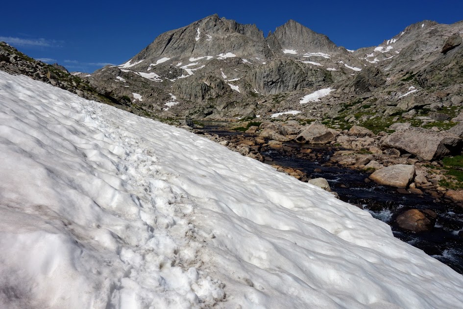
It took a long time to find a campsite that might survive a weather event. I wandered among the trees but came up empty so this was the best I could manage. On this night I experienced the worst storm of my trip. The wind gusted, it rained and while tucked into my shelter I could hear the thunder rumbling and see flashes through my flimsy tent walls. But I survived dry and thanks to my earplugs was able to get some sleep. As seems to be the routine here in the Winds, the morning dawned calm and blue.

After my wild night and an inventory of miles and food, I decided to skip the explorations. Seeing these clouds building by 8am reinforced my decision.

Day 5 – Timico Lake to Pole Creek Lakes

I left the Timico Lake basin without regrets.

I was starting to suspect this wouldn’t be a blue-sky day.

By 8:45am I was back on the Fremont Trail (CDT) ready to head north.

Soon thereafter I found myself donning rain gear. I was so glad I hadn’t proceeded with the exploration decision (this is looking back toward where I’d come). A couple who was also camped by Timico Lake headed toward the pass a few minutes before I left my campsite. I’m sure they found themselves well above treeline and highly exposed during the storm. At least there wasn’t thunder and lightning.

It was time to descend, yes in the rain. I was glad to have my umbrella.

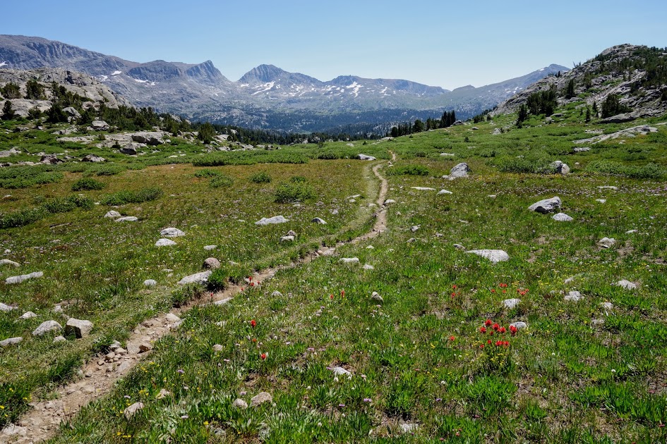
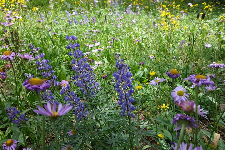
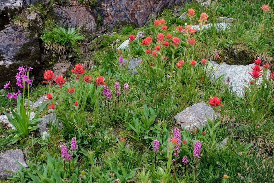
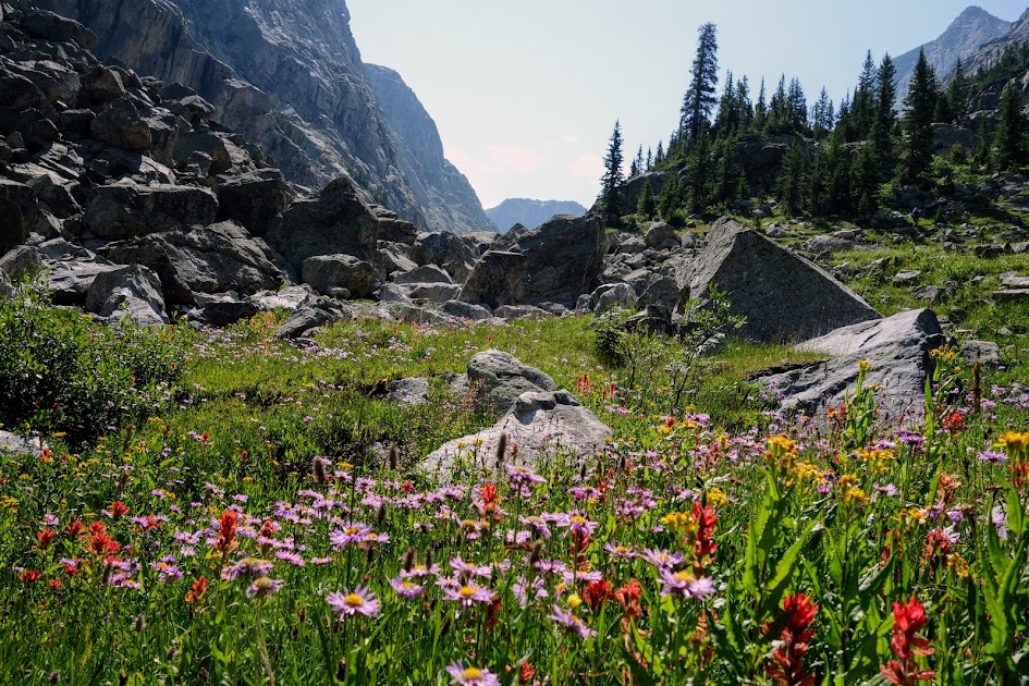
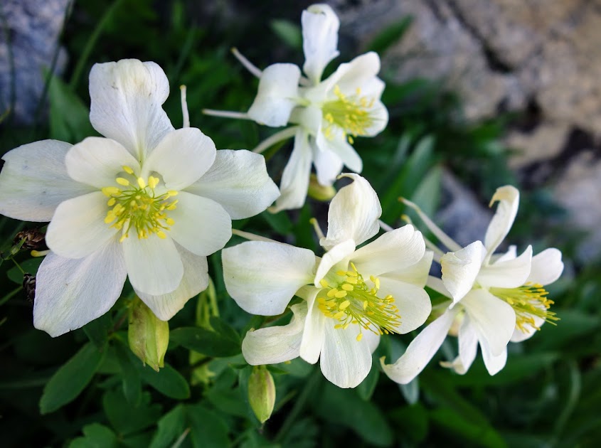
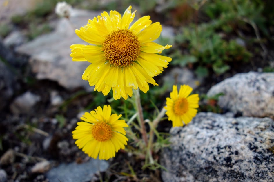
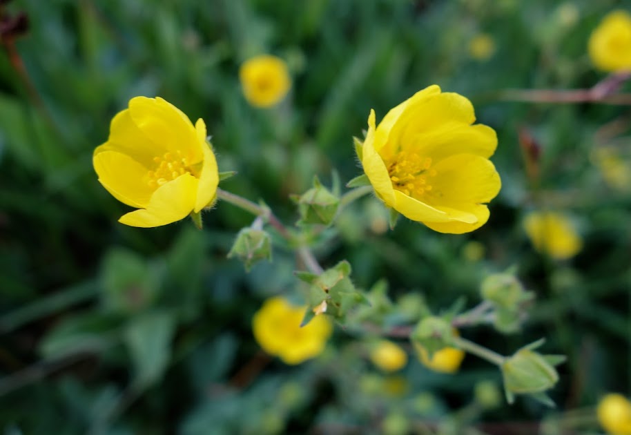
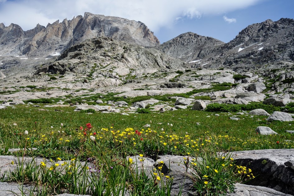
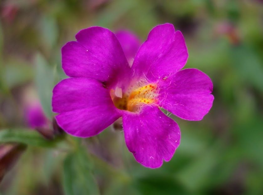
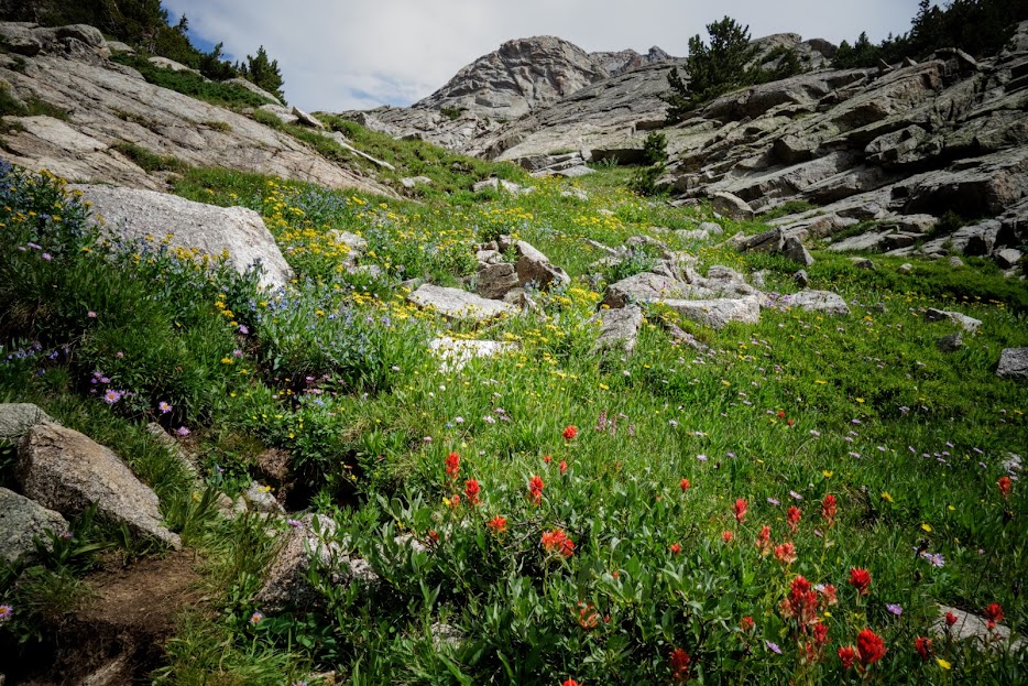
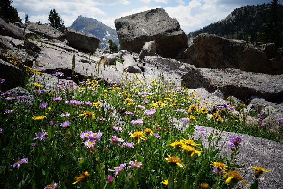
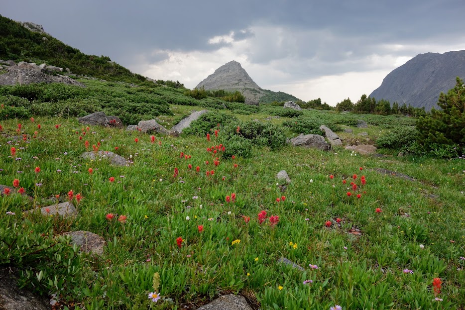
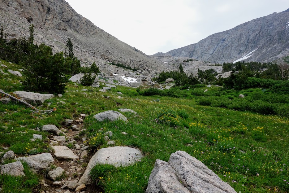
It was well past wildflower season but a few blooms remained.

I wouldn’t want to be here during a lightning storm.

I was disappointed with my timing for this section as I wanted the drama of blue skies against the granite. I’m pretty happy with how my Samsung S22 Ultra handled the low-light conditions.

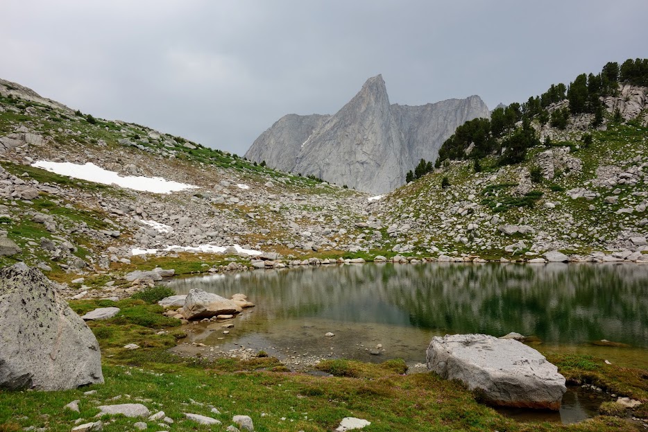
Looking down at Baldy Lakes.

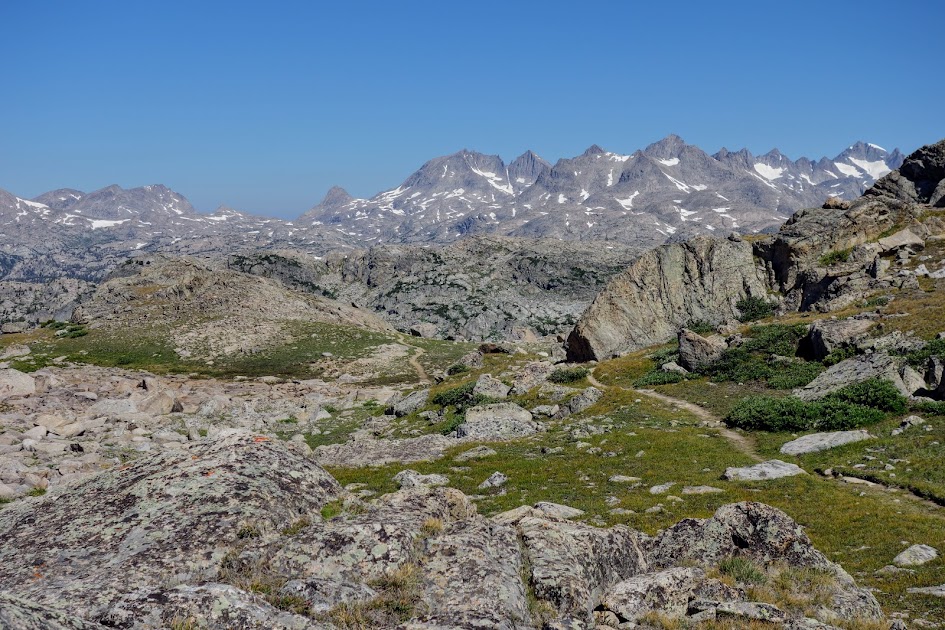
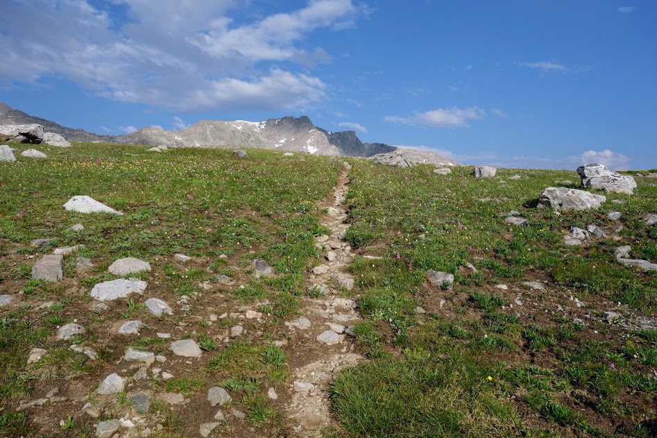
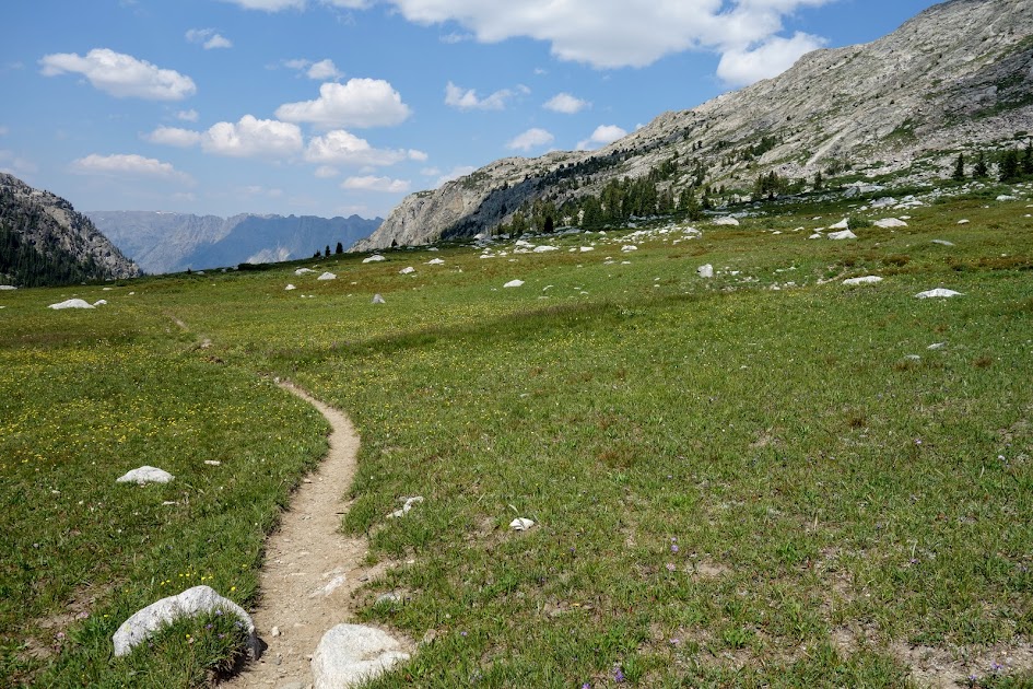
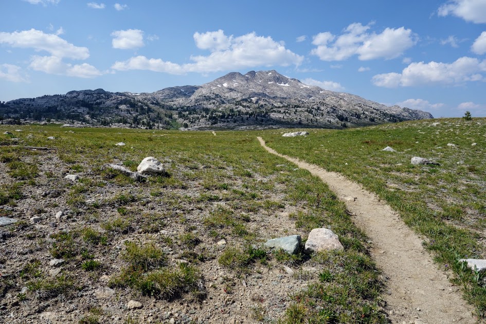
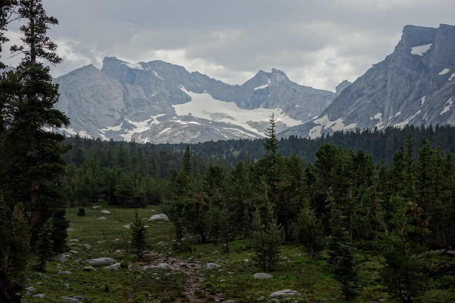
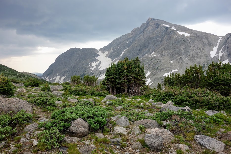
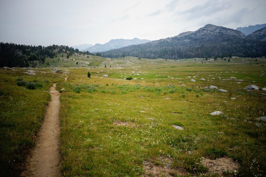
There were a lot of mild rollers in this section along the Continental Divide Trail (aka Fremont Trail). In better conditions, I would want to sit a spell and take in these views.

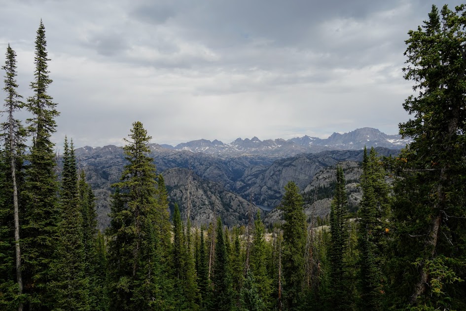
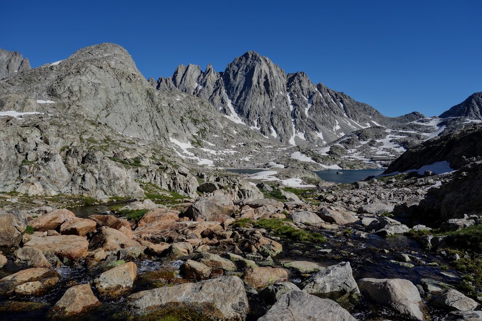
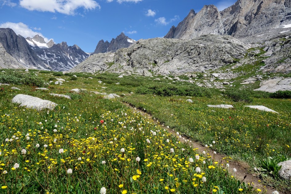
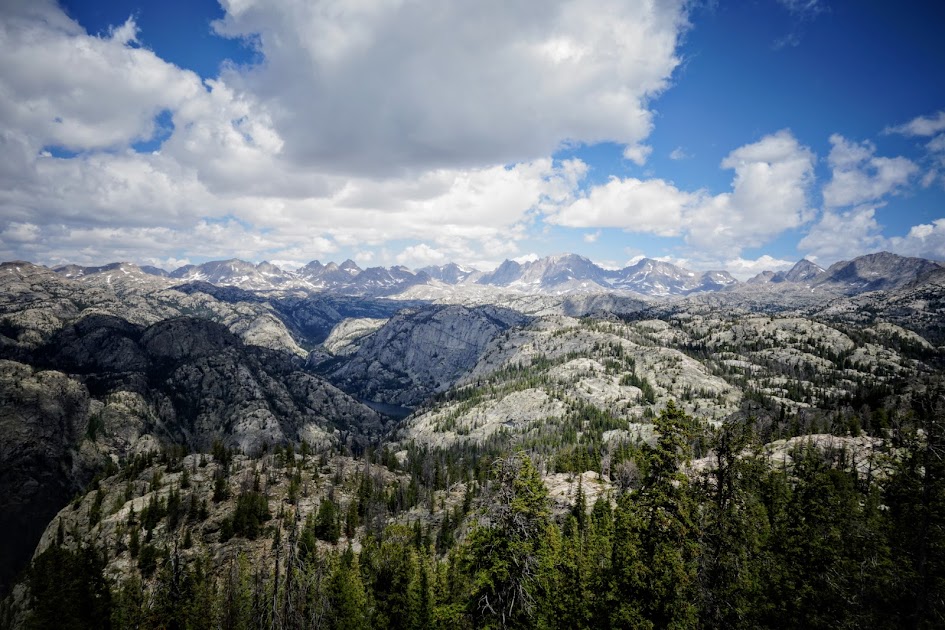
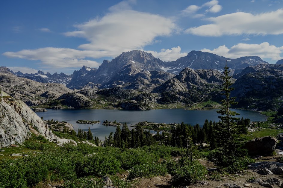
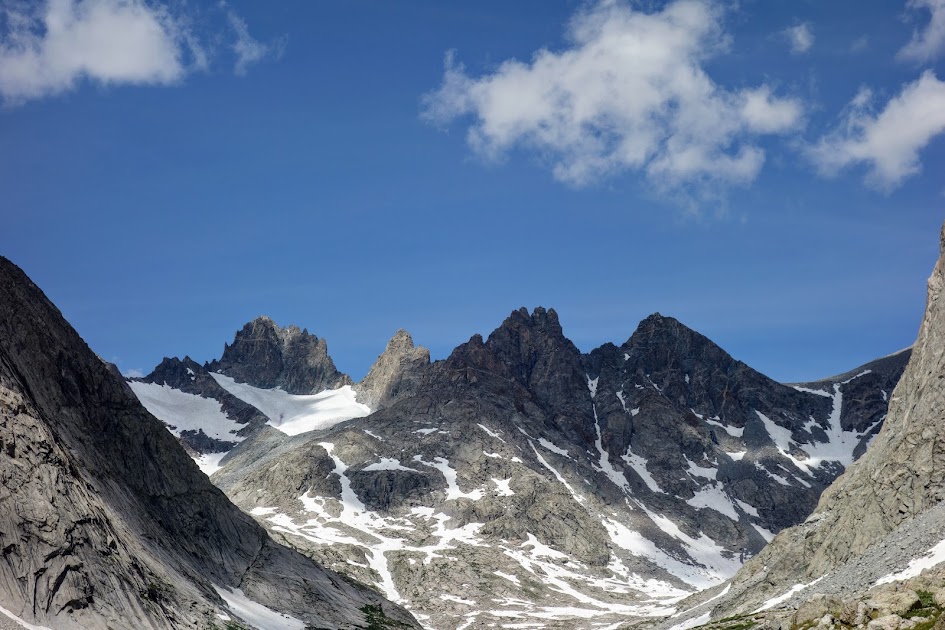
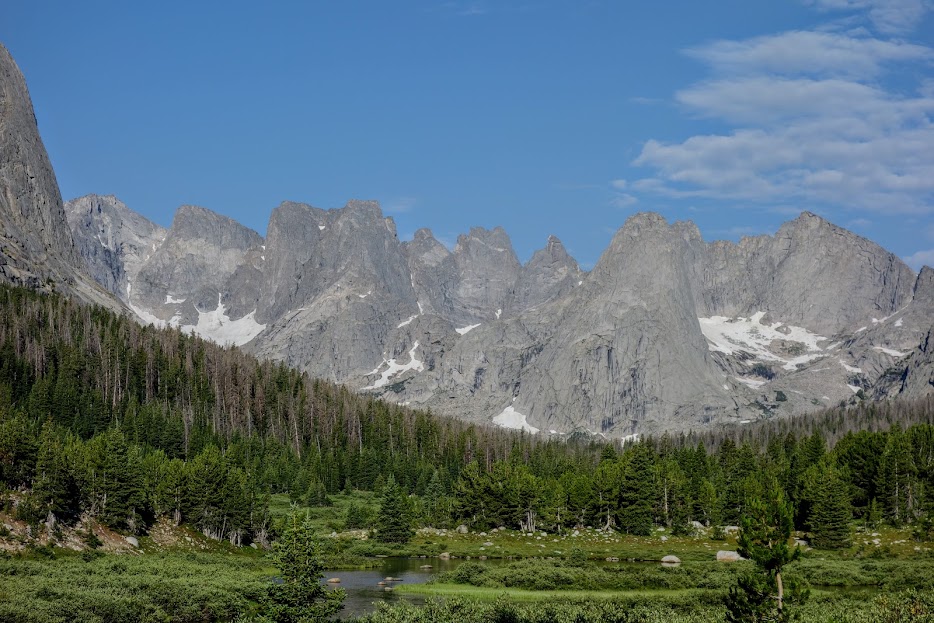
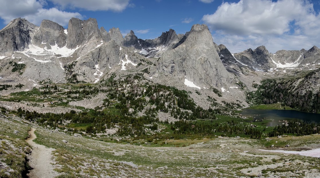
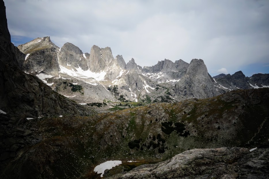
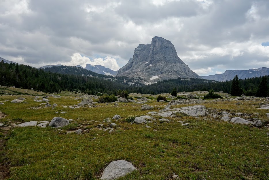
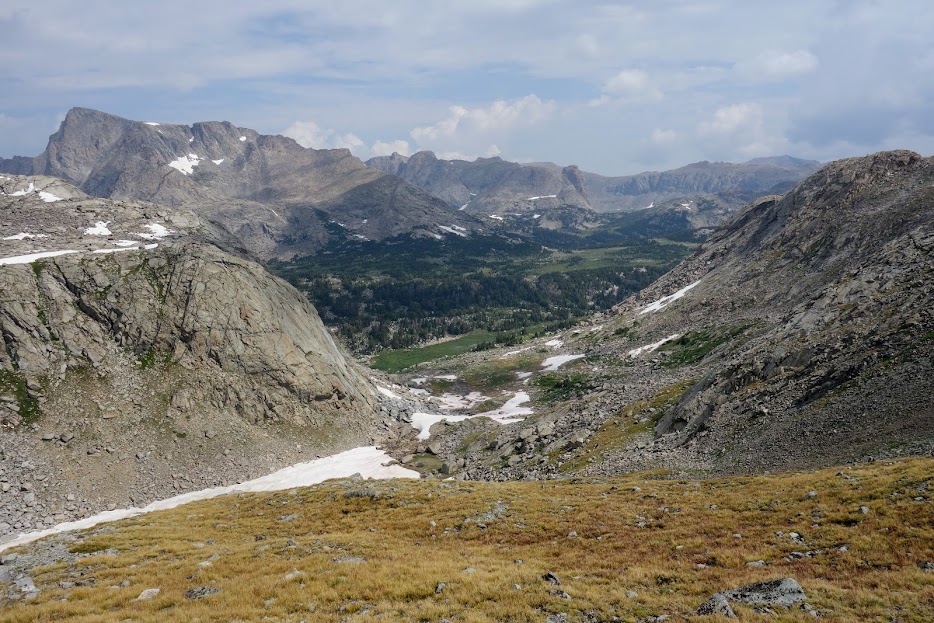
As I approached Bald Mountain Basin, I dreamed of spending more time in the big mountains, the core of the Winds. Although there were reasons to appreciate the route I took, I regretted not being able to spend more time in the big lake basins near the magnificent peaks. The most popular trailheads, located at higher elevations, are super busy for a reason.

Oh rain, oh rain, you are raining on my parade.

And then my happy spirit returned. This little slice of blue gave me the optimism I needed to hope for a break with a view and a little sun warmth.

I marked this area on my map for return exploration.

I found a great place to take a break.

In the distance is Angel Pass and Angel Peak. Many use that pass to reach deeper areas of the wilderness. What’s the blue? That would be my tent drying from the massively wet storm

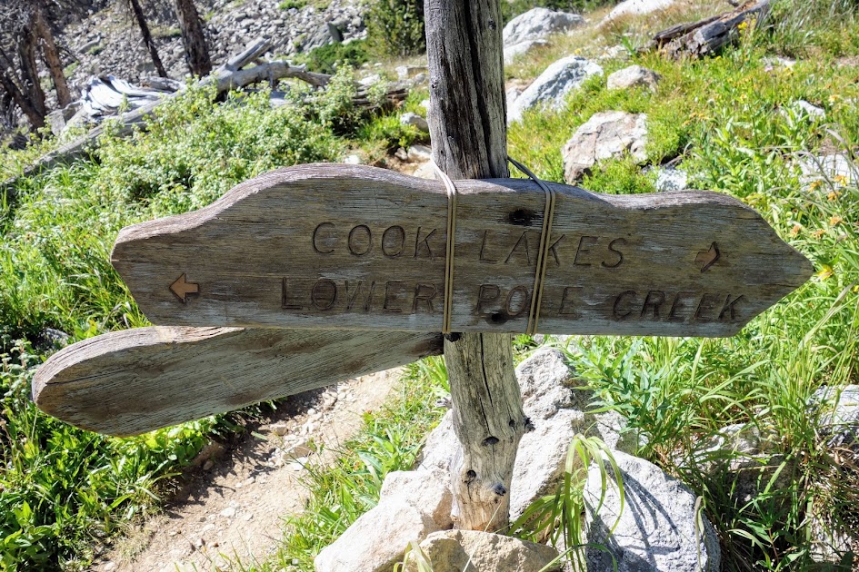
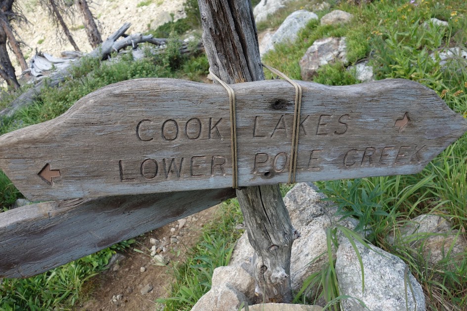
I had planned to hike the Cook Lake loop, connecting to where I hiked in 2017. However, with the unstable weather and unknown trail conditions, I felt like I needed to skip this option and continue onward.

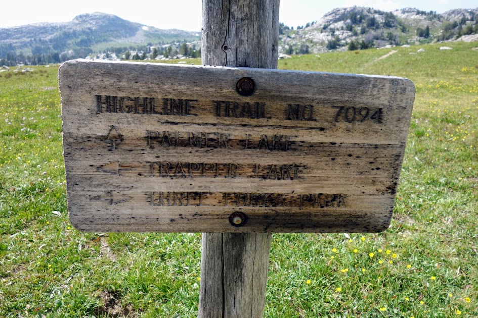
I transitioned from the Fremont Trail to the Highline Trail to begin my slow return to the trailhead.

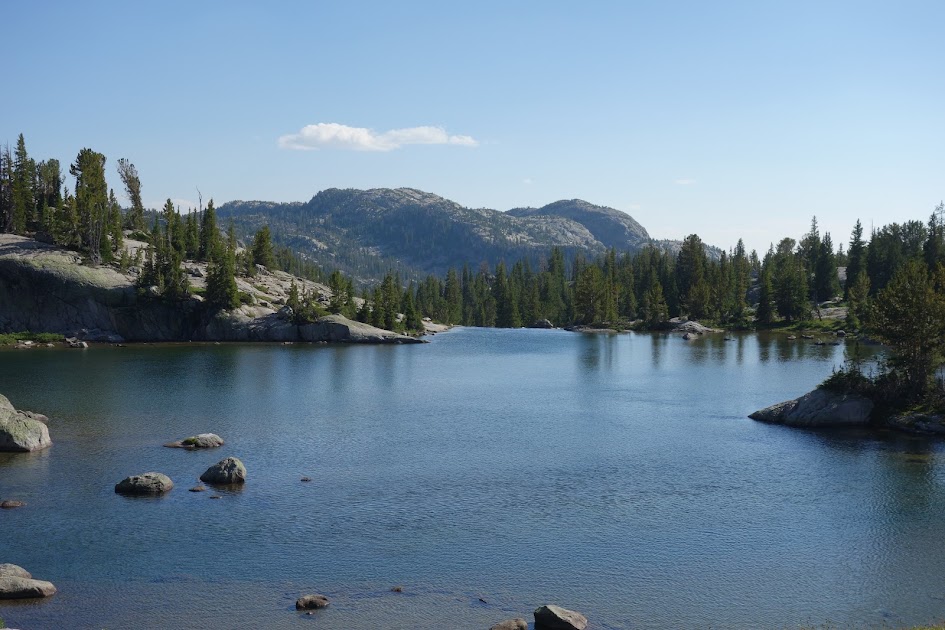
I found more lilypad-covered lakes/ponds.

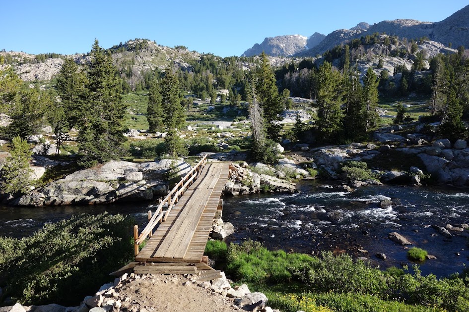
Soon enough it was time to ford Pole Creek. Having entered the wilderness from the Elkhart Trailhead in 2017, I could help but remember that trip with envy and fondness (link).

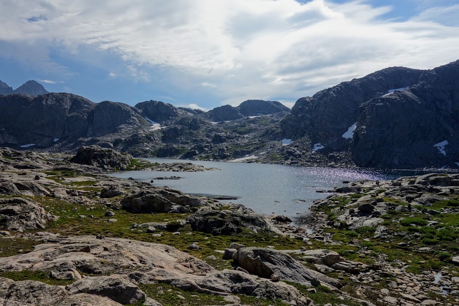
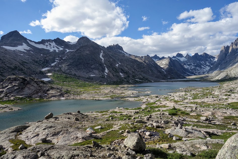
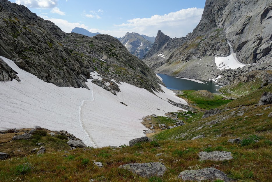
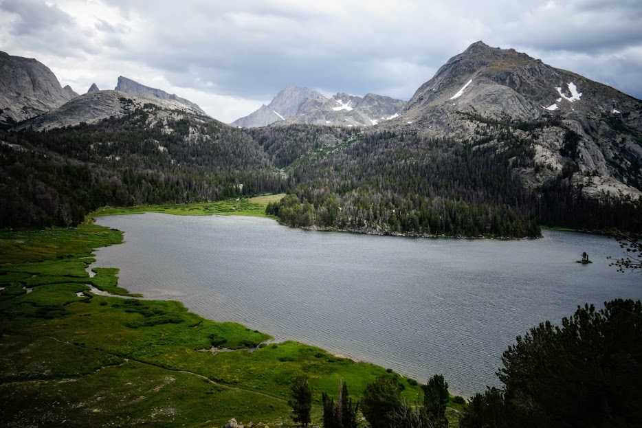
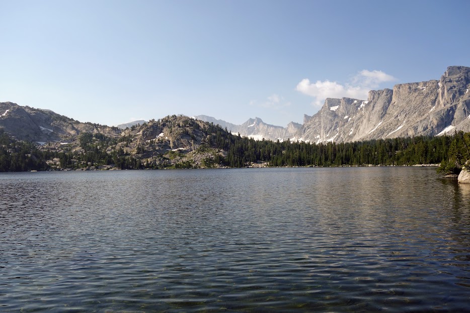
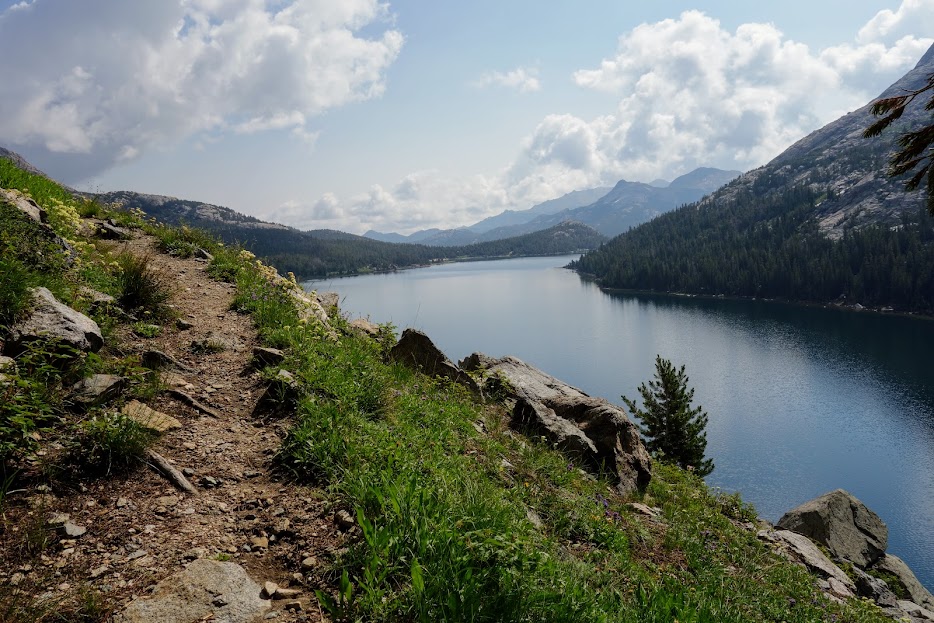
The ford provides a view of the first of Pole Creek Lakes, where I elected to spend the night when I found an awesome campsite.

Pole Creek feeds this lake as shown at the top of the below photo, and runs through this lake before becoming a creek again, one I’d need to ford in the morning.

The only negative was the lack of privacy at the lake for skinny dipping since the area was visible from the creek crossing. Otherwise, this campsite was awesome as I had both creek white noise and pika eeps.

It was chilly and breezy so not the night to get my clothes wet, so I settled for a gallon-bag bath instead.

Day 6 – Pole Creek Lakes to Cross Lakes

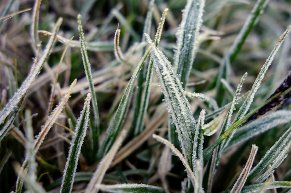
Misty, wet, and frosty conditions were the theme of the day. Although the temperature only dropped to 41 at my campsite, it was much colder as I traveled down the trail. Once again I was glad I’d stopped where I did even though it was earlier than I preferred. It was a wide crossing, reaching just below my knees.

I spent many miles passing through meadows, with wet feet as a direct result. Thankfully I was wearing my rain pants which kept my legs warmer.

When I reached this lake before 8:30am it was easy to say no to swimming. This was the first of the Chain Lakes.

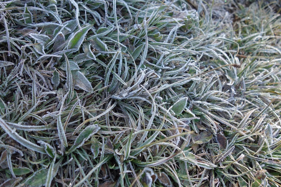
There was still frost evident along the trail.

There was no doubt fall was in the air. Gone were the blooms and mosquitoes, replaced with dry grasses and lots of grasshoppers.
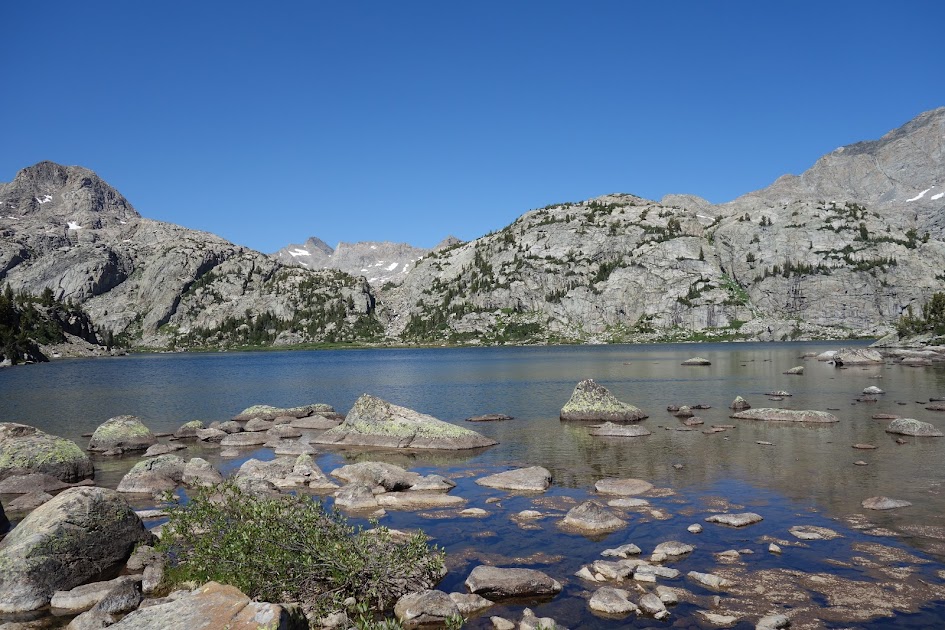
Barnes Lake.

Horseshoe Lake.

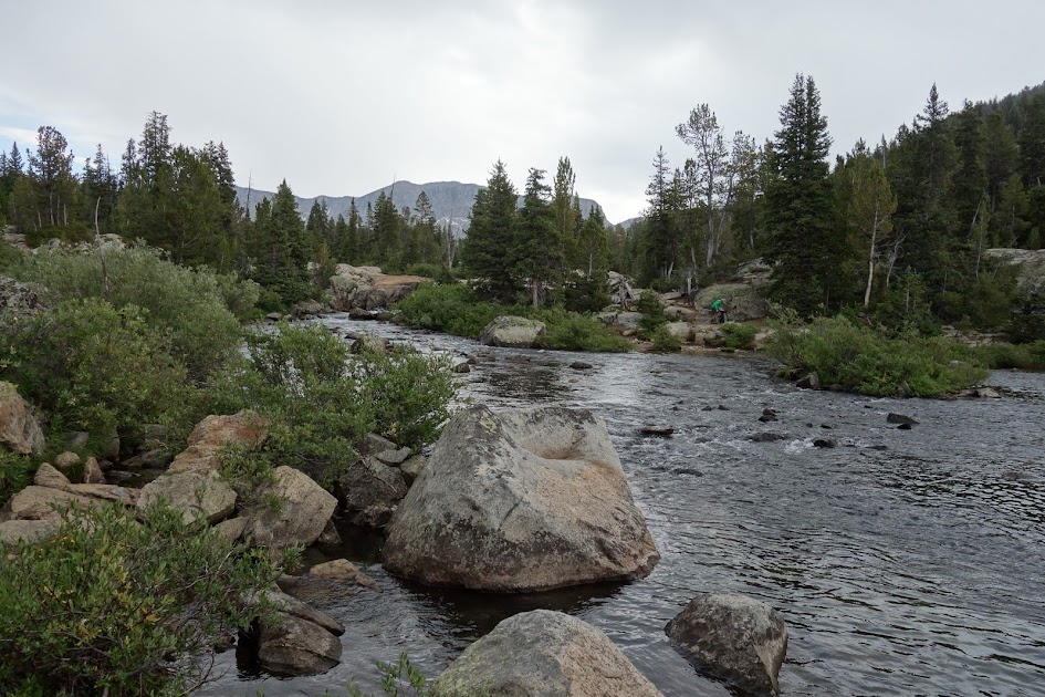
Although staying on the Highline Trail and then taking the Ethel Lake Trail back to the Boulder Canyon Trail was an option, staff at the ranger station had told me a section hadn’t been cleared and after my tree jungle gym I was motivated to avoid a repeat. So I chose the unknown of the Coyote Lake Trail in hopes it was clear. Horses were using it which generally means clear trails. Coyote Lake sure didn’t look like an inviting camping option.

Cross Lake had a nice campsite, although there were some widowmakers around. The peninsula lake included lilypads, however, I was happy to find a decent swimming area. I met a couple earlier who decided to bypass this site.

The lake offered some nice reflections.

Day 7 – Cross Lakes to Boulder Lake

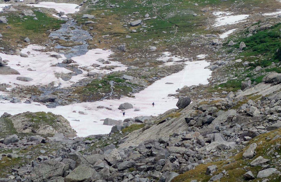
It’s hard not to question your decision to camp early. I was glad I was skilled at reading contour lines on the map and could see that Lovatt Lake would require an off-trail descent, not something I was excited to risk in an area with plenty of deadfall.

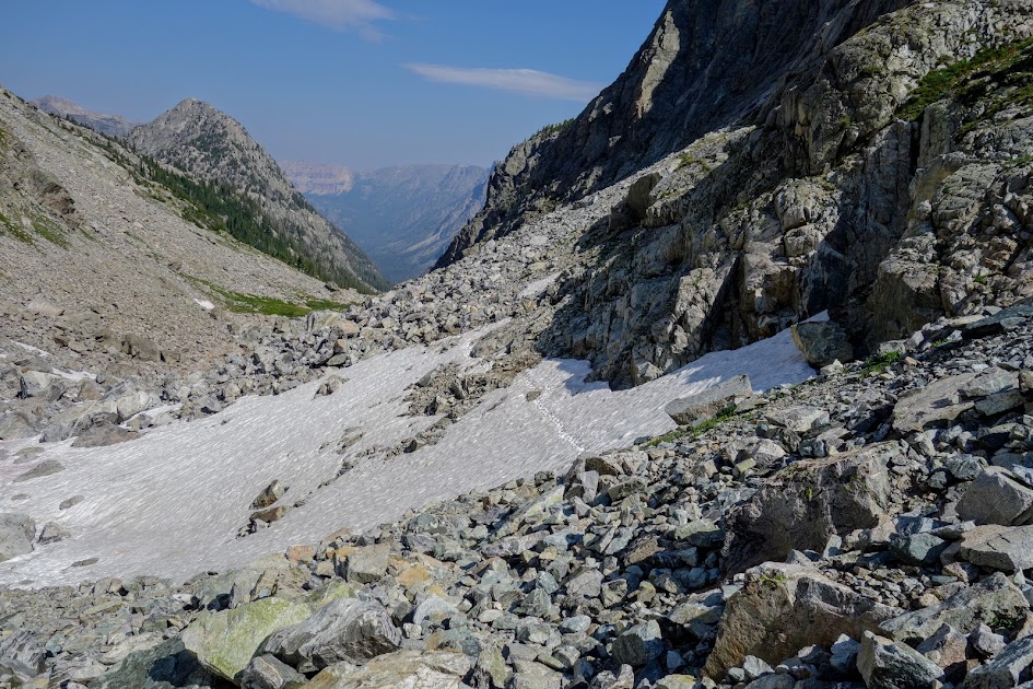
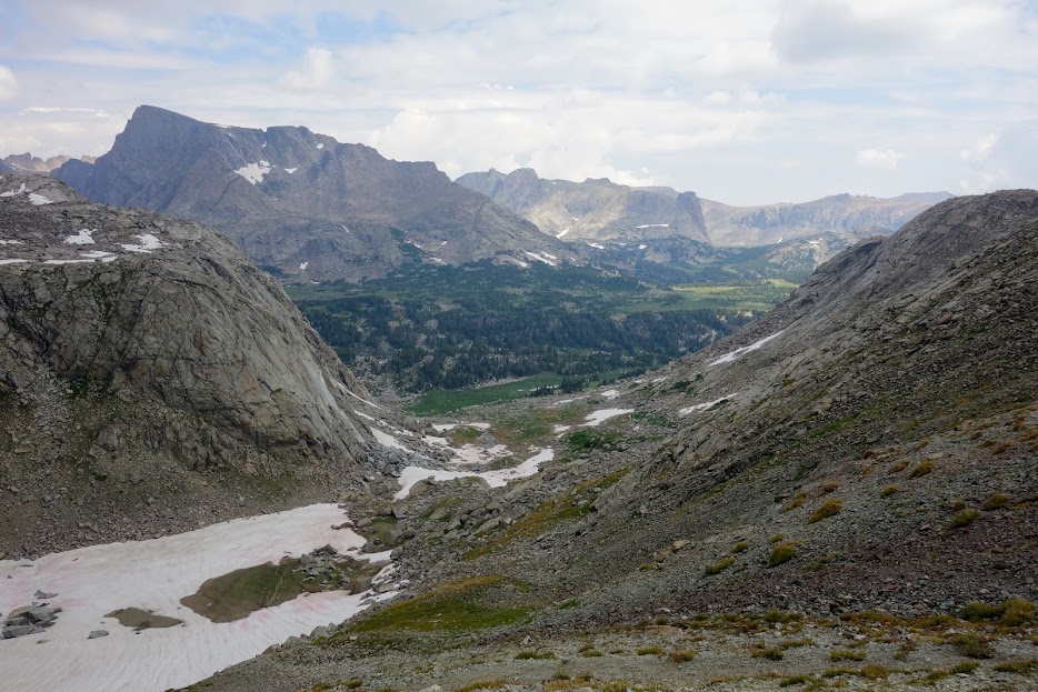
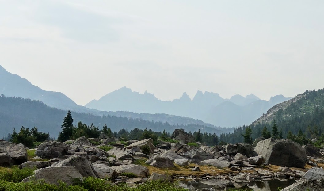
This was a day of mega descending and soon I came to my first view of the valley which seemed to have a bit of smoky haze.

I found occasional glimpes into the high peaks, where of course I’d rather be. “The range is home to a total of 63 glaciers, covering 17 square miles, greater than the total of all other glaciers in the American Rockies at 12 square miles. Seven of the ten largest glaciers in the continental United States are located in the Wind River Range.” Source: https://waterplan.state.wy.us/plan/bighorn/techmemos/glaciers.html

First views down to Boulder Lake. It took me over 2 hours from this point to reach the trailhead.

I finally had a view down to Blueberry Lake. I was so glad I hadn’t attempted to reach this lake for camp the previous night. I assumed it would have a lot of campsites since it was fairly close to the trailhead but I only found one and it certainly wasn’t 4 star worthy. The water quality didn’t invite swimming or drinking either.

The descent trail was hot and exposed, rocky and steep, worn bare by equestrian traffic. I wouldn’t recommend the Coyote Lake to Boulder Lake trails. This was a 49-mile 4,900′ elevation gain/loss loop trip.

My pack weighed 18 pounds at the end (as compared to the 29 when I started). My tent was wet and I had about a half-day of food remaining. My typical base weight (without consumables is 14-16 pounds).

Resources:

Links:

WY – Bridger Wilderness, Elkhart Trailhead (Part 4 of 4)

After completing the Jean Lakes Lollipop Loop, I landed at the Big Water Slide near Fremont Crossing for the night. 

What an interesting place. There is a significant creek (Fremont?) flowing under the bridge (on left of below photo), then creating a pond as it makes this sweeping corner before dropping over large smooth rocks creating a waterfall (top right of photo) as it once again becomes a creek. 

Fremont Crossing Bridge

The pond as it gets ready to go over the slide. There were quite a few fish jumping in this pond.

The top of the slide aka waterfall. 

The crashing power of water. 

The next morning not only was I happy to be kissed by the sun but thrilled to have finally captured the rays.

Soon enough it was time to head south over the Fremont Bridge.

It’s been in the low to mid 30’s in the mornings. I prefer campsites away from water and low spots to minimize condensation and frost. Back at the Highline / Seneca Lake / Indian Basin trail junction, I continued southeast on Highline Trail #094 (aka CDT). 

The summit post at Lester Pass

I loved looking back at all those peak I’d previous visited during this trek. 

While climbing, it was hard not to look backwards at this lovely view. 

Looking to the south, you could see Angel Peak and Angel Pass (the distinctive V). The basin between these ridges held Cook Lakes, my destination for the night. 

Looking back up at Lester Pass

Tommy Lake

I’d planned on hiking the Cook Lake Trail #163 as a loop circumnavigating lower lake while visiting upper lake.

Lower Cook Lake

After battling through brushy trail, I wasn’t able to find an easy way to cross the outlet of Upper Cook Lake and decided it wasn’t worth the effort so reversed my path instead. 

It seemed I had Lower Cook Lake to myself for the night, although I heard gunshots in the distance which was quite disconcerting. The multiple rounds sounded like target practice up the canyon and over the small ridge on the far side of the lake. This was another very active fish area. 

Sunset colors were pretty amazing.

This is a confusing junction as evidenced when I met a CDT thru-hiker who ended up on the Pole Creek Trail #094 rather than the Fremont Trail #096 (aka CDT). 

It’s always a good morning when it starts with wet feet crossings. This one was about mid calf height, the next was about to my knees. 

I enjoyed seeing these bring yellow lilypads blooming on the ponds. 

With the heavy use of this section of trail, you can expect to find many items left behind. I did my part by picking up this bladder and a few more things but I just couldn’t carry others such as a nalgene bottle and some very heavy binoculars. I lost a pen this trip, so karma says I need to pay it forward by helping to clean the trails. 

As I traveled this next section of trail on my entry, I was feeling the feet to the barn syndrome. Elkhart Trailhead here I come!

Eklund Lake sure provides a nice view of the Winds. 

Time to cruise the superhighway. I’d neglected to check my water situation at Eklund Lake and found myself in dire need when I arrived at this sign. There was a pond holding yucky water but I decided to take my chances at finding something better along the way. I had about 1/4 liter remaining and really needed to eat but couldn’t do so without water, so onward I went.

I was rained on earlier this day and it looked like my thunderstorms were building as I arrived at Photographers Point. I befriended a couple guys who were heading up to summit Fremont peak and found one was carrying a gallon of water. He was glad to part with some weight and I was so very grateful for the fresh liter of water. Ah, food, water and onward I went. 

Although water was non existent, there were some remaining wildflower displays. 

How could you not laugh at this stubborn llama (or handler). They were only a couple miles up the trail. I wonder how things were going a few hours and miles later. It wasn’t a pleasant sight watching what it took to get the llama up and moving.

I spent a fabulous 5-6 weeks in the Winds and yet barely touched the surface. There is so so much more to see. I look forward to future exploration. 

For summer 2017, I say goodbye. I’m so thankful for these 6-weeks of exploration. What a memory maker!

Links . . .

Hike Details:

  • Date(s) Hiked: 8/22-23/17
  • Mileage: Approximately 18-20 (conserving battery so didn’t track)
  • Elevation Gain/Loss: Unknown, constant up and down (conserving battery so didn’t track)
  • Trail Conditions:
    • Tree obstacles: minimal
    • Overgrowth: minimal (most on the Cook Lakes trail)
    • Signage: moderate on main trails (confusing without a map or gps at a few junctions)
    • Terrain: lots of muck primarily from excessive pack animal use; also rocky ground and a couple wet feet crossings
  • Water: plentiful (except for final 6ish miles)
  • Camping: excellent
  • Solitude: Expect lots of company on trail. Many day hike from the trailhead to Photographers Point, many also camp at Eklund Lake.
  • Bugs: plentiful but I didn’t use any repellent this trip (the wind is my friend)
  • Wildlife Sightings: none beyond birds, squirrels, chipmunks, pika, and marmuts
  • Precip: I had a little rain my first and last day of this trip
  • Temp: Overnight varied and seemed to fluctuate a lot in the 30’s and 40’s, highs were probably in 60’s-70’s.
  • Jan’s Cherry Picker Delight Scale: 3+ cherries (out of 5)

Tips:

  • Be prepared for altitude, elevation changes, weather changes, bugs and navigation. Also review current food protection requirements/guidelines (I used an Ursack with an Opsack liner). If I were to hike this loop again, I’d use my bear canister as in many areas there were no trees to use as an anchor for my Ursack.

Links:

Resources:

WY – Bridger Wilderness, Elkhart Trailhead (Part 3 of 4)

After a day in Titcomb Basin and another in Indian Basin, it was time to explore areas further north while creating some distance from both the weekend and eclipse crowds. 

So I said goodbye to my lovely campsite with this welcoming sunrise. 

I love hiking in the early morning. 

Instead of returning to the trail junction, I opted to hike cross country through the Island Lake basin to connect with the Highline Trail #094 (aka Continental Divide Trail aka CDT) near the Fremont Crossing Bridge. I was so sick of hiking stock-beaten trails. I’d sank to my knee in this muck my first day. 

Let’s play, make a route. 

Then there I was at the Fremont Crossing Bridge

To the Jean Lake’s I go. 

Lower Jean Lake

I know these for-profit pack trains are required to obtain permits, but I wonder if a fee is involved? If so, the forest service should be using those funds to repair the trails. If not, the groups should be required to participate in maintenance. There were so many on these trails and as a result the tread was a mess for hikers. Rant over! When rocks had been placed in low spots, it made a huge difference in being able to hike through, although it was still a bit like playing hopscotch.

The stream connecting Upper and Lower Jean Lakes. 

This waterfall was gorgeous. I spent a lot more time enjoying this location on my way back through. 

So much water. 

Even on this trail snow traverses were required. 

Of course you know whenever I find flowers and granite, I’m happy! 

It’s hard to tell, but my tent is on a bench above Upper Jean Lake. There were many benches and options for camping although finding privacy for potty time was another issue. There is a small lake just off trail, perfect for a short dip.

The next day, objective one was to summit Shannon Pass

Looks quick and easy, right? 

Looking back down at Jean Lakes. 

Also looks shorter and flatter than it really is. 

There are some nice ponds near the top. 

And, yes more snow traverses. 

The top is within sight, or just another false summit? 

Such a tease. 

In reality it only took me about 45 minutes to ascend but it sure felt longer. 

Peak Lake is another popular destination. The scree fields on the far side of the lake are the beginning of the route over Knapsack Col. I’m so happy with my decision to skip that option after seeing this. I really dislike hiking on scree!

It was great to enjoy the occasional floral display before I hit hell. 

Now I know why this is called Cube Rock Pass. Not my idea of fun 😦

30 minutes later I’m still having fun, NOT!

I was so happy to be out of that rock hell. Took me about 45 minutes to get to this point. 

Now time to lose lots of elevation, visit some wildflower meadows and drop back into treeline. 

I passed over Vista Pass without noticing anything special. It certainly wasn’t memorable. I transitioned to the Highline Trail #094 (aka CDT) heading south toward Summit Lake. It took me about 2.5 hours to descend to this junction from Cube Rock Pass.

Green River Pass was another one that I didn’t recognize immediately. 

There is a long green mesa/plateau between Green River Pass and Summit Lake. It was a huge surprise and I found myself at Summit Lake before I knew it.

This would have been a great place to have watched the solar eclipse, but alas my timing was off. 

As I descended from Summit Lake, I found this welcoming waterfall. 

Looking back at the mesa. 

I was treated to this fiery sunrise from camp the next morning. It’s Eclipse Day! Will the clouds stay away?

My private pond for the night. 

As I headed into the Elbow Lakes Basin, Mother Nature was keeping the suspense high. 

I decided to stop here for the eclipse viewing. I was headed toward higher mountains and worried the clouds might back up against the peaks preventing a clear view. The wind was blowing and it was quite chilly while I hung out for about 1.5 hours. 

I hadn’t researched options for capturing the big event so mostly I just experienced it. But I did capture this photo during Total Eclipse and the next one as the eclipse passed. You can also compare to the before photo above. They don’t even come close to the WOW I experienced during and after the event. The wind stopped, it became freezing cold, so very quiet and a little eerie. 

After the big event, I walked in silence through the Elbow Lakes Basin enjoying the natural beauty. It seemed like it took 15-30 minutes before the atmosphere returned to normal. 

I really liked this softer side of the Winds. I could see myself returning to the Elbow Lakes Basin to roam this hills. 

Soon I was back at the Shannon Pass junction and headed back down to Jean Lakes

I spent lunch enjoying this waterfall between Upper and Lower Jean Lakes. It was funny I watched a group of four grumpies march by without even giving it or me a glance. 

Lower Jean Lake is huge. It’s slightly off trail with plenty of private dispersed camp areas in the trees. 

To be continued . . .

Hike Details:

  • Date(s) Hiked: 8/19-20/17
  • Mileage: Approximately 20-25 miles (conserving battery so didn’t track)
  • Elevation Gain/Loss: Unknown, constant up and down (conserving battery so didn’t track)
  • Trail Conditions:
    • Tree obstacles: none
    • Overgrowth: minimal
    • Signage: moderate on main trails
    • Terrain: most memorable was the challenge of Cube Rock Pass with some bouldering, plus several areas of snow travel, some soggy hiking and wet feet water crossings.
  • Water: plentiful
  • Camping: excellent
  • Solitude: Moderate
  • Bugs: plentiful but I didn’t use any repellent this trip
  • Wildlife Sightings: none beyond birds, squirrels, chipmunks, pika, and marmuts
  • Precip: None this day
  • Temp: Dropped to 33 overnight in my tent
  • Jan’s Cherry Picker Delight Scale: 4 cherries (out of 5)

Tips:

  • Be prepared for altitude, elevation changes, weather changes, bugs and navigation. Also review current food protection requirements/guidelines (I used an Ursack with an Opsack liner). If I were to hike this loop again, I’d use my bear canister as in many areas there were no trees to use as an anchor for my Ursack.

Links:

Resources:

WY – Bridger Wilderness, Elkhart Trailhead (Part 2 of 4)

After an outstanding day at Titcomb Basin, I worried about the rest of my trip. Would I be underwhelmed? As is common, I frequently have little or no advance information about an area, so expectations are pretty much non existent. This was the case with Indian Basin, although I’d been told it was an area not to be missed. 

I believe this is Pothole Lake near the junction of  Titcomb Basin and Indian Basin.

If you thought the above photo looks cold, you’d be right. There was as they say frost on the pumpkin

There was even a newly formed thin layer of ice on some of the ponds. 

Spring comes late at 10-12,000 feet. With wildflowers like these Columbine, you won’t hear me complaining.

By a little after 9am, I was back at the Titcomb/Indian Basin junction. 

I took time to explore an unnamed lake near the trail. 

Back on trail, I took a break near this beautiful waterfall. 

The waterfall looks so small in the big picture, but it was huge and had quite the voice. 

Since I liked the waterfall so much, I decided to set up camp nearby so I’d be carrying a little less weight while ascending Indian Pass. In retrospect it was a great idea as the basin was extremely wet and not ready for camping.

A close up view of the little pond just above and to the left of my tent. 

Soon enough I was back on trail. 

You can see the pass. It took me about 2.5 hours from the waterfall.

Looking back from where I’ve come.

Walking near this collapsed snowfield was a bit scary. By the way, there was a LOT of snow to walk on while ascending Indian Pass.

There were so many false summits. Would I ever reach the top? 

FINALLY, the stick that represents the summit. 

Looking back in the direction I’d come and off toward Pinedale. 

View from the top to the other side. Not very impressive especially as I was expecting to see glaciers. 

This is part of Knife Point Glacier. Sadly, it is still covered in snow so no evidence that it was a glacier. 

I enjoyed the views just as much during my descent. 

Back at camp as I watched a marmot play, I saw this very sad rock. I’m sure he wished he were round, but I told him it was okay to be different and he needed to turn his frown upside down. 

This solo rock should help frowny rock with that smile. 

I think maybe Big Agnes got ideas for their color palette from this sunset. 

To be continued . . .

Hike Details:

  • Date(s) Hiked: 8/18/17
  • Mileage: Approximately 10 miles (conserving battery so didn’t track)
  • Elevation Gain/Loss: Unknown, constant up and down (conserving battery so didn’t track)
  • Trail Conditions:
    • Tree obstacles: none
    • Overgrowth: none
    • Signage: moderate on main trails
    • Terrain: muck from wet ground, consolidated snow travel, rocky
  • Water: plentiful
  • Camping: not very good at this time due to everything still being snowy or soggy
  • Solitude: Expect a few day hikers
  • Bugs: plentiful but I didn’t use any repellent this trip
  • Wildlife Sightings: none beyond birds, squirrels, chipmunks, pika, and marmuts
  • Precip: None this day
  • Temp: Dropped to 33 overnight in my tent
  • Jan’s Cherry Picker Delight Scale: 4++ cherries (out of 5)

Tips:

  • Be prepared for altitude, elevation changes, weather changes, bugs and navigation. Also review current food protection requirements/guidelines (I used an Ursack with an Opsack liner). If I were to hike this loop again, I’d use my bear canister as in many areas there were no trees to use as an anchor for my Ursack.

Links:

Resources:

WY – Bridger Wilderness, Elkhart Trailhead (Part 1 of 4)

With the big solar eclipse date just around the corner, it took careful planning to ensure I would enjoy Titcomb Basin sans the crowds. It tends to be just as popular as Cirque of the Towers

This hike began at the Elkhart Trailhead near Pinedale and initially followed the Pole Creek Trail #119, a very dusty well worn trail. Don’t count on finding water on this stretch. 

You cross into the wilderness quite quickly. 

At the first junction, I followed the trail toward Eklund Lake

I stopped at Photographers Point for the mandatory photo. 

At the next junction, I took the Seneca Lake Trail #123

Hobbs Lake

This female grouse decided she was up for a photo. 

Seneca Lake.

It started raining soon after I passed Seneca Lake. I quickly tucked into this protected campsite near Little Seneca Lake, which incidentally I had to myself for the night.

The next morning I was treated to this colorful sunrise at Little Seneca Lake

At this junction, I followed the trail toward Island Lake.Shortly thereafter you transition to the Indian Basin Trail #046 for a couple miles and continue toward Island Lake

Buttercups were prevalent throughout this trip. 

If you want to camp at Island Lake, plan on plenty of company unless you venture far away from the trail. 

I brought hard boiled eggs with me for three days of lunches, such a nice change from cheese and/or salami. 

At the Indian Pass Trail Junction, I stayed on the main trail (not noted on this sign) following Titcomb Basin Trail #160

Titcomb Basin

I’d considered camping at the basin terminus and really wanted a closer look at Knapsack Col but the chilly wind had me turning around toward the end of the last lake.

There were still some snow fields around to traverse. 

There are plenty of camping options away from the crowds in Titcomb Basin. This was my private spot for the night.

My campsite view. 

To be continued . . .

Hike Details:

  • Date(s) Hiked: 8/16-17/17
  • Mileage: Approximately 18-20 (conserving battery so didn’t track)
  • Elevation Gain/Loss: Unknown, constant up and down (conserving battery so didn’t track)
  • Trail Conditions:
    • Tree obstacles: none
    • Overgrowth: none
    • Signage: moderate on main trails
    • Terrain: lots of muck primarily from excessive pack animal use; also rocky ground
  • Water: plentiful (except for initial 6ish miles)
  • Camping: excellent
  • Solitude: Expect lots of company on trail. Many day hike from the trailhead to Photographers Point, many base camp at Seneca Lake or Island Lake and day hike to Titcomb Basin. There are however plenty of places to find solitude off trail.
  • Bugs: plentiful but I didn’t use any repellent this trip
  • Wildlife Sightings: none beyond birds, squirrels, chipmunks, pika, and marmuts
  • Precip: I had a little rain my first and last day of this trip
  • Temp: Overnight varied and seemed to fluctuate a lot in the 30’s and 40’s, highs were probably in 60’s-70’s.
  • Jan’s Cherry Picker Delight Scale: 4++ cherries (out of 5)

Tips:

  • Be prepared for altitude, elevation changes, weather changes, bugs and navigation. Also review current food protection requirements/guidelines (I used an Ursack with an Opsack liner). If I were to hike this loop again, I’d use my bear canister as in many areas there were no trees to use as an anchor for my Ursack.

Links:

Resources:

WY – Bridger and Popo Agie Wildernesses, Big Sandy Trailhead (Part 5 of 5)

It’s a morning of anxious anticipation. Will I have clear skies? Will the sun be in the optimal position for good lighting? Will the Cirque of  the Towers be the “be all and end all” of the Winds? Will it be the just reward I’ve awaited? It was time to find out! After enjoying sunrise at Bear Lakes (see previous post for hike details), I quickly broke camp and was on trail. Goodbye Lizard Head

First glimpse of Cirque of the Towers. Go away clouds! 

By 8am I was back on the Lizard Head Trail #714 headed toward Jackass Pass

I was greeted by some perky Monkey Flowers

I could feel the anticipation. Somewhere in these 4 miles, I’d find the Cirque. 

After everything I’d seen over the past few weeks in the Winds, I was feeling a bit meh. 

Pingora Peak and Lonesome Lake. Clear blue skies, light behind me, everything I could have asked for, and yet I found myself under impressed.

Even as a lake backdrop, meh . . . 

Each day, I’ve enjoyed watching the nearly full moon slowly drop toward bed; today was not an exception. 

Nearing the top of Jackass Pass, War Bonnet Peak became prominent. I didn’t see any climbers this day.

The heart of the Cirque with Lonesome Lake. I’m enjoying them more as the clouds provide shadows and the light continues to enhance the shapes.

Then there I was at the top of the pass. I’d considered hanging out for the day among the towering giants and hiking to Cirque Lake, and possibly even camping at Climber’s Camp, but my soul just wasn’t feeling it.

War Bonnet Peak was impressive. 

Looking down at Arrowhead Lake

There is a little snowfield to traverse on the descent. Thankfully for me, it’s a bit of an ascent, much easier with my trail runners. 

This stretch was an accident waiting to happen. 

There’s a false summit with a rocky outcropping as you ascend from Big Sandy Lake. It provides an excellent viewpoint. 

As I descended I started seeing more wildflowers. 

Those mountains behind Big Sandy Lake had me gawking. I’d had the Temple Peak and Lake areas on my possible itinerary, but my body was ready for a rest so I decided to save that loop for another day. 

Look at those wildflowers! 

After a bit of a rest, it was time to crank out the remaining six miles to the trailhead. 

I’m sure there were easily 100 vehicles at the trailhead with nearly every state represented. It was fun to see plates from as far away as Alaska and Florida, and to meet hikers from Tennessee, Kentucky, Michigan, Wisconsin, etc. The bulk of the crowds were between the trailhead and the Cirque. Big Sandy Lake is definitely well loved and a staging area for day hikes. I was intimidated by the number of vehicles but pleasantly surprised by the ease at finding solitude. 

After a physically challenging week, it was time for a hotel room and a soak. 

To be continued . . .

Hike Details:

  • Date(s) Hiked: 8/12/17
  • Mileage: Approximately 12 (conserving battery so didn’t track)
  • Elevation Gain/Loss: Unknown, constant up and down (conserving battery so didn’t track)
  • Trail Conditions:
    • Tree obstacles: minimal
    • Overgrowth: minimal
    • Signage: moderate on main trails
    • Terrain: rocky and steep in sections, mucky in others (my most challenging day, the worst section for me was the rock scramble around North Lake)
  • Water: plentiful
  • Camping: excellent
  • Solitude: Minimal, but available. This section of trail is well loved and high use.
  • Bugs: plentiful but I didn’t need deet
  • Wildlife Sightings: none beyond birds, squirrels, chipmunks, pika, and marmuts
  • Precip: expect thunderstorms in July/August; I’ve been wet and dumped on with hail and rain nearly daily
  • Temp: Overnight varied and seemed to fluctuate a lot in the 30’s and 40’s, highs were probably in 60’s-70’s.
  • Jan’s Cherry Picker Delight Scale: 4+ cherries (out of 5).

Tips:

  • Be prepared for altitude, elevation changes, weather changes, bugs and navigation. Also review current food protection requirements/guidelines (I used an Ursack with an Opsack liner). 

Links:

Resources:

WY – Lizard Head / Bear Lakes, Southern Wind River Mountains, Popo Agie Wilderness

Soon enough it was time to say goodbye to South Fork Lakes (see previous post for hike details). 

Valentine Lake was much larger than anticipated. 

The day started with a climb on Bears Ears Trail to the junction with Lizard Head Trail #714. Nancy’s book provided an off-trail option direct from South Fork Lakes. In retrospect I wish I would have taken it.

The trail is nicely switchbacked and sandwiched between the boulders. This is a group of NOLS (National Outdoor Leadership School) students working their way down the trail while I’m climbing up. The gap is the junction for Bears Ears and Lizard Head Trails. If I’d gone cross country, I’d be coming up on the shoulder, bypassing this climb. It took me about 90 minutes to climb the 2.5 miles from the Moss Lake junction to the Lizard Head Junction.

Look closely and you can see the group of 10 NOLS students now down below me. 

This cairn marks the summit, false summit that is . . . . 

Final push. 

Success! 

My guidebook recommends visiting a viewpoint. I’m assuming this is it as I saw a couple people standing on top as I was completing the climb. This gully is where I would have been ascending off trail. Looks can be deceiving. Easier? Who knows. 

And then it was time for more ascending and earned views. 

Are you Lizard Head? Cathedral Peak? or the Viewpoint? With heavy legs, today would not be one for additional exploration. 

Lizard Head Plateau was so different from anything I’d seen to date in the Winds. Quite enjoyable and the first flattish hiking I’ve experienced in this range. 

Even flattish had summits marked by a stick or cairn, or in this case both. 

I believe this is Lizard Head Peak and Lakes

Lizard Head Peak and Bear Lakes

I was so thankful to see this sign as I’d been descending for a long time on a pretty steep trail. My body was tired of fighting gravity. 

This somewhat fresh kill bone was on the trail to Bear Lakes. Any ideas? I’ve been told possibly cow. If so, it was either carried a long distance or a lost stray as there is no open grazing for miles and miles. 

There were quite a few campers in the area, but I found a nice view with waterfall feature site, ensuring first I was the mandatory 200 feet away from the lakes edge. This was my first day in nearly a month with dry feet and even though I was camped in a green area, I had a dry tent in the morning, thanks to a breeze to dry out the few overnight sprinkles. 

To be continued . . .

Hike Details:

  • Date(s) Hiked: 8/11/17
  • Mileage: Approximately 10 (conserving battery so didn’t track)
  • Elevation Gain/Loss: Unknown, constant up and down (conserving battery so didn’t track)
  • Trail Conditions:
    • Tree obstacles: minimal
    • Overgrowth: minimal
    • Signage: moderate on main trails
    • Terrain: rocky and steep in sections, mucky in others (my most challenging day)
  • Water: plentiful
  • Camping: excellent
  • Solitude: Moderate. I saw a solo guy on the ascent to the junction of Bears Ears and Lizard Head plus the group of 10 NOLS students. Didn’t see anyone else until Bear Lakes where there were lots of folks including another groups of NOLS students. Overall it was quiet and there were plenty of spots to camp away from others.
  • Bugs: plentiful but I didn’t need deet (my second lake with overwhelming gnats)
  • Wildlife Sightings: none beyond birds, squirrels, chipmunks, pika, and marmuts
  • Precip: expect thunderstorms in July/August; I’ve been wet and dumped on with hail and rain nearly daily
  • Temp: Overnight varied and seemed to fluctuate a lot in the 30’s and 40’s, highs were probably in 60’s-70’s.
  • Jan’s Cherry Picker Delight Scale: 4++ cherries (out of 5).

Tips:

  • Be prepared for altitude, elevation changes, weather changes, bugs and navigation. Also review current food protection requirements/guidelines (I used an Ursack with an Opsack liner). 

Links:

Resources:

WY – Popo Agie Wilderness, Big Sandy Trailhead (Part 3 of 5)

I prepare for trips by giving myself many options. This gives me the flexibility to revise my loose itinerary on the fly. Today called for cross-country travel to Rabbit Ears Lake, over Macon Pass and on to Washakie Lake, my legs were feeling the fatigue of the previous days so I told myself I’d make a decision at the junction. I said goodbye to Baptiste Lake and Mount Hooker (see previous post for details).

Soon enough I was back on Bears Ears Trail #716 heading toward Grave Lake

The sound of rushing water always gets my attention. 

Soon enough I found myself at Grave Lake. What a HUGE body of water. It was so nice being on trail. The fatigued muscles said we like this option. To reach Rabbit Ears Lake, I would have crossed the Grave Lake outlet and worked my way south along the outlet stream. I’m sure it would have been fun, but I’ve learned to listen to my body and that internal voice. For safety reasons, I send out an InReach message whenever I change trails, go off trail, or find myself in a risky situations such as crossing rivers. 

I found a beach at Grave Lake

More importantly I found a civilized way to cross waterways, not that it mattered at this point as I’d had wet feet for days. I wear quick dry trail shoes with merino wool socks for blister management. I dry out my feet on breaks. Putting on wet socks in the morning is still one of my least favorite things but since they’ll be wet within 5 minutes it doesn’t make sense to put on dry ones. 

Grave Lake

I dropped back into tree line where I found these gems. 

I decided it was time to rebuild my log crossing confidence. SUCCESS! 

This junction is a little confusing. It was time to look carefully at the map. 

I’d be staying on the Bears Ears Trail to the Washakie Trail junction.

This junction at Ranger Park had met continuing my journey east on the Bears Ears Trail

I believe this is Payson Peak. 

As per usual, I was hiking through yet another afternoon thunderstorm. Favorite gear these past few weeks in the Winds has been my umbrella and poncho. 

Upper Valentine Lake

First view of South Fork Lake

The smallest of the lakes in the South Fork Basin. Notice the waterfall! 

I positioned my tent to enjoy nature’s music while also having views of the lake. Yes, those are my socks on top of my tent. I was hoping for drying time between storms. 

South Fork Lake. Here’s a fun story. Upon arrival at the lake, I found my friend Bill who I met a few weeks ago, shared some miles and camp at Tayo Lake. The Winds are indeed a small place. He was parked at the furthest northwest trailhead while I was at the furthest southwest. What a coincidence! 

I had the basin to myself as far I could tell. There had been four fishermen visiting, including Bill, when I arrived but they all returned to Valentine Lake before sunset. 

I was entertained by this light show as the sun slid behind the peak. 

Watching the sun kiss the mountains is my favorite morning activity. 

To be continued . . .

Hike Details:

  • Date(s) Hiked: 8/10/17
  • Mileage: Approximately 8-10 (conserving battery so didn’t track)
  • Elevation Gain/Loss: Unknown, constant up and down (conserving battery so didn’t track)
  • Trail Conditions:
    • Tree obstacles: minimal
    • Overgrowth: minimal
    • Signage: moderate on main trails
    • Terrain: rocky in some places, mucky in others
  • Water: plentiful
  • Camping: excellent
  • Solitude: High! Met a large group hiking toward Hailey Pass, one solo guy, and a group who’d stayed at South Fork Lakes the previous night, plus the four fishermen at South Fork Lakes
  • Bugs: plentiful but I didn’t need deet (overwhelming gnats at South Fork Lakes)
  • Wildlife Sightings: none beyond birds, squirrels, chipmunks, pika, and marmuts
  • Precip: expect thunderstorms in July/August; I’ve been wet and dumped on with hail and rain nearly daily
  • Temp: Overnight varied and seemed to fluctuate a lot in the 30’s and 40’s, highs were probably in 60’s-70’s.
  • Jan’s Cherry Picker Delight Scale: 4+ cherries (out of 5).

Tips:

  • Be prepared for altitude, elevation changes, weather changes, bugs and navigation. Also review current food protection requirements/guidelines (I used an Ursack with an Opsack liner). 

Links:

Resources:

WY – Bridger and Popo Agie Wildernesses, Big Sandy Trailhead (Part 2 of 5)

My next destination was Pyramid Lake. It was a cross country trek from East Fork Lakes (see previous post for details on the hike to the lakes). With Pyramid Peak flagging the way, it’s pretty hard to get lost. 

These cute little trees made me giggle. I think Dr. Seuss has been visiting again. 

Looking back at the East Fork range and the pass to Pyramid Lake

Looking south from Pyramid Lake. As per usual, it was thunderstorm time. 

Those dark clouds surrounding Pyramid Lake sure add to the ominous feeling. 

After waiting out yet another hail storm, followed by cold rain, I elected to take anti-hypothermia measures by setting up camp at Mae Lake. The next day I’d tackle Hailey Pass which is tucked in that ridge behind Pyramid Peak

The next morning it was go time. 

Nancy Pallister’s book, “Beyond Trails in the Wind River Mountains,”  showed an off-trail short-cut saving about a mile. With everything being wet, I decided to play it safe and take the trail. I was in no mood for slip sliding slogging.  

Looking back at Mae Lake and Mount Gelkie (I believe). 

Find the cairns and do a little boulder scrambling. 

Almost there. 

First though, time to plow through a little snow. 

Darn false summits. First I must pass by partially frozen Twin Lakes

What? another false summit. 

Second Twin Lake.

Now I’m almost to the top of the Hailey Pass

Looking back at Upper Twin Lake

YIPPEE!!! It took me about 2.5 hours to cover the 1.8 miles; however, I stopped at one of the Twin Lakes to dry my gear and eat a snack. 

I absolutely loved the views from the pass vantage point. 

In the Winds, you soon learn what goes up must go down . . .in this case all the way to the bottom, which happens to be the drainage basin from Graves Lake

The descent begins with a snowfield, not my favorite. If you look closely in the middle, you’ll see a couple who’ve made it through the steep and are now on the flatter snowfield. It gives an idea of proportions. 

I had a terrifying descent at Mount Whitney last year and was not looking forward to a repeat. I did not have microspikes with me, and was not prepared for glissading as (1) I was wearing a skirt and did not have rain pants; (2) it was hailing and raining so I did not want to expedite hypothermia; and (3) I’m not comfortable with out of control speed. 

Looking back up at that snowfield. 

My direction of travel. 

Looking back at Hailey Pass

Time to head east on Bears Ears Trail #716.

Baptiste Lake. According to Nancy Pallister’s book, “only the south tip is on public land, the remaining is on the Wind River Indian Reservation, only accessed if you have a permit for the day.” I heard it’s a $10,000 fine for being caught without a permit. As of this writing, permits are $80 per person per week, available also in other increments.

See my tent snug as a bug? 

Morning light on Mount HookerNotice the waterfall? This was the first of three I slept near. 

To be continued . . .

Hike Details:

  • Date(s) Hiked: 8/8-9/17
  • Mileage: Approximately 12-13 (conserving battery so didn’t track)
  • Elevation Gain/Loss: Unknown, constant up and down (conserving battery so didn’t track)
  • Trail Conditions:
    • Tree obstacles: minimal
    • Overgrowth: minimal
    • Signage: moderate on main trails
    • Terrain: very good, a few spots of muck
  • Water: plentiful
  • Camping: excellent
  • Solitude: High! Saw a handful of people near Pyramid Lake, didn’t see anyone at Mae Lake until I was leaving in the morning and they were several tents at the opposite end. Met a couple who were also ascending Hailey Pass. I had Baptiste Lake to myself until around 8pm and then one hiker arrived and set up tent on south side of lake whereas I was on west side.
  • Bugs: plentiful but I didn’t need deet
  • Wildlife Sightings: none beyond birds, squirrels, chipmunks, pika, and marmuts
  • Precip: expect thunderstorms in July/August; I’ve been wet and dumped on with hail and rain nearly daily
  • Temp: Overnight varied and seemed to fluctuate a lot in the 30’s and 40’s, highs were probably in 60’s-70’s.
  • Jan’s Cherry Picker Delight Scale: 5 cherries (out of 5). This was a high WOW day!

Tips:

  • Be prepared for altitude, elevation changes, weather changes, bugs and navigation. Also review current food protection requirements/guidelines (I used an Ursack with an Opsack liner). 

Links:

Resources:

WY – Bridger Wilderness, Big Sandy Trailhead (Part 1 of 5)

After spending three weeks on the east side of the Winds, it was time for an introduction to the west side. With the high snow year, it made sense to start in the south and work my way north. Using Nancy Pallister’s book, “Beyond Trails in the Wind River Mountains,” I mapped a tentative route with plenty of alternatives. I began my trek from the Big Sandy Trailhead south of Pinedale. 

I waited until morning to decide if I was going to hike clockwise or counterclockwise. The skies were quite overcast and hazy from wildfire smoke. Since I knew I wanted the best possible conditions for Cirque of the Towers, it was an easy decision to start clockwise, making Dads Lake the first destination. The hike began on the Meeks Lake Trail/Fremont Trail #096/CDT (Continental Divide Trail).

The trail became a bit confusing just before this next sign. Several social trails ran through a meadow, most likely heading to Meeks Lake

Less than 10 minutes later, these signs appeared. Notice how it’s now 4.5 miles to Dads Lake.

And then I FOUND the wilderness. 

Although views were hazy, wildflowers popped. I was especially happy to find tall Elephant Head orchids as those I’d seen on the east side were only about 6″ tall. These were easily 1-1.5 foot tall.

There’s nothing quite like flowers on a dreary day to keep me happy and smiling. 

Easy terrain trail was a welcome change from most of the miles I experienced on the east side. 

Mirror Lake lived up to it’s namesake with so much reflectivity. 

Dads Lake

Marms Lake

More trail happiness. 

My plan was to depart the trail at East Fork River (staying on the Fremont Trail toward Cross Lake until that junction).

Leaving Fremont Trail, I was pleasantly surprised to find fairly well defined tread along the East Fork River

Even thistle like the river. 

This is a ground cover. In the early season yellow but as they mature they get multicolored and then mostly pinks. 

These Queen’s Crown were such Dr. Seussish looking plants. 


Thunderstorms slowed me down, so I didn’t make the lakes the first night and decided this pond would do. 

Not a bad view from my tent where I could watch the storm progress and recede. I was thankful for my umbrella and poncho.

Sunrise the next morning. 

Nothing like drinking a cup of coffee which watching the ridge pink up. 

By the time I was ready to continue north, the skies looked promising. 

The thunderstorms may have cleared, but the wildfire smoke was still hanging around. I was so glad I’d saved Cirque of the Towers for dessert.

Why YES this is the Winds I wanted to find. 

And I found the East Fork Lakes

There were also nearby waterfalls to explore. 

I found this pack stashed presumably by someone out for a day hike. Note to self: might be a good idea to leave a note. I took a photo and marked the waypoint in case I hear of someone MIA. 

To be continued . . .

Hike Details:

  • Date(s) Hiked: August 7-8, 2017
  • Mileage: Approximately 12 (conserving battery so didn’t track)
  • Elevation Gain/Loss: Unknown, constant up and down (conserving battery so didn’t track)
  • Trail Conditions:
    • Tree obstacles: none
    • Overgrowth: none
    • Signage: moderate on main trails
    • Terrain: very good, a few spots of muck
  • Water: plentiful
  • Camping: excellent
  • Solitude: Shared the trail with others between the trailhead and Dads Lake, but then saw no one until I met two CDT thru hikers near the East Fork junction. I also met three guys at Upper East Fork Lake who were out for a 12-day jaunt.
  • Bugs: plentiful but I didn’t need deet
  • Wildlife Sightings: none beyond birds, squirrels, chipmunks, pika, and marmuts
  • Precip: expect thunderstorms in July/August
  • Temp: Overnight varied and seemed to fluctuate a lot in the 30’s and 40’s, highs were probably in 60’s-70’s.
  • Jan’s Cherry Picker Delight Scale: 4++ cherries (out of 5)

Tips:

  • Be prepared for altitude, elevation changes, weather changes, bugs and navigation. Also review current food protection requirements/guidelines (I used an Ursack with an Opsack liner). 

Links:

Resources: