“The Kicking Horse River begins at the outlet of small Wapta Lake and flows southwest. It receives the Yoho River upstream from Field. The river continues to flow southwest until after it drops over Wapta Falls, when it takes a near hairpin turn and flows northwest into the Columbia River in Golden.The river has three waterfalls along its stretch. The first is the Kicking Horse Cascade, a long talus cascade which occurs just below the first highway crossing of the river below Wapta Lake. The second is the Natural Bridge Falls near Field. The final and largest is 100-foot (30 m) Wapta Falls, one of the largest waterfalls in Canada in both volume and width. They are over 500 feet (150 m) wide.” Source: Wikipedia
Natural Bridge Falls
The turbulent water from the Kicking Horse River before feeding through the Natural Bridge.
Wapta Falls
This was a 3-mile 350′ elevation gain/loss round-trip hike. The trail can be mucky after rain and is interspersed with lots of roots.
First view of Kicking Horse River surging down Wapta Falls.
Check out the mist caused by the power of water.
Views from the beach.
I found these Wood Lilies (Lilium philadelphicum) along the road to the trailhead.
They are quite large as you can see in comparison to my hand.
Meeting of the Waters
On my previous visits, I was able to see the color difference but on this day the water appeared the same color.
Nearby signage explained why the color can vary.
Takakkaw Falls
Takakkaw Falls feeds into Takakkaw Creek which flows into the Yoho River which merges with Kicking Horse River.
These falls have high visitation as they are accessible via a short paved footpath.
I was able to obtain this view from another location where you can get a peek up toward Takakkaw Lake.
The Highline and Iceline Trails were why I was in the area but sadly these blue skies didn’t appear until late afternoon, too late for me to start hiking. Sadly it rained all night and was still raining in the morning so I had to skip these hikes for now. I’d hiked them in 2015 (blog link) and was looking forward to a repeat.
Timing is everything and I came up a bit on the losing end this day. The previous day it was smoky, sandwiched between two cloudy, rainy days. I was hopeful Mount Robson, the tallest mountain in the Canadian Rockies at 12,972 feet, would shed the clouds and give me a portrait opportunity. Despite my best efforts, this is all she gave me.
I walked the interpretative trail where I found some lupine. I’m still trying to figure out how to get both the flowers and mountains in focus on my phone’s camera. Since this is one of my favorite compositions I need to keep practicing and researching.
The lake trails were closed for reconstruction, not that I would have wanted to hike high in the rain with near zero chance of views. So it became a morning of waterfalls.
Overlander Falls
I hiked down to the falls and followed the Fraser River a bit beyond to get in a 2-mile round-trip hike.
Oxeye Daisy (Leucanthemum vulgare) ??
Rearguard Falls
Only about a 10-minute drive from the Mount Robson Visitor Center is the Rearguard Falls Provincial Park.
These falls are also along the Fraser River and the 1/2 mile round trip jaunt is worth every step.
It’s hard to capture in an image the power, volume, and sound coming from the river as it travels down these falls.
Yellowhead Lake
I camped at the Lucerne Campground and hiked the nearby loop trail. I regretted not continuing the drive to Mount Robson Meadow or River Campgrounds as I might have gotten a clear view of Mount Robson that afternoon. I think those campgrounds might also be quieter. Lucerne was noisy with traffic and trains.
Sunwapta Pass marks the boundary between Banff and Jasper National Parks. Stopping at the Columbia Icefield Discovery Centre is a must, where the Athabasca Glacier seems to invite a close encounter. After hiking Parker Ridge I was hungry and lucky to get this front-row seat.
“The Athabasca is the most-visited glacier on the North American continent. Situated across from the Icefield Centre, its ice is in continuous motion, creeping forward at the rate of several centimeters per day. Spilling from the Columbia Icefield over three giant bedrock steps, the glacier flows down the valley like a frozen, slow-moving river. Because of a warming climate, the Athabasca Glacier has been receding or melting for the last 125 years. Losing half its volume and retreating more than 1.5 kms, the shrinking glacier has left a moonscape of rocky moraines in its wake.” Source: Parks Canada
You can hike up for a closer view. There are signs showing the dates of previous glacier boundaries. It was enlightening to see the loss that has occurred in my lifetime.
I lollygagged a bit too long in the sun and by the time I set out for the walk it had started sprinkling. I read the glacier creates its own weather. The temperature dropped quickly and it got quite windy in addition to being wet, not pleasant conditions to wander and ponder. This trail is quite steep on uneven terrain. I was happy I grabbed my hiking poles, one gal was jealous and willing to pay me a lot of money.
If the fence doesn’t discourage access, the glacial melt river creates a natural barrier. The last time I was here it was smoky, this time rain prevented clear views. I drove through this area several times this trip hoping for a blue sky day but it never happened.
Access to the glacier is limited by commercial enterprises including guided walks and rides in snow coaches. In the lower-left section of the below photo, you can see the specs of activity on the glacier.
Another fun fact is that some of the snow in the glacier is over 400 years old.
Oh rain, rain, rain . . . me and Mighty Moose weren’t thrilled.
The next day’s forecast wasn’t looking very encouraging. This is when traveling between hiking destinations while living out of your car becomes a bit challenging.
I awoke to this view and felt optimistic about the day.
However, conditions quickly switched from rain and clouds to smoke. How’s that even possible? There were large wildfires in northern Alberta. The smoke must have been hovering above the clouds and when the rain stopped the smoke dropped. I spent the day driving driving driving trying to find pockets of good air quality.
Knowing conditions were bad at my current high elevation, I dropped into the Saskatchewan River Valley and drove to Johnson Lake where I found hazy skies as well.
The geology was interesting and I really wanted to explore this once under-the-sea world.
I returned to the Icefields Highway and continued my drive north to Jasper and on toward Mount Robson. That portion of my journey is in a separate post. After that visit, I returned to Jasper National Park and was finally able to take another hike.
Valley of Five Lakes
My friend had this on my list for rainy-day hikes. I put low clouds and drizzle in this category. With a huge parking lot and close proximity to the town of Jasper it’s unlikely you’ll be without plenty of company.
I hiked the 9A to 9 loop counterclockwise, starting with a visit to the 5th Lake and ending with a long walk around the 1st Lake. The loop around 1st Lake offers few lake views or access opportunities but I enjoyed the relative solitude and nice forest. If you want to end with the lakes, I recommend hiking clockwise. Most hikers prefer the 9a to 9b short-loop option which offers immediate gratification. I’m guessing on a warmer day the lakes would be full of swimmers.
Signage is adequate but confusing using the number/letter system in many places. I talked to several confused hikers, especially at the 9b junction.
All of the lakes were varying shades of green the day I visited. I’ve learned the color changes based on the amount of glacial flour settled or in motion due to wind etc.
The iconic Red Chairs provide views of Third Lake.
Showy Locoweed (Oxytropis splendens)
Alberta is known as Wild Rose Country and these pink roses are prolific in some areas. Although this park is in British Columbia obviously the wild roses know no boundaries.
Great Blanketflower (Gaillardia aristata)
Green-flowered Wintergreen (Pyrola chlorantha)
This was a 5-mile 500′ elevation gain/loss hike.
Tangle Creek Falls Viewpoint
Sunwapta Pass
As I dropped back into Banff National Park this rainbow caused as many cars to stop as wildlife.
Wilcox Pass Trail
Try as I might, this hike was not going to happen this trip. I’d been waiting for good conditions for several days and finally cried Uncle with the forecast showing more precipitation including snow.
Goodbye beautiful mountains and Icefields Parkway.
I stopped at Saskatchewan Crossing where I found this view, which seemed a perfect goodbye.
This is one of those WOW per mile hikes. Views start at the parking lot and never stop. I hiked this trail in 2016 and it’s one of those memories I looked forward to repeating.
Several glaciers are visible from the trail.
This fuchsia-colored vetch was the predominant bloom providing lots of color along the trail and brightening up every view. The trail was clear of all snowfields.
There were several other flowers blooming as well.
Fireweed
Saskatchewan Glacier is the primary focus of this trail.
A panorama giving a bit of perspective.
The view near the end of the official trail at 1.9 miles and 740′ elevation gain.
It was hard to resist a little ramble up one of the nearby ridges.
The glacier view doesn’t improve from this perspective.
There’s another glacier tucked in the mountains to the left, with melt in the pool below.
I wondered about the patterns on the rocks. I assume from the melt and thaw of glacial activity but don’t really know.
This was a 5-mile 1,000′ elevation gain/loss out-and-back hike.
The most well-known glacier in the area is Athabasca as it’s nearest the Icefield Centre, but the larger is Saskatchewan Glacier.
Ever have one of those days when everything seems custom ordered? If I made a list of my perfect trail wishlist, this might have been it.
Decent tread and grade
Healthy forest
WOW views
Wildflowers and wildlife
Reasonable elevation gain and mileage
Lakes and streams
Pleasant temperatures and clean air after a little rain the previous night.
The trail moves quickly through the forest offering views of Crowfoot Glacier and Bow Lake.
It took me about two hours to reach this spot above treeline. Cirque Peak is the tall mountain on the right inviting many hikers to reach for the summit.
The flowers were just starting. I’m sure the meadows will be filled in a few weeks.
Lake Helen or Helen Lake reflecting Cirque Peak. It was 4 miles and 1,400′ from the trailhead to the lake.
The views in the lakes basin make for a wonderful destination.
Looking back at the lake as I worked my way toward the Dolomite Ridge Trail.
The snow band in the distance is Crowfoot Glacier.
Panorama photo from the ridge looking down on Lake Helen.
Looking up at Cirque Peak where I could see hikers ascending. I was a little tempted but that grade is tough on my ankle tendons.
This photo makes the grade look gentle, so deceiving!
I was grateful I had good lighting on this day.
The Dolomite Ridge Trail had a few challenges as well, but it was only an extra mile with 500 feet elevation gain.
That’s Dolomite peak in the background.
This marmot greeter was happy to show off Crowfoot Glacier.
A benefit of hiking up the ridge trail is seeing Lake Katherine.
Dolomite Peak
Lake Katherine views from the ridge.
Back down at the creek, Dolomite Peak was in much better light in the afternoon.
What a wonderful place to take a break.
This view shows Cirque Peak on the left and Dolomite Ridge Trail on the right.
I believe these are American Globeflowers (Trollius laxus).
The Mountain Heather was the predominant bloom on this hike. It had rained the previous night, freshening the blooms and air. The glacier lilies were past bloom and the rain finished them off.
This is marmot and pika country. I found these two juveniles playing and couldn’t help watching and photographing. They had me laughing. “While mom is away . . .”
Descending it’s impossible not to be drawn to Crowfoot Glacier and Bow Lake.
This was a 10-mile 1,900′ elevation gain/loss out-and-back hike.
Views from near the trailhead.
View of Crowfoot Glacier from Bow Lake.
This is the view of Crowfoot Glacier most people see.
This was a day when Plan A & B hikes didn’t work out, so without a Plan C, I needed a new option.
Overnighting is a challenge in Canada’s National and Provincial Parks. The choices are (1) lodging with several-hour drives, (2) advance reservations at a campground (front or backcountry), or (3) first-come same-day reservations. There’s no option for dispersed or wild camping. Since I’m terrible at planning in advance and securing reservations, I opted for first-come campgrounds. With it being shoulder season, there were plenty of openings. On this day I decided to try for the premier same-day campground, Interlakes at Kananaskis Lakes. I easily secured a lakeside site at Lower Lake, and since I’ve experienced the stealing of sites when unattended, I left my car and walked to Upper Lake with two thoughts. I could either hike to nearby Ralston Lake or around the lake.
I had hiked the north side of Upper Kananaskis Lake about a month earlier when it was still sleeping under a sheet of ice, and snow decorated the hillsides. By early June it was almost like summer.
When I got to the junction of Rawson Lake I decided I just wasn’t in the mood to ascent 1,700′ so I continued on my clockwise direction around the lake with this waterfall as the next destination.
The trail was lined with lots of new growth and blooms.
This seemed to be the last remaining Fairy Slipper Orchid.
I was surprised to find what I believe are Jacob’s Ladder blooms.
The Yellow Columbines were just beginning to flower.
I found a few Mountain Forget-Me-Not (Myosotis asiatica) in bloom. I can blame the breeze for this blurry photo.
I’m assuming these are the buds of Forget Me Nots.
Canadian Bunchberry (Cornus canadensis)
This was the waterfall I hiked to about a month ago.
What a difference a month makes! This was a snowy icy scene on my previous visit.
The Hooker’s Mountain-Avens were putting on quite a show.
I saved the best for last. I really liked this geology-rich section on my previous hike. It was a hot afternoon so not quite as enjoyable but my kind of eye candy regardless.
The good thing about feeling hot, is that this lake invited a swim, my first of the season.
I only saw five hikers on the lake circuit, once away from the parking areas. The bears were active as evidenced by two piles of scat I found this day, one on the trail and the other on the road.
This was a 10-mile 350′ elevation gain/loss loop.
I had a nice view of the lake and mountains from my campsite overlooking Lower Kanaskasis Lake.
I’ll admit to being a little concerned about hiking this trail solo. It seemed like a low-use trail, and in fact, on this day there were only two of us, me and a trail maintainer.
It was a day to use my bear-alert voice. Many hikers say, “hey bear.” Another friend yells “whoop, whoop, whoop.” I’ve found A-O to be my preferred shout. I didn’t want any encounters of the grizzly kind.
A couple of days earlier I enjoyed seeing this black bear sow and cub in the Banff area.
Thankfully the trail opened up and it didn’t feel so intimidating.
The Mountain Avens continue to delight me and have become a predominant early June bloom.
White Globeflower (Trollius laxus ssp. albiflorus)
White Pasqueflower (Pulsatilla occidentalis)
They are super tall. Bino Bob is 1.25″ tall.
A juvenile.
Sitka Valerian (Valeriana sitchensis)
Silky Phacelia (Phacelia sericea)
This waterfall dropped into a seriously blue pool.
Views appeared as I began to gain treeline.
Look at those new needles on the larch trees.
Baby cones and some a bit more mature on the larch trees.
Buller Pass was finally visible.
Looking back to a lovely turnaround spot for those hikers not wanting to tackle the rock and screen ascent to the pass.
There were a few snowfields to cross and some nearby snowmelt creeks. Buller Pass is on the right side.
Buller Pass is in the distance.
This section was tedious with some sections eroded and of varying tread. Not my favorite but not horrible either. There were marmots and pika in these rock fields.
Juvenile marmot.
There’s my trail maintainer friend on the final ascent.
Woohoo, there’s the top, such a relief after first reaching a false summit.
Looking back at what I’d climbed.
That’s Mount Assiniboine in the distance. It’s the seventh tallest mountain in the Canadian Rockies.
Views over the other side of the pass include Lillian or Galatea Lakes. A trail drops down to these lakes and on down to Ribbon Creek Falls which I hiked to from the other side a few days later.
There’s a lot of rambling to be done on this pass.
This side might not be so much fun.
These high altitude flowers piqued my curiosity.
Using iNaturalist I learned these are Purple Saxifrage (Saxifraga oppositifolia).
American Smelowskia (Smelowskia americana)
Western Roseroot (Rhodiola integrifolia)
This was a 10-mile, 2,300′ elevation gain/loss roundtrip hike.
This post covers a 10-mile section of the Vermillion River just south of Stanley Glacier, where I’d been a couple of days earlier.
Marble Canyon
This was a 6-mile hike starting with Marble Canyon along Tokumm Creek before following the Vermillion River to Ochre Creek and the Paint Pots.
It’s hard to imagine this area once upon a time being beneath a sea.
The connector trail between Marble Canyon and the Ochre Pots travels along the Vermillion River.
A large burn dessimated much of the Kootenay National Park 20 years ago. There are still many standing burned trees but there is also lots of new growth starting to form a replacement forest.
Paintbrush was the flower of the day besides tons of wild strawberry blooms.
Mistassini Primrose (Primula mistassinica)
Yellow Columbine
Paint Pots
The water stayed amazingly clear even sitting in the pools and pouring down the hillside through the red soil.
There were some old mining remains along the very mucky trail, due to recent rains and snowmelt.
I did a little painting to see if it would stain. It washed right off that night in the shower and didn’t leave any staining.
Numa Creek Waterfall
I stopped at this roadside waterfall for lunch and the view. What a wonderful option for people who can’t hike long distances.
Floe Lake Trail
I hiked up this trail for about 45 minutes before turning around. It’s mostly through the old burn scar but shows plenty of recovery, albeit unshaded, exposed and quite hot.
The trail brings you to a bridge crossing over the Vermillion River.
Regrowth after the 2003 burn.
Floe Lake is near the snowy mountain in the far distance.
Western Solomon’s Plume (Maianthemum racemosum ssp. amplexicaule)
Red Clover (Trifolium pratense)
The first of three Western Toads (Anaxyrus boreas) I saw on this day. This species is at risk of extinction.
When Mother Nature grants early season access to the high country, you say yes and thank you. During my 2015 visit, I hiked this trail (blog link) and remember being WOW’d. Late May conditions were much different than those experienced in August and was thankful my Banff friend recommended this trail and had time to join me on this jaunt.
After less than an hour of hiking through the forest, you get your first peek at the glacier.
This is the turnaround for most hikers.
For those more curious and who want a closer look at the glacier, there is a rocky loop route. You can see the person standing on the rocks to the left (one side of the loop). The right side of the loop is more obvious in this photo. We hiked the loop clockwise, which I preferred as the left side was rockier and steeper the type of terrain I prefer to ascend vs descend.
There should have been massive waterfalls flowing off the wall at this time in May but there was only one large one on this day, somewhat visible in the middle of the rock wall.
The “trail” loops behind this treed area, well below the glacier.
This rocky terrain isn’t my favorite, but better than scree, and the views are well worth the challenge.
Looking back toward the trailhead.
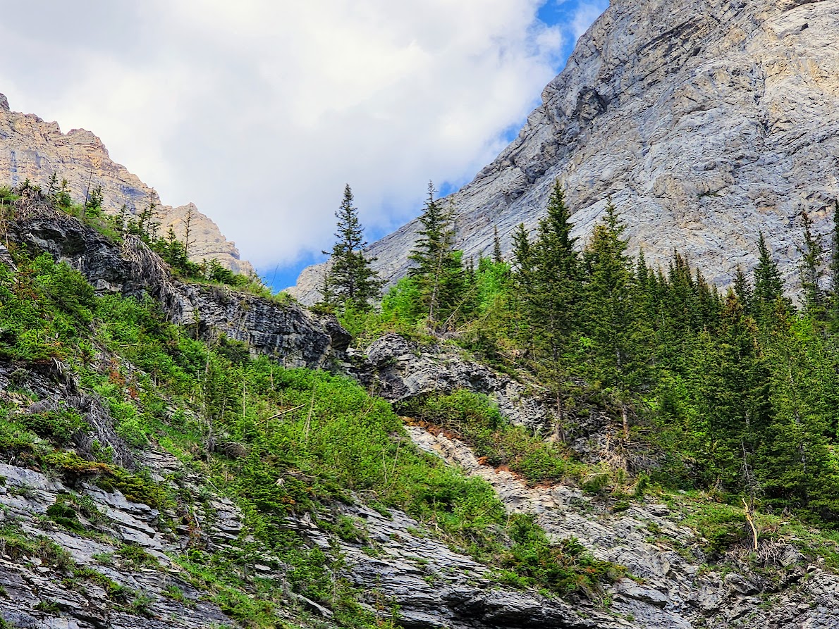
Looking across the canyon.
Views along the top of the loop.
The opposite wall.
Views of the glacier.
We only had a small patch of snow to traverse.
We found buttercups at our glacier viewpoint.
The Hooker’s Mountain-Avens were beginning to bloom.
Currently in the lower forest the yellow violets seemed to be the only flowers blooming.
The waterfalls were tall and high up the rock walls.
This was a 7.4-mile, 1,800′ elevation gain/loss out-and-back hike (according to Gaia).