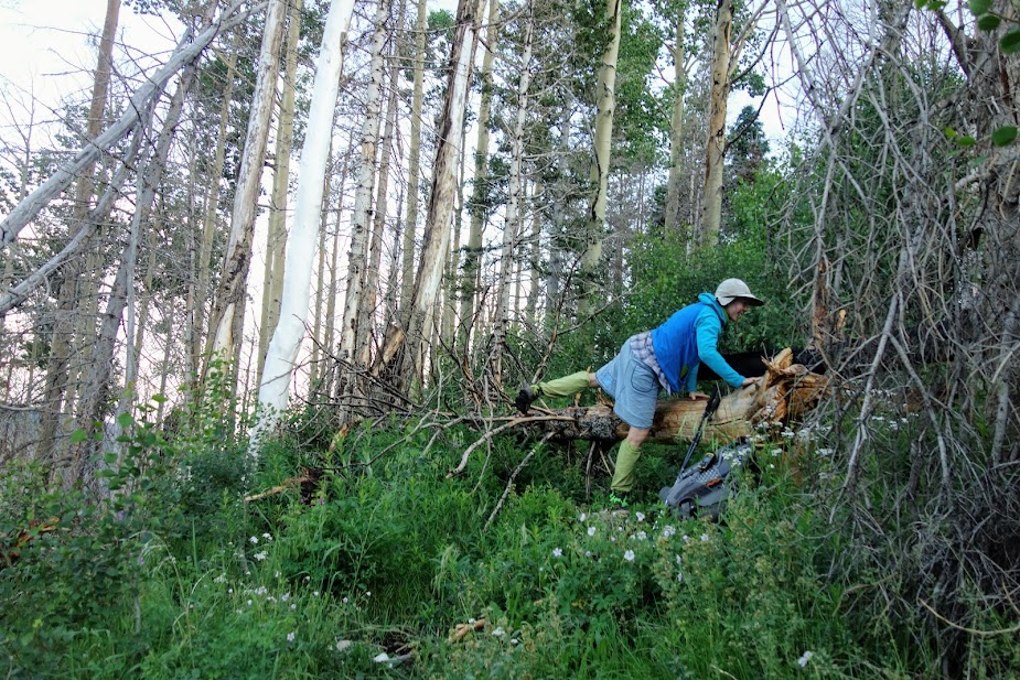
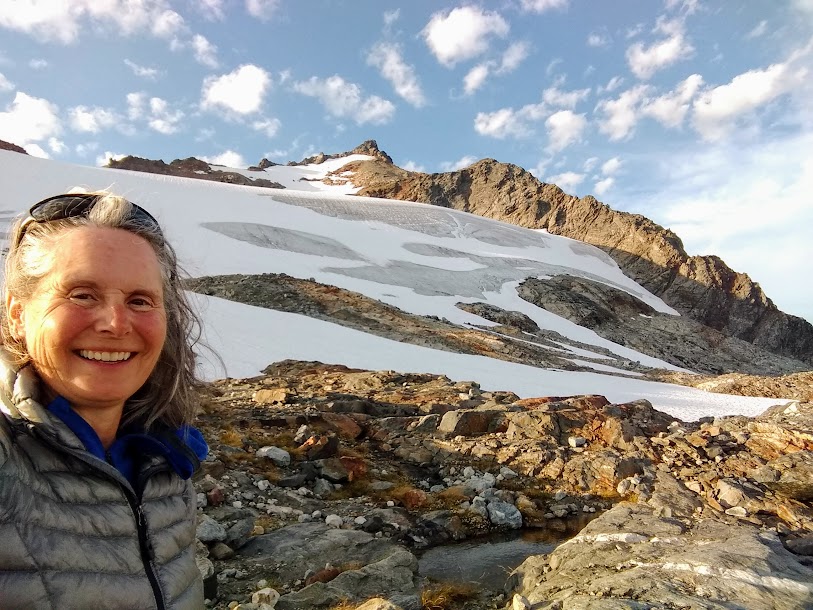
I’ll admit to being a little concerned about hiking this trail solo. It seemed like a low-use trail, and in fact, on this day there were only two of us, me and a trail maintainer.
It was a day to use my bear-alert voice. Many hikers say, “hey bear.” Another friend yells “whoop, whoop, whoop.” I’ve found A-O to be my preferred shout. I didn’t want any encounters of the grizzly kind.
A couple of days earlier I enjoyed seeing this black bear sow and cub in the Banff area.
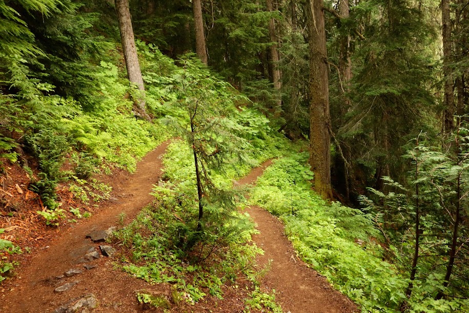
Thankfully the trail opened up and it didn’t feel so intimidating.
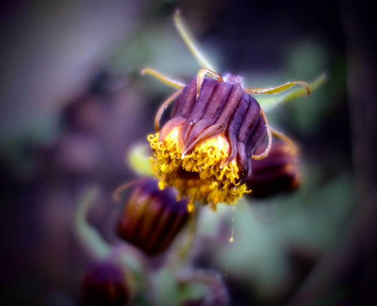
The Mountain Avens continue to delight me and have become a predominant early June bloom.
White Globeflower (Trollius laxus ssp. albiflorus)
White Pasqueflower (Pulsatilla occidentalis)
They are super tall. Bino Bob is 1.25″ tall.
A juvenile.
Sitka Valerian (Valeriana sitchensis)
Silky Phacelia (Phacelia sericea)
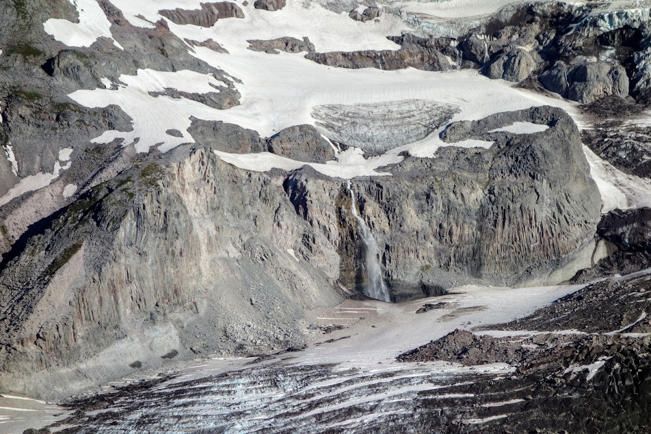
This waterfall dropped into a seriously blue pool.
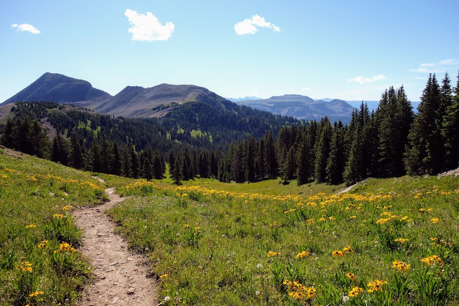
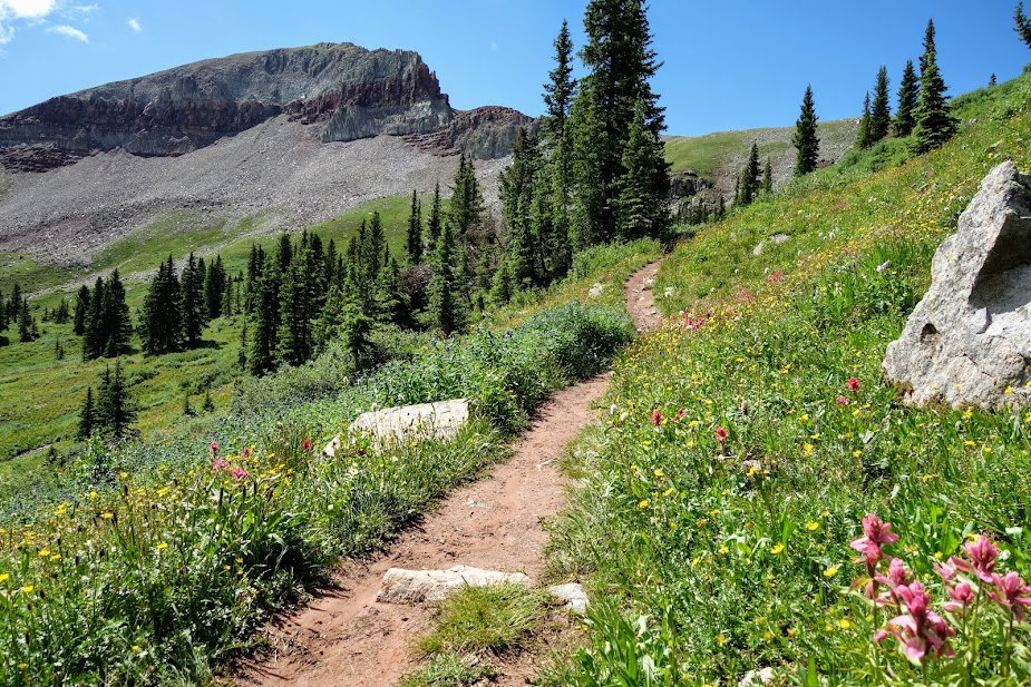
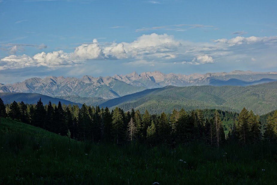
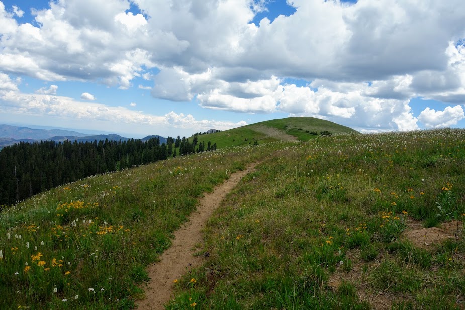
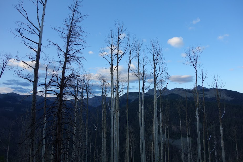
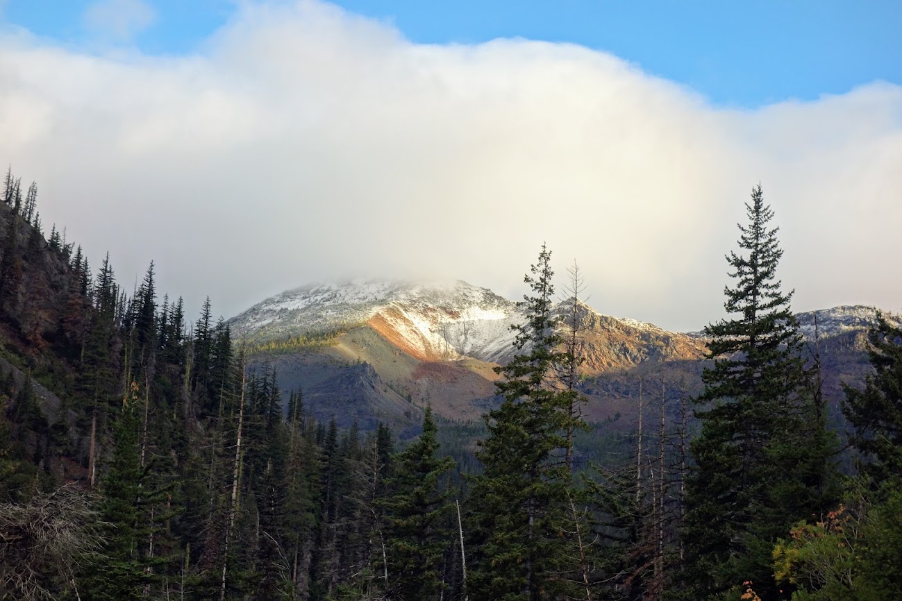
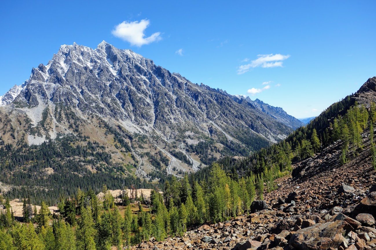
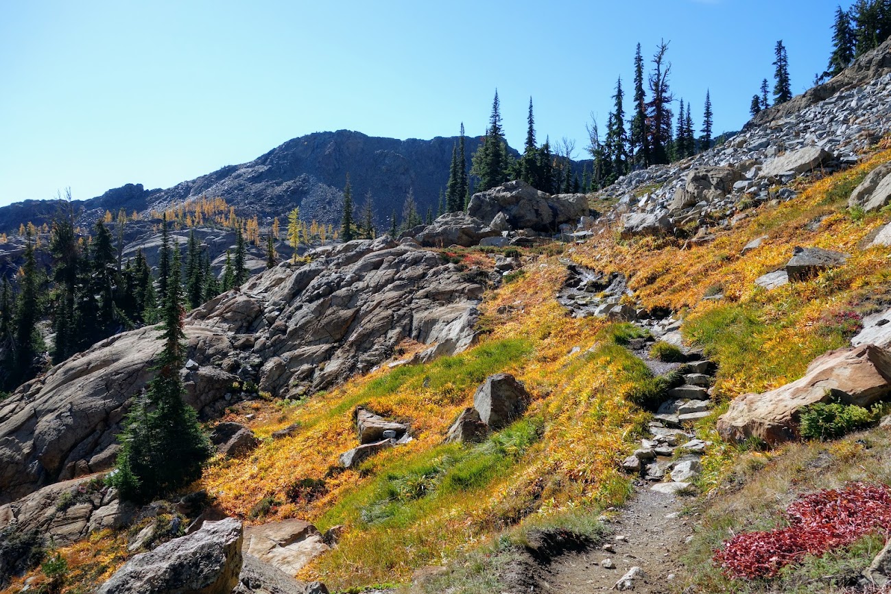
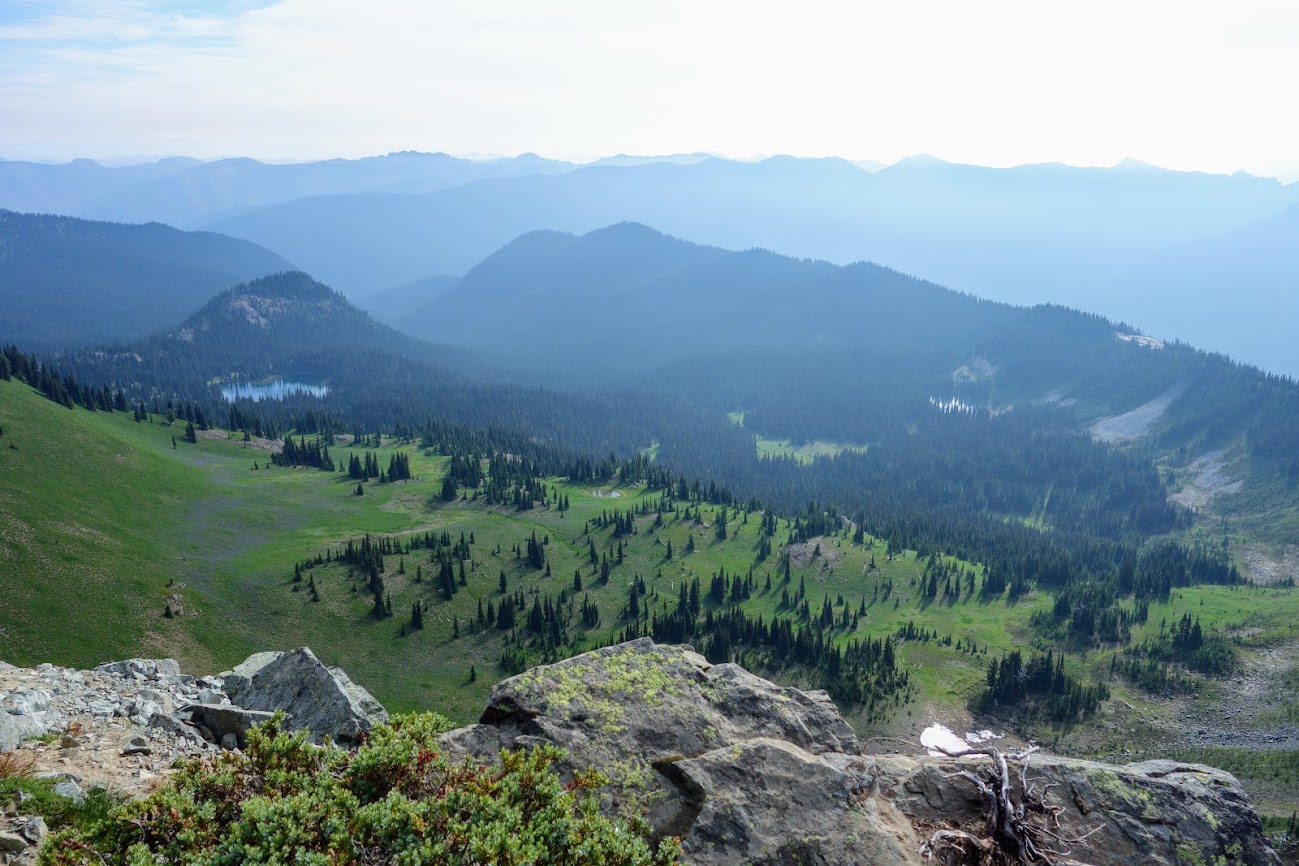
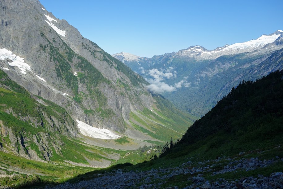
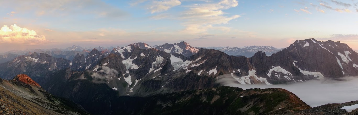
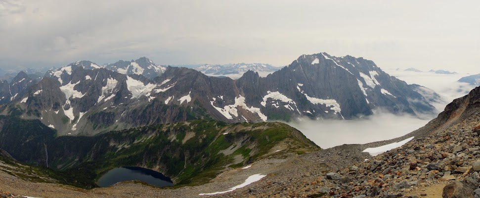
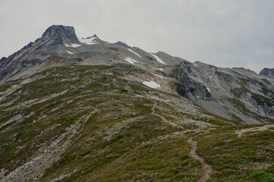
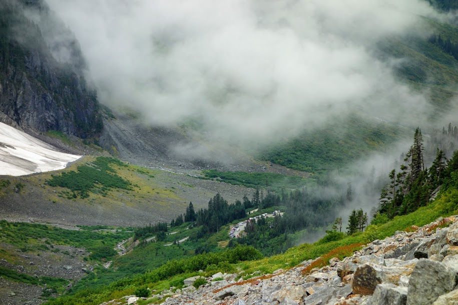
Views appeared as I began to gain treeline.
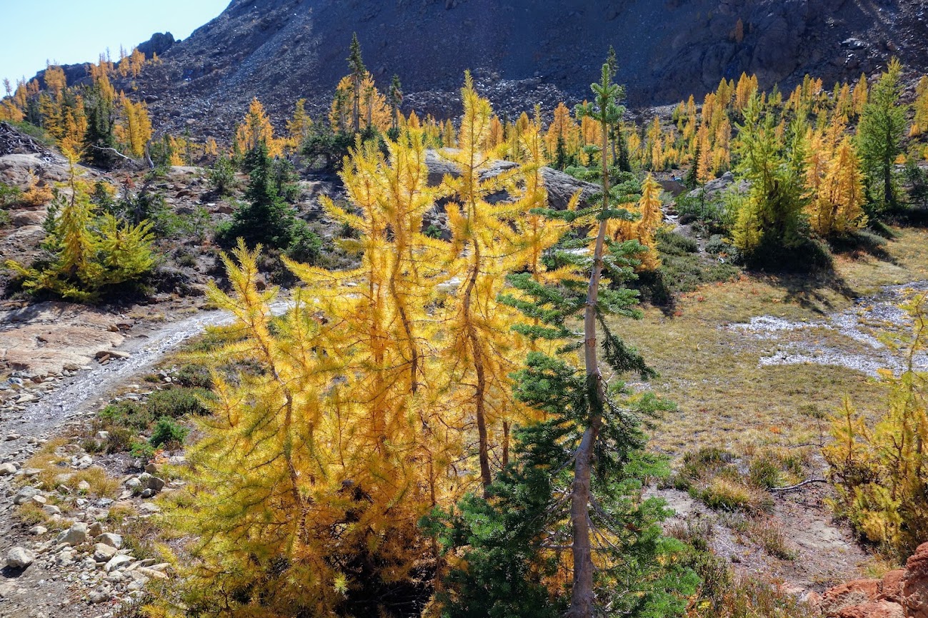
Look at those new needles on the larch trees.
Baby cones and some a bit more mature on the larch trees.
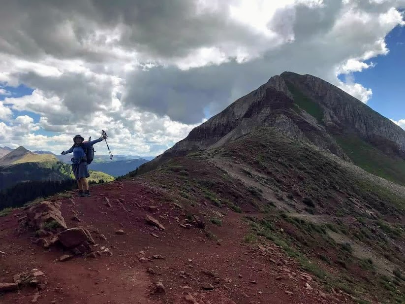
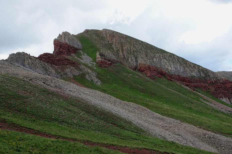
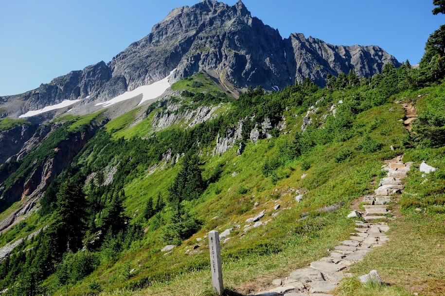
Buller Pass was finally visible.
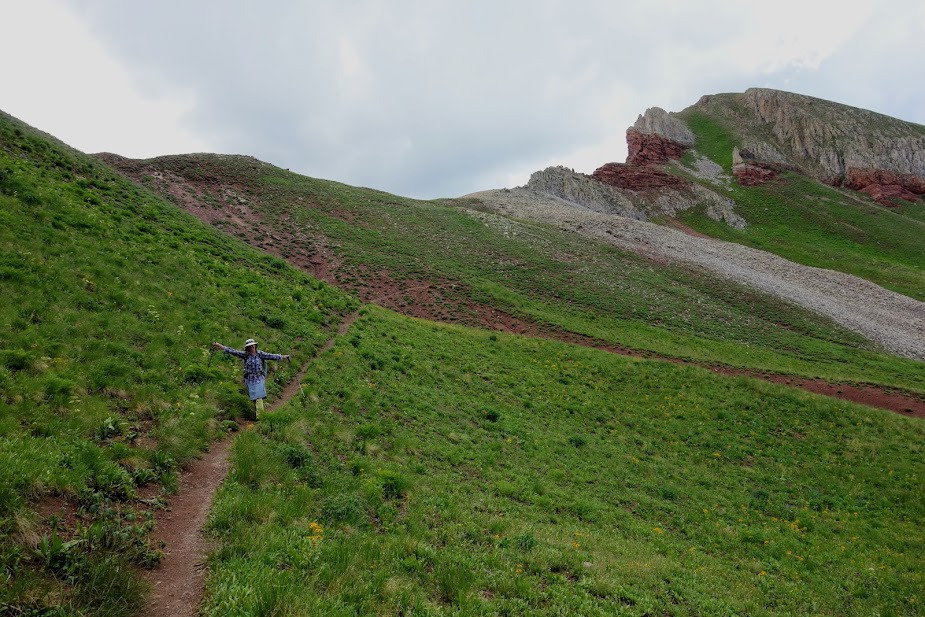
Looking back to a lovely turnaround spot for those hikers not wanting to tackle the rock and screen ascent to the pass.
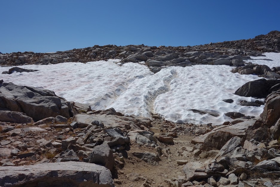
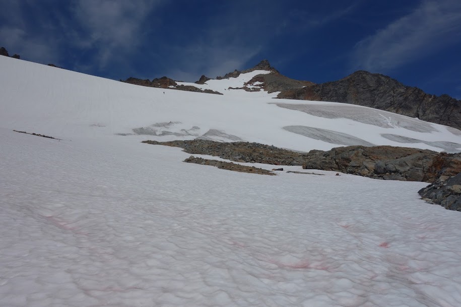
There were a few snowfields to cross and some nearby snowmelt creeks. Buller Pass is on the right side.
Buller Pass is in the distance.
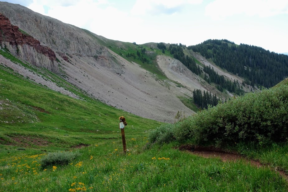
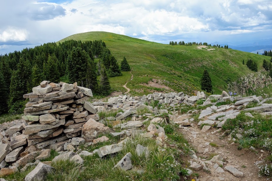
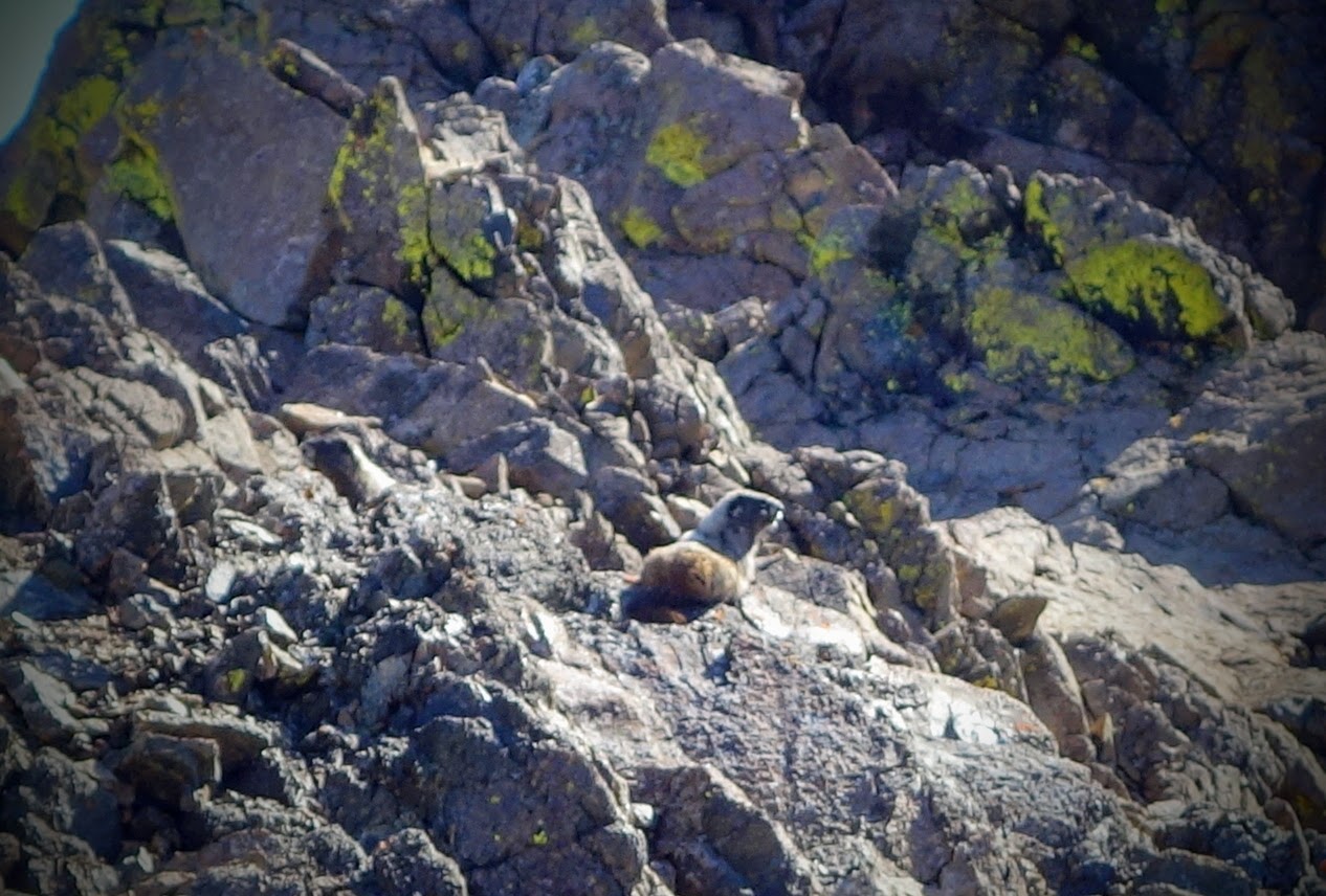
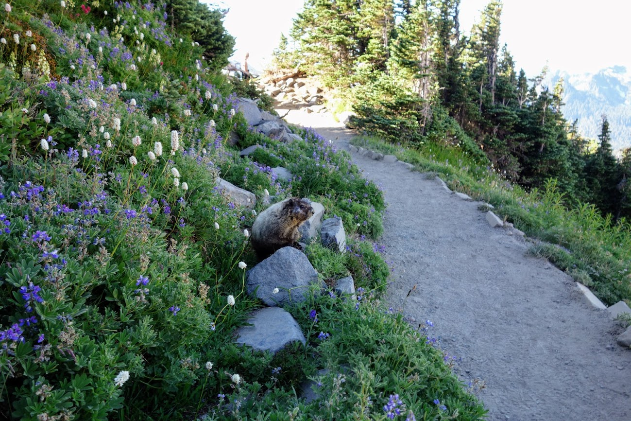
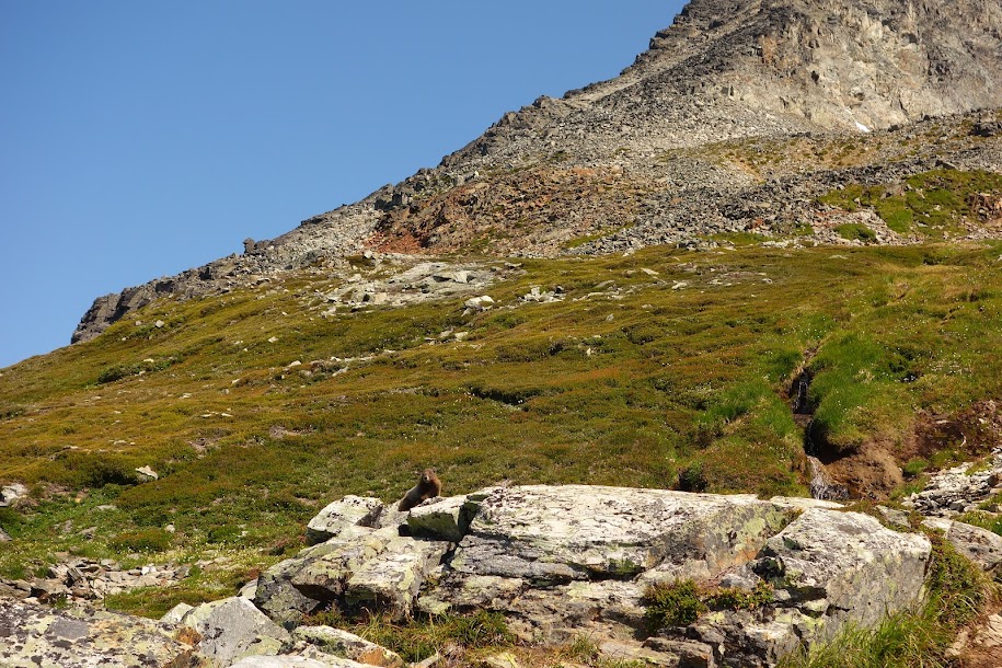
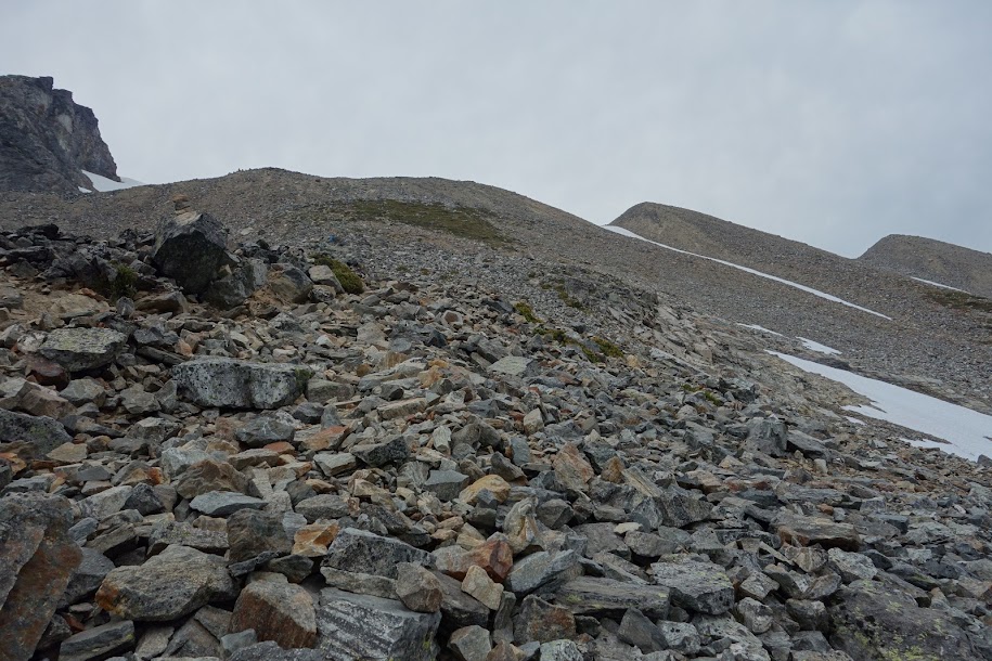
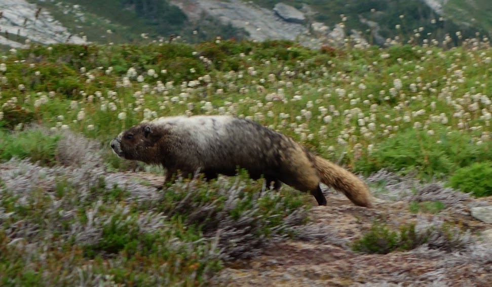
This section was tedious with some sections eroded and of varying tread. Not my favorite but not horrible either. There were marmots and pika in these rock fields.
Juvenile marmot.
There’s my trail maintainer friend on the final ascent.
Woohoo, there’s the top, such a relief after first reaching a false summit.
Looking back at what I’d climbed.
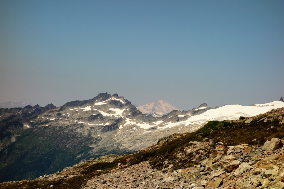
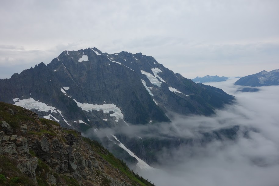
That’s Mount Assiniboine in the distance. It’s the seventh tallest mountain in the Canadian Rockies.
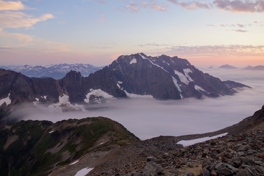
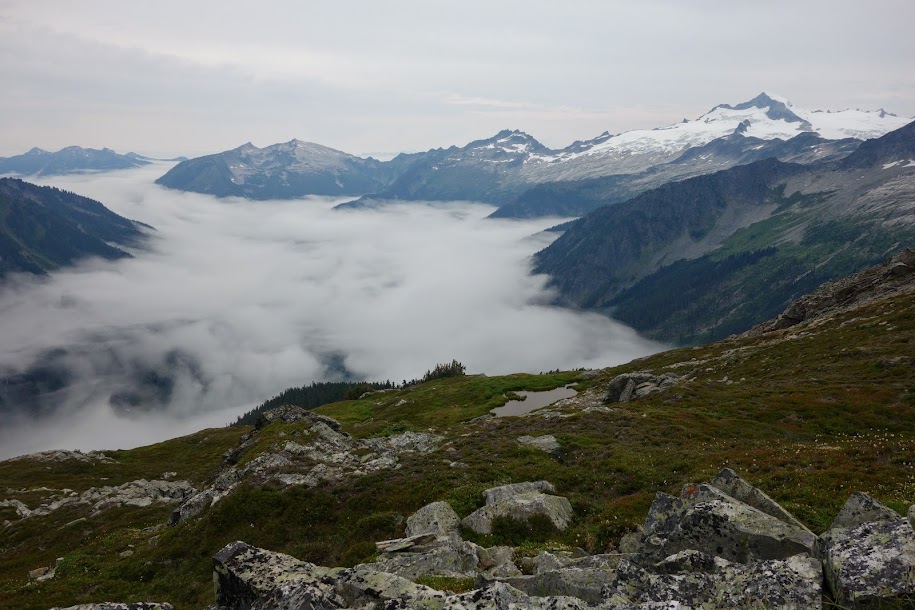
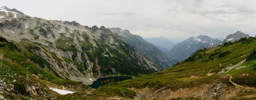
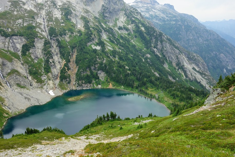
Views over the other side of the pass include Lillian or Galatea Lakes. A trail drops down to these lakes and on down to Ribbon Creek Falls which I hiked to from the other side a few days later.
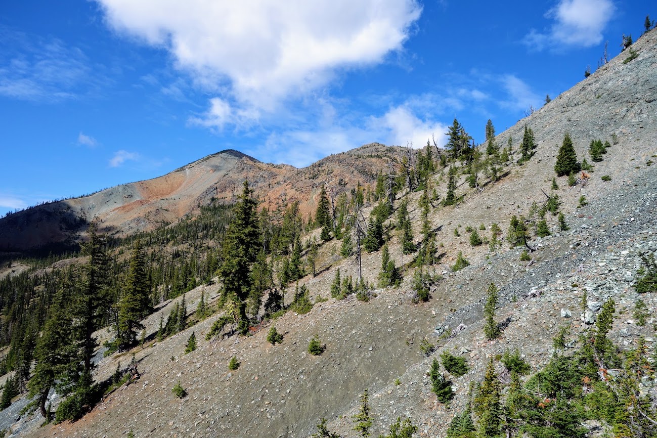
There’s a lot of rambling to be done on this pass.
This side might not be so much fun.
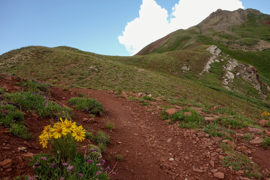
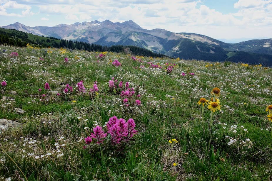
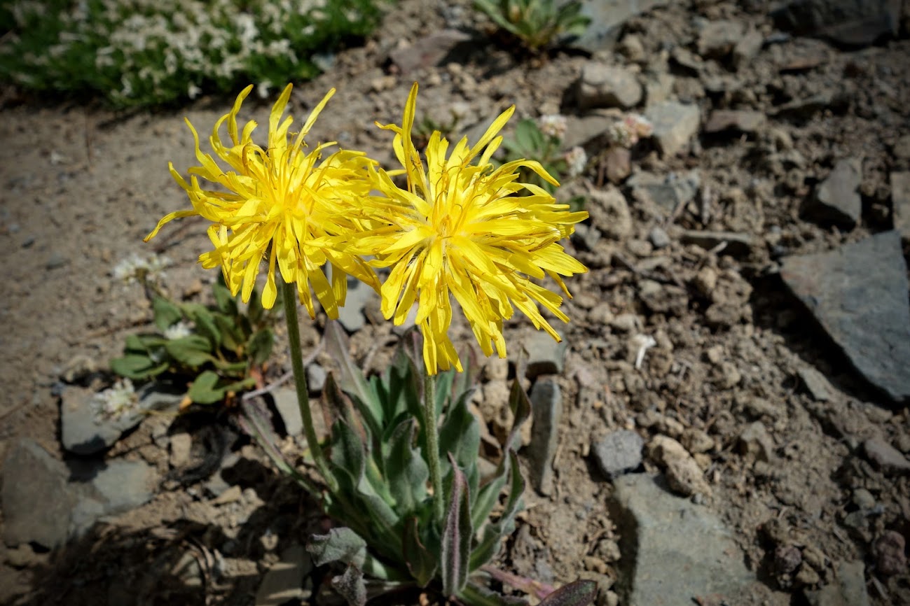
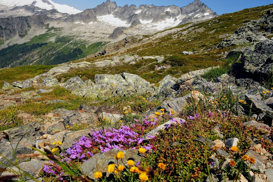
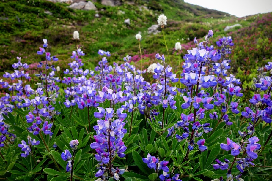
These high altitude flowers piqued my curiosity.
Using iNaturalist I learned these are Purple Saxifrage (Saxifraga oppositifolia).
American Smelowskia (Smelowskia americana)
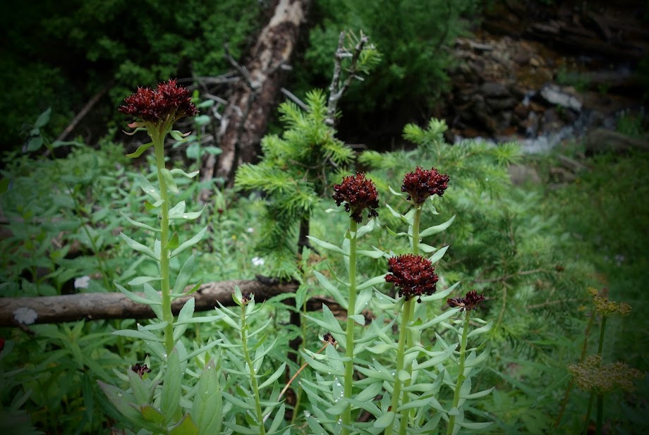
Western Roseroot (Rhodiola integrifolia)
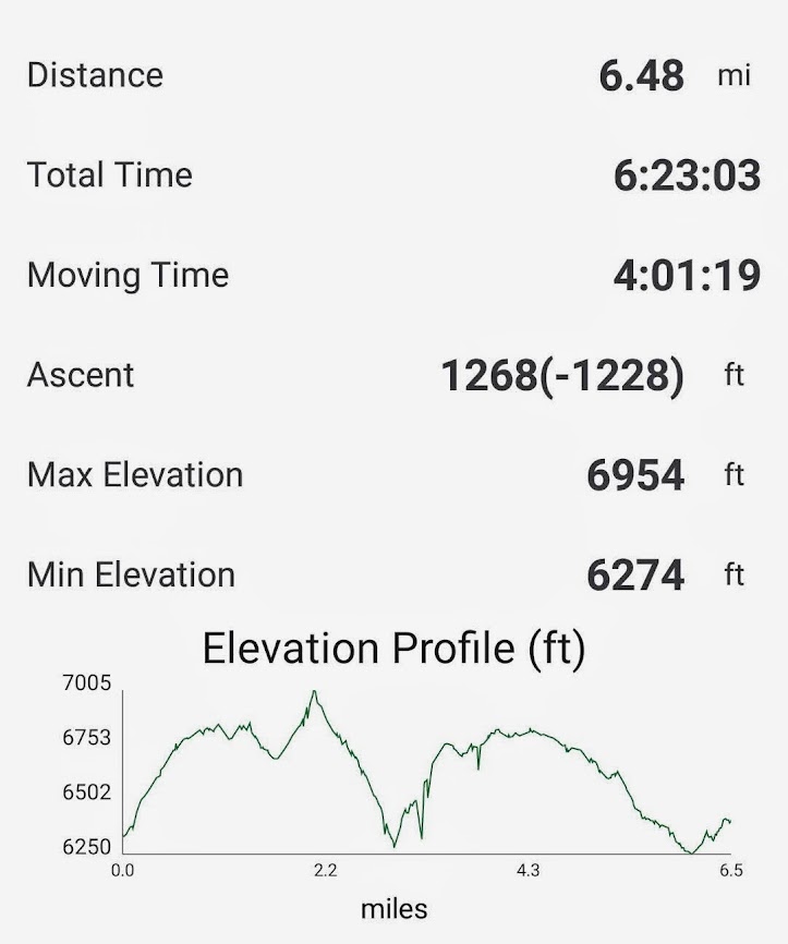
This was a 10-mile, 2,300′ elevation gain/loss roundtrip hike.
I didn’t know what to expect spending much of my time at high elevation. The quantity was miniscule in comparison to some other places I’ve hiked but some of what I saw was WOW worthy. The winner is probably this Abert’s Squirrel I saw while hiking my first section of The Colorado Trail (blog link). “Abert’s squirrel or the tassel-eared squirrel is a tree squirrel in the genus Sciurus native to the southern Rocky Mountains from the United States to the northern Sierra Madre Occidental of Mexico, with concentrations found in Arizona, New Mexico, and southwestern Colorado.” Source: Wikipedia
The runner up was what I thought was a Pine Marten until I read this “These elusive mammals are rarely spotted in Colorado. In fact, since 1991, only 30 sightings have been reported to the United States Forest Service within the state.” Further research indicates this is a Long-Tailed Weasel. “The long-tailed weasel, also known as the bridled weasel, masked ermine, or big stoat, is a species of mustelid distributed from southern Canada throughout all the United States and Mexico, southward through all of Central America and into northern South America.” Source: Wikipedia. This weasel was found while hiking the CDT from Berthoud Pass (blog link).
I only saw one bear, and with the double-tagged ears I found out it was a bad bear. One more strike and he’d be a dead bear! “Colorado Parks and Wildlife (CPW) has a “two-strike” policy under which bears may be tranquilized, ear tagged and relocated once if they in an inappropriate location (e.g. too far into town), or they have engaged in episode(s) of “nuisance” behavior (multiple visits to town, light property damage, etc). CPW only relocates bears if other less-intensive options such as hazing or community education are not deemed appropriate or effective in that situation. If a bear that has been tagged and relocated is physically dealt with again (tranquilized or trapped due to inappropriate location or nuisance behavior), the bear is put down. Bears that pose a public safety risk will be put down regardless of whether they have ear tags or not.” This bear encounter was on Colorado Trail Segment 12 (blog link).
The most frightening encounter I experienced was when this grouse decided I was a threat, and aggressively attacked me. This occurred while hiking the Uncompahgre Plateau (blog link).
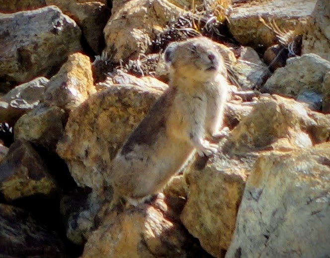
Pikas are winners are of the cute award. I wasn’t nearly patient enough to get the best photos on this trip, but I had plentiful sightings. “A pika is a small, mountain-dwelling mammal found in Asia and North America. With short limbs, very round body, an even coat of fur, and no external tail, they resemble their close relative, the rabbit, but with short, rounded ears.” Source: Wikipedia. “Colorado’s pikas are denizens of the alpine: the high-altitude, mostly treeless tundra that’s frequently exposed to temperatures well below 0°F, winds exceeding 50-100 miles per hour, and is largely covered by snow for nine months of the year. There’s no feasting for a long winter’s sleep either: like rabbits and hares, pikas don’t hibernate. Instead, they keep warm thanks to an extremely thick fur coat, a high metabolism, and a high resting body temperature of roughly 104.2°F. Pikas have an ingenious adaptation for surviving the winter months without access to fresh food. In Colorado, pikas will spend most of the summer collecting grasses and forbs (flowering plants) from nearby alpine meadows and then laying them out to dry in organized collections tucked in amongst the talus. These so-called ‘haypiles’ serve as the winter food cache for each pika: its lifeline to survive until the next summer. Because of this, pika territories and haypiles are defended fiercely!” Source: Colorado Pika Project
The marmots are the opposite of pikas given their happy feasting in preparation for hibernation. They love to laze around in the sun like a fat cat. They tend to be opportunists as well snagging treats from unsuspecting hikers; they were the welcome committee at many sign posts and sitting rocks. This was my first sighting of a juvenile marmot.
Lucky sightings of a Bobcat on the Uncompahgre Plateau (blog link) and Coyote in the Holy Cross Wilderness (blog link).
This Collared Lizard wins the most colorful award. He was spotted while hiking in Dominguez Canyon (blog link). Others in the small critter category were Rabbits and Squirrels.
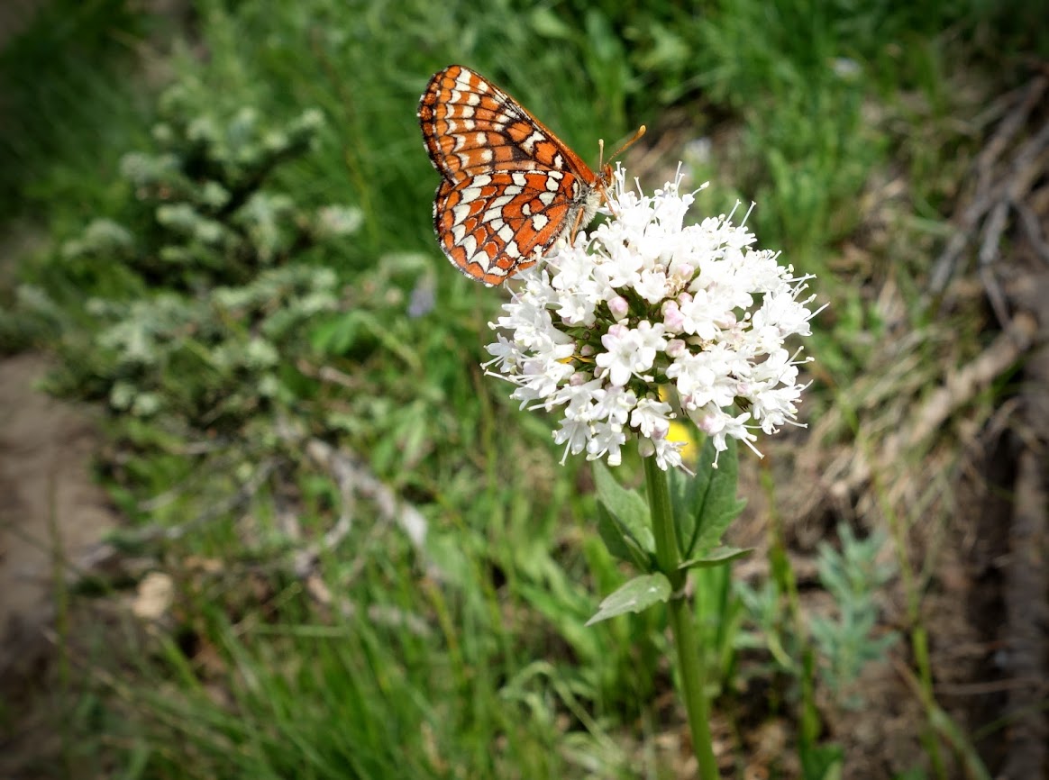
Hard to resist two favorites wildflowers and butterflies. Hummingbird moths were a bonus.
Big Horn Sheep were found while hiking trails in Black Canyon of the Gunnison (blog link) and the Holy Cross Wilderness (blog link). The younsters were seen on my segment of The Colorado Trail (blog link) The only moose sighting was this one while hiking Collegiate West Segment 3 of the The Colorado Trail (blog link). I saw plenty of deer but no elk, although lots of scat.
Grazing Sheep and Livestock Guard Dogs were a bit problematic. I encountered them twice. The odor was overwhelming.
And then there were the pests. The flies were much more bothersome than the mosquitoes, although thankfully most weren’t biters. Open cattle grazing is one of my least favorite activities. I searched unsuccessfully for Bigfoot and this Woolly Mammoth.
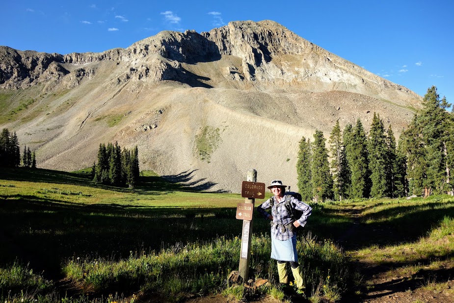
Most everyone agrees the San Juan Mountains are one of the WOW sections of the trail. With early melt this year, they were ready when Joan had time off and we could coordinate another J&J adventure.
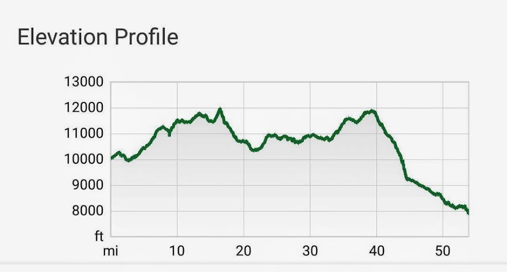
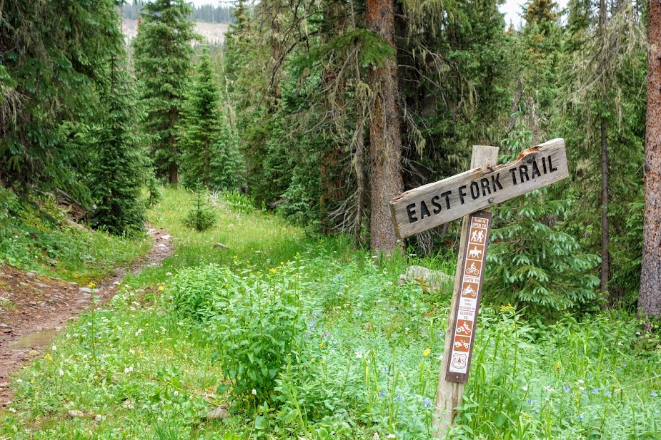
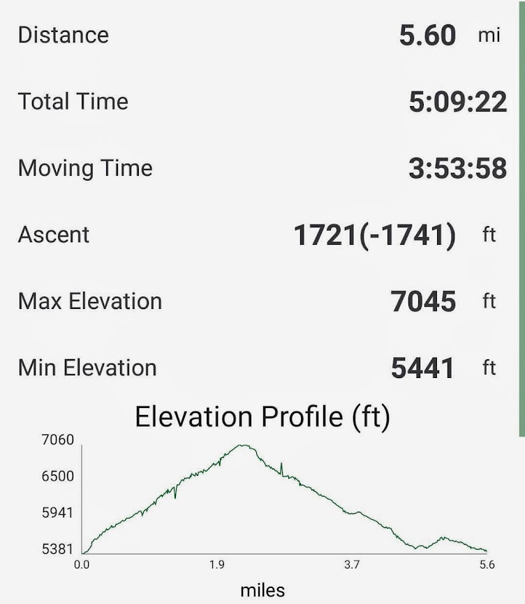
Joan created a route where we could shuttle cars between two trailheads on Highway 145, East Fork and Bear Creek. These trails both connect to THE Colorado Trail, the more northern to Segment 26 at Bolam Pass, and the southern at Indian Trail Ridge in Segment 27 (leaving me a few miles short of completion). These segments are 31.5 miles with 6,013 elevation gain and 5473′ loss. Our route was 50 miles with 4,500′ elevation gain and 6,500′ elevation loss.
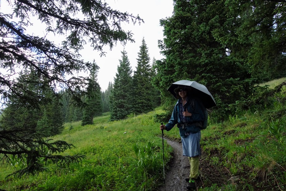
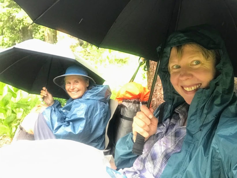
It was a day to test our rain gear and systems, which we would ultimately use daily. It reminded us of our time in Washington on the PCT a few years ago.
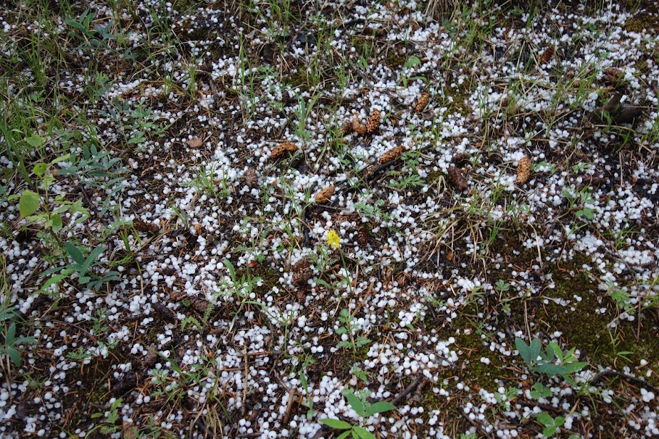
Hail also became a daily occurrence. Our umbrellas and tree cover made these time-outs more tolerable.
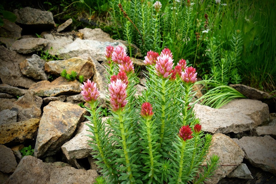
I’ve been trying to capture good photos of these plants for weeks. Still not a great image but I did learn they are Kingscrown (Rhodiola integriflia).
This is a similar but different plant, most likely a clover.
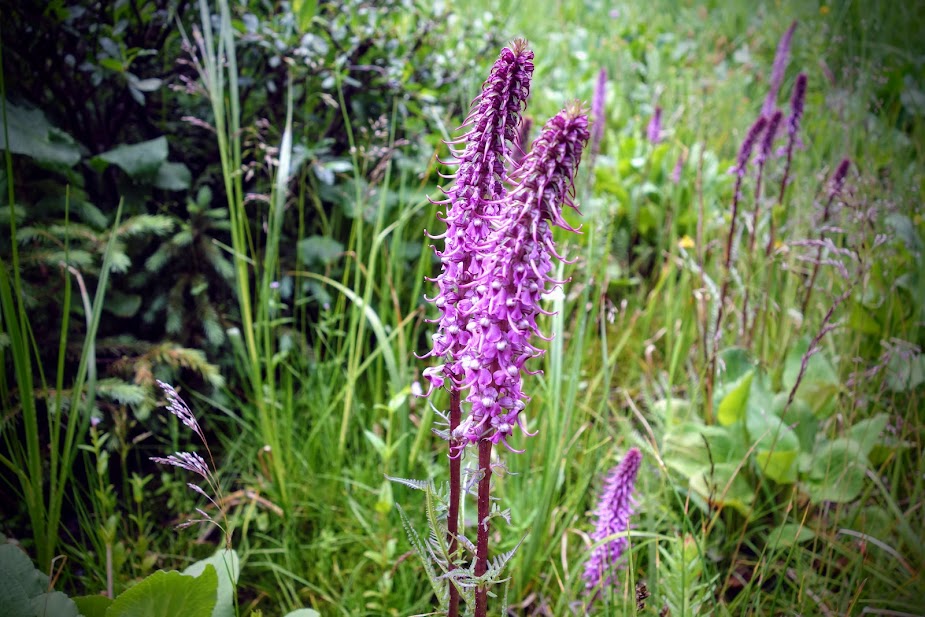
We found lots of Elephant Head Orchids.
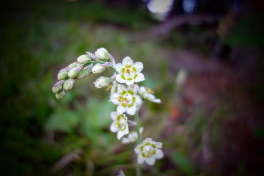
I should have taken more photos of this bloom, as this image is a bit blurry. It was fairly common plant.
We saw a ton of these in bud and a few starting to open but none in full bloom.
Near Bolan Pass there was a seriously mucky muddy road to walk. It was like walking in mashed potato snow, nearly as bad as postholing. We were so happy to get back onto a single track hiking trail.
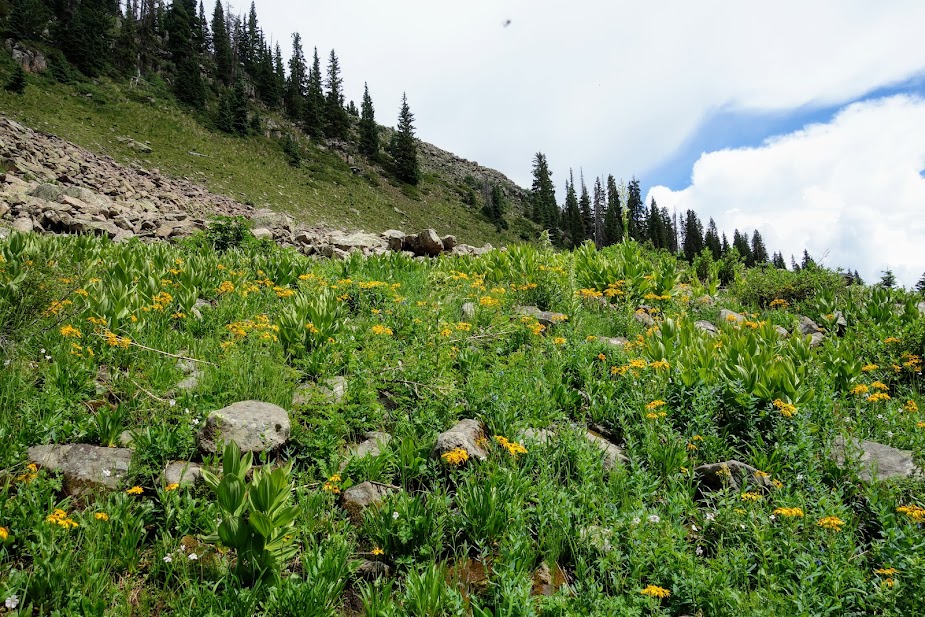
With a 70% chance of daily rain and thunderstorms, the flowers were thriving.
Our first night we camped near Celebration Lakes. We happily stopped early to dry out and get camp set up before more rain.
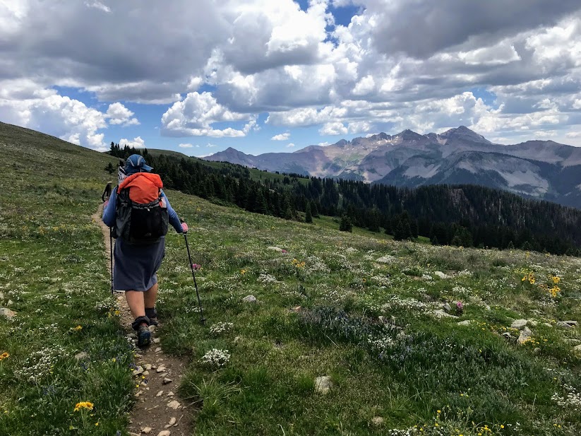
We didn’t have to go too far the next morning before we found mountain views we crave.
We loved walking next to Hermosa Peak.
The next objective was Blackhawk Pass, but first a look back at Hermosa Peak.
Colorful Blackhawk Mountain.
Just when you think you are getting close . . .
You find more and more and more climbing to be done, and the inevitable building of clouds.
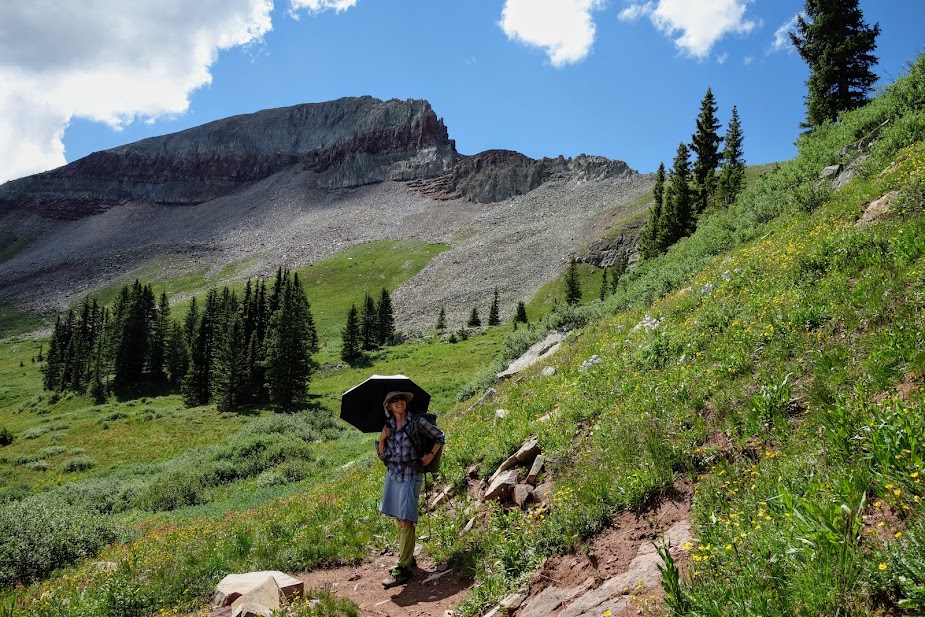
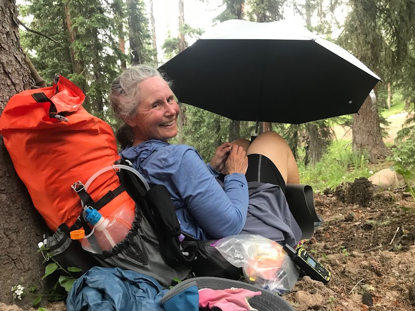
Joan also uses her umbrella for sun protection and heat management.
Near the top of the pass, we could see the use trail to Blackhawk Peak (12,681′). No, we weren’t tempted.
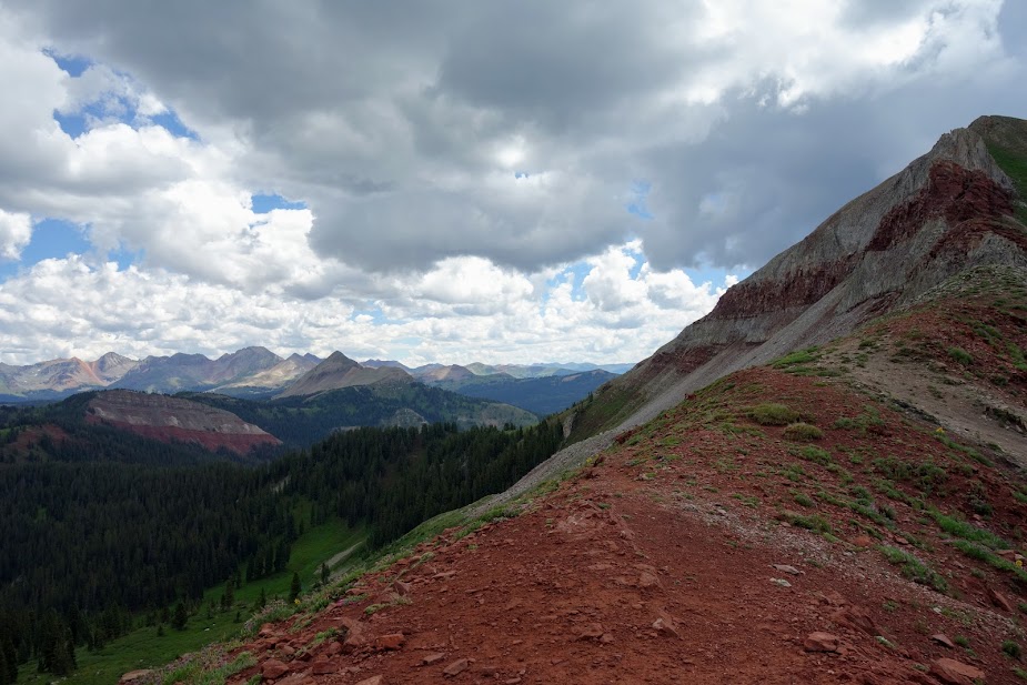
The 360-views of the Rico Mountains were amazing.
It was impossible not to celebrate at the pass.
I enjoyed finding these blooms I first saw at Colorado National Monument a few weeks earlier, now I just have to remember the name.
With thunder rumbling and clouds building we didn’t get to lollygag at the pass near as long as we would have liked. I believe this is Whitecap Mountain (12,376′).
As we headed down we were greeted by a marmot (zoom to sign).
We found a great campsite that offered the best of both worlds, views yet protection during thunderstorms.
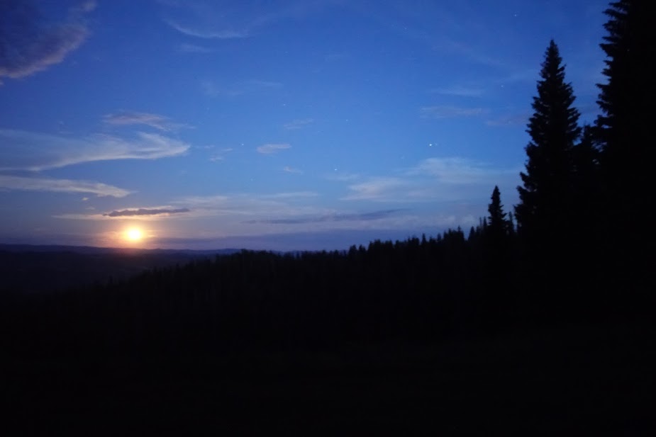
I woke up and saw the full moon rising.
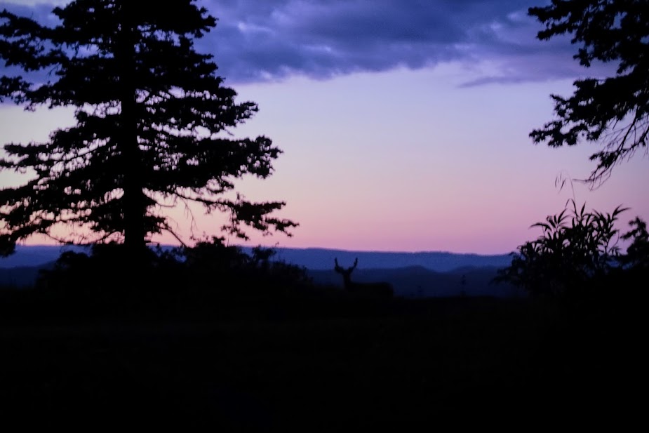
This buck seemed to like this area and spent a lot of time roaming back and forth. I couldn’t grab my camera in time to get the best photo but when he came back for a second lap I caught this one.
This day started without much WOW, but we still found reasons to smile. This is part of a long waterless stretch that we’d started the previous day.
I was thrilled to discover we’d arrived at our exit junction much earlier in the day than planned which allowed us to spend a bit of time on the Indian Ridge Trail. This is looking up toward that 5-mile trail section. We really wanted to camp up there if we could find a thunderstorm safe area, but alas without water and only slanted lumpy options we dropped some of our gear before heading out for a jaunt.
With an eye on the clouds and an ear on the thunder, off we went to play in these huge tundra meadows.
Alpine tundra plants showcasing the La Plata Mountains.
This ridge is a pika and marmot playground. This area isn’t flat and in fact we turned around 2.5 miles short of the high point. I’ll have to catch from the other side if I want to complete Segment 27.
After all that frolicking it was time for a rest and no one does it better than Joan, although she still has her shoes on which is a rarity during breaks.
Joan caught me at some point taking shelter from the hail.
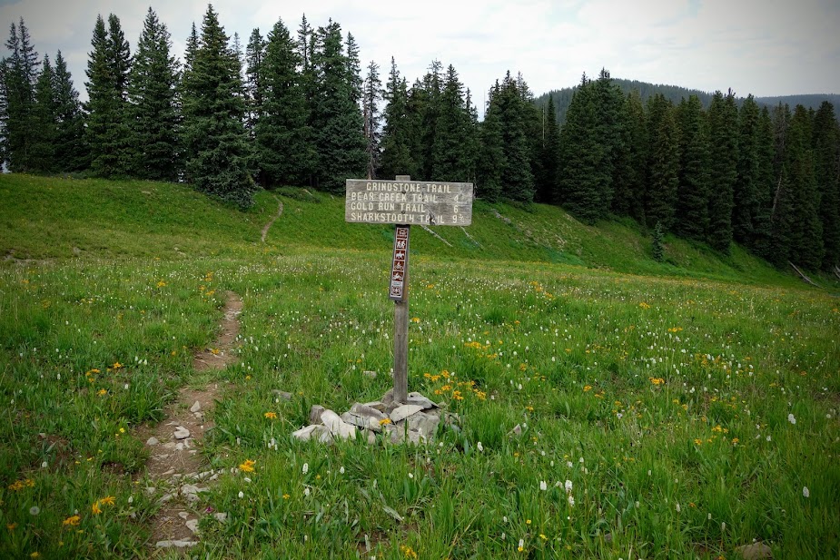
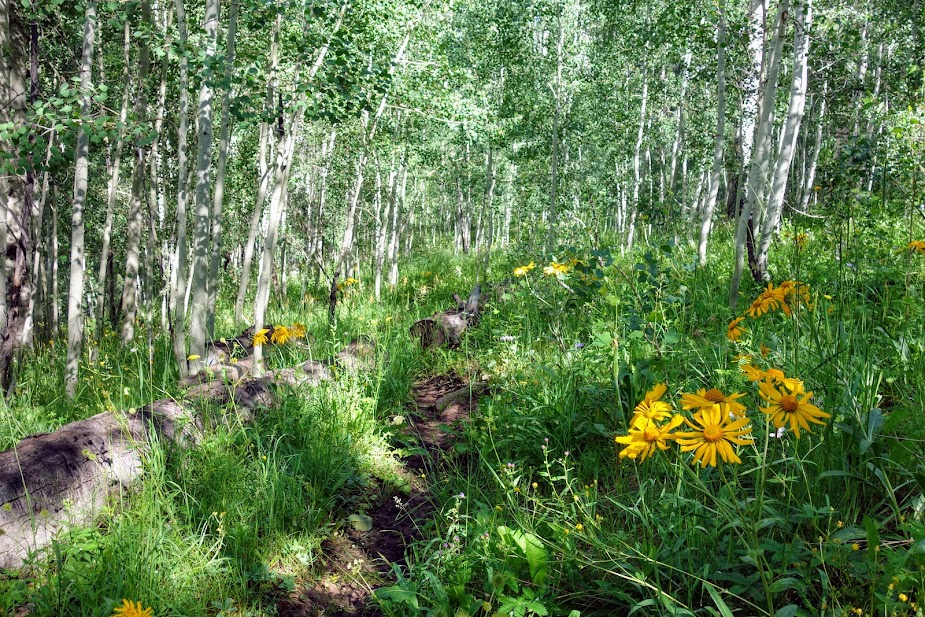
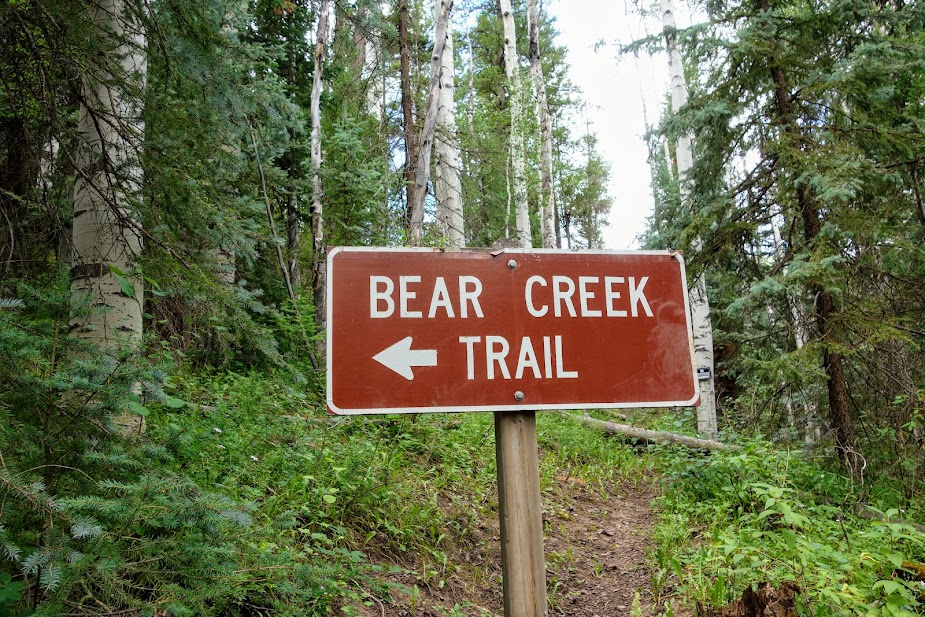
Our exit was via the Grindstone to Bear Creek Trails.
We had views back at where we’d been and used our Peak Finder apps to determine the names of others.
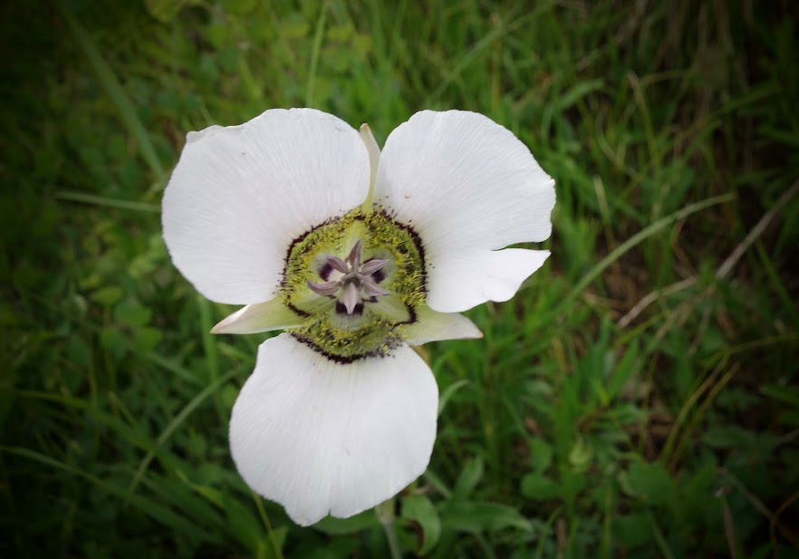
Hidden in the grasses we found a large collection of mariposa lilies.
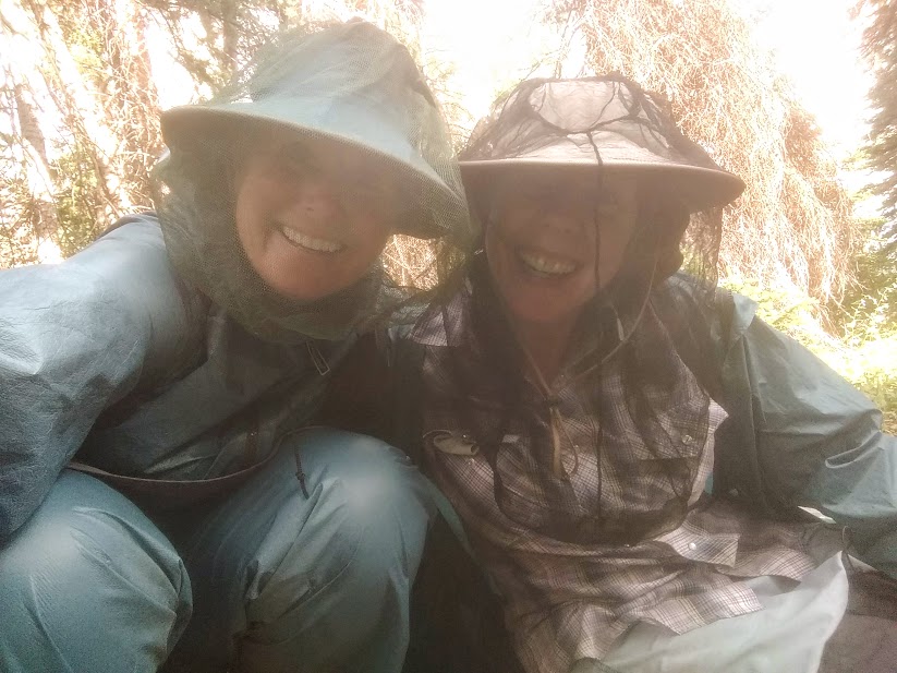
The flies were quite bothersome on this trip, not necessarily biting flies but irritating with tons landing on and buzzing us. Of course there were some mosquitoes as well. Our defense was rainwear and headnets.
I wouldn’t necessarily recommend the Grindstone Trail as it’s low use, overgrown, with recent burn and many log obstacles. Safe campsites were hard to find while water was not.
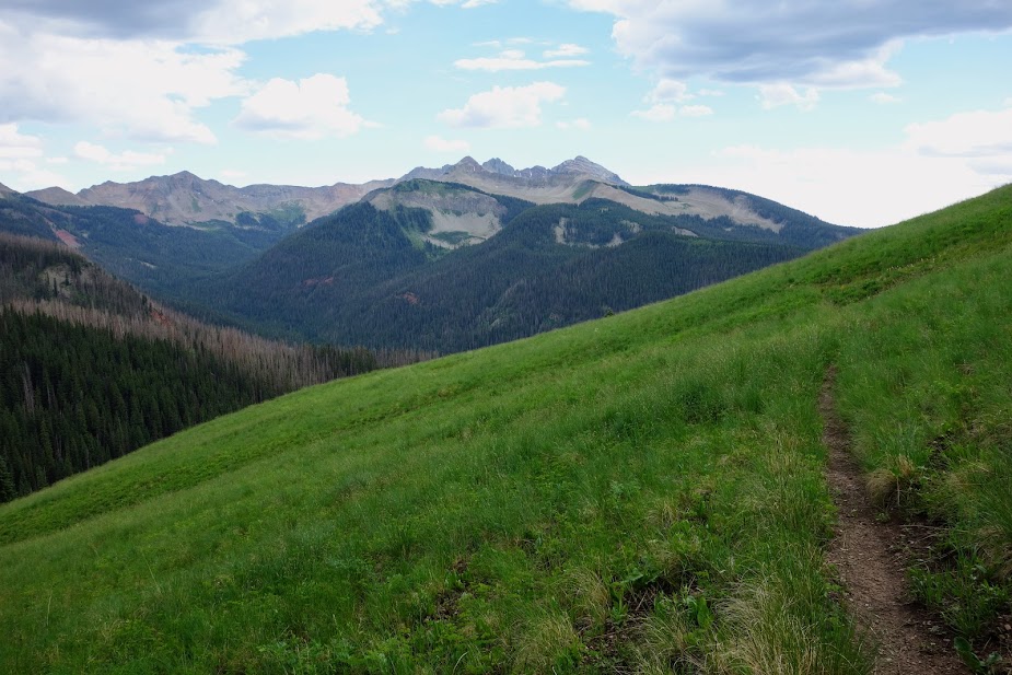
As we dropped elevation we were provided a few filtered views of the La Plata Mountains.
The upper portion of the Bear Creek Trail was filled with meadows and views of the burned trees.
Where’s the trail? After all the recent rains, our lower half was soaked from the wet plants.
We enjoyed the aspen groves as a break from the tall grasses..
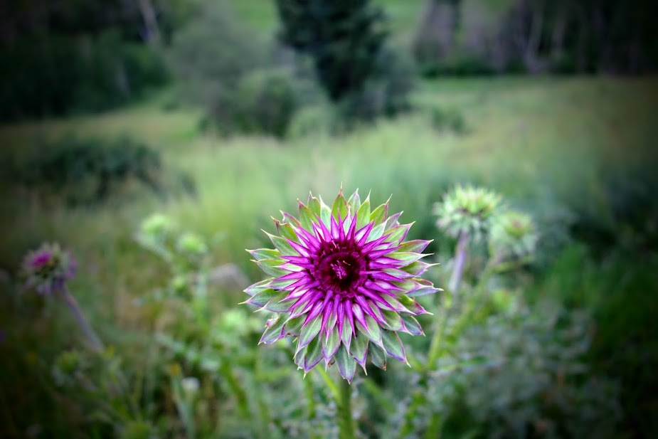
Sadly an invasive thistle has filled many meadows. They were 6-8 feet in height.
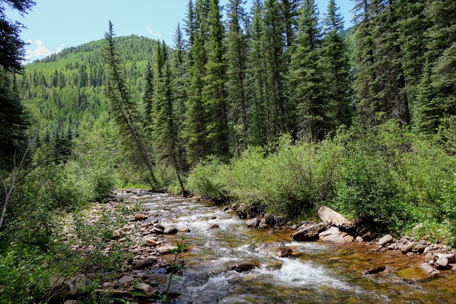
We only saw one hiker on our exit trail until near the trailhead, although we did see a few folks fishing along Bear Creek.
I’ve gotten spoiled hiking the wide and well maintained Colorado Trail, and at this point in my fitness much preferred to this side trail.
This J&J adventure ended much too soon, but it won’t be the last. Where and when who knows, but until then I’ll continue to hike more miles on the Colorado Trail.
Poppy the Pack (blog link) is well broken in after many trail miles. Most likely I’ll make a few revisions on my second version I plan to make this winter.
As of this post I’ve hiked 191 miles toward completion of The Colorado Trail plus 114 bonus miles and over 51,000 feet of elevation gain/loss.
Tips:
The Guthook/Far Out App and Colorado Trail Association Guidebook and Databook are helpful in planning section hikes. The guidebooks details parking and trailhead options along with the elevation profile. Far Out was a great way to plan my turnaround based on mileage and elevation gain/loss. I also used Gaia with the Colorado Trail Nat Geo layer.
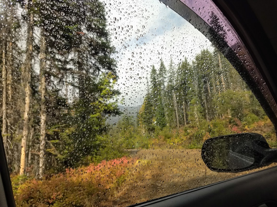
The forecasters got this one wrong. I like to camp near trailheads so I can get an early morning start. Well on this day instead of hiking I read. Living in your car has some drawbacks and on long rainy days there aren’t a lot of options. Yes I could have been like those I saw hiking anyways, some carrying backpacks. That’s the difference between those from the Pacific Northwest and this sunny Californian. I also could have driven back to town but I don’t like wasting gas and since hanging out inside was something I avoided during COVID times, that wasn’t a great option either.
As I drove to the trailhead the next morning, I was mostly excited to see this view of I believe Fortune Peak, although a little concerned about snow since I didn’t have my microspikes or weatherproof shoes with me. Afterall I packed for this trip when it was over 100 degrees. I met a few of the backpackers coming down after a wet cold night. They were regretting not waiting a day for better weather and views.
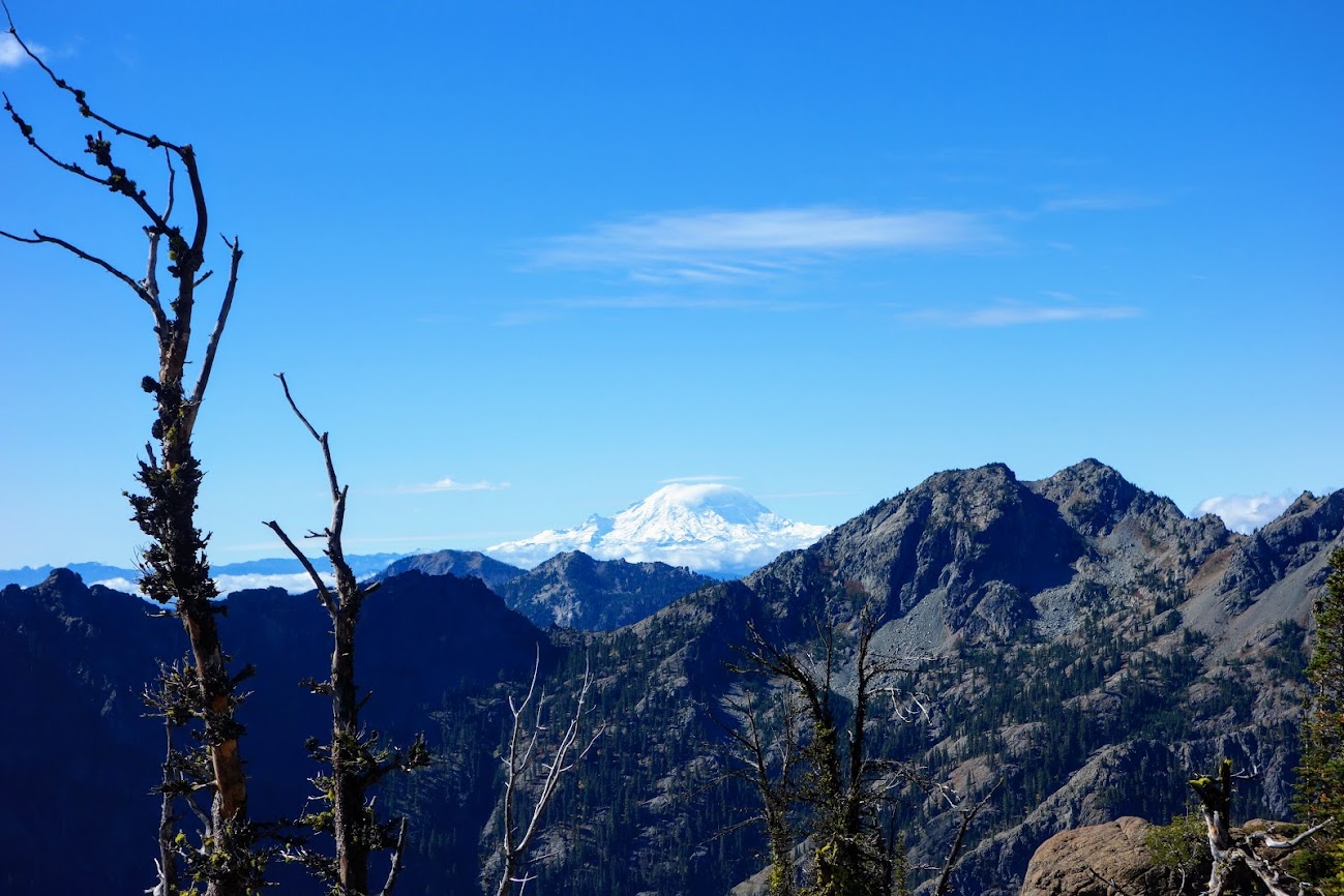
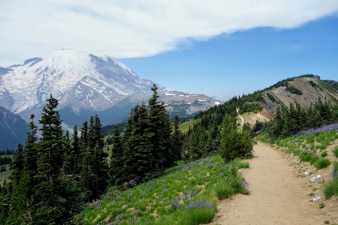
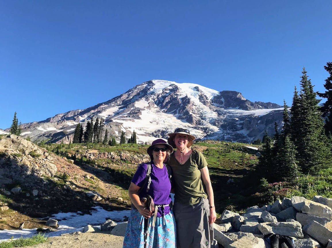
It was a great hike to the pass. I had views of Mount Rainier and cloudy views of either Mount Adams or Mount Saint Helens. The Esmeralda Peaks are in the foreground.
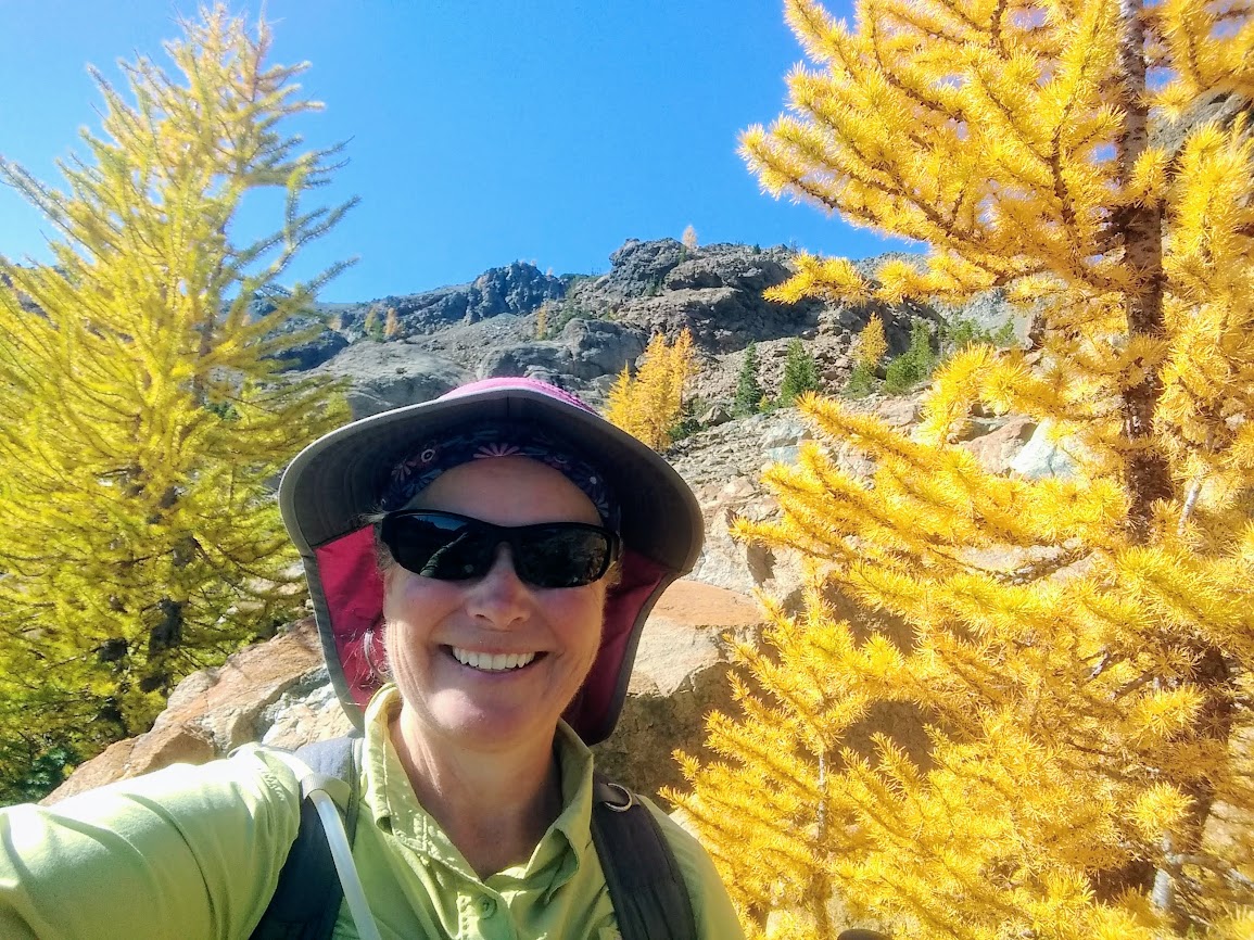
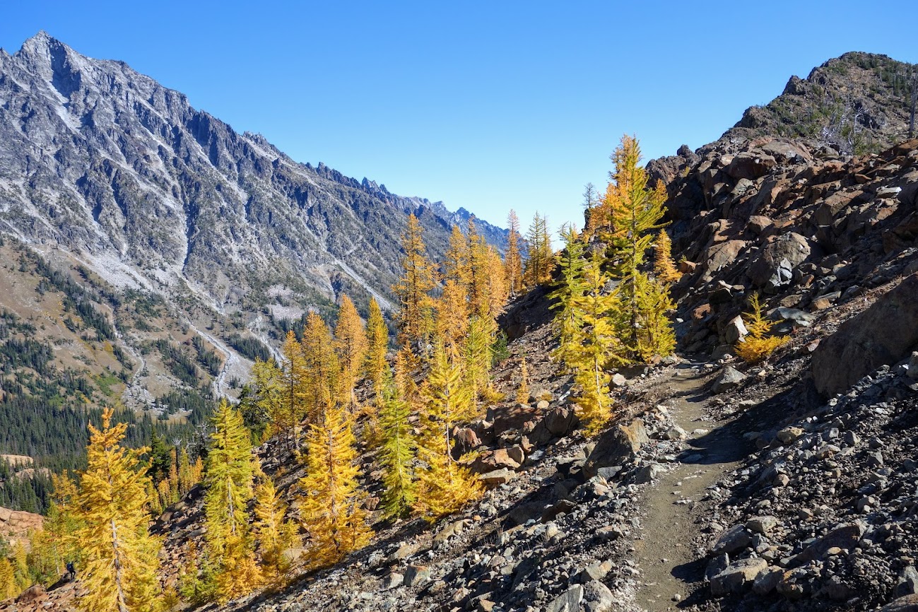
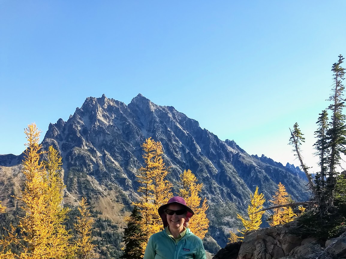
Finding larch turning yellow at the pass and seeing Mount Stuart with it’s first dusting made Ingalls Pass a worthy hike.
This is looking down into Ingalls Creek drainage which I’d hiked from the other end a couple weeks previous, though not quite making it this far (blog link).
At the top I found a marmot enjoying the warm sun.
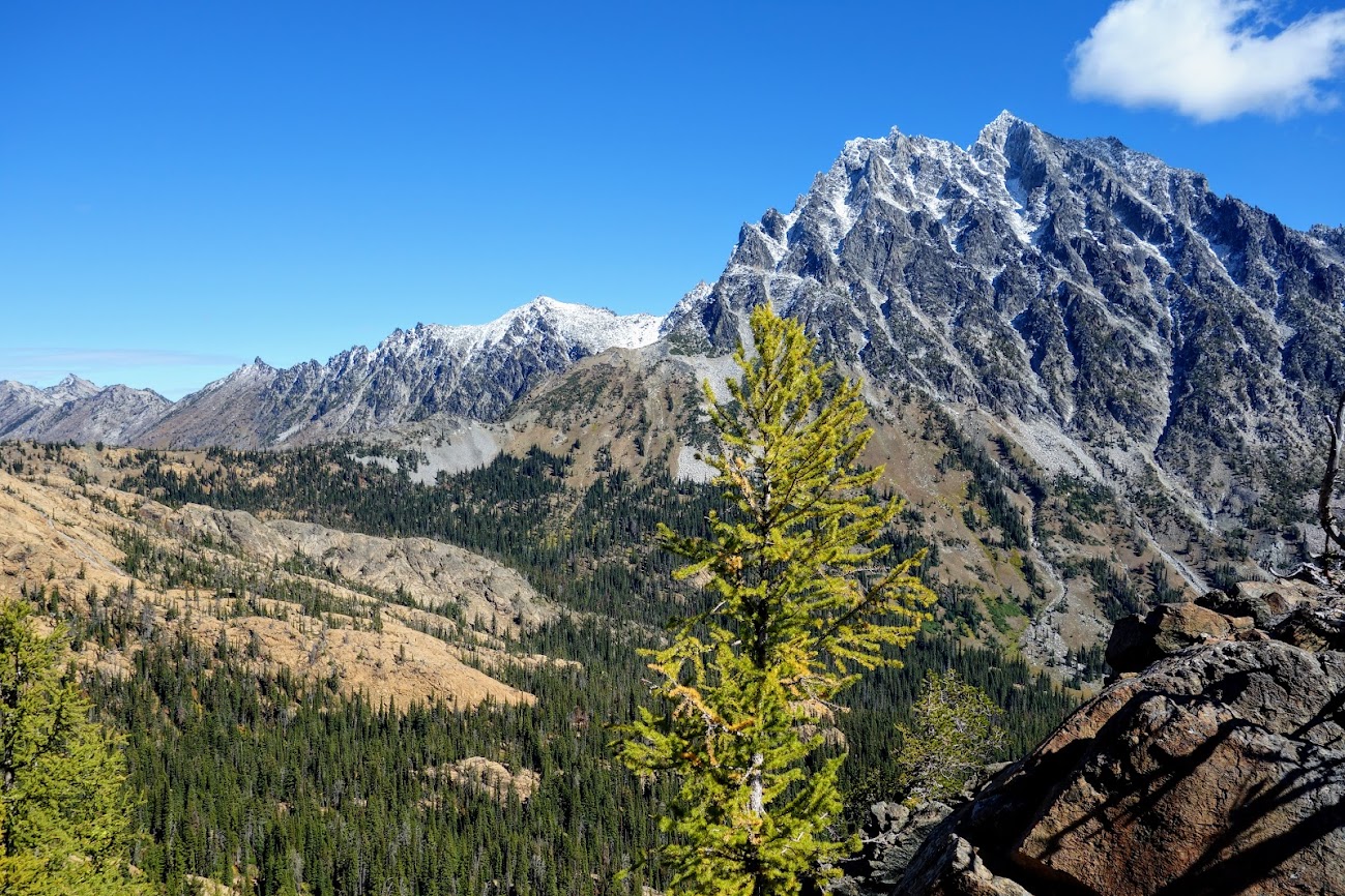
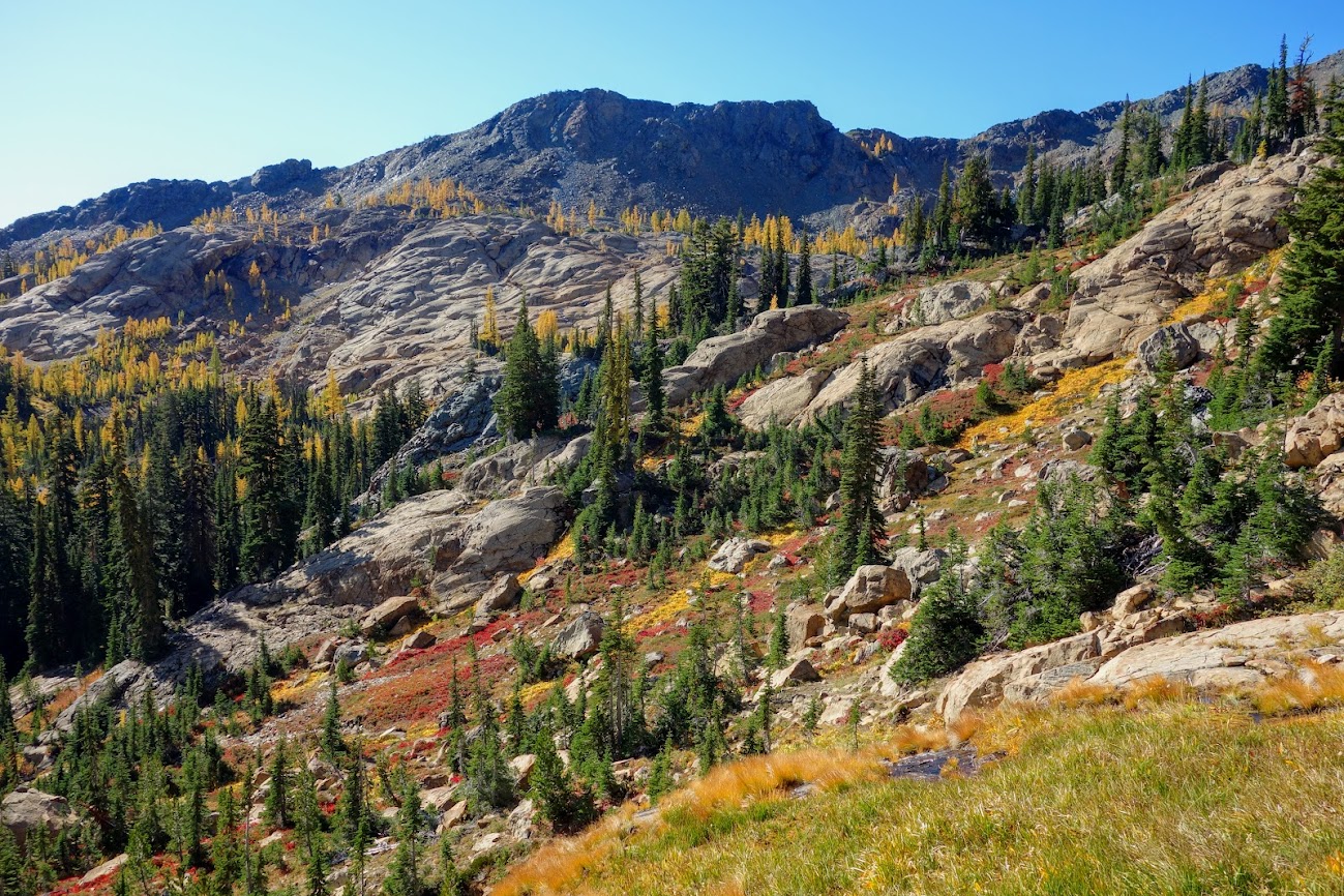
The colors remind me of California’s Klamath Mountains. Ingalls Pass is to the right in front of the colorful mountains which I believe includes Fortune Peak on the left.
In one of the rock fields, I took time to watch the pika scurry about. This one blended well with the rocks.
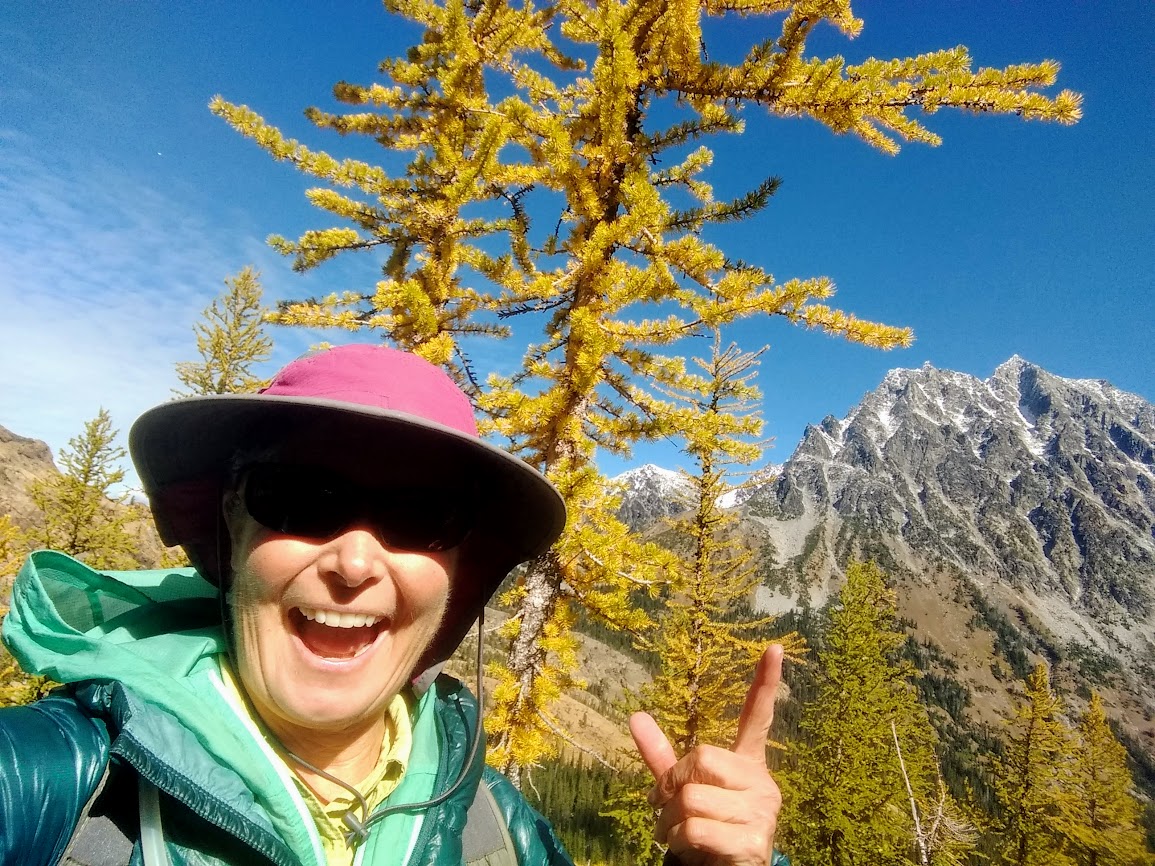
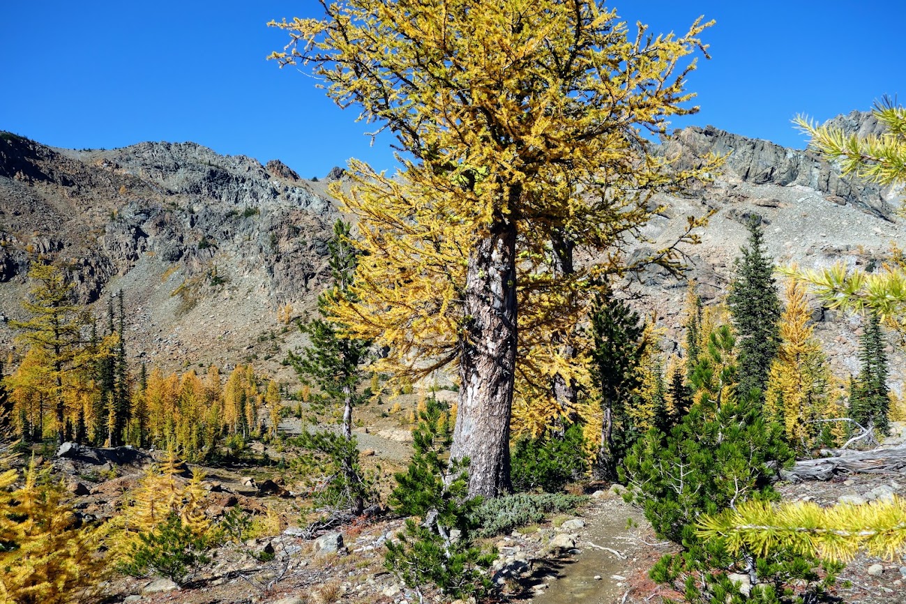
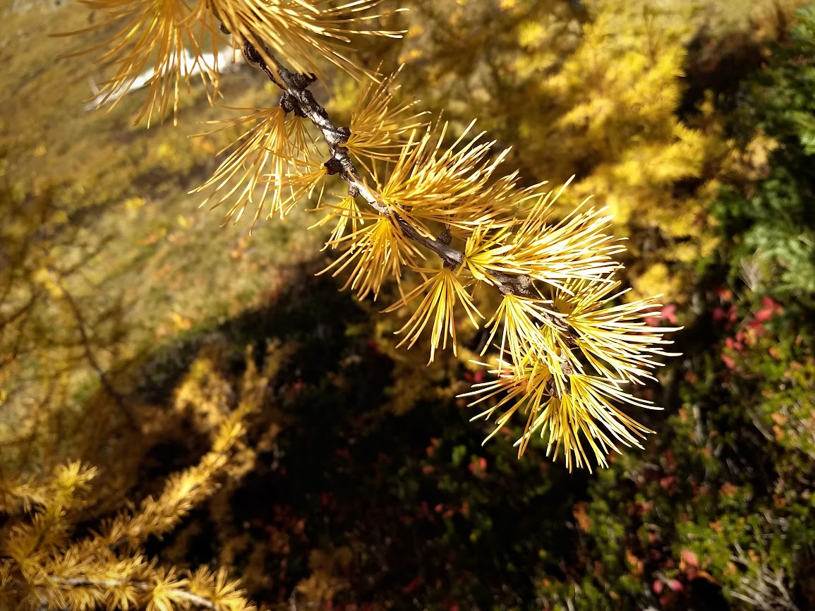
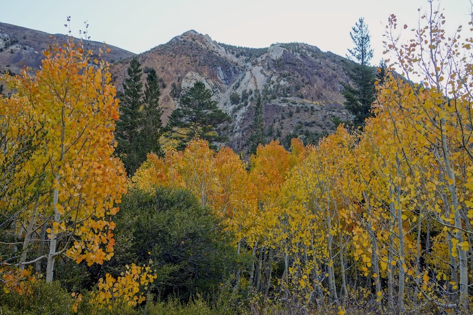
With the yellowing larch signaling a change in season I headed further north hoping to find them in peak color. I returned to Ingalls Pass a couple of weeks later to see how autumn was progressing. I’d say I found gold!
I was still full of energy and feeling strong when I arrived at the pass so decided to continue on toward Ingalls Lake. Headlight Basin is beautiful. You can see why it’s a popular backpacking and hiking destination. This is looking back up at Ingalls Pass.
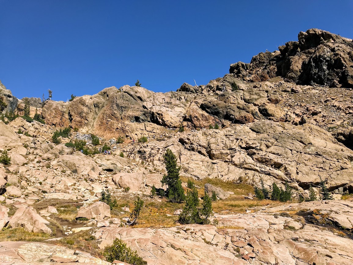
This is the route to Ingalls Lake. There isn’t a trail; it’s more of a multiple-option cairn route, sort of what I call pick your poison. I started up two different routes and realized they were too risky for where I was in my knee rehab. If you zoom you can see people scrambling among the rocks. If I were to see this photo, I’d think it would be easy to stick to the boulders making it a somewhat easy climb but in reality there is lots of class 2 scrambling.
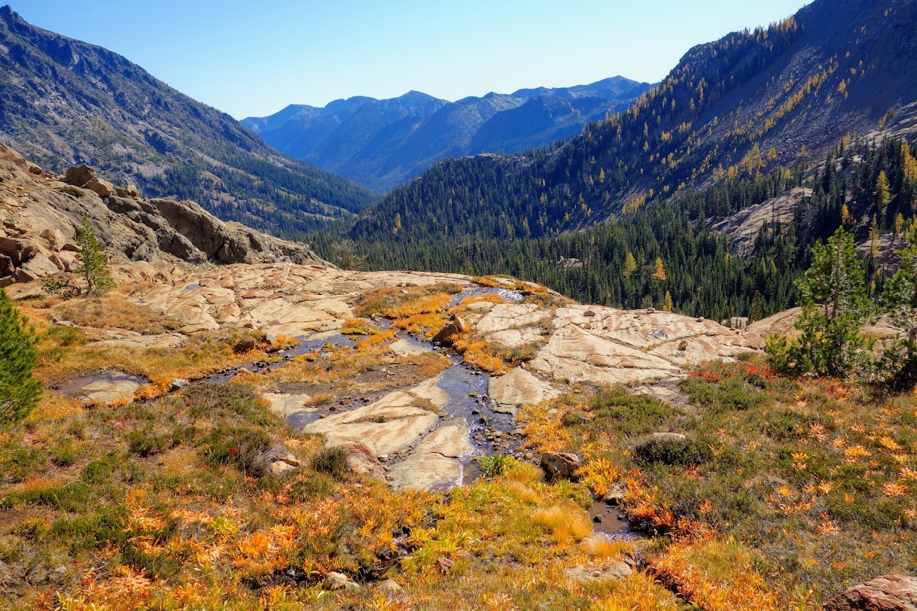
Instead I enjoyed lunch with views like these into the Ingalls Creek Drainage. As a bonus I had time to people watch. Some were suffering greatly carrying overnight packs, even though the lake is off limits for camping. I met a ranger on my way down who was on her way up to check permits and relocate those camped in closed areas.
I made the mistake of taking the alternate trail on my way down. The main trail is a much nicer grade and provides even better views. The shorter alternate trail drops down steeply and then regains some elevation to meet up with the main trail. In retrospect I wish I would have done an out and back on the main trail.
Dr Seuss trees.
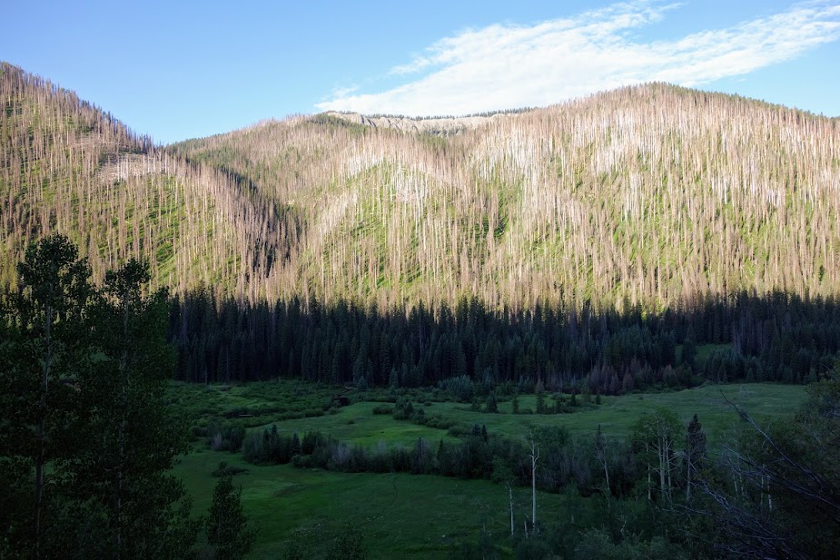
Very few trees were as mature as this one. I wonder if a fire wiped out old growth at some time in the fairly recent past.
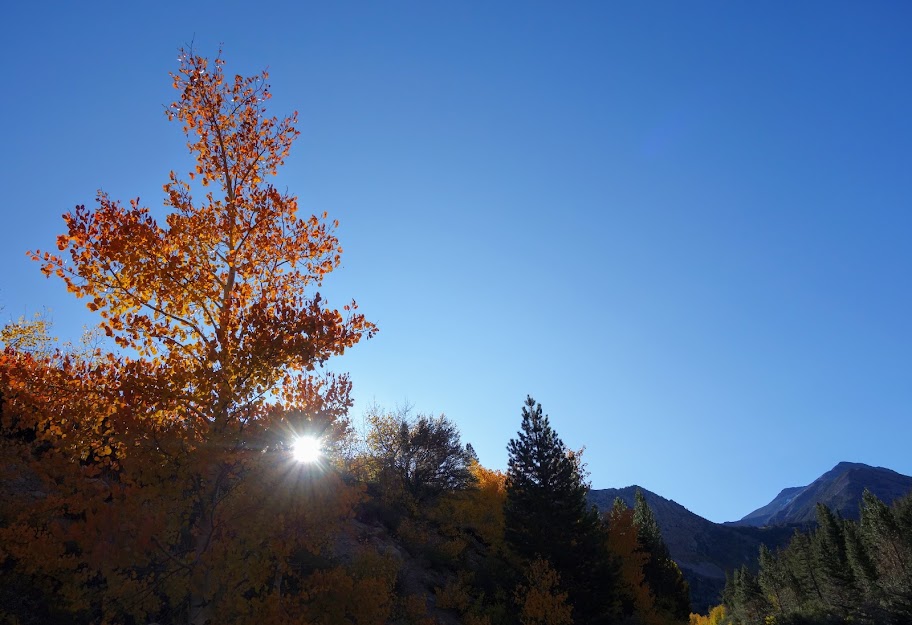
I was still a tad early for peak color but it was still a WOW experience and not one I regretted.
ADVENTURE DATE(S): September 19-20 and October 1, 2021
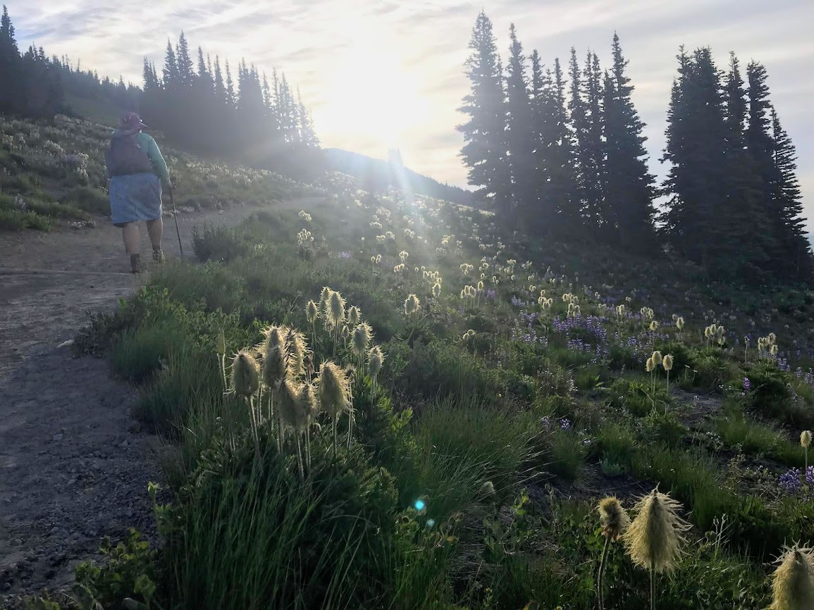
Joan and I were giddy with joy from our last two days spent in Rainier alpine zone and couldn’t resist pushing our luck. As we joked, this will be another rest day for Jan. It was my 7th day in a row of hiking and I sure didn’t want to risk a setback, but . . . it’s impossible to say no to such opportunities. We were in the right place at the right time! So back to Sunrise we went. This time we took the Sourdough Ridge Trail to the east, rather than west as previous day (link).
Early morning light on the Sourdough Trail. The mound in the background is First Burrough we’d hiked the previous day.
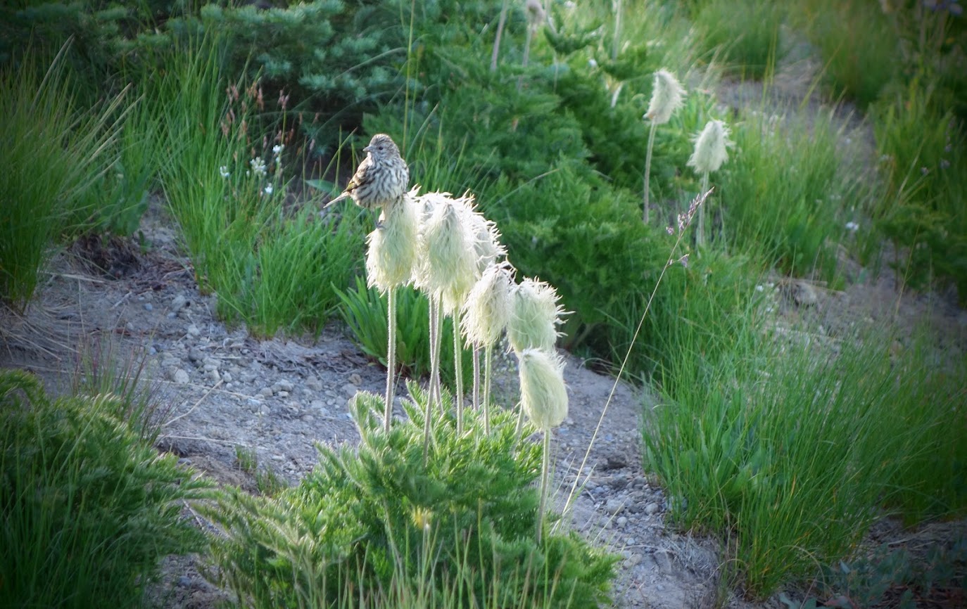
This meadow kept us smiling. This is probably the largest display of Dr. Seuss mop heads I’ve ever seen (pasqueflowers).
Even the birds found these plumes worthy of a stop over. A birder informed me this is a Pine Siskin.
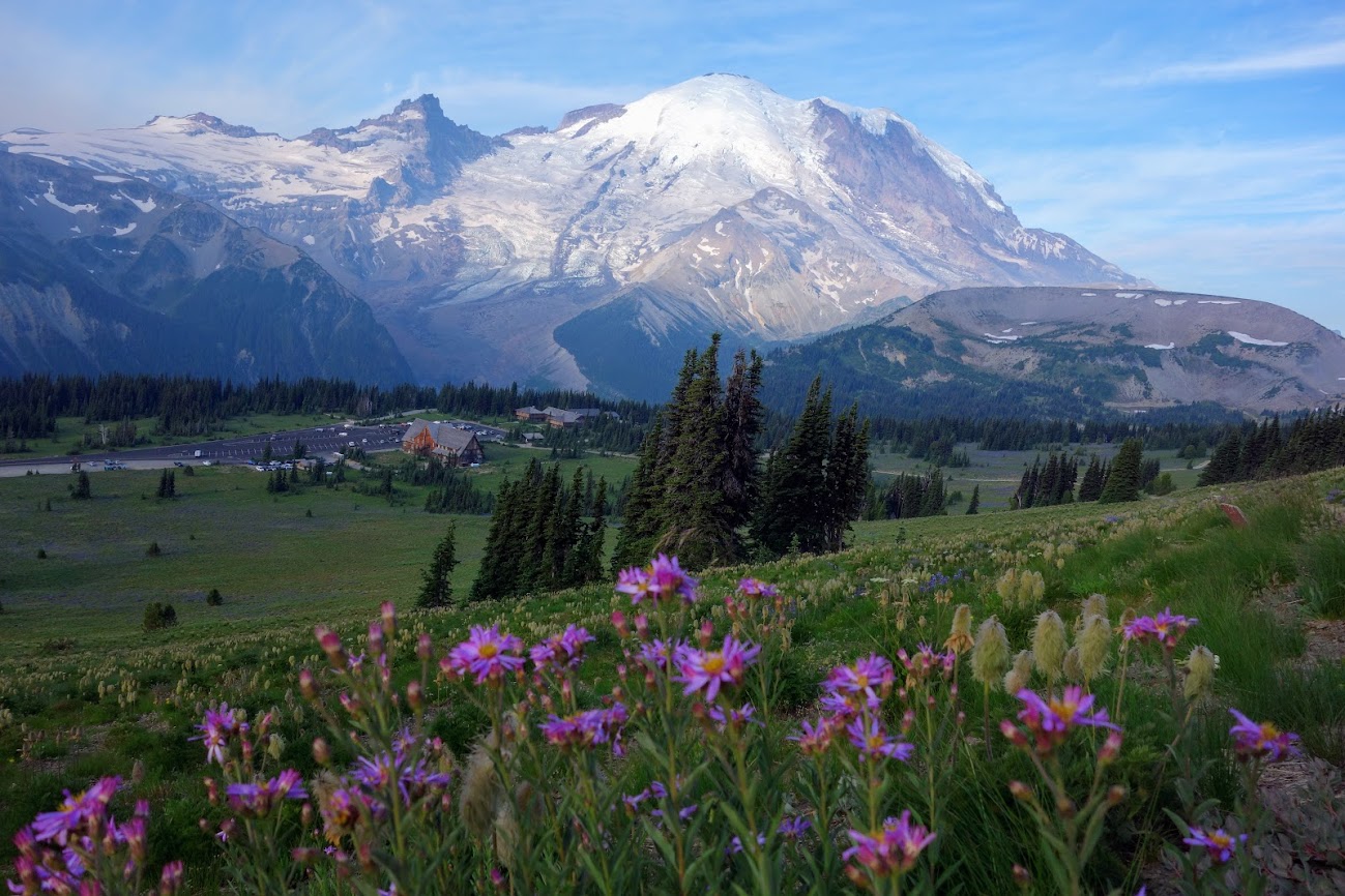
The asters brightened the meadows. Sunrise lodge is in the valley. This photo was taken at 7:30am. Within an hour the parking lot and road will be packed.
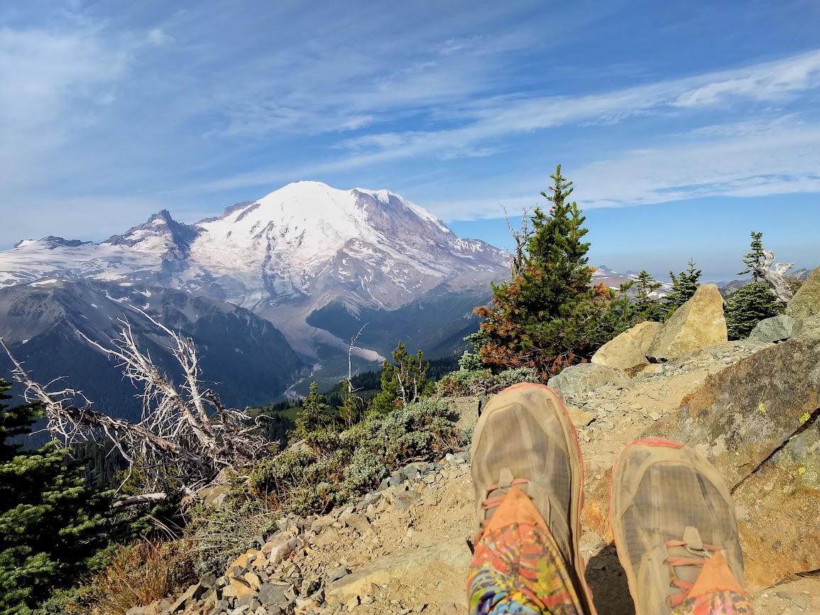
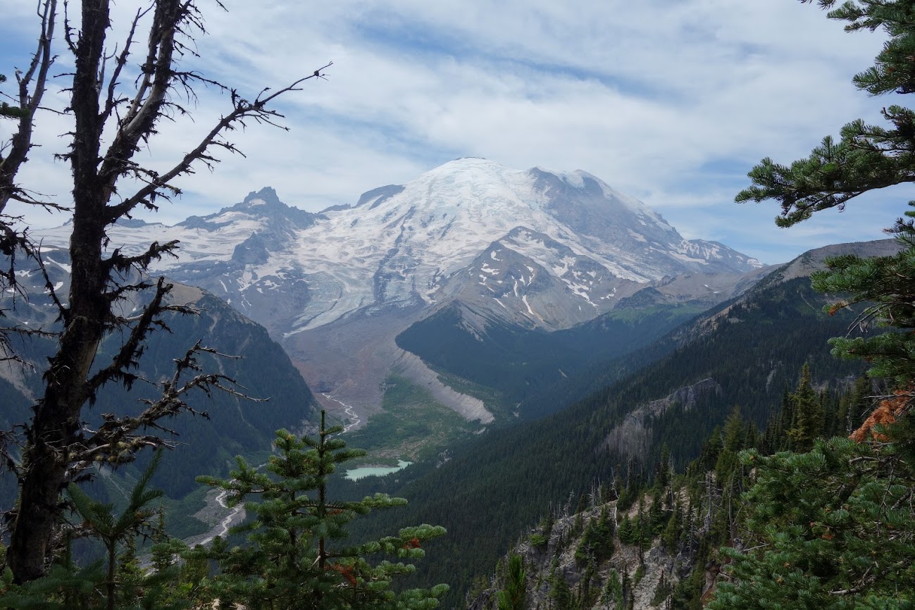
My view from Dege Peak.
This was my turnaround spot while Joan continued on to eventually drop 1,000 feet to the Lakes Trail which included Sunrise and Palisades Lakes. We couldn’t decide if the haze was smoke or clouds, but it burned off later in the day so clouds seemed to win.
The view into the lakes basin from Dege Peak.
These yellow blooms seemed to fit the Dr. Seuss theme.
I finally found a butterfly willing to sit for a portrait.
I couldn’t help but wonder if we were in for a weather change.
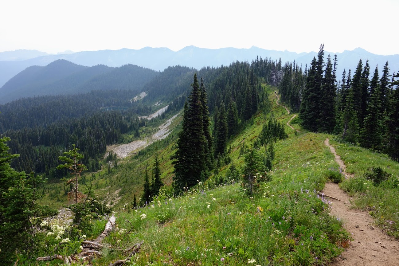
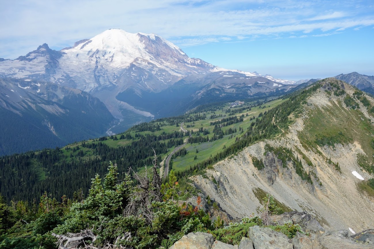
I love how the Sourdough Ridge trail showcases varied geology as well as provides amazing views of the mountain.
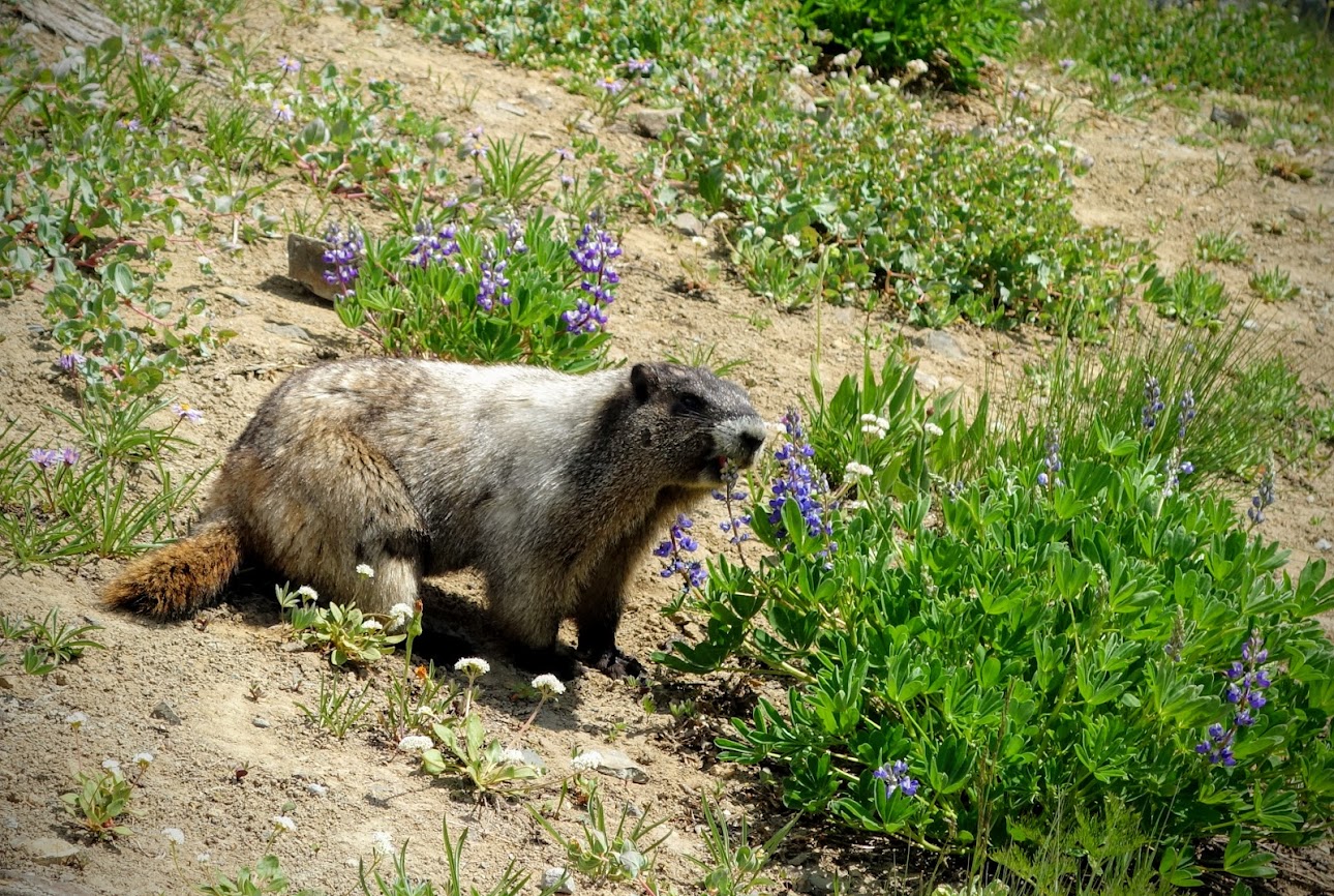
The marmots loved the lupine. This guy was taking large bites. YUM!
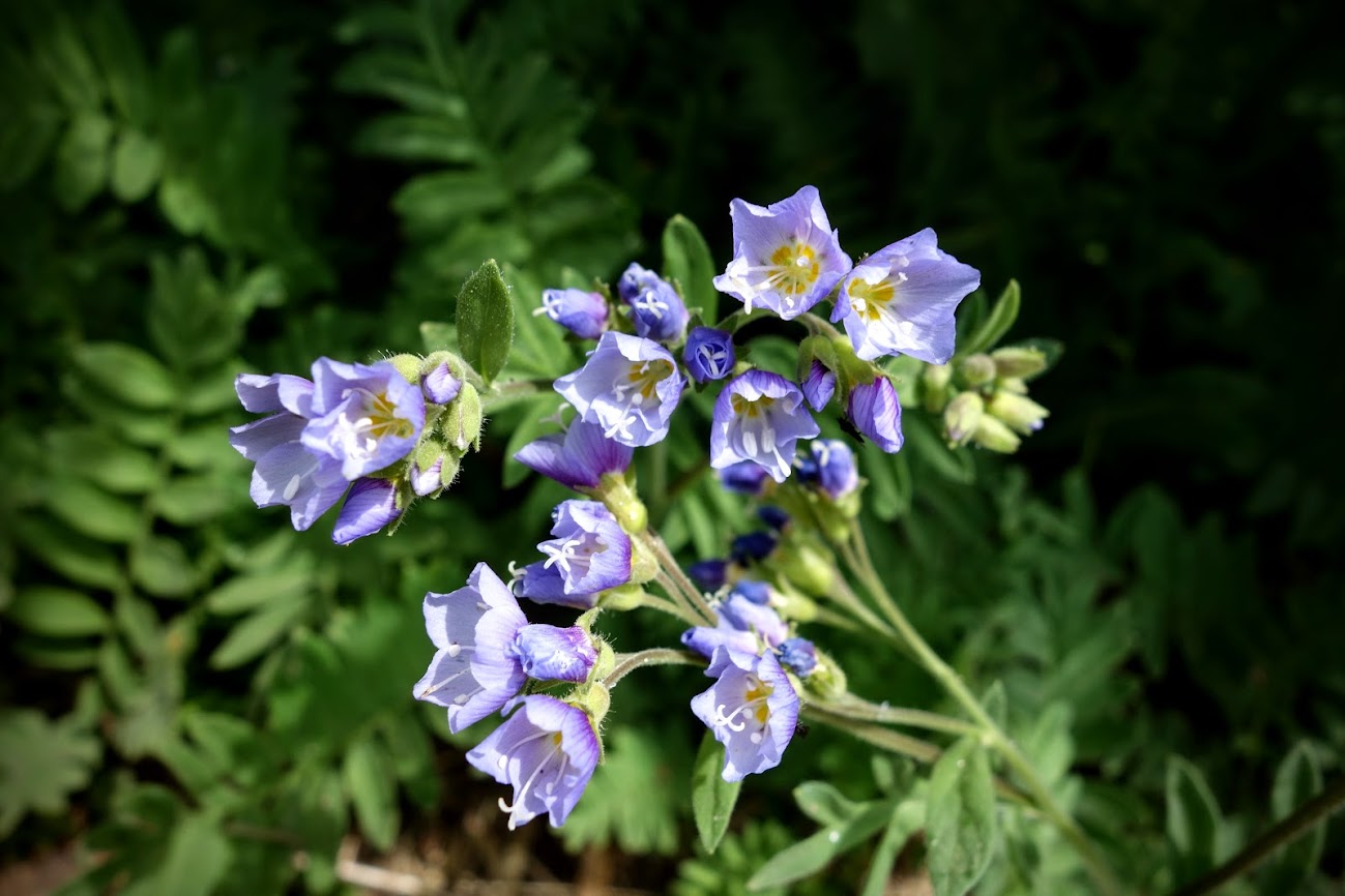
I found more Sky Pilots (Jacob’s Ladder).
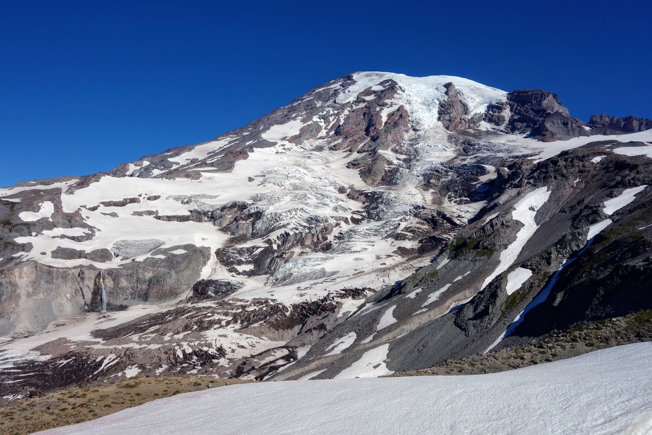
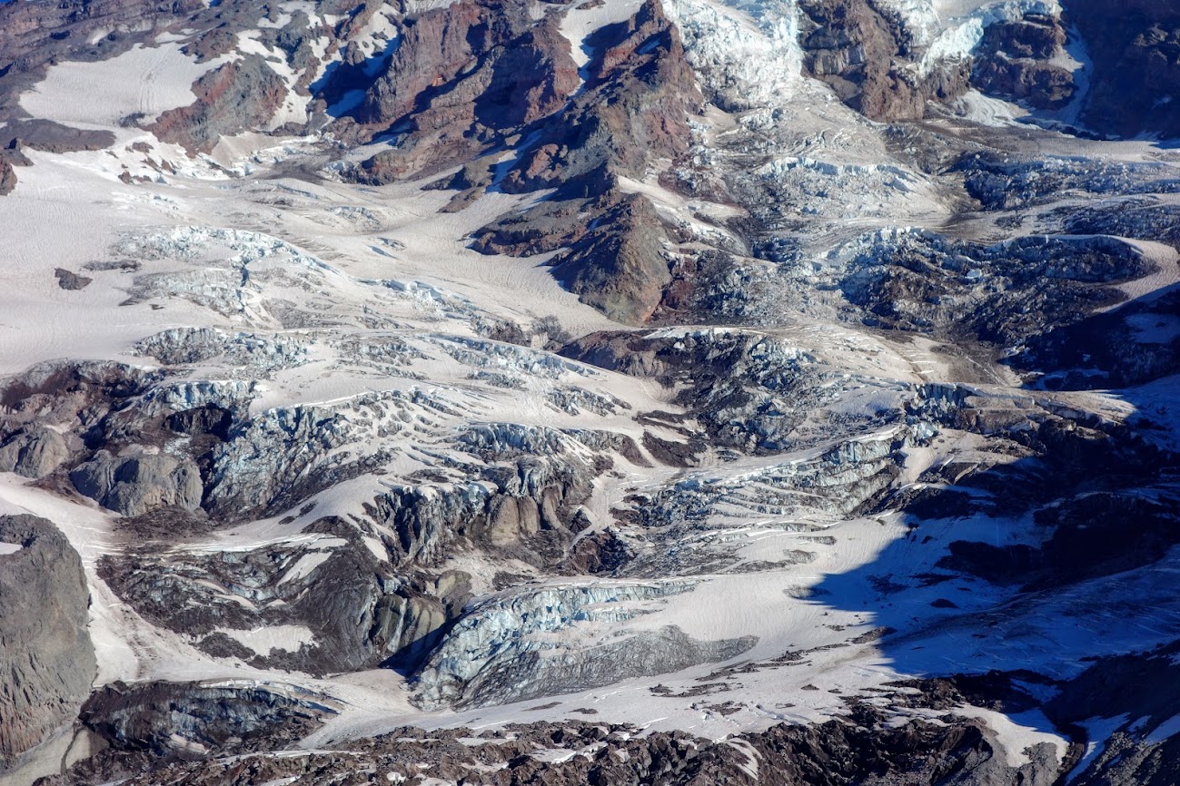
When I was done lollygagging on Sourdough Ridge and the Nature Trail high route, I visited the Emmons Glacier vista to learn more about this largest-in-the-nation glacier.
Yes indeed it was another zero. Ha another non-rest rest day. Ok friends might consider it a zero or nero but it was plenty of work for me.
I added a solar shower to my car camping kit. We’d fill it in the morning and let it heat on my dashboard and then shower in camp. This was the only time we had neighbors and had to erect a bit of a privacy curtain, otherwise we found sheltered areas near our campsite. We survived 11 days without a real shower! Being able to rinse off the sweat and dust before bed made sleeping much better, although this night I had a pesky mouse in my house who just didn’t want to leave or die.
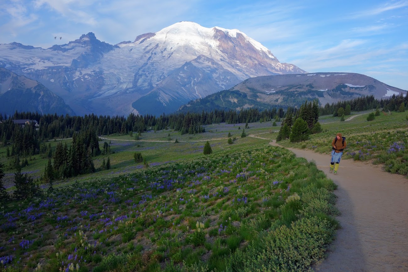
After a couple days at Stevens Canyon (link) it was impossible to ignore the pull of the mountain. So on a Sunday, yes a Sunday, during peak summer tourist season, two crowd-adverse gals decided to test the waters. Joan and I left our campsite at 5:30am for optimal crowd-avoidance strategy. It worked! We got our pick of a parking spot in the main area at Paradise.
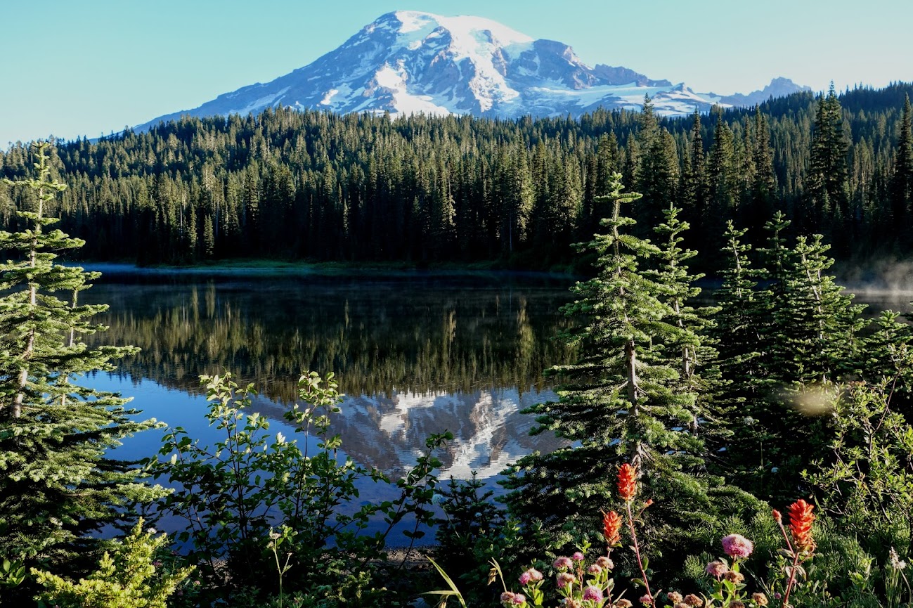
After a stop at Reflection Lake, we decided “sub alpine” filled with hordes of skeeters was less appealing than hordes of people at alpine. I was reminded of my hike around Mt Rainier on the Wonderland Trail in 2014 (link).
Reflection Lake
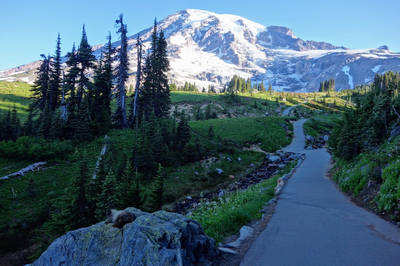
Skyline Trail
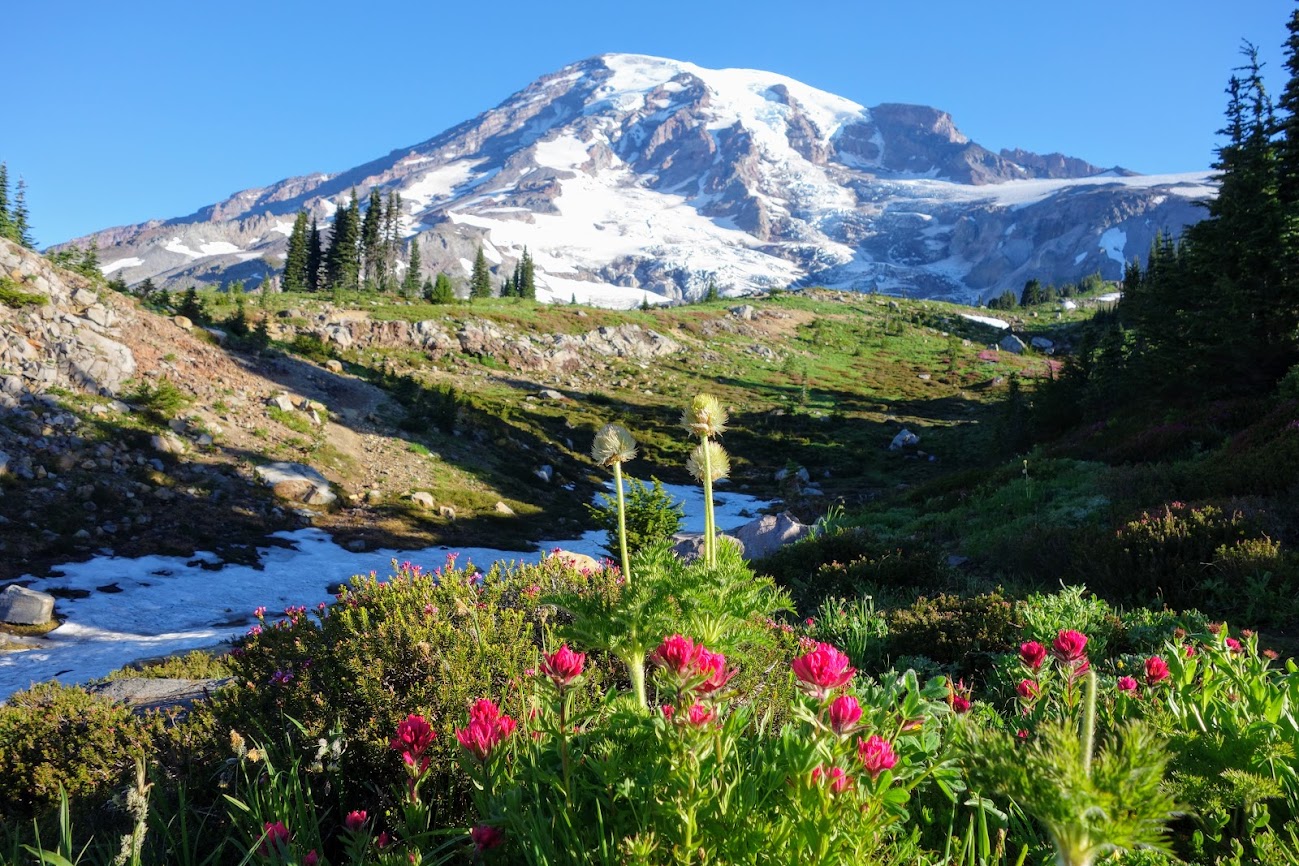
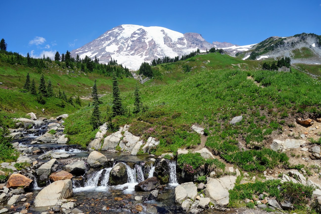
We couldn’t ignore a calling to the Skyline Trail. With much trepidation about my knee and body performance, we began our hike. The views kept me smiling. It was my kind of WOW per mile. So many views and wildflowers. I felt like I could touch the mountain. How lucky to have beautiful blue skies devoid of smoke and fires. Temperatures were warm but with plenty of water and snow we stayed comfortable. At the end of the day, I was thrilled with my recovery and performance. The long steep downhill tested my body but my hips complained more than my knee so I figured this meant I’d moved on from knee rehab to rebuilding general fitness.
The first section of the Skyline Trail is paved which really helps with dust and erosion given it’s high use. Notice the marmot laying on the big rock in foreground.
The marmots are such portrait hams.
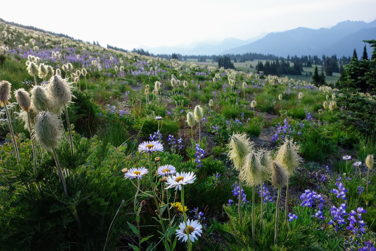
This was a flower power tour.
The lupine smelled strongly of grape jelly.
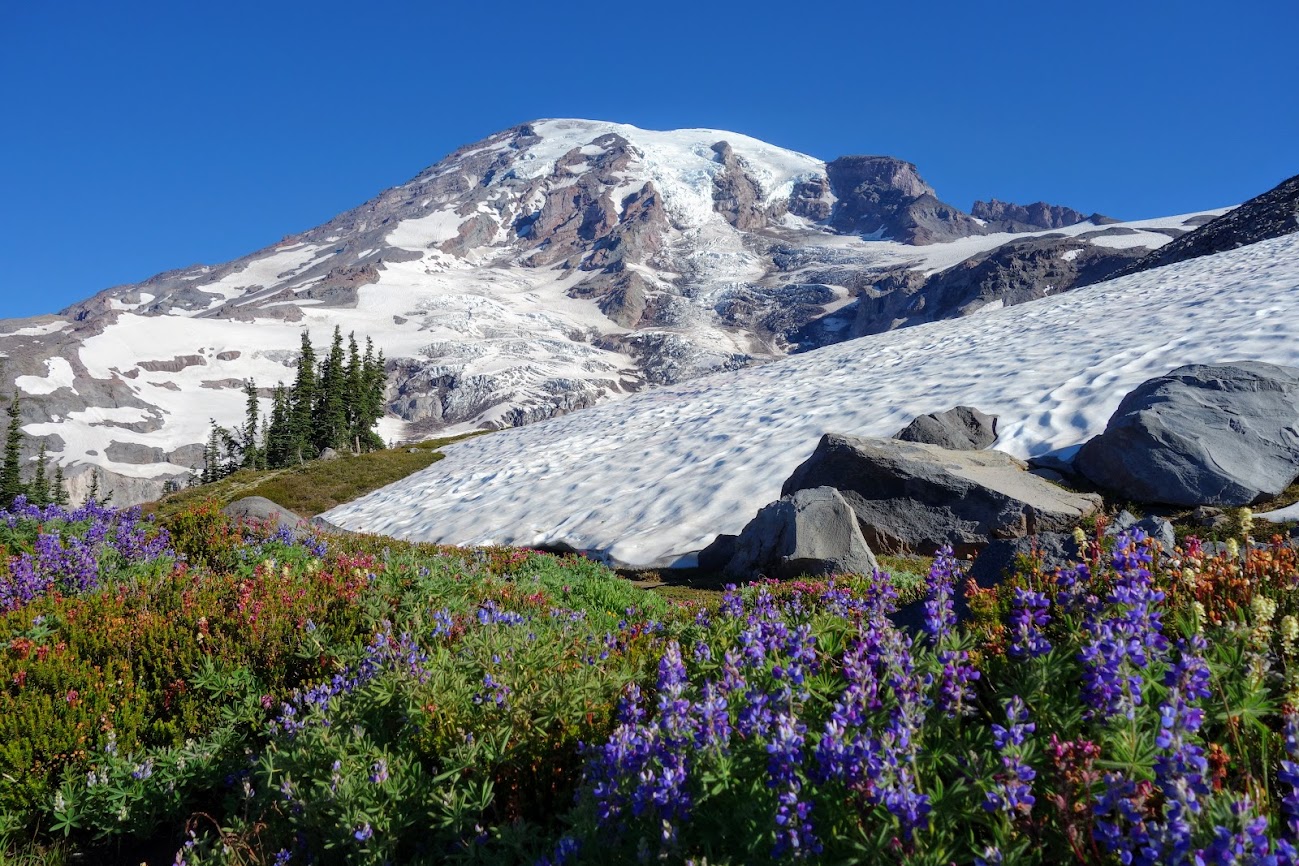
We had a few snow patches to hike through and were wishing we’d carried our microspikes.
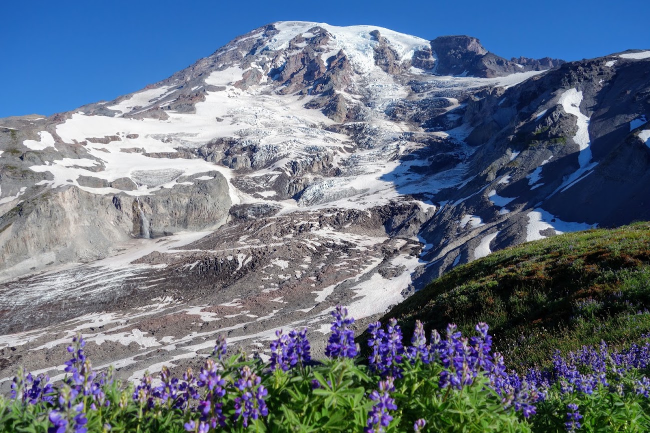
This is the Nisqually Glacier. Notice the waterfall. There are 25 major glaciers on Mount Rainier and numerous unnamed snow or ice patches, which cover about 35 square miles.
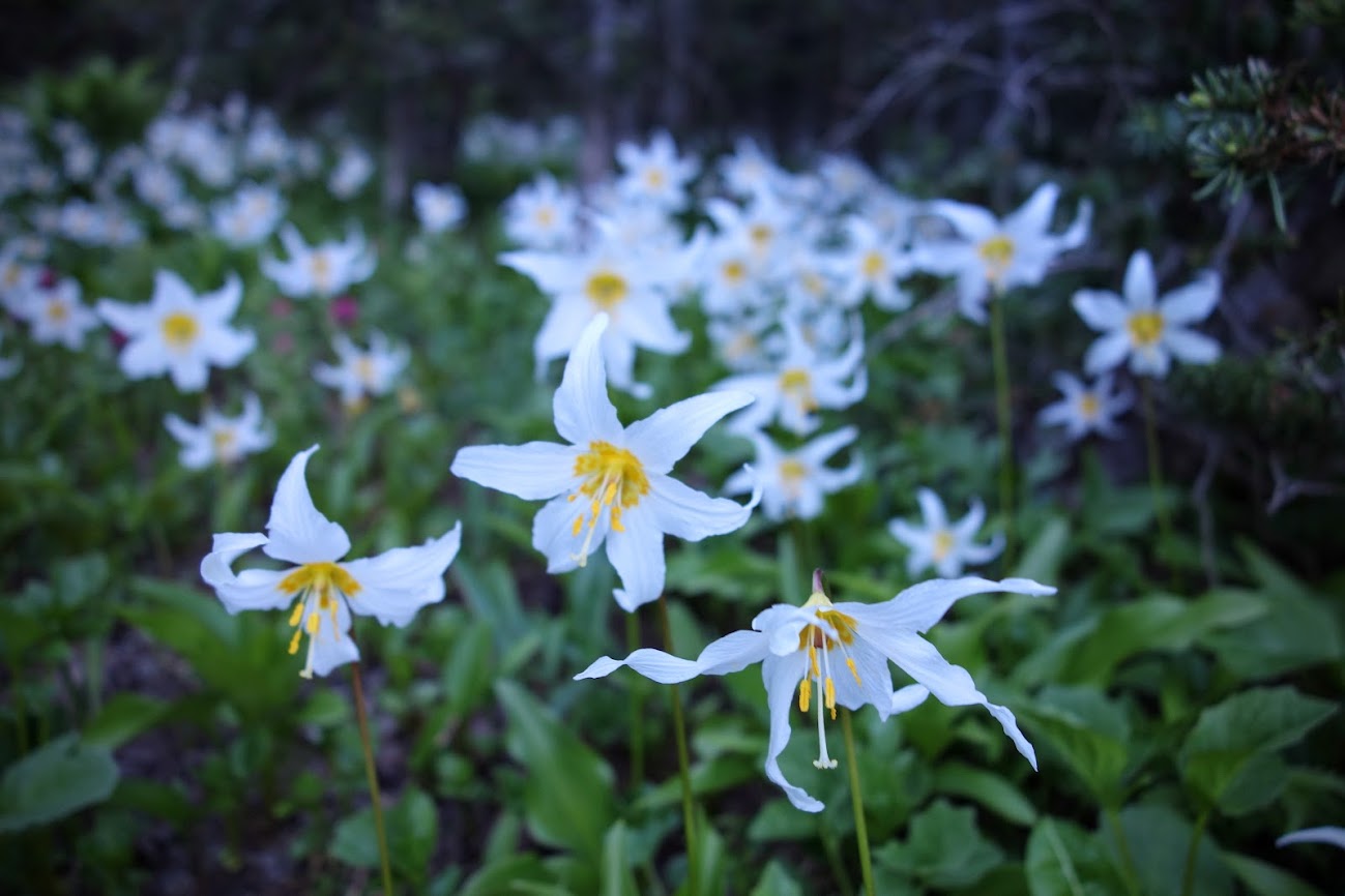
Nothing like Glacier Lilies to accompany the Nisqually Glacier.
Trail reality . . . we definitely weren’t alone. Funny this viewpoint is of the Goat Rock wilderness where Joan had hiked the PCT the previous week (link), and where I’ve hiked two times previously.
I was thrilled to find Sky Pilots (Jacob’s Ladder).
Water water everywhere, fields of green and loads of floral color.
This was my third day in a row to hike. I was beyond excited about my performance and recovery.
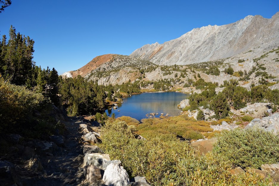
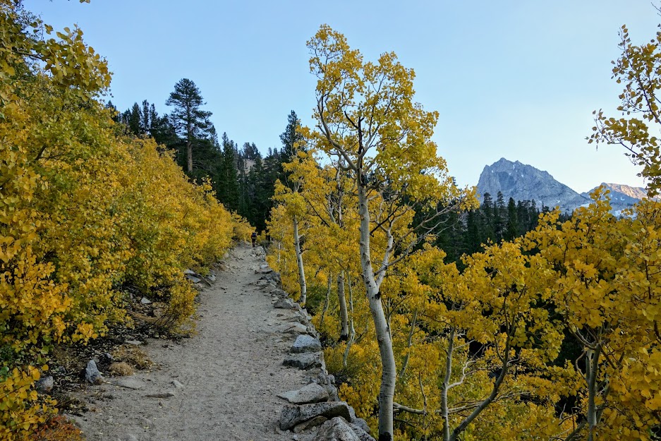
After hiking from the Big Pine Creek Trailhead both North Fork and South Fork, I returned to Bishop before chasing another lead for peak fall colors. As I drove toward South Lake, I was excited to finally see the colors I’d been seeking for the past week.
I began to wonder if I’d ever make it to the trailhead. I was beyond happy with the visual eye candy.
The tapestry of colors along the mountains was especially eye catching.
But alas, I finally arrived!
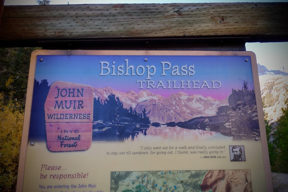
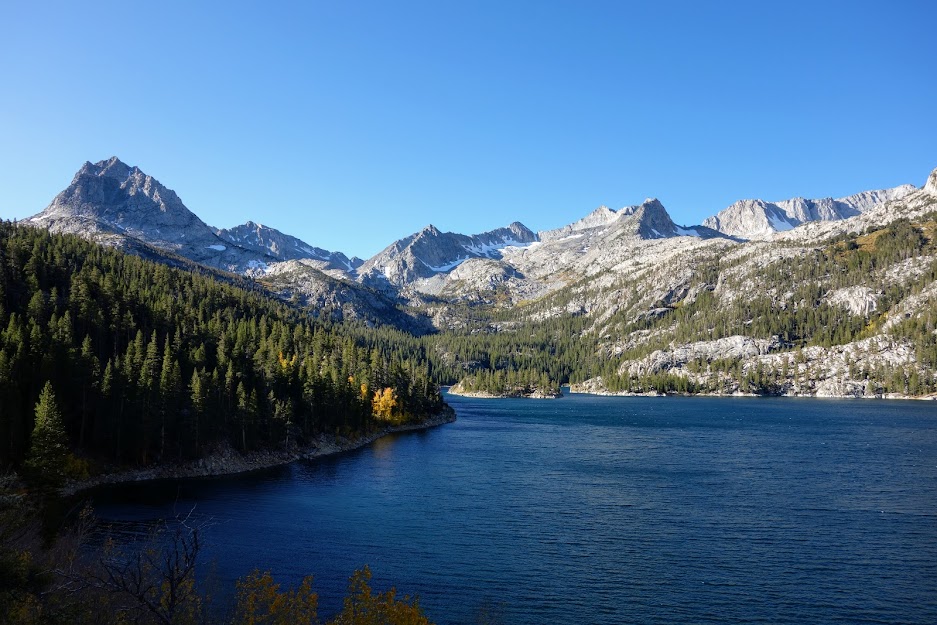
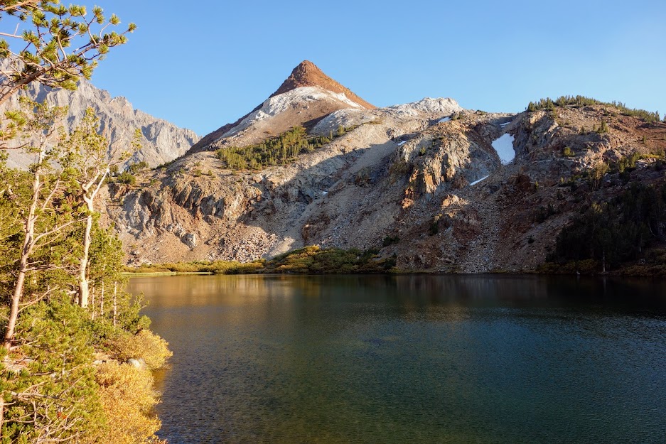
South Lake
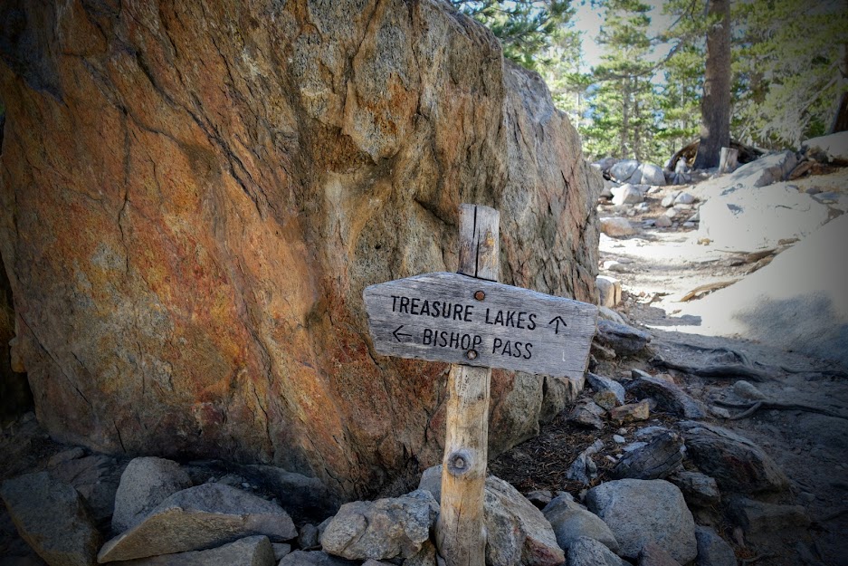
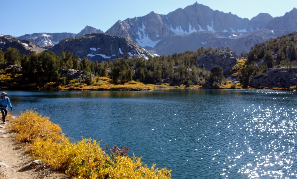
On this day I decided to follow the trail to Bishop Pass.
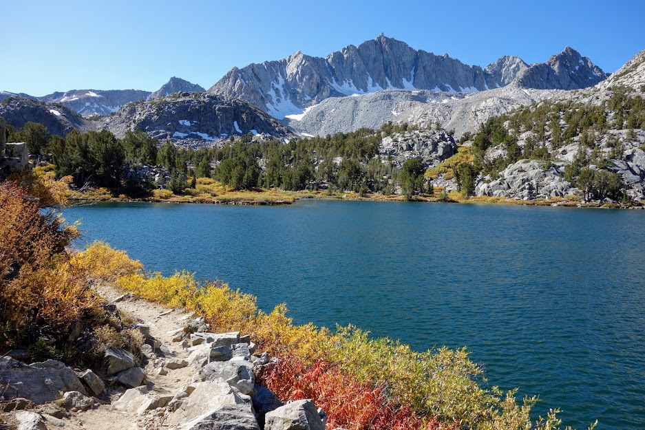
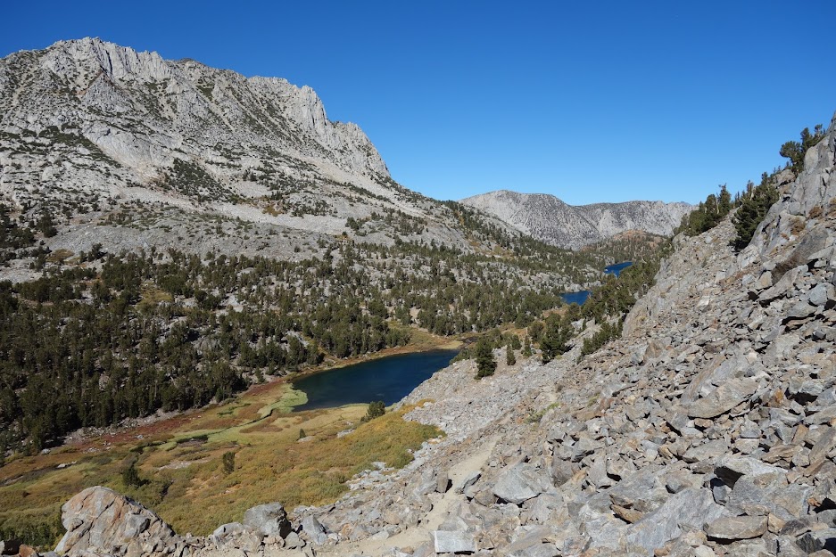
Long Lake was a beauty.
This is Chocolate Peak. My plan was to hike the loop to Chocolate Lakes on my return trip.
As the trail continues, I continue to smile while trying to guess the location of Bishop Pass.
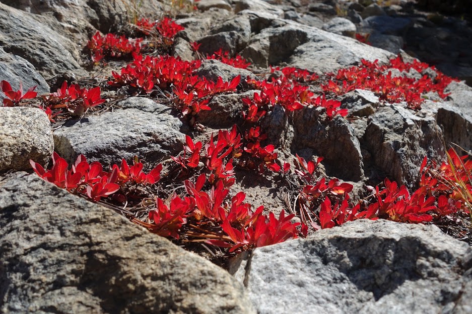
There were a few patches of this red vegetation which really popped among the gray granite boulders.
Hello my friend, is it nearing hibernation time?
Nice view back at Saddlerock and Bishop Lakes with Hurd Peak rising to the left.
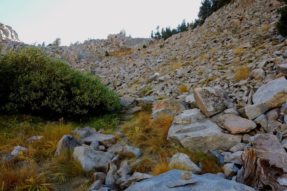
Time for some climbing.
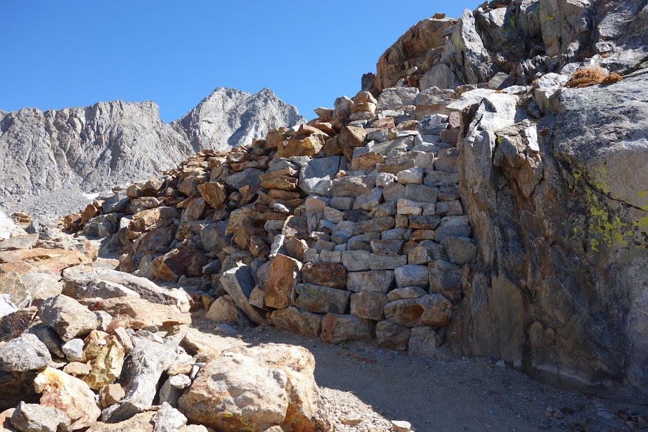
This is a good view looking down at the switchbacks with a hiker descending.
An example of some serious trail building involved in creating all these switchbacks.
Looking back at the upper tarns and lakes reminding me of how many places there are to explore in this giant playground.
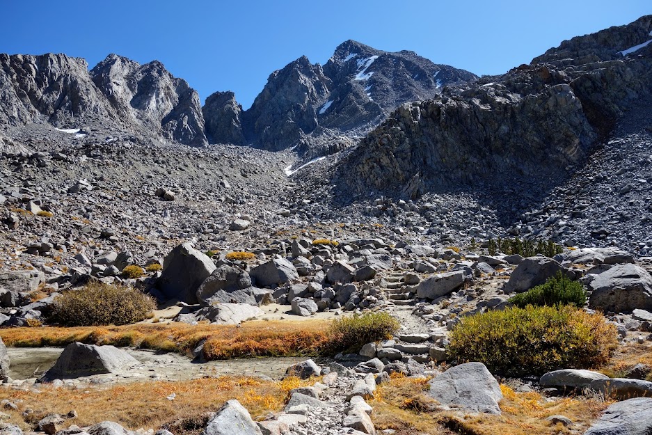
Nearing the final push.
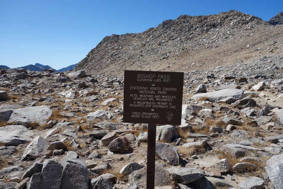
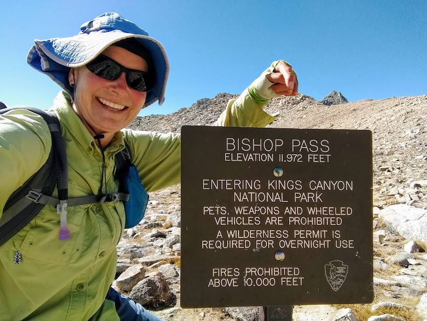
The Bishop Pass sign is in the distance.
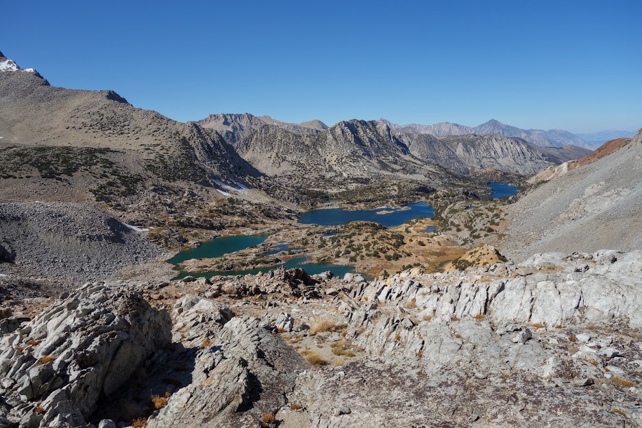
The views were incredible. This was the trail descending into Dusy Basin, another one marked on my list for a future visit.
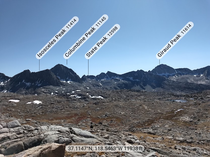
Once again my Peak Finder app was so helpful in identifying the various mountains.
After spending some time gawking at maps and views, it was time to descend enjoying incredible views along the way. You can even see Chocolate Mountain peeking out in the far distance.
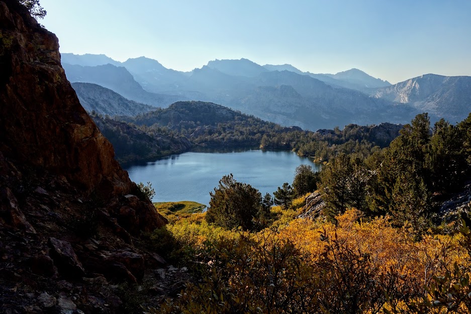
View of Ruwau Lake from Bishop Pass Trail.
Ruwau Lake from the Chocolate Lakes Loop trail. I met this hiker coming from the opposite direction who gave me a bit of intel on this secondary most unmaintained trail.
When you don’t do your research, you might find yourself climbing. I was beginning to get a bit nervous about running out of time. It was already after 4pm when I reached this viewpoint above Ruwau Lake.
Ut oh, I really wasn’t anticipating rocky route finding. The looming question, is it time to turn back?
Around 5pm, I found the first of the Chocolate Lakes.
The backside of Chocolate Peak with Chocolate Lake in the foreground.
Whew made it back on the main trail by 6pm. This day became my favorite of this fall jaunt second only to Virginia Lakes.
Adventure Date(s):
October 9, 2019
Hike Details:Tips:
Bishop is a great place to catch up on chores, eat some good grub, etc. If you need a shower I recommend The Hostel California rather than the one at the laundromat as it was dirty and disgusting. Check online reviews of laundromats. If I remember correctly there are three in town. You can use your Safeway ID for shopping at Vons; get your gas discount. Looney Bean was my favorite for coffee, eats and WiFi.
You can pick up a fall colors map and guide at many visitor centers and ranger stations along Highway 395. There are also several online sites offering current conditions; this is one I used and recommend (link).
OPEN OPEN OPEN. When I arrived at the Marblemount Wilderness Information Office at 6:30am I found about 10 others in line ahead of me awaiting the 7am opening. We were all hoping to secure a walk-up permit for North Cascades National Park where this is the game you must play for backcountry camping if you don’t want to reserve six months in advance.
Finally the doors opened. First up was a group of guys who’d been waiting since 5am. Soon enough two groups in front of me secured the spots I wanted. However, one benefit of living this flexible lifestyle was that I was able to delay my start by a day and thus was still rewarded with a permit to Sahale Glacier Camp. I spent the day taking care of chores and of course eating, including dealing with a fraud alert on my primary credit card. The fun of traveling was figuring out where and when to receive a replacement. This ended up being my best option, 40 miles away from Marblemount.
Finally it was time. When the trail looks like this, you know it’s gonna be a slow slog.
I got an early start and was welcomed by this friend.
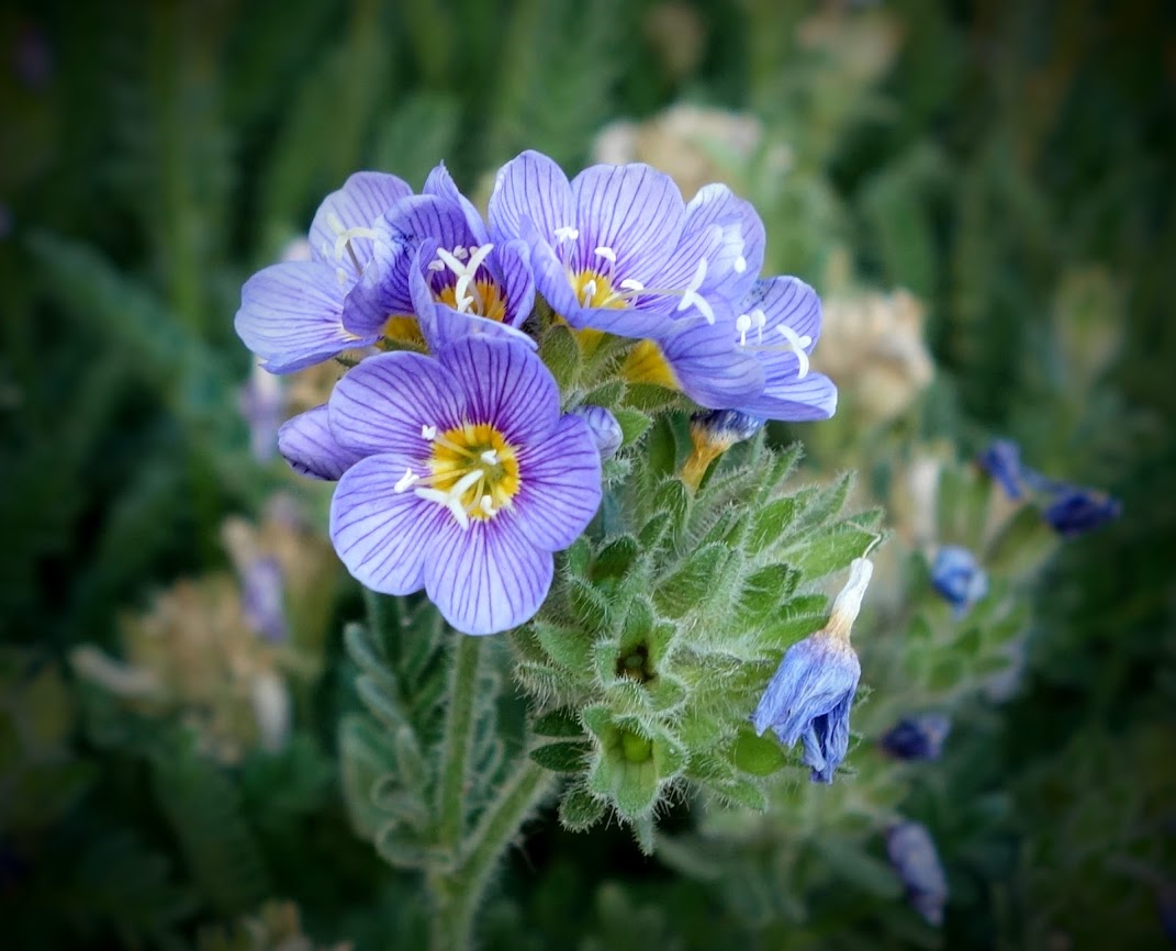
These were so tiny and delicate. I’m guessing a type of penstemon.
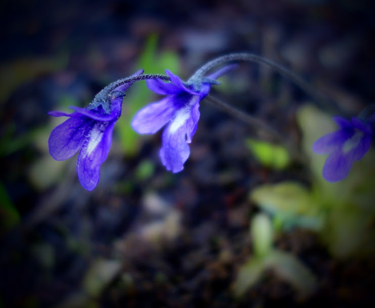
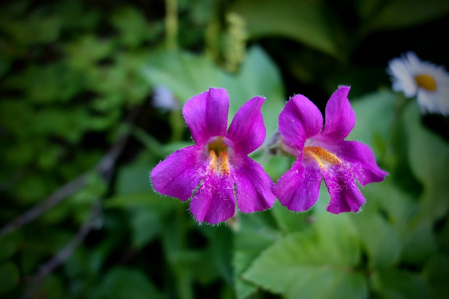
Monkey Flowers
Looking back down from where I’d come.
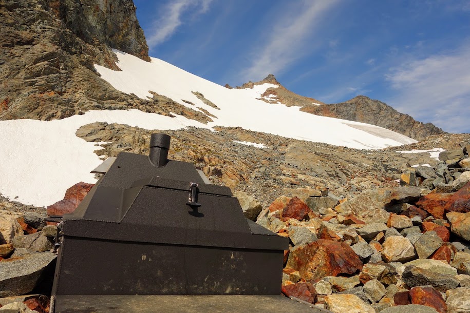
I have a love/hate relationship with backcountry toilets like this one at Cascade Pass, especially when they involve more ascending. With the amount of traffic this trail sees I’m grateful to not see white butterflies and piles of human excrement.
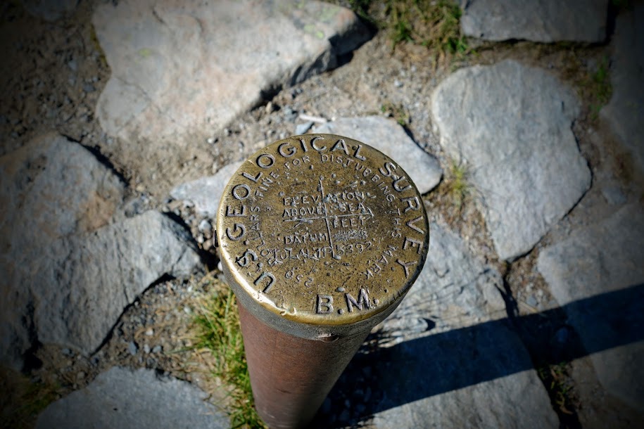
Cascade Pass survey/benchmark post.
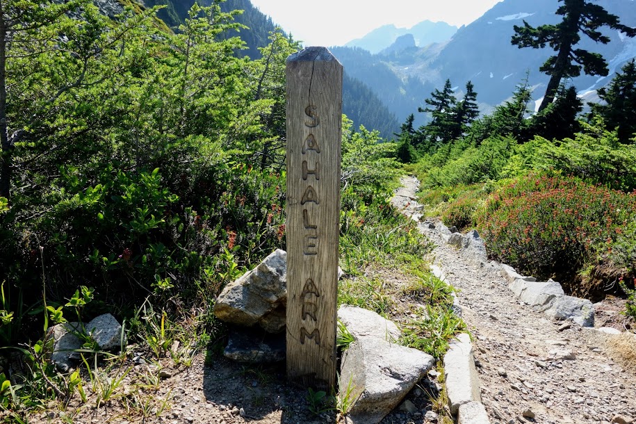
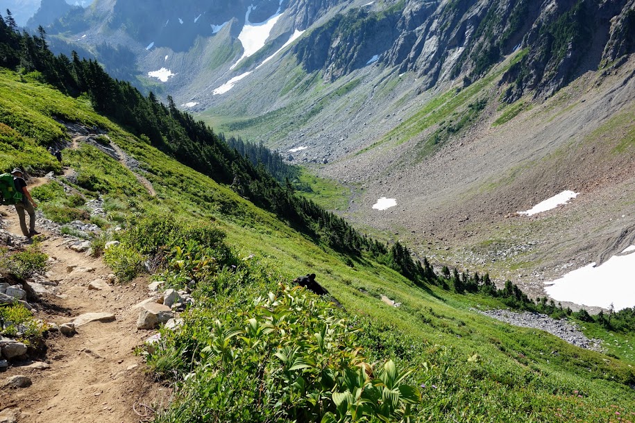
I was excited about this next section as I’d heard as it attracts much wildlife.
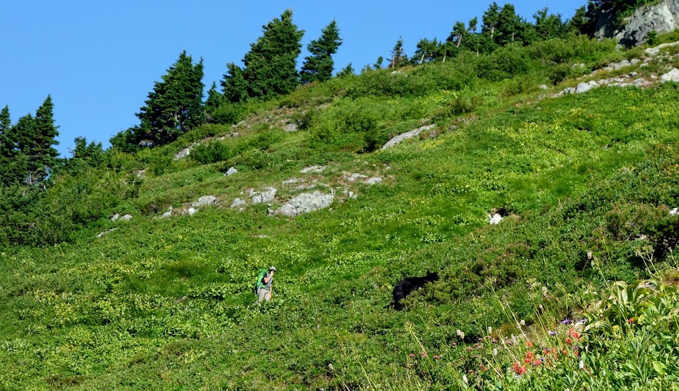
As if on cue, just 10 minutes later we spy this black fuzzy guy on the hillside. Of course, he’s decided to hang out between the switchbacks.
I think he was intoxicated from the flowers and berries he was happily consuming and had no interest in leaving his paradise.
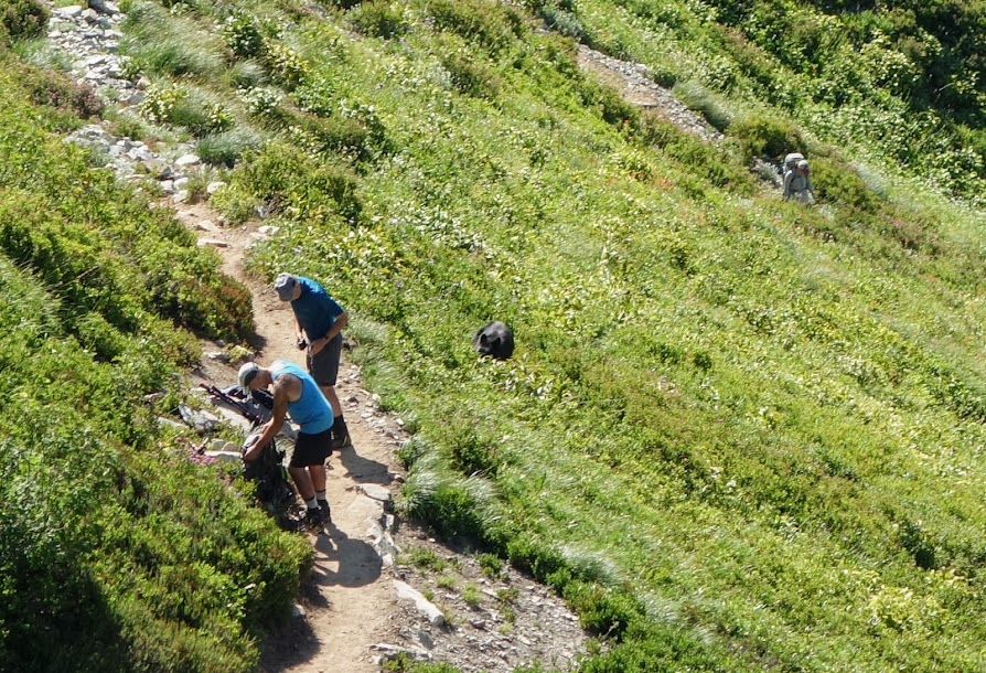
We grouped up, encouraged him to leave but after a long wait we walked by on the high trail without incident.
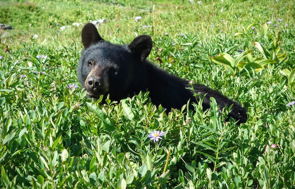
I continued hiking but several others hung back wanting to savor this close encounter with nature. When I looked back I was surprised to see these guys with their backs to the bear. I think they were so wrapped up in the moment they didn’t realize what they’d done. We met one of these hikers later and found out the situation turned violent when the bear spied a marmot, pursued, killed and devoured his prey. Now that was a wild kingdom experience!
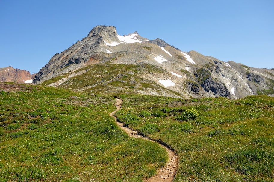
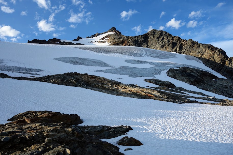
Back to nature’s beauty as the climbing toward Sahale Glacier continued.
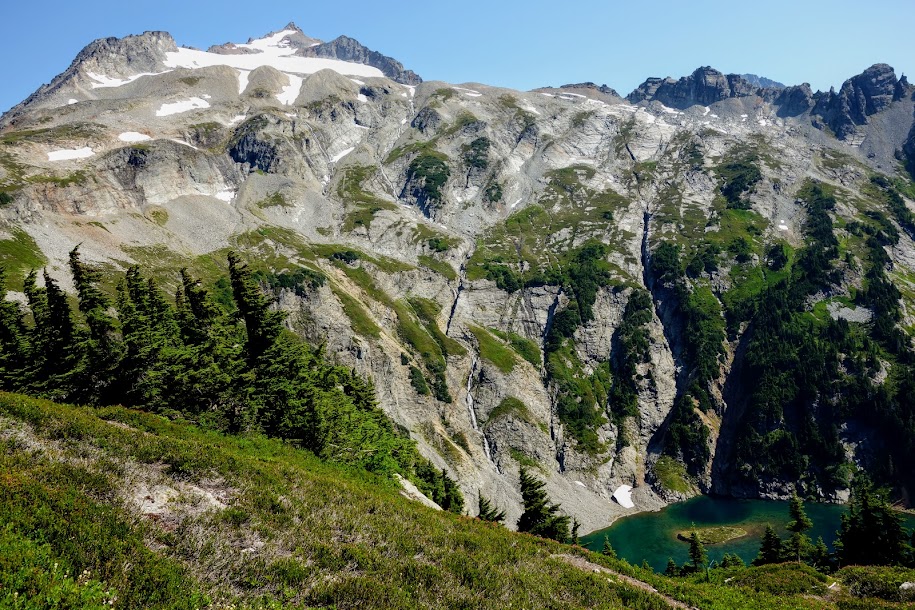
Doubtful Lake, which I planned to visit as part of my exit hike the following day, plus a glimpse of Sahale Glacier, my destination for the night.
I didn’t take as many photos as I should have on the hike up to Sahale. After this section, the trail worked it’s way through scree and boulders at a much steeper grade.
Photography breathing breaks are essential.
The marmots weren’t very photo friendly on this trip.
There are only a couple places where you can see Mt Baker.
And finally, I arrived at Sahale Glacier Camp. From the trailhead, it took me a little less than 6 hours to hike these 6 miles with 4000′ of ascending.
Mike was planning on ascending the Glacier. I was his accountability buddy and enjoyed watching his progress.
The glacier is much larger than it appears. Mike is nothing but a tiny speck the lip of the snowfield and false summit.
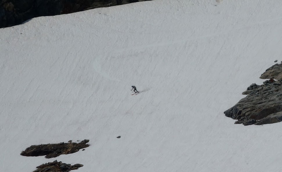
I watched another person hike up with skis and make a couple runs.
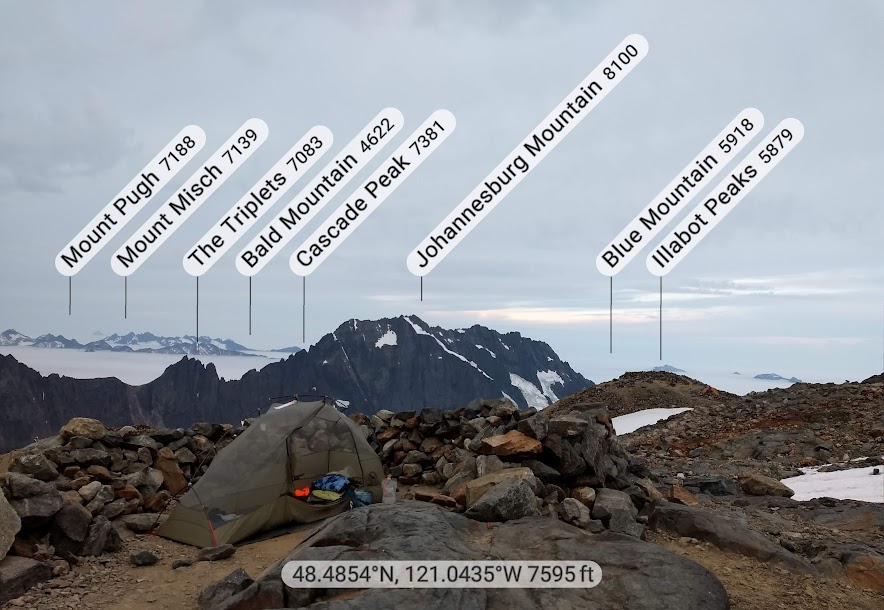
This is from PeakFinder app.
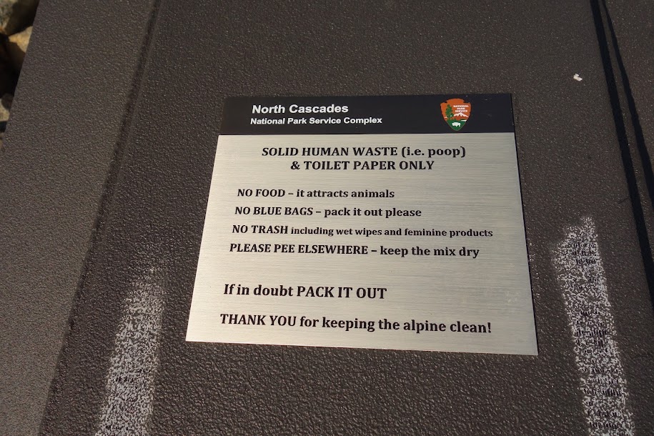
Pooper with a view, no privacy and a trek requiring planning; wouldn’t want to wait until the last minute as it’s a bit of a rocky jaunt.
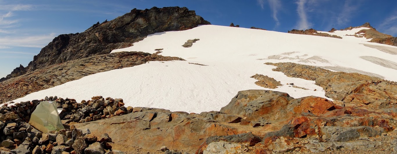
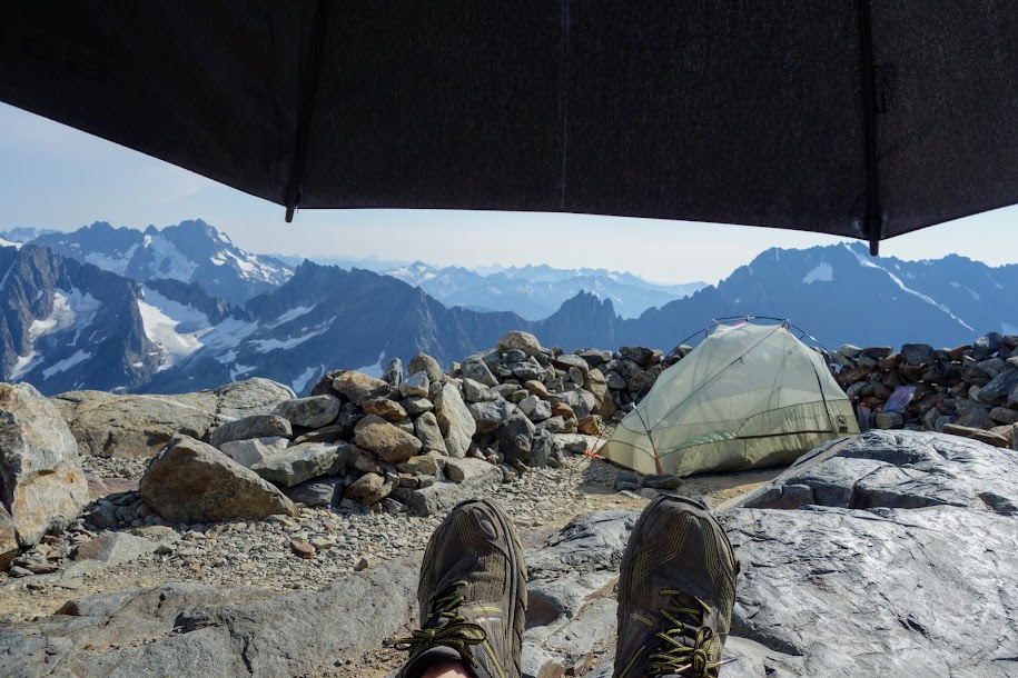
This photo shows the location of some of the premier campsites. Each of the three gray snow-free mounds just below the glacier hold single campsites.
I chose a campsite nearer the glacier and snowmelt. All the sites have nice rock walls as wind barriers.
With no shade around I was thankful for my umbrella. The sun was intense.
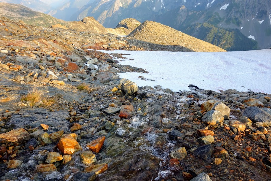
Water water everywhere but thankfully there was a breeze and bugs were pretty much non existent.
I spent way too many hours in camp. I regretted not bringing my microspikes so I could walk the glacier.
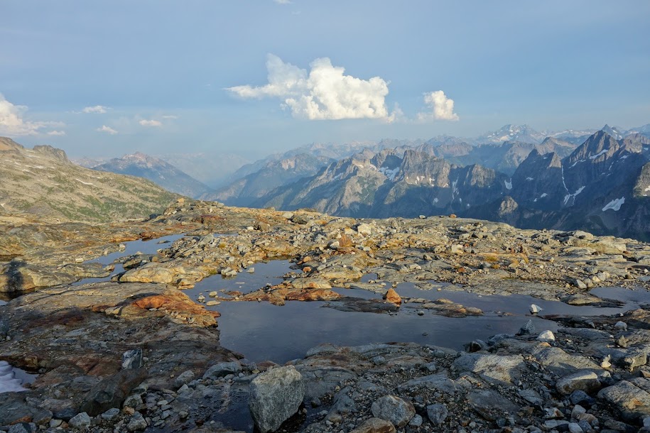
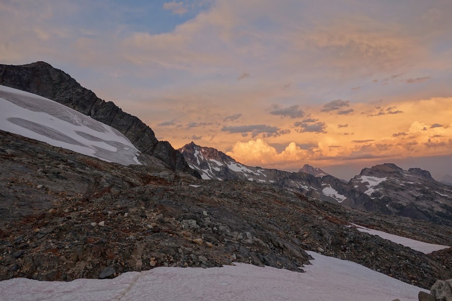
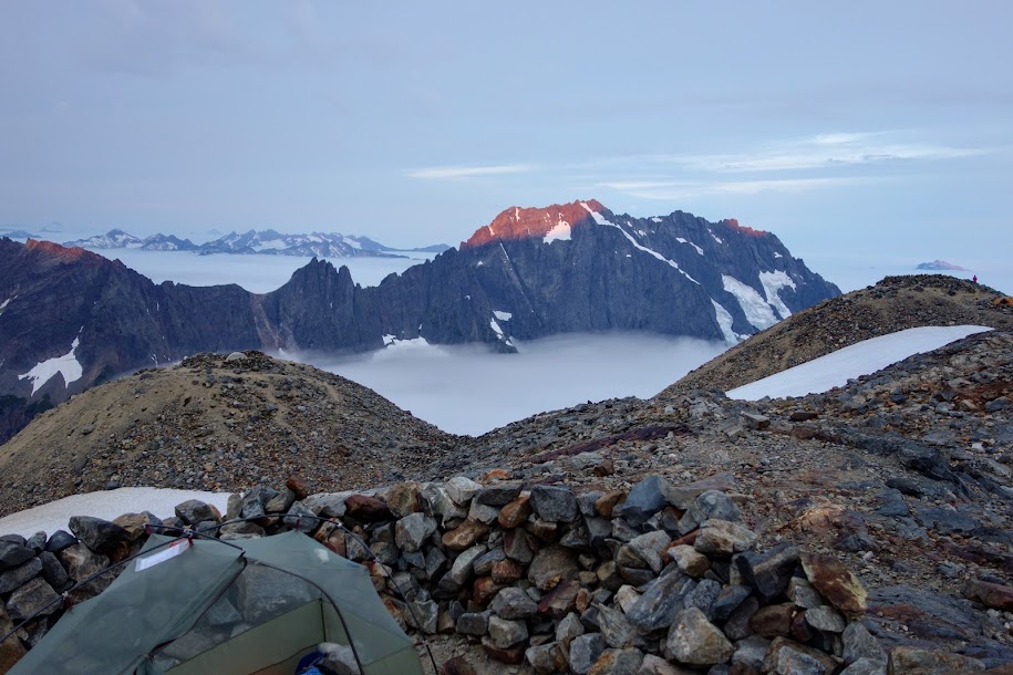
Sunset was incredible as the weather was a changing and the valley canyons filled with rolling fog.
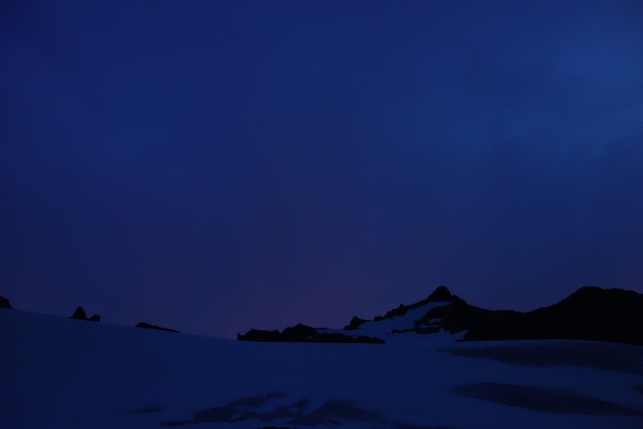
First light from my tent.
Early morning visitors, only a pair and not even a little pesky.
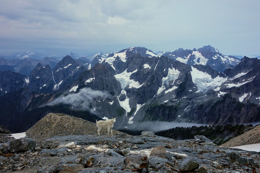
First light on Johannesburg Mountain. Little did I know this would be the only sun I’d see all day. This was at 6am. My tent is in the middle and on each of the peaks to the left and right are occupied campsites.
PeakFinder app is so helpful.
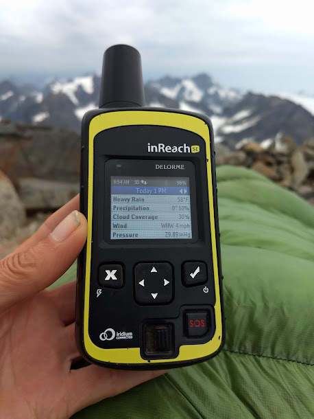
I checked weather on my InReach to see if rain was headed my way. I wanted to know if the fog/clouds would burn off or if I best get off this exposed location. I’ve found the forecasts somewhat unreliable but with heavy rain predicted by 1pm, I decided I best heed the warning.
It was looking doubtful that I would visit Doubtful Lake on this gray chilly day.
This is the sketchy part of the trail with mixed slippery dirt, scree and boulders. Not my favorite type of terrain. If you look carefully toward the top of the photo you’ll see a couple just beginning their descent.
I didn’t want to drop into the cloud.
Looking back from where I’d come. You might be able to spy the couple descending behind me as colorful tiny dots.
Run marmot run, don’t let that bear get you.
Sahale Mountain to the left, with Doubtful Lake in the lower middle.
Oh Doubtful Lake how I wanted to visit you but you’ll have to wait for a nicer day.
Down down down I go, descending into the swirling clouds.
Finally I was back into the forested switchbacks where I was hoping for some ripe berries.
It seems I finally found worked my way out of prime wildflower season. There were still some around but not in the quantities I’d experienced a few weeks earlier.
Adventure Date(s):
August 8-9, 2019
Hike Details:
Tips:
Permits are required and can only be obtained either in advance from the recreation.gov site or from a wilderness office for same day or next day camping. Rangers are out and about checking permits. Mine was checked twice. If you are planning on being an early arrival, check at the door for a number system. The first day the numbers weren’t out. The second day it was raining and we were waiting in our cars. About 15 minutes before opening they put out a box with numbers. It was much more efficient but they should put them out much earlier.
This was a great option for WiFi, as was The Eatery.
Lots of options can be found in Sedro Wooley; Lorenzo’s was recommended by a friend.
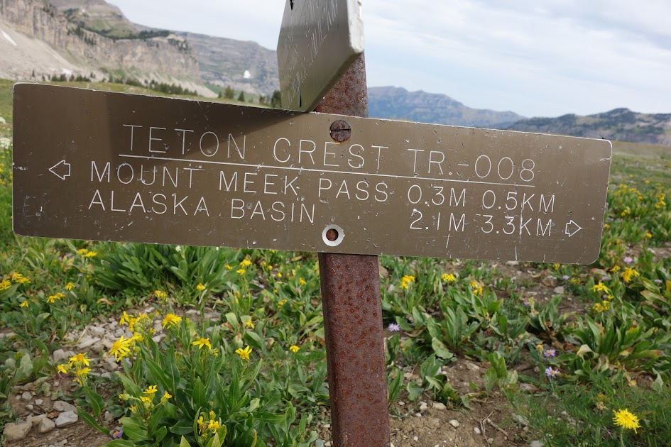
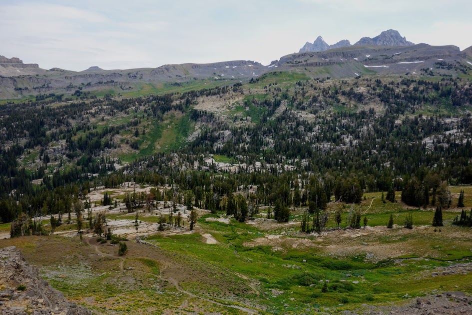
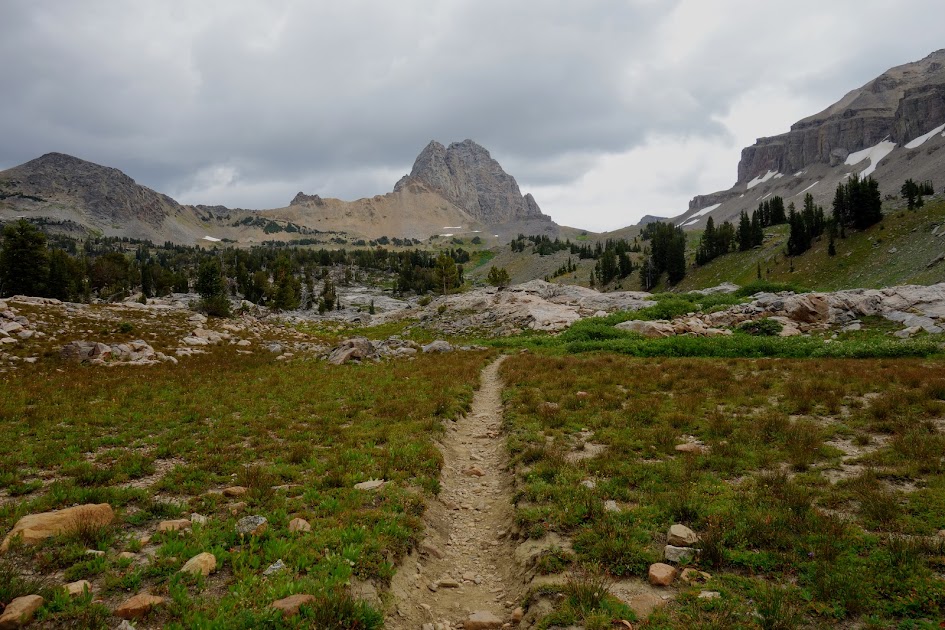
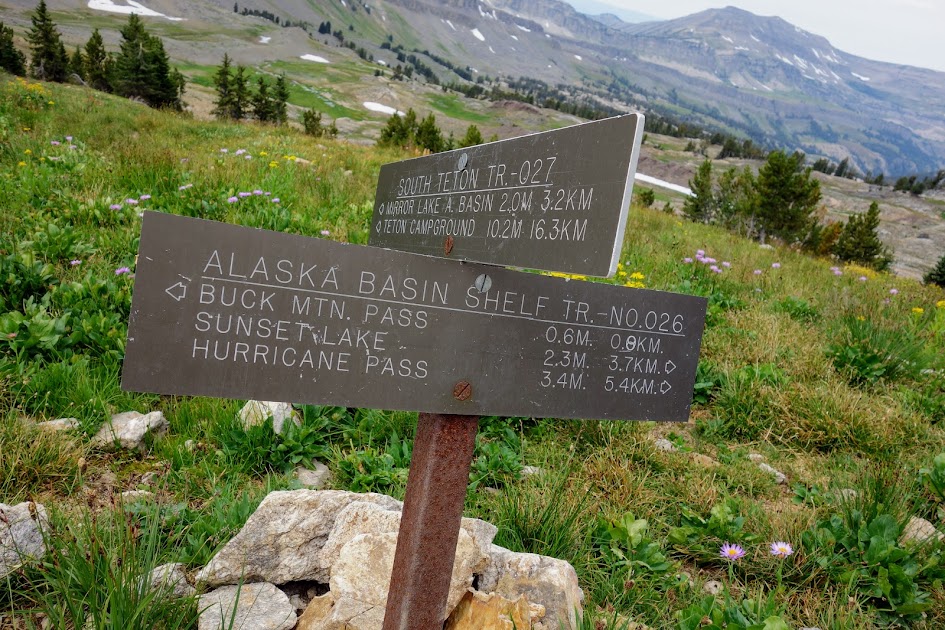
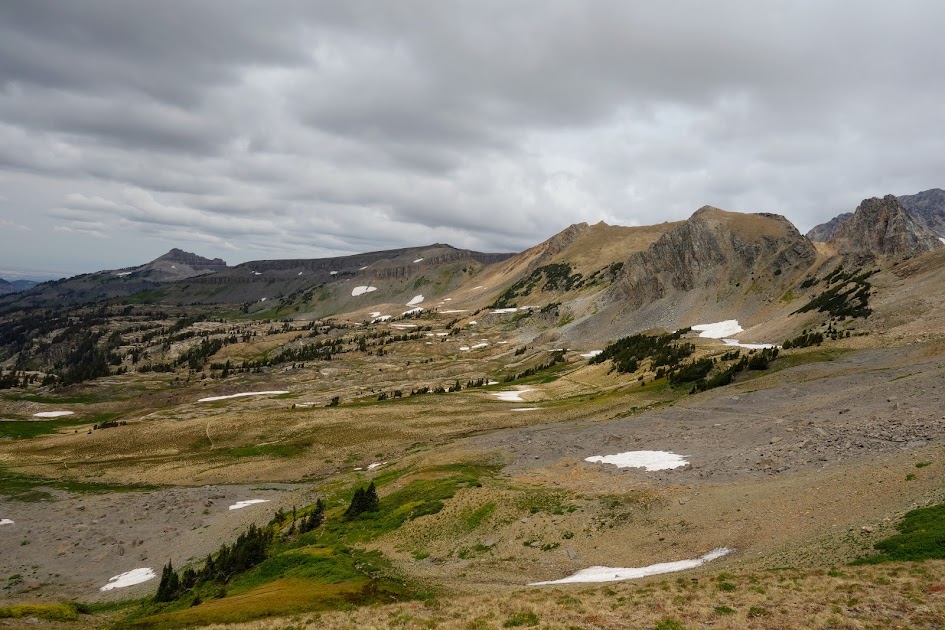
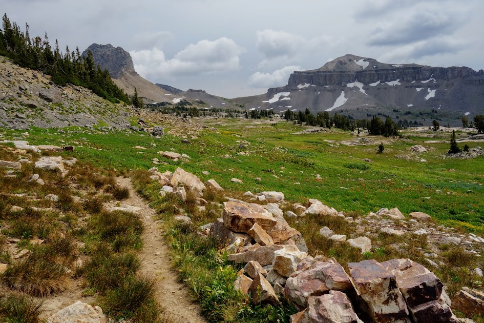
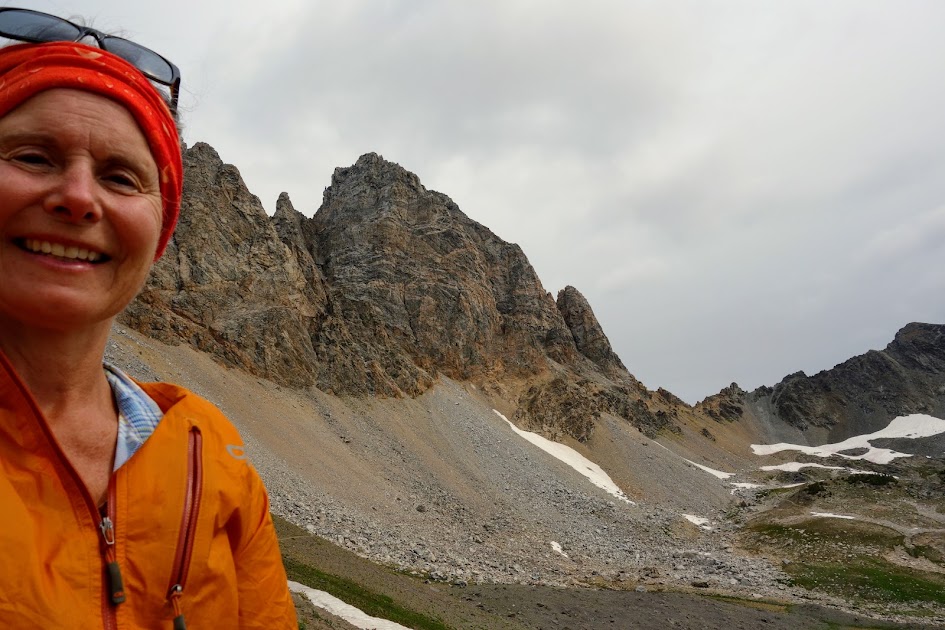
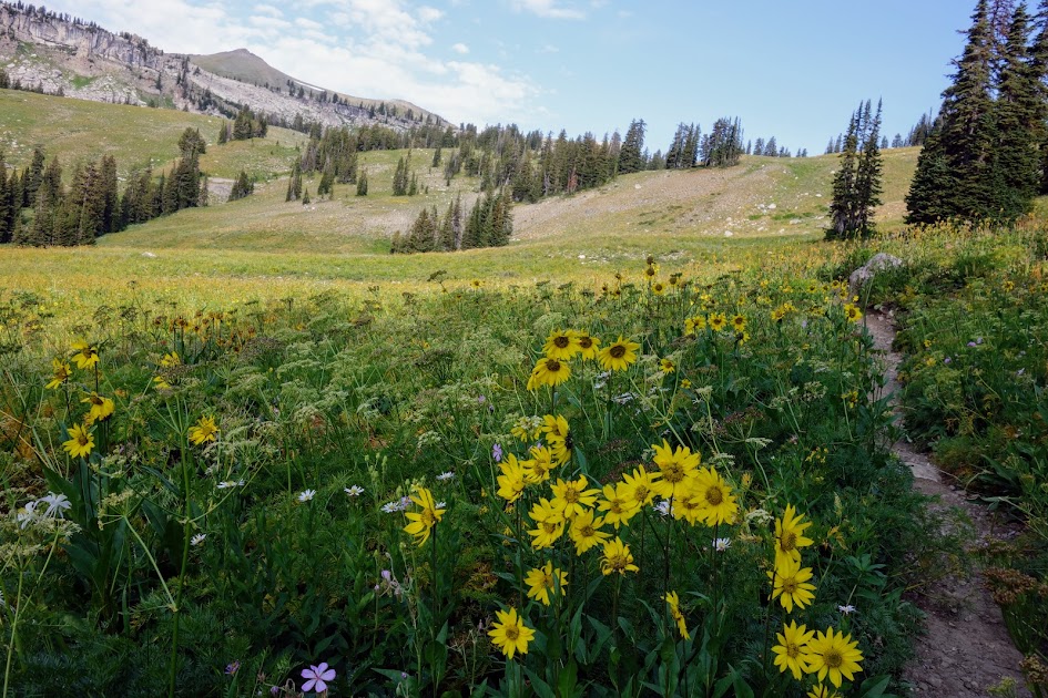
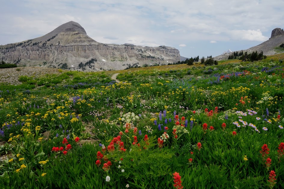
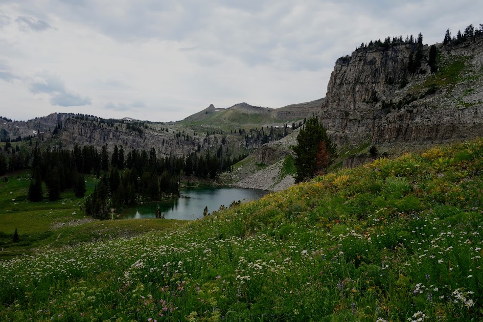
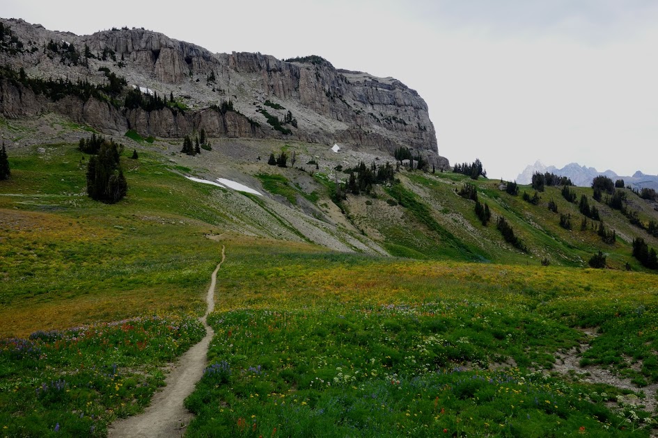
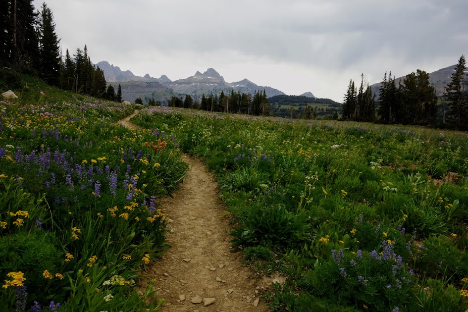
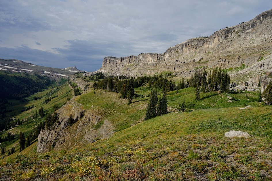
My primary goal of the day was to explore Alaska Basin.
The cloudy skies made for perfect hiking temperatures but less than ideal views and photos.
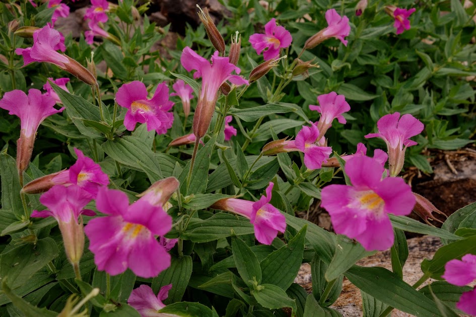
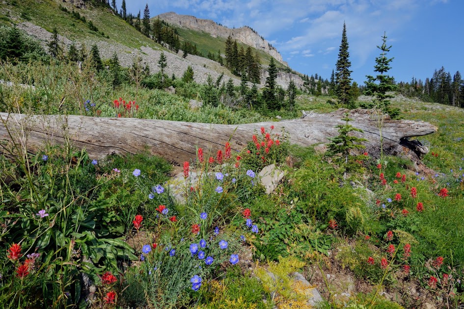
The Monkey Flowers were at peak and were prolific near water sources.
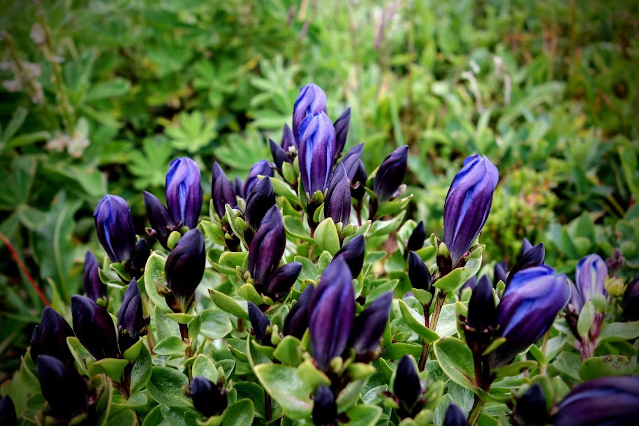
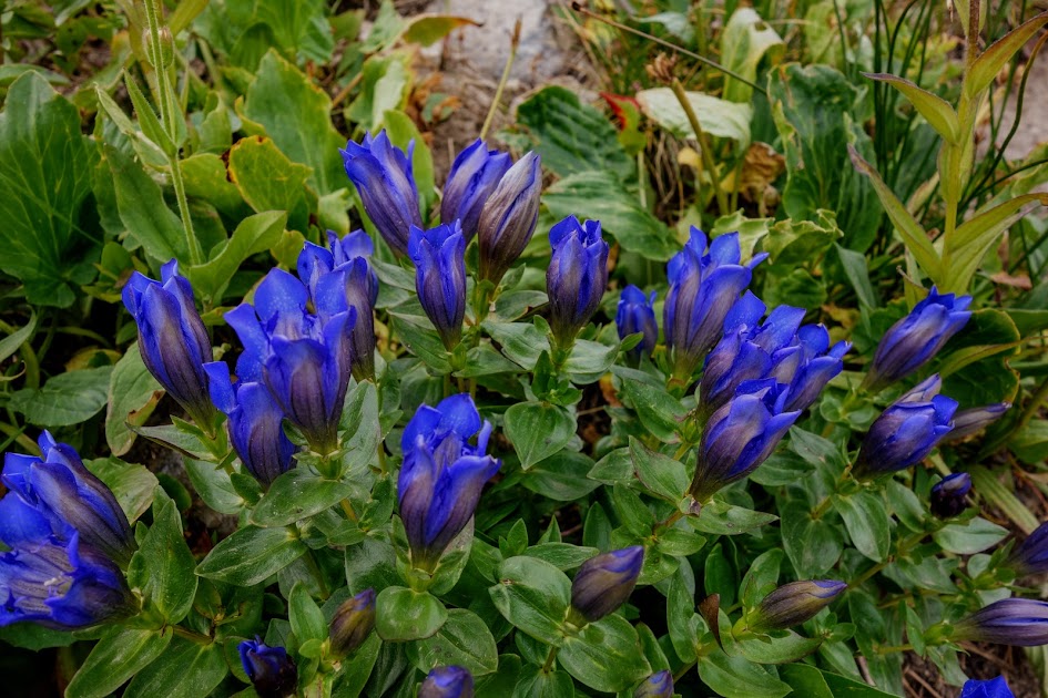
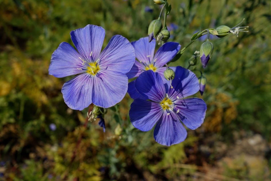
There were a few shady enclaves hiding Gentian flowers.
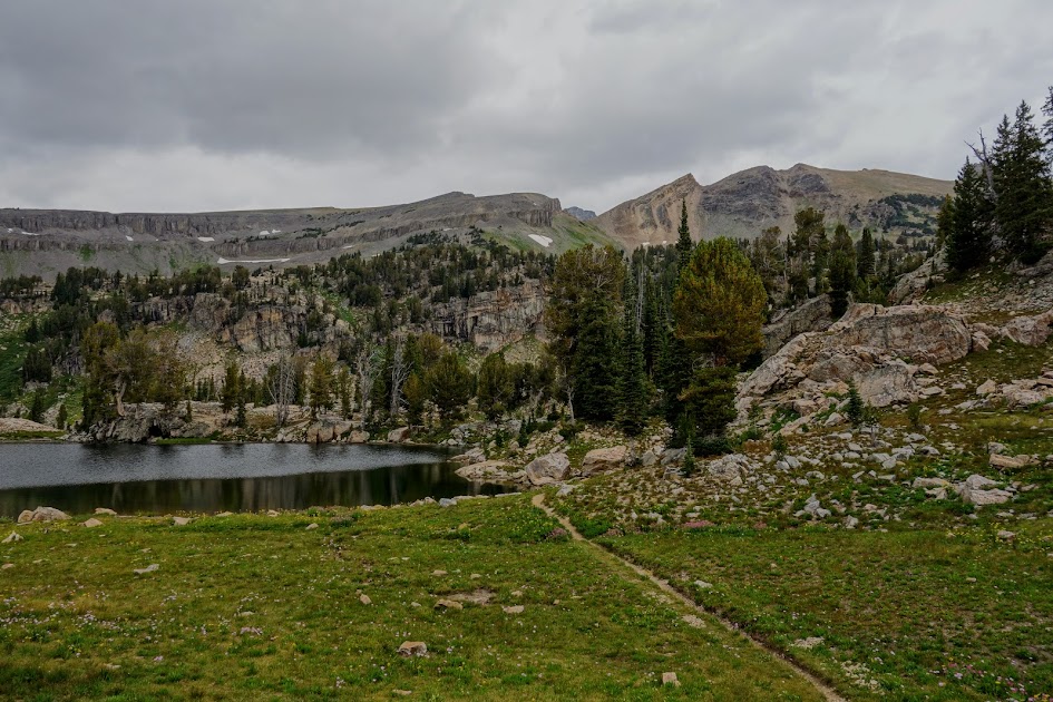
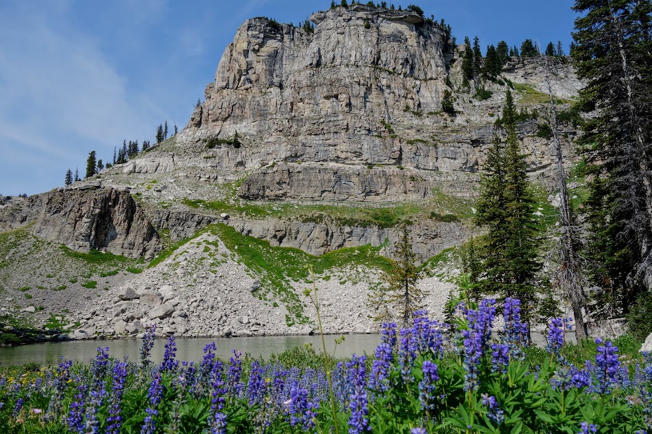
There are several lakes in the basin. I was quite disappointed by the quality of lakes in the Tetons. They are much more like ponds, not a place you want to swim nor gather drinking water.
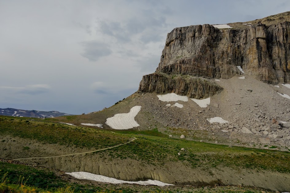
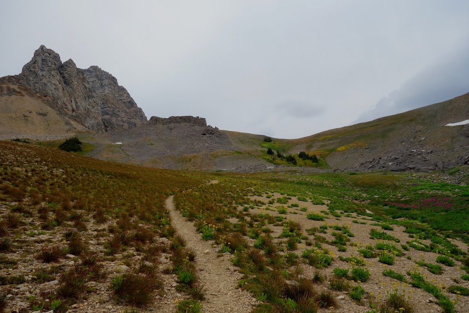
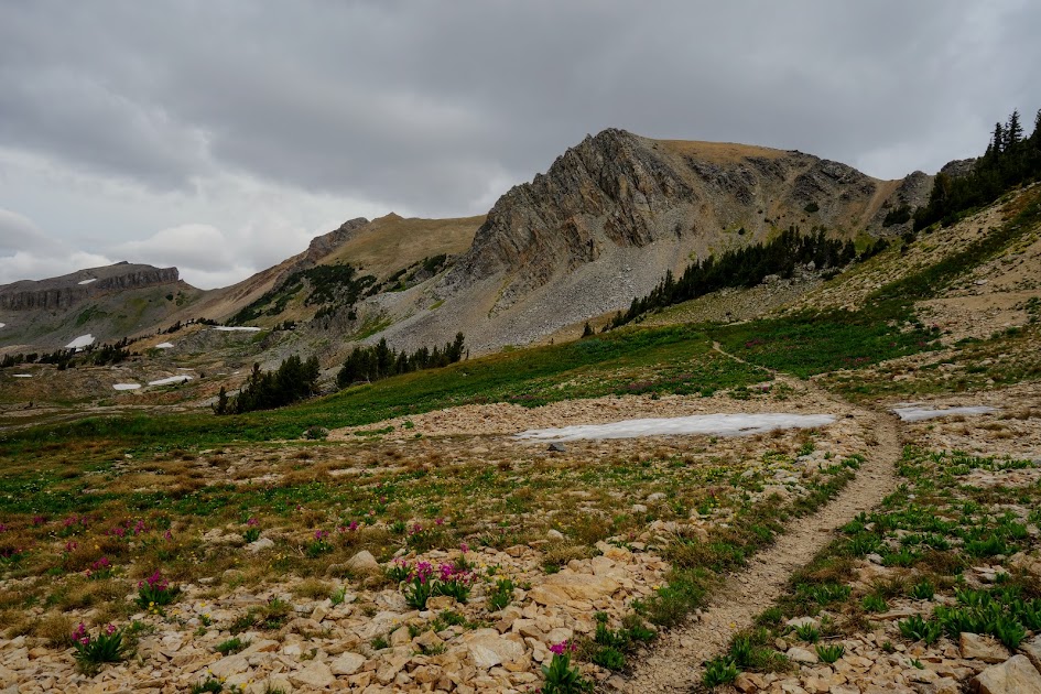
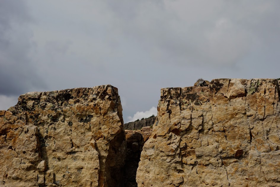
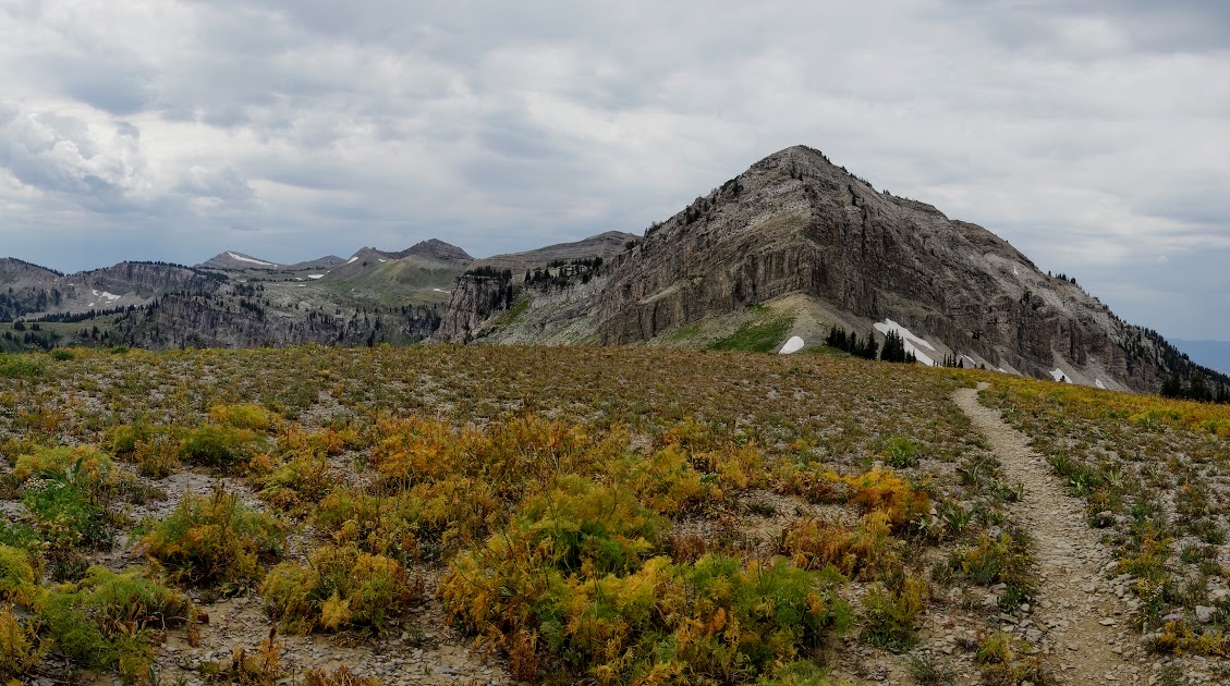
There is a side trail that takes you to the pass next to Buck Mountain, a detour on my agenda.
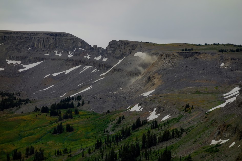
Look closely at the mark under the clouds. That’s a helicopter! I met a man running down the trail. He said he’d had to run to the pass from the basin to call 911 on his cell. Jackson Hole is between the gap. His friend had developed severe stomach pains overnight and needed urgent extraction. Relying on cell signal in the mountains is risky; I’m thankful for my InReach (two-way satellite communicator).
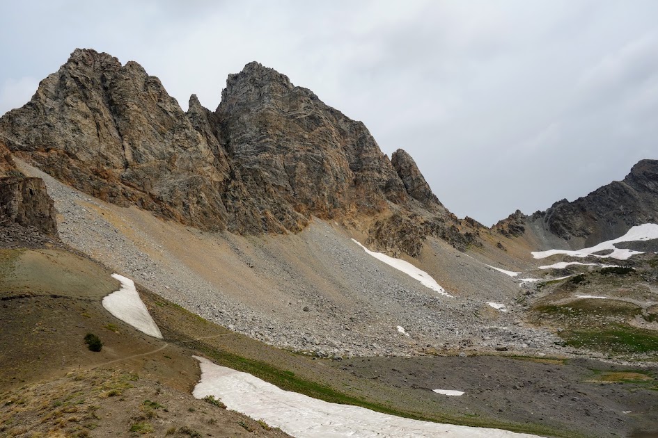
What’s on the other side of Buck Mountain Pass?
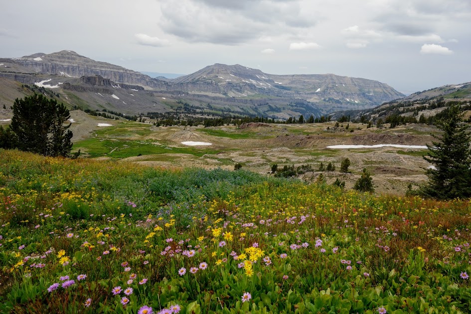
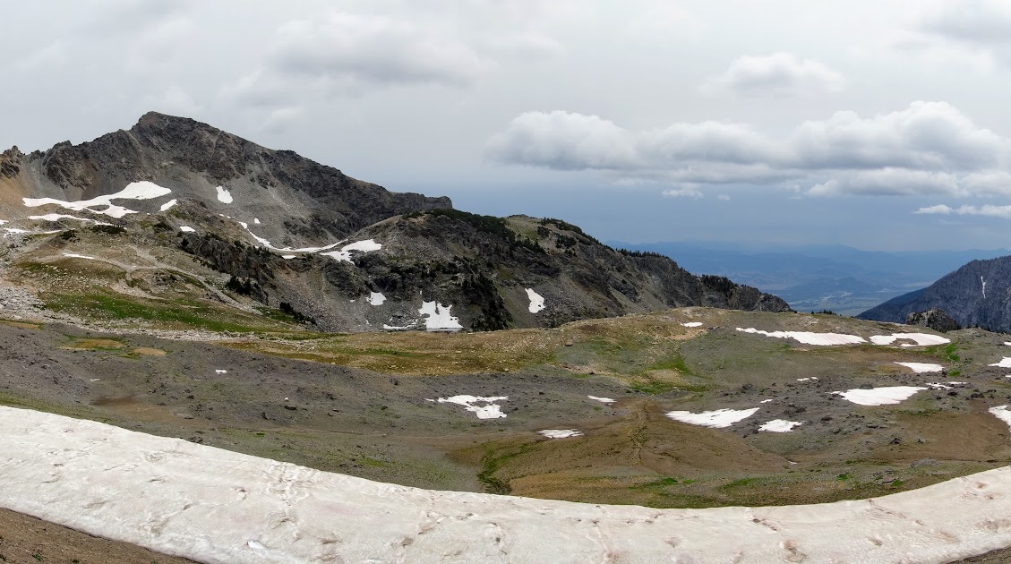
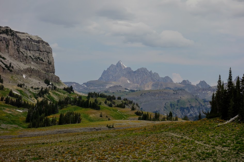
Looking down into Alaska Basin.
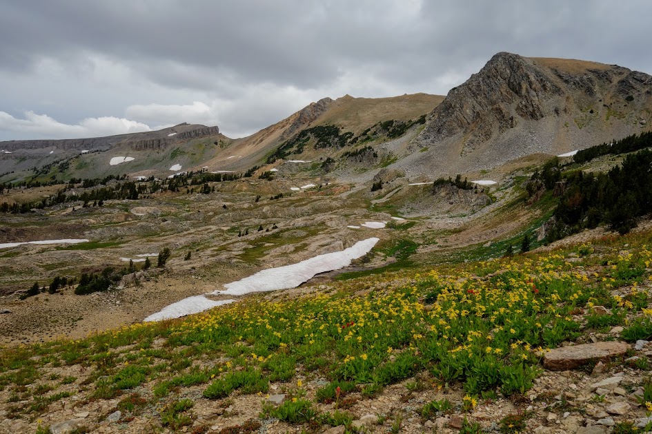
Views from Buck Mountain Pass.
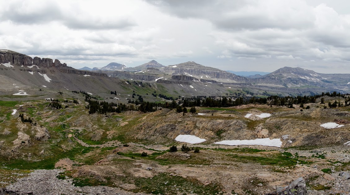
The trail continues around the other side of the Alaska Basin.
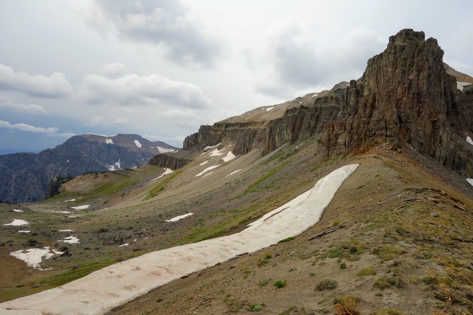
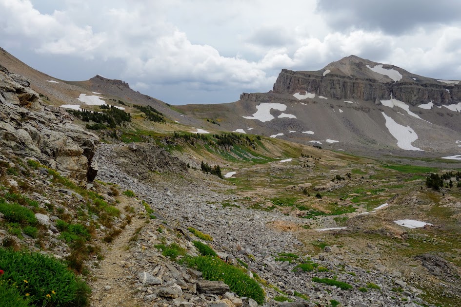
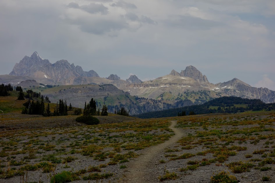
Looking back up toward Buck Mountain Pass.
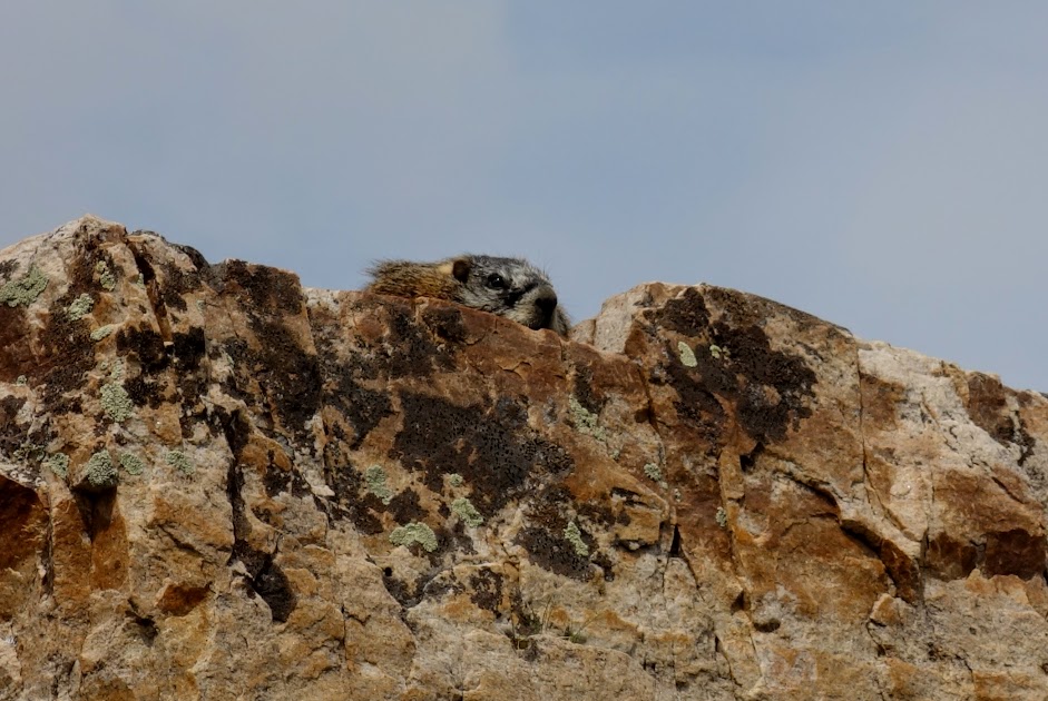
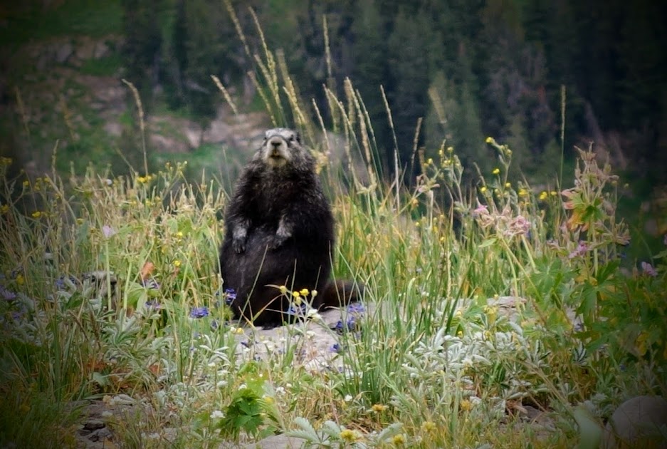
Do you see me? This marmot made me chuckle. He was absorbing the warmth of the rock, hiding from the breeze and hoping I didn’t see him.
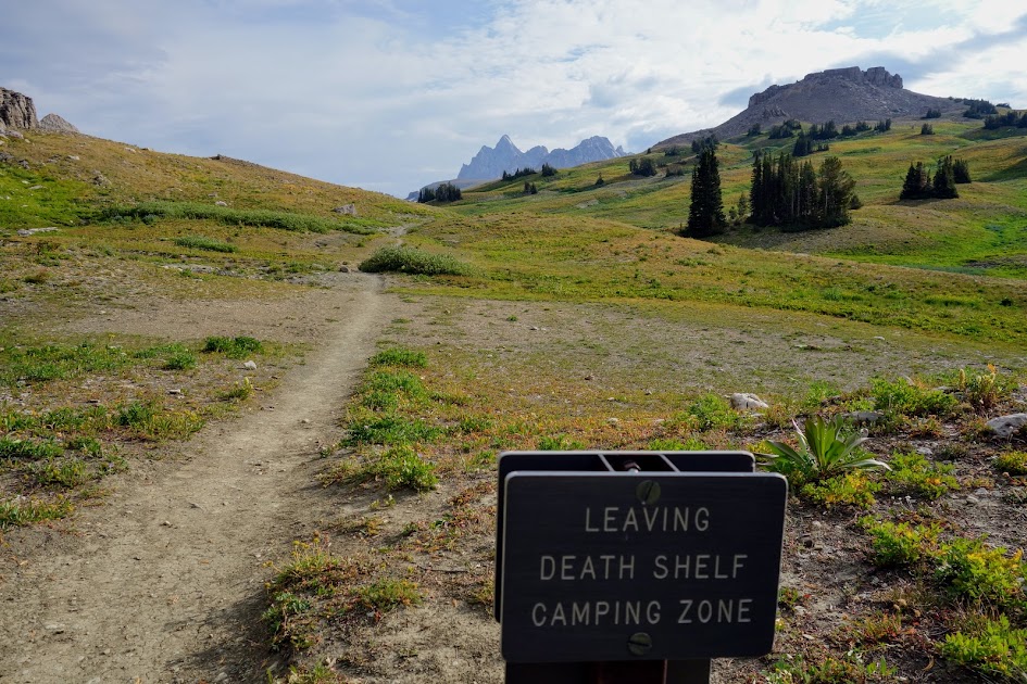
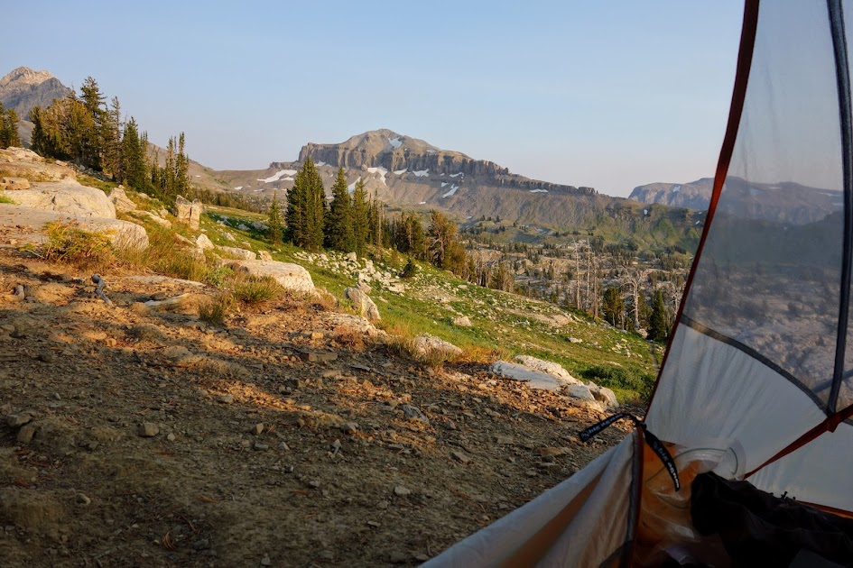
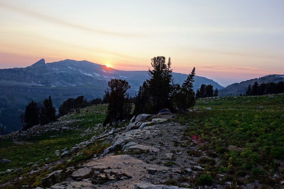
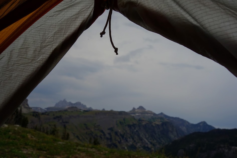
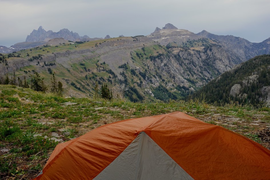
I’d originally planned to camp at Sunset Lake, but because I was outside GTNP I had the flexibility to camp elsewhere. When I found this spot on the Alaska Basin Shelf, with nearby water, I knew this would be a better home for me. I had a view of where I’d spent the day and felt as though I had the entire place to myself.
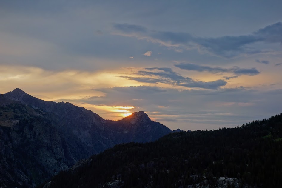
With smoke in the air, I had a nice sunset view. Wonder if the view was better at Sunset Lake?
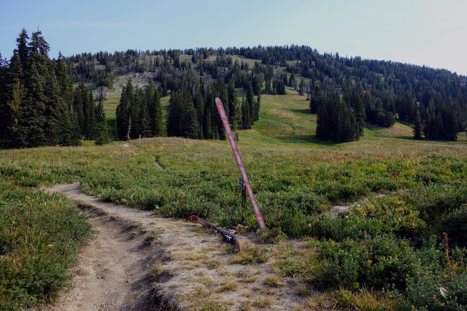
Worst case of Leave No Trace (LNT) I’ve seen. Wonder how long these skis have been here? Wonder how the person exited? Did this person receive a helicopter ride?