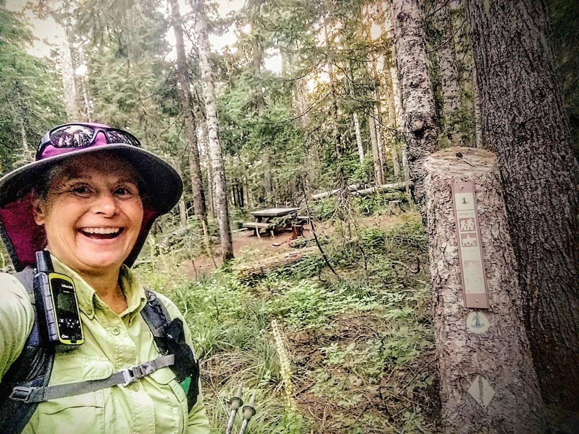
After completing my initiation trip a few days earlier I was anxious to dive deeper into the wilderness. I obtained good information regarding road and trail conditions, as well as this trail recommendation, from staff at the ranger station in Philipsburg.
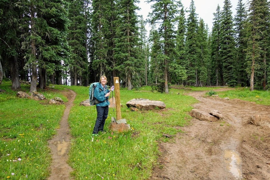
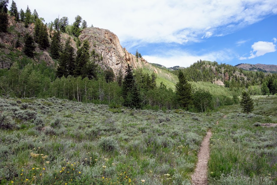
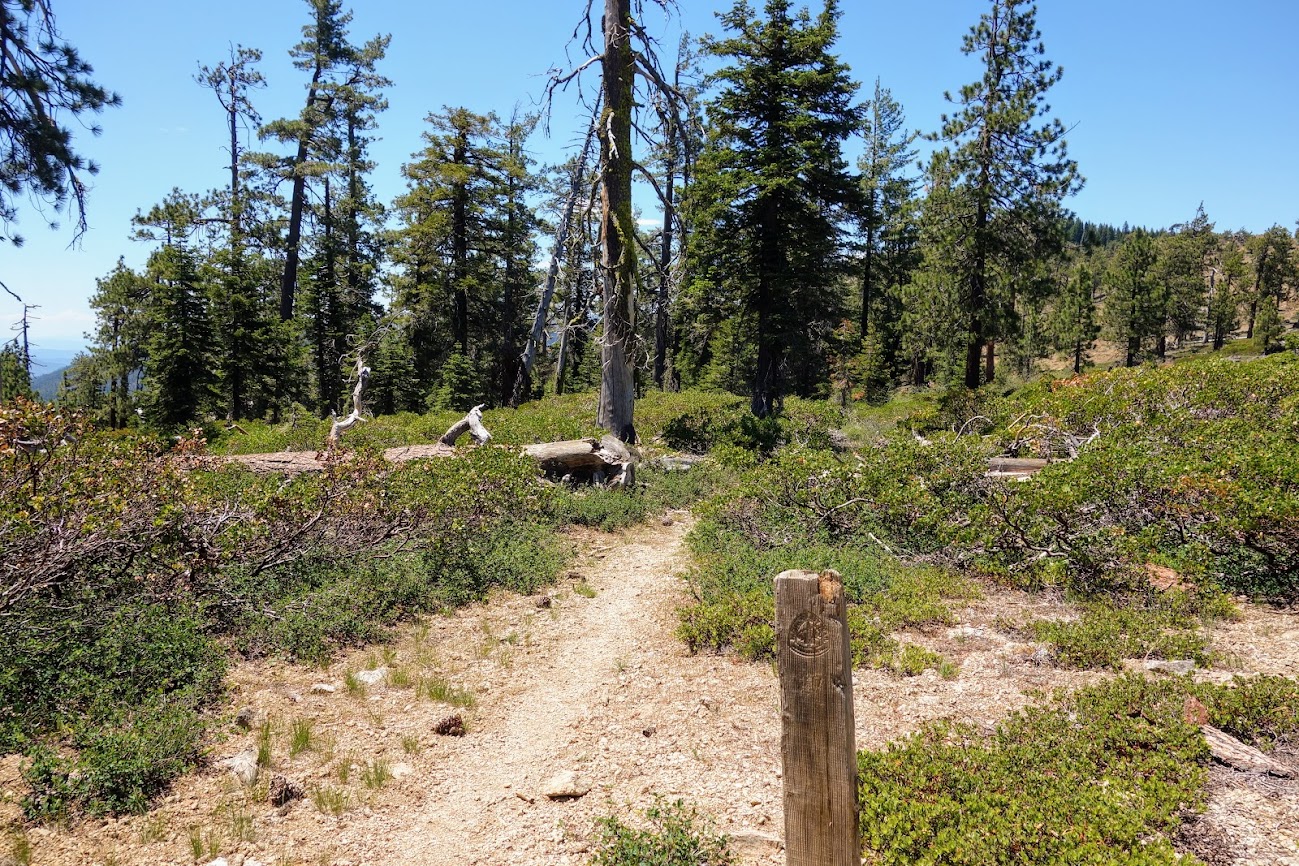
I hiked a clockwise loop, starting along Page Creek Trail.
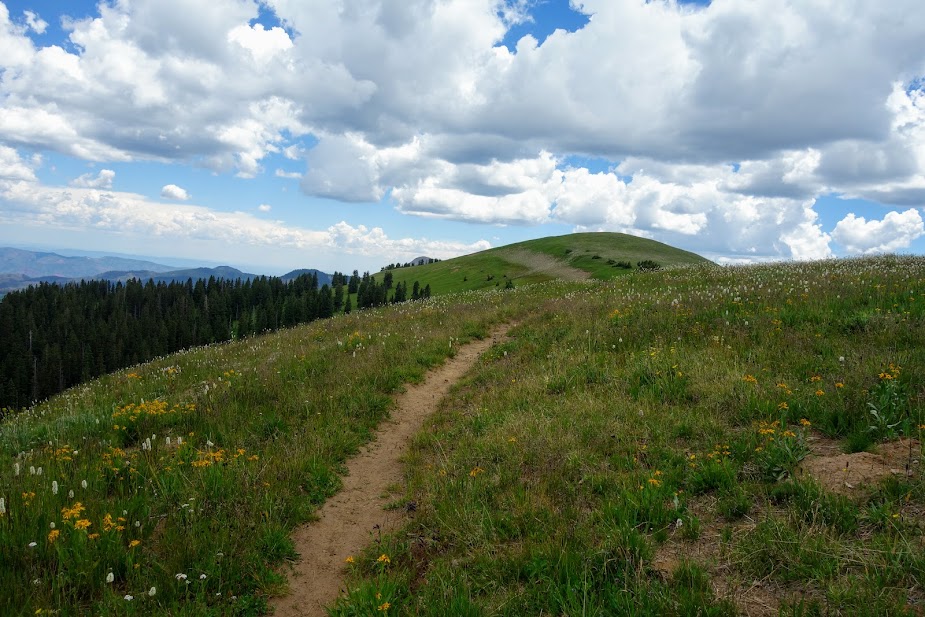
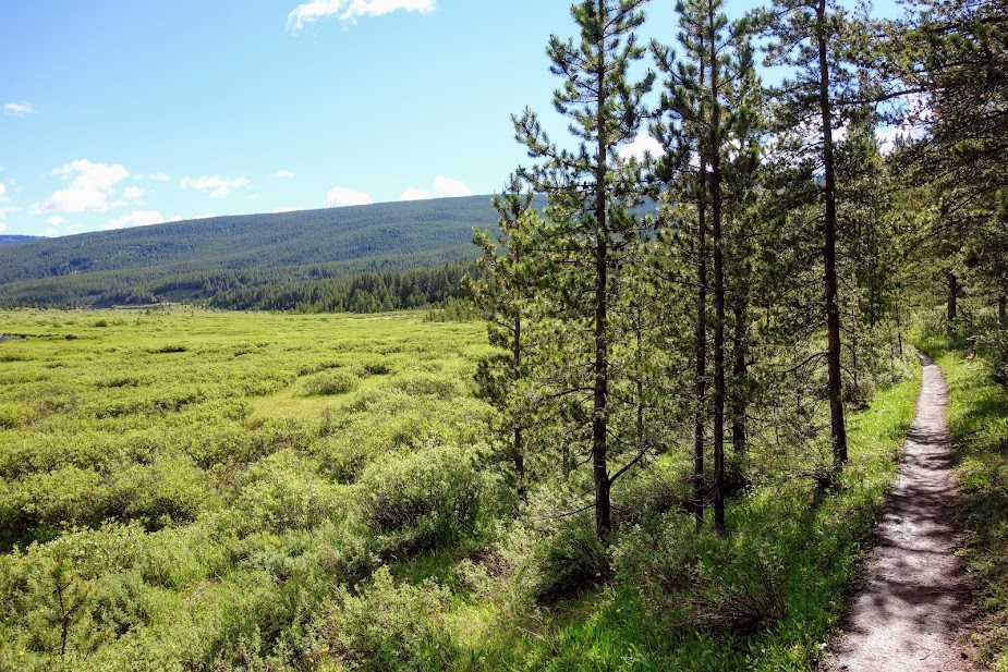
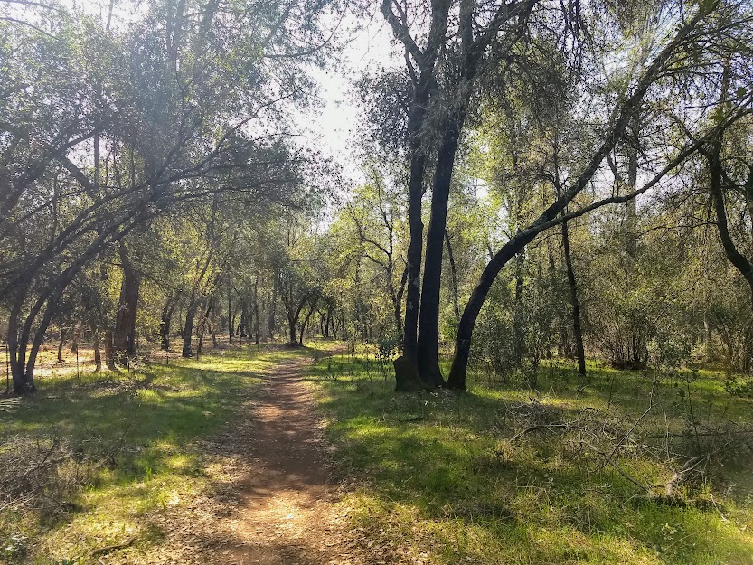
I hiked about 7 miles through a lovely forest without taking a single photo until I got to the Continental Divide Trail (CDT) junction. It was a long slow ascent gaining about 2,200 feet. The trail was in great condition and I enjoyed the meditative plodding. My plan was to take a detour off the loop to visit Goat Flats.
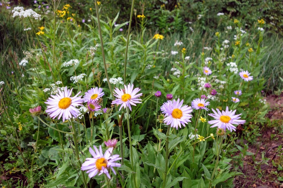
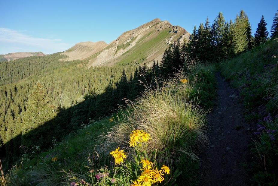
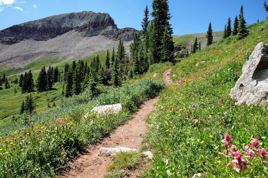
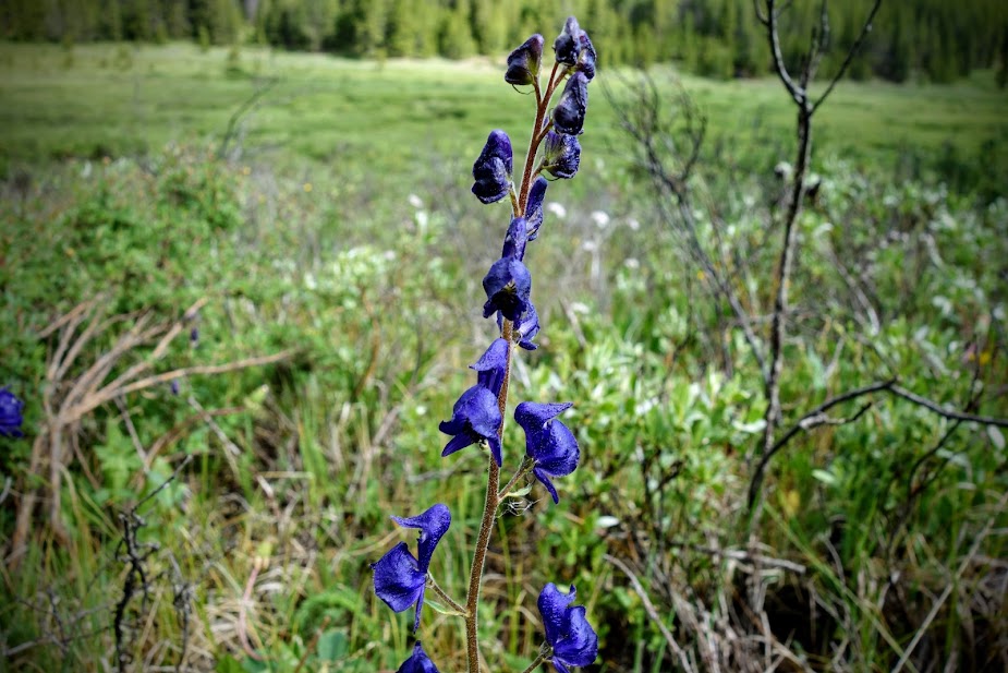
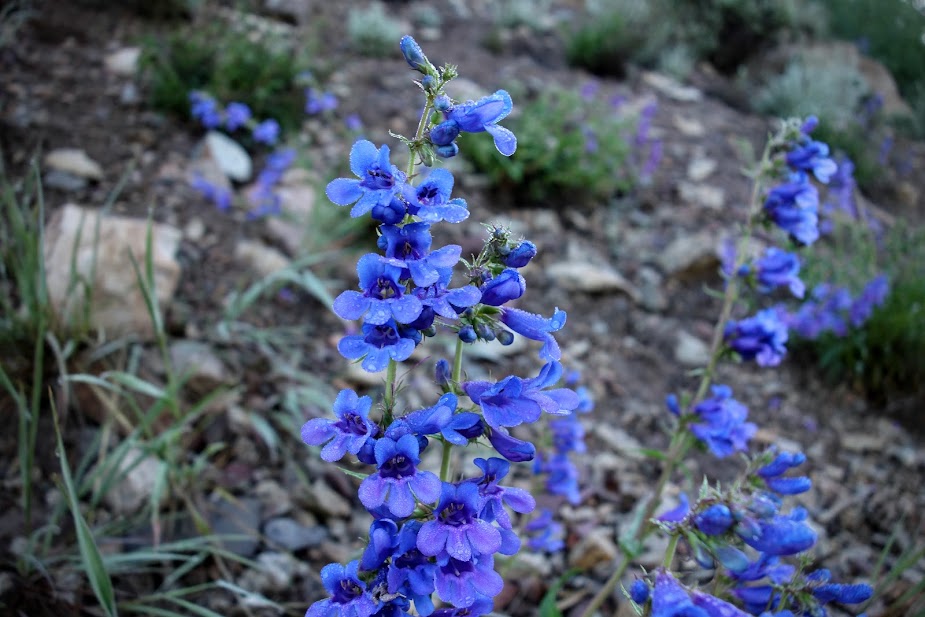
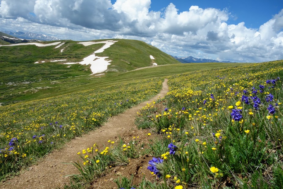
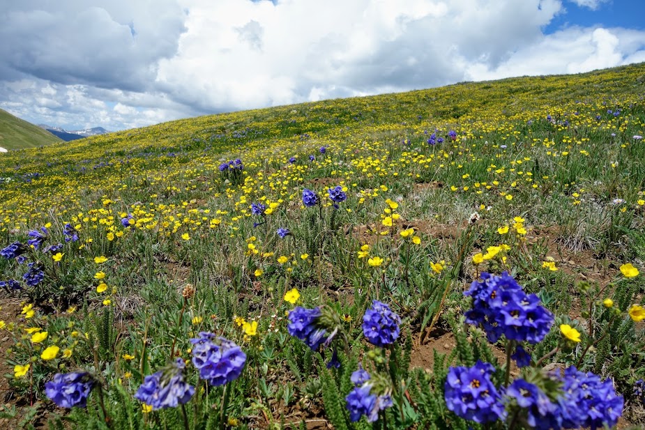
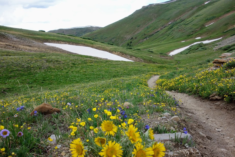
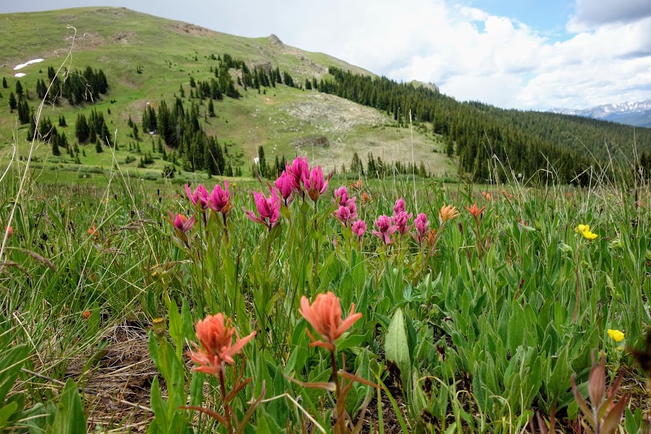
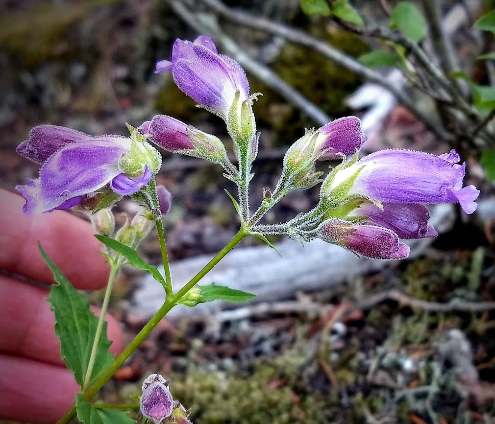
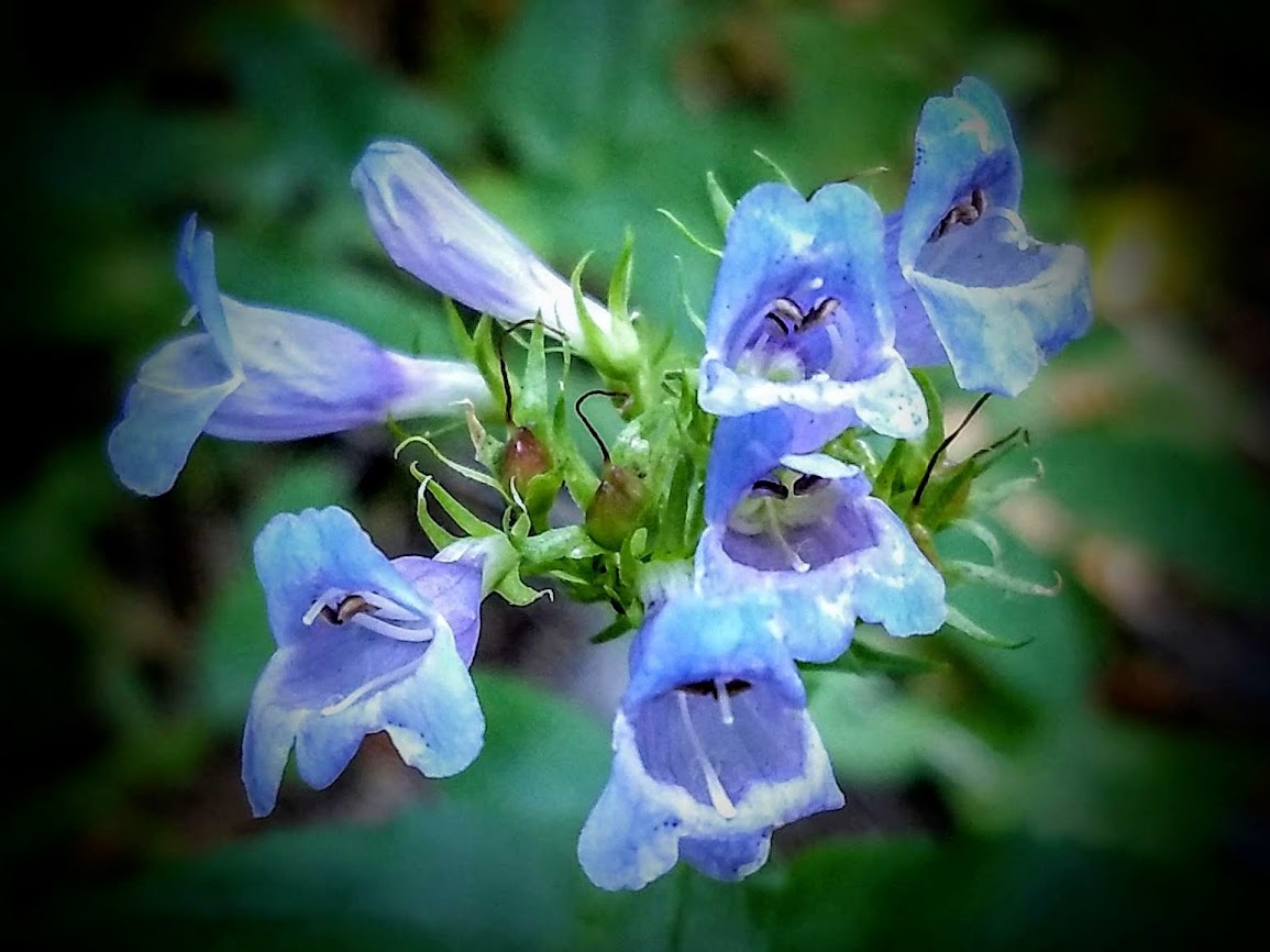
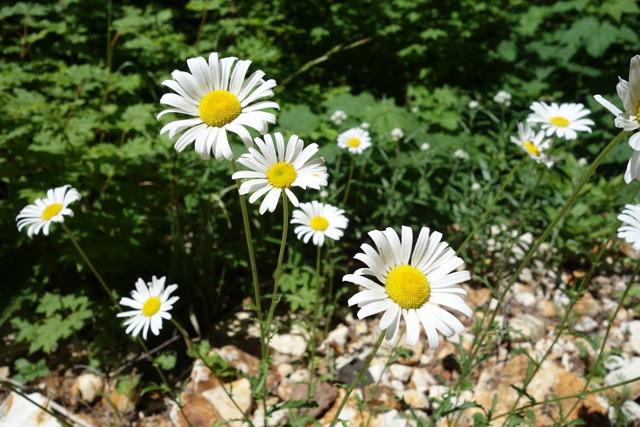
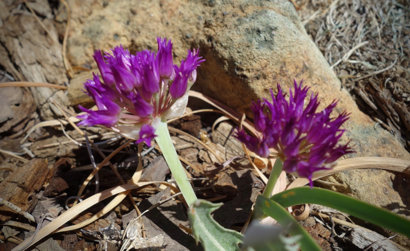
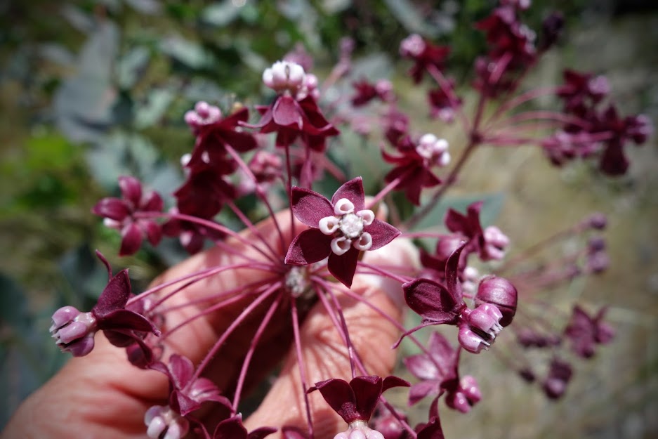
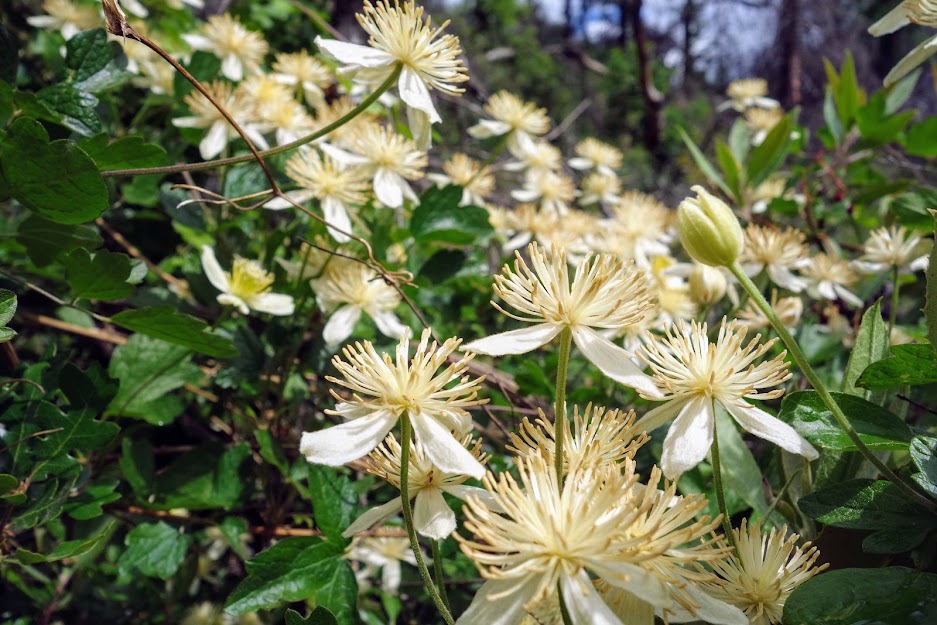
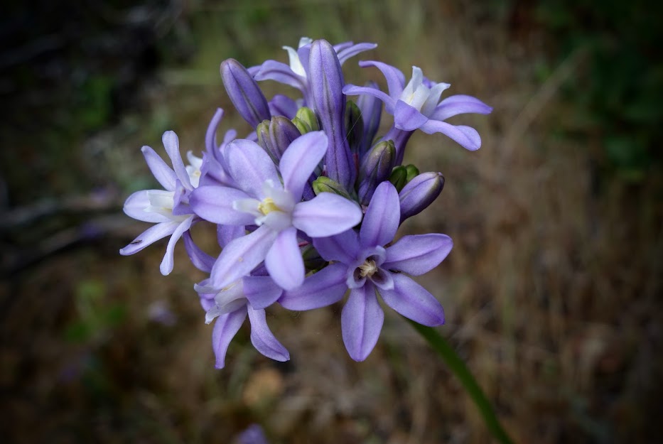
Once on the CDT, I found myself surrounded by flowers.
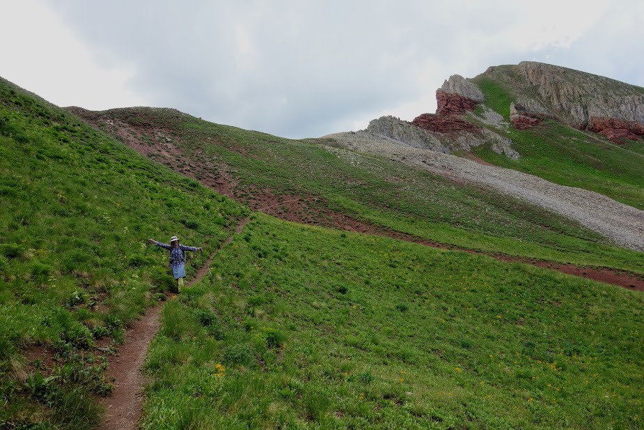
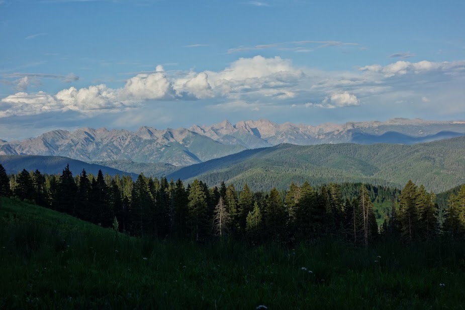
Views opened up as I ascended toward Goat Flats.
The trail wove through a forest of larch trees.
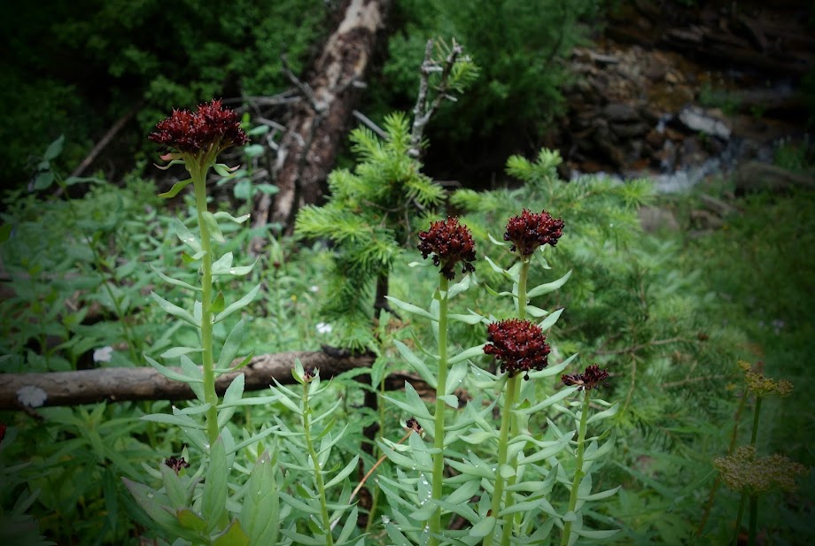
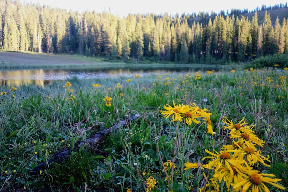
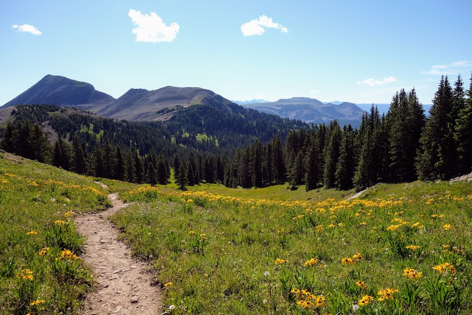
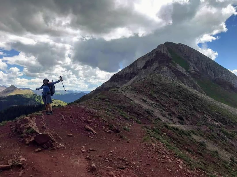
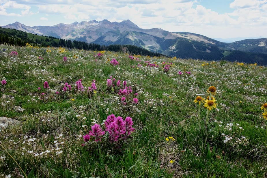
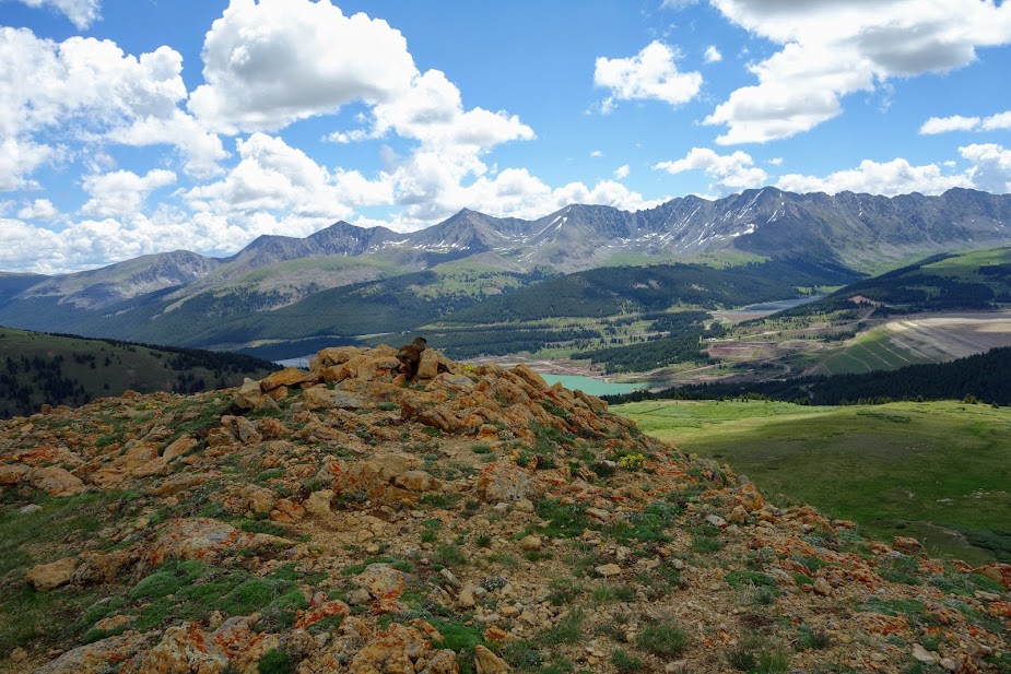
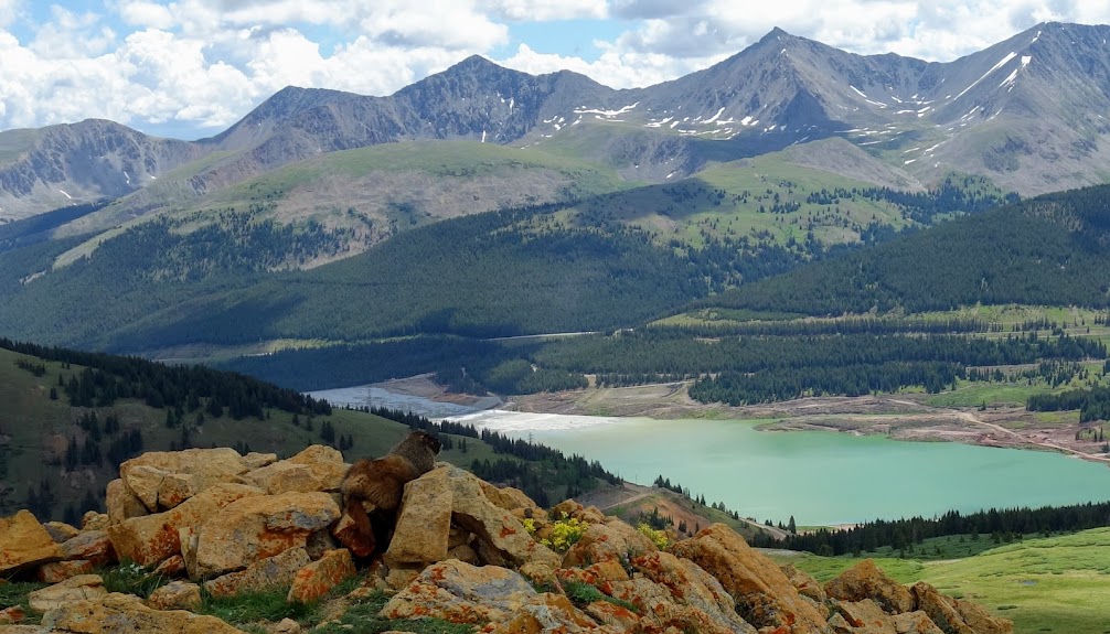
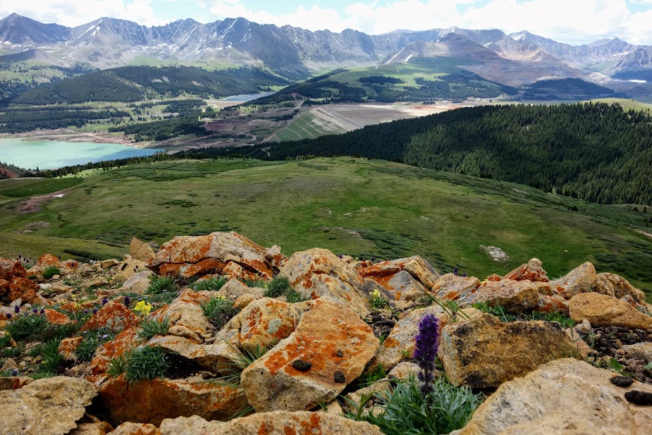
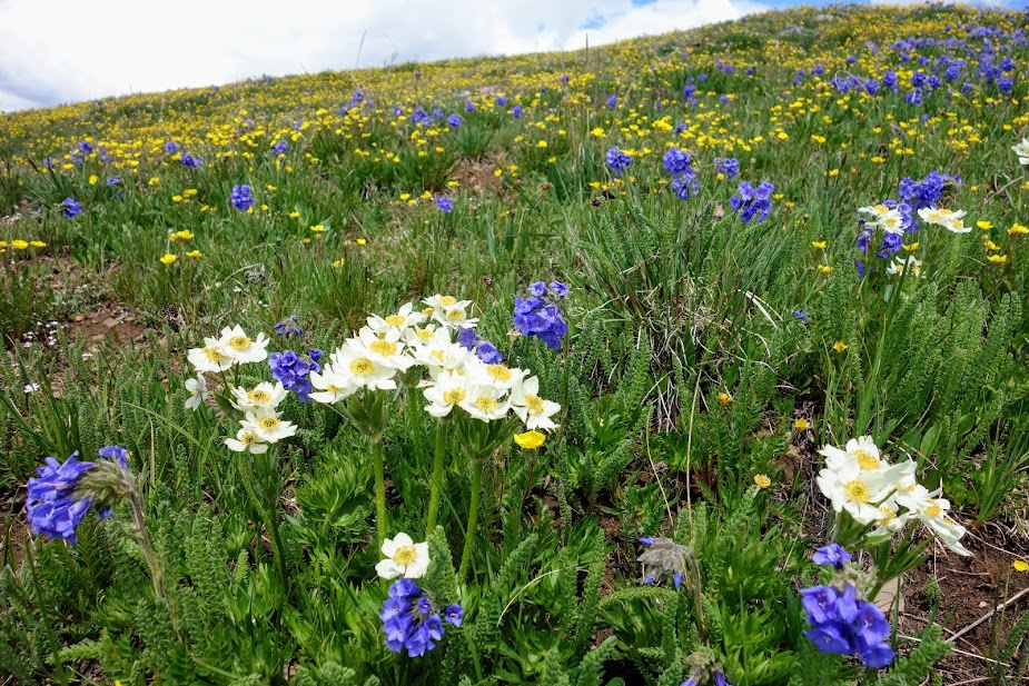
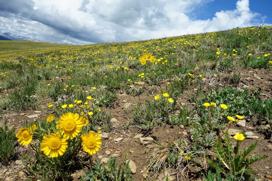
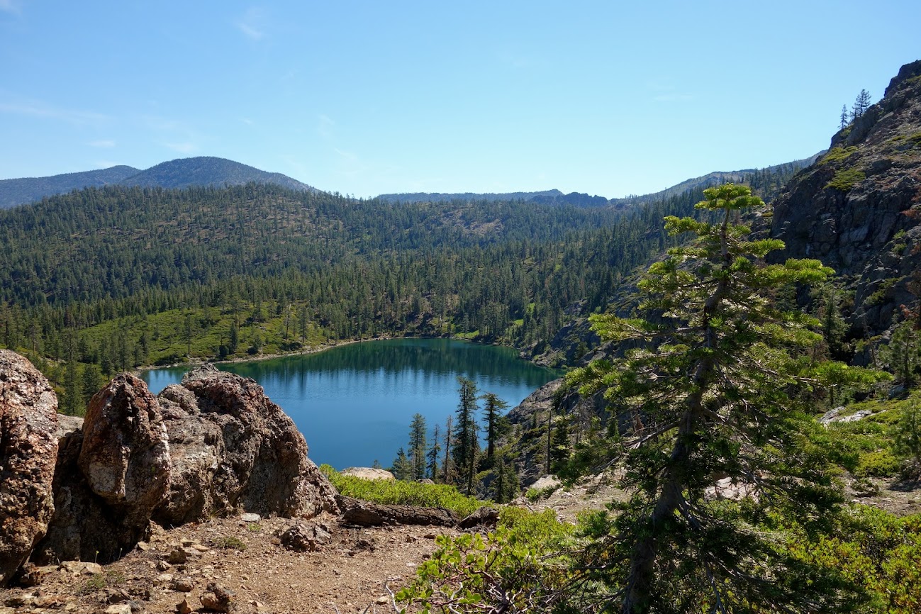
At about 8.5 miles and 3,000′ elevation gain, I arrived at Goat Flats. To the left are Mount Tiny and Storm Lake Pass. These meadows would have been filled with high-alpine blooms a few weeks ago.
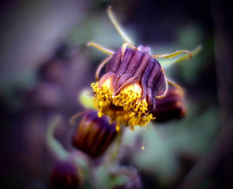
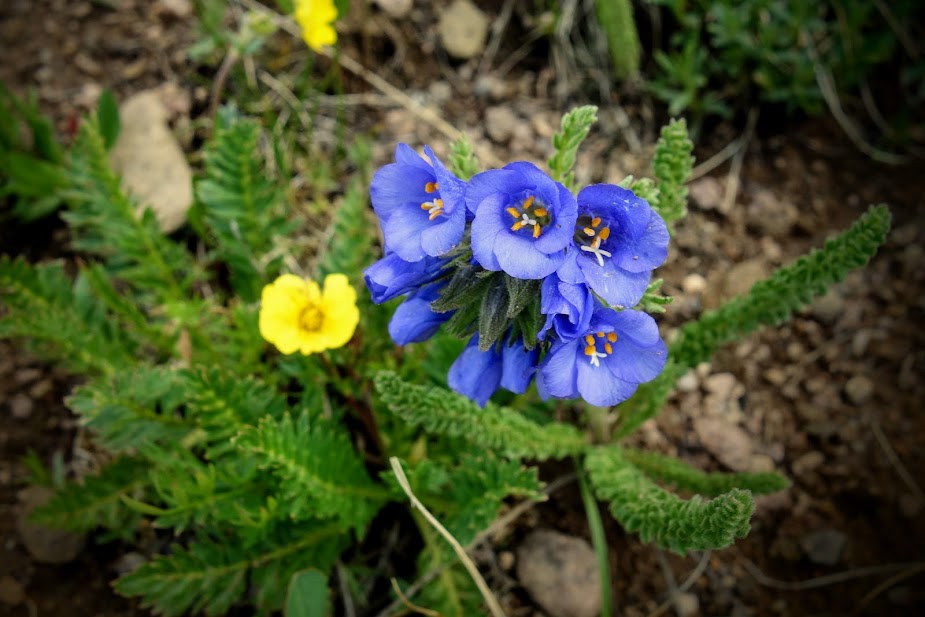
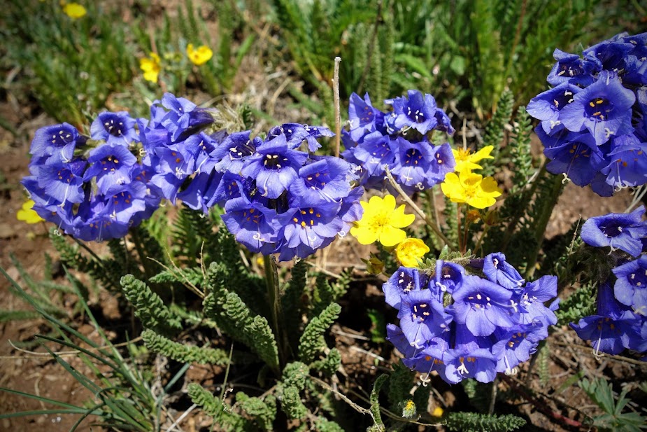
Arctic Gentian was the star of the meadows during my visit.
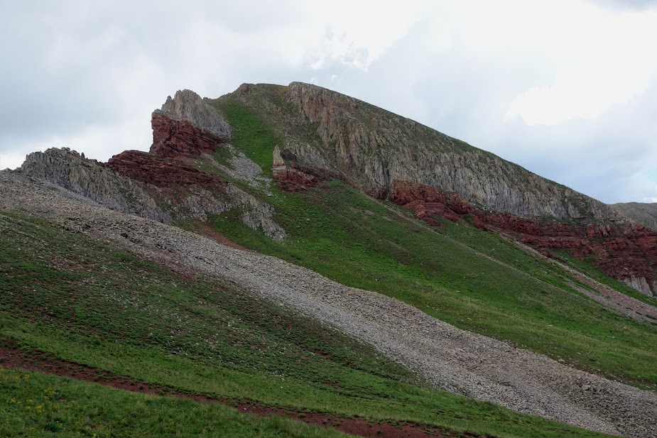
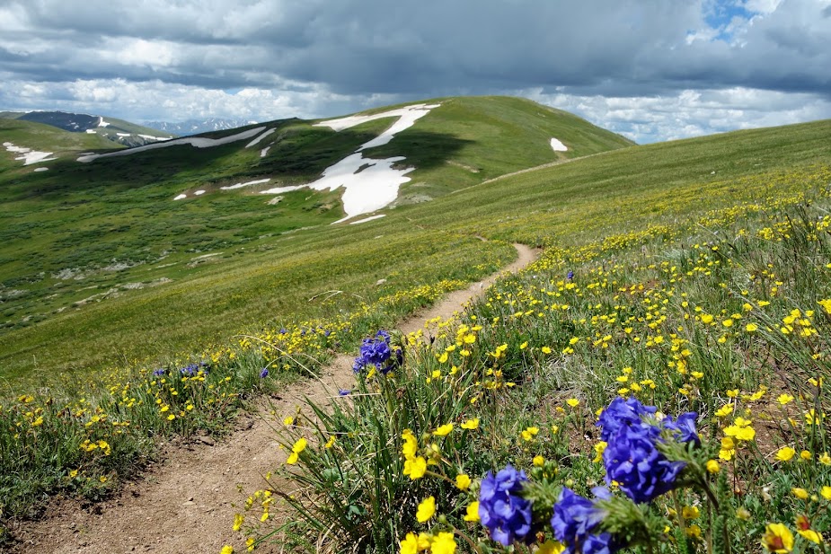
Views from Goat Flats.
If I had more time and energy, I would have loved to explore the trail that leads to Storm Lake Pass.
I wandered about taking in the views before heading back down to the junction and Page Lake.
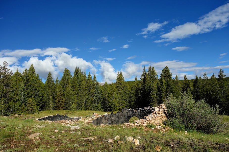
Page Lake wasn’t anything special but I was glad to have it to call home for the night.
I was not happy to see smoke at sunset. There was a somewhat nearby smallish fire so I was hopeful it would be gone in the morning.
12 hours later all was good once again. Whew!
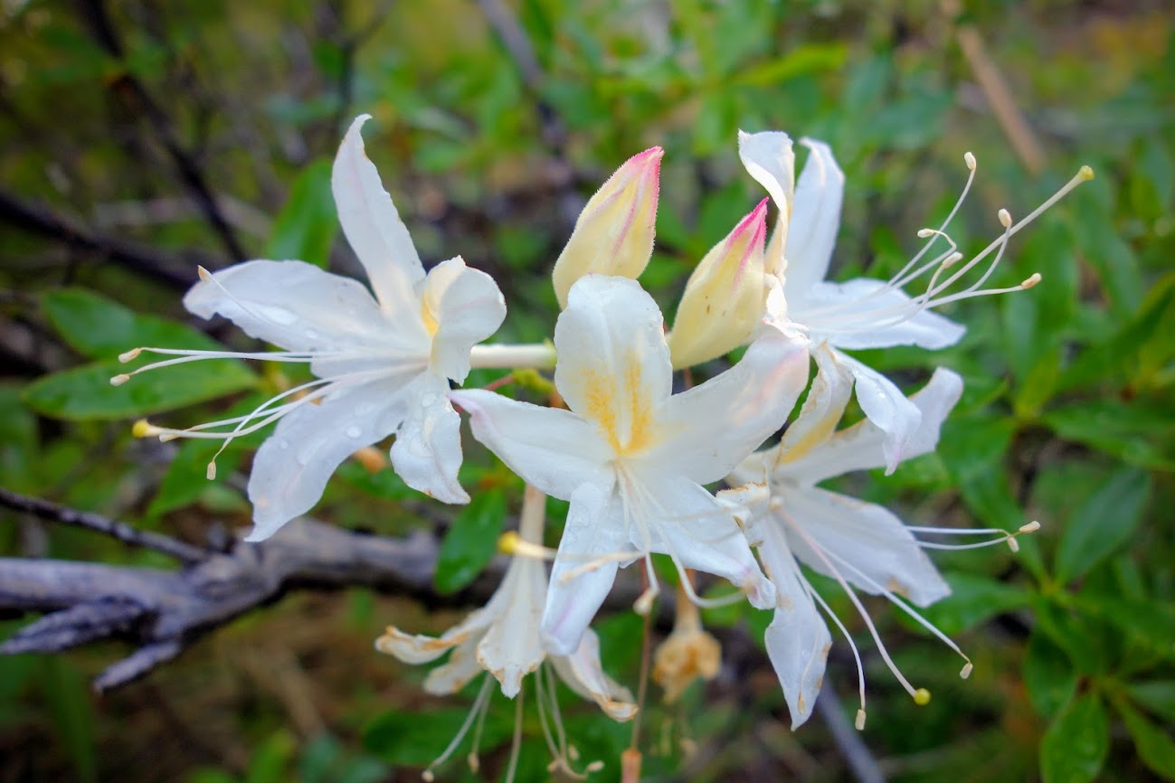
I found some monkeyflowers on my way to Flower Lake.
Flower Lake was a beauty and would have made for nicer campsite views and swimming, but I’m glad I didn’t push any further as my uphill tank was empty.
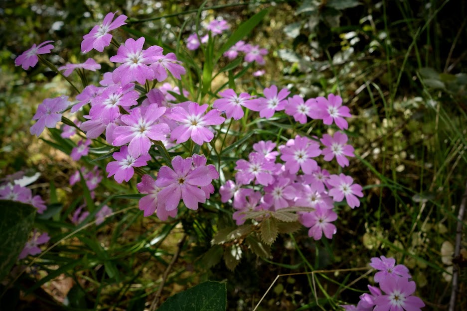
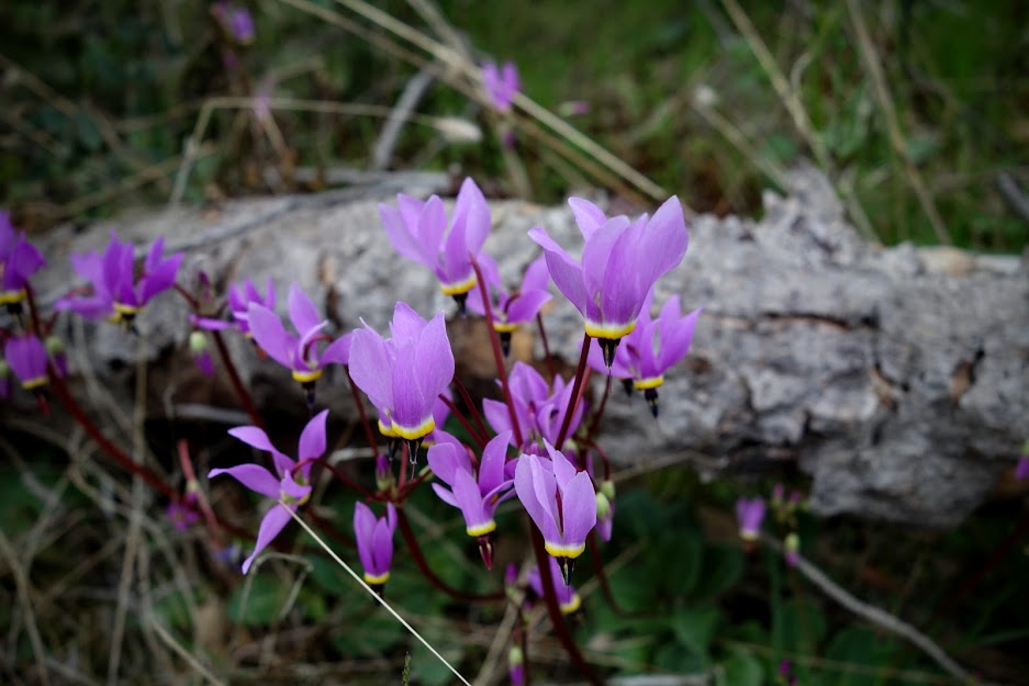
I found this mass display of Shooting Stars shortly after leaving Flower Lake.
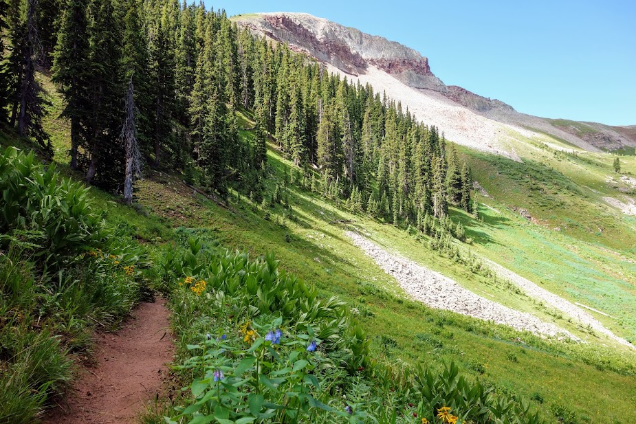
While it was the last day of July, there was residual snow reminding me I was near the Continental Divide.
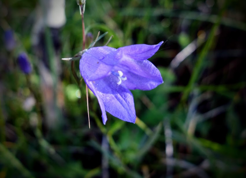
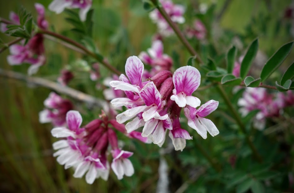
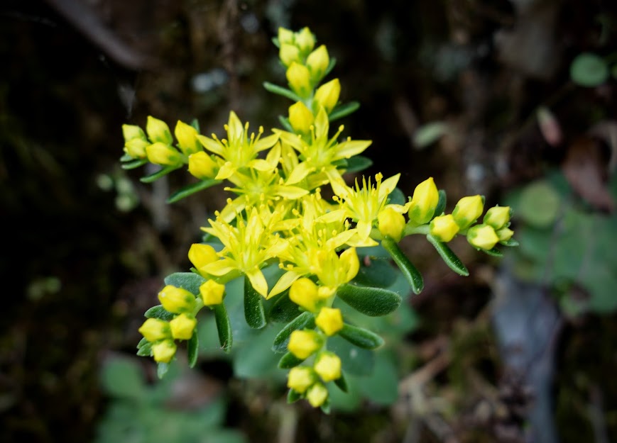
I was happy to find more spring blooms.
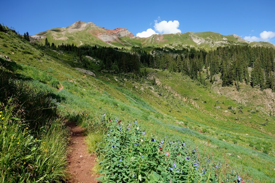
As I climbed up to the next trail junction, I had views back at Flower Lake.
From this viewpoint you can see Goat Flats in the distance, as well as both Page and Flower Lakes.
Nearly to the ridge at 9am. This is Rainbow Mountain at over 10,000′, which seems appropriate after visiting Rainbow Lake and Rainbow Pass recently.
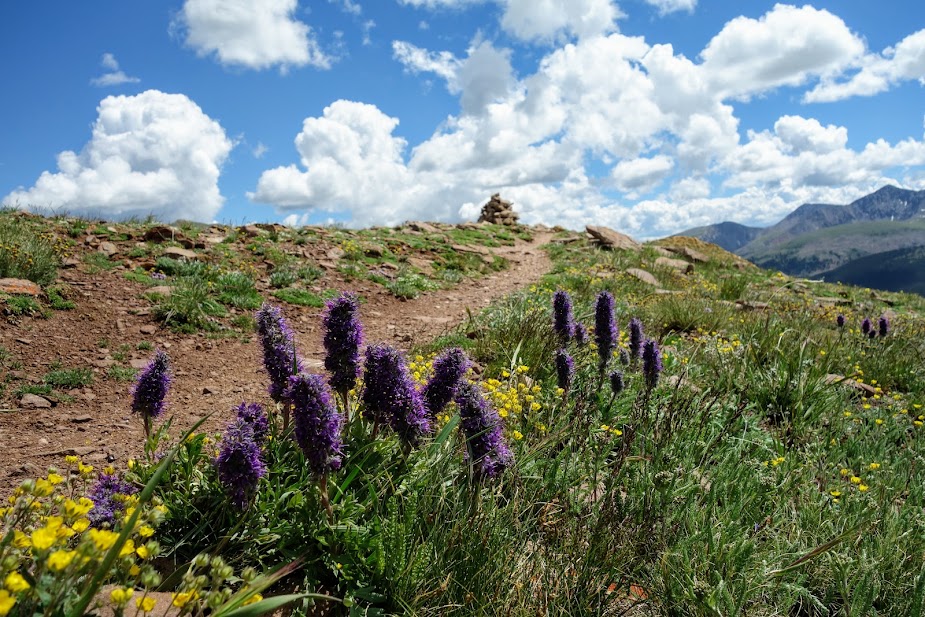
Woohoo, I love ridge views!
Wandering this ridge and across Rainbow Mountain would have been great fun, but I didn’t think I had sufficient time and food to extend this trip.
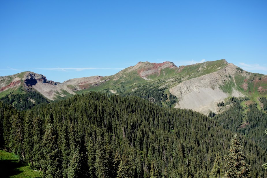
Over there is my next destination, Cutaway Pass.
This is Cutaway Mountain.
All too soon it was time to go down so I could go back up.
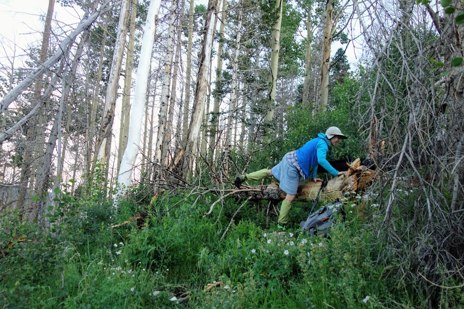
There was a large section of avalanche debris. I was thankful for the trail crews, they are my heroes!
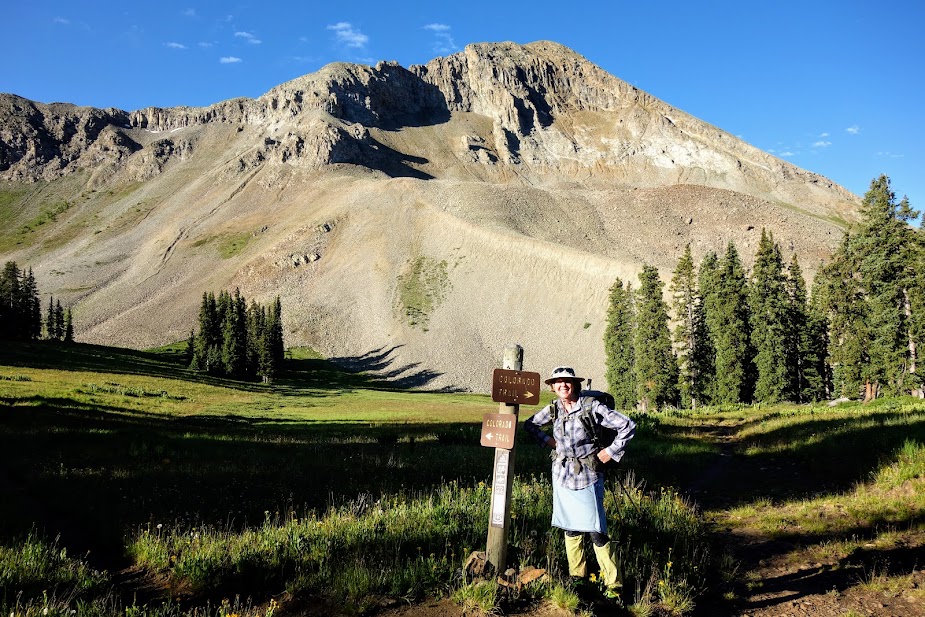
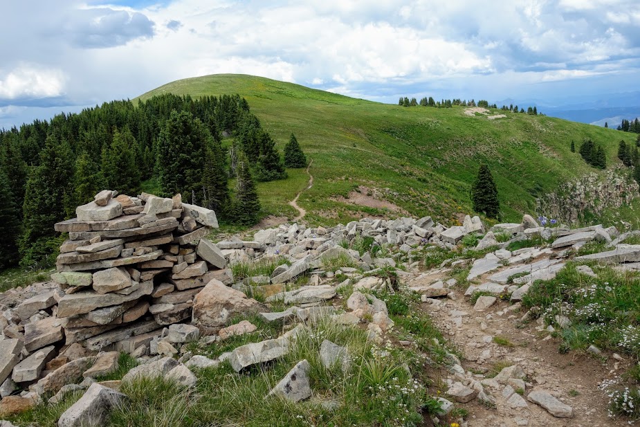
Cutaway Pass was another detour off my planned loop. I met two guys and a gal hiking the CDT.
The trail had nice Jan-friendly switchbacks.
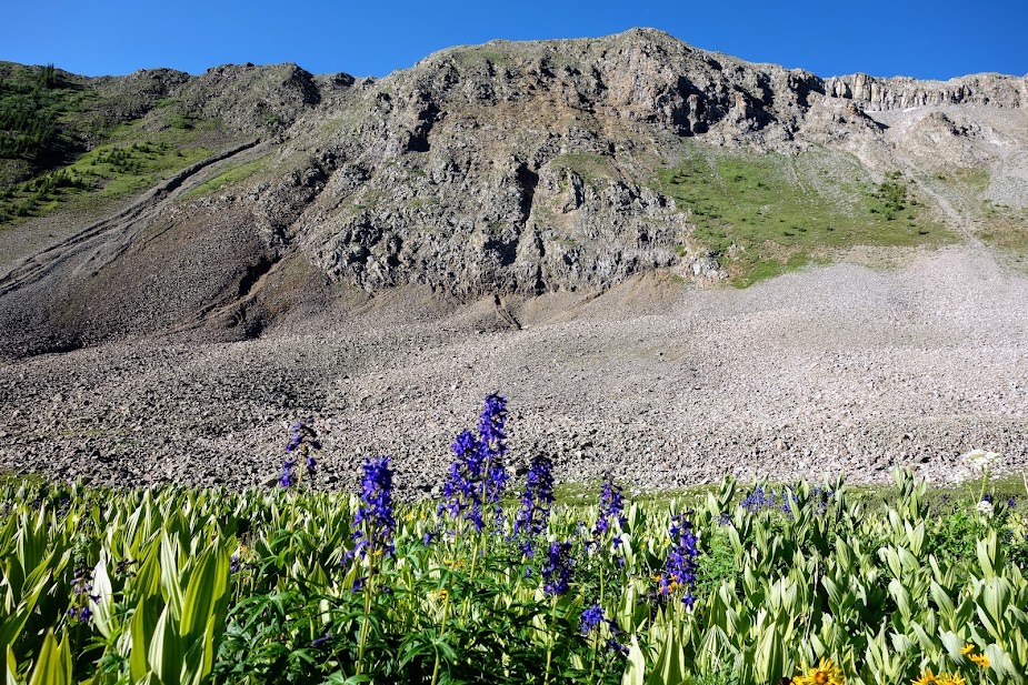
I enjoyed being up in the granite.
Yay for views!
This White Bark Pine tree was amazing. I couldn’t help but wonder about the age. According to Wikipedia, the oldest is 1,267 years old.
I reached Cutaway Pass at 9,000′ after 20 miles with 5,000′ elevation gain and 2,300′ loss.
I wandered up the Hiline Trail a bit to gain better views. This is Beaverhead Mountain.
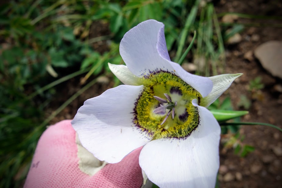
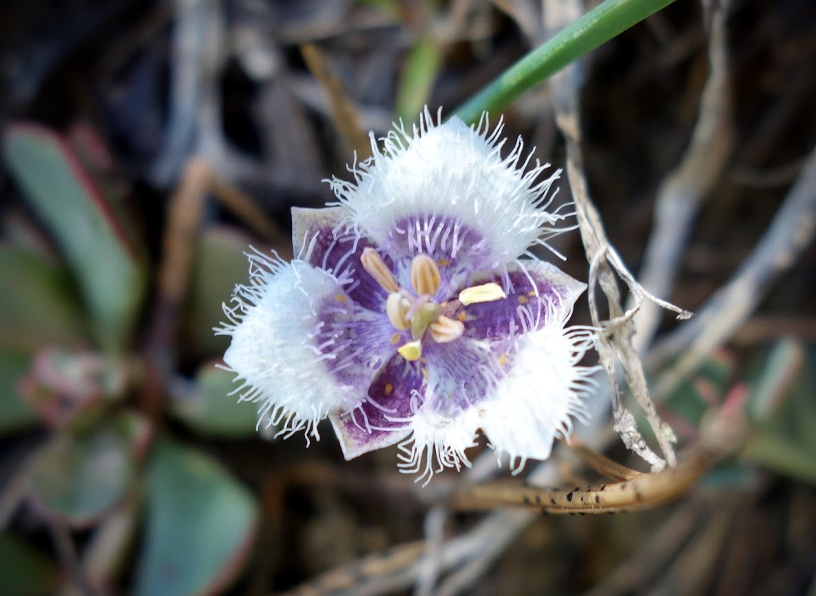
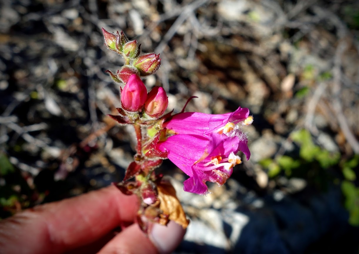
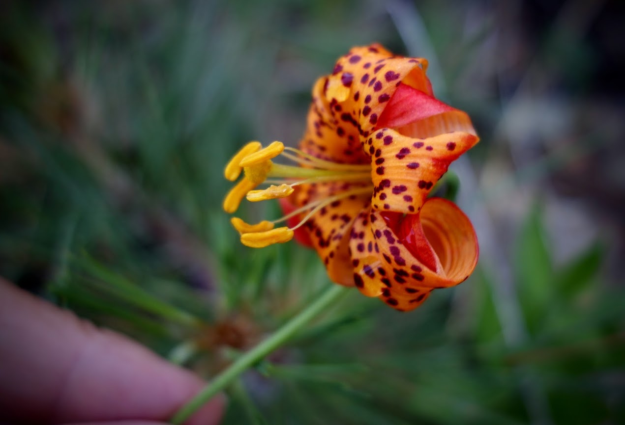
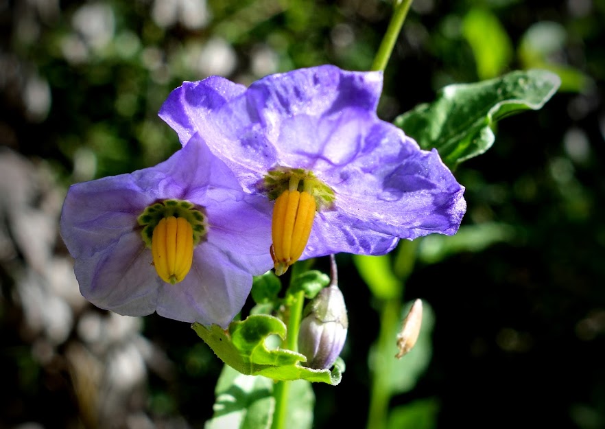
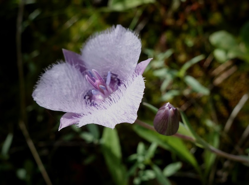
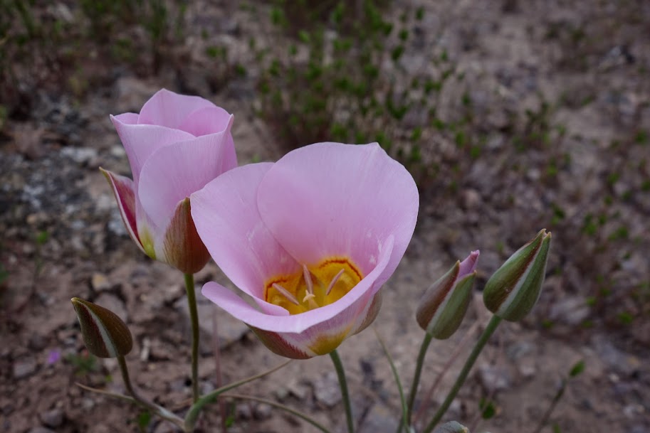
I was surprised and thrilled to find this Mariposa Lily.
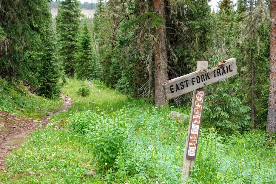
I found a flat spot for a campsite near a creek for the night. The next morning I would be hiking down the East Fork Rock Creek Trail.
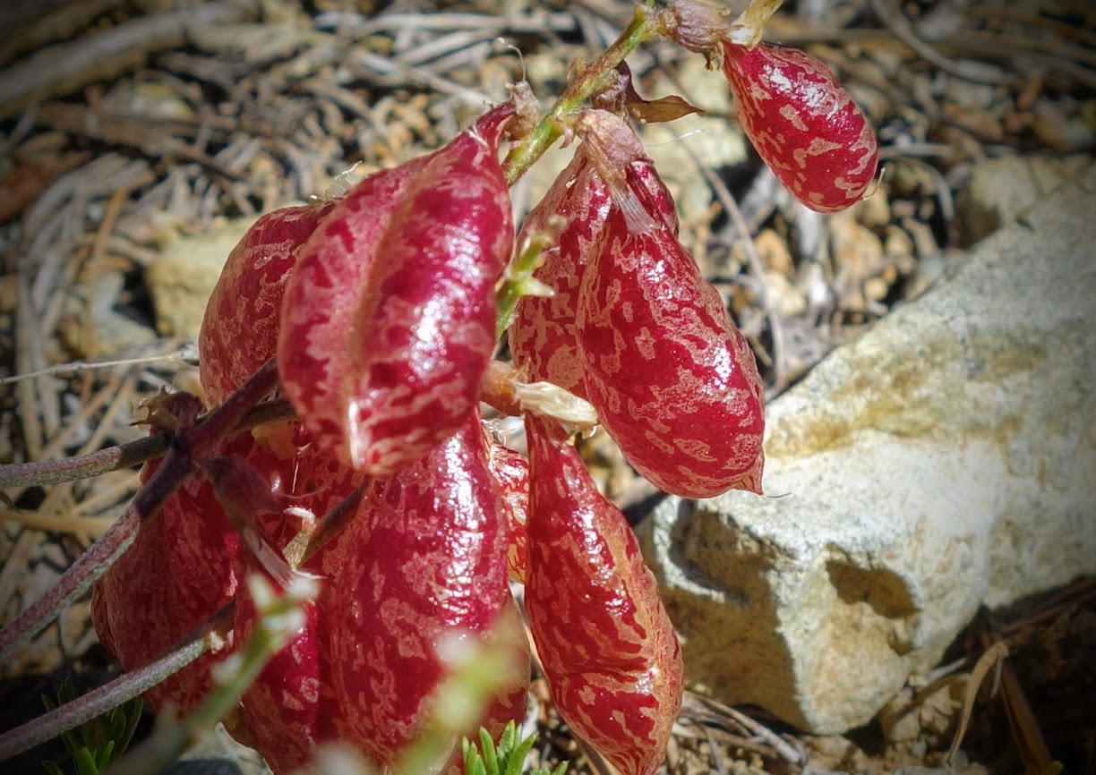
Trail magic!
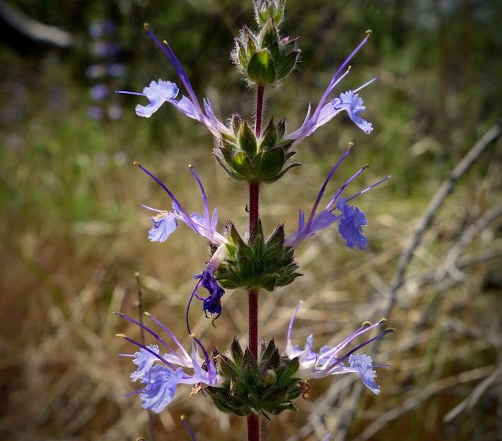
Morning beauties.
Back at the trailhead, I met these guys hauling in bridge planks with their mule teams. It was great to be able to thank them in person for all their trail work. This was possibly the best condition wilderness trail and forest I’ve hiked through. The USFS districts seem to have prioritized their budget to maintain trails. What a wonderful but rare treat!
This loop ended up being about 30 miles with 5,000′ of elevation gain/loss.
Although the “Bears Ears” are a prominent geologic point, the designation of this area as a National Monument didn’t occur until 2016 by President Obama. In 2017, President Trump reduced the 1,351,849 acres to 201,876 acres. President Biden restored the full acreage in 2021. My first visit to this area was in 2015 (blog link).
Hiking through these canyons is outside my comfort zone. I’m grateful for the opportunity to spend time with Joan, an experienced and skilled southwest desert explorer. With two cars, we made this a one-way trip starting at Kane Gulch Ranger Station and exiting at Bullet Canyon, both places I’d hike previously but was missing a large section in between. “Grand Gulch is a serpentine canyon entrenched into the otherwise gently sloping surface of Cedar Mesa. It is famous for its Ancestral Puebloan cliff ruins and rock art. Grand Gulch and its tributaries feature miles of winding canyons lined with cliffs that provided sheltered overhangs to people in the past. Some ruins are amazingly inaccessible, perched high on ledges and under overhangs. Other attractions include the scenery and wildlife, as well as the solitude of desert canyons.” Source: https://www.blm.gov/visit/grand-gulch
This is route hiking. The “trails” are the path of least resistance whether that be a wash, animal or human path. Conditions change regularly. We arrived shortly after monsoons had flooded much of the higher ground leaving mud, water and muck in the washes. Signage is non existent. To find drinkable water, campsites and artifacts you need to be an explorer with exceptional navigation skills. You might find the name of a site or spring on a map but without detective skills you’ll likely be frustrated.
Slickrock walking is my favorite!
Bench walking is even better.
I’d forgotten about desert hiking and started without my tall leggings. Bushwhacking through the grasses and plants is part of the deal. I brushed against something and ended up with several spines that poked through my gaiters lodging in my leg. We both got cactus stuck to our shoes. There was also a spiny thing that attached to my underwear. It’s not a friendly bare legs environment unless you stay in the main wash.
Whenever we got on trails like this one, I called it a 5-minute reprieve as it rarely lasted long. Soon enough we’d be back to bushwhacking or wash walking.
Occasionally you find yourself walking up waterfall channels, especially when entering or exiting the canyon. Grippy shoes come in handy for this activity.
Those “steps” were quite challenging for me at times given my short legs.
Joan made it look easy.
The canyon is breathtaking.
You’d never guess there were ancient dwellings hidden among this wall.
But if you look closely you might find something like this.
Once you learn it’s a bit easier to spot these treasures, especially if you have great distant vision or binoculars, or in my case an excellent zoom on my camera.
Of course gaining better views often takes some effort.
Jailhouse Ruin is one of the few sites easy to see from the trail especially with three white orbs painted above the dwelling. I explored this site fully on a previous visit to Bullet Canyon (blog link).
This kiva is still available for entry and inspection. It’s a special experience and one I suspect will have more limited access in the future.
Turkey Pen was one the first sites I saw way back in 2015 (blog link). While there was a low fence around the site, we were able to view the details. Now much is only visible through binoculars.
It’s impossible to ignore the degradation of the structures and rock art. Much is due to time and elements, but human visitors tend to be greedy from careless to purposeful.
Rock art fades, veneer breaks away, graffiti and bullet holes are all too common. There are thousands of unprotected sites like these. We’ve been taught not to touch the walls in order to extend longevity of these petroglyphs and pictographs.
I particularly enjoy finding colorful pictographs knowing they used plant pigments as paint.
Look, don’t touch! I consider these museum quality art galleries.
Touching structures is to be avoided but it’s enjoyable to inspect at a safe distance.
Rock art comes in many sizes, styles and colors.
This human shape is not in the style of most others I’ve seen leaving me wonder if it’s older or younger than those.
Sometimes you find treasures in unexpected locations.
The Green Mask image is a famous one and I’m glad I got to see it.
Look around the sites for military ammunition boxes as they often contain information.
In some areas fences have been added to encourage explorers to stay out of sites. We didn’t see footprints so we were encouraged that most hikers are being respectful.
When physical fences aren’t present, we create an imaginary one to protect structures, rock art and midden piles. “A midden is an old dump for domestic waste which may consist of animal bone, human excrement, botanical material, mollusc shells, potsherds, lithics, and other artifacts and ecofacts associated with past human occupation.” Source: Wikipedia
Notice how the structures blend in with the natural rock making them more challenging to spy with the naked eye.
The harder to locate or access, the more physically protected, lead to structures in amazing condition for being around for hundreds or thousands of years. “The earliest known documented inhabitants of the Cedar Mesa area in Southeastern Utah were the “Archaic,” a highly mobile, low-density hunting and gathering culture, which depended on wild animals and plants, probably exploiting resources through seasonal movement using open campsites and natural shelters. Recent research indicates that they were moving through the area from B.C. 6500 to B.C. 1500. Excavations at Old Man Cave on the northeast edge of Cedar Mesa substantiate these early dates (Geib and Davidson 1994:191-202). Members of this culture made stemmed projectile points for atlatl weapons and ground stone tools. More than 250 elements of abstract polychrome rock paintings found at the Green Mask site in Grand Gulch are attributed to the archaic period (Cole 1993:198-201).” Source: http://bcn.boulder.co.us/environment/cacv/cacvarch.htm
It’s a privilege to see the architectural details and to imagine the age of these branches used.
If you’re lucky you might find pottery shards or corncobs lying about on the ground.
This “museum” display is discouraged. We are taught to leave items where they were found.
After recently visiting the Long House at Mesa Verde National Park along Wetherill Road, it was cool to find his autograph here. “In the winter of 1893–1894, Wetherill organized an expedition to Grand Gulch with the financial backing of the wealthy New York brothers Benjamin and Talbot Hyde.” Source: https://gamblershouse.wordpress.com/2012/06/22/wetherills-intellectual-influence/
I wouldn’t have guessed water would be found in this niche. Joan had been through on a previous trip where she discovered pools mostly likely from an underground spring. I expect to find water near cottonwood trees but that wasn’t the case on this trip.
Many of these pools are shallow and require a scoop. Joan has found a small ziplock to work when extremely shallow or easily disturbed.
Joan looked at this canyon and was confident she’d find water.
Sure enough she found pools and puddles. Success!
My hero!
This is why most of the available water in the main channels isn’t easily drinkable. While you can collect and let it sit overnight to let the mud settle, often it won’t or it’ll clog your filter. Getting near the water can be a challenge as this mud can be quite slippery or like quicksand.
Finding campsites was another challenge. I was grateful again for Joan’s experience. This oak forest was wonderful even if we did trade views for protection and soft ground.
We were searching for flattish ground above the recent flood plain, minus cactus, rocks and cryptobiotic soil. On this night I got my views! This wouldn’t be a good location during wind events but rain would drain well.
Desert etiquette is a key skill such as avoiding cryptobiotic soil, where to poo and knowing not to wash in the few precious drinking water puddles. Along this campsite trail was pristine mature cryptobiotic soil making it fun to find an appropriate place to dig a cat hole.
There was no doubt seasons were changing.
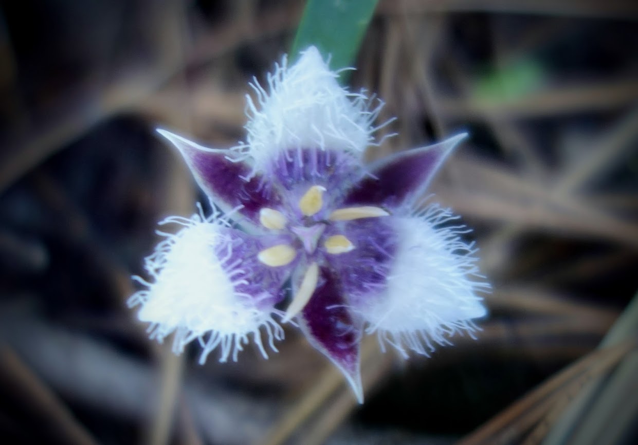
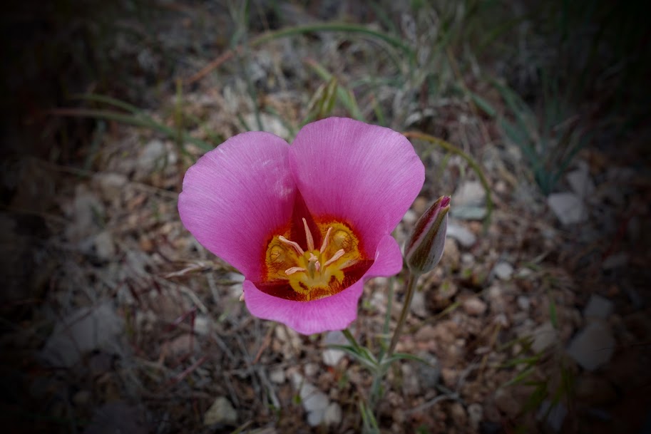
I found one mariposa lily extending the summer season.
These beauties added a nice color pop along the trail. Narrowleaf Four O’Clock (Mirabilis linearis).
The monsoon flash floods flattened everything in it’s path, but these flowers were survivors. There are flash flood warnings at the trailheads It’s best to check the forecast for rain in a 100-mile radius which might drain into this canyon causing flash flooding conditions. We were constantly looking around for an escape plan should it happen unexpectedly. I’ll never forget the time there was sudden snowmelt turning a dry wash into a mud flow river (blog link).
Although it was a holiday weekend, we didn’t see many hikers. This group was taking a day off and it was hard not to chuckle at this image of them sitting around a mud-colored pool I’m sure pretending it was a clear lake. Access is limited by the permit requirement for day hiking and overnighting in Grand Gulch. https://www.blm.gov/programs/recreation/permits-and-passes/lotteries-and-permit-systems/utah/cedarmesa
We found our own way to relax.
There is plenty of exploring to do besides finding historic sites. When Joan discovered this slot she couldn’t resist. I was happy to be the photographer.
This was another memorable J&J Adventure, one with joy and challenges but most of all a wonderful time of friendship. How long will these treasures be available for self discovery? How many will be negatively impacted by human visitors? Once again I’m grateful for the opportunity.
For us this was a 34-mile 2,600′ elevation gain/loss trip. These numbers will vary widely based on the “trails” chosen and side trips. We spent much of our time dropping into and climbing out of deep washes. It was physically demanding as evidenced by this zigzaggy profile.
Most everyone agrees the San Juan Mountains are one of the WOW sections of the trail. With early melt this year, they were ready when Joan had time off and we could coordinate another J&J adventure.
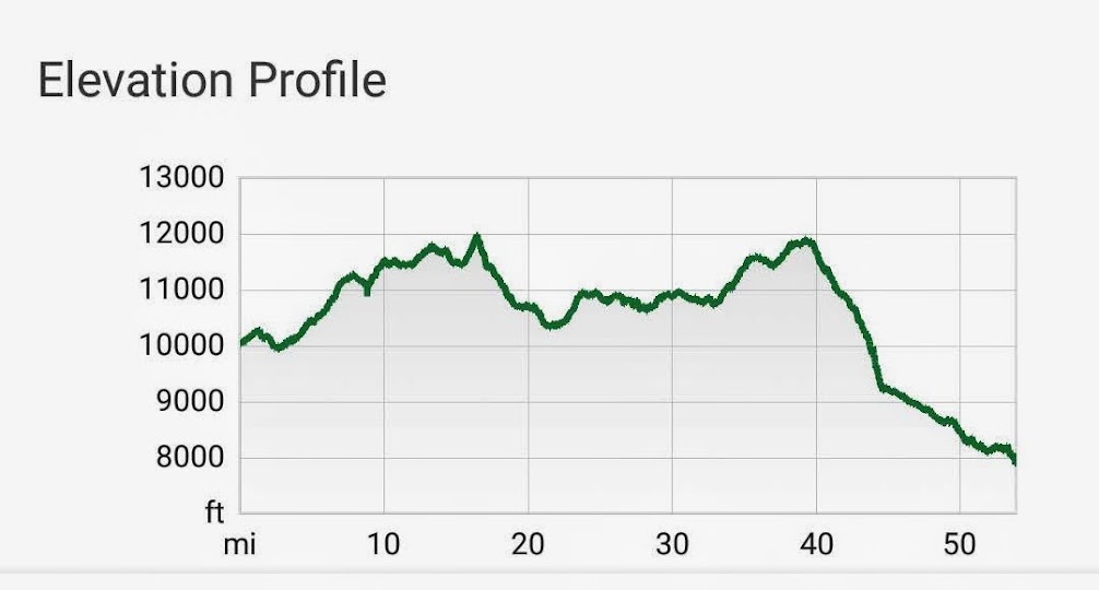
Joan created a route where we could shuttle cars between two trailheads on Highway 145, East Fork and Bear Creek. These trails both connect to THE Colorado Trail, the more northern to Segment 26 at Bolam Pass, and the southern at Indian Trail Ridge in Segment 27 (leaving me a few miles short of completion). These segments are 31.5 miles with 6,013 elevation gain and 5473′ loss. Our route was 50 miles with 4,500′ elevation gain and 6,500′ elevation loss.
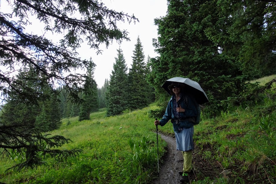
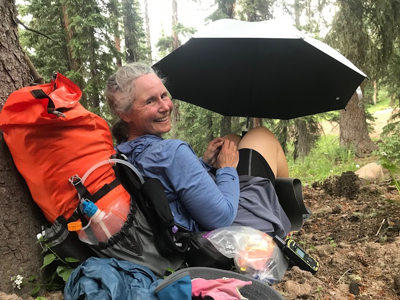
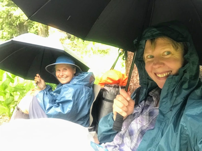
It was a day to test our rain gear and systems, which we would ultimately use daily. It reminded us of our time in Washington on the PCT a few years ago.
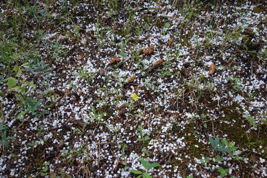
Hail also became a daily occurrence. Our umbrellas and tree cover made these time-outs more tolerable.
I’ve been trying to capture good photos of these plants for weeks. Still not a great image but I did learn they are Kingscrown (Rhodiola integriflia).
This is a similar but different plant, most likely a clover.
We found lots of Elephant Head Orchids.
I should have taken more photos of this bloom, as this image is a bit blurry. It was fairly common plant.
We saw a ton of these in bud and a few starting to open but none in full bloom.
Near Bolan Pass there was a seriously mucky muddy road to walk. It was like walking in mashed potato snow, nearly as bad as postholing. We were so happy to get back onto a single track hiking trail.
With a 70% chance of daily rain and thunderstorms, the flowers were thriving.
Our first night we camped near Celebration Lakes. We happily stopped early to dry out and get camp set up before more rain.
We didn’t have to go too far the next morning before we found mountain views we crave.
We loved walking next to Hermosa Peak.
The next objective was Blackhawk Pass, but first a look back at Hermosa Peak.
Colorful Blackhawk Mountain.
Just when you think you are getting close . . .
You find more and more and more climbing to be done, and the inevitable building of clouds.
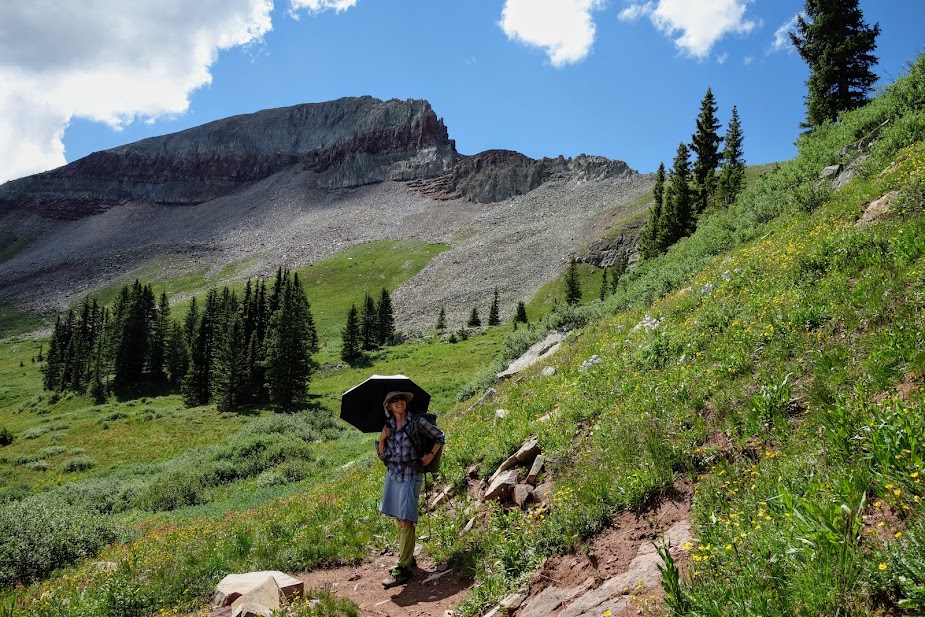
Joan also uses her umbrella for sun protection and heat management.
Near the top of the pass, we could see the use trail to Blackhawk Peak (12,681′). No, we weren’t tempted.
The 360-views of the Rico Mountains were amazing.
It was impossible not to celebrate at the pass.
I enjoyed finding these blooms I first saw at Colorado National Monument a few weeks earlier, now I just have to remember the name.
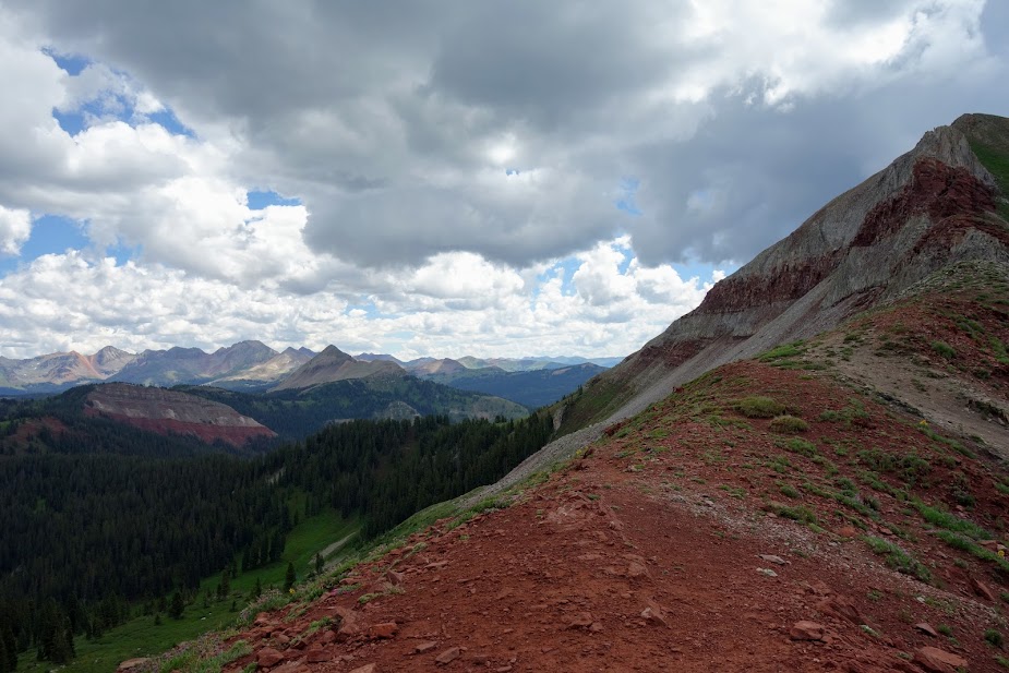
With thunder rumbling and clouds building we didn’t get to lollygag at the pass near as long as we would have liked. I believe this is Whitecap Mountain (12,376′).
As we headed down we were greeted by a marmot (zoom to sign).
We found a great campsite that offered the best of both worlds, views yet protection during thunderstorms.
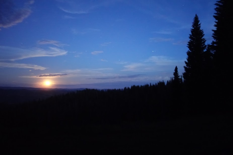
I woke up and saw the full moon rising.
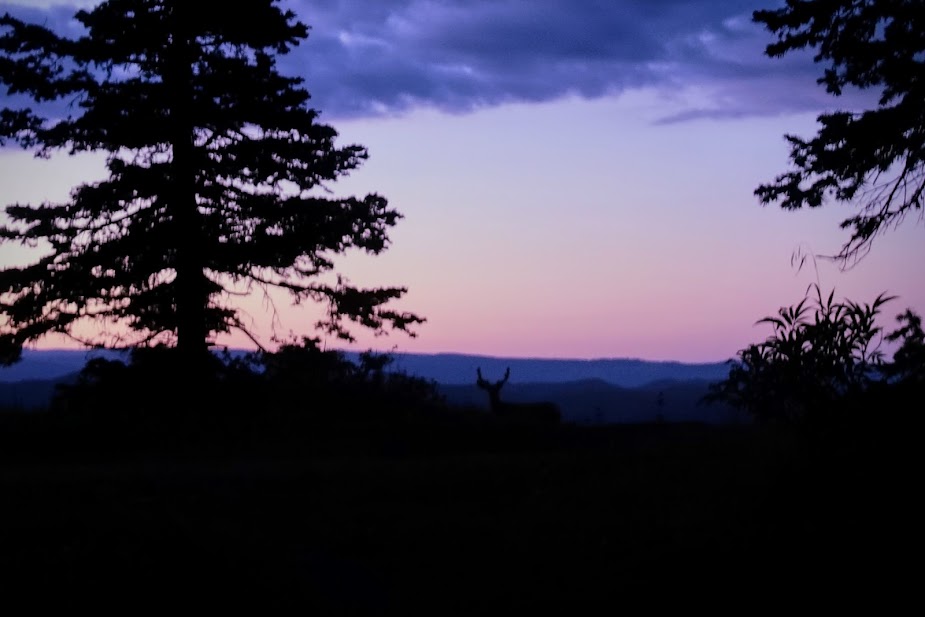
This buck seemed to like this area and spent a lot of time roaming back and forth. I couldn’t grab my camera in time to get the best photo but when he came back for a second lap I caught this one.
This day started without much WOW, but we still found reasons to smile. This is part of a long waterless stretch that we’d started the previous day.
I was thrilled to discover we’d arrived at our exit junction much earlier in the day than planned which allowed us to spend a bit of time on the Indian Ridge Trail. This is looking up toward that 5-mile trail section. We really wanted to camp up there if we could find a thunderstorm safe area, but alas without water and only slanted lumpy options we dropped some of our gear before heading out for a jaunt.
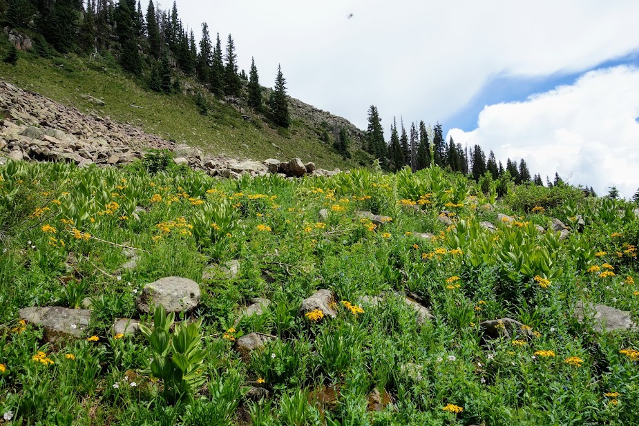
With an eye on the clouds and an ear on the thunder, off we went to play in these huge tundra meadows.
Alpine tundra plants showcasing the La Plata Mountains.
This ridge is a pika and marmot playground. This area isn’t flat and in fact we turned around 2.5 miles short of the high point. I’ll have to catch from the other side if I want to complete Segment 27.
After all that frolicking it was time for a rest and no one does it better than Joan, although she still has her shoes on which is a rarity during breaks.
Joan caught me at some point taking shelter from the hail.
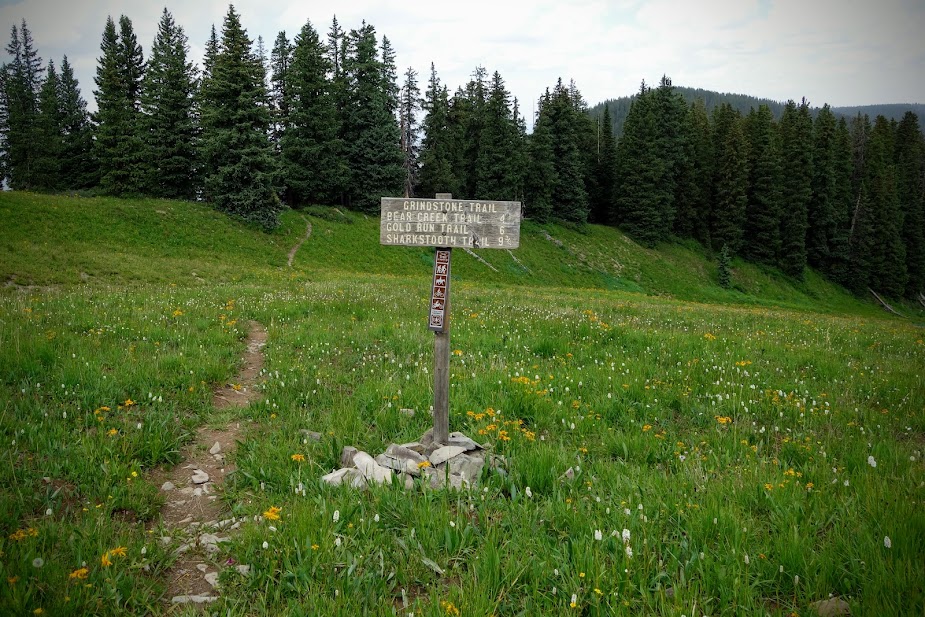
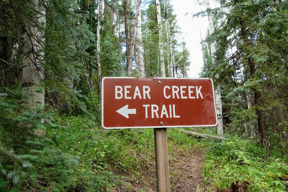
Our exit was via the Grindstone to Bear Creek Trails.
We had views back at where we’d been and used our Peak Finder apps to determine the names of others.
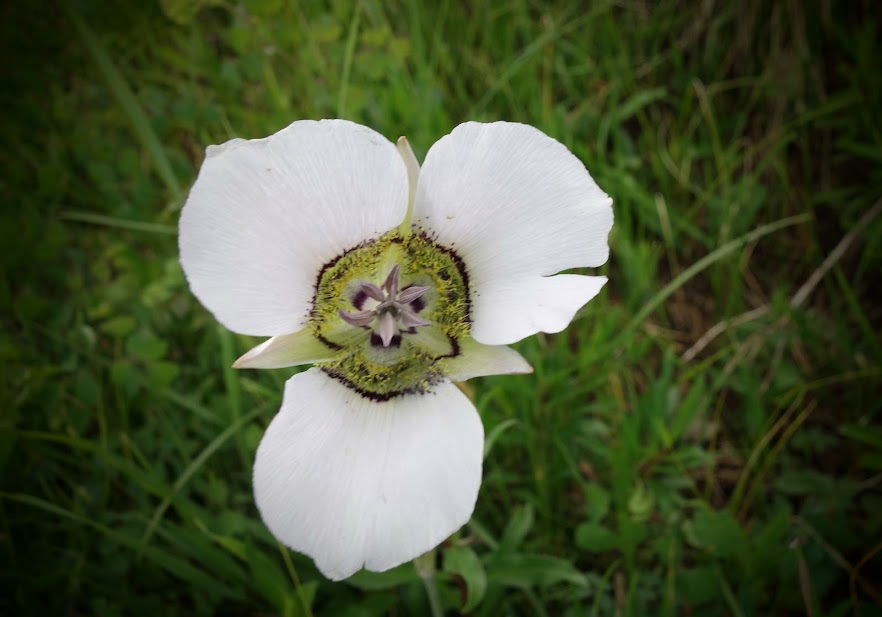
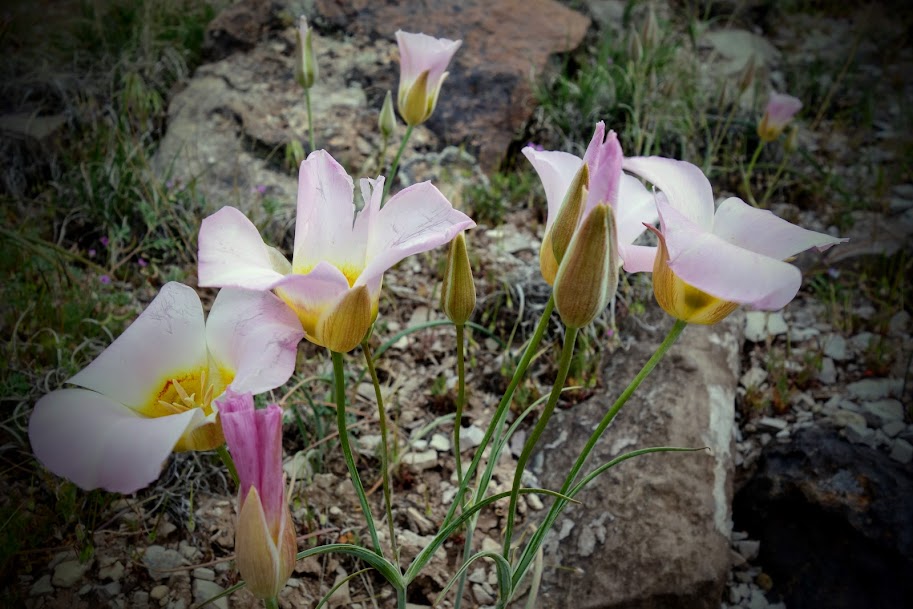
Hidden in the grasses we found a large collection of mariposa lilies.
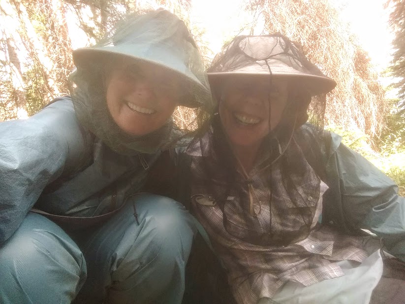
The flies were quite bothersome on this trip, not necessarily biting flies but irritating with tons landing on and buzzing us. Of course there were some mosquitoes as well. Our defense was rainwear and headnets.
I wouldn’t necessarily recommend the Grindstone Trail as it’s low use, overgrown, with recent burn and many log obstacles. Safe campsites were hard to find while water was not.
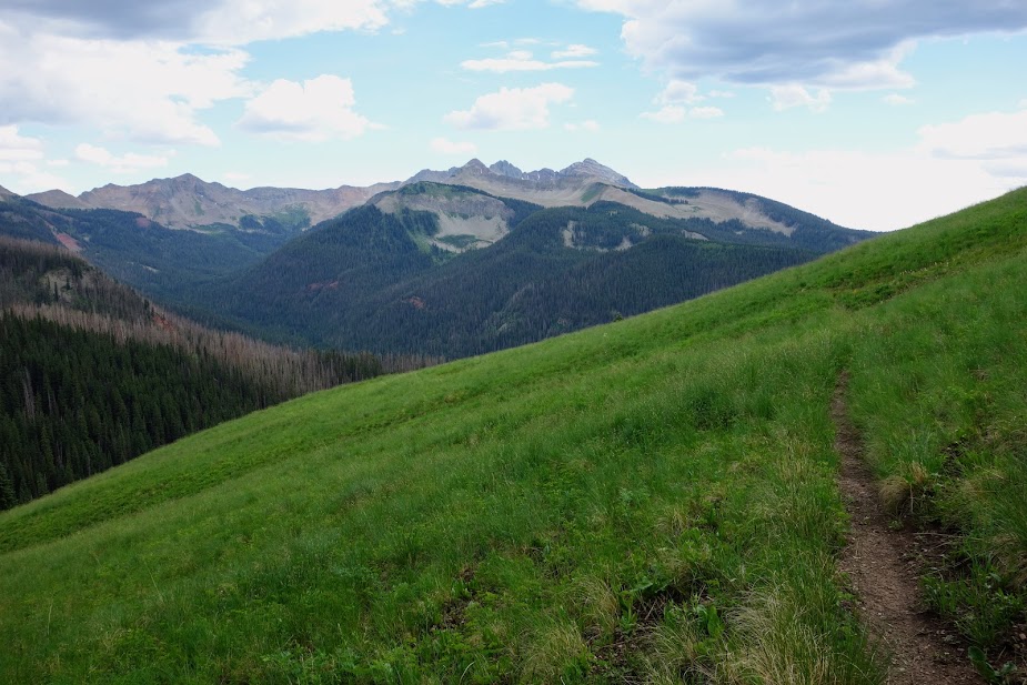
As we dropped elevation we were provided a few filtered views of the La Plata Mountains.
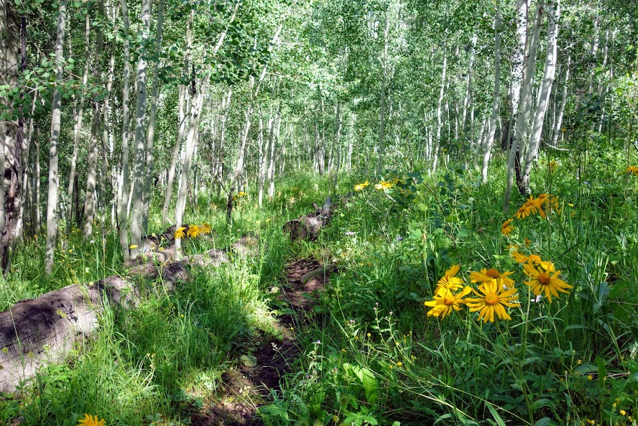
The upper portion of the Bear Creek Trail was filled with meadows and views of the burned trees.
Where’s the trail? After all the recent rains, our lower half was soaked from the wet plants.
We enjoyed the aspen groves as a break from the tall grasses..
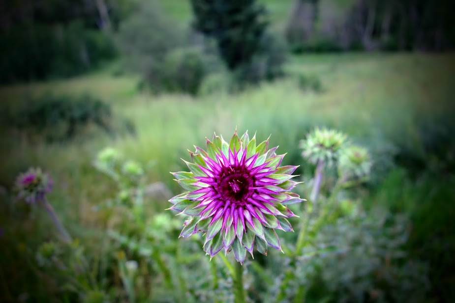
Sadly an invasive thistle has filled many meadows. They were 6-8 feet in height.
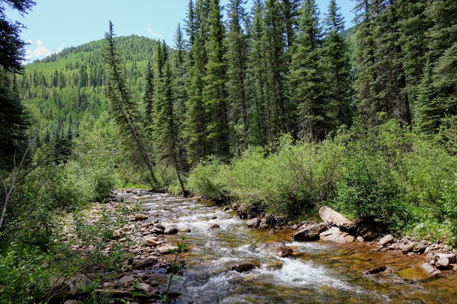
We only saw one hiker on our exit trail until near the trailhead, although we did see a few folks fishing along Bear Creek.
I’ve gotten spoiled hiking the wide and well maintained Colorado Trail, and at this point in my fitness much preferred to this side trail.
This J&J adventure ended much too soon, but it won’t be the last. Where and when who knows, but until then I’ll continue to hike more miles on the Colorado Trail.
Poppy the Pack (blog link) is well broken in after many trail miles. Most likely I’ll make a few revisions on my second version I plan to make this winter.
As of this post I’ve hiked 191 miles toward completion of The Colorado Trail plus 114 bonus miles and over 51,000 feet of elevation gain/loss.
Tips:
The Guthook/Far Out App and Colorado Trail Association Guidebook and Databook are helpful in planning section hikes. The guidebooks details parking and trailhead options along with the elevation profile. Far Out was a great way to plan my turnaround based on mileage and elevation gain/loss. I also used Gaia with the Colorado Trail Nat Geo layer.
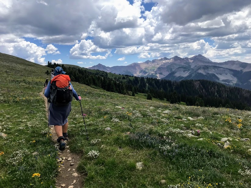
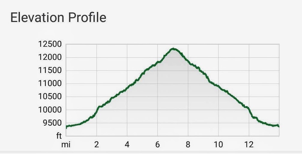
This segment is 25.4 miles with 4,417′ ascent and 3,810 descent. Highlights include Camp Hale and the 10th Mountain Division, plus copper mining history. But for me the WOW views and flowers defined this section. I hiked the southwestern 13 miles in two sections; the northeastern 12 miles will need to await a future visit.
Highway 24 Crossing
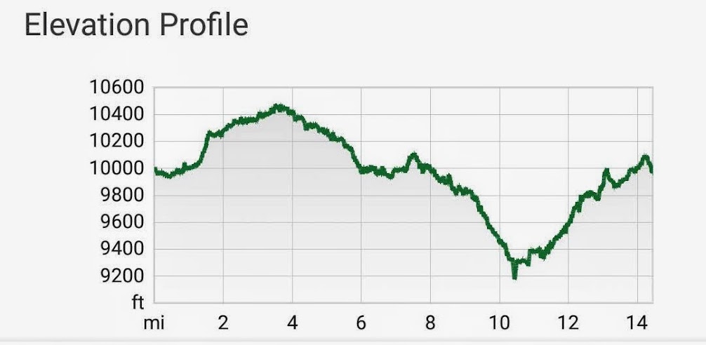
I first hiked south to Tennessee Pass Trailhead and then north to Camp Hale Trailhead. This was a 14-mile 2,400′ elevation gain/loss round trip hike.
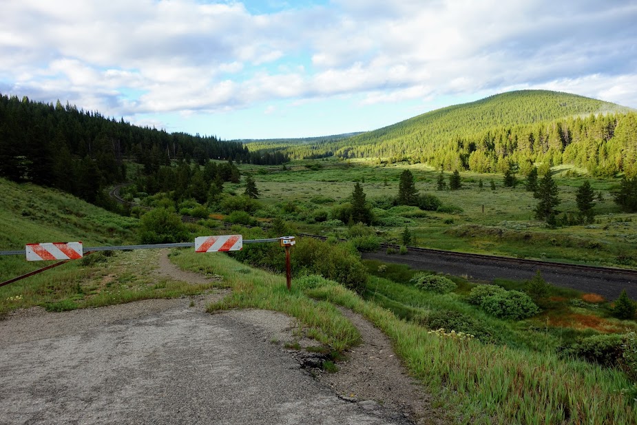
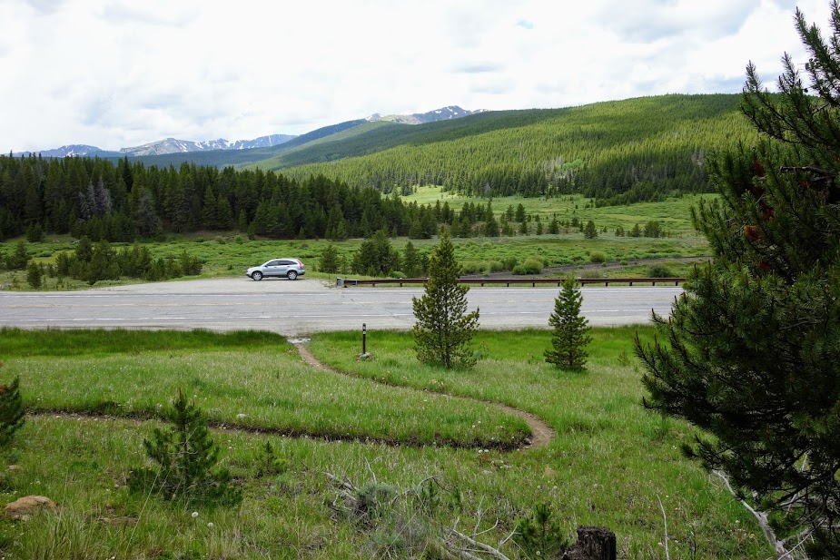
There’s a nice spot to park off the highway. The gate is the “trailhead.”
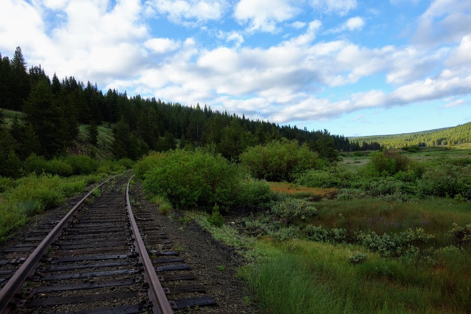
You almost immediately cross the train tracks. I couldn’t help but wonder if this track is still active.
These were the first engraved signs I’ve seen.
I wondered if this would be day I would get drenched. I was prepared!
With the recent rains, the ground and plants were saturated. I was thrilled to see all these blooms and thankfully the mosquitoes must have drown.
I’ve seen several coke ovens aka charcoal kilns over my years of traveling, many in better shape than these. “Coke ovens were used to convert the coal mined in the local area into industrial coke, a relatively clean-burning fuel used in the smelting of iron ore. In a process known as “coking,” coal was shoveled into an insolated beehive-shaped and ignited.” I was disappointed on my way back to find a hiker using it as a clothes line to dry out their gear.
This section also includes views of the Ski Cooper resort near Leadville and Tennessee Pass. Further northeast the trail passes through Copper Mountain resort.
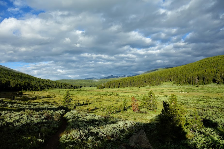
This section provided the most “flat” walking since Waterton Canyon in Segment 1; in fact a portion was on an old railroad bed.
I finally found some monkshood blooming.
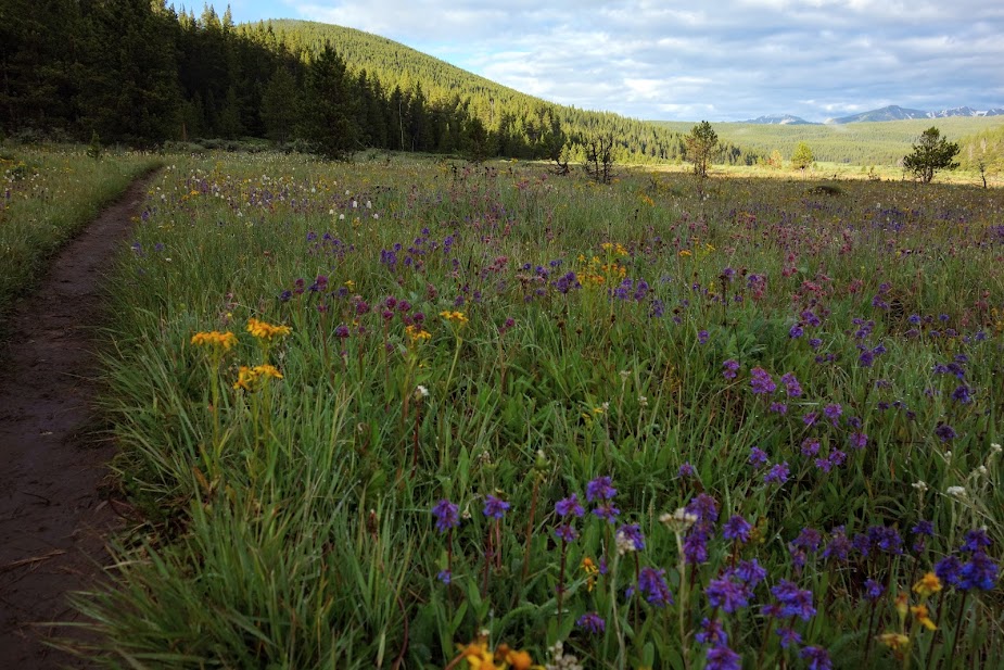
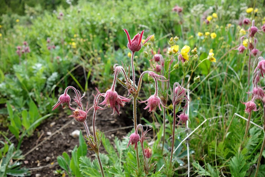
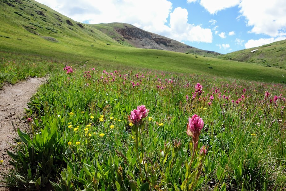
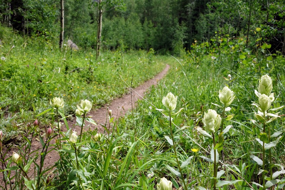
The meadow was filled with Three-Flowered Avens.
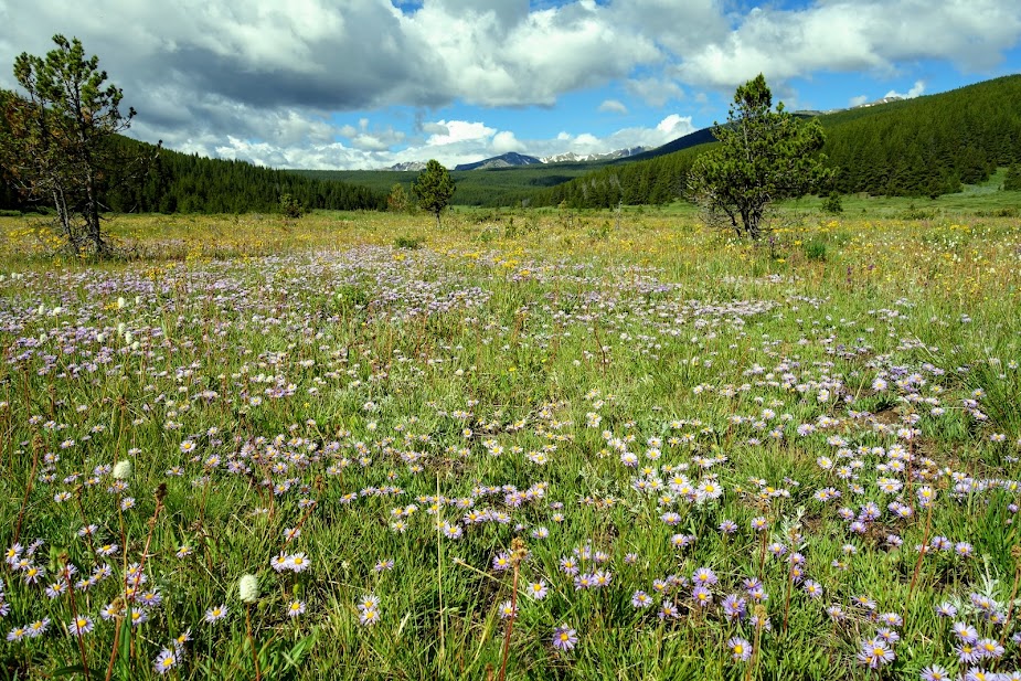
Asters filled the meadows as well. The mountains in the distance include Mount Massive and Mount Elbert.
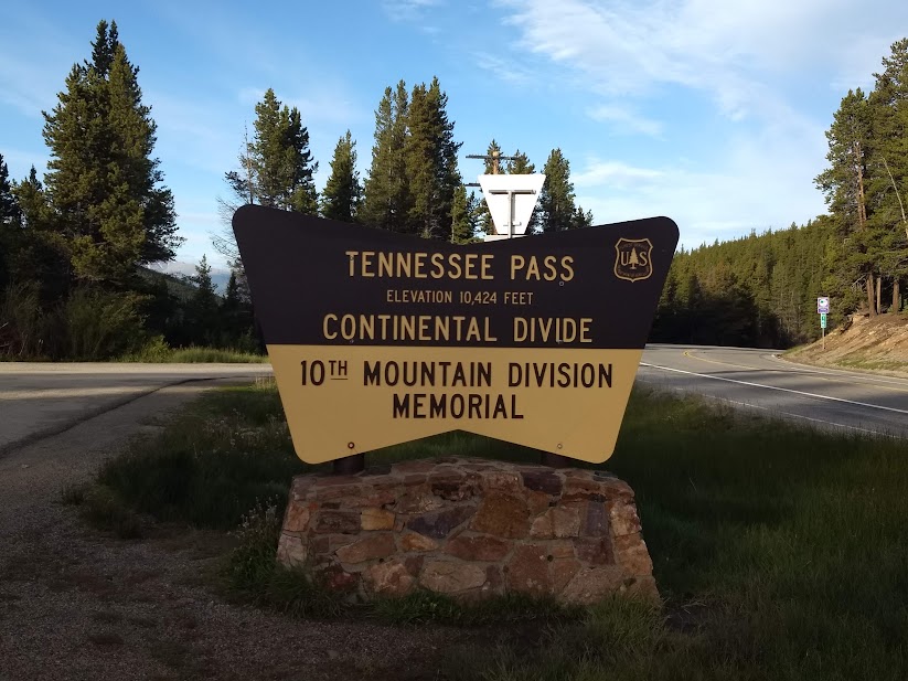
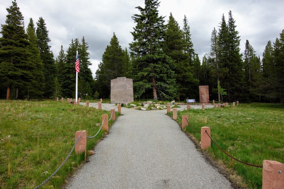
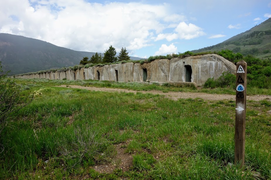
10th Mountain Division is a memorial at Tennessee Pass.
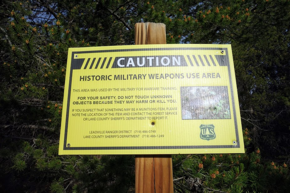
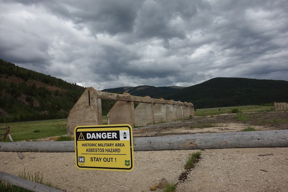
Bunkers remain at Camp Hale, a training facility for the 10th Mountain Division. I sat out a rain shower and ate my lunch inside one.
There is plenty of evidence of the area’s history.
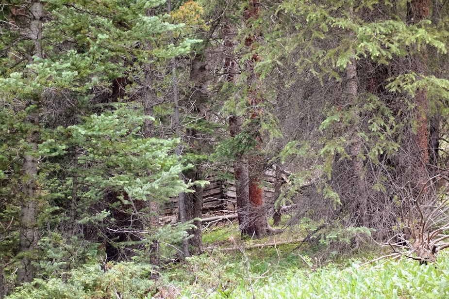
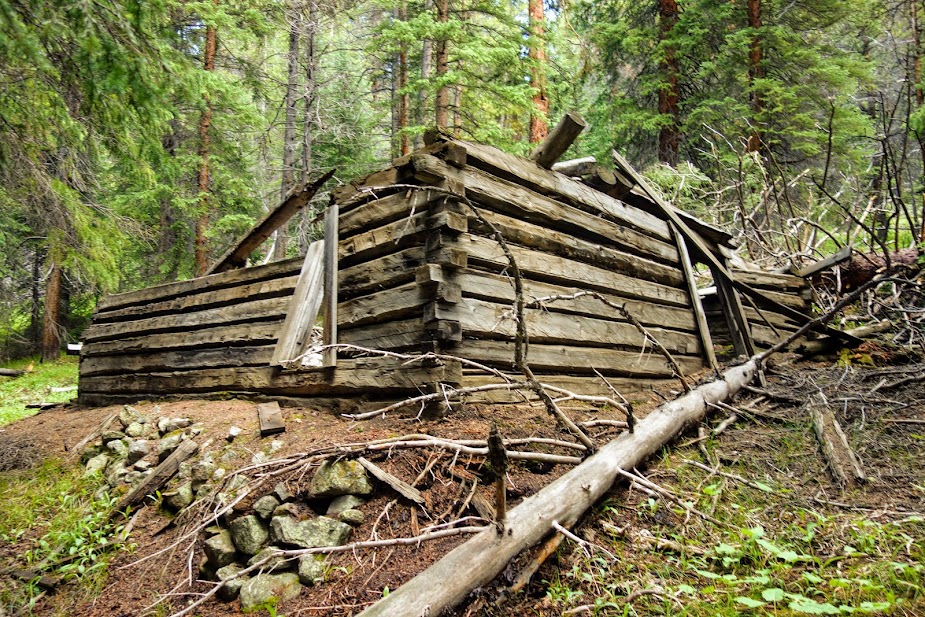
I noticed this cabin in the woods on my way to the Camp Hale Trailhead, so on my return to the Highway 24 crossing I couldn’t help but stop to explore. I wondered if this was used by the troops.
A happy sight!
Camp Hale Trailhead
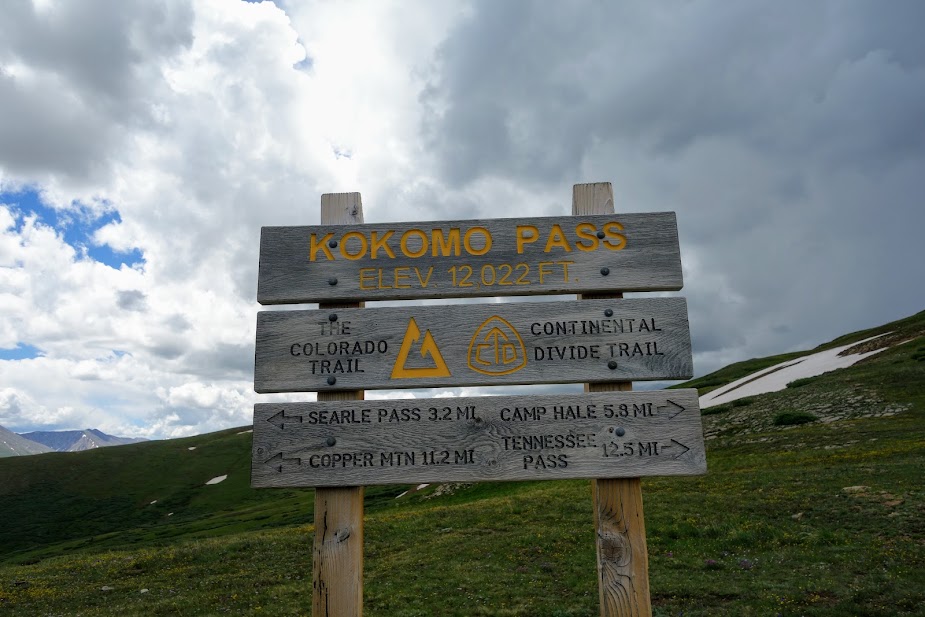
I hiked northeast to the high point, Elk Ridge. This was a 13-mile, 2,900′ elevation gain/loss round trip hike. This was a challenging day for me so I was grateful for the rewards!
This was to be a WOW day with so many blooms and views. It started with these penstemon within a short distance of the trailhead.
Harebells I believe.
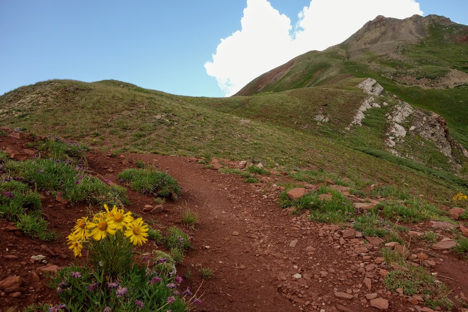
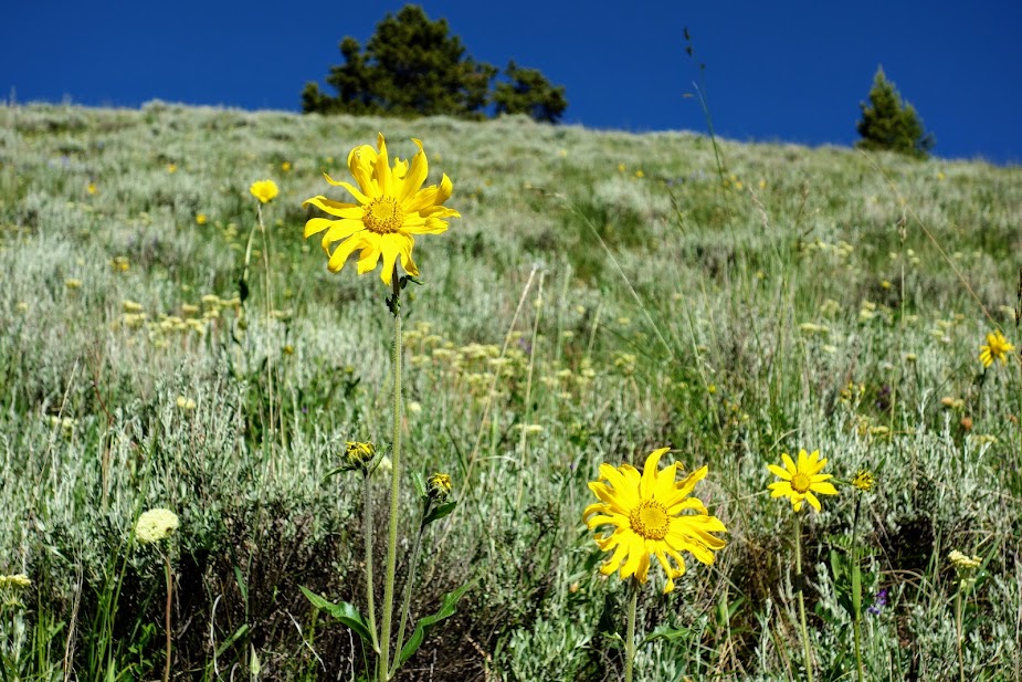
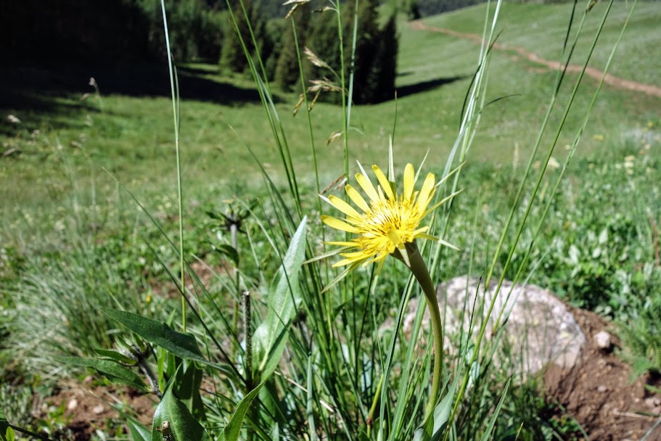
The first sunflowers I’ve seen. I bet soon the hillsides will be filled with glorious yellow blooms.
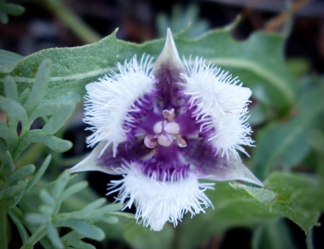
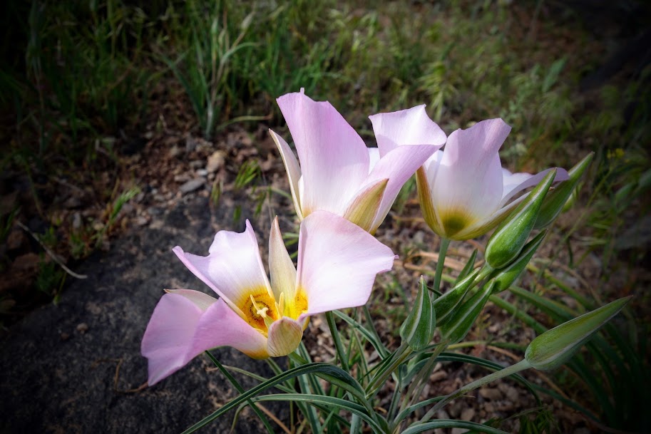
I found a few mariposa lilies hiding among the grasses.
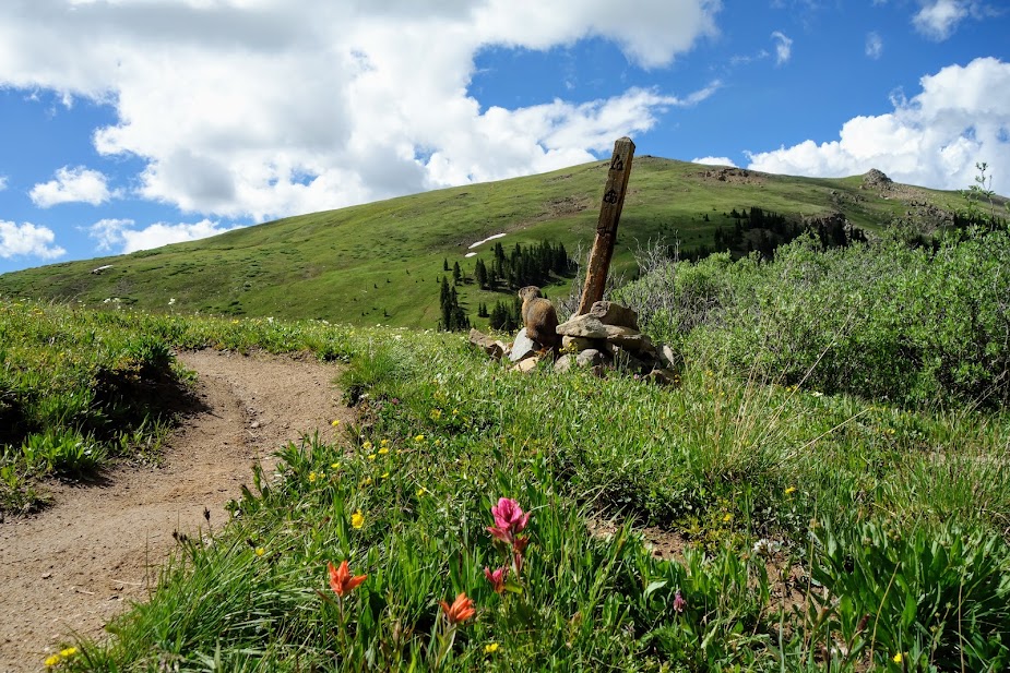
Once I was above treeline I was greeted by this marmot.
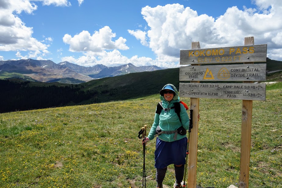
Kokomo Pass is directly ahead.
It was super windy and chilly at the pass.
There were unique plants in the alpine tundra.
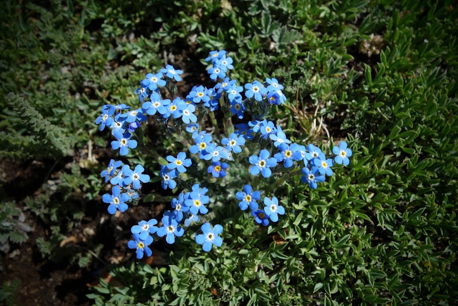
Sky PilotsForget-Me-Nots
Elk Ridge was a bloom fiesta.
Cool purple flowers lead the way to the Elk Ridge high point. I believe these are a type of phacelia.
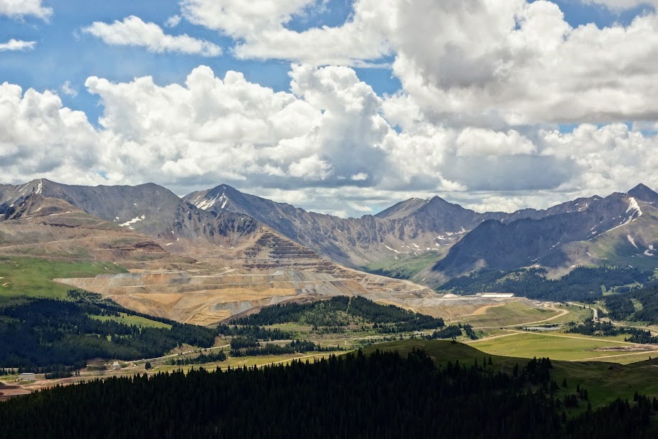
At this viewpoint another marmot is sitting atop the rock pile. The turquoise colored lake is really a copper mining holding pond.
Mining has changed the landscape.
Back to happier thoughts.
The growling thunder signaled the end of my lollygagging time.
These baby alpine sunflowers were so cute. I later learned they are called Old-Man-Of-The-Mountain.
So many sky pilot blooms.
It was hard to say goodbye to the ridge but knowing I’d hike back up from the other side at some point made it a bit easier.
Soon enough it started hailing, thankfully as I was near treeline and could take shelter under a tree.
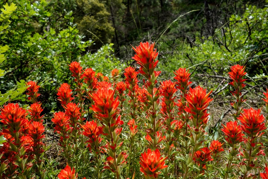
I loved the paintbrush color variations.
I couldn’t help admiring the mariposa lily another time on my way day down.
I believe these are a white or yellow paintbrush.
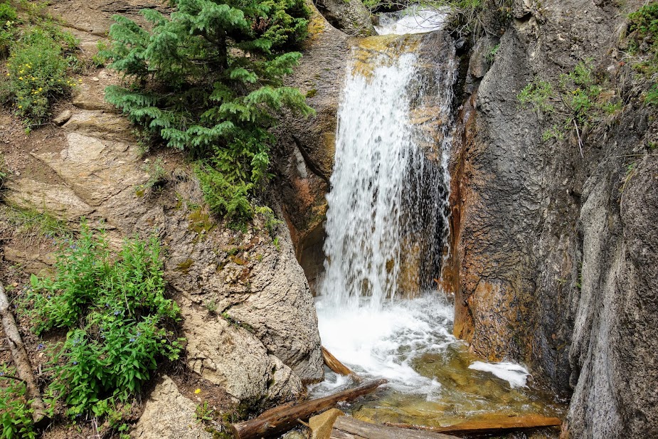
The first significant waterfall of my time on The Colorado Trail, Cataract Creek Falls.
Lovely rock features on the final miles back to Camp Hale Trailhead.
The Guthook/Far Out App and Colorado Trail Association Guidebook and Databook are helpful in planning section hikes. The guidebooks details parking and trailhead options along with the elevation profile. Far Out was a great way to plan my turnaround based on mileage and elevation gain/loss. I also used Gaia with the Colorado Trail Nat Geo layer.
Leadville is nearby and is an excellent town for resupplying, doing laundry, grabbing a shower and using WiFi.
As a recap, I’m Joan’s sidekick as she works toward completion of this section. We are camping together when convenient and I’m enjoying a bit more variety than PCT standard fare. The previous post covered Bridge of Gods to Panther Creek (link).
Day 5 – Crest Camp on FR-60 (2198.9) to Panther Creek Camp on FR-65 (Mile 2183.0)
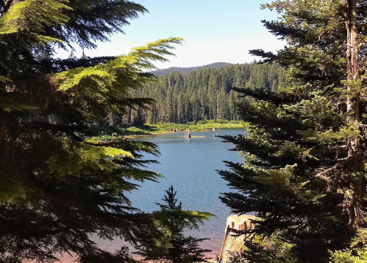
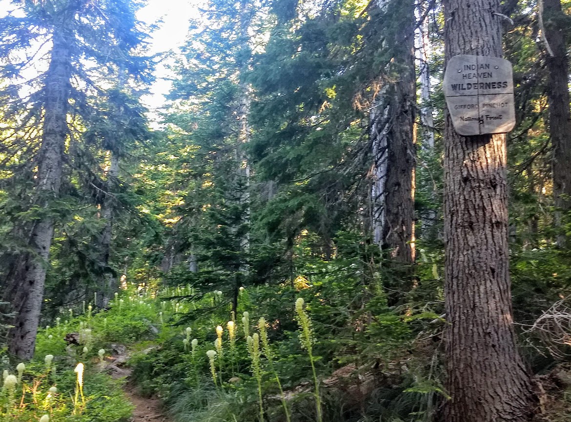
Both Joan and I hiked south through Big Lava Bed Unusual Interest Area although I turned around at the end and she continued north. According to Wikipedia, “The Big Lava Bed, located in the Gifford Pinchot National Forest in the southwestern area of the State of Washington, originated from a 500-foot-deep crater in the northern center of the bed. The Big Lava Bed is the youngest feature of the Indian Heaven volcanic field. The 0.9-cubic kilometer lava flow erupted from the cinder cone about 8200 years ago. The lava flow traveled 13 km from the source crater. Lodgepole pine, alder, and other pioneer plants struggle to grow, seen sparsely growing between and amid towering rock piles, caves, and strange lava formations. Access into the interior of the lava bed is difficult, since there are no roads or trails crossing the lava field.”
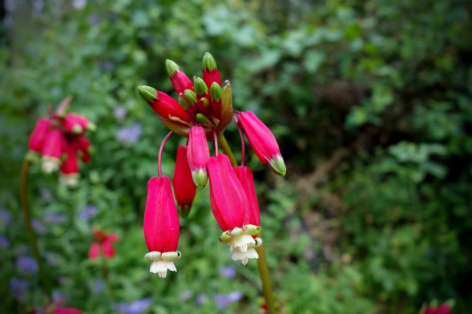
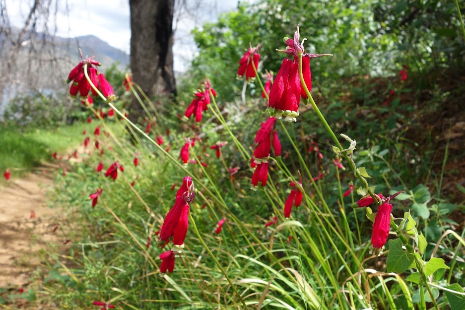
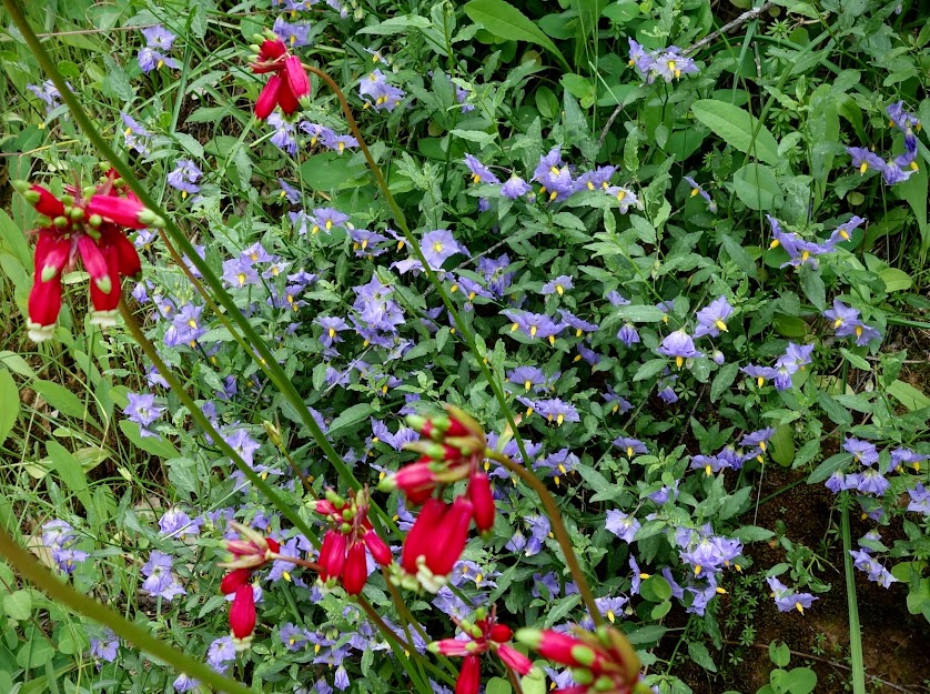
Although I saw a few lava caves and features, it was the penstemon that grabbed my attention.
After my hike I took a detour to swim at Goose Lake.
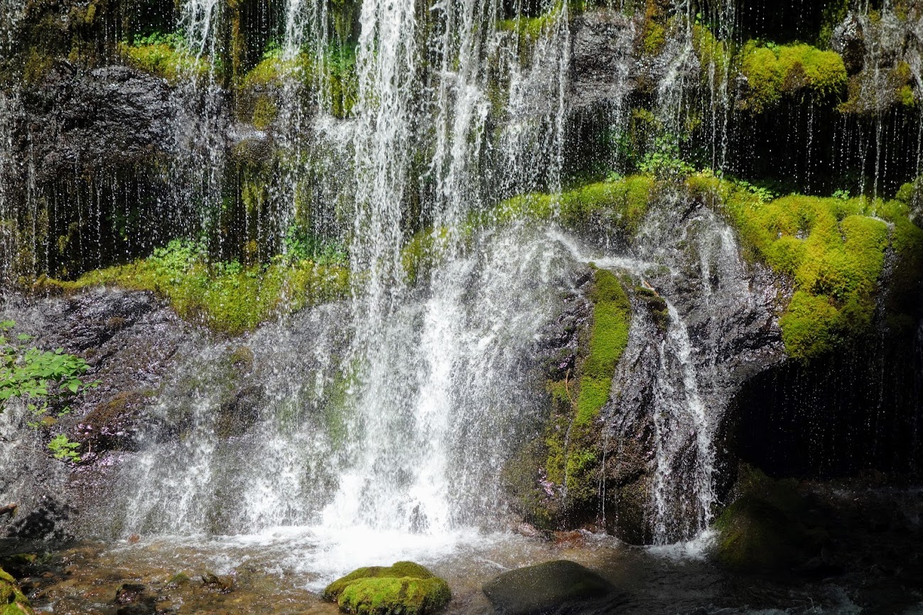
Next was a short hike to see Panther Creek Falls. There were a lot of warning signs and relatively new fencing. I later learned a person died somewhat recently.
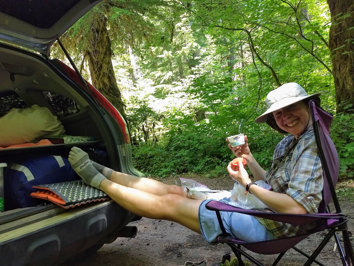
The best part of the day is when Team J&J are back together again.
Days 6 and 7 – Crest Camp on FR-60 (Mile 2198.9) to Williams Mine Trailhead on FR-23 (Mile 2229.9)
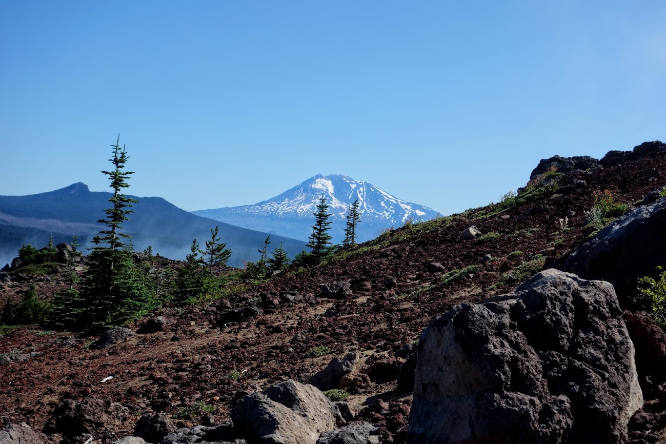
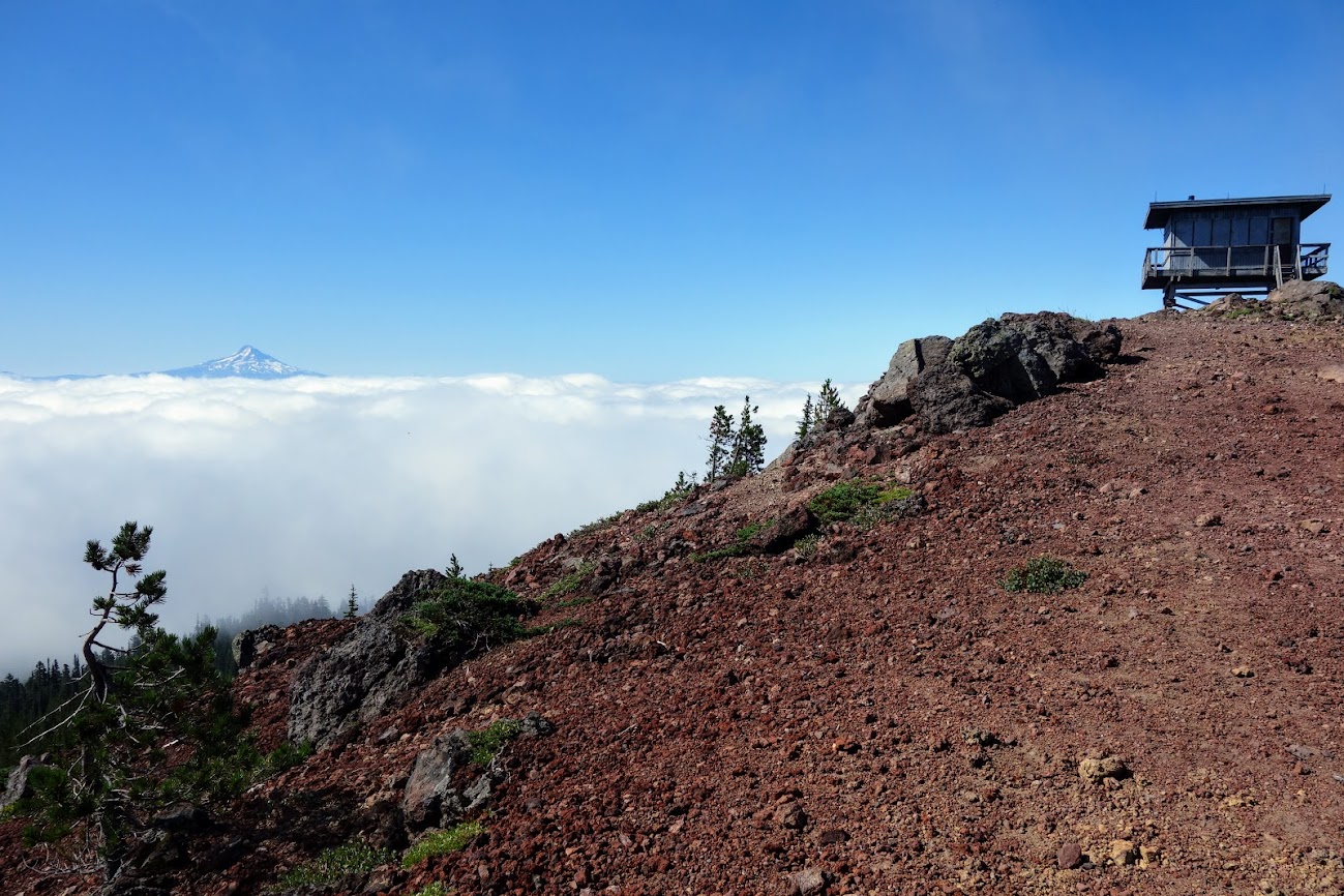
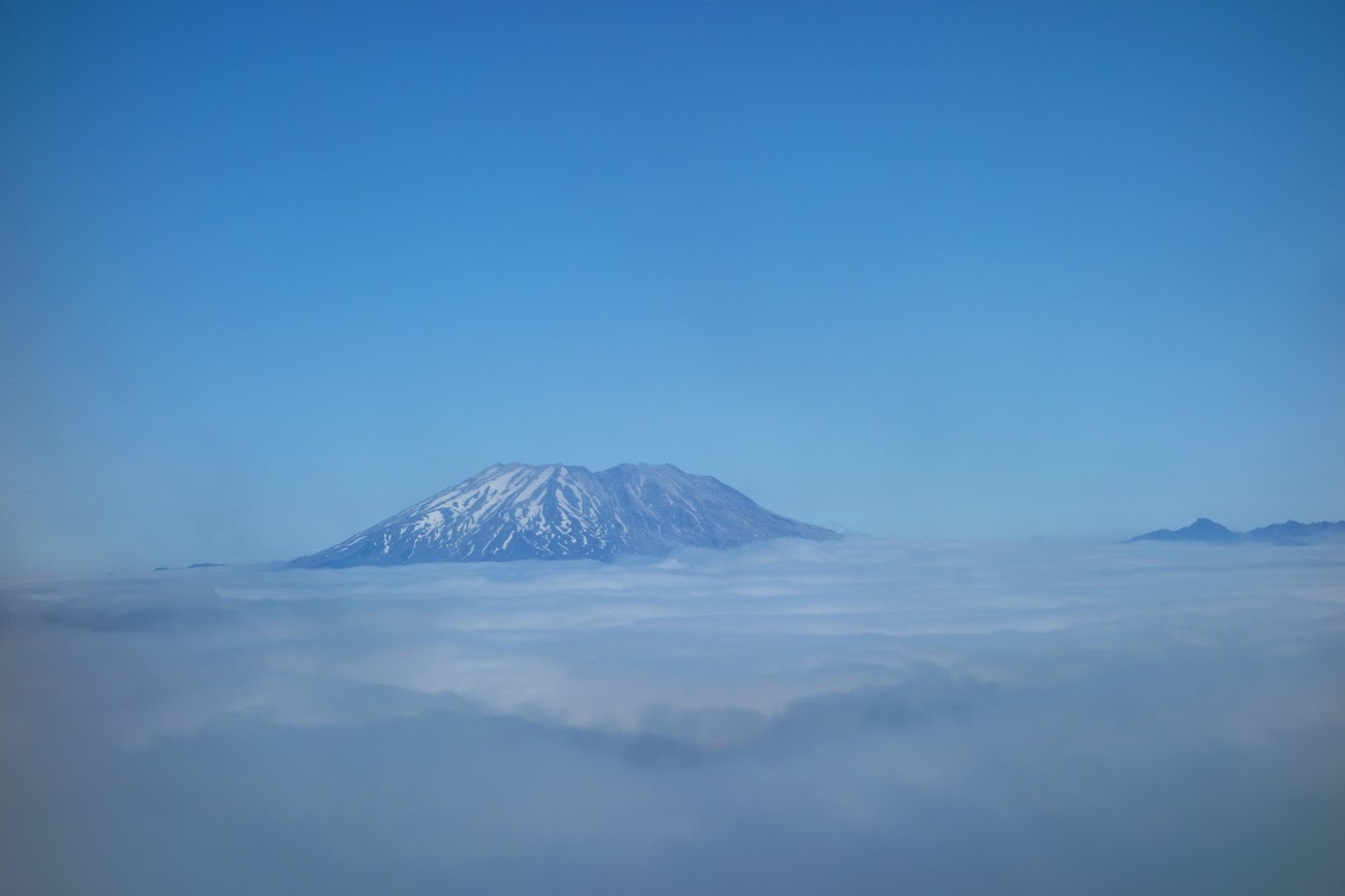
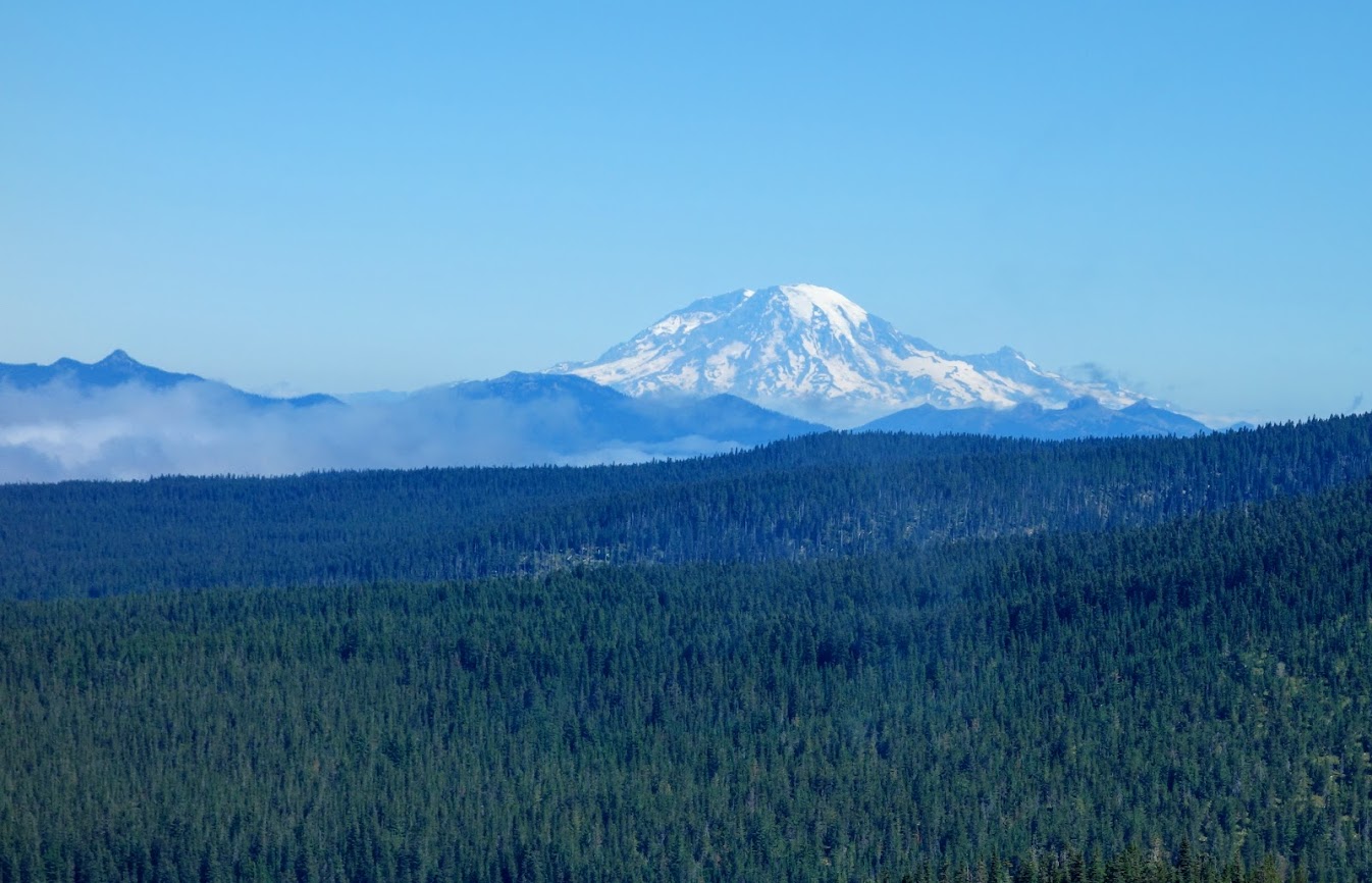
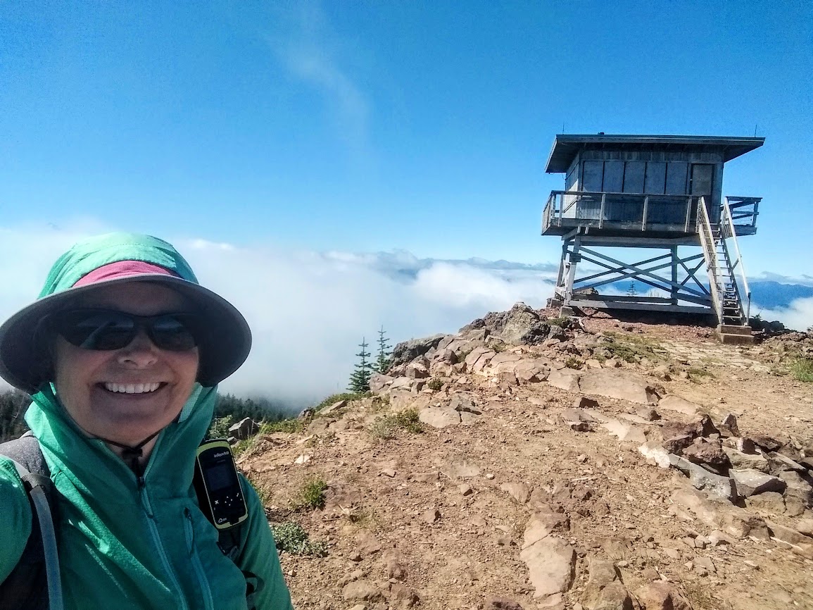
As Joan heads north into Indian Heaven Wilderness, this would be our first night to spend independently. We both hiked north on the PCT, but I made a loop to visit Red Mountain Lookout.
From the lookout I had incredible views of the cascade peaks including Adams, Hood, Saint Helens and Rainier.
Mount Adams
Mount Hood
Mount Saint Helens
Mount Rainier
I was really excited to hike nearly 9 miles with 1,400′ elevation gain. My knee felt great and I only had a little complaining by the rest of my body. Bouncing back after about 9-months of little activity isn’t so easy.
I also found some happy blooms to keep me company.
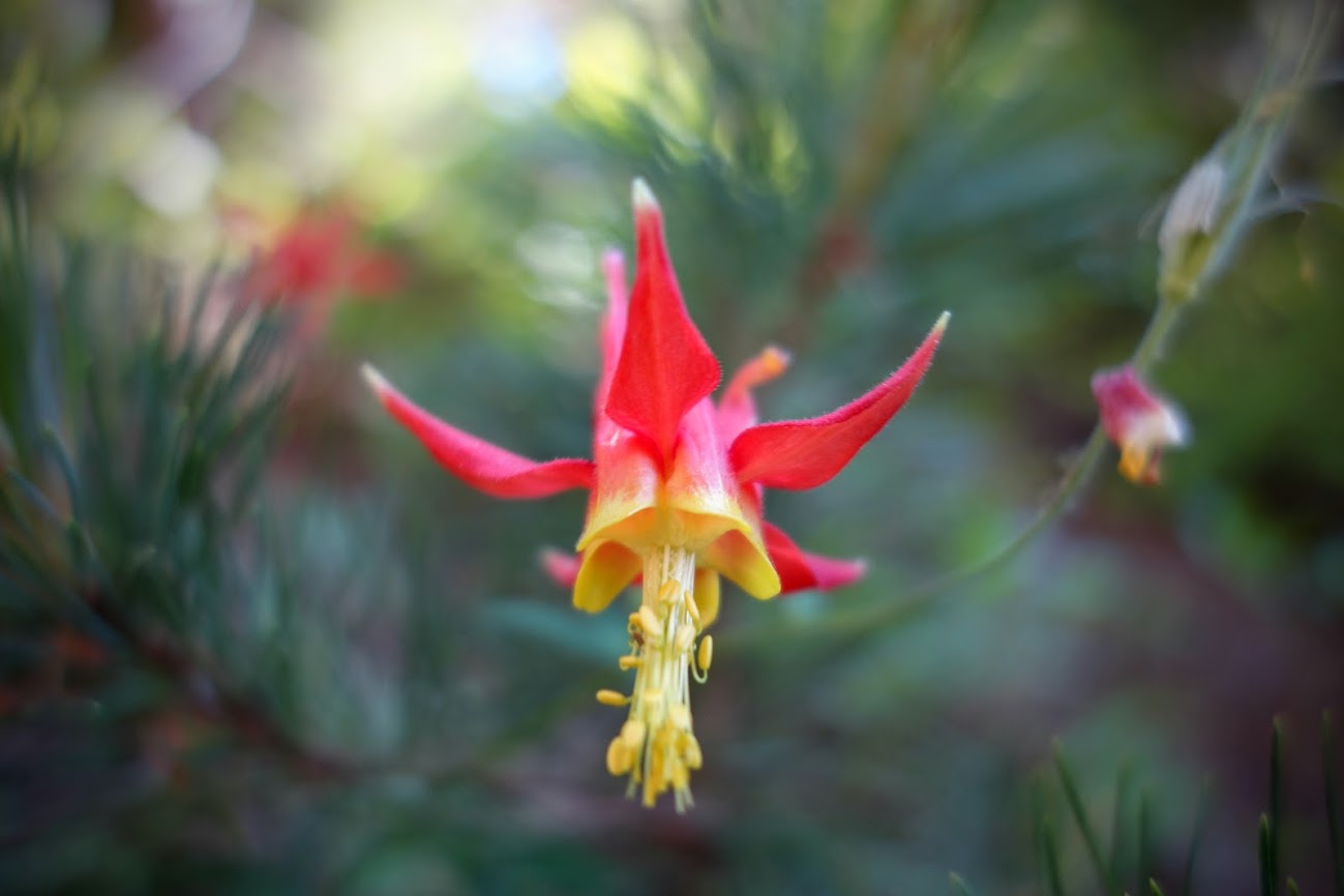
Columbine
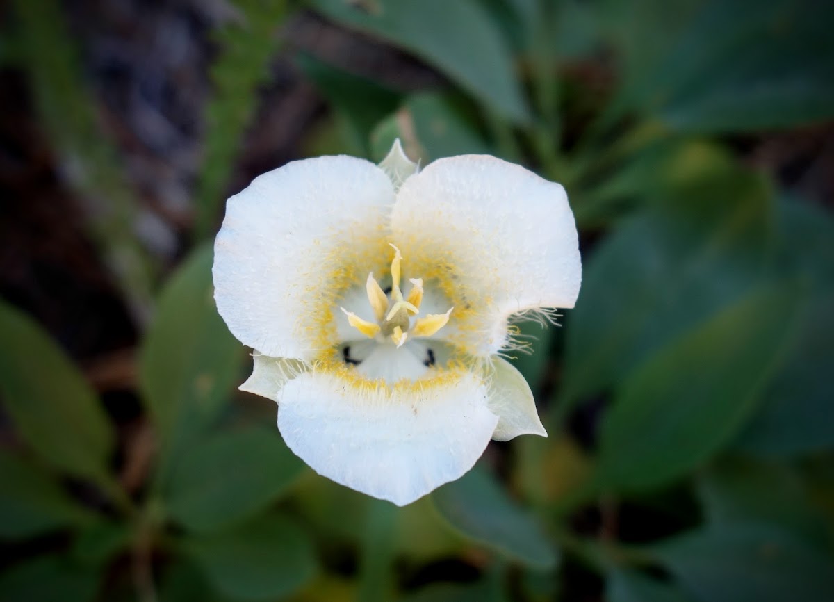
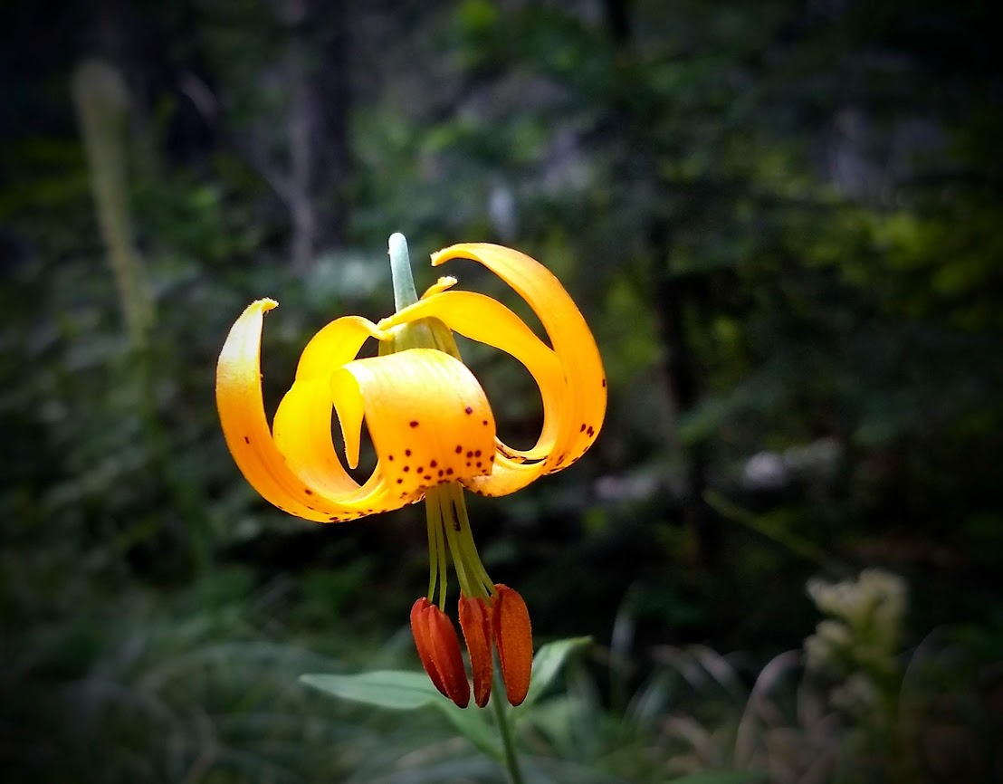
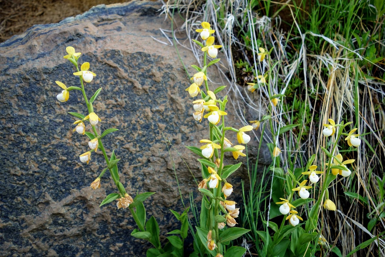
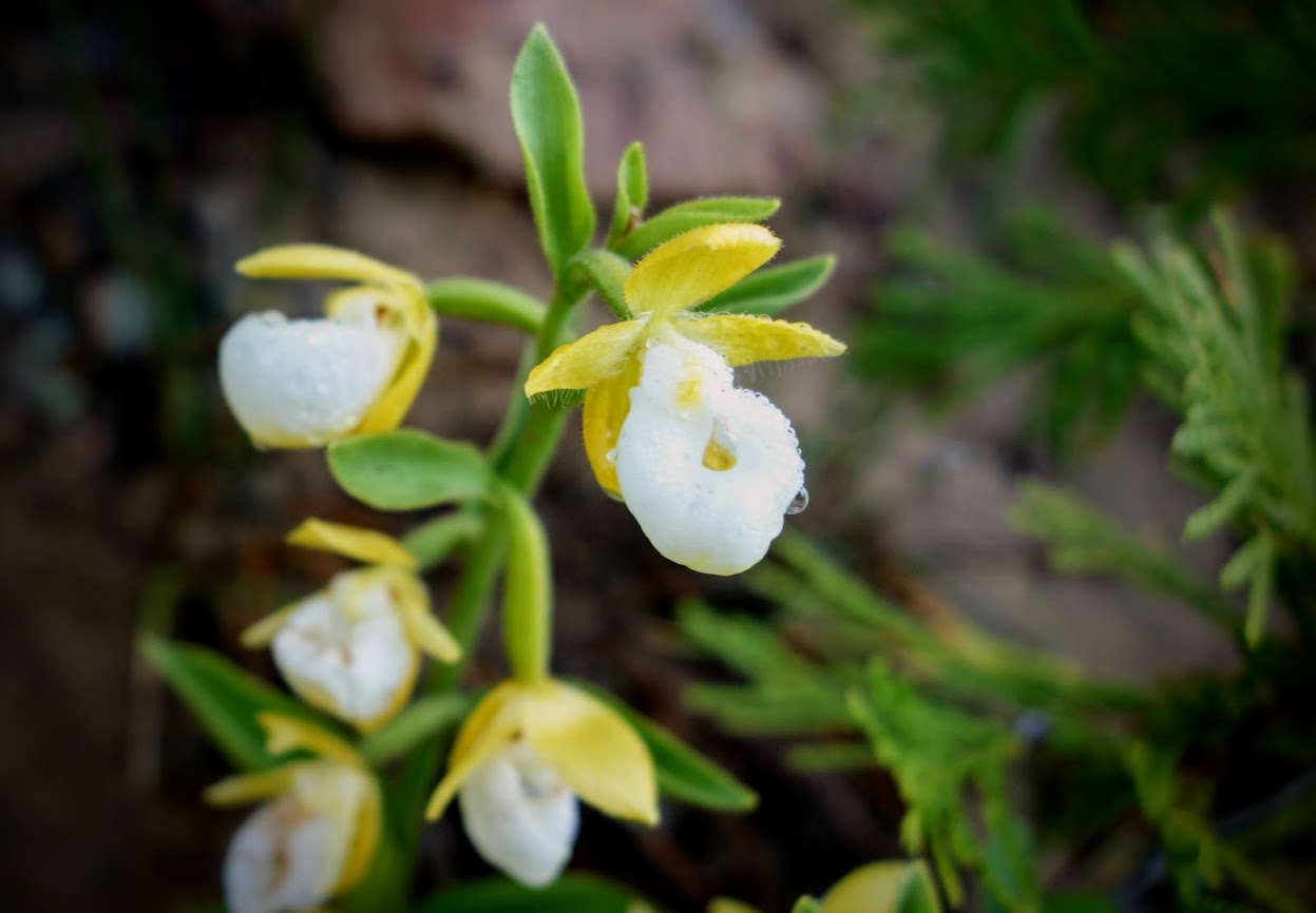
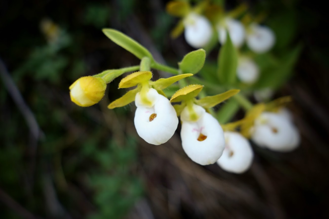
Mariposa Lily
Leopard Lily
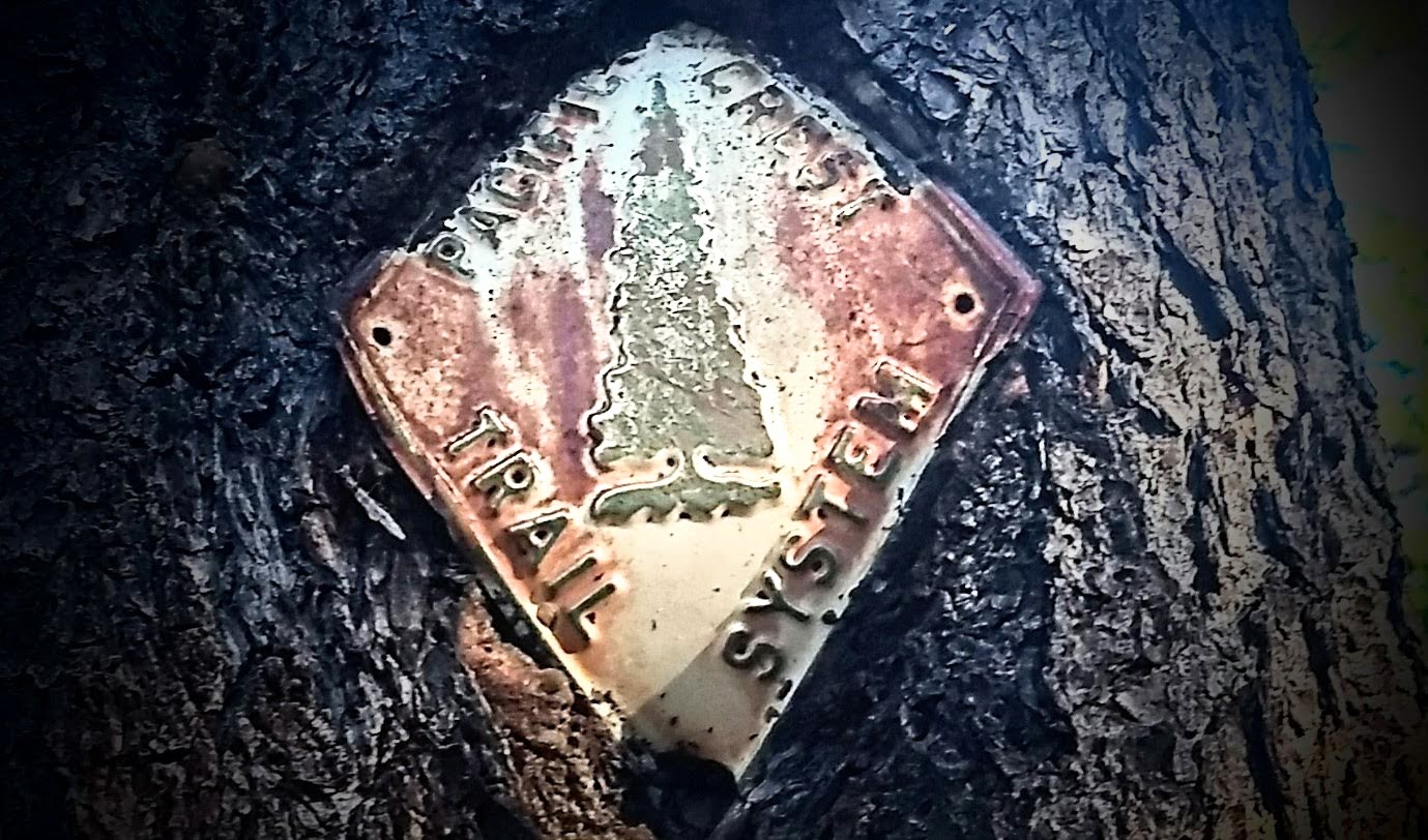
One of the cool old signs.
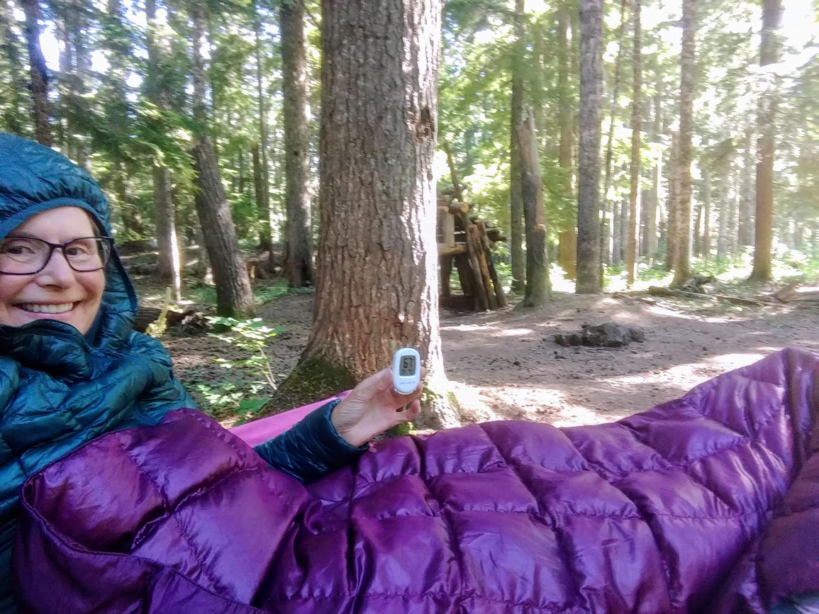
I was thrilled to feel chilled. How wonderful to wrap in down in July. Funny it was only 67 but when you are use to 110 and 75-80 degree lows, it takes the body a bit to acclimate.
It had been 100+ degrees in the valley. We needed to escape so even though we knew it’d be warmer than preferred for hiking, we’d be near water and shade, and it’d be at least 20 degrees cooler. It was slightly below 60F when we arrived at trailhead around 8am, and 85F when we finished about 3pm.
I first hiked to Sifford Lake a few years ago when I was on my comeback after my wrist surgery (link), so it seems apropos to do the same following my knee surgery. This is the first lake and by far the most visited of the multiple lakes in the Sifford Lakes basin, thus we’ve renamed it Lake Popular.
There are several opportunities to obtain views of the distant mountains and down into Warner Valley.
This was my first time to explore the network of lakes. The trail was in good condition and easy to follow to the first lake in the cluster. We called this one Island Lake (notice the tree coming out of the rock in the middle of the lake).
Finding the rest of the lakes required a bit of wandering and fun navigation.
We called this one Rock Lake.
Some of the lakes are quite close together. In this photo, Rock Lake is on the left with Lassen Peak in the background; Island Lake is on the right.
Most of the lakes weren’t very inviting for a swim like this one we called Grassy Lake. Most likely this will soon become a dry pond.
We were surprised to find one lake already dry, so yes this one became known as Dry Lake.
The largest of the lakes, Big Sifford Lake, offers views of Lassen and Reading Peaks. We enjoyed lunch at this spot and were hopeful a bear would saunter out of the woods and take a swim.
Panarama Lake
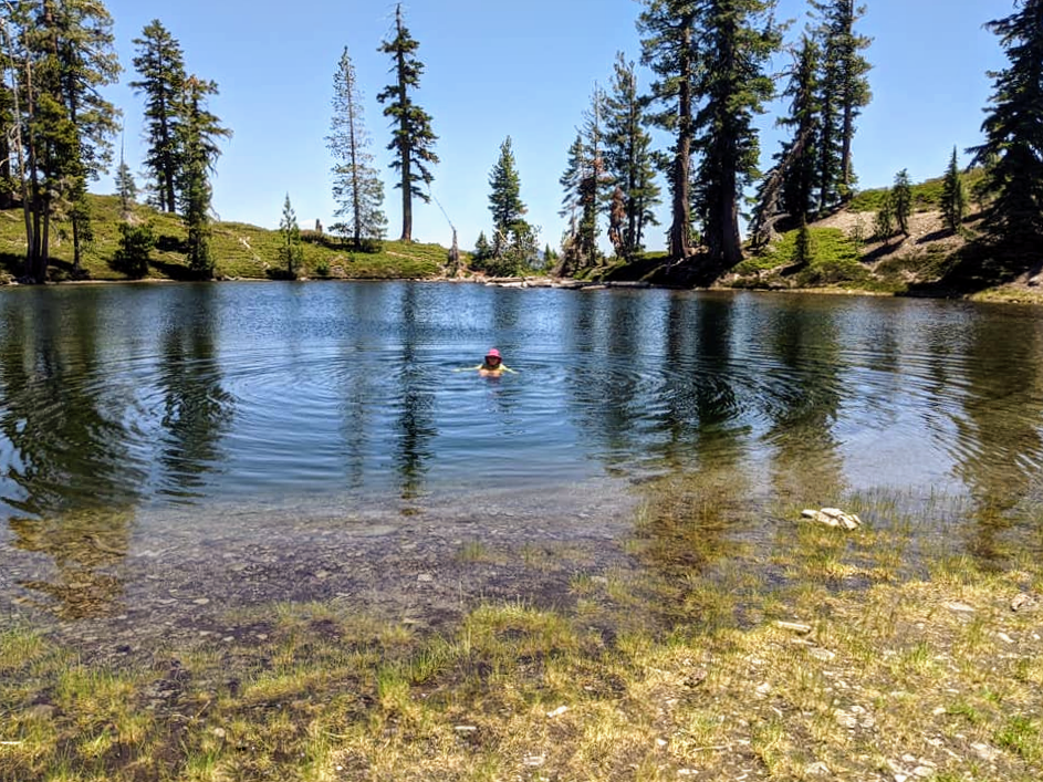
Unknowingly we saved the best for last, Swimmer’s Lake.
Looking down at Lake Popular, from where we started our jaunt to find all of the other Sifford Lakes.
We also did some wandering around to find viewpoints.
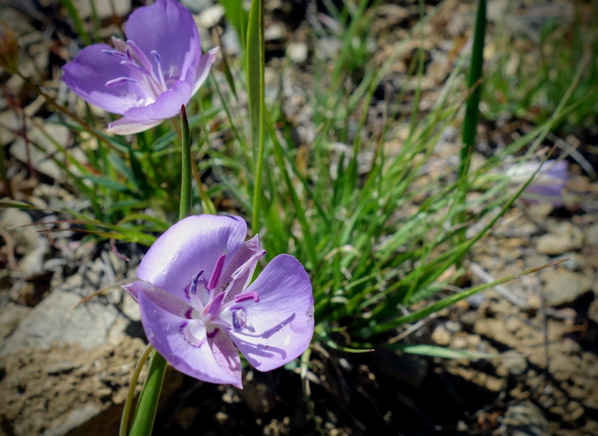
The most common bloom of the day was these Mariposa Lilies.
Penstemon provided bright pops of pink along the trail and seemed to enjoy hiding in rocky alcoves.
This hike begins with a descent along Kings Creek to the first Sifford Lake aka Lake Popular, then it’s a climb to the lakes basin. We saw a young family in the early morning hiking the waterfalls loop then didn’t see anyone until we reached Lake Popular on the return trip when we met another young couple. There were many hikers in the afternoon on the waterfalls trail. Our route was less than 7 miles with about 800 feet elevation gain/loss. How were the skeeters? Lucky us non-existent until we stopped by Kings Creek to soak our feet. That water was freezing COLD and the mossies seemed to love the environment. Needless to say we didn’t stay long. That was our cue, exit left!
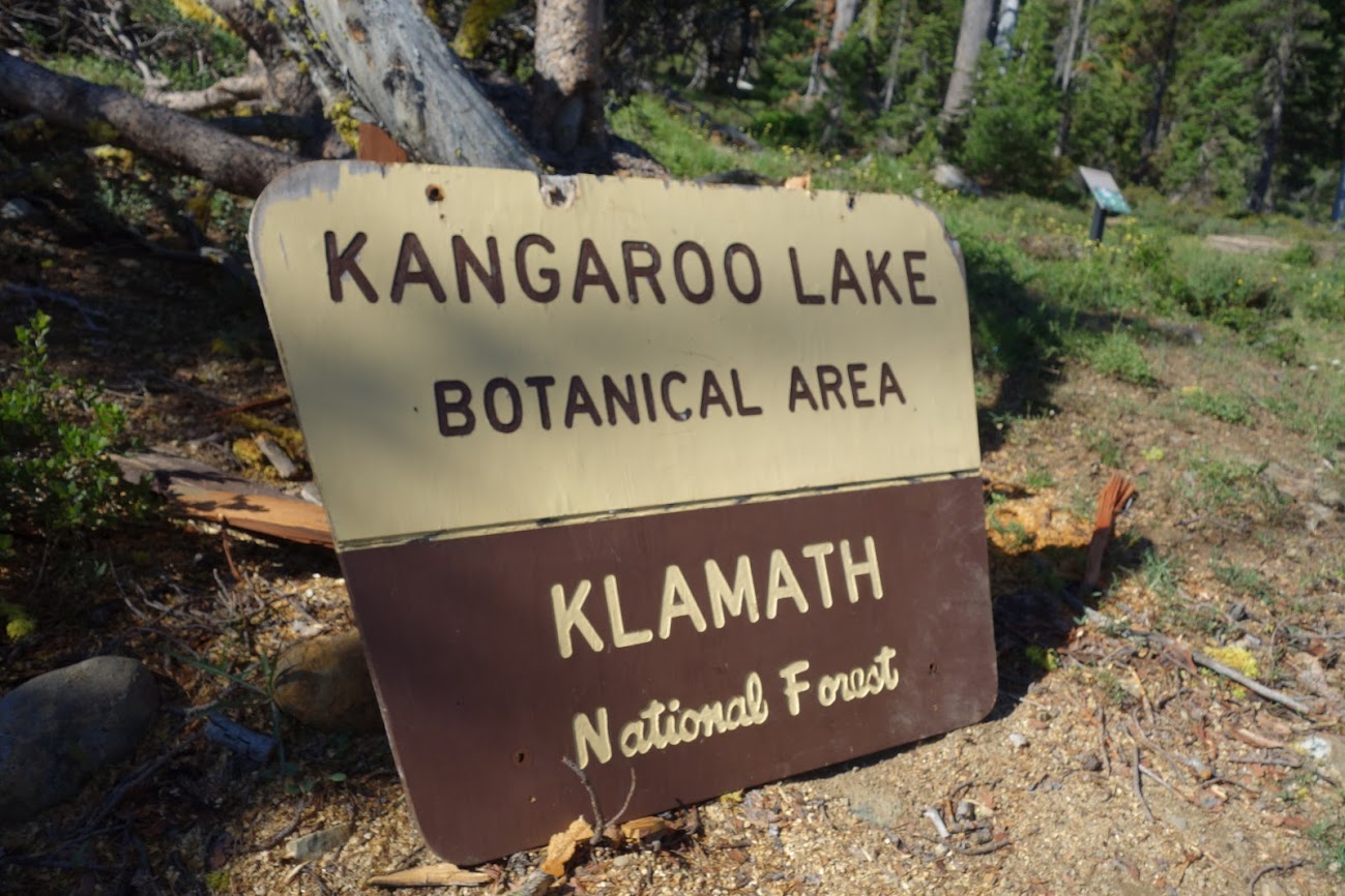
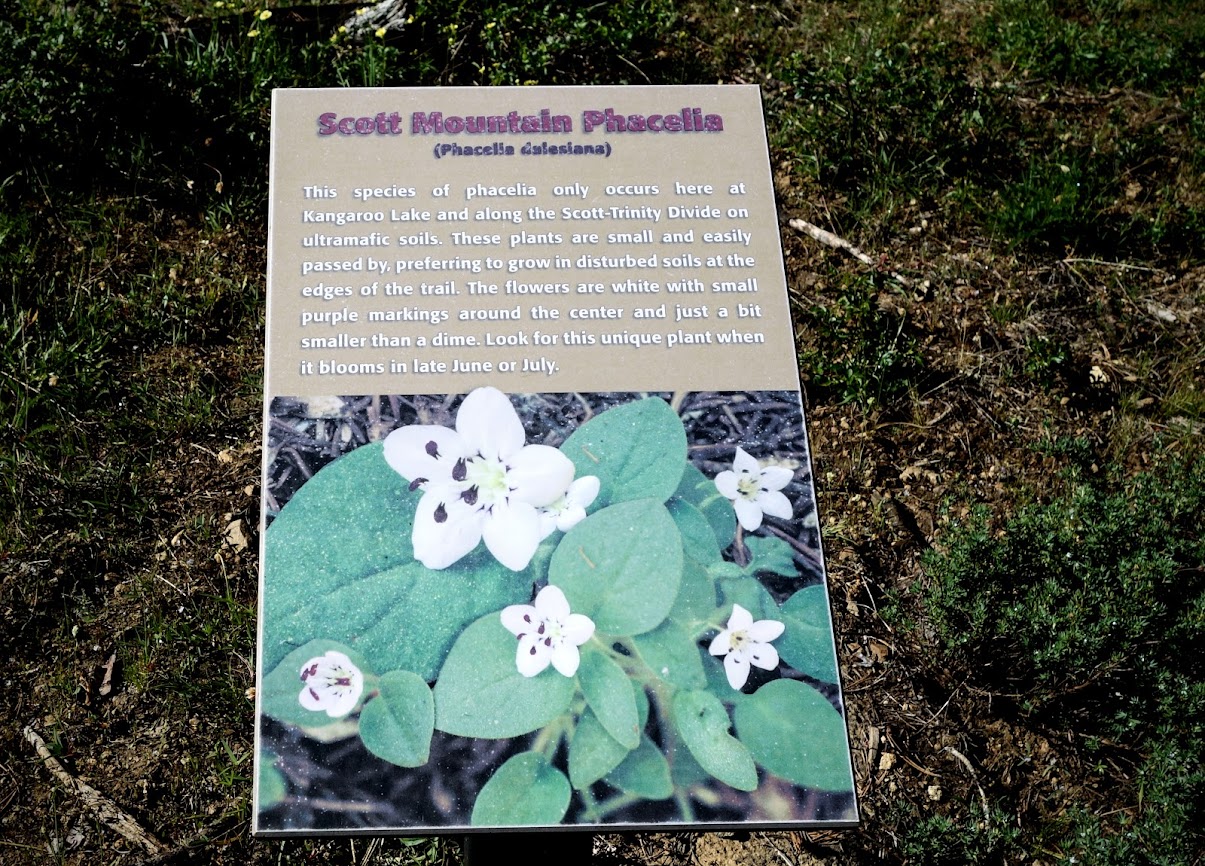
The Klamath National Forest is home to many rare and endemic species. As such they have several botanical areas which have been protected (link) including the Kangaroo Lake Botanical Area. “A 430 acre site located on the southeast edge of the Salmon/Scott River Ranger District (T40N, R7W, SEC 14). The area varies in elevation from 6000′ to 6857′. It provides a diversity of plant habitats ranging from wet seeps and meadows to rock walls. The high level of habitat diversity is associated with a correspondingly high botanical species diversity. Sensitive plant species present include Phacelia dalesiana and Epilobium siskiyouense.” Source: Klamath NF
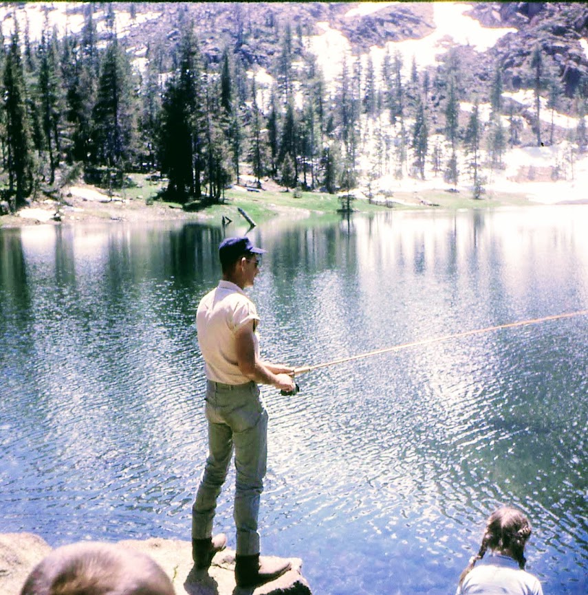
I have fond memories of Kangaroo Lake from my childhood when we camped nearby, and my dad spent hours fly fishing.
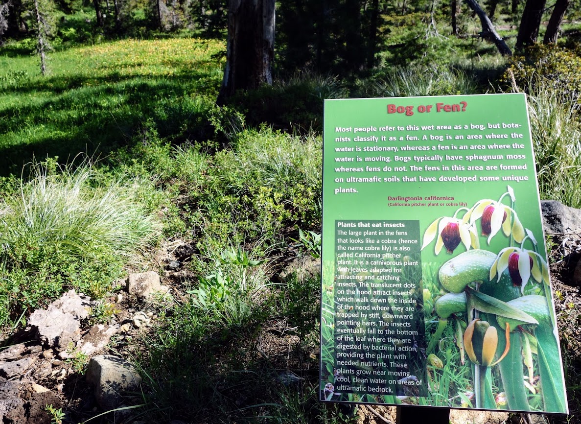
On this day though we were out to explore the Fen Nature Trail, a word that only came to my attention over the past few years.
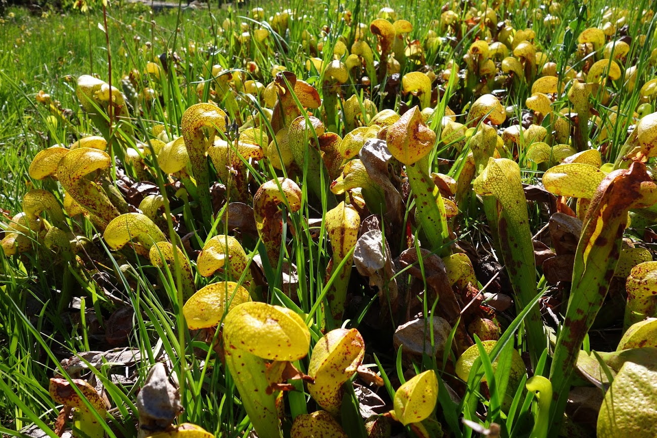
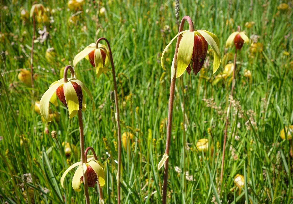
We found plenty of fens with Darlingtonia californica aka Cobra Lilies or California Pitcher Plants.
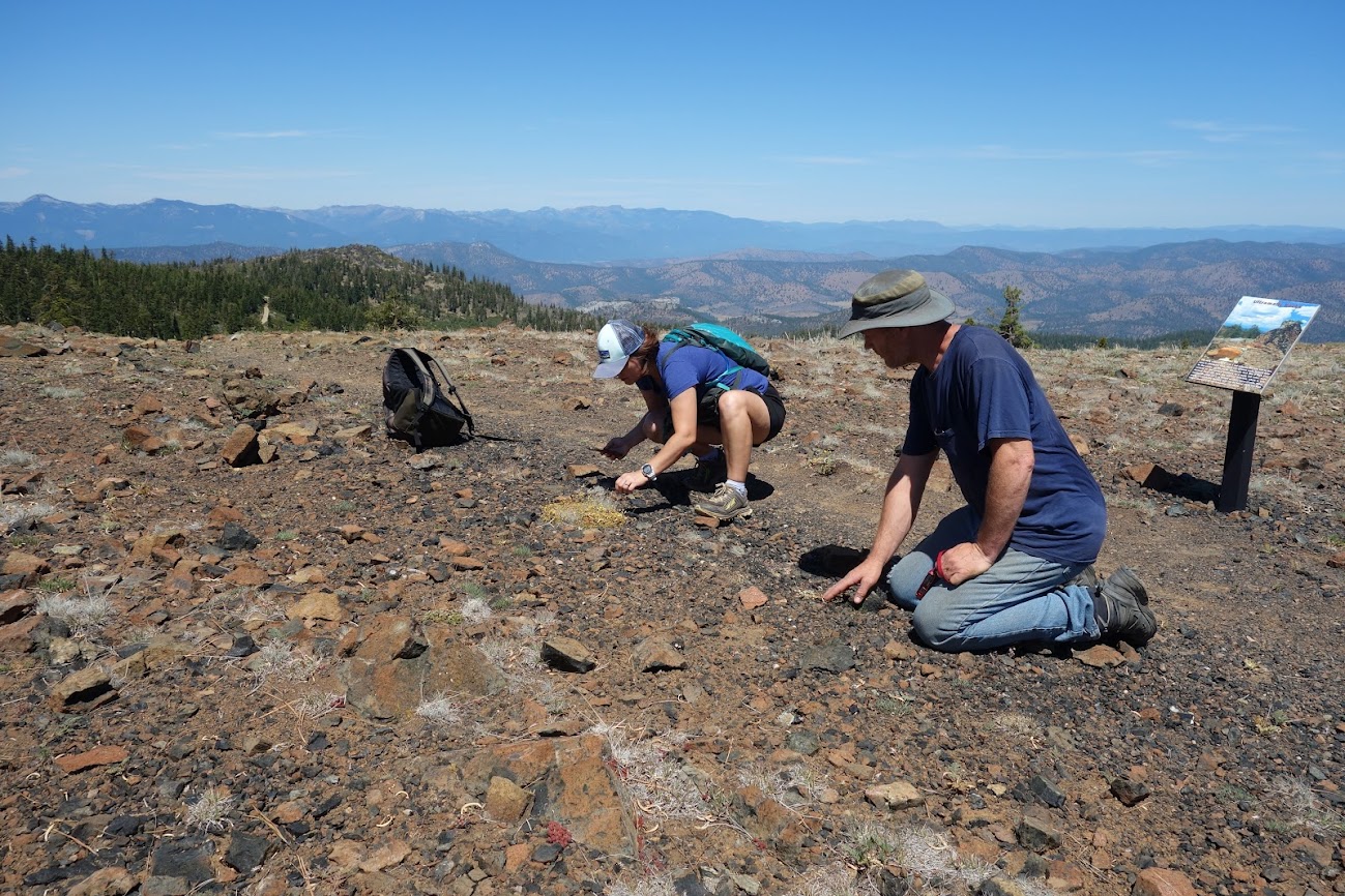
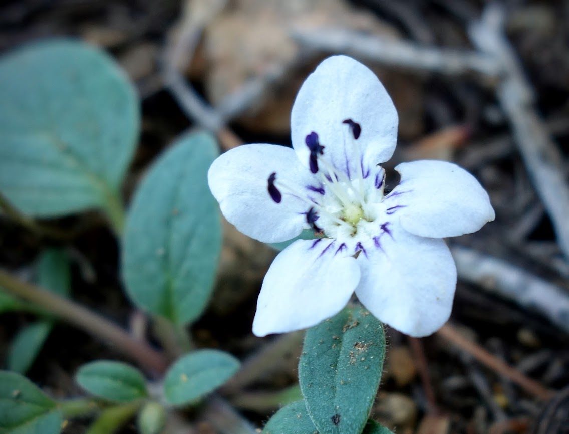
We were hoping to find the rare Scott Mountain Phacelia, which I’d been lucky enough to stumble across unexpectedly a few weeks earlier at a different location (link).
Are you hiding down here?
How about here?
Success!
Calochortus elegans aka Elegant star tulip and Northwestern mariposa lily
Calochortus nudus aka Naked Mariposa Lily
Owl’s Clover with bug for extra credit.
Allium (onion) but not the rare one.
Sedum (aka Dr. Seuss trees)
Buckwheat, but not the rare species.
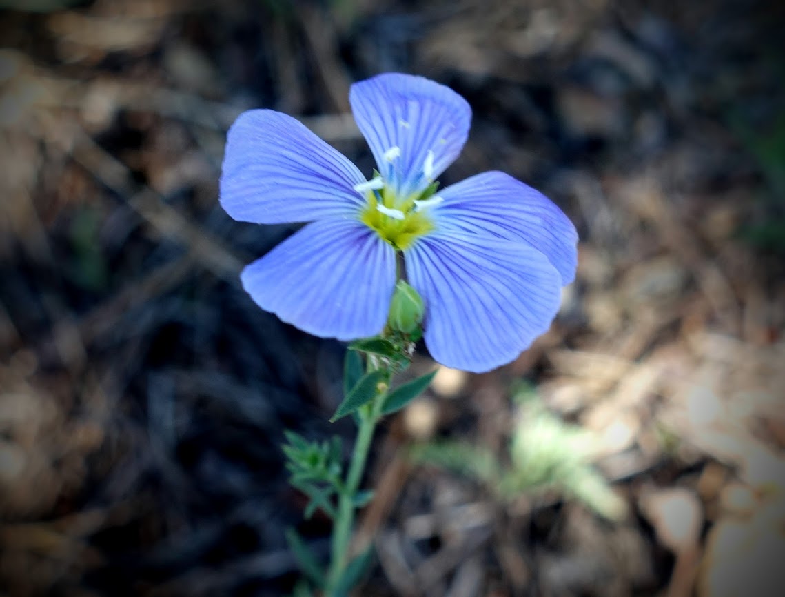
Blue Flax
Penstemon newberryi
Bladderpods
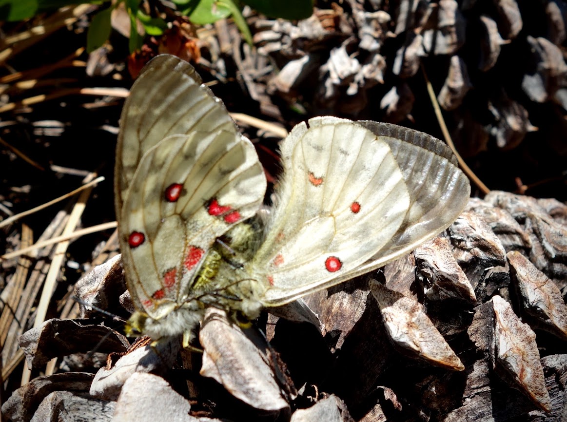
Intense butterfly or moth mating.
We enjoyed several views of Kangaroo Lake and distant views of three other listed botanical areas including China Peak, South China Peak and Cory Peak. Someday I’ll make it a priority to spend a day botanizing in those areas as well.
We hiked the trail to where it connected with the PCT. Our trip was less than 3.5 miles and about 750′ of elevation gain/loss.
Bonus: roadside botany on our drive to the trailhead
When I spied a group of rare California Lady’s Slippers (Cypripedium californicum), I was giddy. They were freshly washed after a little overnight rain.
Apocynum andrsameifolium aka Dogbane
Shasta Leopard Lily
Sidalcea, Checkerbloom.
Rhododendron occidentale aka Wester azalea
Showy Milkweed (creative edit)
My botany fieldtrips have been such a fun rehab diversion. It’s highly unlikely in “normal” times I would have taken a day to drive 3-4 hours to spend 5 hours hiking 3.5 miles, followed by another 3 hours of driving. It was a wonderfully long 12-hour day filled with friendship, education, photography and visual delights.
After a 3-week hiking hiatus, when invited to join my botany friends for a short hike at Whiskeytown National Recreation Area, how could I say no? Special note of thanks to them for helping with identifications.
Firecracker flower (Dichelostemma ida-maia) was one somehow missing from my photo library. I’d found a few on my bike rides but they just didn’t offer the WOW I needed.
There were some nice patches of firecrackers.
The firecrackers contrasted nicely with nightshades.
I was quite excited to be introduced to the ginger bloom. I’ve taken many photos of the beautiful heart-shaped ginger leaves. I was enlightened yesterday about the hidden bounty. This is the most common variety in Shasta County, Hartweg’s Wild Ginger (Asarum hartwegii). The bloom in Trinity County is significantly different. “California has four species of wild ginger, all with similar habits and looks, but separated slightly by range or character differences. The two most common are Asarum hartwegii, or Hartweg’s wild ginger, and Asarum caudatum, or creeping wild ginger. Hartweg’s wild ginger is the most common in the conifer forests around Redding, while creeping wild ginger is commonly found in Trinity County and along the North Coast. Though called wild ginger, this plant is not related to the ginger normally used in the kitchen. The wild ginger name comes from the aroma that the leaves emit when crushed, or that the rhizomes (underground stems) emit when broken apart. Researchers have now determined that wild ginger plants contain poisonous chemicals that are harmful to humans if consumed. “Seed dispersal in wild gingers is significantly aided by ants, which benefit from the location of the flower on the forest floor. some researchers have suggested that pollination occurs by flies and gnats attracted to the rotten-flesh color and the sometimes musty, rotting smell that the flowers produce. However, other researchers have found that wild ginger relies heavily on self-pollination instead.” Source link
Bush Poppy (Dendromecon rigida) was another I wanted to see. We found one unaccessible patch and then a little later we found the gold mine! This is in an area burned in the 2018 Carr fire. I wonder if that heat contributed to seed distribution.
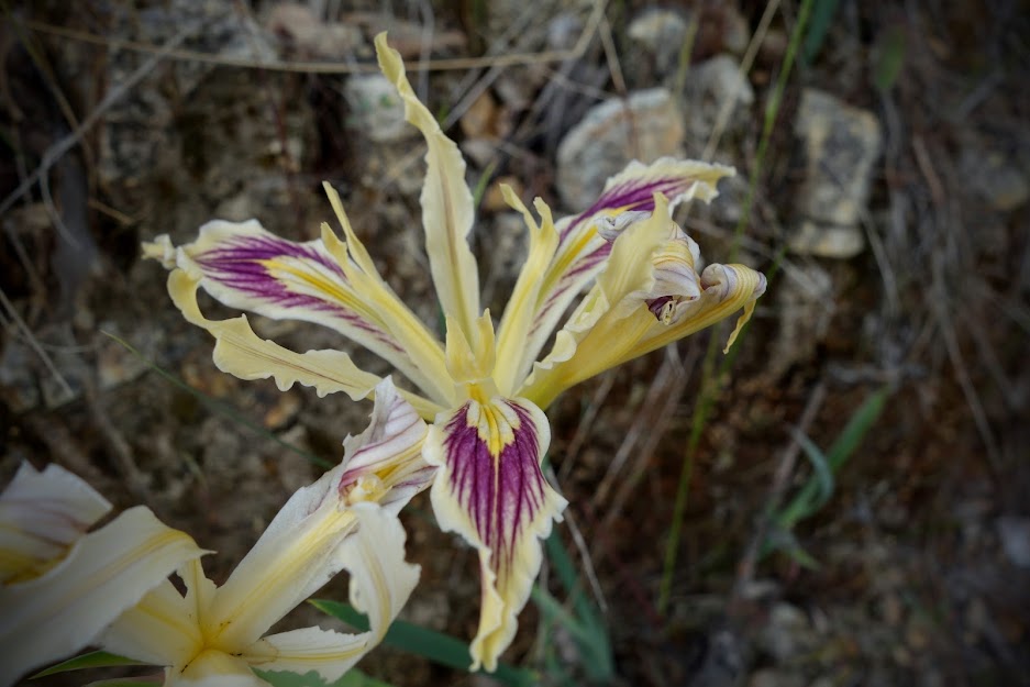
It was a great time to be on the trail for a wide variety of blooms. There were several colors of iris.
The trail was lined with California snowdrop bush (Styrav redivivus).
The Purple milkweed (Asclepias cordifolia) had clearly found perfect conditions in which to grow. The plants were 3-4 feet tall.
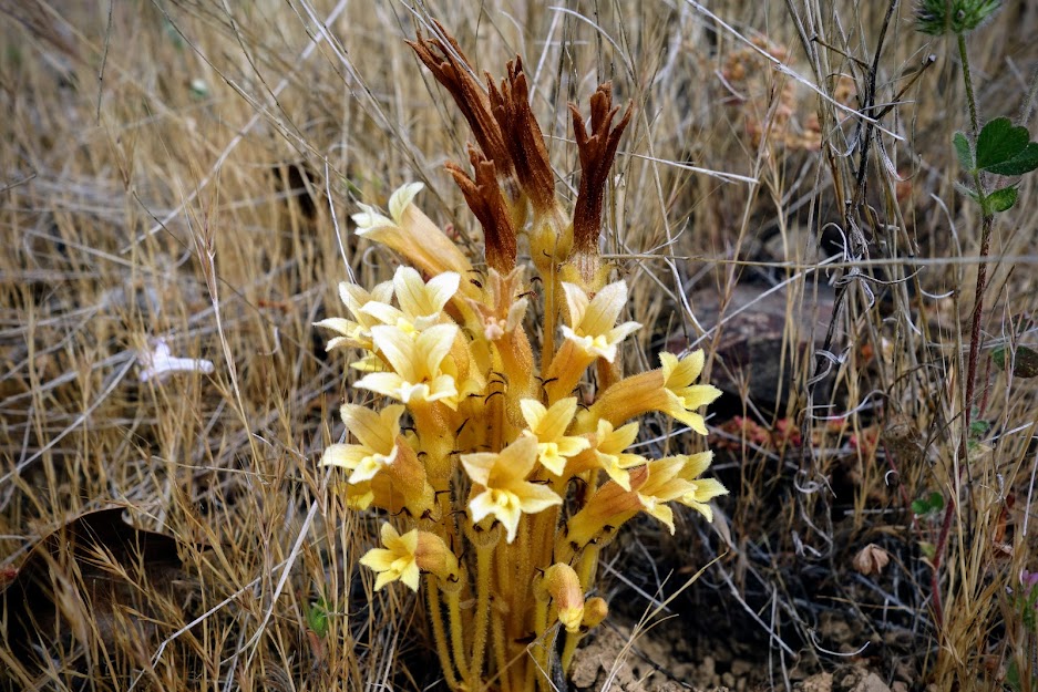
Clustered broomrape (Aphyllon fasciculatum) is a parasitic herb,producing little or no chlorophyll; instead, they draw nourishment from the roots of other plants by means of small suckers called haustoria.
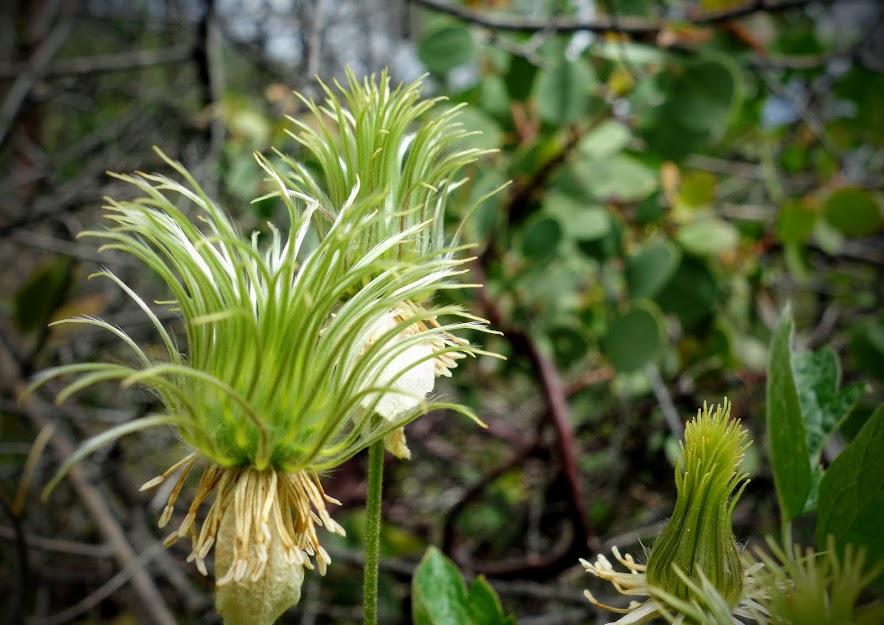
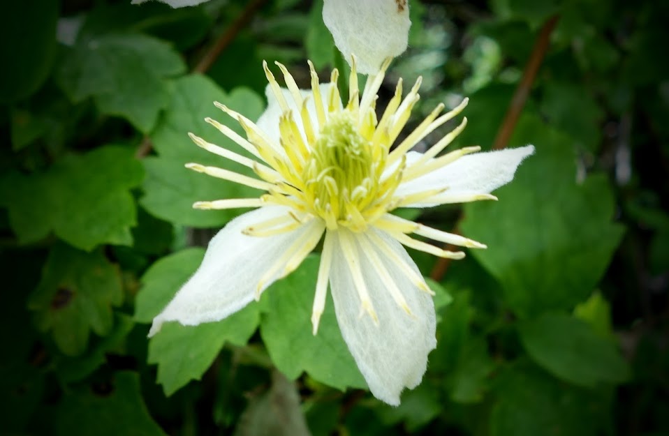
The clematis looked like it was having a bad hair day. They were quickly passing peak bloom.
Stipulate lotus (Hosackia stipularis)
Sulfur Pea (Lathyrus sulphureus)
Creeping or Sonoma Sage (Salvia sonomensis)
Brodiaea
Hairy star tulip
Sedum
I only found one patch of paintbrush.
Phlox
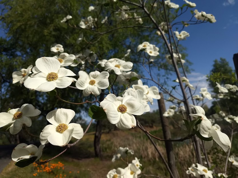
Dogwoods were just starting to bloom.
With little spring rain, I don’t expect April showers to bring May flowers; however, I suspect I’ll still find plenty. I hope you all get out and enjoy a few blooms as well.
I continued marching my way toward freedom from knee surgery rehab (link) during the month. My first big accomplishment was on the Sacramento River Trail in Redding when I was able to walk the hilly side to Ribbon Bridge. My gait was still awkward on inclines/declines. I continued working on hip/quad strengthening.
There’s nothing like stairs to help me gain fitness, and in this case it’s a bonus rehab workout. This 42-step staircase provides a great detour on my walking route.
After a friend recently hiked the Oak Bottom Ditch Trail at Whiskeytown National Recreation Area, I was encouraged to do the same. It’s one I’d previously bypassed due to it’s proximity to the highway, plus being relatively short at 2.5 miles and nearly zero elevation gain. But for rehab purposes it was perfect. That’s Shasta Bally in the background.
There were large patches of Indian Warrior aka Warrior’s Plume.
Most exciting was finding first-of-the-season Pussy or Kitten Ears.
When you get spring fever, what do you do? That’s right, pull the paddleboard out of storage and on this 75-degree, no wind day, make a 2021 maiden voyage. If the photo looks familiar it might be because my walk previously was along the right shoreline.
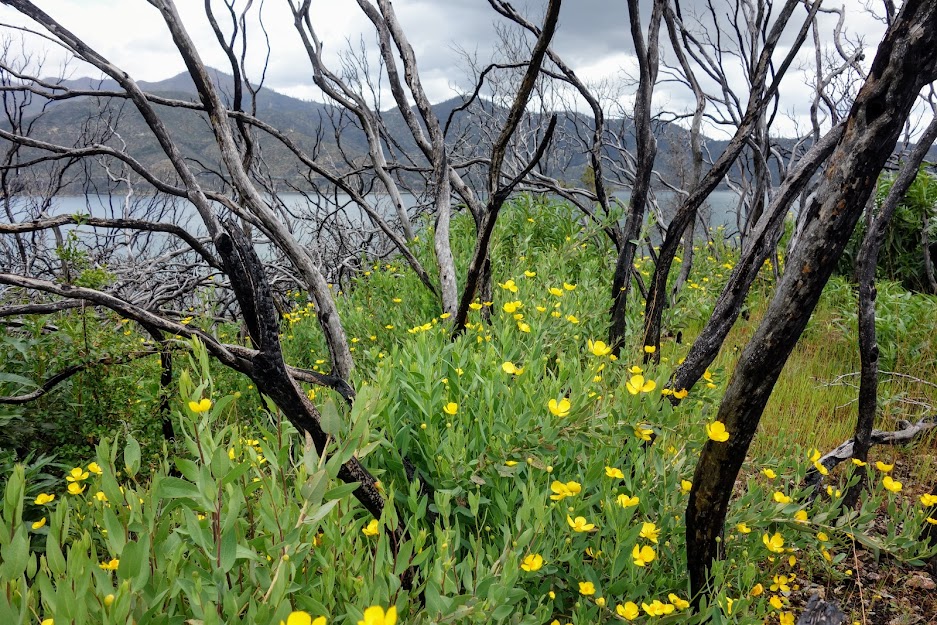
The Churn Creek Greenway Trails provide an option to the paved Lema Ranch Trails on McConnell Foundation land. They include wide gravel paths as well as single track along the creek. Buttercups were showy as they welcomed spring.
It was a milestone day as I reached 8 miles on the mostly flat Upper Sacramento River Ditch Trail, part of the BLM Keswick Trails system. I walked between the Walker Mine trailhead and the Flanagan Trail junction enjoying the rare treat of being outside a burned canopy.
There were a few Indian Warriors blooming but the Toyon Berries were really putting on a show.
This trail offers views down to paved Sacramento River Rail Trail I’d walked several times in February, and where I’d set my previous milestone of 6.5 miles.
When a friend shared photos of a couple wildflowers I’d been anxious to photograph, it was time to revisit Princess Ditch Trail, part of the BLM Mule Ridge trail system. Rain was in the forecast but I knew overcast skies lent themselves to better photography. I started from the Stoney Gulch Trailhead walking south toward the down tree that turned me around on my last visit. The Buttercups spread their cheer along the trail.
First on my search list were these white shooting stars.
I struck out on finding Scarlett Fritillary but I was happy to find these Checker Lily (Fritillaria affinis).
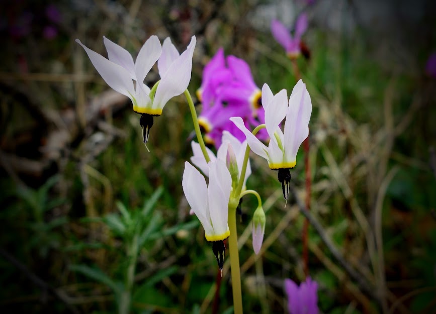
The trail was loaded with Henderson’s Shooting Stars.
I found my first Mariposa Lily bloom of the year.
The Blue Dicks were just coming into bloom.
The most recent WordPress update makes it nearly impossible for me to edit posts, so I’ll attempt to use their new formatting on my next post. If it’s too much work, this may be the end of my blogging for now. Google is also making changes starting in June where I’ll no longer have free photo storage so that’s already had me researching options. Argh CHANGE! sometimes good, sometimes bad, but usually requires adaptation or failure. Wish me luck!
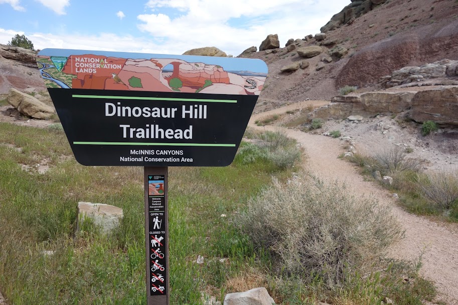
Last May I stopped at Dinosaur National Monument and was beyond WOW’d by the Carnegie Quarry and Exhibit Hall (link). On the way to and from Colorado National Monument I saw a small sign for Dinosaur Hill. On my final day at the park, it was overcast and I still had a bit of energy so decided to check it out.
It was cool to see that about 50% of the interpretive signs were done in braille.
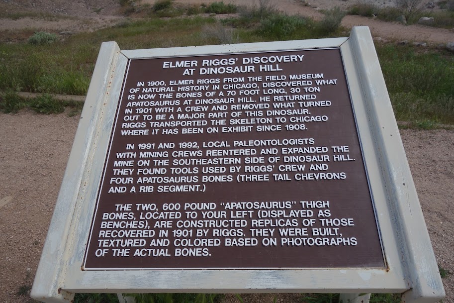
I was underwhelmed for the most part. Kids would be extremely disappointed with the lack of fossils to see. This was the best display in my opinion.
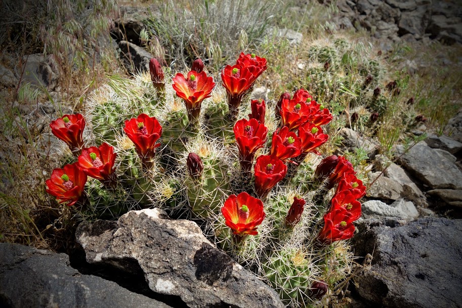
Finding this large display of blooming Claret Cup Cactus was my reward. I don’t think I’ve ever seen this many blooming simultaneously on one plant.
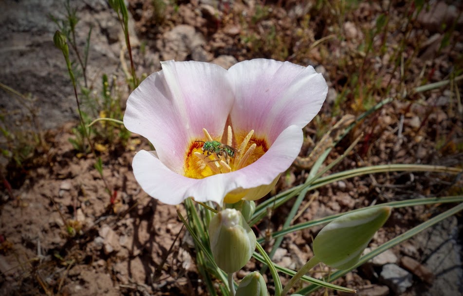
I also found a few blooming Mariposa Lilies and this one was extra large. It was probably 3″ at the opening. It was extra special with the bonus of a visitor enjoying the nectar.
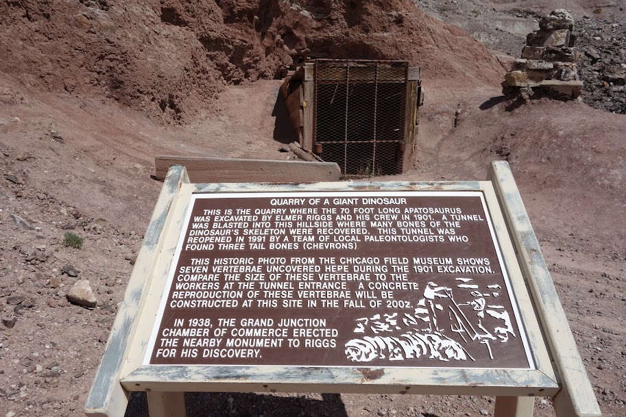
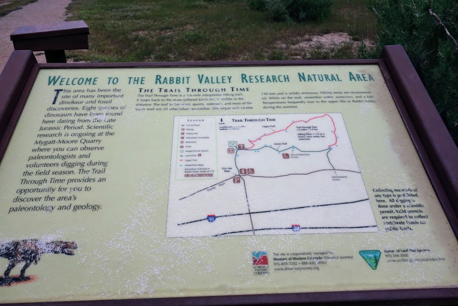
I’d seen an exit sign for The Trail Through Time on Interstate 70 shortly after crossing into Colorado. This area was referenced on the signage at Dinosaur Hill so when I found myself in the area, I decided to take a peek.
Time to step back 150 million years.
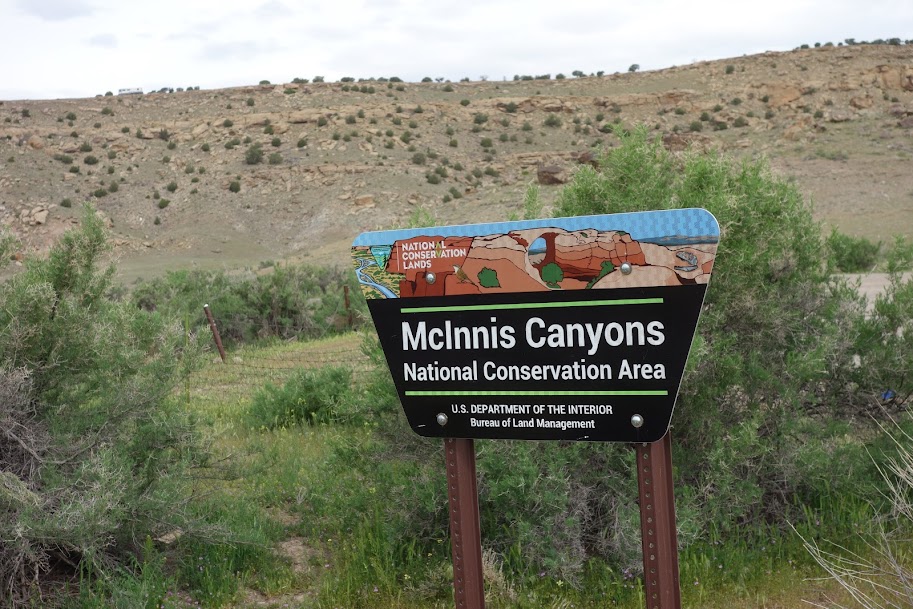
The interpretive signs and displays were much improved as compared to Dinosaur Hill even though both are provided by the McInnis Canyon National Conservation Area.
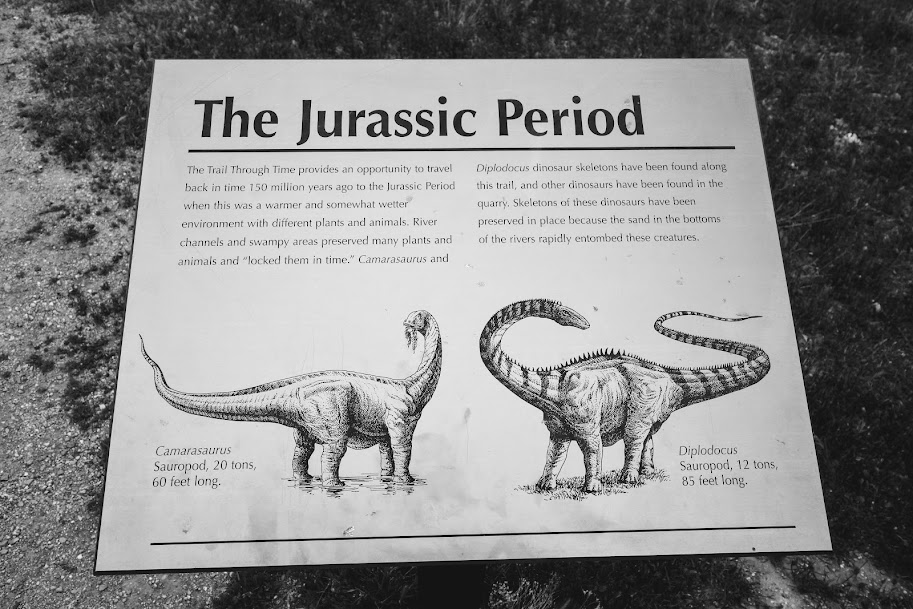
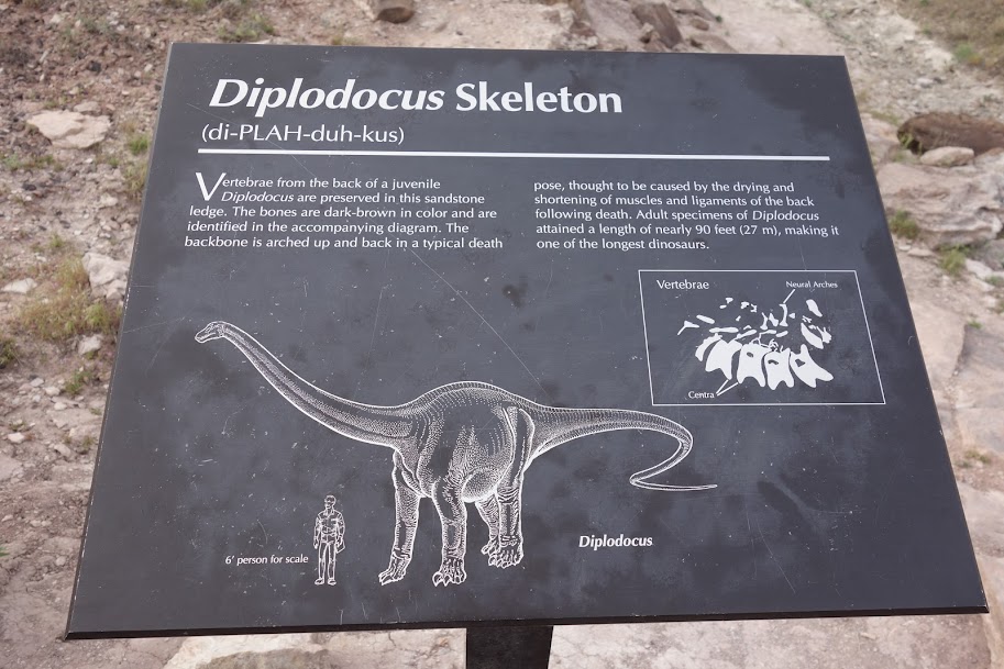
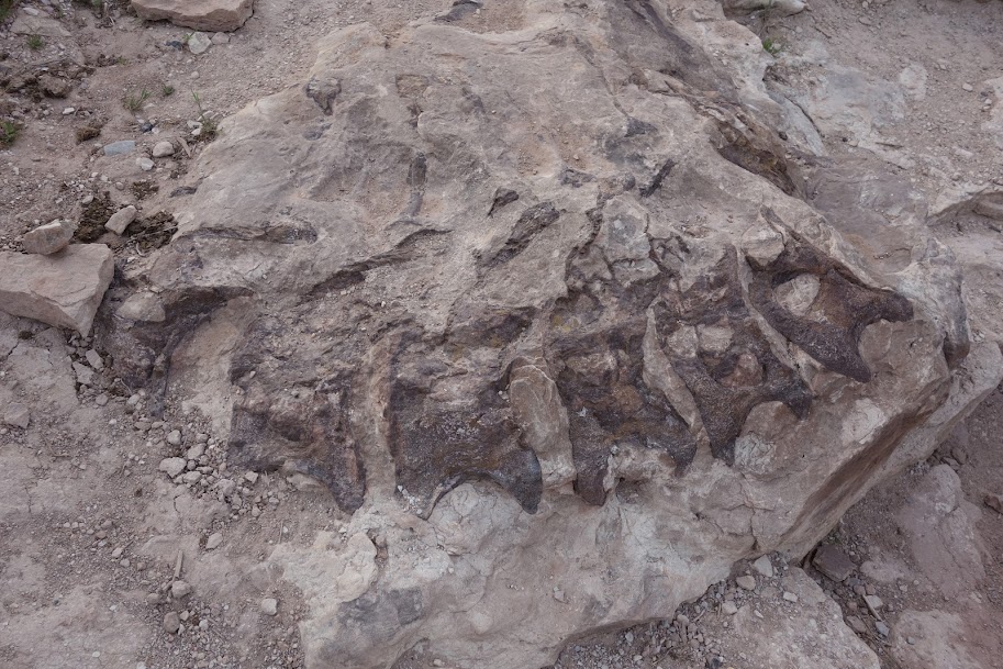
This was my favorite.
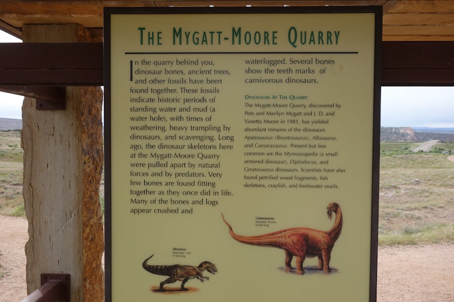
It’s hard to believe the fossils in this site were not discovered until 1981. Makes you wonder what else is in the area. It’s also interesting to think of previous land ownership and the other nearby parcels.
The highlight for me was finding the hillsides filled with mariposa lily. Here are a few of my favorites.