“Autumn is a second spring when every leaf is a flower.” -Albert Camus
Here in far Northern California we don’t get the flashy colors of aspen or larch. The jeweled autumn tones of oaks in our foothills, combined with reds of dogwoods, and the always catchy Indian Rhubarb, make for more subtle color distribution, which are also more challenging to photograph.
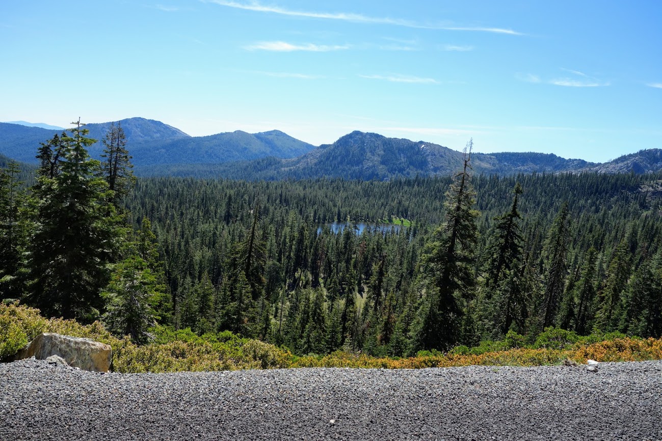
McCloud Falls
For minimal effort, and a 2-mile jaunt, you can hike past three waterfalls, known as Lower, Middle and Upper McCloud Falls. For those more adventurous you can continue on the Upper McCloud River Trail for another 14 miles. There is road access at several intervals if you want to stage a second vehicle or wish to break this into day hike options. This is one of the few places where you can backpack and camp along the McCloud River. (Link to previous post with 4-seasons of photos.)
Burney Falls
You can reach these falls by hiking the PCT or by visiting McArthur-Burney Falls Memorial State Park. On this day I hiked a figure-8 loop combining the PCT with park trails. It’s about 1.5 hours from Redding with multiple sightseeing and/or hiking options to make it worth the drive.
Whiskeytown National Recreation Area
This National Park is less than a 30-minute drive from my home base in Redding. It suffered a massive wildfire in 2018 and as such it’s been a multi-year project to bring back trails.
Papoose Trail from Sheep Camp Trailhead
This use to be my favorite trail. It was one of the last built in the park before the fire and offered a variety of trees and wandered in and out of canyons, and up to a ridge before dropping down to Boulder Creek Waterfall, which can also be access from another road. I was glad to see some pine trees now taller than me and the slow comeback of Bigleaf Maples, Black Oaks and Dogwoods.
Whiskeytown Falls
This is the only trail in the park that wasn’t massively burned in the 2018 Carr Fire so I love hiking it and remembering how the rest of the park looked. The background story on these falls is interesting as well.
“Before becoming Whiskeytown National Recreation Area, this area of the park was privately owned by Arthur Coggins, whose logging company selectively removed Douglas fir, ponderosa pine, sugar pine and incense cedar during the 1950s. At this time, the loggers were generally the only people who knew about the falls. Park rangers initially learned about the waterfall in 1967 but kept it quiet. At that time, the park did not have the staff to protect this treasure or the money to construct a trail to the falls. Eventually, these rangers moved on and others who knew about the site passed away. Knowledge of the falls was generally forgotten and only a few residents visited the falls over the years. It wasn’t until 2004 that park natural resource managers Russ Weatherbee and Brian Rasmussen found the falls again. Under the leadership of park superintendent Jim Milestone, funding was secured and the formal trail to Whiskeytown Falls was constructed. It opened to the public in 2006.” Source: NPS website
Crystal Creek originates from springs further north and is the source for both Whiskeytown and Crystal Falls.
Lassen Volcanic National Park
This park is about 1-1.5 hours from Redding. The road through the park is closed in the winter but areas are accessible at both ends. First snow of the season is always a good excuse to take a drive, especially if there is a possibility of lingering fall colors.
Brokeoff Peak Trail
I’ve probably hiked this trail more than any other in the park. I enjoy the variety it offers as well as the challenge, gaining 2,500′ over 3.25 miles. Below are links to previous posts:
Redding offers a variety of paved and dirt trails, it’s one of the reasons I keep this as a home base. One website notes “an impressive 225 miles of trails within a 15-mile radius of downtown.” Of course neighborhood walks are always an option especially when rain brings muddy trails.
Sacramento River National Recreation Trail
For many miles, this trail borders protected riparian zones where bald eagles, bears, mountain lions and many others visit or call home. In 2018 the Carr Fire roared into town, covering these 10+ miles in the blink of an eye. It came within 1/4 mile of my house, leaving a path of devastation. I’ve spent a lot of time pondering recovery and have finally come to terms with this altered landscape and it’s need to rebuild a foundation. This is a sample of what to expect after five years of recovery. I wonder what it’ll be like in another five years. If we are lucky, there will be some shade trees.
Thankfully there are also miles where you can forget about the burn while enjoying the river and trees.
It was an exceptionally colorful fall.
BLM Trails
Redding is surrounded by public lands managed by the BLM with many miles of trails in almost every direction.
Trinity Divide
In early October I spent a few nights in a favorite area less than two hours from Redding (blog link).
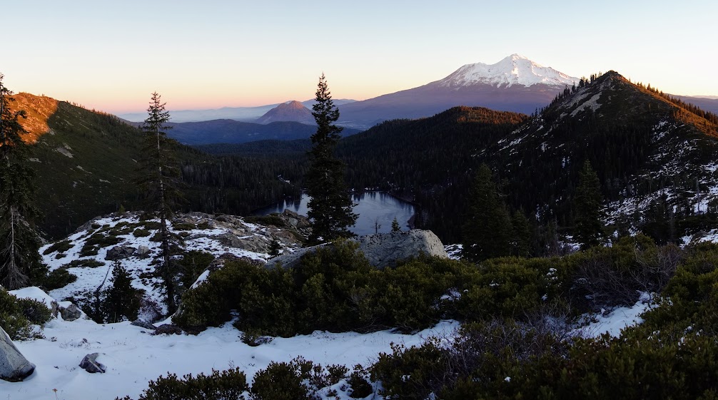
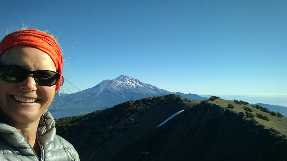
Thanksgiving week gifted me a weather window worthy of day hikes and car camping around Mount Shasta.
I spent time watching the colors of Mount Shasta change as the sun made it’s disappearing act and again in the morning when it reappeared.
Last fall this hike would have required snowshoes. November is usually a mixed bag in terms of snow levels so on this day I happily used my microspikes on the icy sections.
Again I was there for sunset and sunrise, where I was delighted to capture these craggy highlighted in early morning light.
Trinity Alps Wilderness
I snuck in another late fall backpack trip, this time celebrating both Halloween and November 1st (blog link). This is another area less than a couple hours from Redding.
I was ecstatic to capture sunrise from this bucket list location.
With the deciduous trees now mostly barren of their leaves, it is time to officially say farewell to autumn and welcome to winter. The nearby mountains have seen their first winter tease of white while lower elevations have felt the lowering temperatures and first frost. I’m looking forward to finding a perfect white canvas where I can leave my snowshoe prints, feel the brisk air, and witness the fine art of snow, ice and frost decorating those barren branches.
Flashback to October 2008, my first visit to this area and perhaps when the curiosity seed was planted.
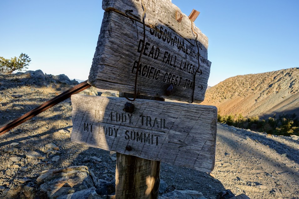
Having hiked the PCT through this area multiple times, it was hard to ignore the multiple trail junction signs. I wrote in a 2015 blog post, “This is the trail crossing for the Sisson-Callahan trail, one still on my list to explore.” At each junction, the Sisson-Callahan Trail drops into valleys while the Pacific Crest Trail (PCT) hugs the contour line high above those valleys.
Friends have been sharing about their explorations along this trail since 2015. For some reason I skipped opportunities to join them. A neighbor’s son told me about the work his crew was doing on a section, and I’d been seeing more references online like this one, “Shasta McCloud Management Unit received $117,000 from the Regional Office to work on heavy deferred maintenance on the Sisson Callahan Trail.” The PCT Association posted about recent land acquisitions (link), “The PCTA has been working to permanently protect every mile of the trail—and today, in a historic leap toward achieving this goal, we’re thrilled to announce that along Northern California’s Trinity Divide in the Klamath and Shasta-Trinity national forests, 17 miles of the PCT that was previously on private property—as well as 10,300 acres of land surrounding the trail are now in public ownership and permanently protected.”
According to a Forest Service publication (link), “Cattlemen, prospectors and trappers who came into the Upper Trinity Area from Scott Valley first established the trail in the mid-1800s. An official trail was constructed around 1911 by the Forest Service shortly after the creation of the Shasta National Forest. The trail linked the Callahan Ranger Station in the Scott Valley with the Forest Headquarters which was in Sisson (Mt. Shasta) at the time. The trail provided a much shorter route for Forest Officers traveling between the two stations than the wagon road from Sisson to Gazelle and then up Willow Creek to Callahan.The Sisson-Callahan trail was designated a National Recreation Trail in December in1979.” Further research revealed the SC NRT is a 10-mile section of the original route covering an area between North Fork Sacramento River and Deadfall Meadows Trailheads. It utilizes what was the old PCT also known as the Deadfall Lakes Trail and combines 5W04, 6W05). Unlike the PCT, bikes are permitted on this trail.
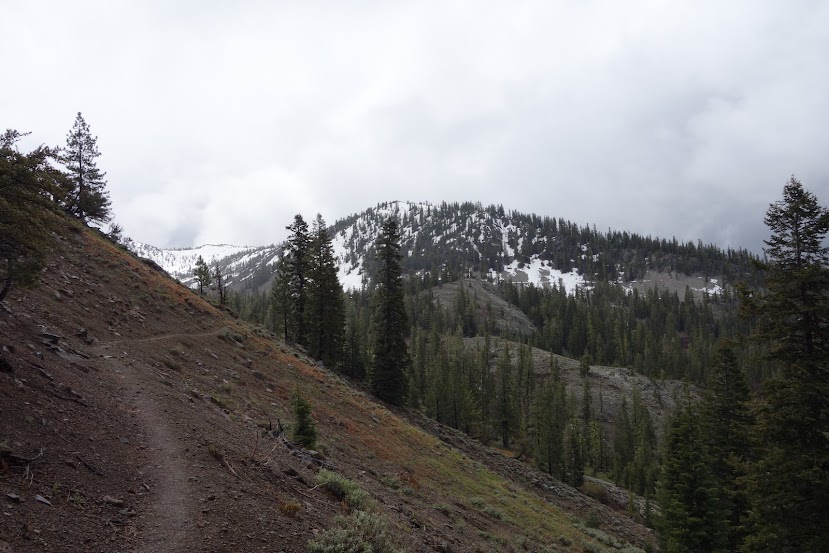
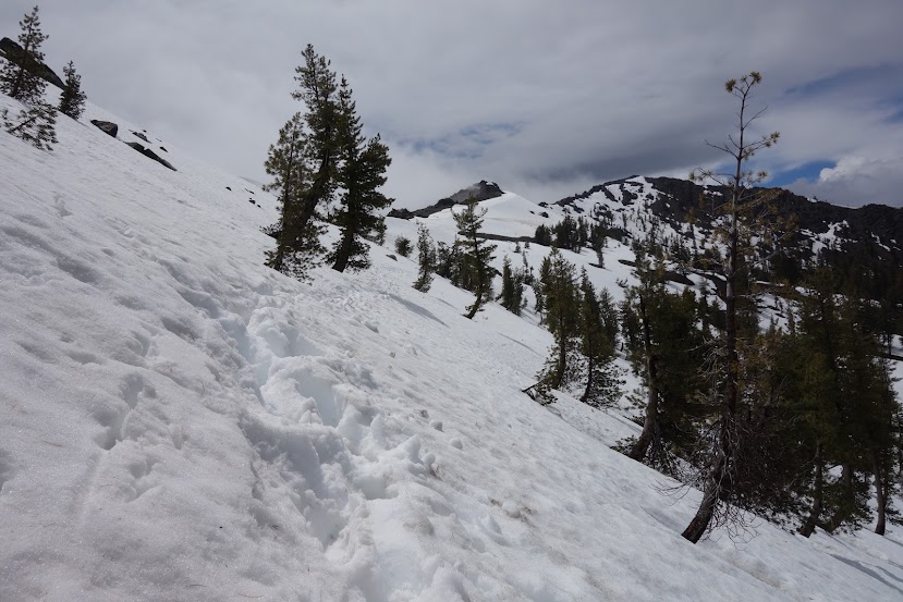
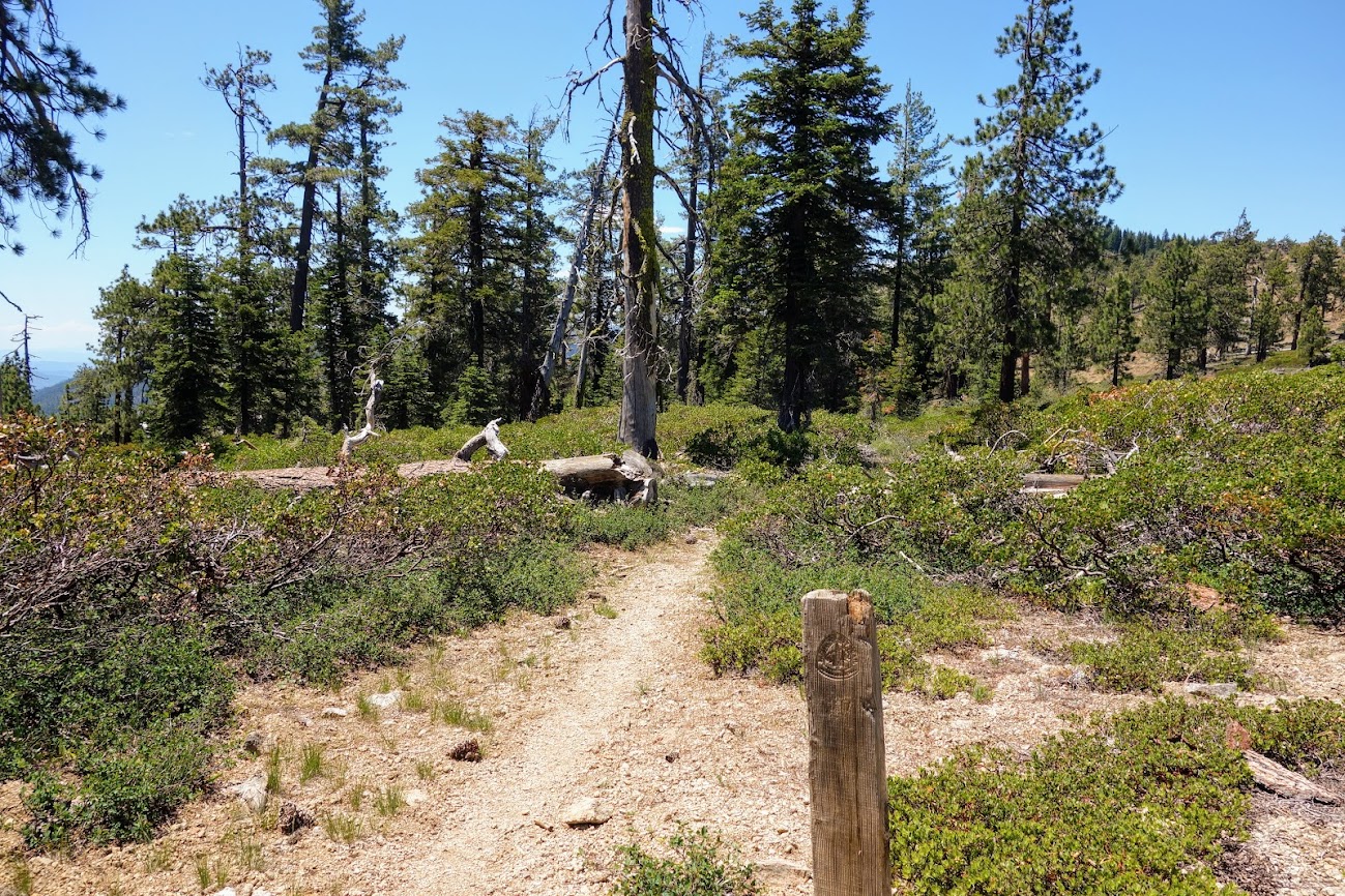
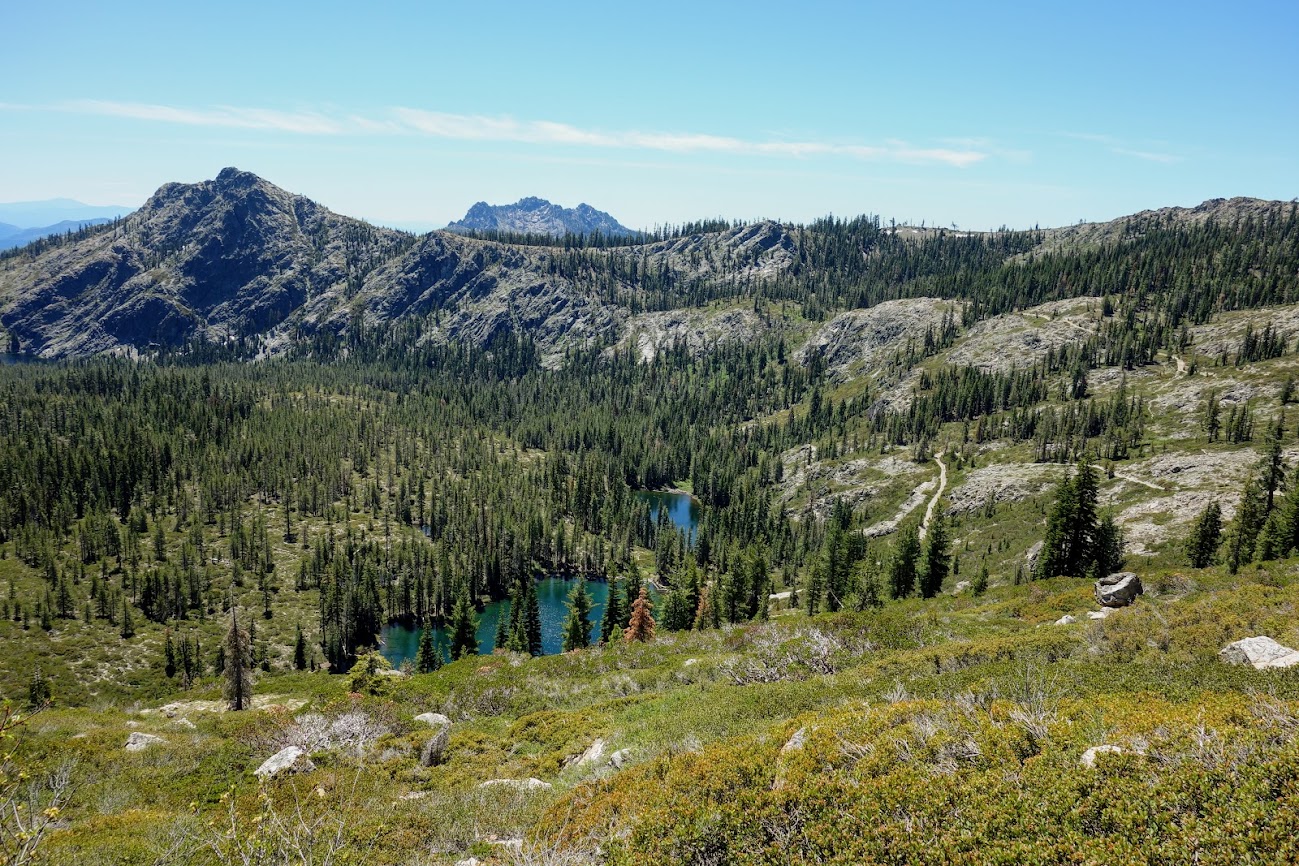
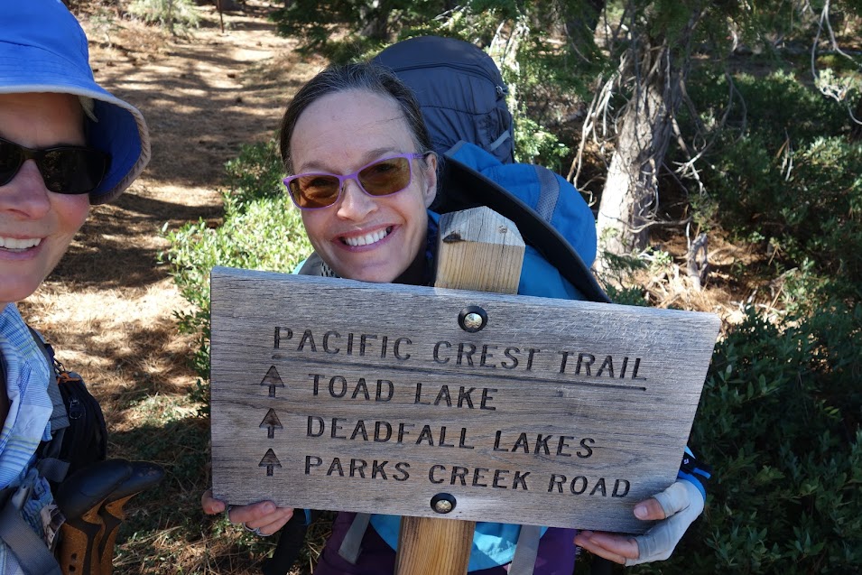
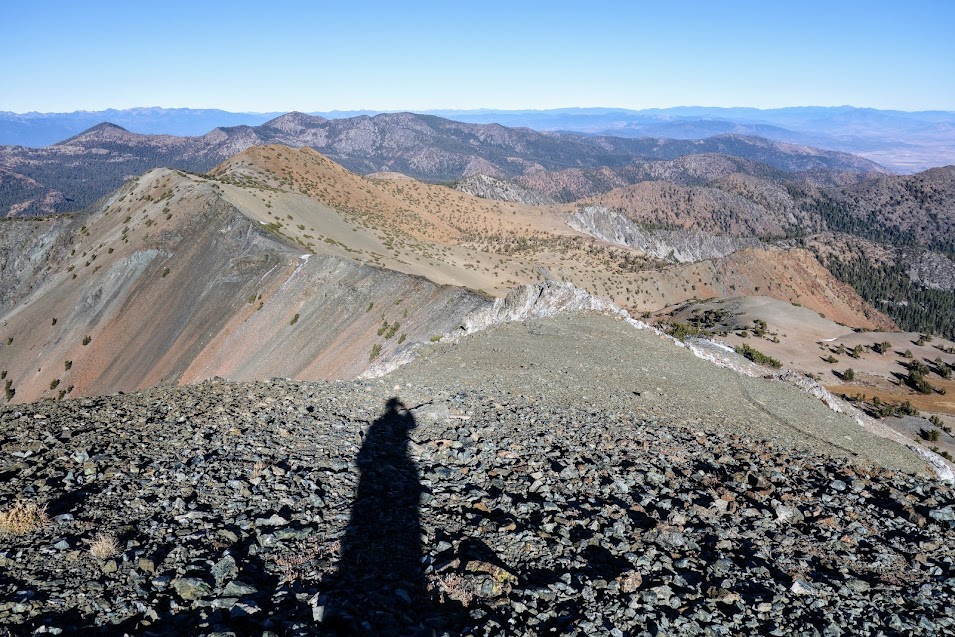
With a weather window inviting a fall jaunt, curiosity (and all those seeds) got me out the door. I hadn’t committed to a plan and wanted options so elected to start from the Parks Creek Trailhead. I arrived to find 16 cars in the parking area. I was shocked as it was late Thursday morning in October. WTH? Well a couple miles later I met a large group of kids from Sisson Elementary who’d been out for a field trip. Another seed to explore the Sisson-Callahan Trail? Fall colors were popping.
I stopped at a spring to fill my water containers and saw this tiny frog/toad, much smaller than Bino Bob.
Since Bino Bob didn’t get to pose with the frog/toad, he decided these pinecones would be better than nothing.
There were a few remnants of summer not quite ready to spread their seeds.
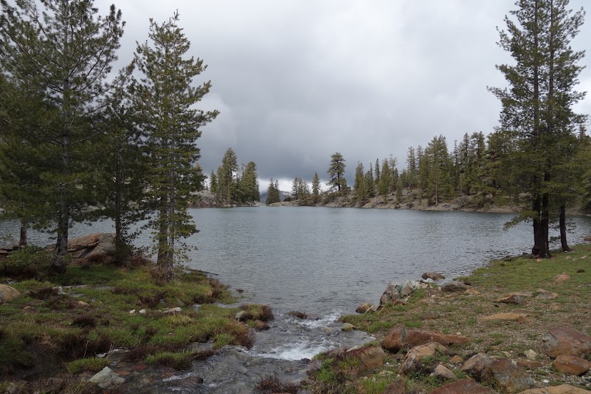
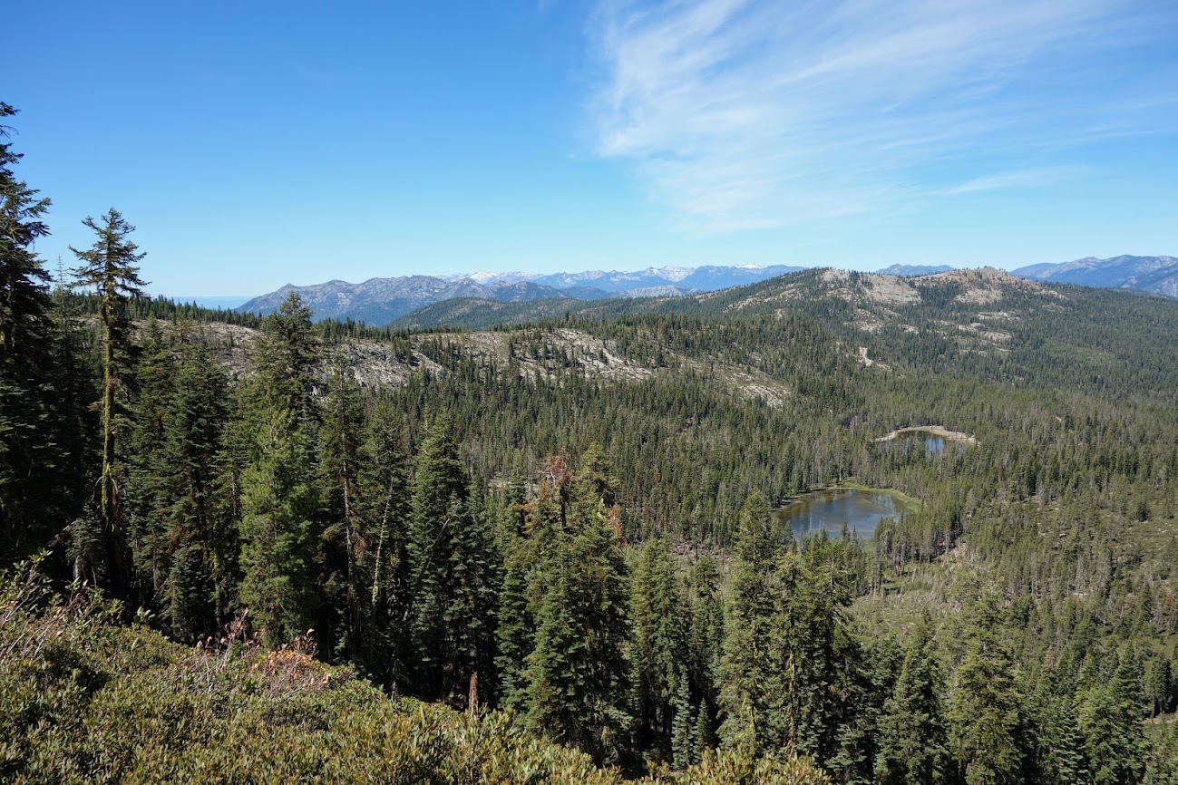
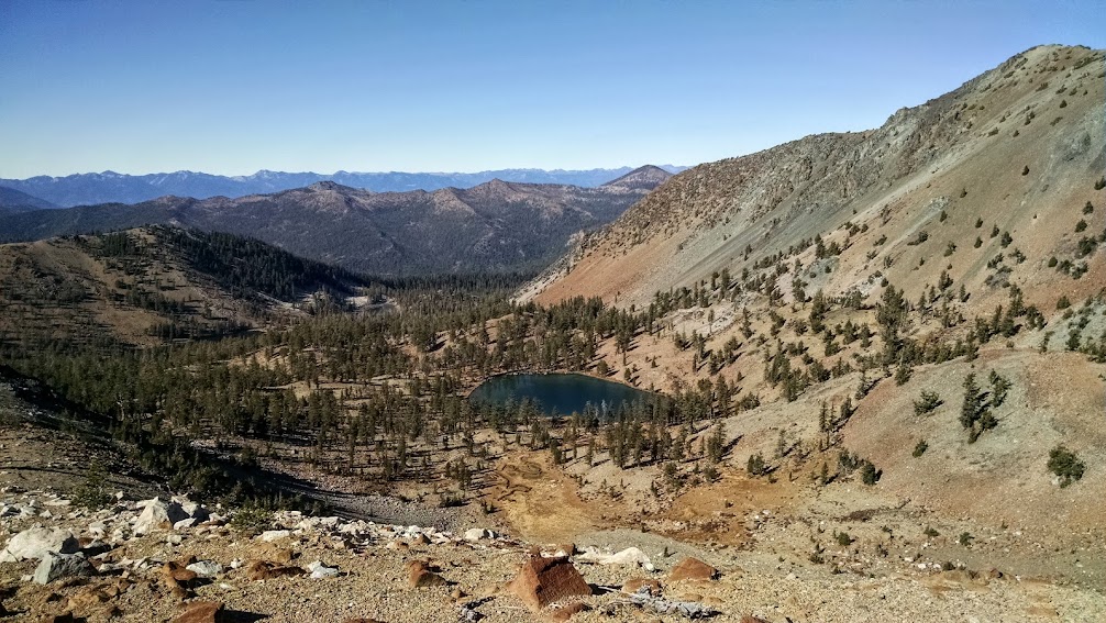
It was quite breezy so my goal was to find a wind-protected campsite. The kids had warned me about the gusts at Middle Deadfall Lake, not that I’d planned to visit as I wanted to be nearer Mt Eddy in case conditions and my mood invited a morning summit. Many of the lakes in the area are fed by underground springs. Since this pond was still retaining water in October I could only assume that was the explanation.
There was another nearby unnamed pond/lake I had wanted to find, so since I was in explorer mindset and had time, I set off. Based on the map is pond/lake is fed primarily by Deadfall Creek, a reliable source spilling across the trail near the trail junction to Middle Deadfall Lake. Maybe there was another pond/lake down lower. I’ll have to take an earlier route on my next visit.
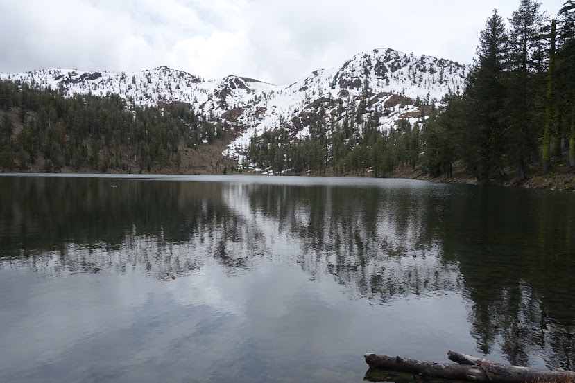
I was happy to find my favorite little hideaway lake looking good, with a nice sheltered campsite. I had negative memories from my last visit when my knee popped requiring major surgery (blog link).
With the wind whipping there wouldn’t be any swimming on this day.
Instead I wandered around enjoying new views of Mount Eddy. “Mount Eddy is the highest mountain in the Eddys (a subrange of the Klamath Mountains), the highest point in Trinity County, and interestingly enough (for you useless trivia fans), the highest mountain west of Interstate 5. It is by far the highest peak in the region… except for one Mount Shasta (a mere 5,000-something ft. higher), which lies just across the valley. Mt. Eddy was named after Olive Paddock Eddy, the first woman to climb Mt. Shasta.” Source: Summit Post
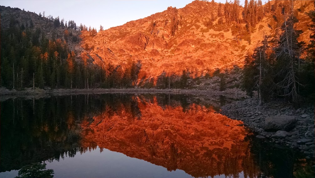
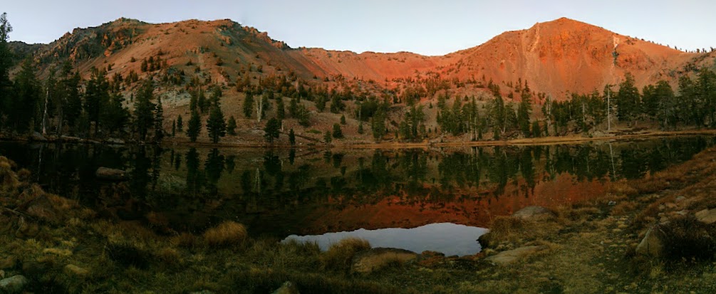
The Klamath Mountains are composed of ultramafic rocks, particularly serpentine and peridotite, which glow red at sunset and sunrise.
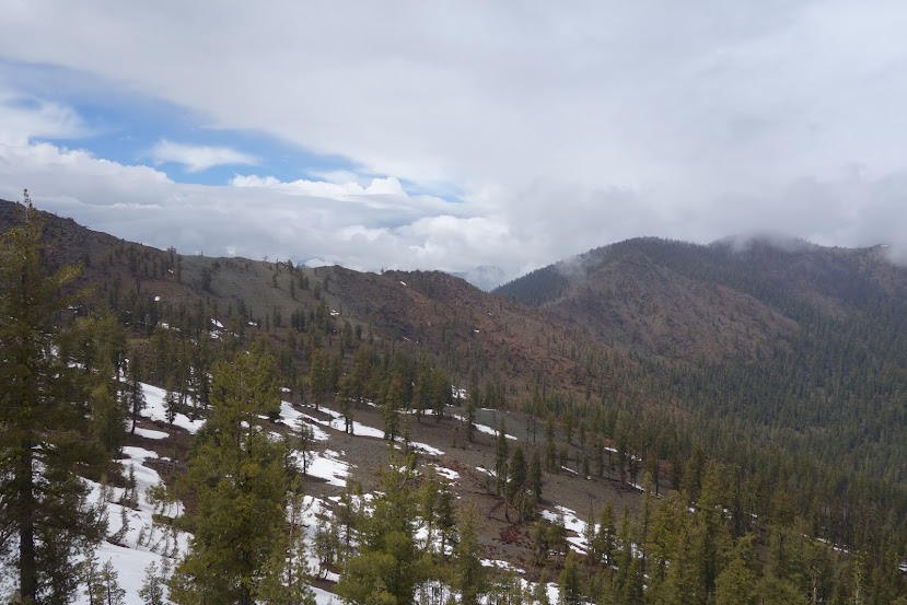
Looking northwest toward the Marble and Russian Mountains.
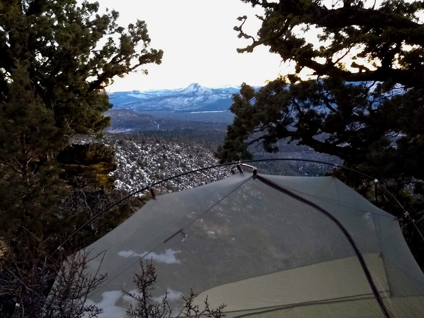
It was a VERY bad night. The wind huffed and puffed and tried to blow my tent down. Instead it coated my face and everything else in a fine layer of dust. It was the first time I deployed the peak guylines on my Durston X-Mid Pro 1.
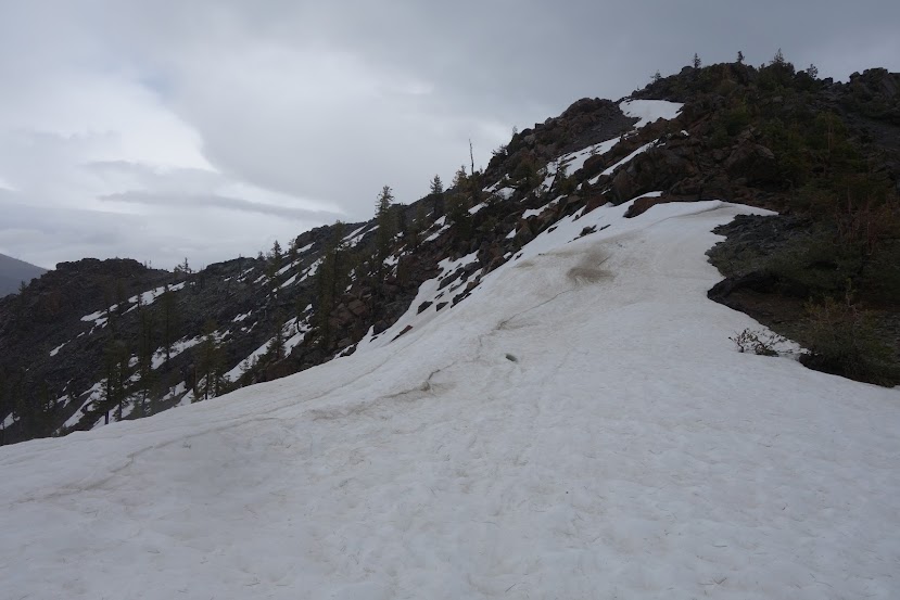
I was anxious to drop elevation and get out of the wind which was still gusting. I would NOT be summiting Mt Eddy in these conditions. I got an early start, first walking along Upper Deadfall Lake. I knew the campsites at that lake wouldn’t be wind protected. By the way, some signage indicates Dead Fall Lakes but everywhere else seems to consistently show the spelling as Deadfall.
By 8:30am I was on the Deadfall Divide, looking down at the lake where I’d camped the previous night. It was decision time. Was I ready to commit to a descent? I hadn’t done any homework except for downloading multiple layers on the my Gaia mapping app. I didn’t even know there were two different trails, the Sisson-Callahan National Recreation Trail and the Sisson-Callahan Historic Route Trail. What’s the worse that can happen? Yep, I was prepared to reverse course.
Part 1 – Sisson-Callahan National Recreation Trail
The trail descends from 8,035′ to 6,374′ over 2.5 miles on nice switchback trails, through a lovely forest. The trail is eroded in places due to extensive bike use. In my post-hike research I learned this is a popular shuttle ride with groups dropped off at the Deadfall Meadow Trailhead to ride up to the Deadfall Divide and then drop down to Lake Siskiyou. I didn’t see anyone on this section of trail and in fact hadn’t see anyone since the school kids the previous day.
You know this section is historic given the tree blazes and license plate markers. I read these were placed for snow travel.
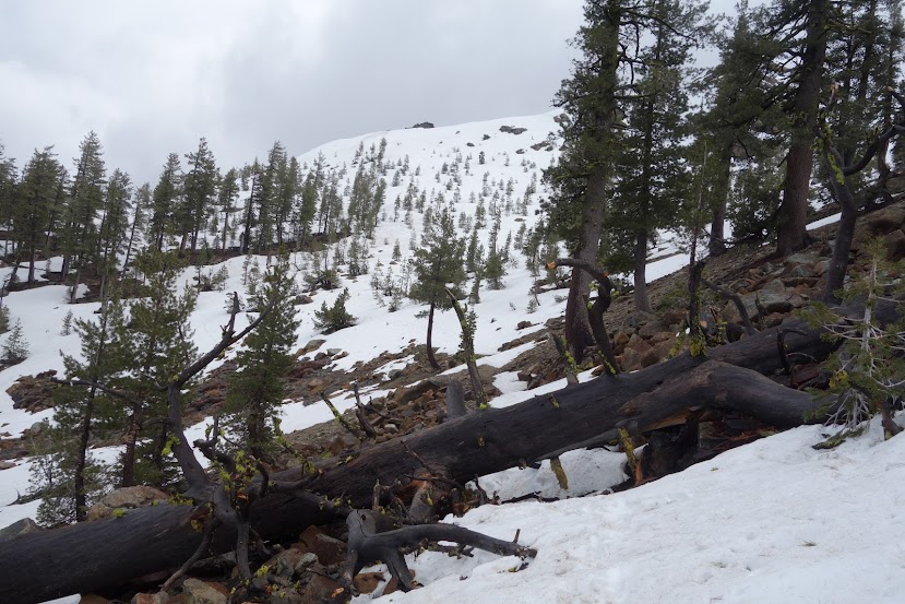
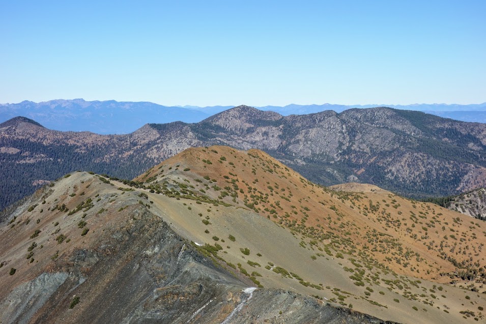
Look at those beautiful trees.
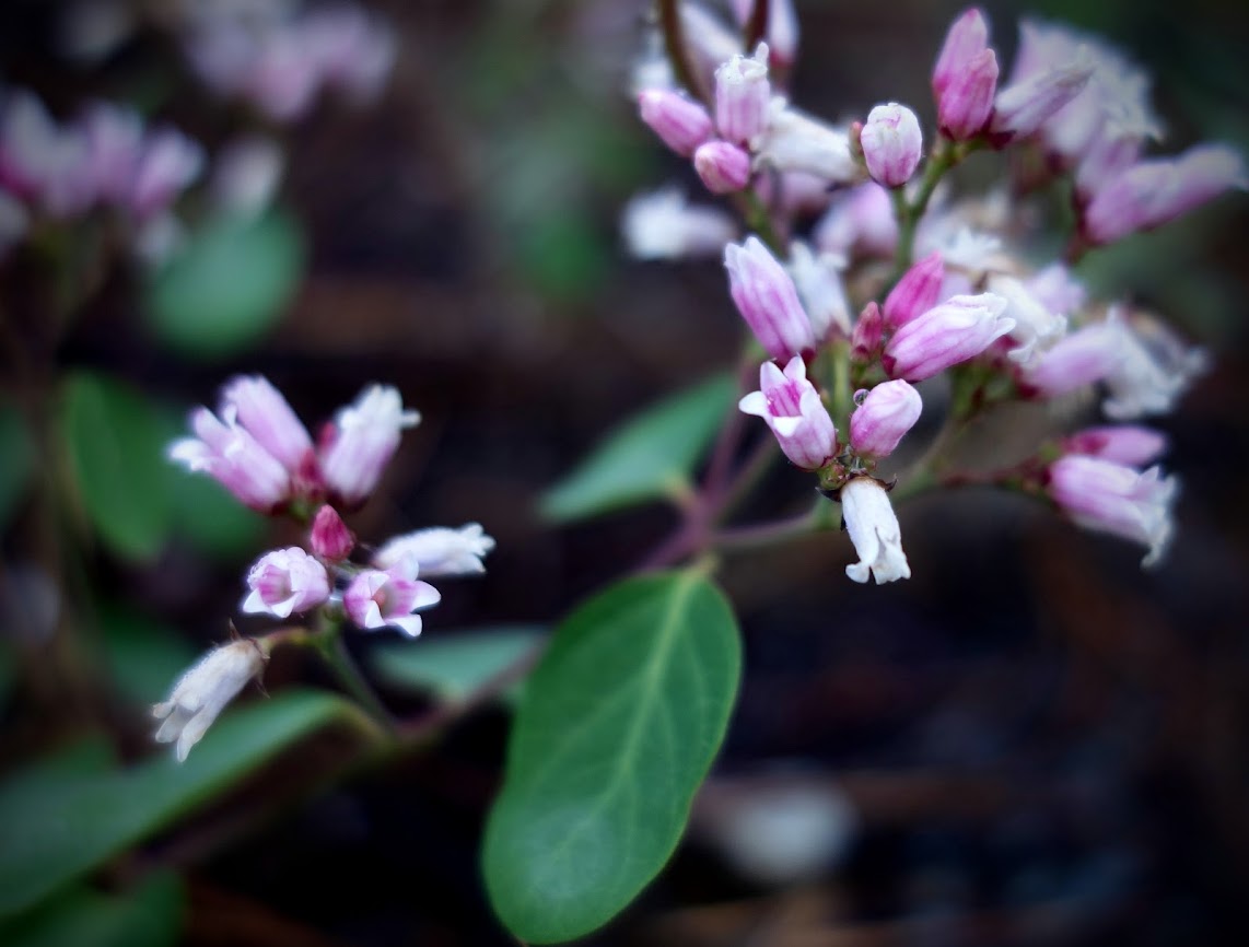
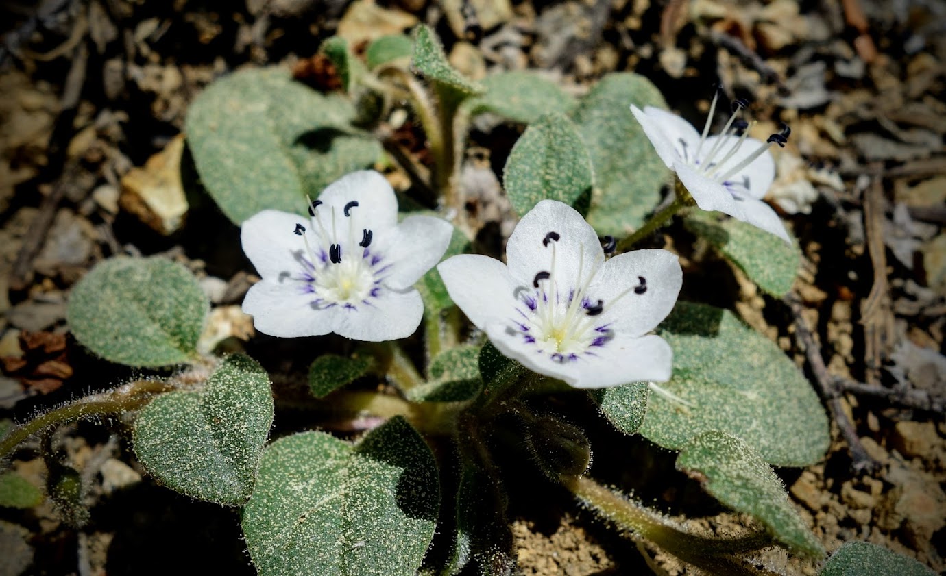
Toward the bottom of this section there were several springs and fens with a few flowers still blooming. I bet this would be a great trail for botanizing.
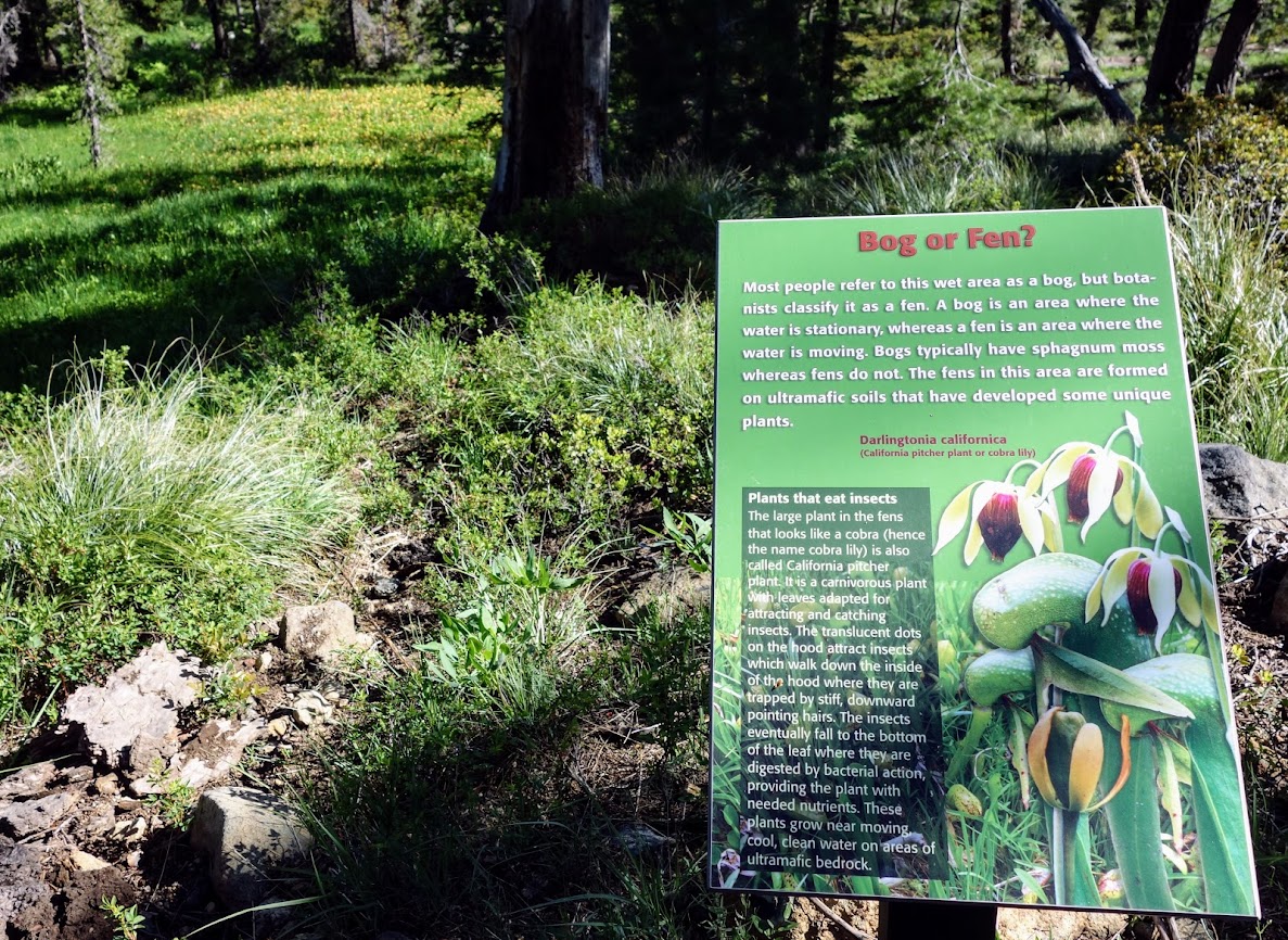
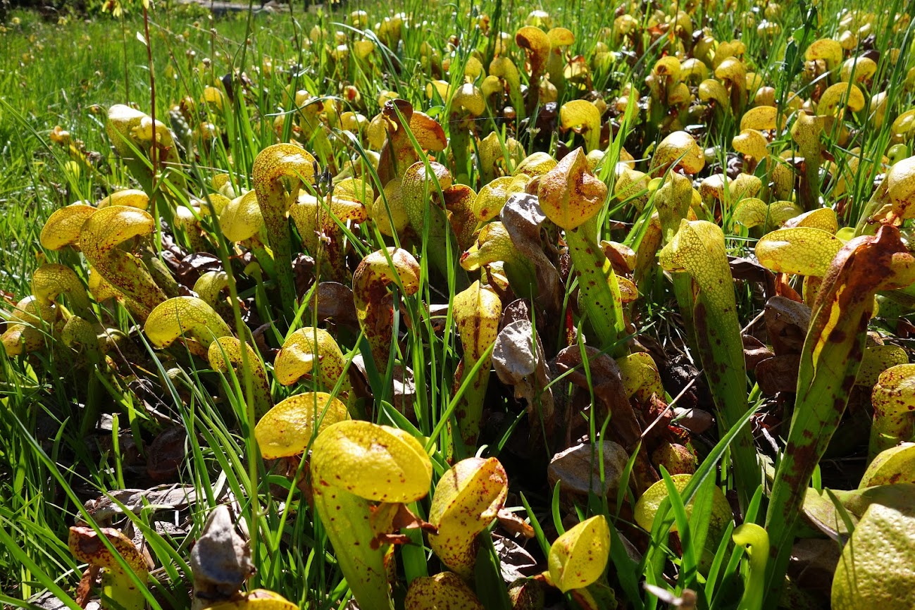
Darlingtonia californica, also called the California pitcher plant, cobra lily, or cobra plant, is a species of carnivorous plant.
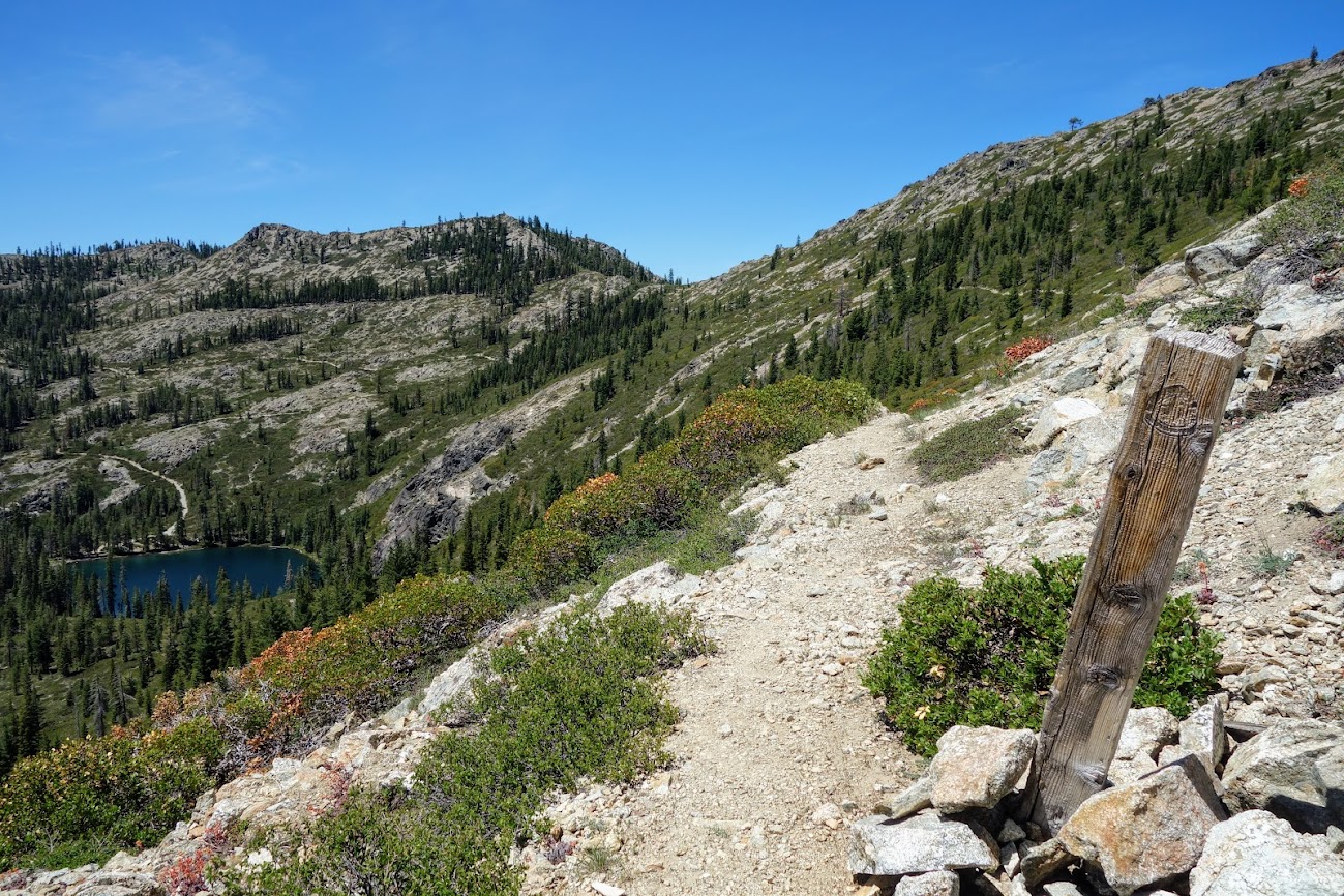
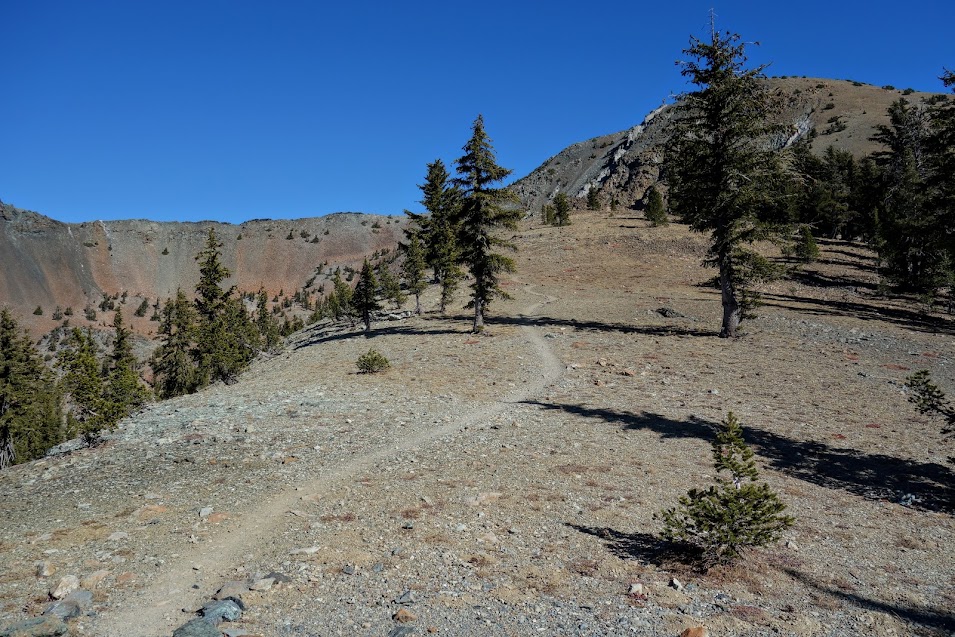
Even with the bike use, the trail is narrow and faint in places. With these PCT markers it makes you want to look at a map and find the old route.
Part 2 – Sisson-Callahan Historic Route Trail
The trail highlighted in yellow represents the Sisson-Callahan National Recreation Trail while that in blue represents the historic route (6W06).
It took me a while to find this junction.
I expected a junction sign. Well after spending time exploring I found this old sign not visible from my direction of travel. Then I found the faint trail. I was beyond thrilled as I really didn’t want to hike back up to Deadfall Divide.
Being conservative when it comes to solo travel, I knew I’d be turning around if navigation became too challenging. I quickly turned off autopilot and focused on trail finding. Some places had negligent tread, others like were reassuring. This is a view looking down back at Mt Eddy and first views of Mt Shasta. I’d descended to the valley from a pass just out of view, this side of the summit.
After about an hour, 1.75 miles and 1,000′ elevation gain, I reached the PCT and my first bail-out spot. I could easily be back to my car in a little over 5 miles.
From the divide the trail down looked to be nicely switchbacked. I won’t lie the traversing PCT was much more inviting but I had that niggling curiosity on my side.
Soon I found this sign. Interesting . . . maybe this is or will be part of the Sisson-Callahan Recreation Trail.
The original trail had been built in the most expeditious manner, straight up, down, across and at 90-degree angles. The rebuilt trail is my track shown in pink.
After about 45 minutes, with some of it requiring an eagle eye to find the next placard, white flag taping, cairn and even an occasional tree blaze I came to what appeared to be the end of the trail. I was in a meadow with no trace of the trail. The section between the switchbacks and this meadow seemed to have been worked recently.
When I got home and researched this trail, I was excited to learn I benefited from this group’s work.
I jumped up to a road and after following it for about 30 minutes I found this arrow that seemed to indicate this was the route.
The trail highlighted in yellow was my route. The blue highlight shows were the trail ended and where the map indicates it should proceed.
I took a little detour to Bear Creek to gather water and discovered signed trail to the north and south of the road. It looks like if I would have hiked down 40N45 to where the blue highlighted trail ends I might have found more hikeable trail. This was looking south toward 40N45.
I hiked north on the “trail” from Bear Creek to Trinity River. It was tedious taking me 1.75 hours to cover 2 miles. I was hoping to find a campsite nearby and dreaming of soaking in this pool but alas rocky terrain and steep hillsides said nope, keep hiking.
Instead I was distracted by some fall foliage while I hauled water up up and up a rocky trail in search of a suitable campsite.
It had been a long challenging day. I was happy to find this perfect campsite where I wouldn’t receive another dust bath if the wind gusts returned. Thankfully it was a quiet night and I got great sleep making up for the previous night. Two things to mention. It was quite warm for October. My first night at 7,800′ only dropped to 50F. This second night at 6,100′ dropped to 48F. The other thing was I met another backpacker. He’d began his hike at Bear Creek and had planned to camp at Bull Lake, but like me he found those two miles much more time consuming than expected.
Early morning light highlighted the scene.
Trail conditions were excellent from Trinity River to Bull Lake with no navigation require.
Asters were one of the few blooms still shouting, look at me!
You are more likely to see a bear on this trail than a human. Shoe prints were a rare sighting.
I made it back up to the PCT, giving myself another chance to consider adventure or a more direct trip back to the trailhead. It was only 10 miles between the PCT junctions, but it was an unforgettable journey. I only donated a little blood along the way.
Speaking of decisions, this comment on the PCT app made me chuckle. Imagine a hot summer day arriving to this pass and seeing this inviting lake. If the lake won, it would be easy to think why not just continue down versus climbing back up to the divide. My advice, just say no unless you are ready to trade miles for time.
Should I take the freeway or the road less traveled?
Since I live the “no regrets” motto, I knew I needed to finish this journey of exploration and adventure.
Let me just say this was another section that hasn’t been brought back yet; however, it was a fairly easy terrain to navigate and I was able to find old tread aligned with the trail as shown on my map. There were occasional cairns, tree blazes and old cut logs to help with the navigation. My only company was a group of cows.
I mentioned before how this area was a patchwork of public and private lands, but through the PCTA Land Acquisitions Program these private holdings near the PCT are becoming public. One of the first changes are removing fences.
It took me about an hour to hike that little 2-mile section. I have been unable to find evidence, on any of my map layers or on the internet, of additional segments between this end point and Callahan.
Part 3 – PCT
I was looking forward to the final 11-miles of this journey. What a wonderful dessert to be hiking PCT grade! I enjoyed a grand view down into Robbers Meadow where I could see the pond I’d visited. I’m sure there’s a good story behind that name.
1.6 miles later I returned to the Bull Lake junction. Lighting was much better so I enjoyed lunch with this view of Mount Shasta and Mount Eddy.
These old sign posts seem to be unique to this area. I haven’t seen them elsewhere on the PCT.
I was thrilled to find these spring-fed pools. According to the PCT app, Farout, the spring was dry and the next water source was further than I wanted to hike. Using my pre-filter scooper I was able to pull three liters of water, filter and enjoy yummy water.
This was a favorite find, gentian with fall foliage.
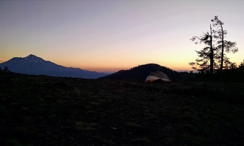
I wanted to camp with a view but once again it was windy, and that recent dust bath lesson kept me from taking that risk. Instead I settled for this view of Mount Eddy. I met three thru hikers that evening, a couple who didn’t start until late May from Mexico and were heading north hoping to complete Oregon before winter. A solo guy had flipflopped and would be finishing in Ashland in less than two weeks.
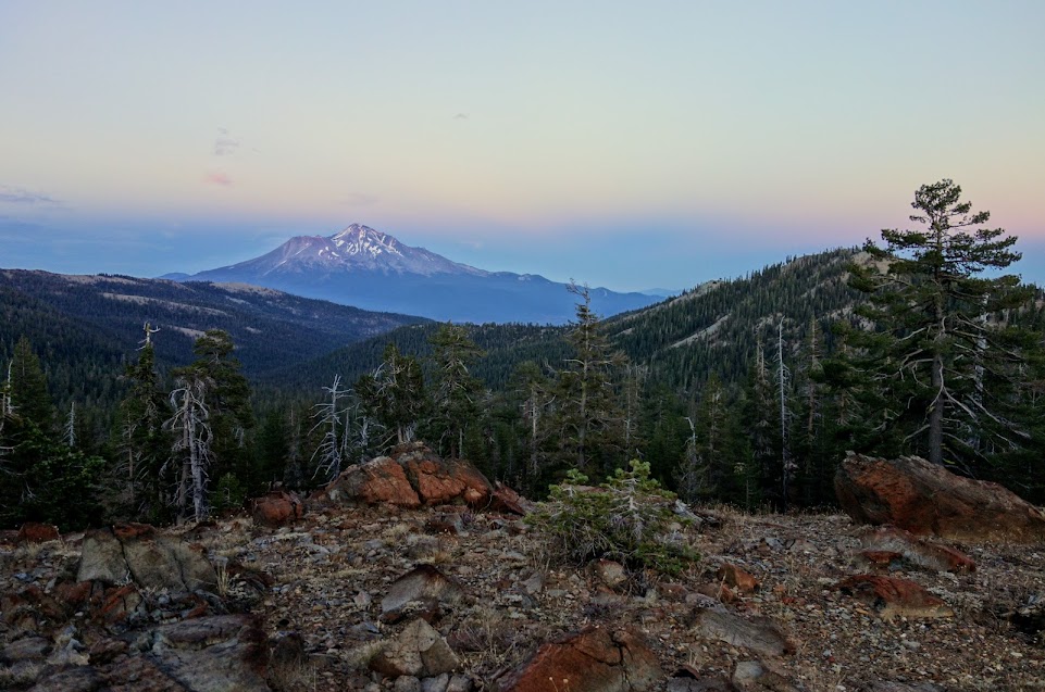
I rushed out the next morning to try to catch sunrise over Mount Shasta but instead I got the sun coming up behind Mount Eddy.
My initial plan was to camp at Cement Bluff Lake or on the bluff. I was happy to arrive with first sunbeams.
I forgot to look for the “trail” down to the lake to see if camping at the lake was a realistic option in the future. I was happy with my choice to stay near the spring. It was quiet, I avoided the wind, and I didn’t have to carry water to dry camp. I later met three more thru hikers, all flip floppers. A couple from Belgian were finishing in Ashland and the solo was finishing in Crater Lake. It’s been a crazy year of logistics given snow obstacles.
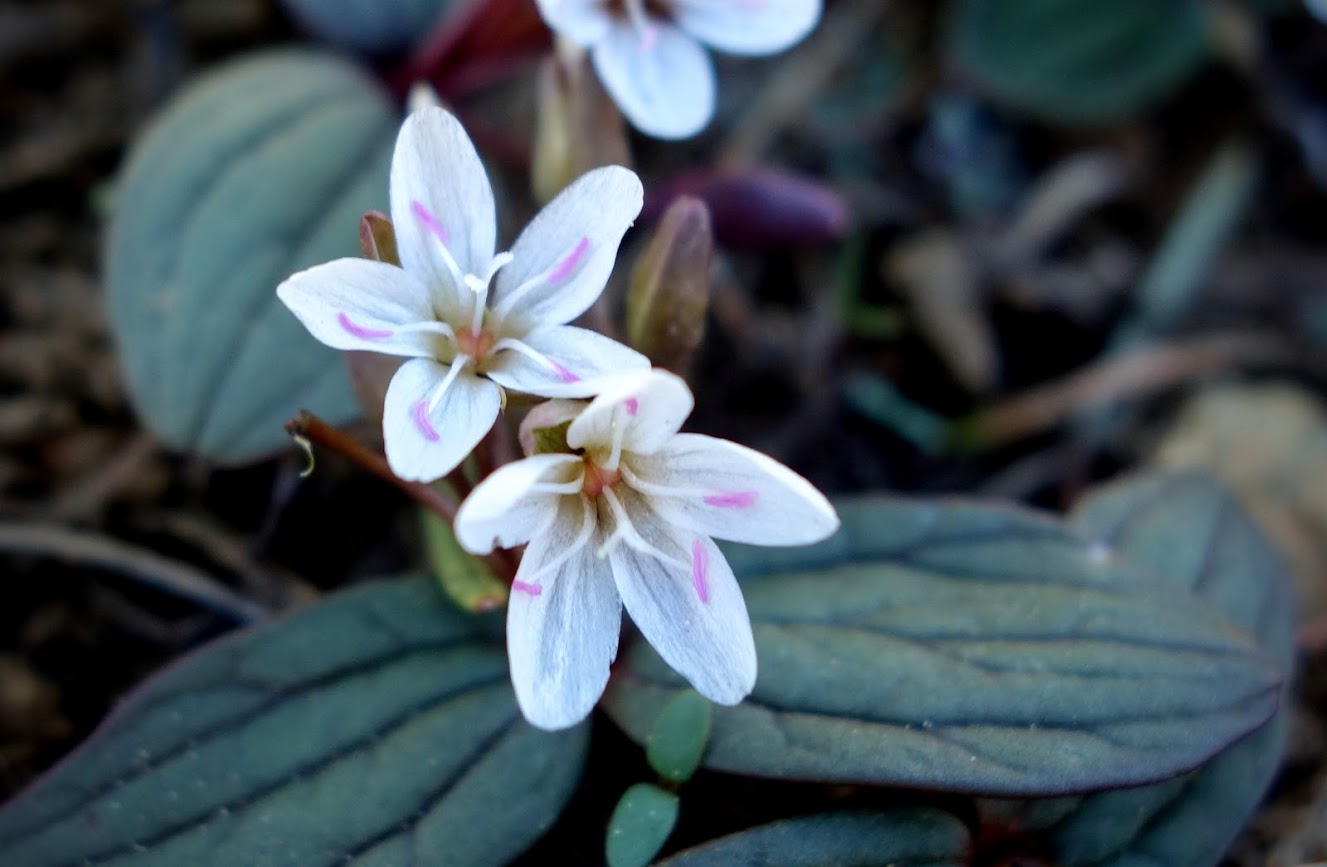
Bino Bob found some flowers just his size.
This was a 33-mile 4,300′ elevation gain/loss figure-8 route, or as I shall call it the SC with a PCT Twist.
The first 3 miles and last 11 miles (highlighted in pink) were PCT sections. The 5.5 miles highlighted in yellow were on the Sisson-Callahan National Recreation Trail (SCNRT). The middle 13.5 miles (highlighted in blue) is the Sisson-Callahan Historic Route, destined to become part of the SCNRT.
Safety First:
When I put myself in situations where I’m solo in low-use areas, especially when taking off-trail routes, I take extra precautions.
inReach – I send out waypoints frequently to my map and contacts so if I go MIA SAR has a starting point. I also use this device to request weather updates. After my first night of crazy wind I checked in case I didn’t want to continue forward with my plan.
Maps – I download various maps for using offline on my phone, and carry a paper map with compass. I use the Gaia app and pay for the premium subscription so I have access to many maps such as NatGeo, USFS, USGS, etc. I enjoyed referencing the historic 1900, 1930 and 1960 USGS layers on this trip.
Tracking – I record my hike so I can see where I am in reference to the “trail” so I can easily adjust my navigation when I find myself straying from the path by following game or cattle tracks rather than the trail. I add waypoints with details that might help in the future, such as where I found flowing water or areas appropriate for camping.
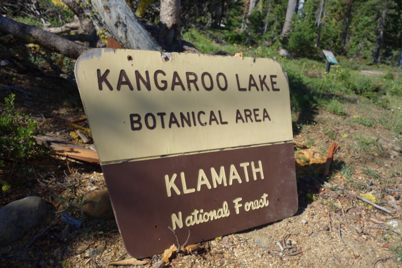
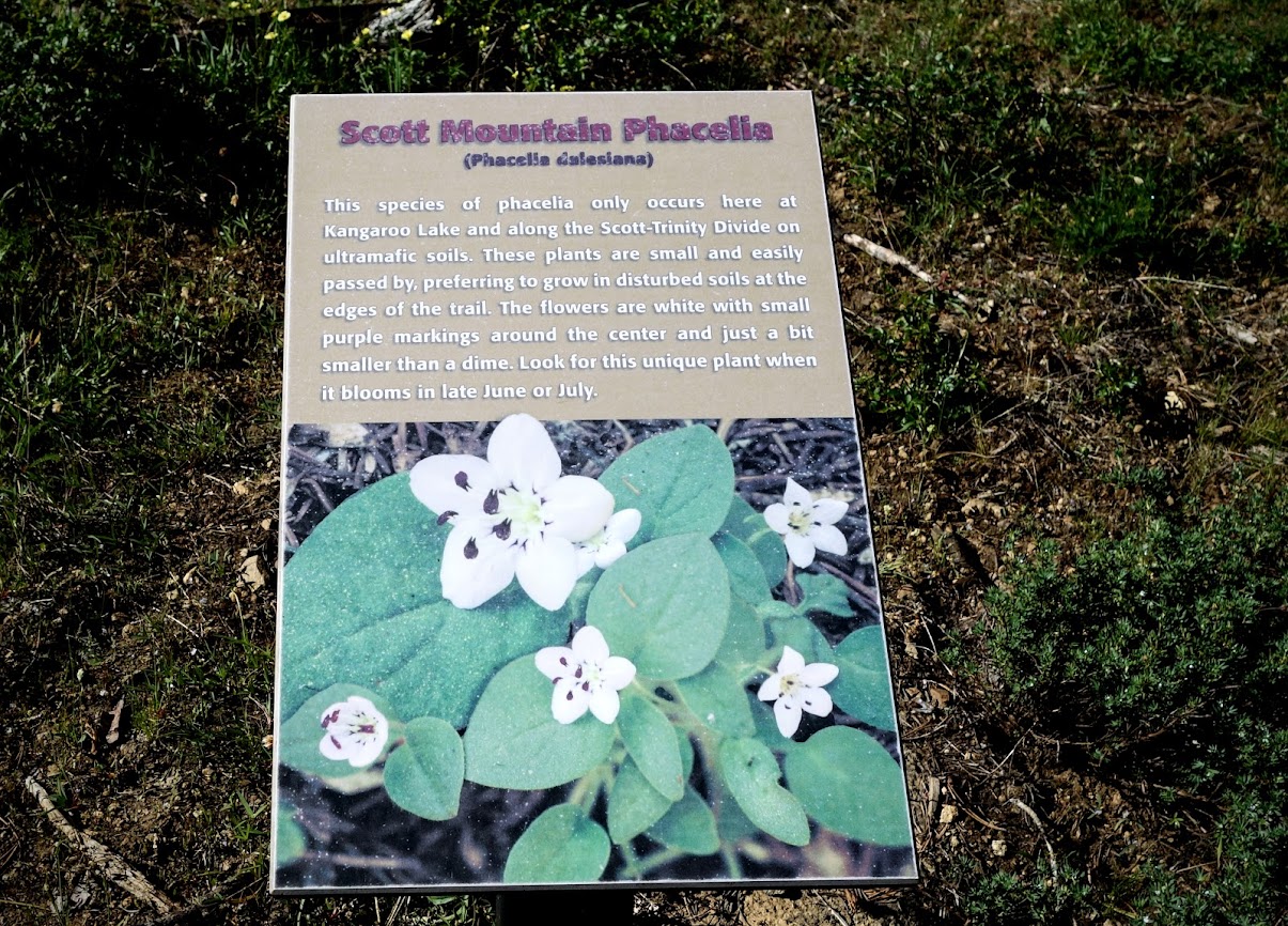
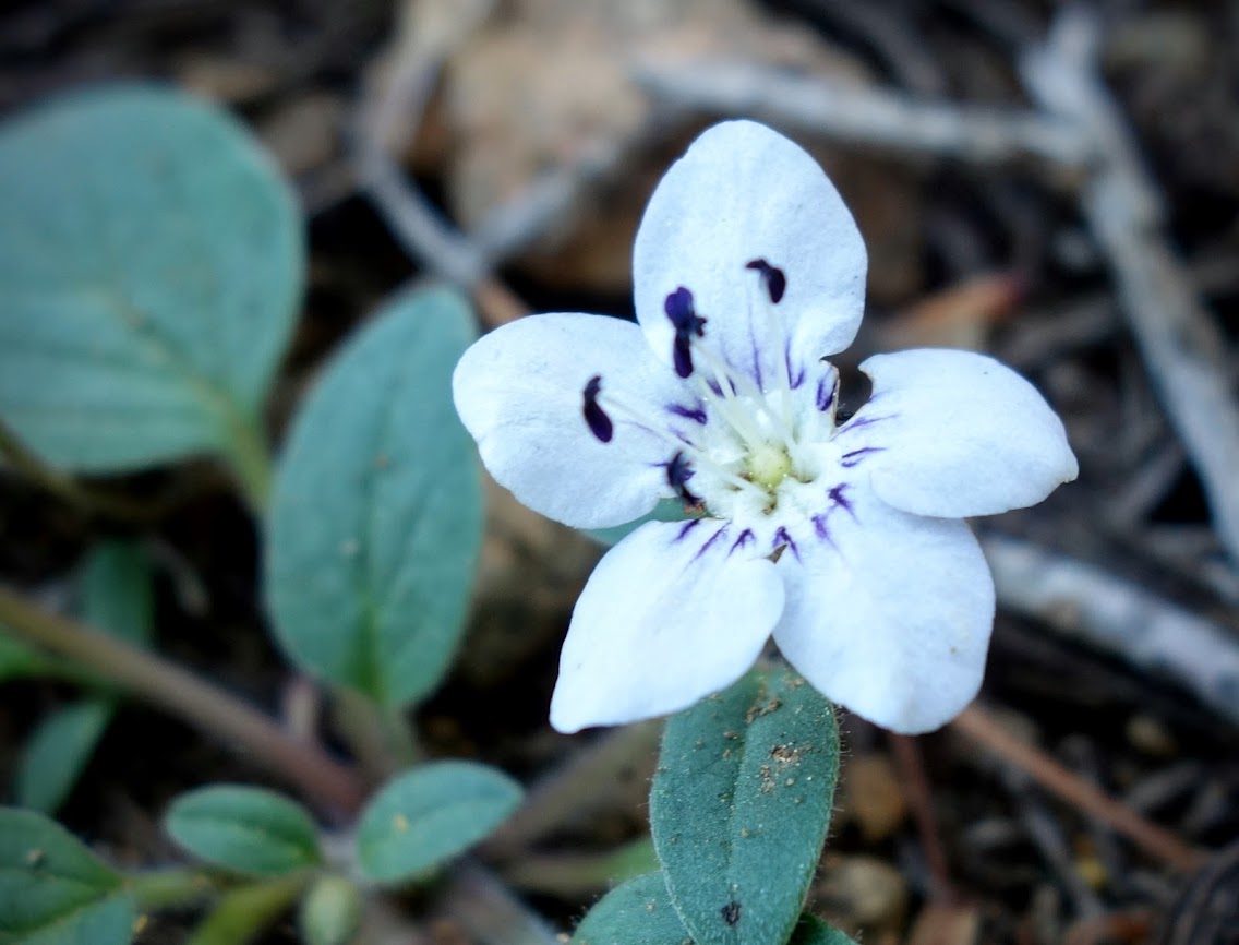
The Klamath National Forest is home to many rare and endemic species. As such they have several botanical areas which have been protected (link) including the Kangaroo Lake Botanical Area. “A 430 acre site located on the southeast edge of the Salmon/Scott River Ranger District (T40N, R7W, SEC 14). The area varies in elevation from 6000′ to 6857′. It provides a diversity of plant habitats ranging from wet seeps and meadows to rock walls. The high level of habitat diversity is associated with a correspondingly high botanical species diversity. Sensitive plant species present include Phacelia dalesiana and Epilobium siskiyouense.” Source: Klamath NF
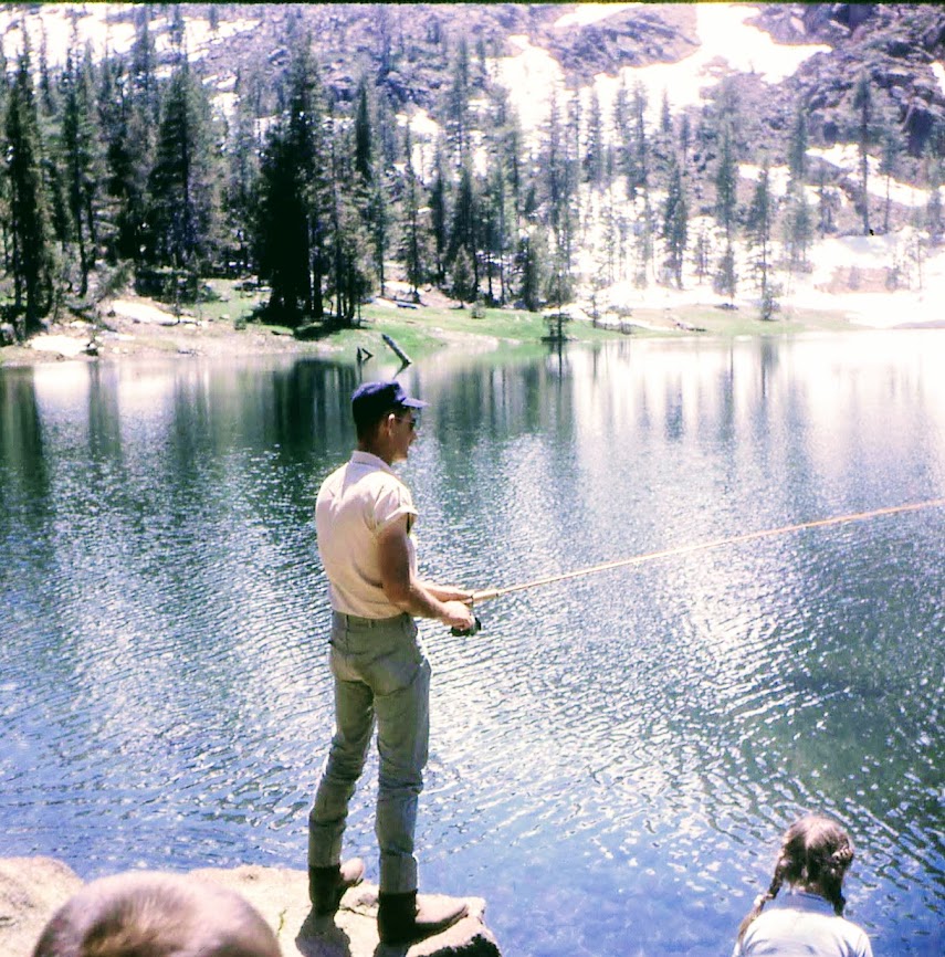
I have fond memories of Kangaroo Lake from my childhood when we camped nearby, and my dad spent hours fly fishing.
On this day though we were out to explore the Fen Nature Trail, a word that only came to my attention over the past few years.
We found plenty of fens with Darlingtonia californica aka Cobra Lilies or California Pitcher Plants.
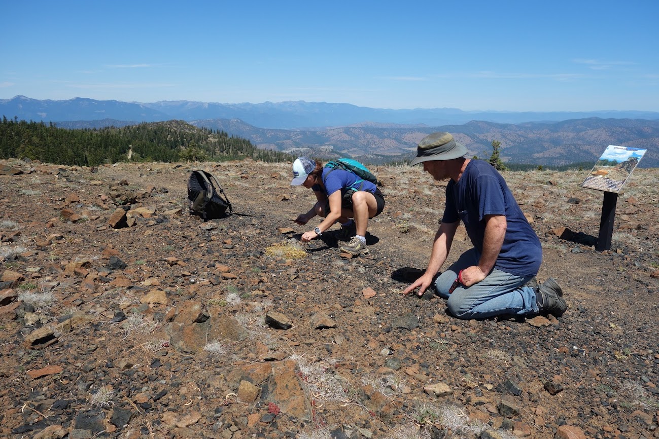
We were hoping to find the rare Scott Mountain Phacelia, which I’d been lucky enough to stumble across unexpectedly a few weeks earlier at a different location (link).
Are you hiding down here?
How about here?
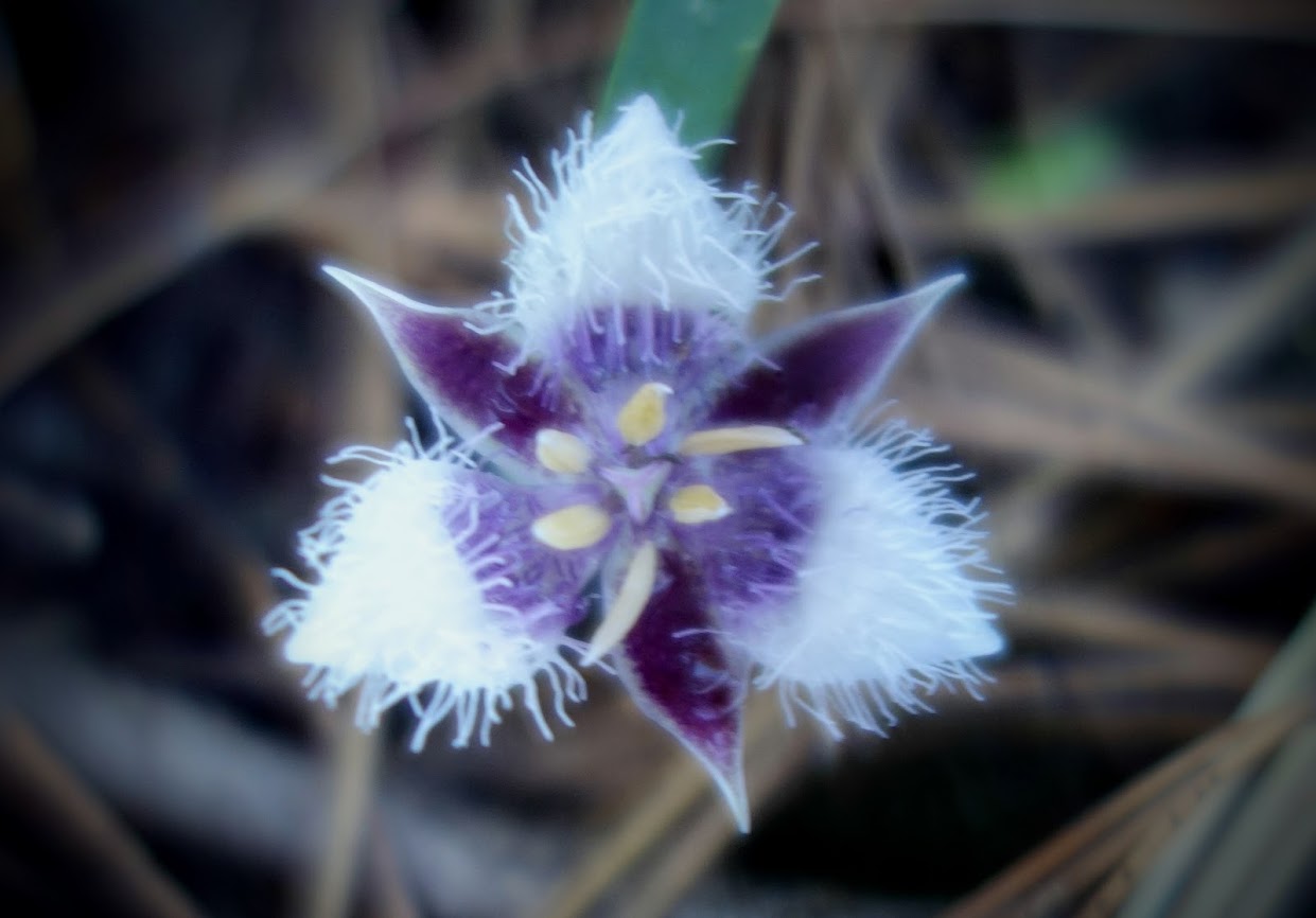
Success!
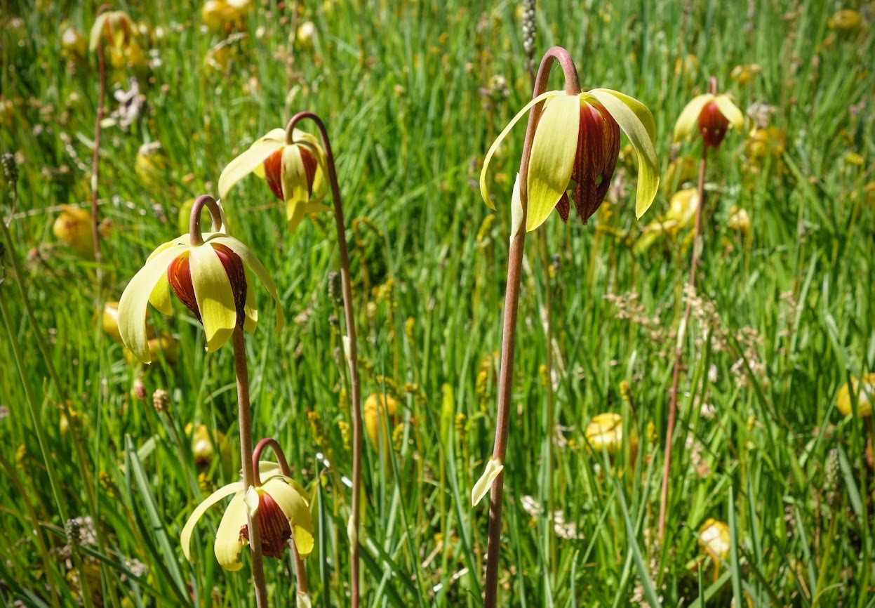
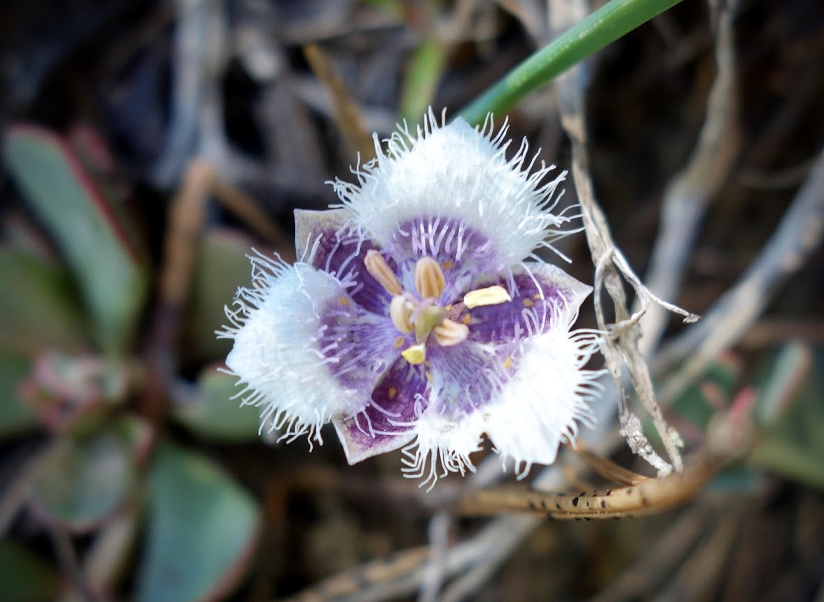
Calochortus elegans aka Elegant star tulip and Northwestern mariposa lily
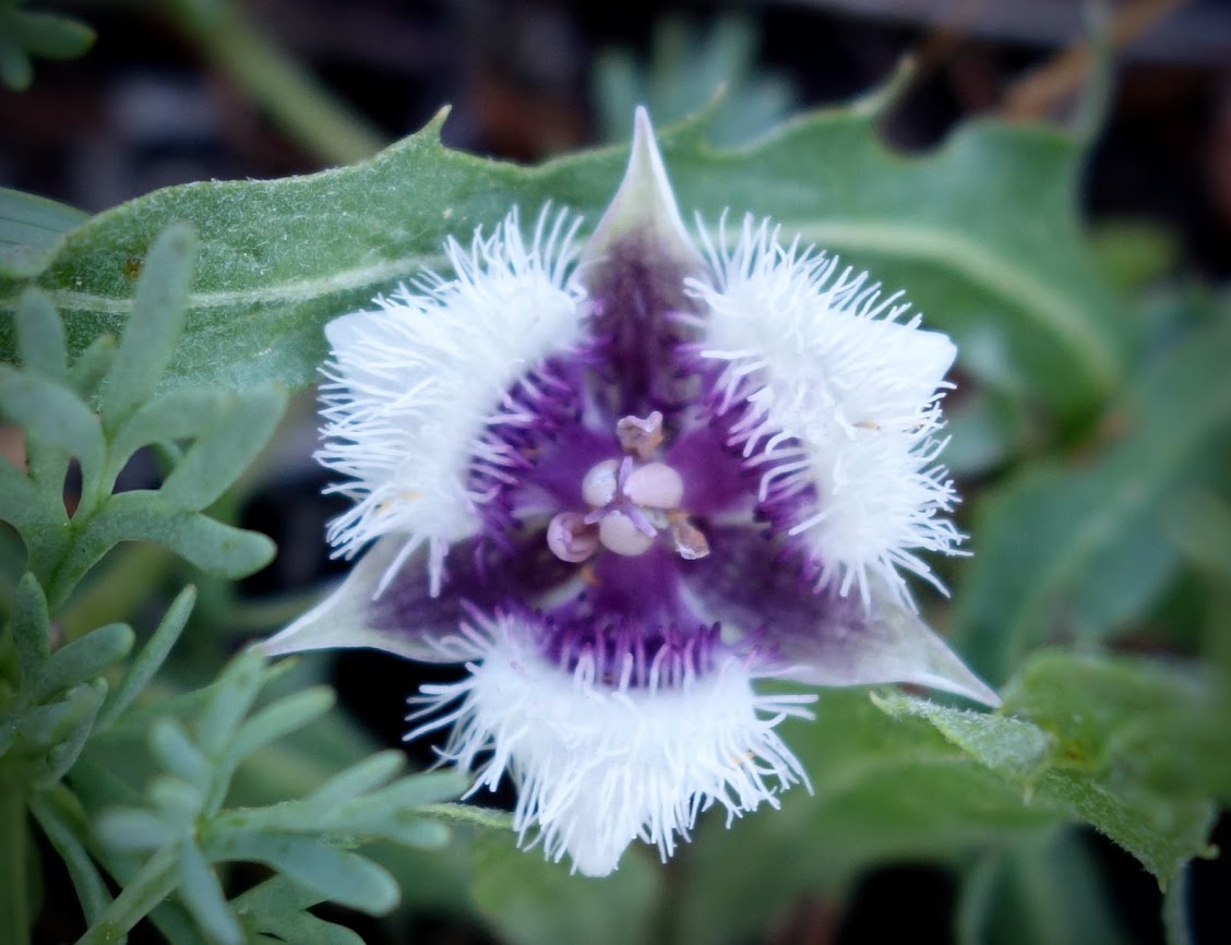
Calochortus nudus aka Naked Mariposa Lily
Owl’s Clover with bug for extra credit.
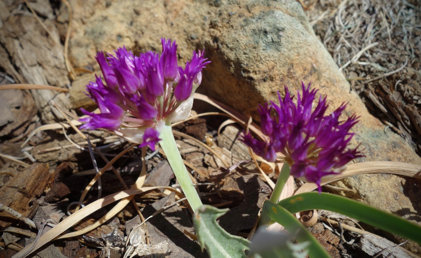
Allium (onion) but not the rare one.
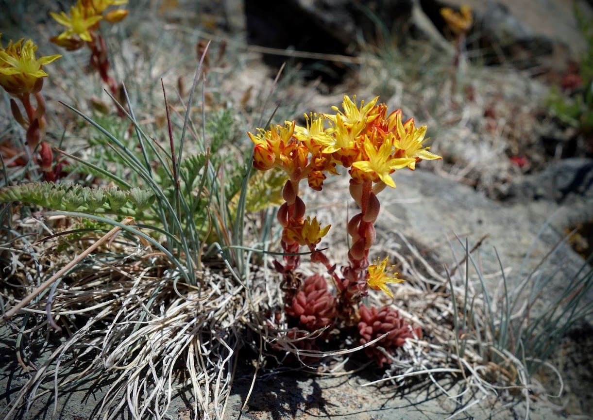
Sedum (aka Dr. Seuss trees)
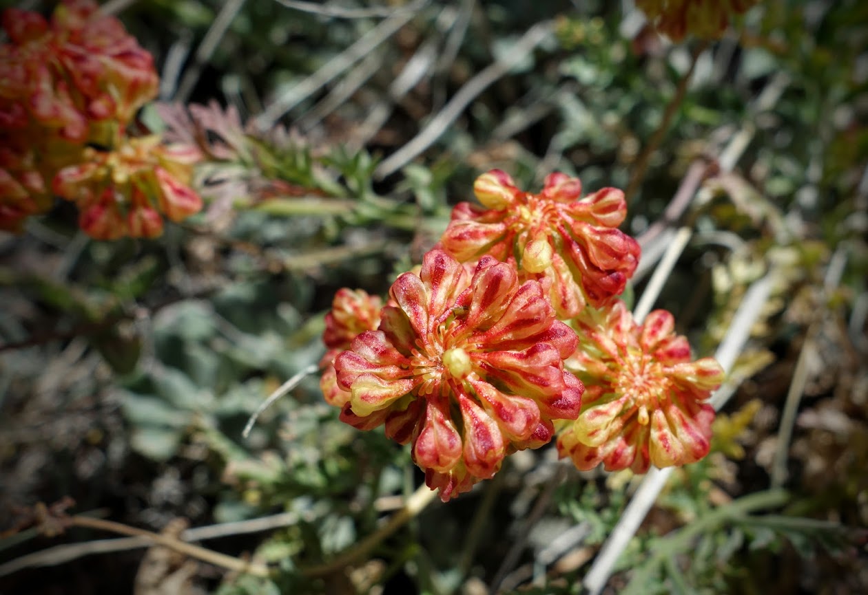
Buckwheat, but not the rare species.
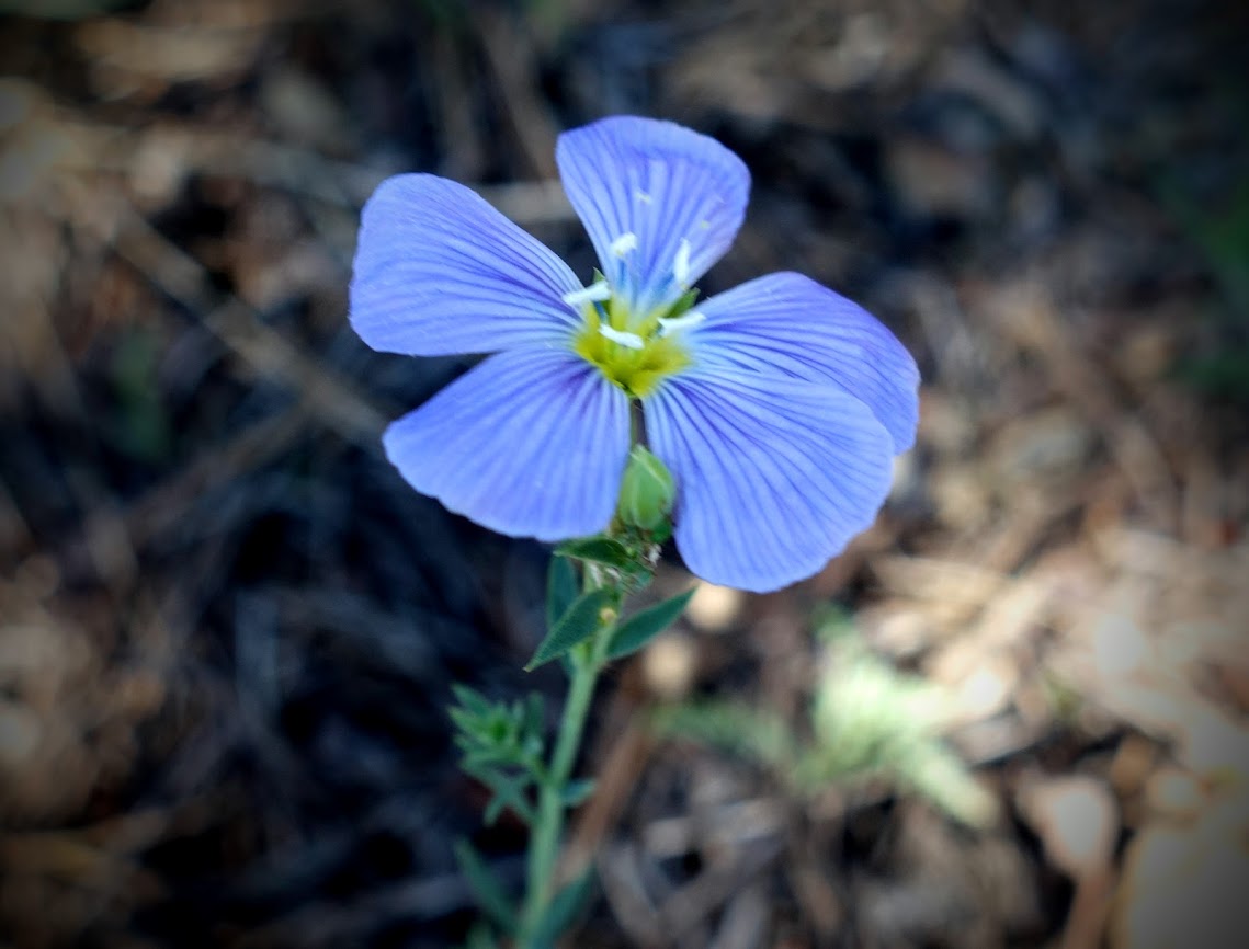
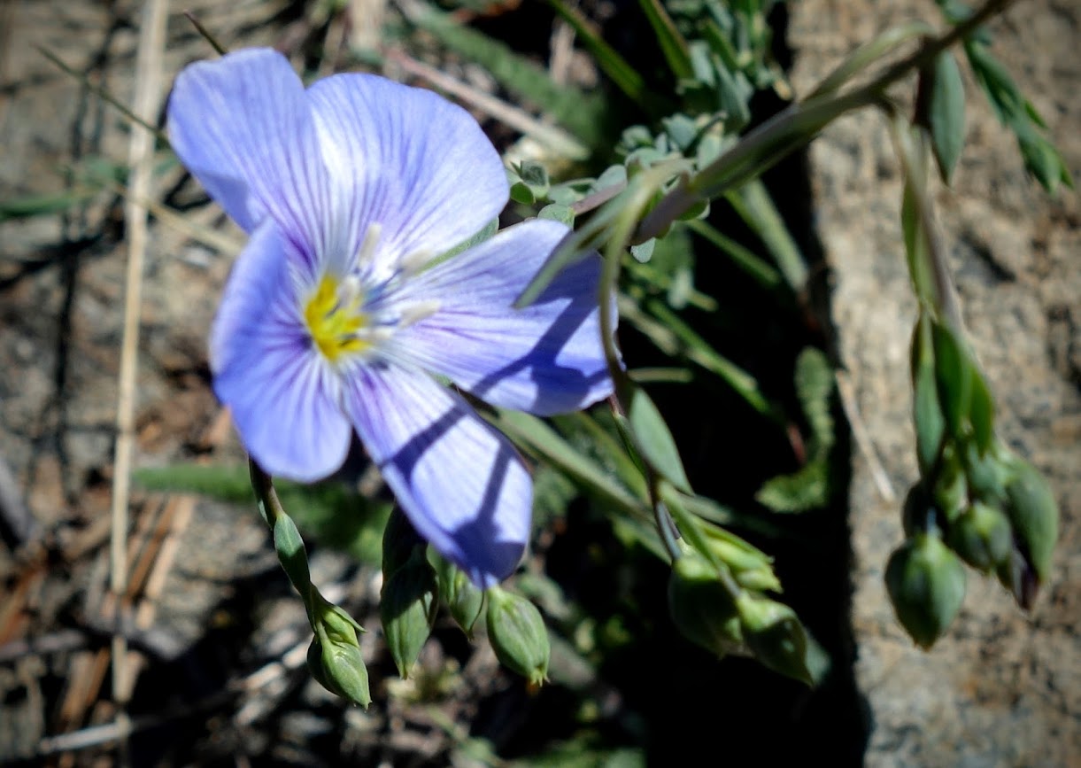
Blue Flax
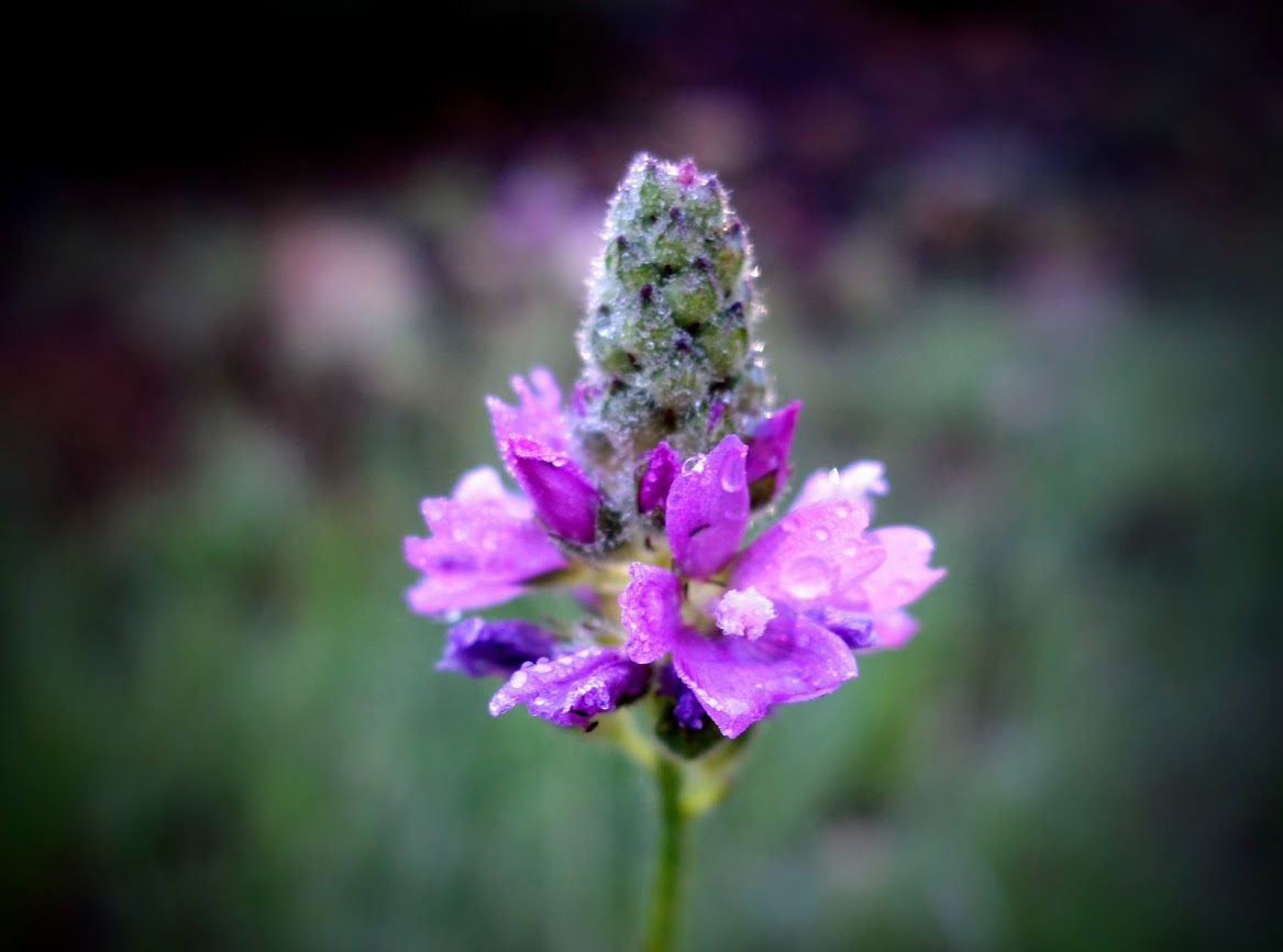
Penstemon newberryi
Bladderpods
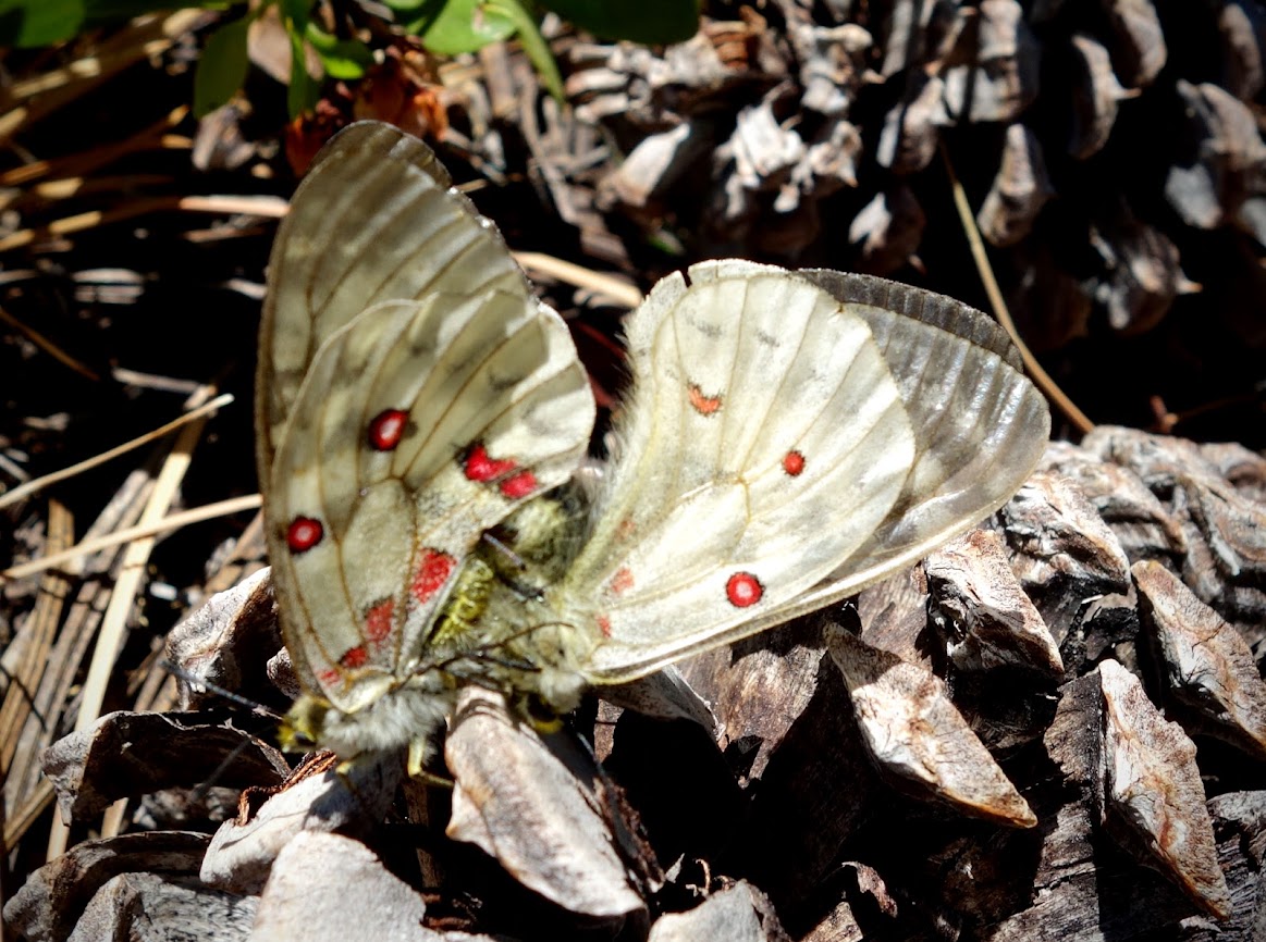
Intense butterfly or moth mating.
We enjoyed several views of Kangaroo Lake and distant views of three other listed botanical areas including China Peak, South China Peak and Cory Peak. Someday I’ll make it a priority to spend a day botanizing in those areas as well.
We hiked the trail to where it connected with the PCT. Our trip was less than 3.5 miles and about 750′ of elevation gain/loss.
Bonus: roadside botany on our drive to the trailhead
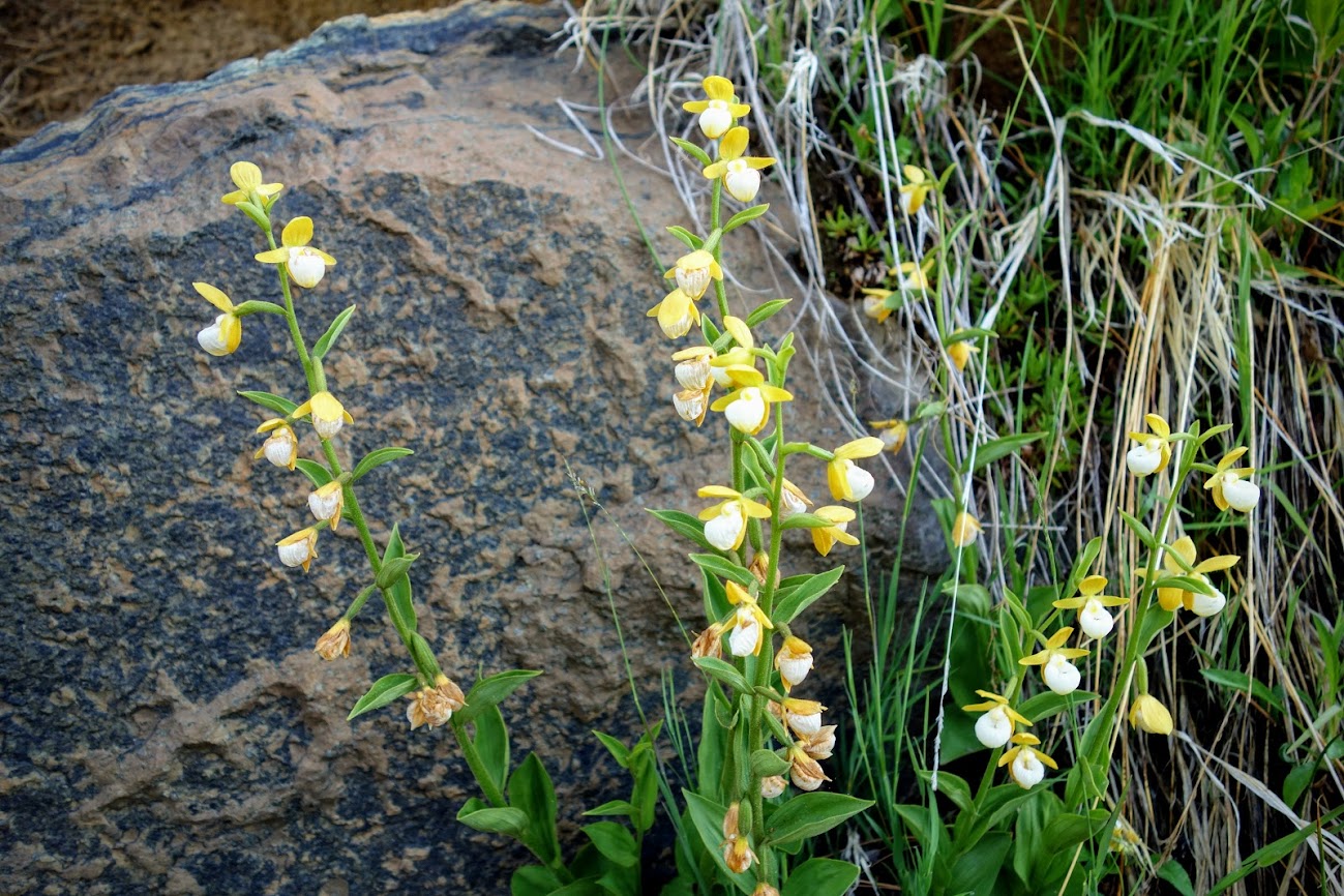
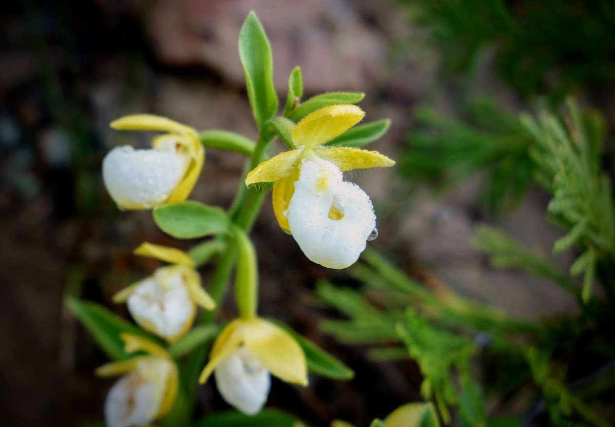
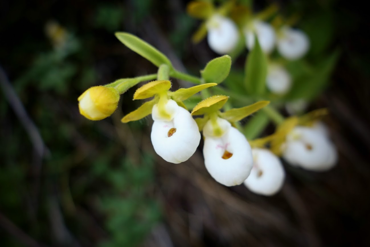
When I spied a group of rare California Lady’s Slippers (Cypripedium californicum), I was giddy. They were freshly washed after a little overnight rain.
Apocynum andrsameifolium aka Dogbane
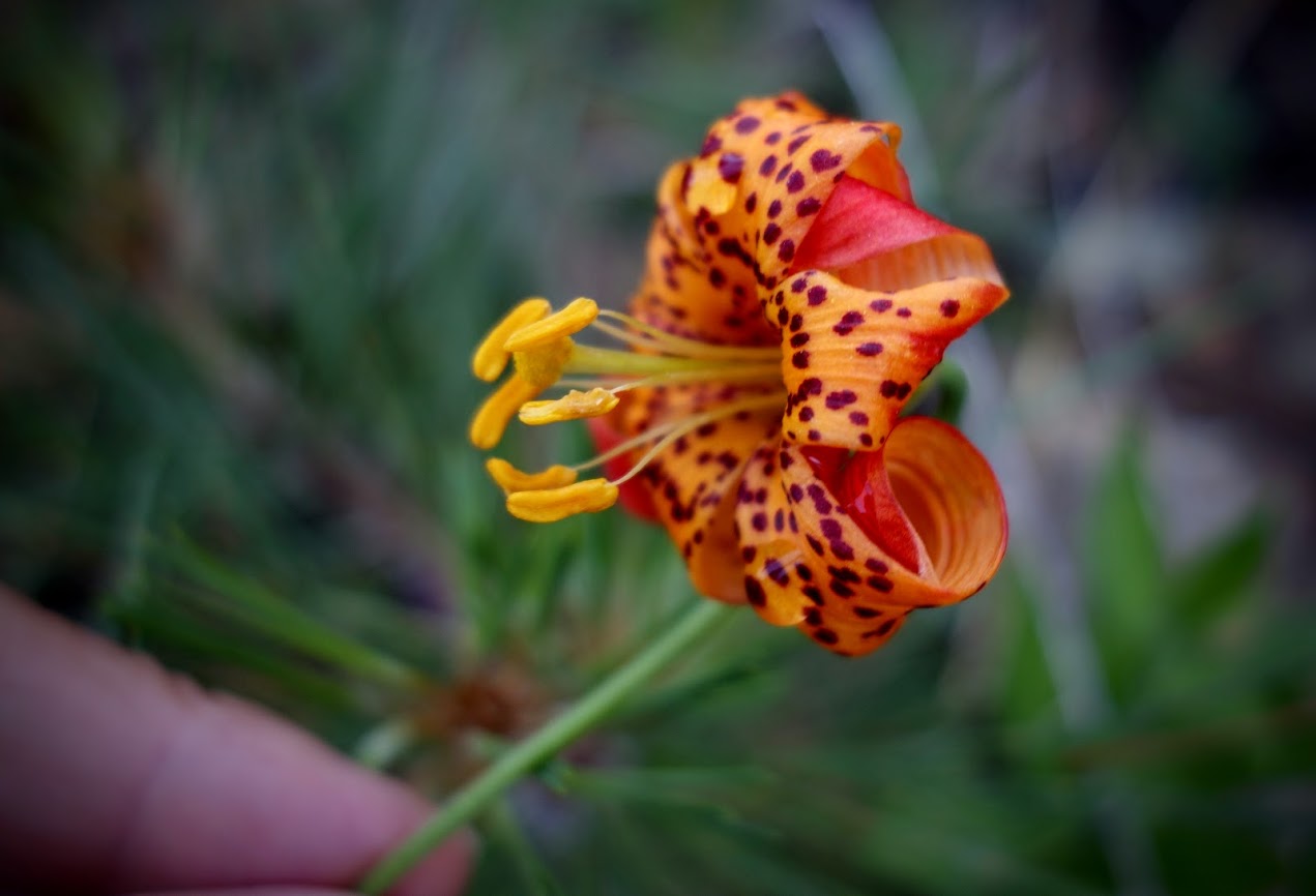
Shasta Leopard Lily
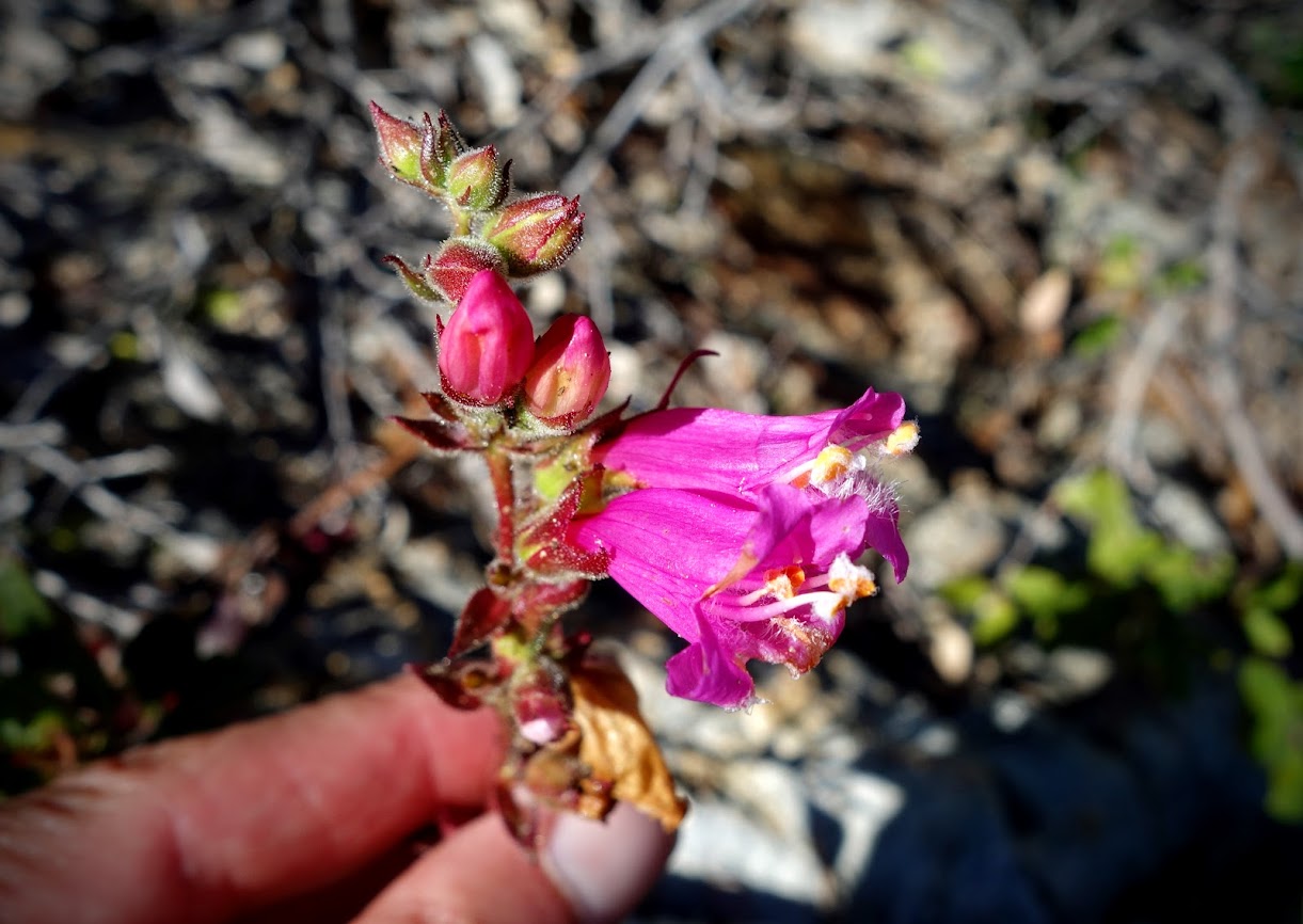
Sidalcea, Checkerbloom.
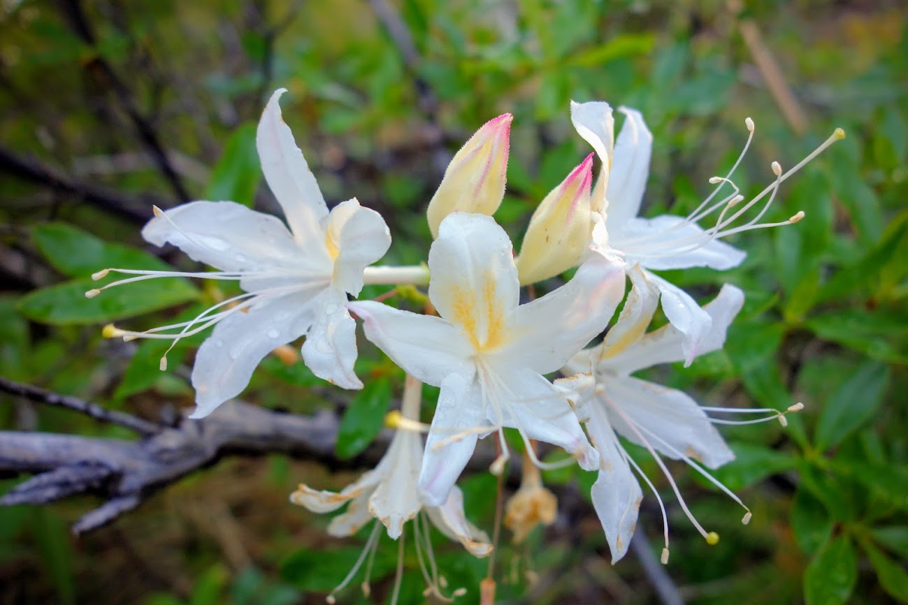
Rhododendron occidentale aka Wester azalea
Showy Milkweed (creative edit)
My botany fieldtrips have been such a fun rehab diversion. It’s highly unlikely in “normal” times I would have taken a day to drive 3-4 hours to spend 5 hours hiking 3.5 miles, followed by another 3 hours of driving. It was a wonderfully long 12-hour day filled with friendship, education, photography and visual delights.
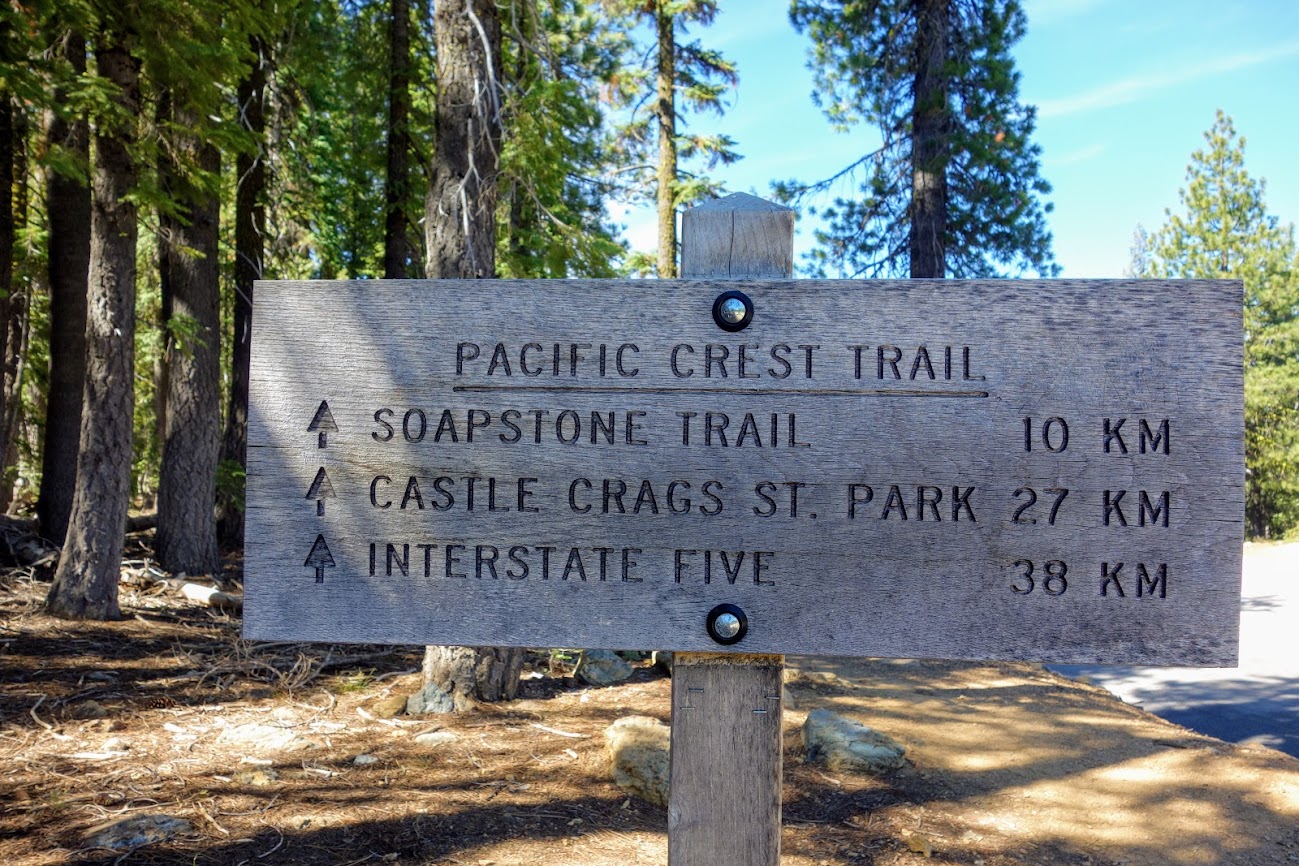
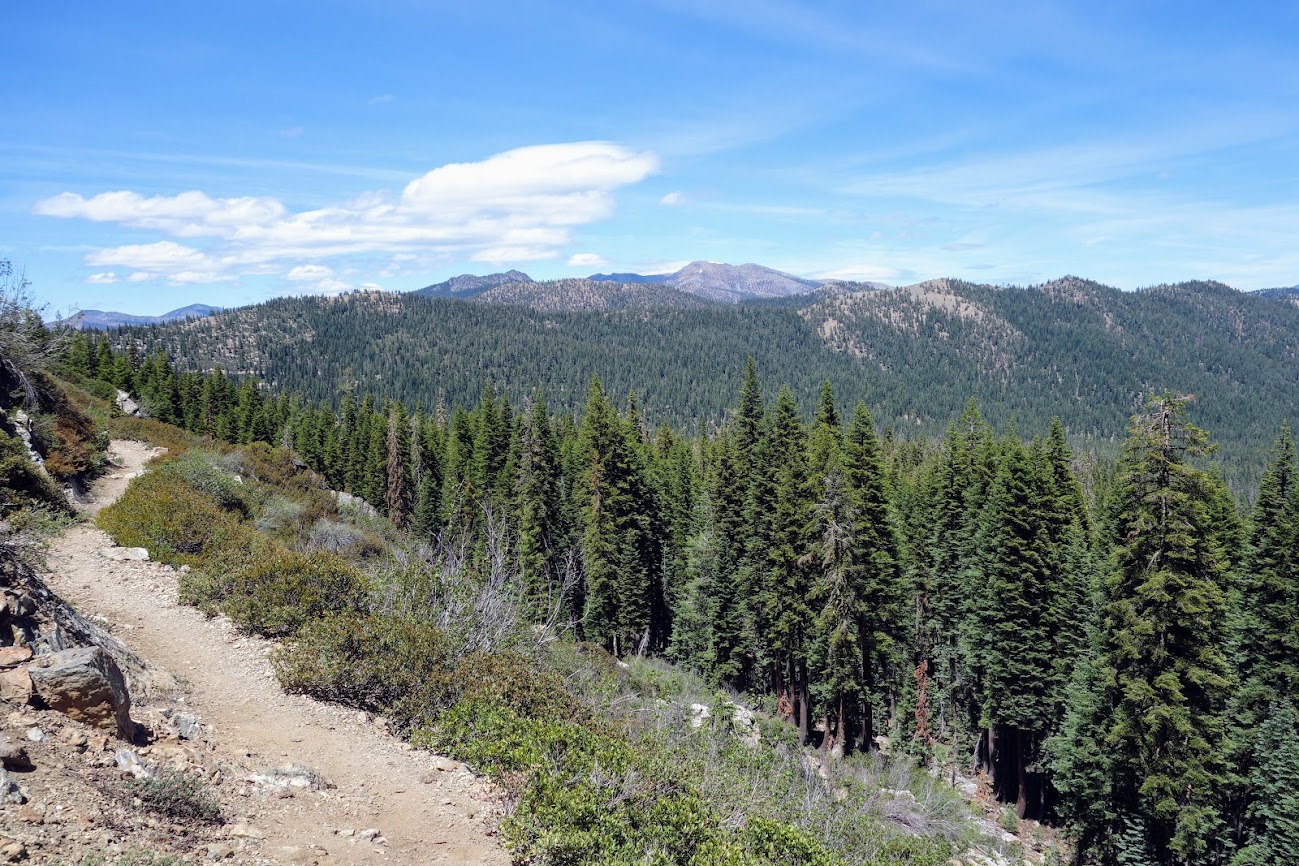
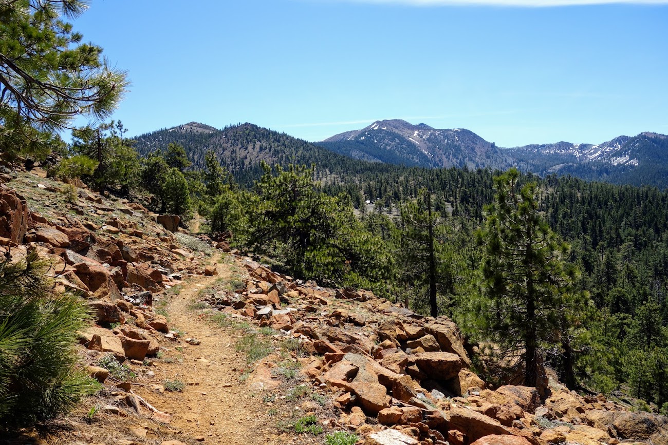
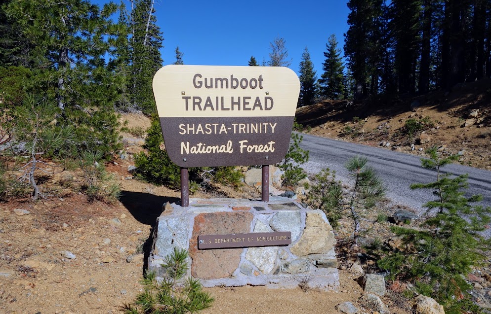
I had so much fun on my recent PCT hike from the Parks Creek Trailhead (link), it seemed time to try another section. I’m lucky to have multiple access points within a couple hours of my home base. I hiked south on this day. Note: I believe this is the only KM sign on the PCT.
There’s Mt Eddy in the distance, near where I was the previous week. It’s about 15 trail miles between the Gumboot and Parks Creek Trailheads.
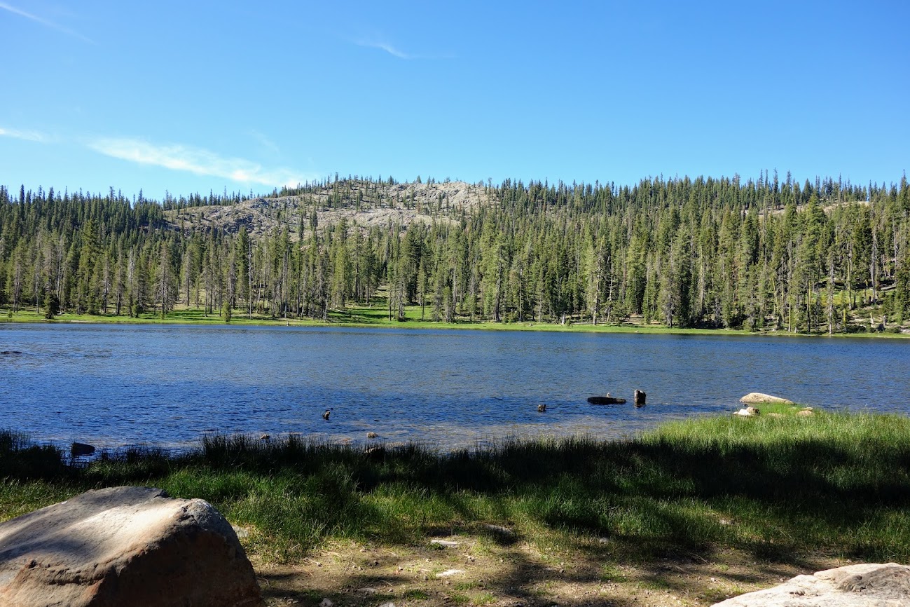
This is Gumboot Lake, the namesake for this trailhead. It’s accessible via a nearby road and might be worth a stop for a swim at the end of a hike.
The view of Gumboot Lake from near the trailhead.
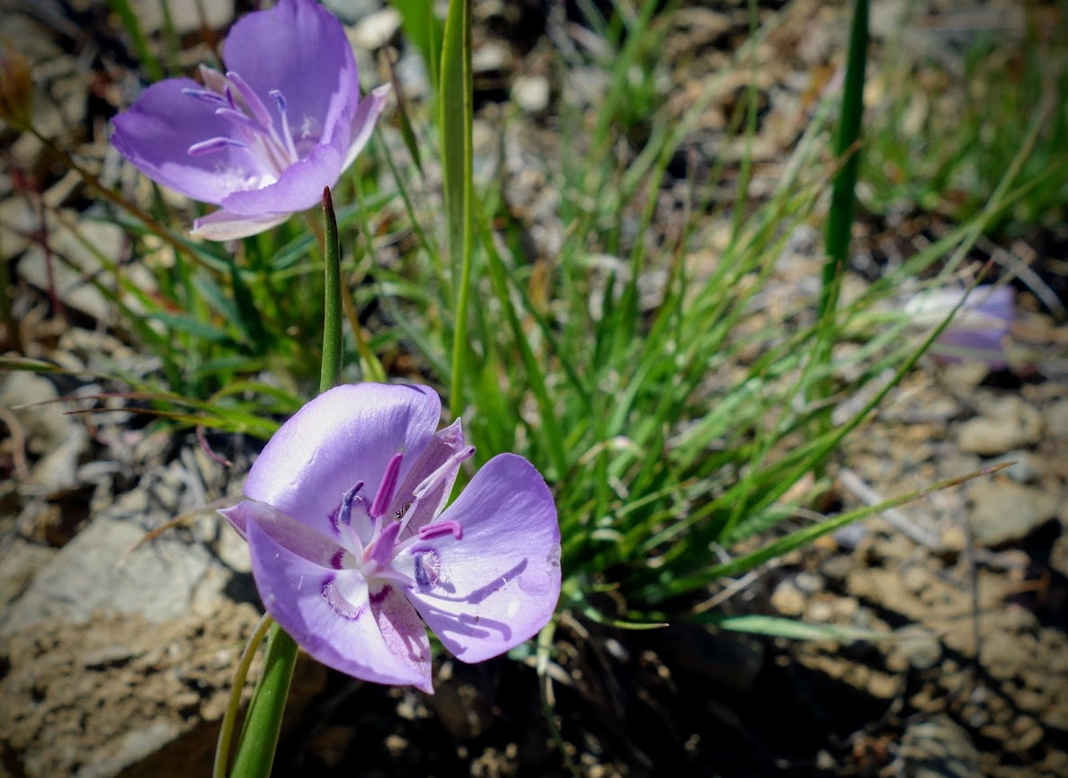
The highlight of my day was finding Scott mountain phacelia aka Howellanthus dalesianus.
Near the beginning of the hike, the Mumbo Lakes become visible to the west. Once again not all the easily accessible.
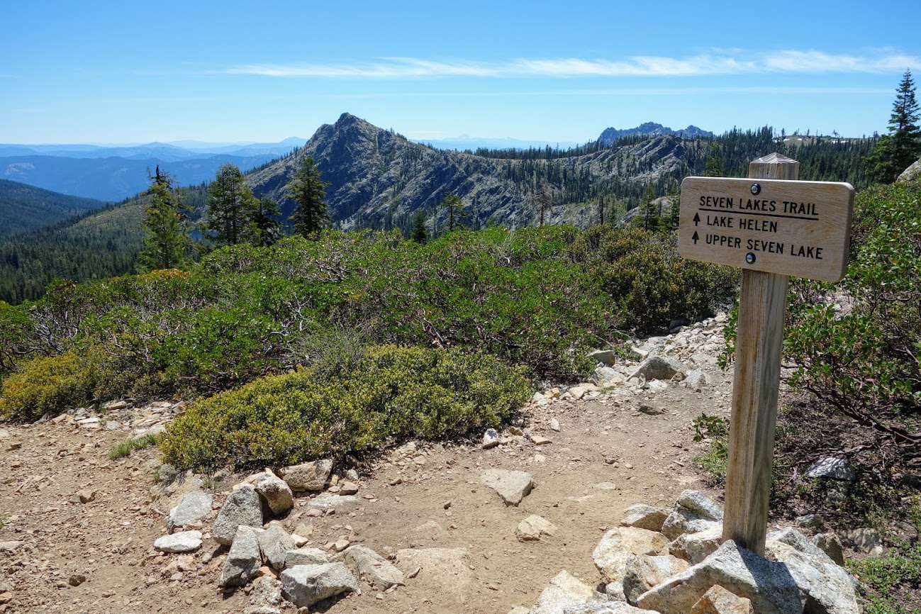
A couple miles from the trailhead you reach the junction to swimmable lakes.
Lake Helen is probably the most visited with it’s easier access. Shown here are Upper and Lower Seven Lakes. Someday I want to explore the basin and make my way to all seven lakes.
Although not considered one of the seven lakes in Seven Lakes Basin, Echo Lake is on private property and doesn’t welcome trail visitors. It’s backed by Boulder Peak at 6,968′, not part of the private parcel. I’m sure the PCT Association would be interested in purchasing this property if it ever goes on the market.
A nice view showing perspective of the PCT in relation to Upper Seven Lake. The trail down looks to have been recently groomed. I remember access use to be quite dicey cutting through a lot of overgrown manzanita combined with rocky terrain.
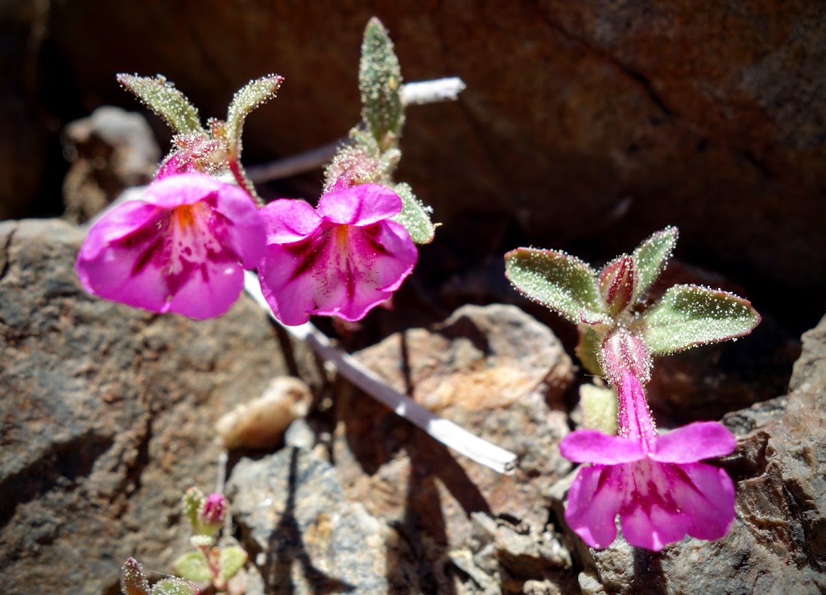
Monkeyflowers were a tiny alpine variety.
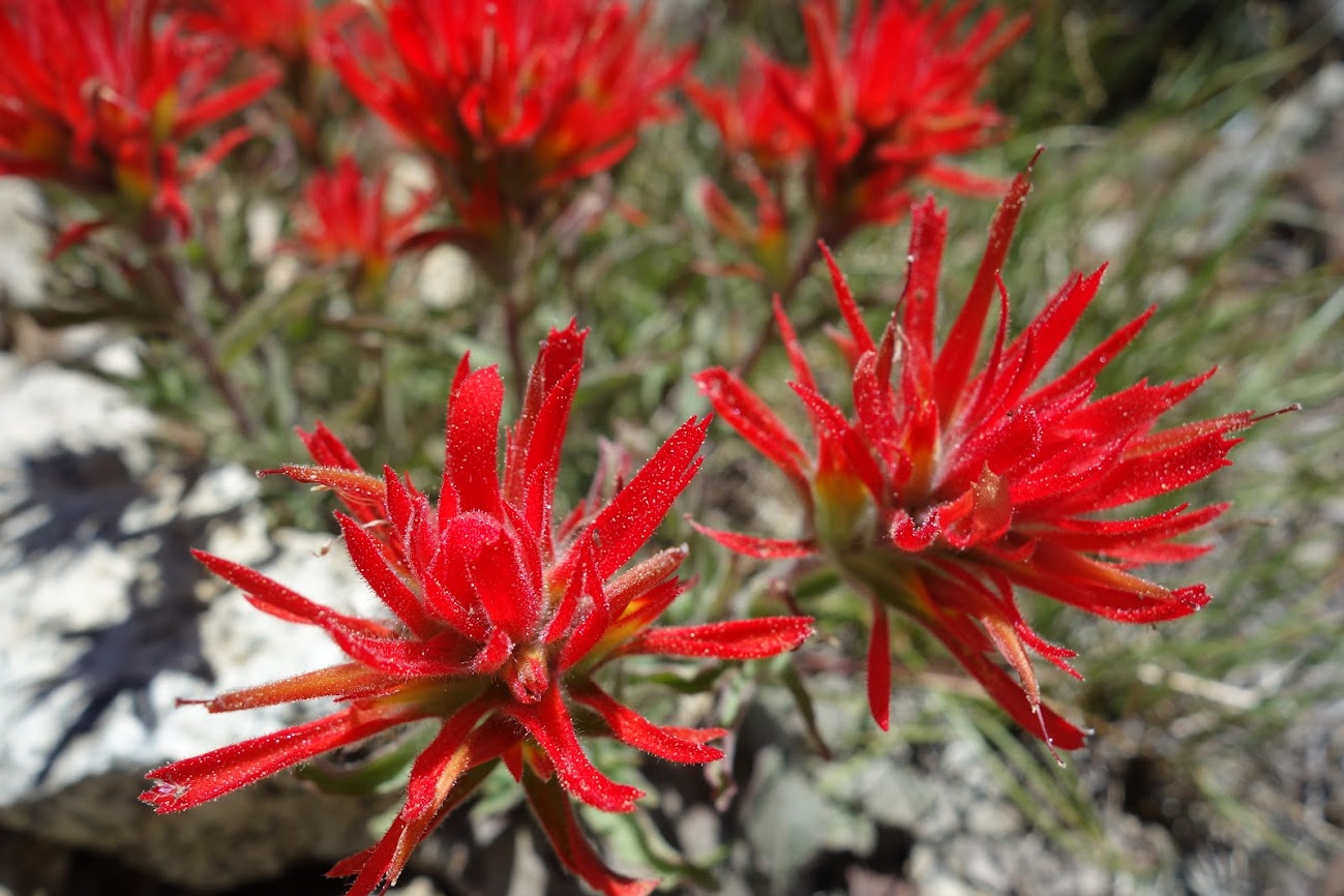
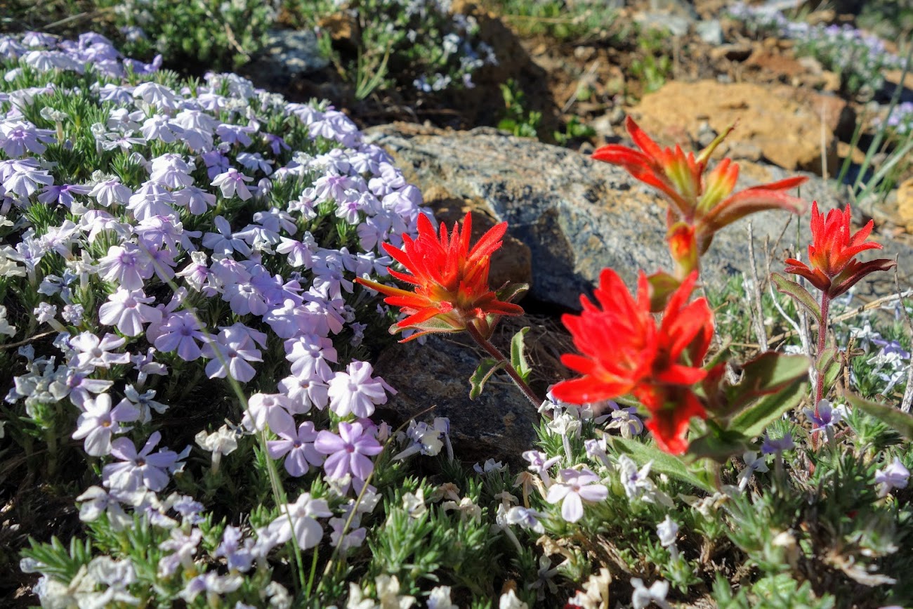
The paintbrush was brilliant red.
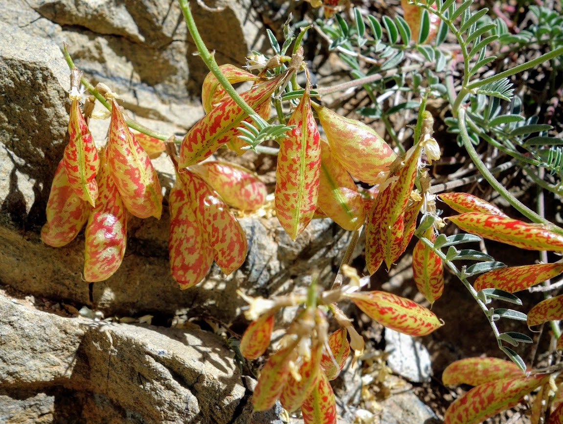
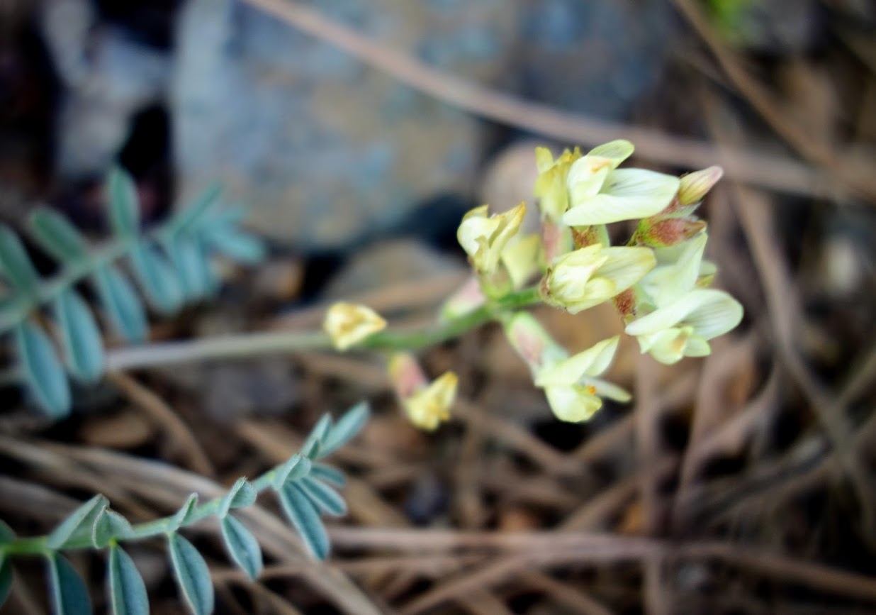
Bladderpods of Astragalus whitneyi var. siskiyouensis.
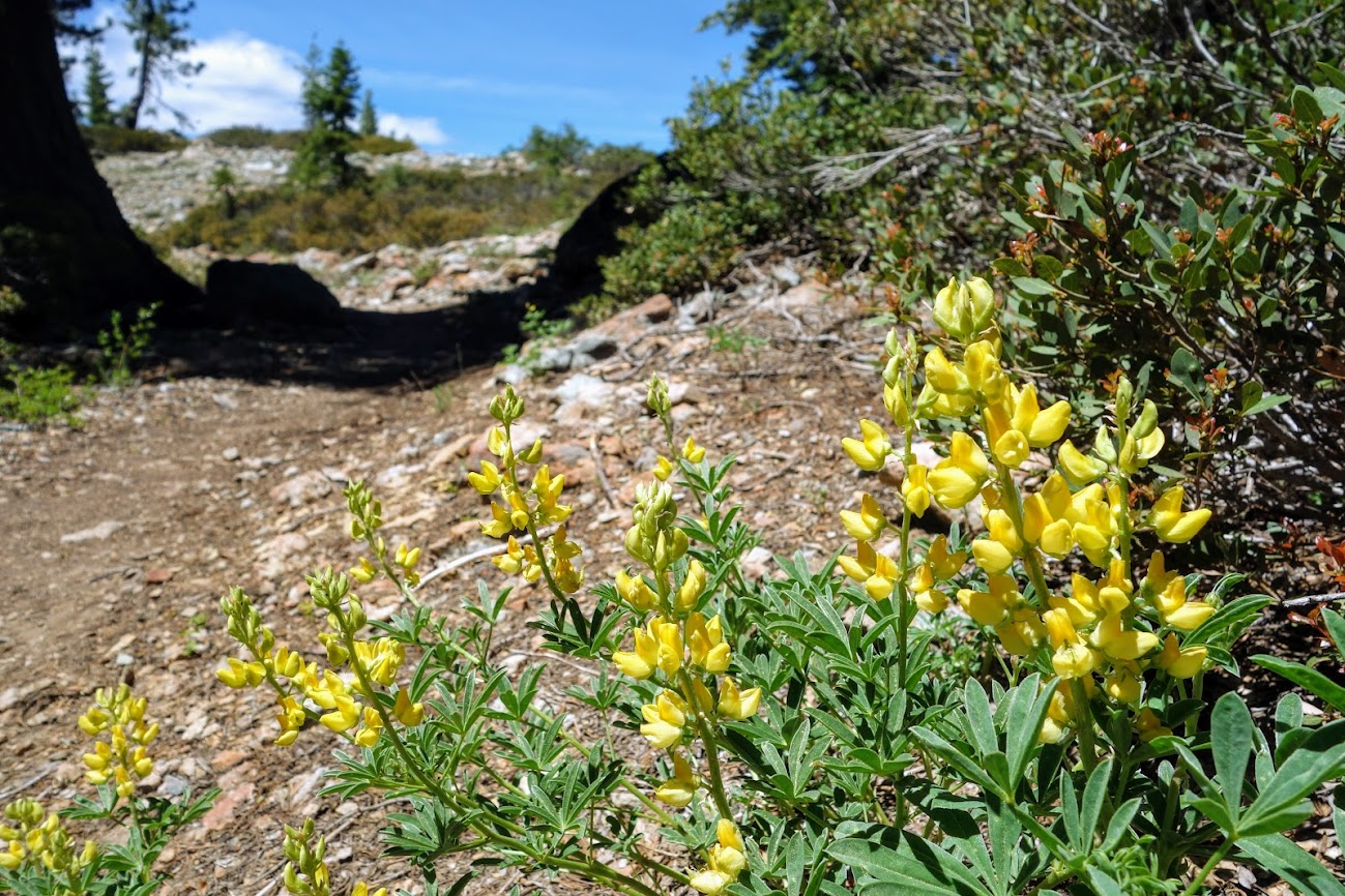
The most prevalent bloom of the day was Mt Eddy Lupine, named for this mountain range dominated by serpentine soil.
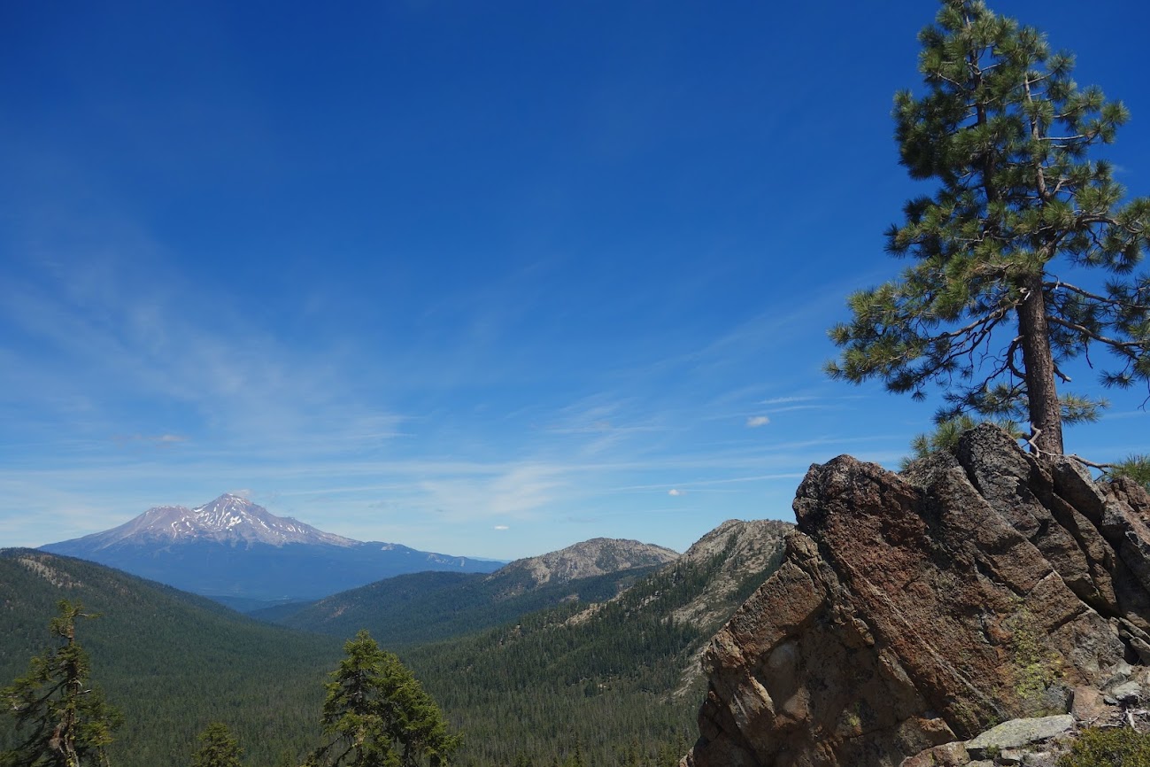
As is typical for hundreds of miles along the PCT you are granted views of Mt Shasta.
I love this trail image.
I believe these are Torrey’s Blue-Eyed Mary, Collinsia torreyi. These are tiny plants at only a few inches tall. The flowers are less than 1/4″. I can’t believe they are recognizable as the wind was blowing and I figured I’d get a big blurr.
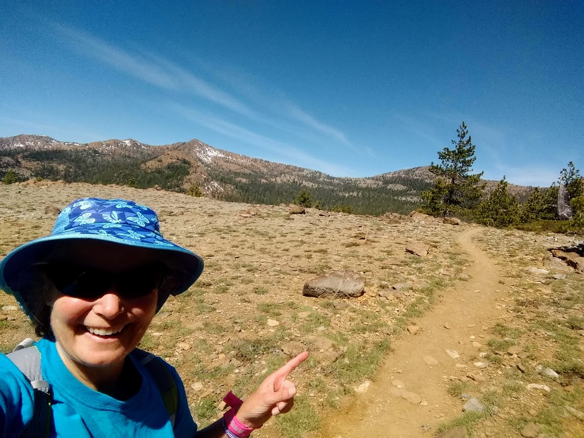
What makes Jan happy? Cool geology, views and blooms. Oh and maybe hiking on the PCT! The terrain was a little rockier with more rolling hills than I remembered but I had a fun day tromping a few miles. I met several hikers out for multiple nights, one gal who was hoping to make it a few hundred miles before returning to her teaching job in late summer. There were also a handful off to the lakes for a swim.
I’m surprised I haven’t blogged more about this section of the trail as it was where I walked my first steps on the PCT. The year was 2008. I’ve been on this section many times with one of my most memorable getting to visit Echo Lake on a snowshoe trek.
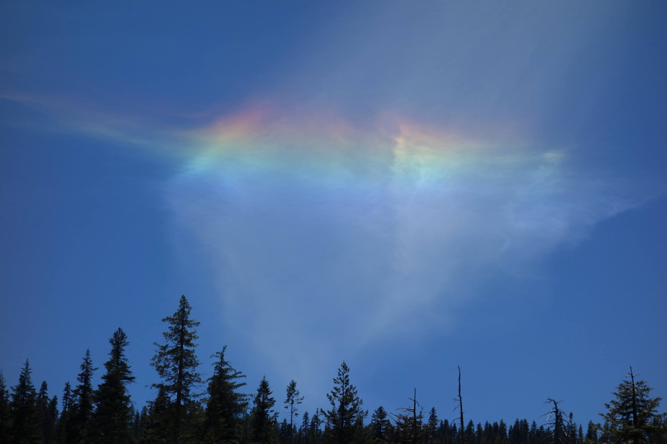
It was a magical day where I saw my first and only Circumhorizontal arc.
It’s time for another chapter. Graduation doesn’t mean I’m ready for epic adventures but with increasing feelings of normalcy it’s time to HIKE! The challenge is finding easy trail and this is where time spent on the PCT comes in handy. I knew this stretch would be a perfect test. While most head south to the Deadfall Lakes or Mt Eddy summit, I hiked north toward Cement Bluff and Bull Lake.
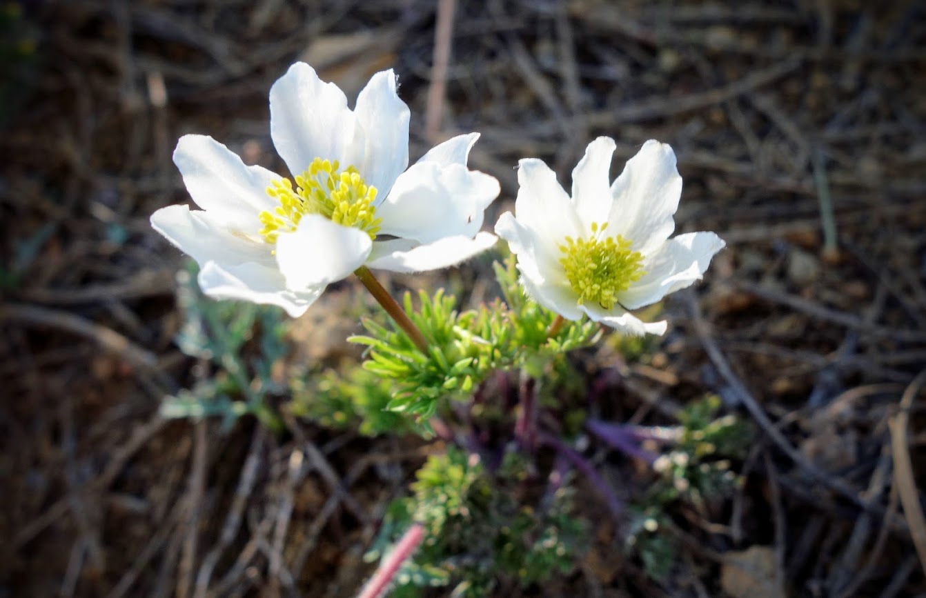
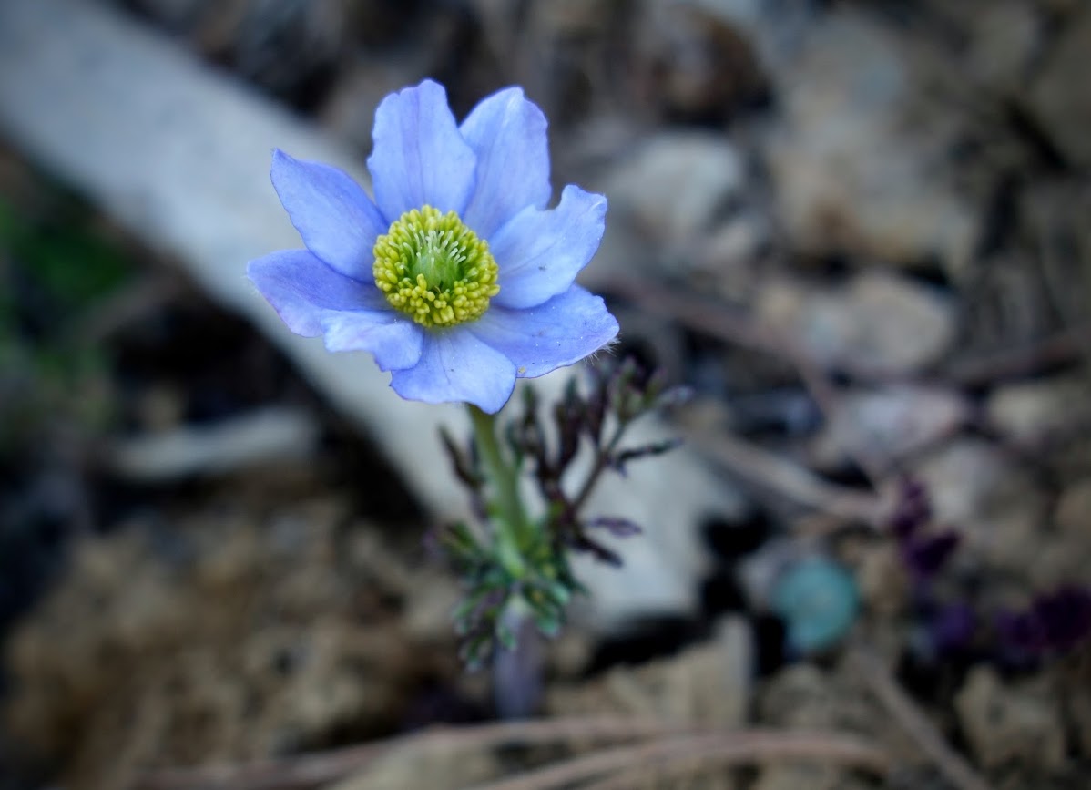
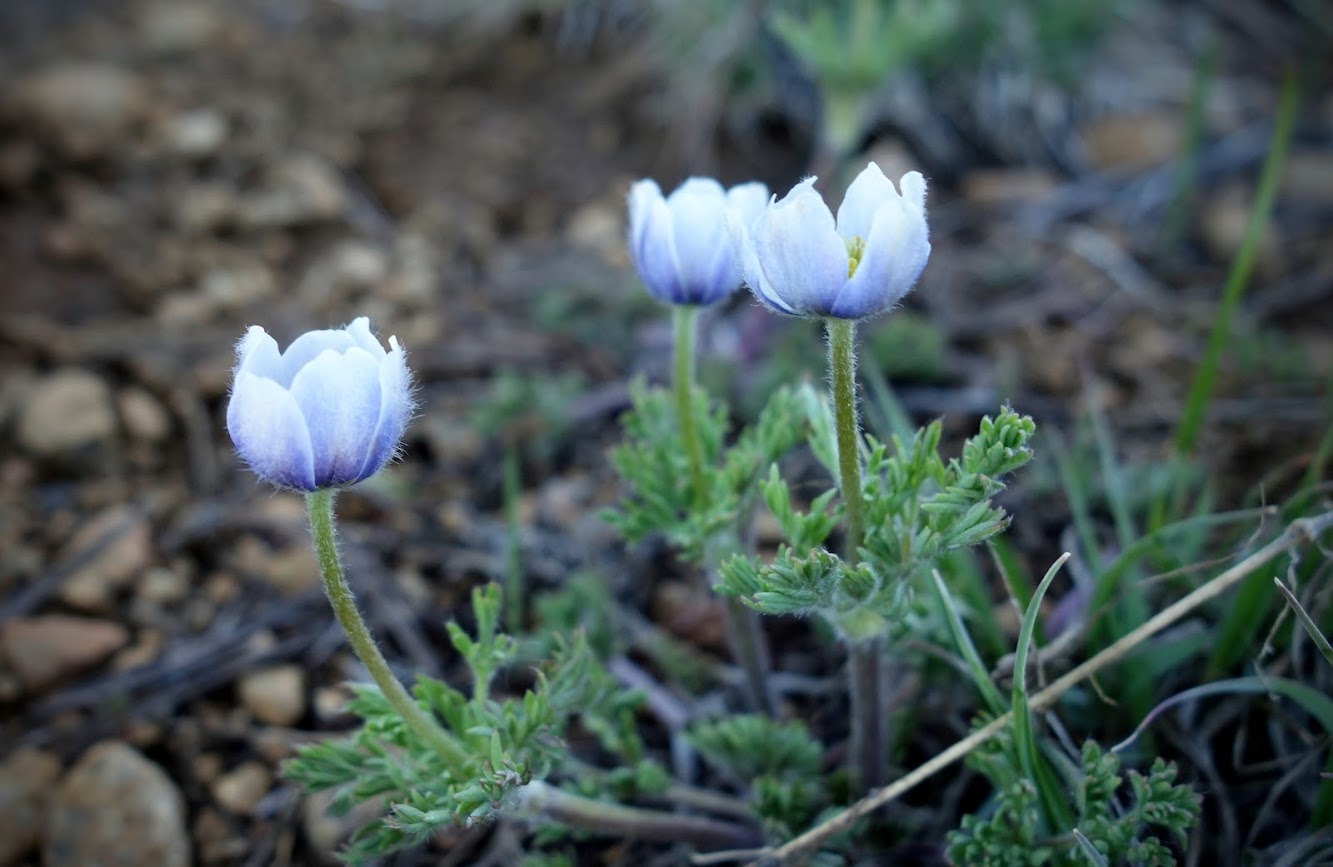
Early spring blooms gave me reason to take it slow. Recently I watched a video about botany in the area (Serpentine Botanical Wonders) which taught me I’d been erroneously been calling these Pasqueflowers when instead they are Anemone drummondii.
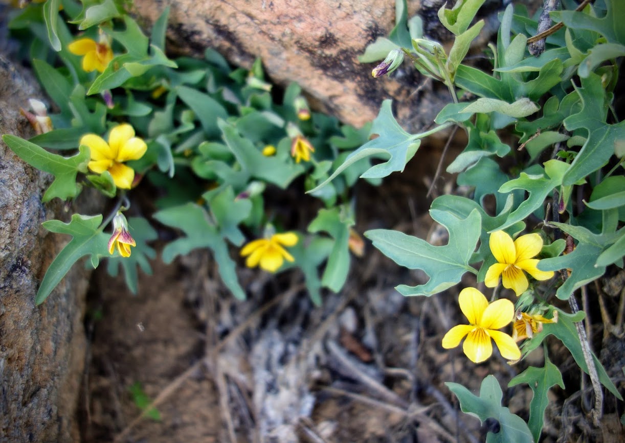
With their very distinctive leaf shape, I learned these are Viola lobata.
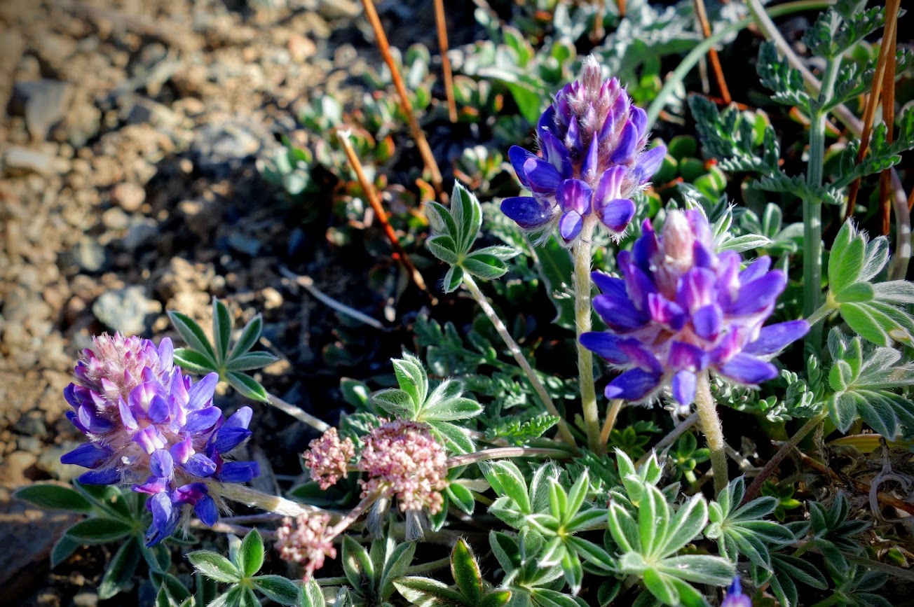
These are very tiny lupine, most likely Lupinus lepidus var. sellulus.
I thought this might be a rare Mt Eddy Lupine, but my botany friends burst my bubble by indicating it is Astragalus whitneyi var. siskiyouensis.
Blue Flax
Hydrophyllum occidentale.
The paintbrush and phlox were the most common blooms.
Lewisia nevadensis.
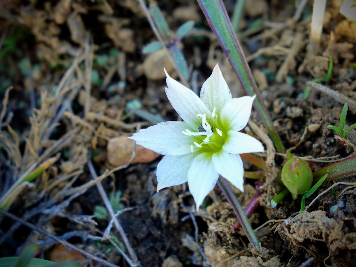
Claytonia obovata, Spring Beauty.
As I walked toward Mt Eddy I couldn’t help but remember the day nearly 9 months ago when my knee said POP (link). I’ll be back, I have no doubt especially after this hike. I felt strong and ready to start rebuilding my strength and endurance.
My journal post, “I took my knee for a walk and what did I find? Yes miles of smiles! I’m learning to accept #WhatICanDo and making each of those moments meaningful. I hiked 5 miles! YES 5 miles without any complaints or setbacks.”
Not only did I spend time this fall in Lassen Volcanic National Park (link), but I also found a few other favorite places in far Northern California to jaunt.
Hike #1 – Castle Lake Trailhead
Castle Lake
Little Castle Lake
Mt Shasta Views
Castle Crags and Lassen Views (on a smoky day)
Hiking Date: October 21, 2018
Hike #2 – Trinity Alps, Stuart Fork Trailhead
Hiking Date: October 28, 2018
Hike #3 – Lassen, Kohm Yah-mah-nee Visitor Center
Ridge Lakes
Date Hiked: November 30, 2018
Hike #4 – Mt Shasta, Bunny Flat Trailhead
Black Butte
Date Hiked: December 2, 2018
Hike #5 – Castle Lake Trailhead
Date Hiked: December 6, 2018 (no stats on this date)
Hike #6 – Mt Shasta, Bunny Flat Trailhead
Sierra Club Horse Camp Cabin
Date Hiked: December 10, 2018
Hike #7 – PCT, Dog Trailhead
Date Hiked: December 13, 2018
Hike #8 – PCT, Twin Bridges Trailhead
Date Hiked: December 19, 2018
Hike #9 – Mt Shasta, Southeast Wanderings
The bears were still wandering around.
Date Hiked: December 22, 2018
Hike #10 – PCT, Cache 22 Trailhead
Final sunset of 2018
Date Hiked: December 31, 2018 (no stats)
Instead here’s my cheer to you for a fantastic 2019 filled with adventure, good health and plenty of smiles.
And that my friends is a wrap for 2018. Below is my year in review video.
Hikers are a funny breed. I don’t have many friends who are sufficiently motivated by sunrise views to agree to a 5:30am feet-on-the-ground start time. Not only did my friend Steve recommend this crazy adventure, but our new friends Matt and Kyle, whom we met the previous day on Black Butte (link to related post), were also looking for an epic outing.
Kyle found a perch from which to watch nature’s show.
Meanwhile I jumped over to Heart Lake to capture this image.
This panoramic shot captures Castle Lake in the center, Left Castle Peak, Right Castle Peak, Black Butte (which we hiked the previous day) and Mt Shasta.
Mt Shasta got a kiss of pink.
Soon enough it was time to say goodbye to Kyle and Matt, and resume our focus on hiking Mt Bradley Ridge toward the lookout. Once Steve and I reached the ridge, Castle Crags became the highlight.
I’ve yet to make it to the Mt Bradley Lookout. It’s on the next hill in the photo, about an hour each direction. But with our unplanned detour to Heart Lake, we were running short of time and energy.
Mt Bradley lookout, with the Mt Lassen range in the distance.
From the ridge we got views of Lake Siskiyou, Black Butte and Mt Shasta.
We stopped by Little Castle Lake on our way back to the trailhead. It’s almost ready for ice skating.
The sun was just about to slip behind the mountain as we returned to partially frozen Castle Lake.
Hike Details:
Date(s) Hiked: December 10, 2017
Mileage (per ViewRanger): 10.5 miles round trip
Elevation Gain/Loss (per ViewRanger): 2,670/2,670
Elevation Low/High (per ViewRanger): 5,381/6,122
Trail Conditions:
Tree obstacles: minimal
Overgrowth: minimal
Signage: none
Terrain: snow and ice with some steep sections
Navigation Skills: moderate, the trail junctions are not signed, some of the trail is marked with cairns, other requires compass or GPS navigation.
Water availability: minimal, best to bring what you need.
Camping availability: camping is not permitted at Castle or Heart Lakes
Solitude: at 5:30am, we had the place to ourselves but by 7am, we had company.
Bugs: none during the winter season
Wildlife: none except for birds and squirrels
Precip: none on this date
Temp: 20’s – 40’s
LNT: I picked up a mitten, otherwise trail was in good shape.
Jan’s Cherry Picker Delight Scale: 4+ cherries (out of 5)
Tips:
Much of the trail is shaded so plan for icy conditions at this time of year. Microspikes worked well especially on the steep downhill sections.
The access road can also be quite icy. It’s usually sanded but may not be if you’re looking for an early start.
This area typically requires snowshoes in December.
These gals needed some time on the PCT. I think you can see why my friend Jill’s trail name is Bright. She’s a ray of sunshine!
After spending the previous night on Castle Peak and enjoying a relaxed hike back to the trailhead, we traveled the short-distance to the Gumboot Trailhead.Our first night was spent at Porcupine Lake. Although it was late October and quite chilly, we were joined by a group of three guys planning to summit Porcupine Peak in the morning. Those sunset colors were insane!
The next day, we hiked north toward Mt Eddy. Not to be outdone, Mt Shasta kept her presence known.
The geology of the Klamath Mountains, of which Mt Eddy is a part, is unique and has been studied extensively. College of the Siskiyous has published an excellent paper titled, “Geologic Overview of the Eastern Klamath Mountains” for those curious (related link). Jill is a bit of a geology nerd and pointed out a few things like intrusions and serpentine.
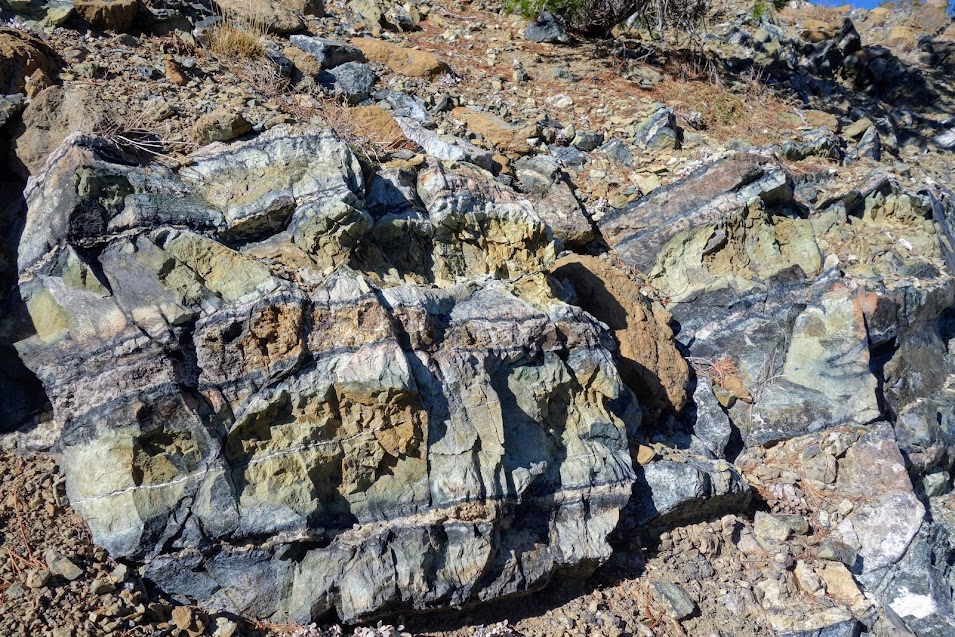
Serpentinite, produced by the metamorphism of basaltic oceanic rocks, and intrusive rocks of gabbroic to granodiorite composition are common rocks within the Klamath terranes. Source: Wikipedia
In the summer Deadfall Lake (aka Middle Deadfall) is usually a busy place but on this late fall day, we had it to ourselves.
Upper Deadfall Lake at sunset.
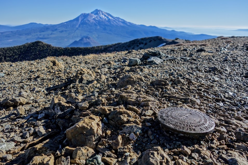
The summit of Mt Eddy was our first destination the next morning.
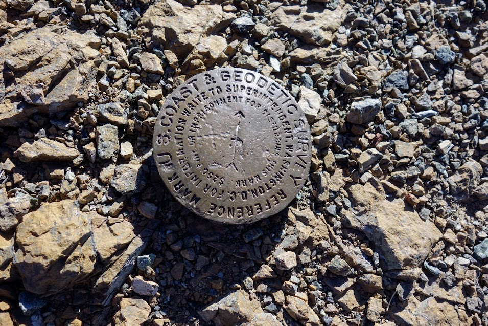
Let’s find the 9,000′ summit.
Nothing marks success quite like a summit marker.
Jill’s great idea. We both found it a little challenging to get both the marker and the mountain in focus.
Such a tapestry of textures, shapes and colors to the north.
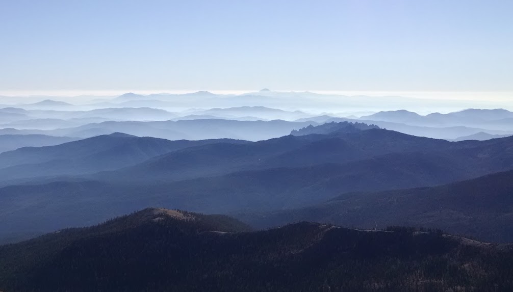
To the south is Castle Crags, recognizable by the pointy spires, but mostly hidden within the smoky blue ridge mountains (due to controlled burns).
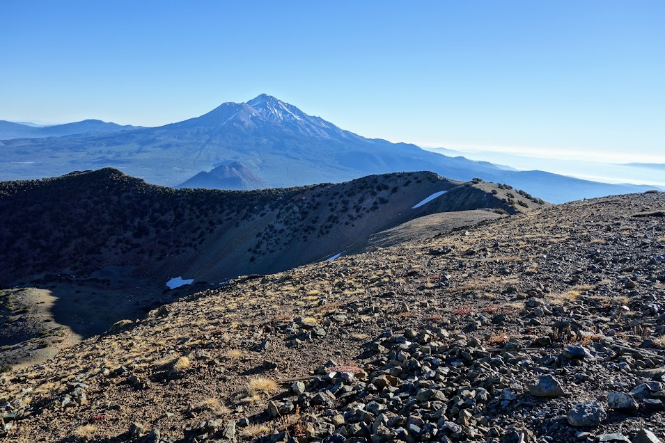
To the west is Mt Shasta dwarfing Black Butte. While exploring this tongue, I noticed a hiker over on the next ridge and discovered a route leading the way. I didn’t have time this day, but I’ll be back to explore that area.
This is about where my blog banner photo was taken.
Looking west into the Upper Deadfall Lake basin.
We choose to spend the night with another view of Mt Shasta. Goodnight my lady . . .
When you have a guest, you want to show them the best, right?
It’s a short jaunt around the shores of Castle Lake and on up to Heart Lake. You can tell by the shadows in the above photo, we’d gotten a late start. Now it was time to earn our grub.
This is a spot that’s long been on my list. Just like my previous night on Girard Ridge, I didn’t get a WOW sunset, but who can complain about a view like this, perfect weather and spending time with a new friend.
My 7am view.
Good morning world!
What a view! Black Butte on the left, Mt Shasta taking center stage, Castle Lake in the middle flanked by what locals call Left Peak. If you look closely near the bottom right corner, you can see the heart of Heart Lake.
Standing on Castle Peak (aka Middle Peak) we also had front row views of Castle Crags and the many ridges beyond. Fall in Northern California means controlled burn season, which means smoky skies and the opportunity for amazing sunsets, sunrises or in this case misty looking mountains.
Hidden in the shadows of this ravine lies the PCT. Soon enough it was time to descend through the rubble and manzanita.
Back at Castle Lake, we could look up toward Castle Peak (aka Middle Peak) but alas it’s a fool’s ridge as the reward awaits only those willing to climb further.
Hike Details:
Date(s) Hiked: October 26-27, 2017
Distance: 8-10 miles round trip
Tips:
Camping is not allowed at nearby Castle nor Heart Lakes
Dates Hiked: May 22, 2015 (Part 2: Miles 1530.85-1537.19) . . . to be continued Direction: Northbound Section P: Castella to Etna -Miles: 98.5 (Halfmile 1498.7-1597.2) -Elevation: Low Point 2,157′, High Point 7,769′, Gain 17,594′, Loss 13,770′ After 10 days of stormy weather, it was time to face my retreat point and see for myself how conditions have changed.
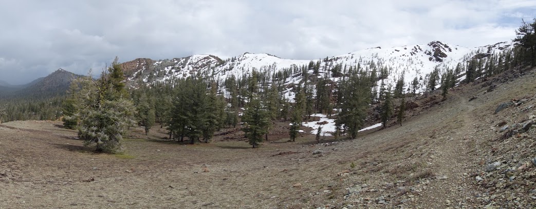
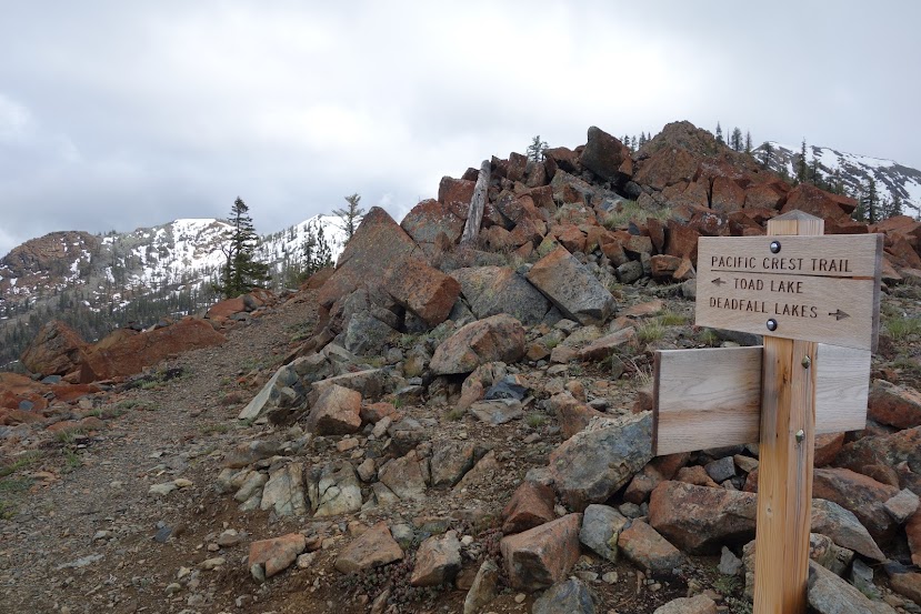
Destination: The ridge between Deadfall Lakes and Toad Lakes
A bit of snow outlines the trail as it ascends from the Deadfall Lakes basin.
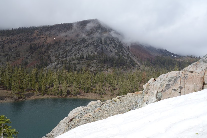
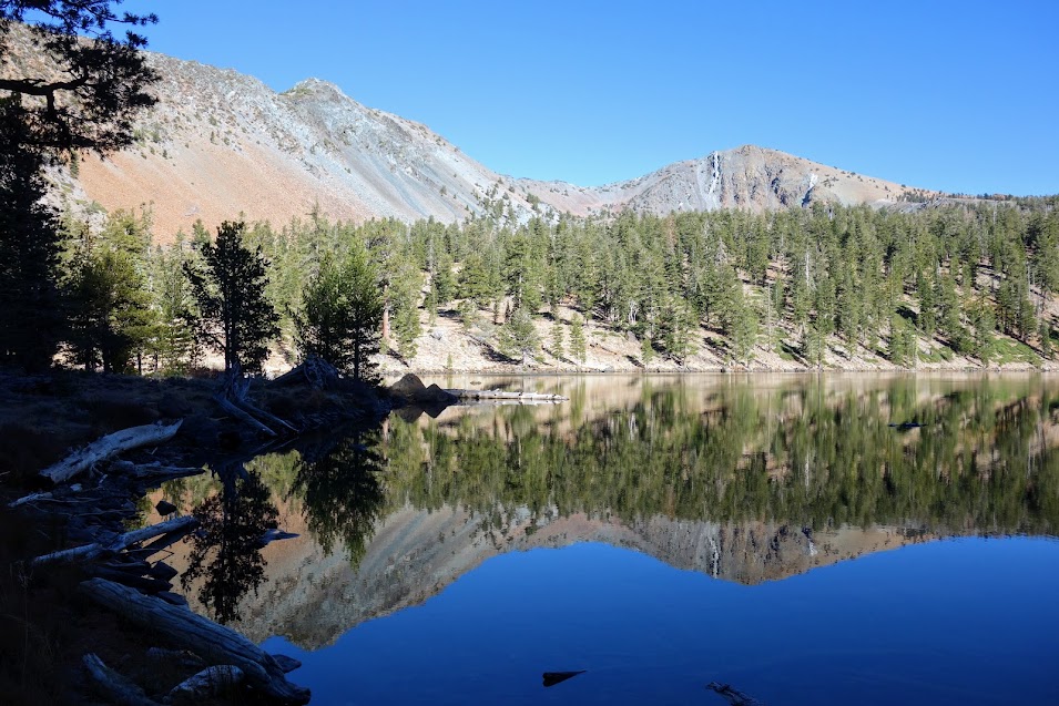
Lower Deadfall Lake
The beautiful colors of the mountains surrounding Deadfall Lakes basin.
Middle Deadfall Lake
The beginning of the snow trudgefest.
It was raining while I crossed this section of soft wet snow.
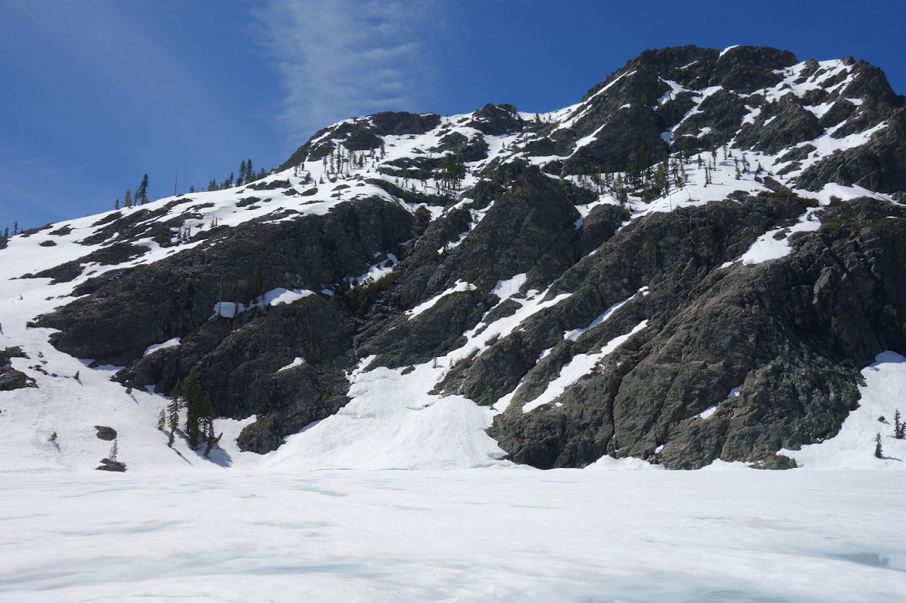
Such a contrast from 10 days prior when this was a steep snow covered slope punctuated by an avalanche fracture (Part 1 Post).
The cornice is gone . . . but . . . notice the bike tracks 😦
Only a fracture remains of what once was the cornice.
I postholed to my knees at times on this traverse. The rain stopped after I reached the ridge making for a much more pleasant descent. It was great to be able to grab some photos before the rains returned. Being wet and cold makes me question whether I have what it takes to be a long-distance hiker. I sure was glad to be heading home to an Epsom Salt soak and warm bed.
This snow traverse at 7,000+ feet is about 1/2 mile.
Not much snow on the south-facing slopes
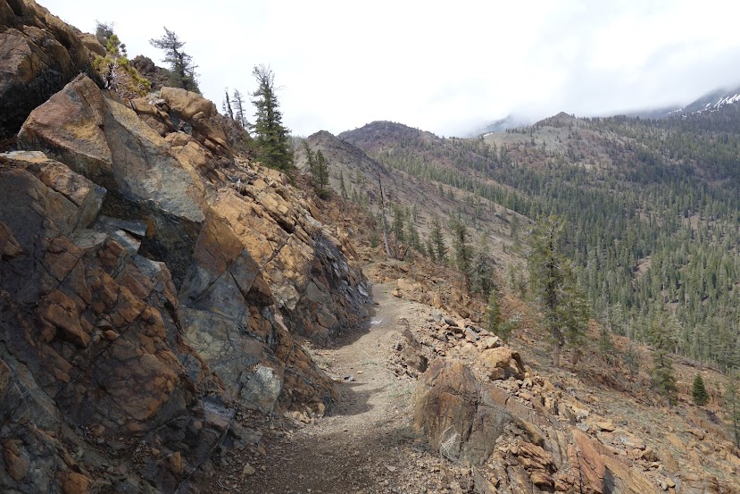
The PCT sign is a good snow level indicator as the trail transitions from a north-facing slope into snow-free terrain.
There were several down trees, crossing with snow and on steep traverse slopes can be a challenge. The Backcountry Horsemen can’t clear the trails until the snow melts. I I was appreciative of the tree-free trail from Deadfall Lakes to Parks Creek Road.
A nice look back at the ridge separating Toad and Deadfall Lakes, showing the 1/2 mile snow traverse.
The geology in this area is quite interesting.
This is the trail crossing for the Sisson-Callahan trail, one still on my list to explore.
Ahhhh, back into my bright green forest . . . I love this section of forest. The trees are coated with a delicious shade of green – think Granny Smith apples.
Another look at Lower Deadfall Lake, this time from the PCT.
Deadfall Creek is running full with all the recent rain and snowmelt. This sprawling creek makes for an interesting crossing.
This tree was a real standout.
Looking northwest toward the Trinity Alps!
And so the story of Section P continues . . . 60 miles remaining . . .


 After 10 days of stormy weather, it was time to face