AZ – Arizona Trail, The Wildflower Edition (March/April 2023)

I found my first blooms along the Arizona Trail in early March. With plentiful rain, there was no shortage of flowers. Poppies stole the show. Disclosure: I took most of the photos with the Galaxy S22 Ultra phone instead of my Sony RX100 camera and the quality especially on macro photos isn’t up to my normal standard. I also did my best with flower identification, but there may be errors and would be happy to see corrections in the comments.

Tuber Anemone

Redstem Stork’s Bill

Lupine.

Owl’s Clover

Henbit Deadnettle

Fairy Duster

Scorpion Weed

Goldfields?

Fiddleneck

Redmaids

Chicory

Gilia?

Mustard/Bladderpod?

Blue Dips and Globemallow

There are a few places in Arizona where you can find pink poppies. I found a few on a previous trip but had planned to visit an area known for mass blooms. This didn’t happen but I found a few of these yellow outliers instead.

Fringe Pods hiding among the Poppies.

Spiderwort?

The predominant blooms of early spring was Blue Dips (Dipterostemon). They come in a variety of colors from fuchsia to pink to blue to purple to white.

Four O’Clocks?

I’ve always loved the purple round balls on sticks, aka Salvia or Chia.

I was a little early to enjoy cacti blooms.

I was too early for the ocotillo blooms as well.

The yellows brighten the desert. The desert marigolds are one of the first to make an appearance.

By the time Brittlebush line the trails, many of the other blooms start to fade.

I found evening primroses in yellow and white.

Cream Cups?

Daisies.

Dandelion.

Vetch.

Wild Rhubarb.

Miner’s Lettuce.

Toadflax.

Larkspur.

Paintbrush.

Sedum.

Penstemon.

Verbena.

Allium (desert onion).

Nightshade.

Monkeyflower.

Carphochaete bigelovii, Bigelow’s Bristlehead?

Lewisa.

Spring Beauties.

Candytuft.

Lilies.

Happy Jan playing in the blooms.

These photos were taken while hiking the following sections of the Arizona Trail.

Links:

Resources:

AZ – Arizona Trail Passage 15 SOBO YoYo, Florence-Kelvin Trailhead to Freeman Road Trailhead (03/23)

I said goodbye to my friends and I was off for a multi-night, 50+ mile challenge.

I hiked the first 5 miles of this passage a couple of weeks earlier (link) and was looking forward to seeing the color change.

There were significantly more blooms and a lot more variety, although it was still a little early in the morning for many to open. They are solar powered!

There were some nice patches of Owl’s Clover.

Lots of buds on the cacti.

There was a lot more lupine this trip.

Chicory and Scorpion Weed (Phacelia) were also more prevalent.

There were a few bright red penstemons along the trail.

The Arizona Trail Association created this wonderful switchback section of the trail. I call this Jan grade!

The blooms decreased as I hiked south.

Goodbye poppies for now.

There is rarely a flat section on the Arizona Trail. I heard one group singing the Up and Down song as they passed by. This section is one of the flatter but it was plenty challenging for me.

In fact, this is the full trail elevation profile.

It’s too bad the cows don’t like to eat cholla. On a positive note, the spines catch the light and add so much texture to the view.

Arizona has an open-grazing policy and there are many gates along the trail that keep cows separated and out of some sections. Blooms seem to be much less intensive in cow areas. I found a few that they must not like.

I forgot about wash walking.

Finding a waterfall in the desert feels a bit of a miracle, but after a wet spring, this wasn’t a mirage.

The unusually wet spring also made for a very green desert. Such a treat!

I applaud the Arizona Trail Association for making water more accessible. This is a spring-fed tank.

I know about cutting trees, but can’t even imagine having to cut up a saguaro. That’s some spiny business!

Soon the yucca will be blooming.

Speaking of cows . . . I selected this campsite due to the wind. There weren’t any cows around and no fresh cowpies were evident. Around sunset, this young male appeared, thankfully we had a sturdy fence separating us.

However, he must have been lonely. He stared at me for a long while.

I tried everything to encourage him to move along.

Then this female showed up on my side of the fence. He switched his infatuation to her. For hours and hours, they shared many vocal sounds including moans, loud eating, peeing and defecating near my tent. She wasn’t interested in moving along either. The male decided to bed down nearby. Even with earplugs, it was a restless night.

I was happy when morning finally arrived and I could get back on trail.

This next section included a LOT of ATV track. There were so many miles of steep up and down.

The cactus didn’t mind these electrical giants.

But if not for the cattle, we might not have these water sources.

There was a small stretch of trail decorated by very porous large boulders.

The leaves on this bush were prickly like holly. I later saw yellow flowers in place of the buds. It was too windy to get a decent photo of the blooms.

I believe these are a type of onion.

My turnaround point was the Freeman Road Trailhead. I couldn’t believe it when I heard shouts of “is that Jaunting Jan?” Yes indeed it was my friends, the Wander Women. I was beyond excited to spend more time with these women I consider trail sisters.

I was protected from more animal encounters by a fortress of cacti.

We shared a nice sunset.

Annette and Kristy weren’t feeling their best and were nursing injuries and ailments, but they were still in good spirits and continued to impress with their Bad Ass Feral Female attitudes and performance. This is the first time, in all their thousands of miles, that they’ve had to deal with illness on trail. It’s not easy but they proved they had dogged determination.

I shared my pre-filter which minimizes clogged filters.

I’d been wanting to camp under a saguaro.

I love walking in the early morning when the light is magical.

This was a happy moment when the steep ATV road transitioned to single-track trail.

We shared some smiles at the waterfall.

Brittlebrush is about to explode and add intense color along the trail.

I’ve seen a lot of bunnies and jackrabbits but this was the first one who wanted to be photographed. I was thrilled!

Getting it done!

Soon we were back in the flower zone.

Registers are provided at many trailheads.

This marked the end of my yoyo of this section, and the completion of 266 miles for the Wander Women as they continue their northerly trek from Mexico. Be sure to follow their adventures on their YouTube channel. You’ll find me on this episode (link).

Crossing the Kelvin Bridge is a significant milestone. For me, it brings back memories of when the restaurant in Kearney brought me and Joan pizza, ice cream, water, and beverages to this location. It was the beginning of a tradition.

I was thrilled to complete this 50+ mile, 4-day jaunt. It was challenging, but I DID IT!

Links:

Resources:

CA – Klamath National Forest, Kangaroo Lake Botanical Area (June 2021)

The Klamath National Forest is home to many rare and endemic species. As such they have several botanical areas which have been protected (link) including the Kangaroo Lake Botanical Area. “A 430 acre site located on the southeast edge of the Salmon/Scott River Ranger District  (T40N, R7W, SEC 14).  The area varies in elevation from 6000′ to 6857′.  It provides a diversity of plant habitats ranging from wet seeps and meadows to rock walls. The high level of habitat diversity is associated with a correspondingly high botanical species diversity. Sensitive plant species present include Phacelia dalesiana and Epilobium siskiyouense.” Source: Klamath NF

I have fond memories of Kangaroo Lake from my childhood when we camped nearby, and my dad spent hours fly fishing.

On this day though we were out to explore the Fen Nature Trail, a word that only came to my attention over the past few years.

We found plenty of fens with Darlingtonia californica aka Cobra Lilies or California Pitcher Plants.

We were hoping to find the rare Scott Mountain Phacelia, which I’d been lucky enough to stumble across unexpectedly a few weeks earlier at a different location (link).

Are you hiding down here?

How about here?

Success!

Calochortus elegans aka Elegant star tulip and Northwestern mariposa lily

Calochortus nudus aka Naked Mariposa Lily

Owl’s Clover with bug for extra credit.

Allium (onion) but not the rare one.

Sedum (aka Dr. Seuss trees)

Buckwheat, but not the rare species.

Blue Flax

Penstemon newberryi

Bladderpods

Intense butterfly or moth mating.

We enjoyed several views of Kangaroo Lake and distant views of three other listed botanical areas including China Peak, South China Peak and Cory Peak. Someday I’ll make it a priority to spend a day botanizing in those areas as well.

We hiked the trail to where it connected with the PCT. Our trip was less than 3.5 miles and about 750′ of elevation gain/loss.

Bonus: roadside botany on our drive to the trailhead

When I spied a group of rare California Lady’s Slippers (Cypripedium californicum), I was giddy. They were freshly washed after a little overnight rain.

Apocynum andrsameifolium aka Dogbane

Shasta Leopard Lily

Sidalcea, Checkerbloom.

Rhododendron occidentale aka Wester azalea

Showy Milkweed (creative edit)

My botany fieldtrips have been such a fun rehab diversion. It’s highly unlikely in “normal” times I would have taken a day to drive 3-4 hours to spend 5 hours hiking 3.5 miles, followed by another 3 hours of driving. It was a wonderfully long 12-hour day filled with friendship, education, photography and visual delights.

CA – April 2021, Wildflowers of Butte County

I was introduced to this volcanic area in 2013, before it was popularized, regulated and overrun by the masses. With the exception of last year I’ve been traveling every spring since then and haven’t had the opportunity to return. Last year it was closed due to COVID, this year I was determined to return. It was one of my knee rehab goals. But I have severe crowd anxiety. I’d prefer to skip these opportunities rather than share with the masses. I also have a no regrets policy so I was determined to find a way to enjoy regardless of it’s popularity.

This 2013 photo clearly shows I didn’t know about not crushing the blooms, but then again it taught me to behave like the cows.

I clearly remember visiting the waterfalls, especially making this sketchy descent to explore the cave and cool rocks below one of the waterfalls. I hear a rope now exists to assist with that steep section.

It was worth it, but I can say been there, done that, don’t need to do that again. There are 9 waterfalls that can be viewed during the rainy season on an 11-mile cross-country loop (link). I’ve only been to a few so someday I’ll go back and hike this complete loop.

My goal this trip was much different. My knee was a little extra sensitive so my plan was to take it easy and see what I could see given my limitations. To minimize crowd encounters I arrived on a weekday at 8am and followed the cow paths rather than the waterfall trail. The poppies were still sleeping, so while I waited for their 10am wake-up call, I roamed and found many more photography opportunities.

Kellogg’s Monkeyflower
Seep Monkeyflower
Meadowfoam
Fringe Pods
Prettyface

“Created by ancient lava (basalt) flows, the approximately 3,300 acre North Table Mountain Ecological Reserve is an elevated basalt mesa with beautiful vistas of spring wildflowers, waterfalls, lava outcrops, and a rare type of vernal pool, called Northern Basalt Flow Vernal Pools.” Source: North Table Mountain Ecological Reserve webpage

Jan’s perfect bouquet!
Owl’s clover, Bird’s-eye Gilia, Blue Dips/Dicks, Lupine, Poppies, Popcorn flowers and green green green!
Owl’s clover and Bird’s-eye Gilia
Bird’s-eye Gilia and California Poppies
California Poppies, Lupine and Blue Dips

I enjoyed seeing the vast color swatches.

It was a great day to hang out with the cows.

On the other hand far in the distance I could see the waterfall trail conga line.

When I arrived just before 8am there were maybe a dozen cars in the parking area. When I left around noon there were hundreds with hordes of people every which way. My strategy was successful and I didn’t encounter others until the last few minutes of my day. For those wanting to explore the large variety of wildflowers, the season covers several months and includes over a hundred varieties. You can download this botany guide (link). For further information and preparation, be sure to visit the North Table Mountain Ecological Reserve website (link) to purchase your day use permit, CDFW Lands Pass (link). If you go please respect private property signs and fences, and carry a litter bag to clean up after those less thoughtful.

Peak wildflower season is short. Usually 2-3 weeks in late March to early April. Once things start drying out, the large stickers pictured below will ruin your shoes and socks, which will keep you to the main trails.

I felt like I was one in a million, the pink among the blue.

It was a no-regrets day. If it wasn’t a 4-hour round trip drive, I’d return more frequently to find individual blooms like the fairy lanterns.

“I must have flowers, always, and always.”
― Claude Monet

CA – Trinity Alps Wilderness, Poison Canyon Trailhead . . . early summer jaunting

Rather than WOW per mile views, on this trip you get WILD per mile experiences. You’ll earn your views and grub by navigating your way through overgrowth, tree debris fields, and faint to non-existent trails. This is a place to find solitude. Over 5 days I crossed paths with 5 hikers. Intrigued?

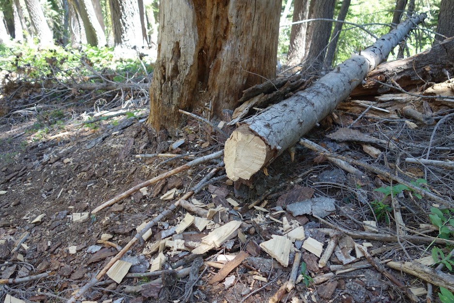
I read somewhere that conditions had been improved on the Lilypad Lake/Thumb Rock Loop somewhat recently. I found a few cut logs as evidence on the way up to the junction. The trail steadily climbs from 4,100′ elevation at the trailhead to finally this first view of Ycatapom Peak.
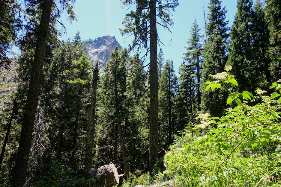
While getting slapped in the face a few too many times as I worked my way through the low elevation foliage, I was rewarded with these late spring early summer blooms.

Bleeding Heart

Western Prince’s Pine
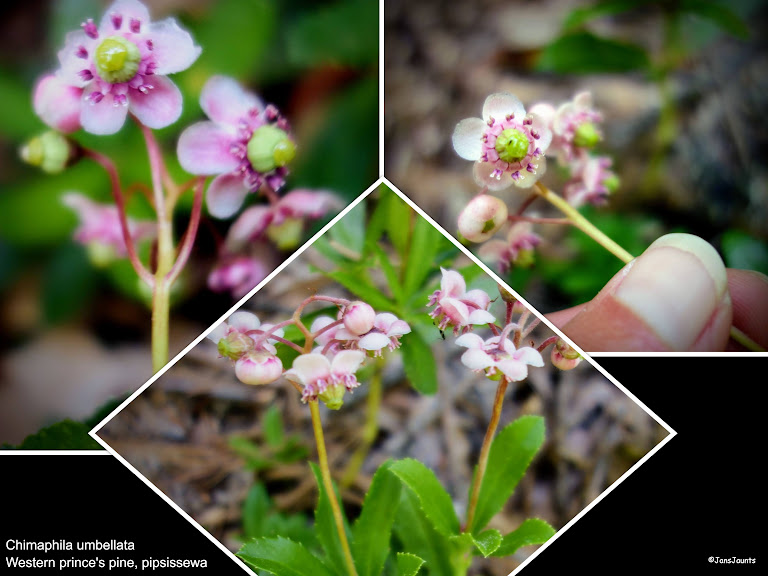
Leopard Lily

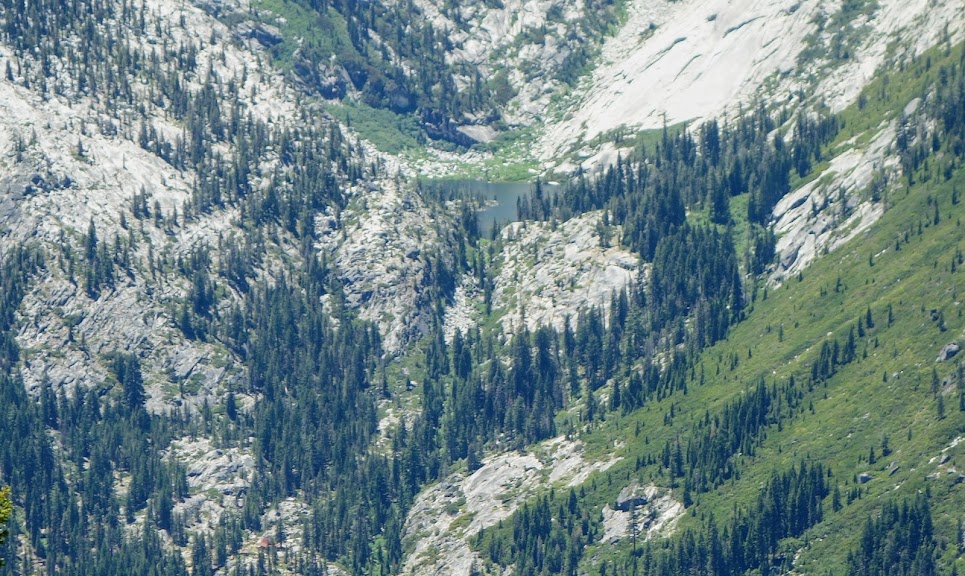
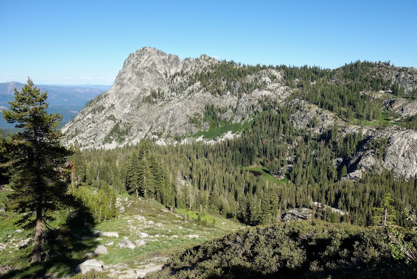
At 2.8 miles, having gained nearly 1,900′ in elevation, you reach the trail junction to Lilypad Lake and Thumb Rock. Since I hiked the loop in 2014 (blog link) I continued on the Poison Canyon Trail. Having now climbed 2,700′ in 4 miles you arrive at Tracy Trail to Boulder Lake junction. Not too much later you are granted this view of Lilypad Lake (bottom left), Thumb Rock and the beautiful hanging meadows.

To complete the panoramic view, Ycatapom Peak with Lilypad Lake visible in the lower middle. Trinity Lake is in the valley below.
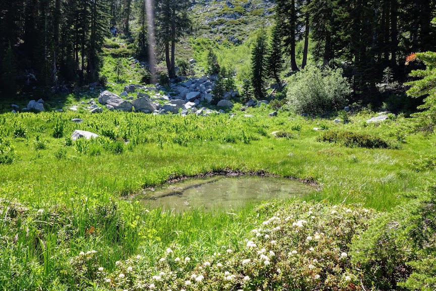
Water becomes sparse and you may limited to meadow puddles in the early summer.
Given my late start and the upcoming water situation, I decided to camp before the ridge. It was breezy and chilly, ending with a 29F degree low and a frosty sleeping bag since I chose not to use my rainfly.

I got an early start the next morning and was treated to views of Mt Shasta as I climbed toward the Parker/Union Divide.
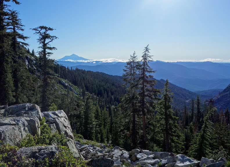
The views from the divide were impressive. At this point I was 5 miles and 3,500′ into my trip.
Landers Lake

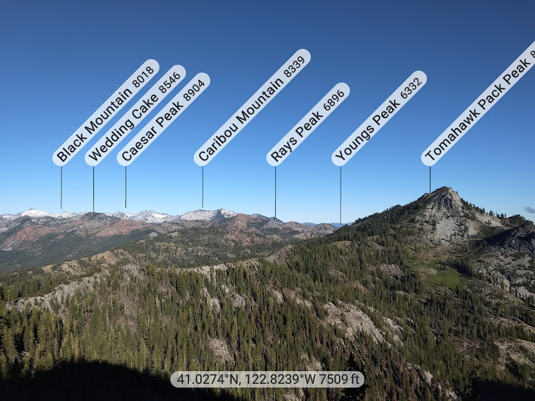
My next destination was Landers Lake which is located in the crown of mountains in the middle of this photo. Red Rock Mountain (not to be confused with Red Mountain) is the dominant peak surrounding the lake. As is true within the Trinity Alps, what goes up must go down, sadly with little room to roam at the top. My original goal was to make it to the lake for my first night but between the elevation gain, trail conditions and water situation, it wasn’t in the cards.

This was a fun part of the trail where you got to stay high before dropping into the valley. It reminded me a bit of Knife’s Edge in Washington’s Goat Rocks Wilderness. In my perfect world, there would be lots more of this in the Trinities.

As I started my descent I found this lovely meadow of corn lilies not yet ready to bloom.
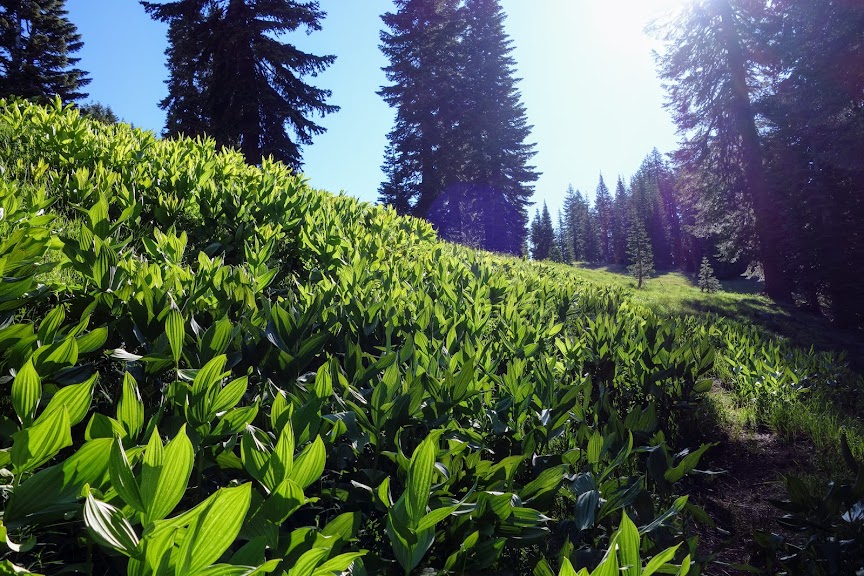
I was thrilled to find the first-of-the season blooms on owl’s clover.

These were one of the predominant blooms on this trek. Too many similar blooms to identify for this extreme amateur botanist.

At 8 miles I reached the junction to Landers Lake.

I attempted to reach the lake during my late April trip up Swift Creek, but there was too much snow (blog link).

Looking back from where I’d come.

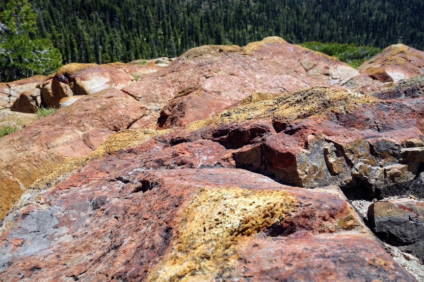
The colors and textures of these rocks is eye candy to this want-to-be geologist.
And finally I arrived at lovely Landers Lake, 4,200′ and 10.5 miles from the trailhead (plus a 1,300′ descent). Red Rock Peak looks tiny in the background. For those more nimble than I, you can skip a few miles scheduled for my next leg of this journey by going over the shoulder rather than taking the trail.
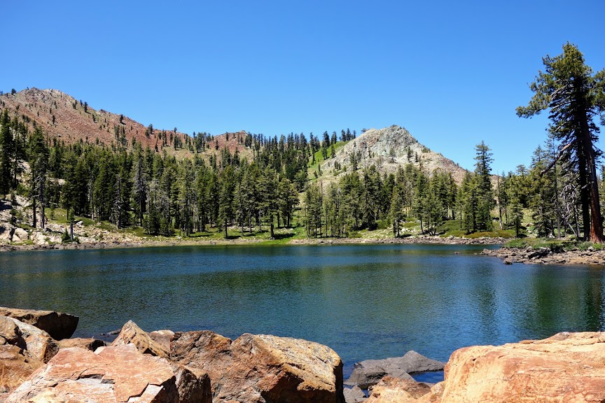
Although it was quite early, I decided to spend the night as the next leg had water issues and more elevation gain than I was ready to tackle. So I wandered around enjoying the fluttering butterflies and warm sun, although the breeze made it too chilly for a dip.

Red Rock Mountain’s namesake red was very apparent in the early morning light.

Historical Mining Trail Loop

The next leg included the Sunrise Creek, Yellow Rose Mine and Dorleska Trails. I wanted to take one of two short cuts, but I knew from my experience it would end up wasting more time and energy than just taking the trail which meant descending before regaining that elevation. In retrospect I was happy with my decision when I saw I would have had to go through a huge ravine as well as deal with brush. So at 12.7 miles from the Poison Canyon Trailhead, I connected with the Sunrise Creek Trail.

There were a few wildflowers at around 6,000′ including these Mariposa Lilies.

Bog Orchid

Let the fun begin. Where oh where does the trail go? If I were a trail were would I be? Shall I go through the swamp or the bushes? At least these were short enough they didn’t slap me in the face like I found at the 4-5000′ elevation.

If you’re lucky you might find an old blaze on a tree, like this one without bark. How much longer will that tree be standing?
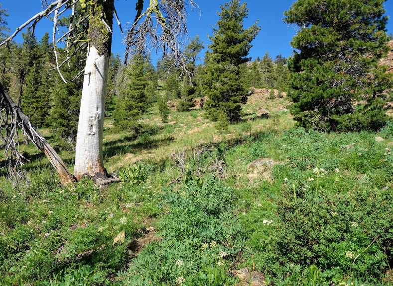
Look at those wide open views with plentiful opportunities for exploring.

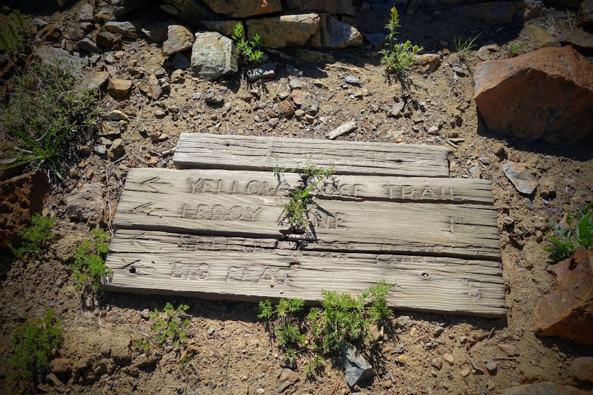
At 14.5 miles with 5,500′ of elevation gain and 2,300′ of loss, I arrived at the Yellow Rose Mine Trail.
This notch is the shortcut route to Landers Lake. Doesn’t look too bad from this side. Red Rock Mountain is the left peak.

While many hike this loop to see the mining relics, my primary purpose was to see the mountains that flank the Salmon River drainage including the likes of this, Caribou Mountain and Sawtooth Ridge.
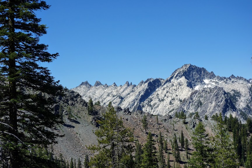
A recent hike included a trip to Horse Heaven, the high point above Tri-Forest Pass (blog link), the knoll at the far end of Sawtooth Ridge.
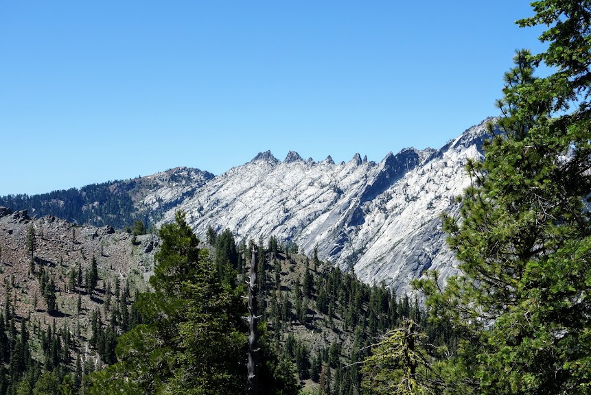
As you continue along the trail the views get better and better. This is Caribou Mountain with mostly private Josephine Lake easily visible in the middle of the photo. The Caribou Lakes basin is on the other side of the ridge. I believe that’s Caesar Cap Peak in the background, but it might be Thompson Peak.
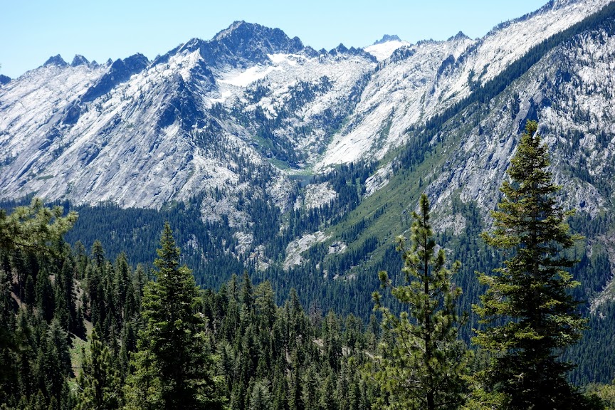
Preachers Peak at 7,202 look pretty unimpressive and easily baggable at the ridge between Yellow Rose and Dorleska Mines. Wonder who this Preacher dude was as there’s not only a peak but also a campground named after him.
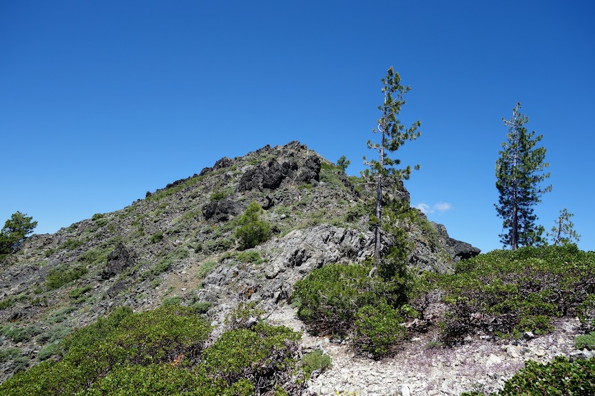
This was the first mining site I encountered except for a couple small pit mines with nothing that caught my eye worth sharing. I believe these are the remains of the Le Roy Mine. This USGS report (link) has some information regarding the mines. See page B131.
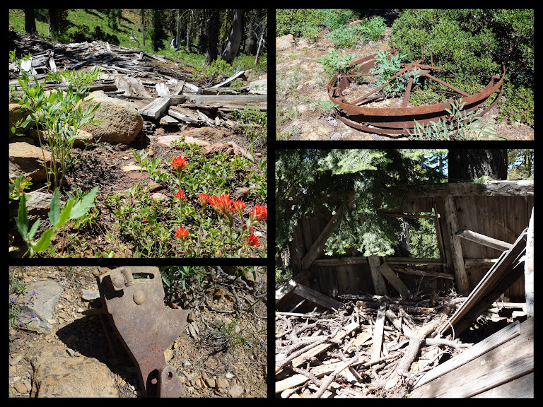
I believe these are the remains of the Yellow Rose Mine. This USGS report (link) has some information regarding the mines. See page B127.

The Dorleska Mine sites were spread over several areas. Additional information can be gleaned from the document referenced above, same page as Yellow Rose Mine. It’s hard to imagine hauling all this equipment up these steep trails, made more for mules than humans, but back in the late 1800’s miners were made of hardy stock but by 1938 they were ready to leave it all behind.

This pond just below Dorleska will forever hold negative memories.
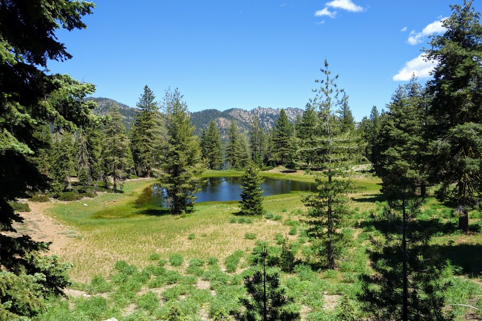
I found myself flailing through deadfall on a steep slope and as I exited the shade, I realized my hat was gone. What? NOOOOOO! I usually have it tethered to my pack for this very reason. So back up to the ridge I went, searching searching searching and calling out to my hat, “BLUE oh BLUE where are you?”

Finding myself out of luck and a little mournful as I said goodbye to my old friend Blue. As I headed down toward Bullards Basin, I found this lovely meadow of Blue-Eyed Grass. It helped me deal with my loss.

Foster, Lion, Conway and Big Boulder Lakes

After 21.5 miles with 6,300′ elevation gain and 4,600′ loss, I reached the junction for the Lion Lake Trail, bypassing options to Union Lake.

I got an early morning start climbing up the ridge. I was greeted by this meadow of Cow Parsley.

I had awesome views looking back at Red Rock Mountain and the ring of peaks hiding Landers Lake.

Looking back I can see down to where I camped the previous night, the drainage leading around the bend to those views of Caribou Mountain and of course Red Rock Mountain with Landers Lake in the front and the mines on the other side. You can’t see in this photo, but there is a huge swath of headless trees which I’m assuming are the result of an avalanche at some point in the past.

Finally I was back at Foster Lake, a place I’d visited in 2014 on my loop hike from Boulder Lake trailhead to Foster Lake, then down to Thumb Rock and Lilypad Lake before returning to the trailhead (blog link).

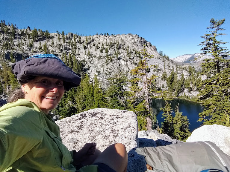
It was time to try out my invention. My eyes are extremely sun sensitive and knew I’d suffer without a visor. So as I was packing I placed my Nat Geo map inside a gaiter which went inside another gaiter. They have elastic cords at one end that usually hold them up and I was able to attach those to my ponytail, using a buff to keep it on my head. I’m happy to report it worked well for my final two days, never bouncing around or falling off. Function wins over fashion!
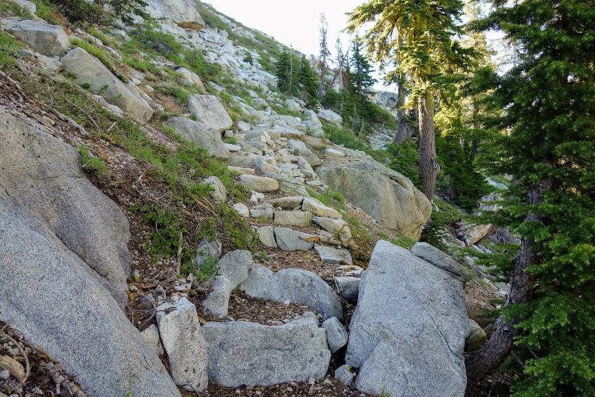
The trail building efforts from years begone through the granite have remained firmly in place. The staircases are much appreciated.
However, the trail traversing along Lion and Conway Lakes is quickly becoming more of a deer path rather than one for human use. If you have exposure and sideslipping trail issues, I’d have second thoughts.

I loved this stretch showcasing nature’s gardening.

As I dropped elevation I was faced with more down trees, blow down and overgrowth. There was one obstacle so large there wasn’t safe passage but I had to figure out a way and take my chances. This trail needs some love. I was feeling pretty grumpy coming into Big Boulder Lake. I was prepared for it to be busy as it’s very near the Boulder Lakes Trailhead. Upon arrival there was an obnoxious couple cussing up a storm and a group camped on a distant shore. I wandered the shoreline looking for a place I could access the lake for a swim. No real options except in the overused camping area so back I went. As I was getting ready to swim several other groups arrived. One group decided to start a fire. It was 2pm and hot enough to want to be in the shade. What’s next? That’s right the stereo is fired up and the booze comes out. Yep that was my cue to get myself up the trail. On a positive note the swim was invigorating and a few of the lilies were blooming but they were too far from shore to get a photo.

My original plan had been to go off trail to Tapie, Lost and Found Lakes which are hidden behind the granite mounds to the left in the below photo; Big Boulder Lake is in the middle. Since my route had been much more challenging than anticipated, I was not only short of stamina but was also on food rations. I noted the jump off point for a future trip.

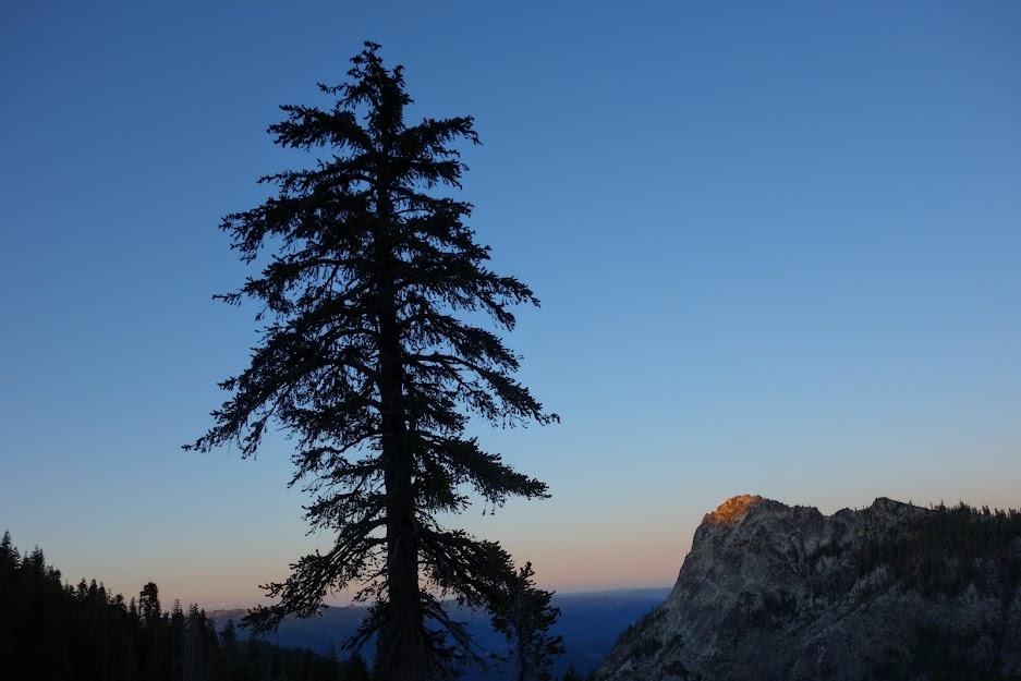
Instead I decided to spend the night on the ridge, enjoying a few hours with Mt Shasta and capturing this wonderful sunrise.

With my rationed food selection, it was time to chow and start the long downhill descent.

The bears seem to like this brushy canyon. This was about the freshest pile I’ve seen. Once before I came upon a pile still steaming, but this one was still had a nice urine ring. I saw another pile about a mile later. Never saw a bear but saw plenty of evidence throughout this route.

The next section of trail was through more down trees, blow down, overgrown bushes, through meadows, etc. I was so tired of getting slapped in the face with branches and having my face draped with webs. But I survived and lived to tell this story. There is no better way to end this post than with a few more of the blooms I saw on this lollipop loop route.
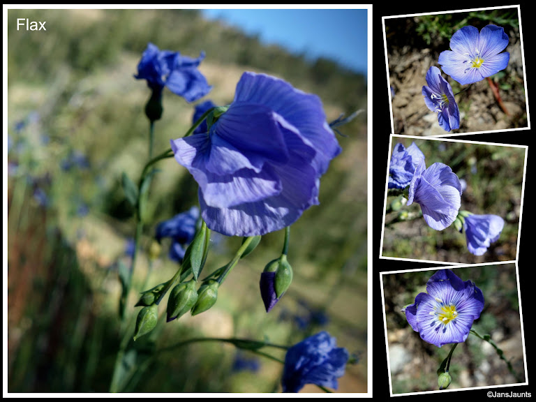
Followed by a well deserved meal.

Adventure Dates:

  • June 28 – July 2, 2020

Hike Details:

Resources:

Links:

Disclosure: Amazon affiliate links may be included which provide me a tiny kickback to help pay for this site.